Sundrop Farm
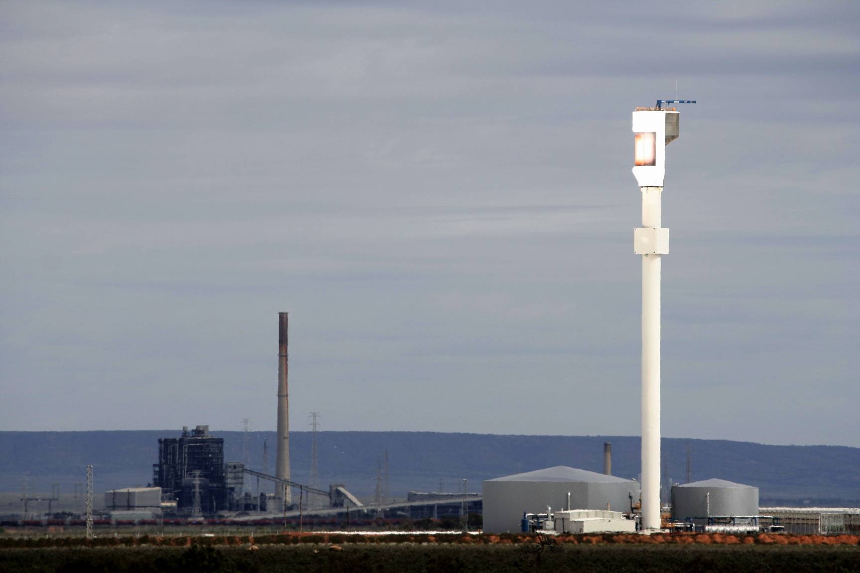
If you approach Coober Pedy from the south you cannot help noticing
Sundrop Farm's solar power tower just south of Port Augusta.
(If you came from Adelaide you will have also seen the
Snowtown Wind Farm, at the time of writing the second biggest but most productive in the country.)
The innovative Sundrop Farms development uses the power of the sun to take the salt out of seawater and to cool or heat (as required) massive greenhouses where many tonnes of tomatoes are grown hydroponically each year.
On the left of the photo is the shut down Northern Power Station; the last coal-fired power station in SA.
It was demolished a year or so after this photo was taken.
South Australia has had a huge success in moving from fossil fuels to renewable energy over the first couple of decades of the third millennium.
When (and if) you pass through Port Augusta you should call into the Arid
Lands Botanic Gardens, even if only for a cup of coffee or lunch at the
very pleasant visitor's centre, but better yet, take an hour to stroll
around the gardens and learn a bit about some of the plants you'll be seeing
as you go further north.
The image is a composite of two photos taken by my
drone, a DJI Phantom 3 Advanced model.
Click on (or touch) the image to see it in more detail.
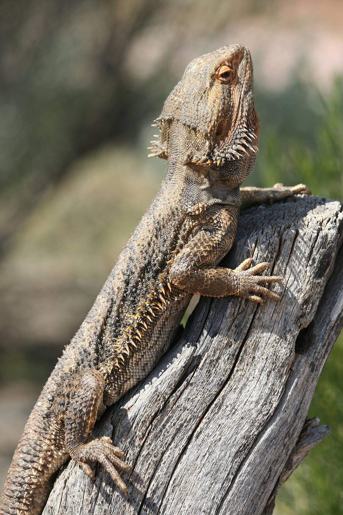
If you visit the botanic gardens on a warm day you may not only see
interesting plants, you might also see lizards (or snakes) like this bearded
dragon.
Click on (or touch) the image to see it in more detail.
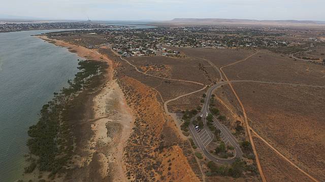
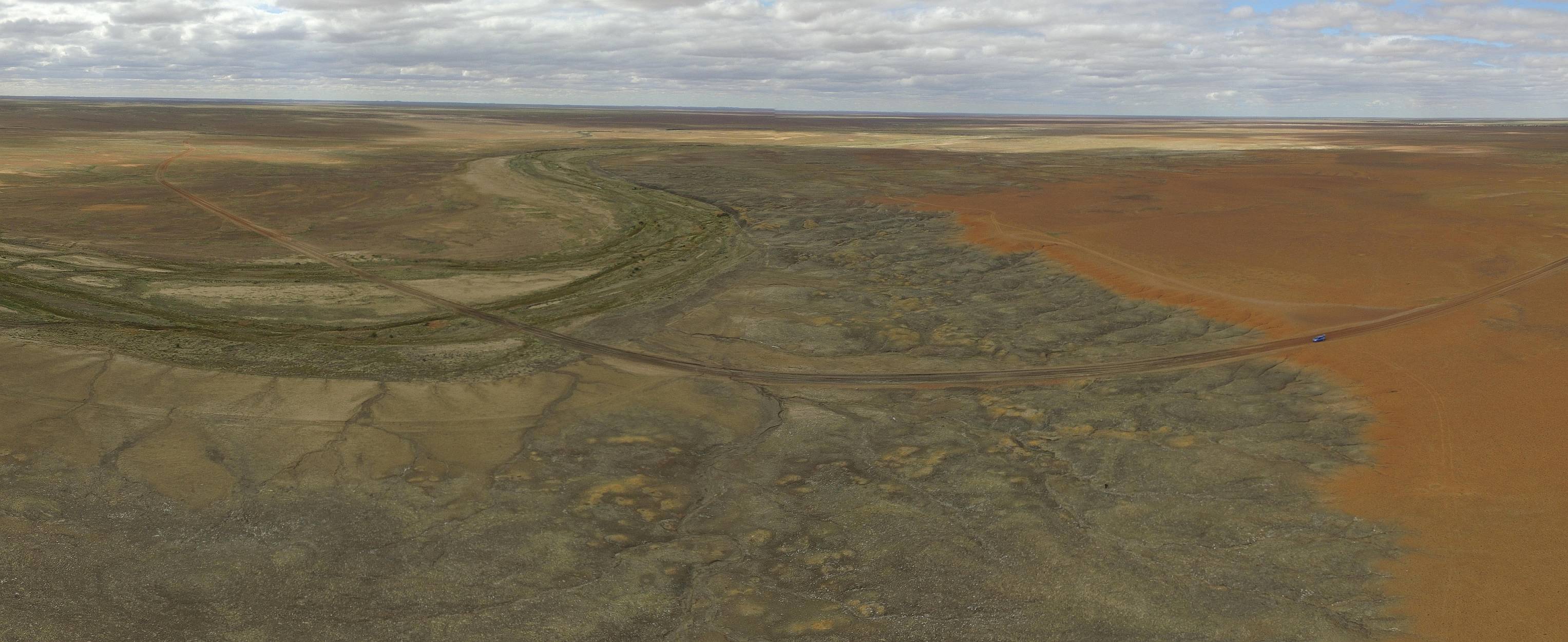
Red Cliffs car park is within the greater Arid Lands Botanic Gardens area.
This photo, taken by my drone and looking roughly south, shows the car park in the foreground, upper Spencer Gulf on the left and winding into the distance with the city of Port Augusta on both sides of the water.
The Gulf gets gradually wider toward the south.
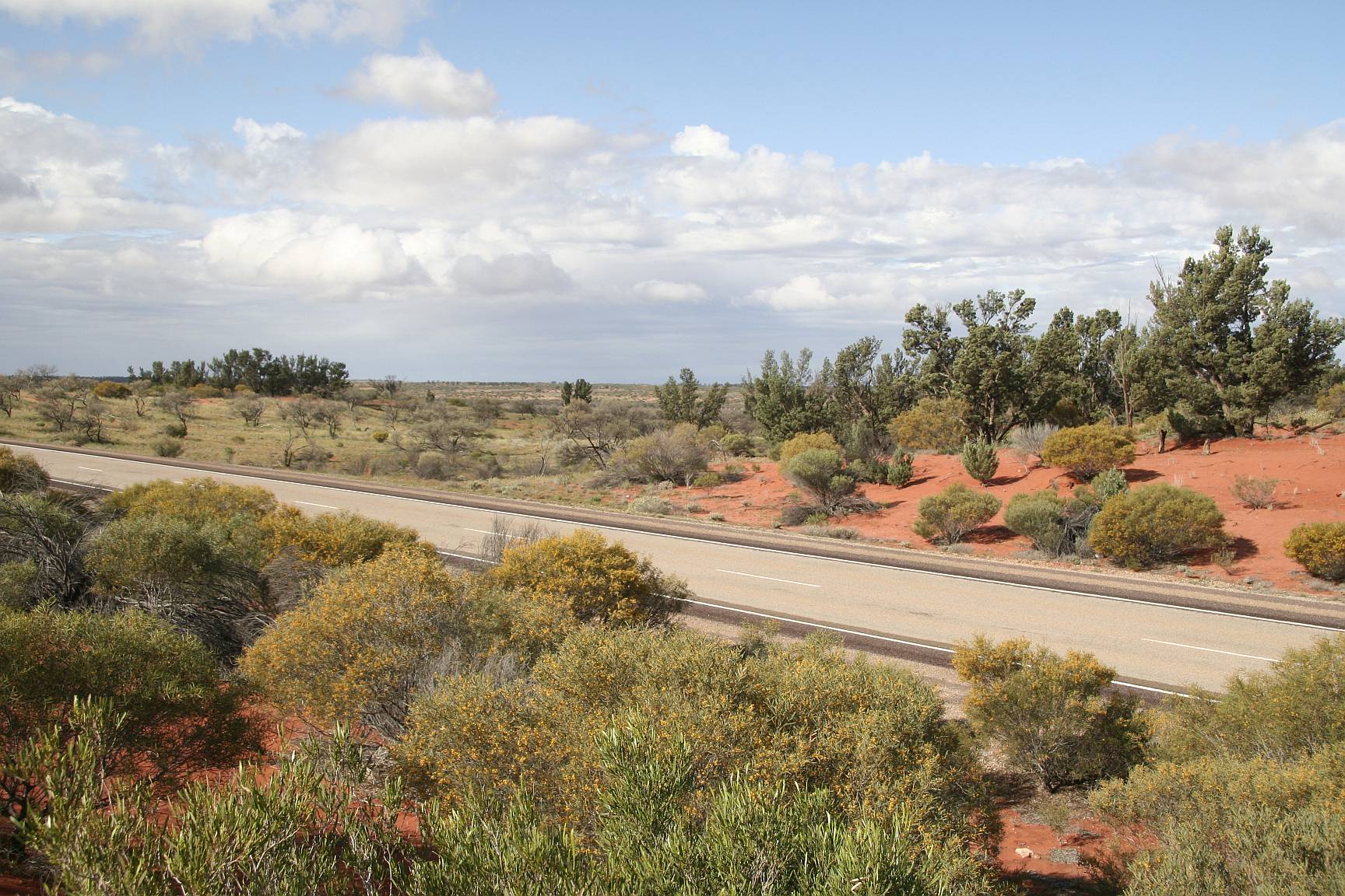
There is much to see along the Stewart Highway for those with the eyes to
see it.
The country receives a low average annual rainfall, around 150-180mm, but in
my experience it is surprising how often one happens to have rain during a
visit; as we had on this trip.
It rained all night on our first night's camping at
Woomera, giving the camper trailer a good try-out.
The vegetation varies greatly from place to place.
There are areas of bluebush, with very few trees; there are areas with a good
covering of acacia trees with saltbush; there are areas with little vegetation
at all and stony ground as far as the eye can see; and there are a couple
huge salt lakes.
My first eight years after leaving school were spent on the family dairy farm.
A dairy cow is a very different looking animal to a beef cow.
Dairy cows in the Australian outback are like hens teeth.
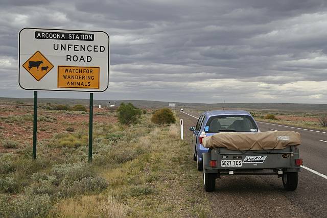
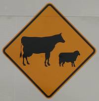
You will see many of these signs, showing an unmistakable silhouette of a
dairy cow in country where all the cattle were beef breeds.
Did the person who designed the signs not know the difference, or just not
care?
The photo shows the country south of Island Lagoon (between Port Augusta and
Pimba); and the gathering rain clouds that lead into rain all that night.
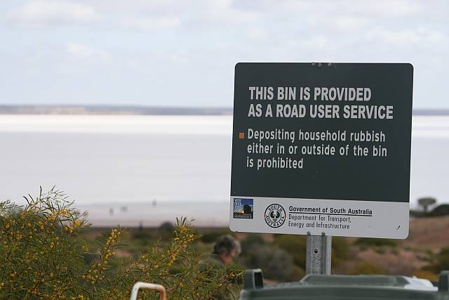
All the roadside rubbish bins along the Stewart Highway had signs like this
one beside them.
Household rubbish comes from houses.
In most cases there would not have been a house within twenty kilometres
of the signs; you wouldn't think that householders filling the bins would be
a significant problem.
This photo was taken at
Lake Heart, about 40km up the Stewart Highway from
Pimba.
Stating the bloody obvious!
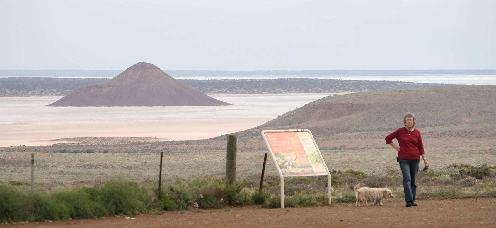
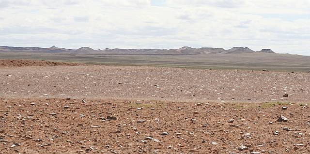
The road to The Breakaways, about 30km north of
Coober Pedy.
This salt lake, named
Island Lagoon for pretty obvious reasons, can be
seen from a roadside lookout about 30km south of Pimba.
The photo was taken with a fairly long focal length telephoto lens; the lake
is quite a distance from the viewing area.
Socrates and Denece in the foreground.
There are about 40 stock grids across the road between Port Augusta and
Coober Pedy; the car makes a loud noise as it passes over each.
Socrates freaked-out every time we went over a grid, unless we slowed right
down to 50km/hr or less; he got quite panicky.
Some dogs do, others don't.
Before coming home we got a drug from the Coober Pedy chemist that made him a
lot calmer.
The drug was Phenergan and the dosage recommended by our favourite vet
for our 8kg dog was 25mg.
One tablet a couple of hours before travelling seems to work well.
Click on (or touch) the image to see it in more detail.
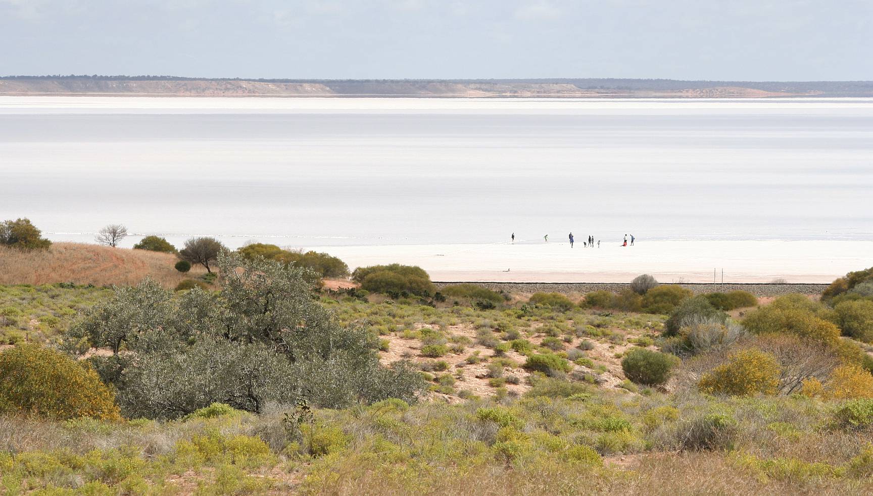
Lake Heart is a popular roadside stop about 40km
NW of Pimba.
While it is big, it is much smaller than a number of other of South Australia's
salt lakes.
I used to work in the north of SA quite a bit.
I remember seeing a car hopelessly bogged about where those people are walking.
It was there for months!
There is no worse place to get bogged than a salt lake.
Click on (or touch) the image to see it in more detail.
This view of Lake Heart was taken with my drone on the way home.
In the higher definition view you can see our car with me standing behind it
controlling the drone.
The image is a combination of five individual photos.
Click on (or touch) the image to see it in more detail.
Pigface flowering on the roadside, south of Island Lagoon.
Click on (or touch) the image to see it in more detail.
Flowering pigface again.
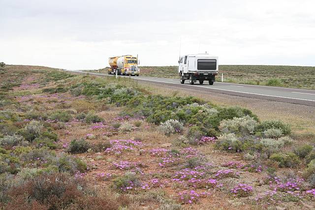
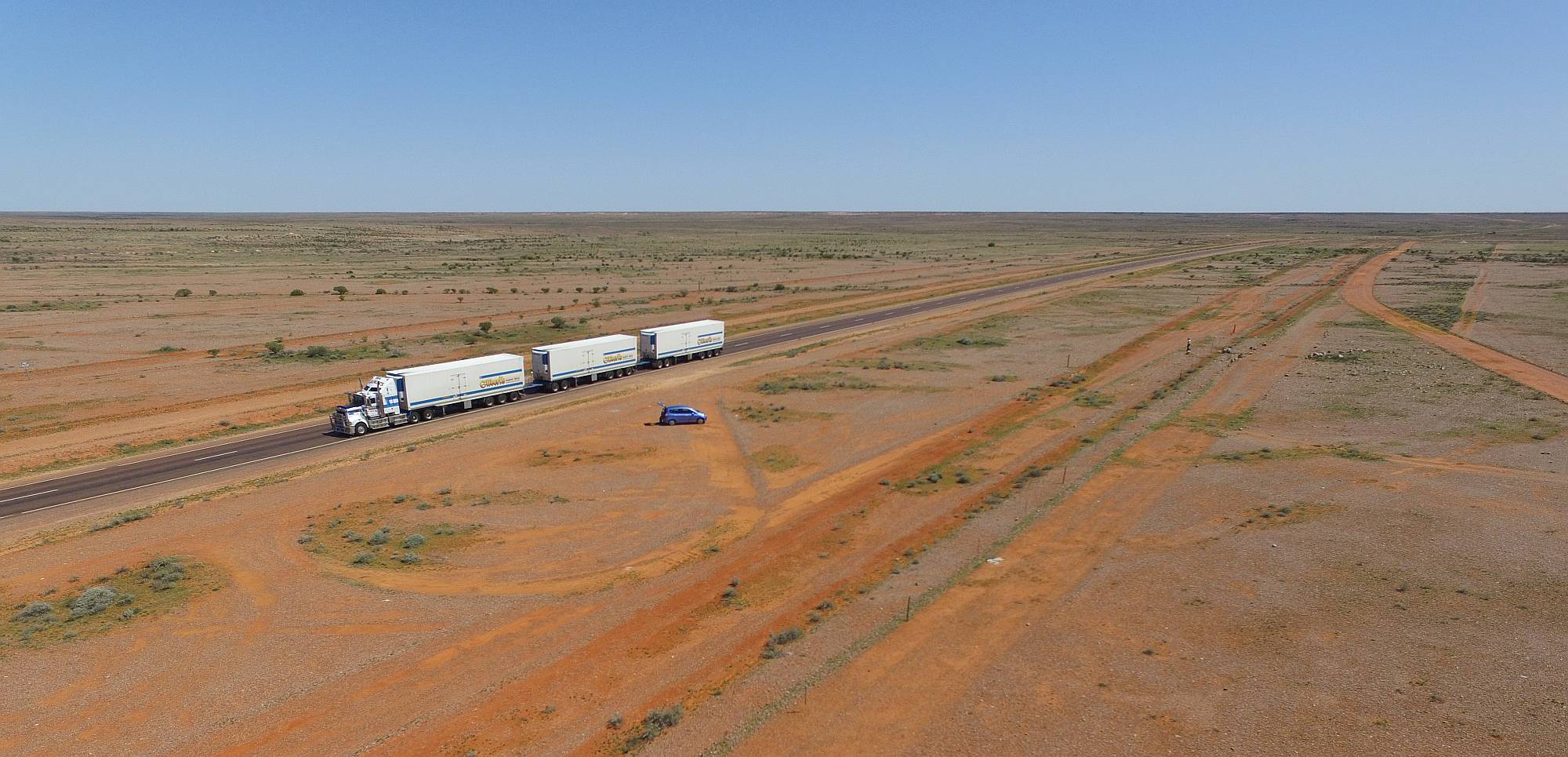
The road gets a fair bit of traffic, especially campers and
road-trains.
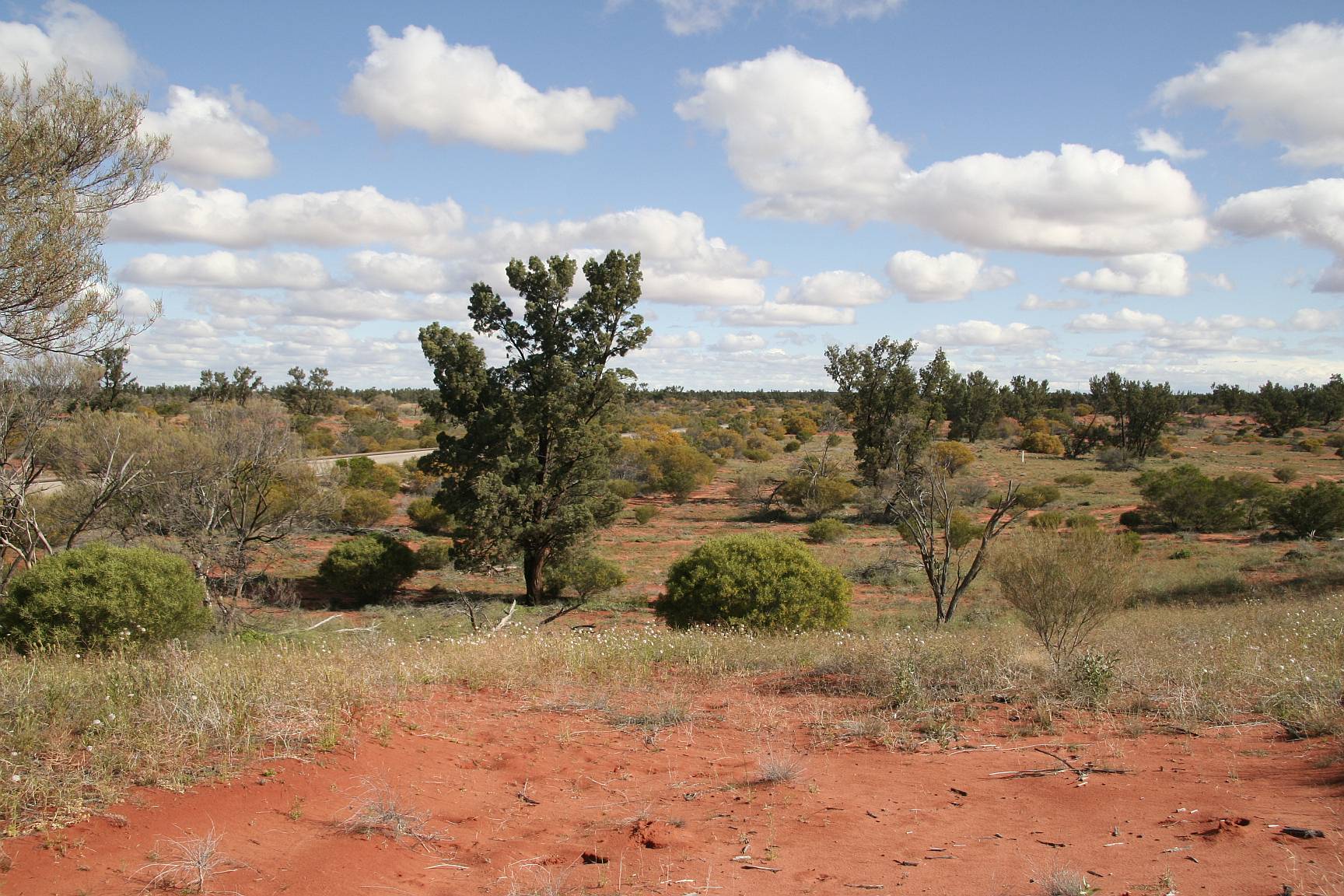
This, and the next three images, was taken of vegetation in a sand-hill area
on the roadside between Woomera and Roxby Downs.
We had cloudy and rainy weather on several of the days of our trip.
Sunshine, such as on this occasion, brings the colours out much better than
on overcast weather.
Click on (or touch) the image to see it in more detail.
There are more native cypress-pines (Callitris) trees in the Roxby Downs
area than many other parts of South Australia with the exception of the
Flinders Ranges.
The big dark tree near the centre of the photo is Callitris.
Click on (or touch) the image to see it in more detail.
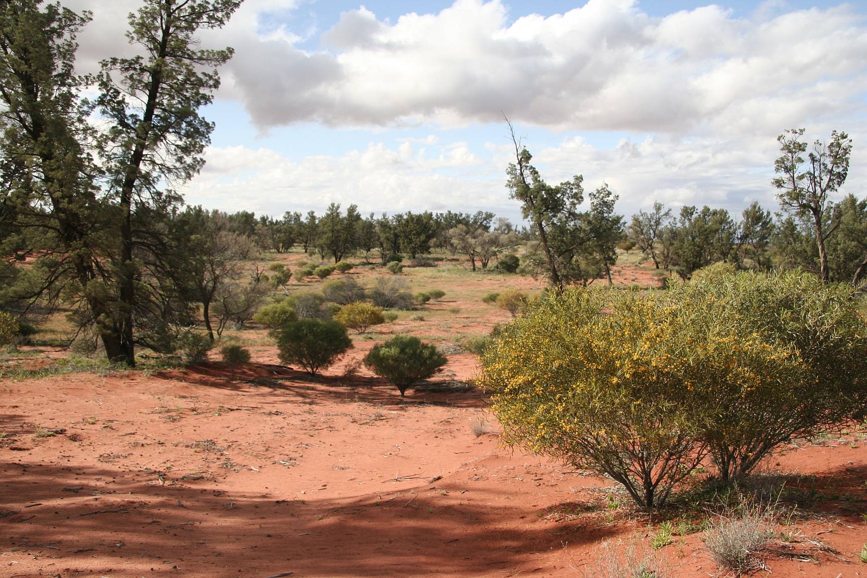
Callitris on the left, flowering Acacia on the right.
Click on (or touch) the image to see it in more detail.
Blue sky, red sand, Callitris, Acacia and daisies
Click on (or touch) the image to see it in more detail.
Flowering shrubs in a little gully in Coober Pedy; near the William Creek
road; opal diggings in the background.
I think some of the plants were 'wild hops' (the rusty red one), Eremophila,
Sena; but I'm not at all sure.
Click on (or touch) the image to see it in more detail.
After Port Augusta the Stewart Highway passes by Pimba, a tiny town just off
the highway.
From Pimba you can take a side trip to Woomera, 6km away, Roxby Downs (80km)
and the opal mining town of Andamooka, another 30km beyond Roxby.
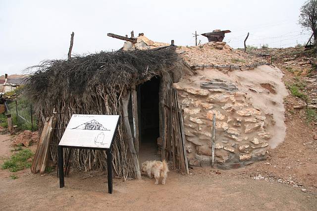
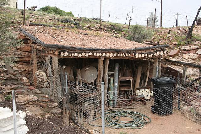
The original homes in Andamooka are called semi-dugouts.
They were typically built into the side of a slope and had Callitris logs
covered with a layer of soil as a roof.
Now most of the houses are far more conventional, as can be seen in the photos below.
There was a well maintained group of restored semi-dugouts on the main street,
this is one of those, and several photos of others follow.
This shed shows how the roof is built, Callitris logs covered with soil.
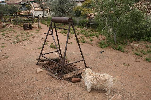
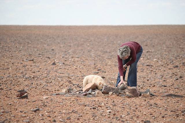
Socrates is investigating a reconstructed hand-dug shaft; the way it used to
be done.
Of course shafts are now drilled by machines and the spoil is lifted out by
machines, not by windlasses.
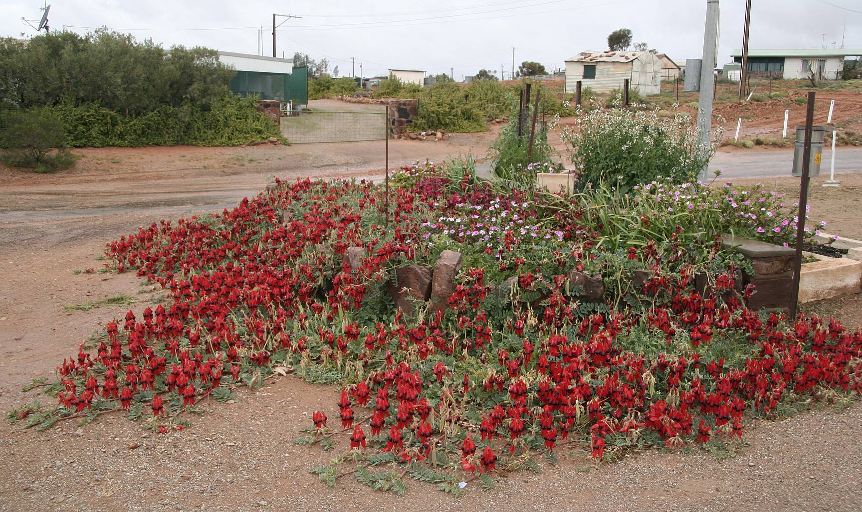
A garden dominated by Sturt's desert pea.
Click on (or touch) the image to see it in more detail.
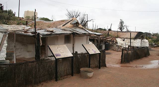
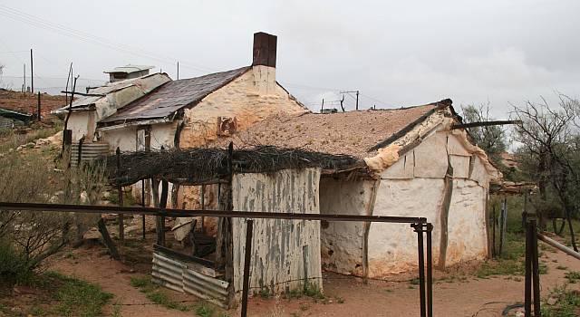
A part of Andamooka township
A part of Andamooka township
Roxby Downs main street.
The tourist information centre is on the right.
It does meals, coffees, as well as providing information.
The movie on the history of Olympic Dam Mine is worth watching.
Roxby Downs exists to provide for the huge Olympic Dam copper, uranium, silver
and gold mine.
It is a modern, tidy town; a huge contrast the seemingly little-planned town that is the nearby
Andamooka.
Roxby has a number of well stocked shops including hardware.
No doubt far more money has been available from the Olympic Dam mine for the development of Roxby than there is in Andamooka, where many of the people would have little money to spare and there is no big corporation to provide funding.
Click on (or touch) the image to see it in more detail.
Woomera has a history of rocket launches and of connection with the armed
forces.
Australia was the forth country in the world to put a satellite into orbit;
it was launched from Woomera.
(The first three nations were USSR, USA and France.)
Click on (or touch) the image to see it in more detail.
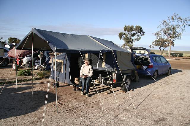
Denece, Socrates, and our camper trailer at the Woomera Caravan Park.
The first night we had at Woomera it rained all night.
The photo was taken in the morning following the second night.
We had all the food we left in the camp-kitchen refrigerator stollen while we were at Woomera.
Apparently we were unlucky; the manager was surprised to hear about it.
I think that this was the only time we have had food stollen from a shared fridge.
There is a well stocked general store, a hotel that provides meals, and an
excellent pizza store (in the Caravan Park) at Woomera.
(All my underground photos in Coober Pedy were taken without flash or a
tripod.)
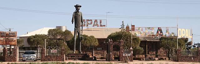
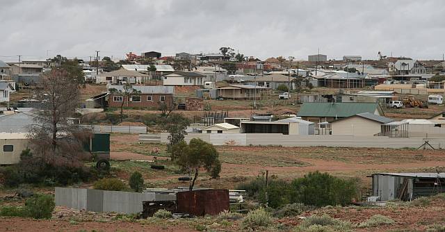
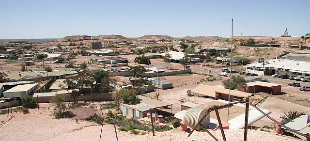
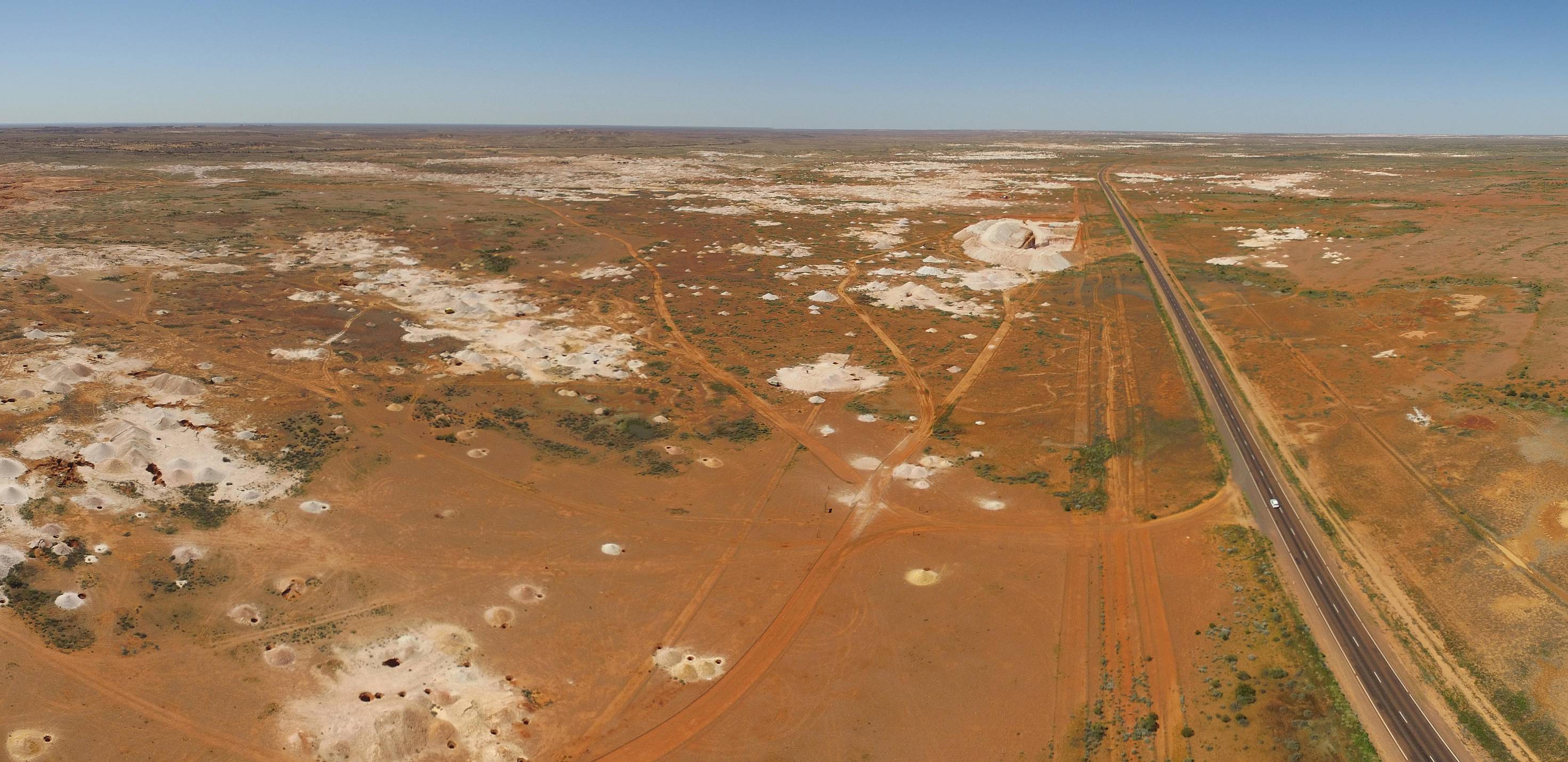
A part of the main street of Coober Pedy viewed from one of the lookouts.
With 1,762 people in Coober Pedy according to the census of 2016 it is the only town worthy of being called a town on the 1,200 km of the Stuart Highway between Port Augusta and Alice Springs.
There is a wide variety of modern accommodation in Coober Pedy, above ground and underground, and a good variety of choices in places to eat.
I would guess that tourism would be far more important economically to the town at the time of our visit than opal mining.
The 'spaceship' object on the lower left is a prop from one of the many movies
made in the Coober Pedy area, Pitch Black.
Click on (or touch) the image to see it in more detail.
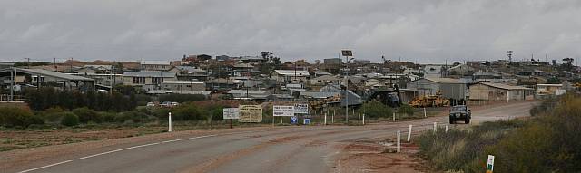
The lower end of the main street of Coober Pedy from one of the lookouts.
The drive-in movie theatre screen can be seen left of centre.
Denece and I were told by another camper that Aboriginal kids sneaking into
caravans or tents to steal food in the town area was a big problem.
The children would wait around until someone left a caravan to go to the
toilet and then would go in and steal anything they could eat or sell.
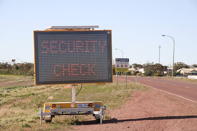
The image on the right is of an electronic notice on the main entrance to the
town warning
visitors to ‘Report suspicious activity’, ‘Lock doors and
windows’, ‘Remove
items of value’ and ‘Don't be the next victim’.
Sadly, Aboriginal adults loitering, apparently with nothing to do, or drinking,
in town was a common site.
It seems that alcoholism must be a major factor in the apparent lack of
parental supervision of Aboriginal children.
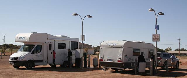
We stayed at
Riba's, which was about six kilometres out of town.
The proprietors told us that because it was so far out there was no problem
with theft.
Mosquito lavae will breed in any small pool of water.
A litre in an old tire serves very well.
This is a part of the image; click on (or touch) the image to see the whole
thing.
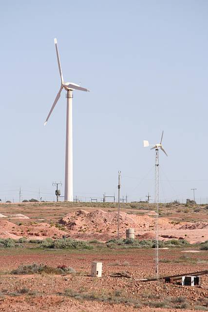
Coober Pedy had the
first big wind turbine in South
Australia and was second only to
Salmon Beach Wind Farm
in Esperance, Western Australia.
Salmon Beach had six 60kW turbines built in 1987, the Coober Pedy 150kW
turbine was built in 1991.
So far as I can find out the Coober Pedy turbine has not been in operating
condition for much of its life.
Whenever something goes wrong specialists have to come a long way to fix it
at considerable expense.
It was quite windy while we were in Coober Pedy but the turbine was not
turning at all.
Note the small domestic wind turbine in the foreground.
Two large, modern, 2MW turbines are to be built in Coober Pedy together with
a large solar PV farm and a large battery system.
Information I had received some time ago was that construction was to start
in September 2016 (the month of writing this).
(Update: the
new turbines were operating by June 2017.)
We were told that Coober Pedy has the most expensive water in South Australia
(or was it in Australia?)
The locals pay $5/kL, people who pick up water at the filling station shown in
this picture pay $1/30L; about $33/kL or about seven times what the locals
pay.
This seems a bit excessive to me (we didn't have to buy any water).
I wonder how an enterprising local resident would go if he was to offer
water for, say, $1/60L?
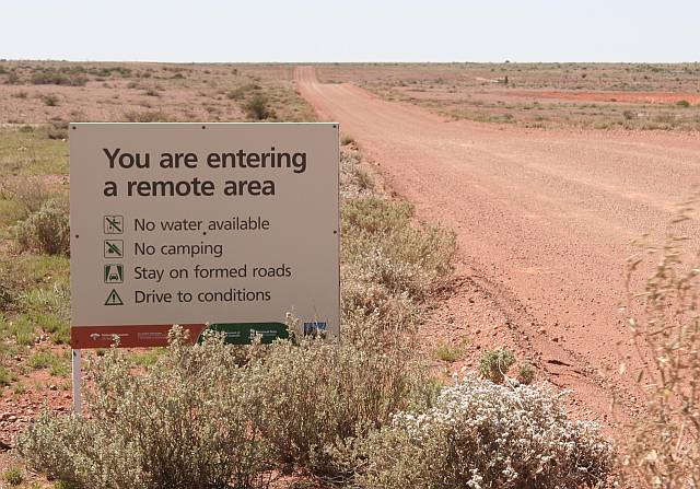
Coober Pedy is in a very dry area.
Its water is pumped in from, if I remember rightly, about 30km out of town.
It is then desalinated.
All this requires energy and Coober Pedy gets its electricity from diesel
engines, which make for expensive electricity.
(This is going to change; see
Renewable energy at Coober Pedy.)
People in the parts of South Australia that have reticulated water pay about
$2/kL.
Under the circumstances I think Coober Pedy's $5/kL water is no more
expensive than is reasonable.
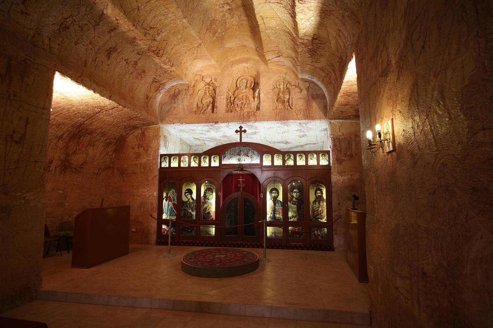
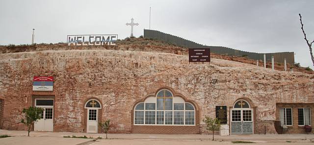
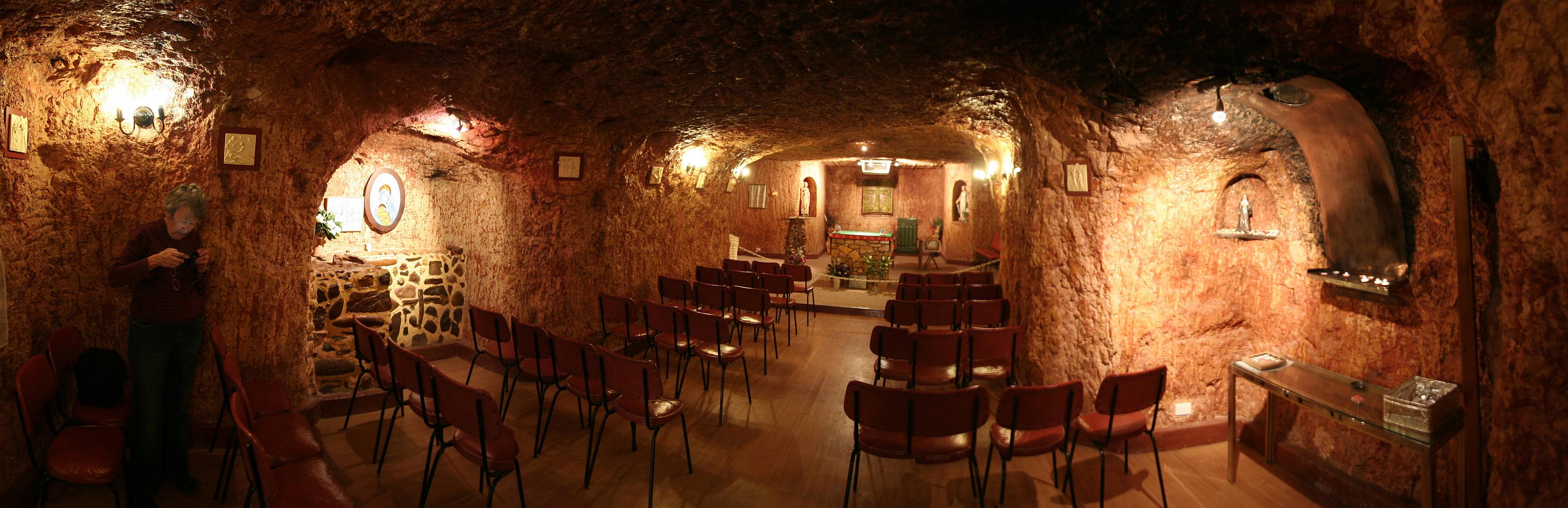
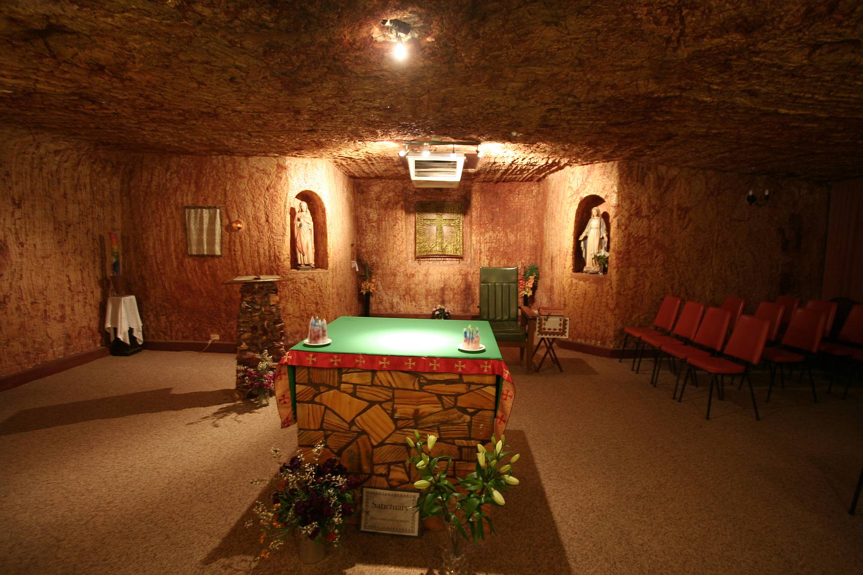
A 'must see' in Coober Pedy is the underground Serbian Orthodox Church of
St Elijah.
Christianity in all its variations, and its relation Islam, is of course a
delusion, but it has lead to some of the world's greatest architecture.
The Church of Saint Elijah is certainly one of the most striking and original
examples of architecture in Coober Pedy.
Click on (or touch) the image to see it in more detail.
More images below...
A view of more of the Serbian church.
There is no seating because people stand throughout Serbian Authodox services.
Note that the roof is vaulted; this would allow for a greater span without
increased danger of roof collapse.
I did not find out any rules in Coober Pedy about the safe width of a tunnel
with either a
flat or vaulted roof, although there are certainly rules about how thick the
dividing walls must be between adjacent tunnels, and there are rules about
how thick the overlying shale must be for stability.
Roof stability must generally be very good.
I don't recall ever hearing about anyone being killed by a dugout home roof
collapse in Coober Pedy.
Click on (or touch) the image to see it in more detail.
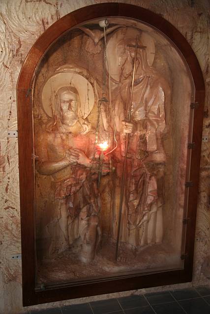
Saints carved into the native shale within the church.
Front of the Serbian Orthodox Church of St Elijah.
This is the only side exposed to the outside world.
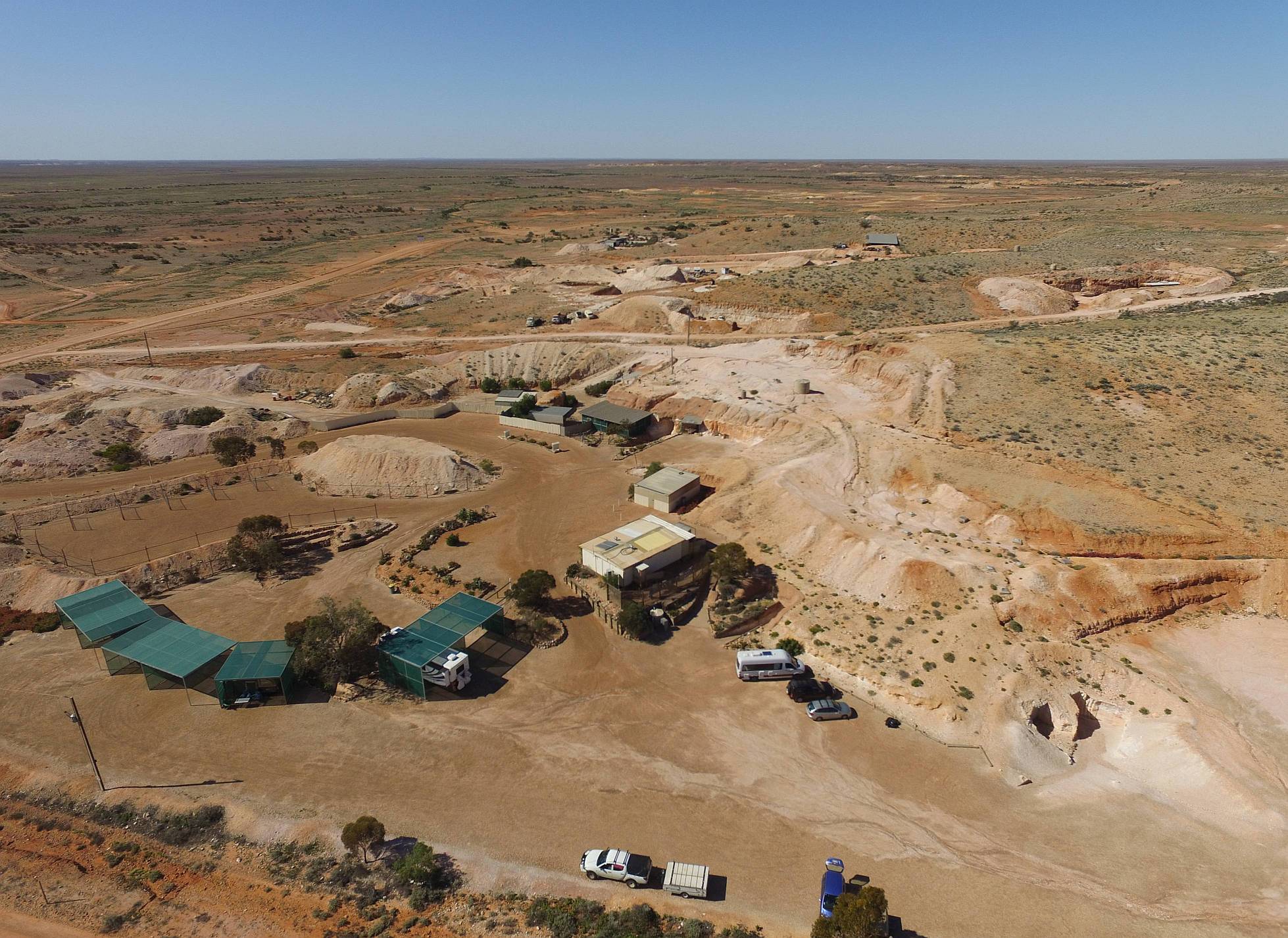
A drone photo of Riba's.
The outdoor powered sites are under the shade cloth carports on the left.
Our car, from near which I was controlling the drone, is the blue one at the
extreme bottom of the image.
More detail of a part of the area is given in the image below.
Click on (or touch) the image to see it in higher definition.
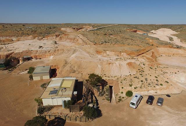
A closer drone photo of part of Riba's place.
The entrance to the 'TV Room' can be seen in the bank on the right; the
entrance to the demonstration mine is just to the left of that.
The BBQ area is the square place on the left; the bathrooms are the larger
place in the foreground.
The entrance to the underground camping and bedrooms is to the right of the
bathroom building.
Denece and I did the mine tour.
In general it was quite good, although it is very hard to know how much of
what we were told is fact and how much fantasy considering that about a third
of the time of the tour was a
divining demonstration
Divining
is not supported by any evidence and is delusional; it just does not work,
how could it work?
I have worked over thirty years in the groundwater industry and have, in that
time heard a lot of claims by diviners, although most of them concerned
searching for water.
The guide for Riba's mine tour spoke of divining for 'slides', which he told
us were minor geological faults where opals might be found.
I recall another diviner telling me that he could divine for opals.
I asked him how he could know whether his divining rod was responding to opals
or water.
He replied that it responds to opals in opal country and water where
groundwater can be found.
A hole drilled to around 120 metres anywhere in the vicinity of Coober Pedy
will get a water supply (although it will be too saline to drink).
You'd have to wonder why all that water doesn't overload the divining rods
in the Coober Pedy area.
How is it that Riba's divining rods respond to 'slides' while the other
bloke's responded to opal?
I've listed ten good reasons
to believe that divining does not work on another page on this site.
There are no good reasons to believe it does work.
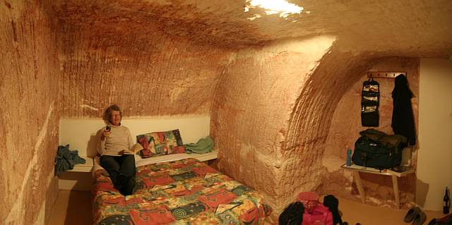
Our bedroom
It was very basic, but quite comfortable.
There were no power points, reading lights or chairs.
The room was cheap ($66/night).
We wondered why Riba's didn't fit the rooms out a bit more fully, they could
then have charged considerably more.
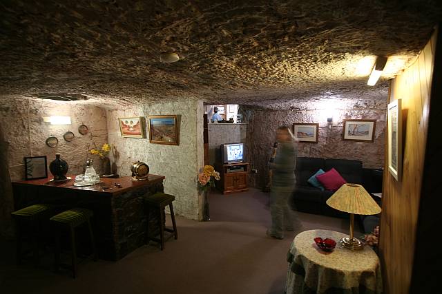
The TV Room
This is a combination of three images so as to fit most of the room in the
one photo.
Click on (or touch) the image to see it in more detail.
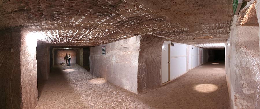
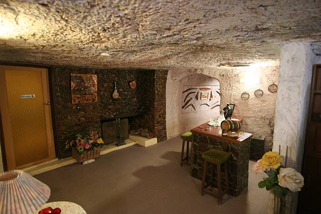
Riba's underground camping area.
Our bedroom was through the third door on the left of the tunnel on the right.
There were several other tunnels and a number of alcoves for campers to use.
This underground house is open for inspection at a small fee.
It was built by a woman,
Faye Nayler,
who opened a cafe, called the Windlass Cafe, in 1961.
My first visit to Coober Pedy was in 1963 and I think I remember Faye and
her cafe.
I think she jokingly called it the Windy Lass Cafe; she was talkative.
At the time, if my memory serves, the only accommodation in town was a
galvanised iron hotel or motel (Brewster's?)
Another room in Faye's House.
We were told that Faye built the house herself, with the help of several
female friends.
We were also told that the temperature in Coober Pedy's dugouts varied from a
low of 20°C in winter to 25°C in summer.
I can well believe this, having had some experience with
underground living.
The alternative to living underground at Coober Pedy is lots of air
conditioning; see
Above-ground Coober Pedy.
The Catholic Church is smaller than the Serbian Orthodox, but I thought it
more attractive, although less interesting from an engineering or
architectural point of view.
This is a combination of four images.
Click on (or touch) the image to see it in more detail.
Another shot of the Catholic underground church.
Click on (or touch) the image to see it in more detail.
This looks like accommodation for workers of some sort.
Note the many air-conditioners – a necessity to anyone living on the
surface in Coober Pedy.
The power demand on a hot day must be pretty enormous.
The Coober Pedy Hospital is just visible in the distance on the left-centre.
Click on (or touch) the image to see it in more detail.
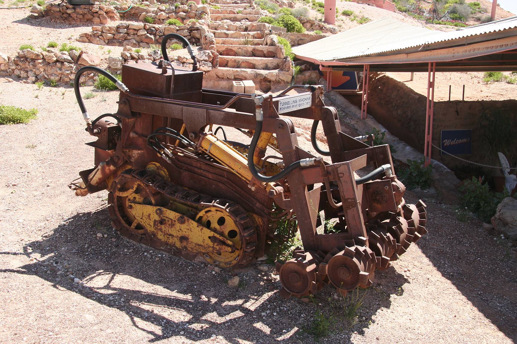
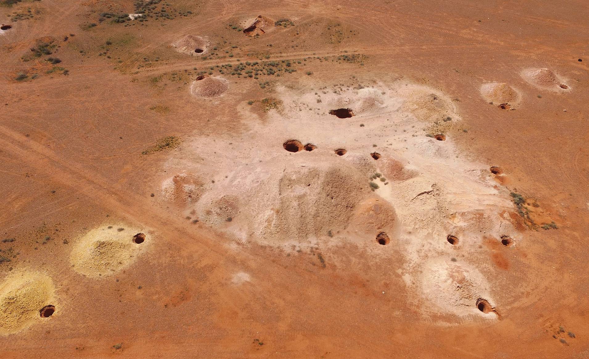
An old tunnelling machine – on the main street.
This machine digs out the shale (locally called sandstone) and allows the
blower (photo below) to suck it up to the surface.
Click on (or touch) the image to see it in more detail.
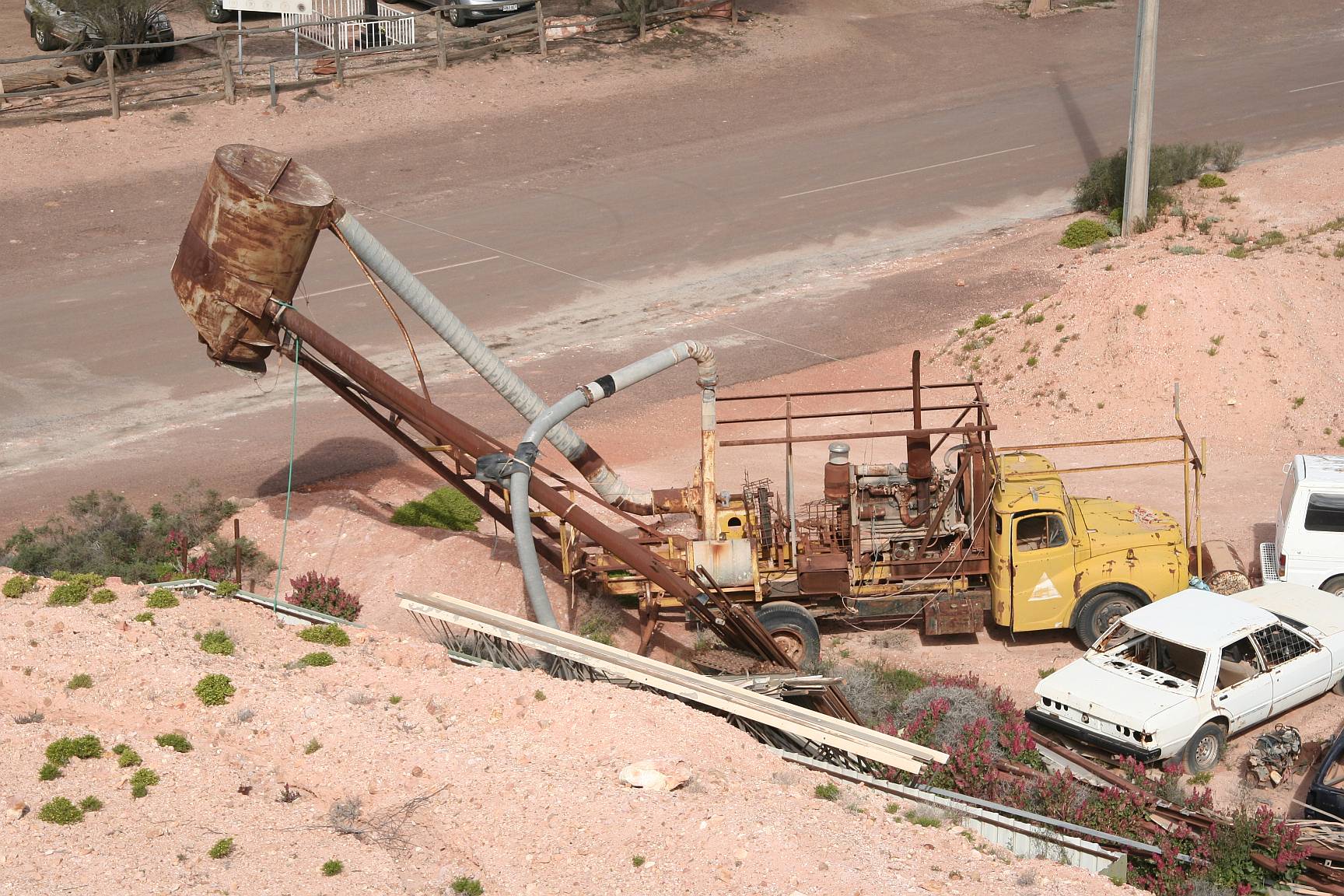
An old blower on one of the side streets of Coober Pedy.
This machine sucks the shale (and possibly opals) from the tunnelling
machine (photo above) to the surface.
Click on (or touch) the image to see it in more detail.
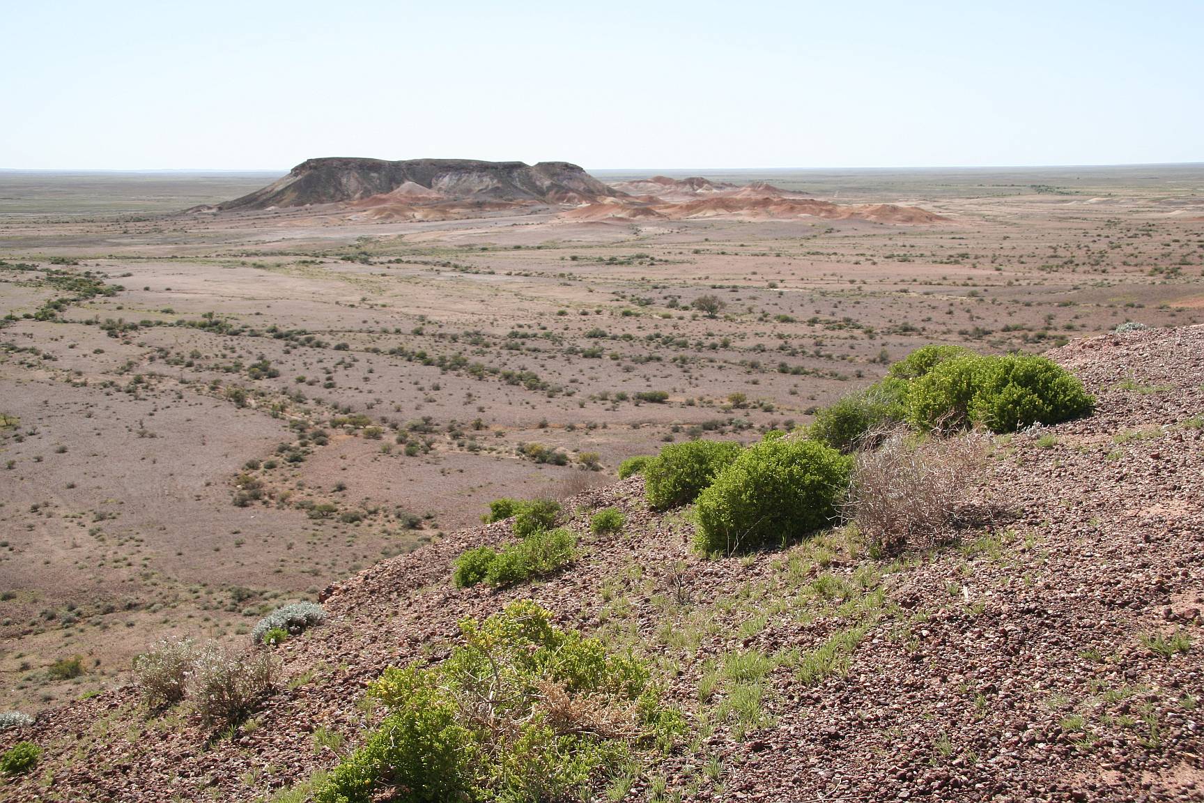
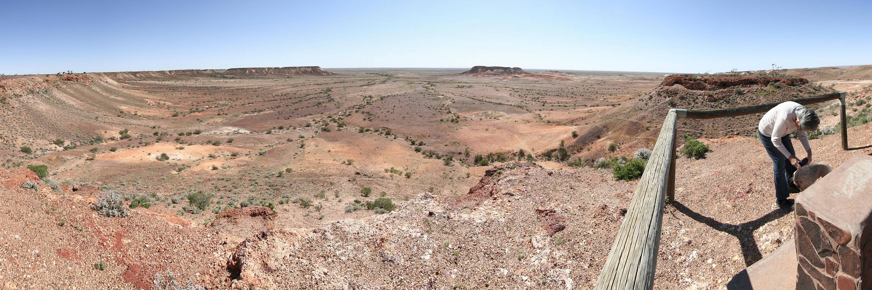
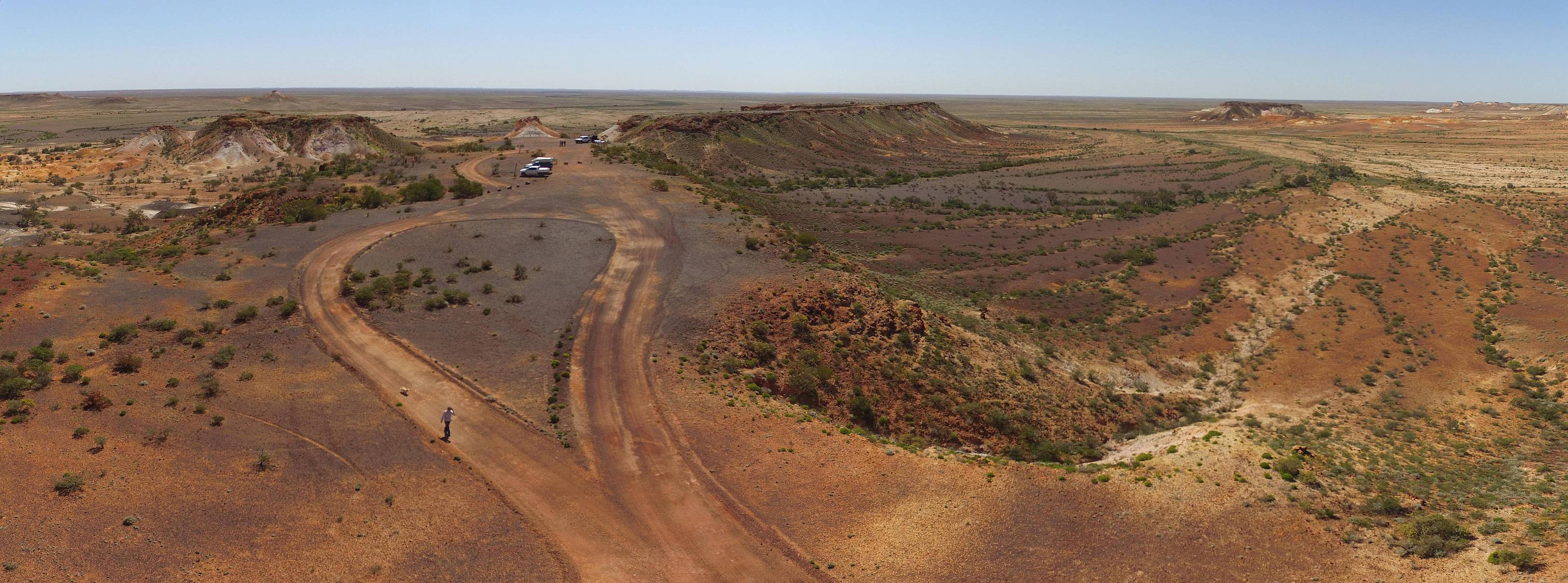
The Breakaways was the highlight of our visit to Coober Pedy.
The beauty of the place is difficult to put into words.
I'm sure that we were fortunate in that when we went there the green of the
vegetation that was advantaged by the good winter and early spring rains
added green to the pallet of reds, browns, yellows, black and white that
were in the rocks.
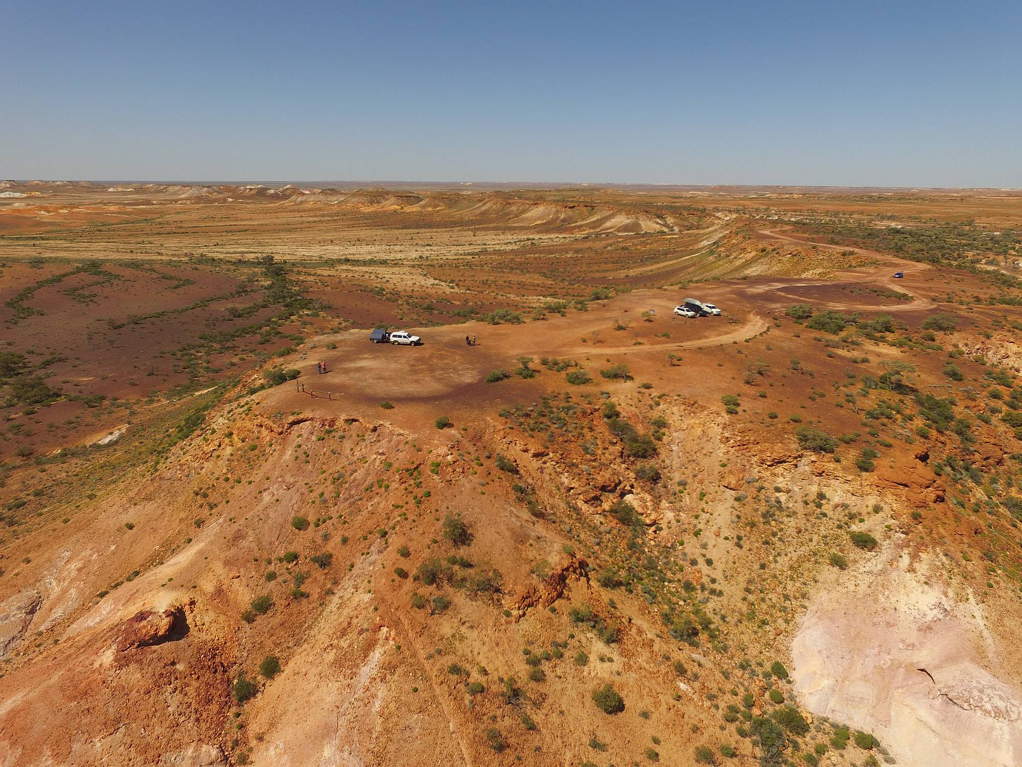
I used a drone to get some photos of The Breakaways.
Shortly after I flew my drone a woman came and told me that it was illegal
to use a drone in a conservation park.
I asked her what the justification for this was and she replied that it was
to protect Aboriginal sacred sites, which might be visible from a drone
while not from the places where walkers go.
The great advantage to photography that a drone gives in The Breakaways is
that it can get above
the level of the ridge-tops, there is no other way of doing so.
On 2016/09/19 I emailed the Department of Environment asking about this
prohibition.
I received a reply on 2016/09/28.
The reason he gave was:
The use of drones in parks is regulated to protect our native fauna, as well as
the community.
Flying a drone in a park can present a nuisance because of the impact on the
privacy and enjoyment of visitors, but they can also disturb nesting birds
such as osprey and other raptors.
If these birds are disturbed, they many not return to their nests, resulting in
the death of their chicks.
Permission to use a drone in a park may be given as part of an application
to undertake an activity such [as] commercial photography or scientific
research.
The spokesman for DoE did not mention Aboriginal sacred sites; if the banning
of drones in conservation parks is at least partly to do with Aboriginal
sacred sites then it greatly concerns me that everyone should have their
freedoms limited based on the superstitions of a few.
Since writing this I have been contacted by someone who told me he had been
told to stop using his drone at Kings Canyon National Park.
The same justification about Aboriginal sacred sites was given.
He said that this was absurd because helecopter flights over the canyon were
frequent and they would be looking at the same sites.
Of course there are no ospreys in Australia's inland conservation parks.
|
I've owned my Phantom 3 Advanced drone since late in 2015.
This trip was in September 2016; it has confirmed to me the value of drones
for landscape photography.
The photos that were taken with my drone would have been impossible to get
any other way, short of hiring a helicopter.
I believe that they have added a lot more interest to this page than there
would otherwise have been.
As of 2016/09/24 there were 65 photos on this page; 13 of those were drone
images, the others were taken with a Canon EOS 350D digital SLR camera
(I may well add more photos later).
Also, while I thought that 52% of the DSLR photos were worth displaying in
high definition, I used 84% of the drone photos at high definition.
Also see Drones: some notes, thoughts, observation, uses and DJI Drones: a personal experience.
|
From the more southerly of the lookouts, looking roughly south.
Click on (or touch) the image to see it in more detail.
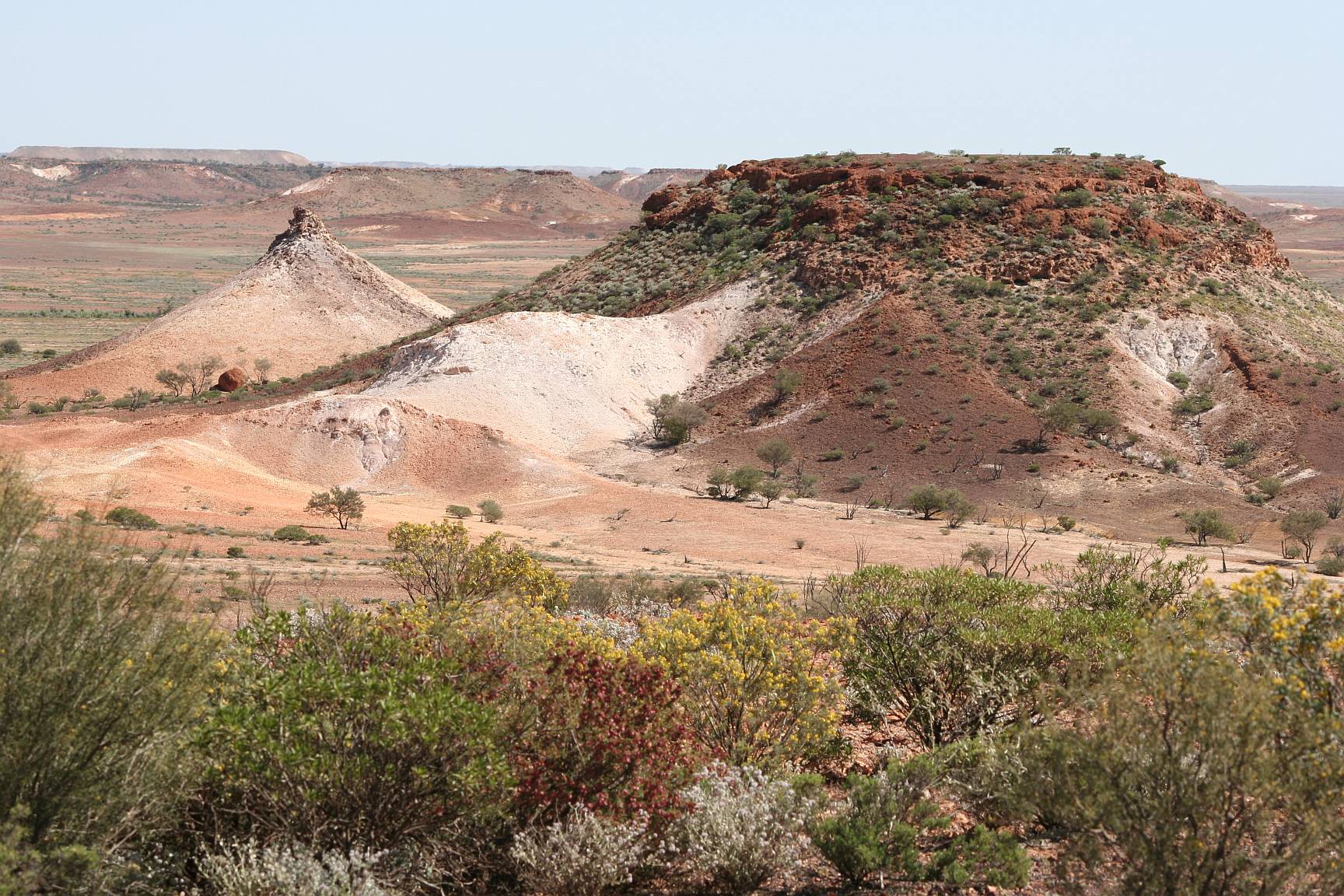
One of an infinite number of possible good views of The Breakaways.
This one was taken from the ground; others, below, were taken from the air
with my drone.
Click on (or touch) the image to see it in more detail.