| ||||
|
The so-called Clare Valley, actually several valleys in an elevated region, has many houses scattered through scrubby or grassy undulating hills. It is one of the most bushfire-prone areas in the state.
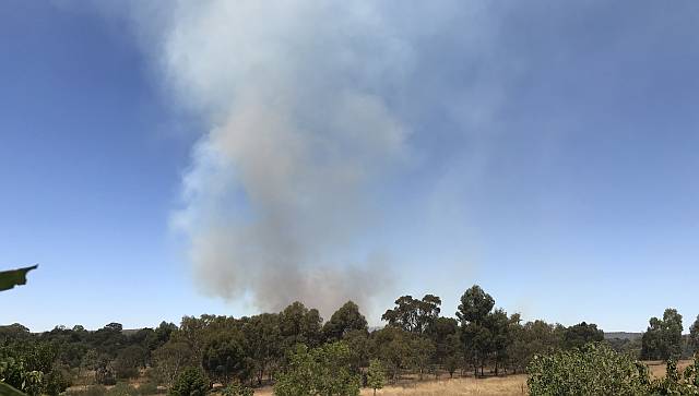
I took particular notice of the reports available on the radio and Internet because one of the many properties threatened by the fire was mine. If one is to defend one's property from fire it is essential to have some idea of where the fire is and how fast it is advancing.
Of course it is easy to see the direction of the fire, from the smoke plume, but it is very difficult to judge the distance and impossible to know how fast it might be advancing by just looking at the smoke.
The Country Fire Service head quarters produced periodic warnings about any fire. They could have inform people who are, or may be, threatened by the fire of exactly where the fire-front was, and how fast it was advancing, but they did not. My wife and I knew that our place was down-wind from the fire, but we knew very little more than that.
Of course one does not want to bother the local fire-fighters by phoning them to ask exactly where the fire is every hour or so, they have their hands full fighting it. Similarly, you shouldn't drive near the fire because you could put yourself in danger and you could get in the way of the fire-fighting operations.
My wife and I were prepared to protect our property from the fire, but we had no idea when, if ever, the fire was likely to get to us. After a couple of hours it seemed that the fire was not getting appreciably closer so I climbed a nearby hill and from the top could see that the fire was no closer than two kilometres.
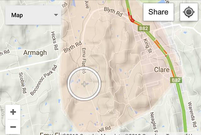
The map on the right was provided via the Internet by the CFS with minimal information. It seems that the shaded area was the area considered to be at risk. Our property is bounded by Scobie Road, Boconnoc Park Road and Blyth Road.
After the fire
The following day, Saturday 3rd, my wife and I attempted to find out how far west the fire had burned. Emu Flat Road was closed to us, for safety reasons. We went to the SAS headquarters in Clare where we were told that the fire was almost entirely confined to the area east of Emu Flat Road; there was only a small outbreak in dry grass about 200m wide and of a similar length where the fire had crossed the road and been extinguished; fortunately before it got into another patch of scrub.On Sunday 4th we drove the 1.5km section of Emu Flat Road where the fire had burned along the eastern side. It had come within 500m of the south-eastern side of the village of Armagh and had burned very close to a number of houses that were on both sides of Emu Flat Road. The fire didn't burn north as far as the Blyth Road anywhere that we could see.
Plainly, the fire-fighters had done an excellent job of protecting homes and sheds.
Information via Facebook
A few days after the fire a friend told me that during the fire a number of people were getting information from the Northern Argus Newspaper's Facebook page. Residents were posting information as they learned it.I ask, wouldn't accurate and timely information from CFS Headquarters, who should be well informed about the fire situation, be far preferable to random postings from the public who might be well intentioned, but perhaps no better informed than me? However, given the information vacuum from CFS Headquarters, I suspect the Facebook page could only be better than that.