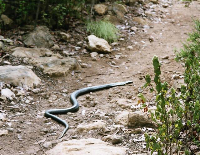
Kangaroo Island is probably best known for its wildlife and this is well
justified: kangaroos, wallabies, seals and penguins are common; echidnas,
platypuses, goannas and snakes can also be found; then there are the birds...
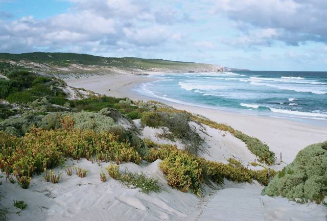
However, it also deserves to be known for its scenery and its beaches
(and probably its fishing, although that's not for me).
KI is about 120km SW of Adelaide in South Australia and 13km off the
coast at the closest point; in size it is about 140km
from east to west and 40km from north to south (about the size of Bali,
although having a thousandth the population, 4200 against 4.2 million).
About half the people of KI live in Kingscote.
My wife, Denece, and I have visited KI several times.
This page has photos taken during our last few visits.
To have some sort of order I have started this page with the ferry crossing
from Cape Jervis to Penneshaw and gone from there clockwise around the coast.
| |
| |
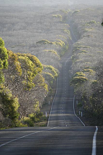
Looking back toward Cape Jervis and Starfish Hill wind farm
| |
|
| |
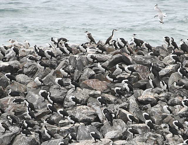
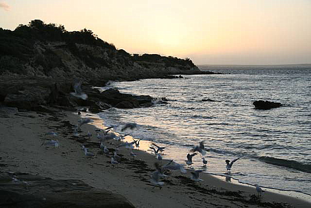
The first numerous wildlife we saw on Kangaroo Island, these cormorants
were on the breakwater at Penneshaw.
| |
|
| |
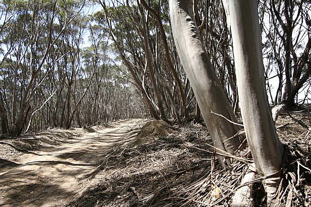
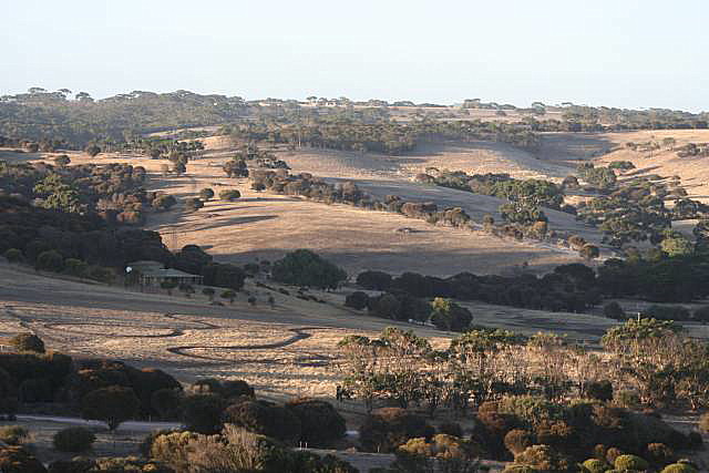
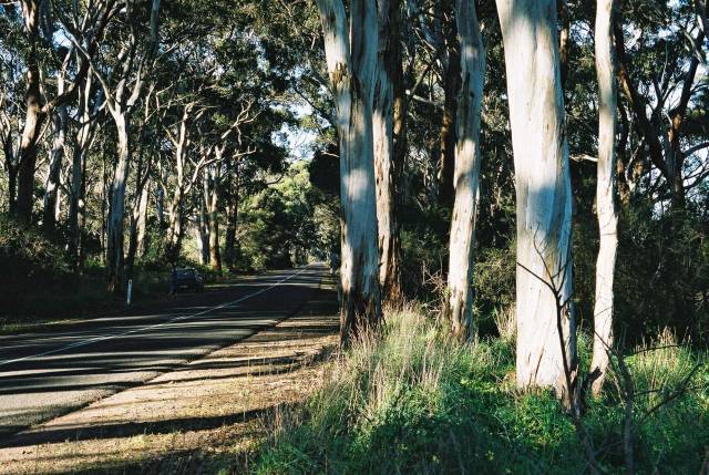
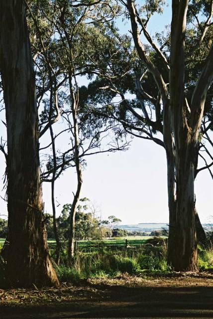
A gum-tree lined back road just east of Penneshaw
|
|
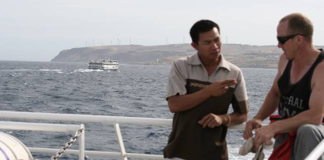
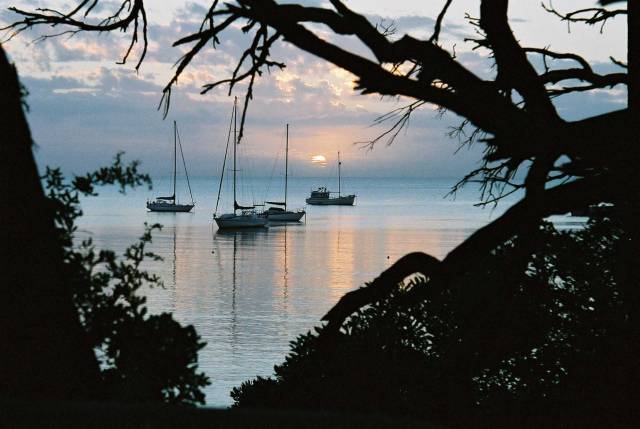
Most people cross to the island on the ferry from Cape Jervis to
Penneshaw, a distance of around 18km.
In our experience the crossing is most often calm, but can be quite rough
at times.
Our most recent trip over, on January 22nd 2009, was the roughest that we
have experienced.
We started seeing some of the wildlife even before the ferry had docked at
Penneshaw; the breakwater was covered with pied cormorants.
The photo at the right shows only a small part of the whole colony.
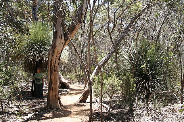
It might be a matter of taste, but I love these smooth-barked gum trees
that form dense copses in some parts of the Island.
There are many scenic back roads on KI, you haven't seen the island unless
you've got off the bitumen in many places; and you don't need a 2-tonne 4WD
to do it, we got everywhere we wanted to go with no trouble in a little
Honda Jazz.
We were surprised at the relatively small number of big 4WDs on the island;
it seems the islanders have better priorities than buying needless
polluting fuel guzzlers; good on them!
Perhaps they care about the
environment,
climate change and
ocean acidification
more than mainlanders do?
|
|
| |
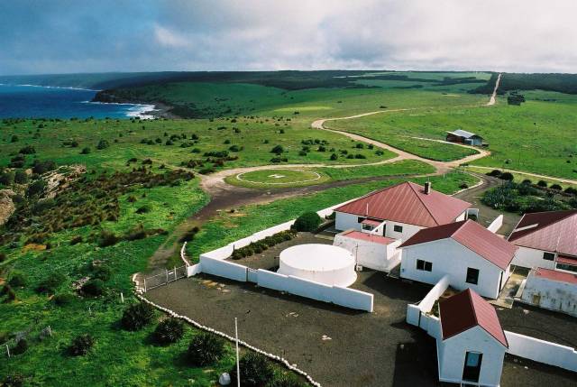
Cape Willoughby light station accommodation and the south coast;
the photo was taken from the top of the lighthouse
| |
|
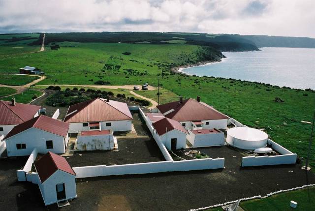
| | More of the light-keeper's houses and a little of
the north coast
| |
|
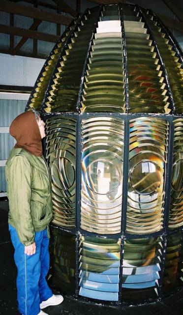
Cape Willoughby lighthouse light lens
This lens was used in the days when it was important that lighthouses
have the absolute maximum visibility.
In recent times ships are much more left to their own GPSs and radar to
look after themselves.
We were told that the Cape Willoughby light now is visible from about 40%
the distance that it used to reach.
| | Old light lens in storage
|
|
Right at the eastern end of KI and of the Dudley Peninsula is Cape Willoughby
and its well maintained light station.
The light is now automatic and unmanned - the days when lighthouses
provided employment in remote regions are long past; but the old
light-keeper's accommodation is available to travellers.
|
|

| |
Pennington Bay
| |
|
| |
A small part of Pennington Bay
|
|
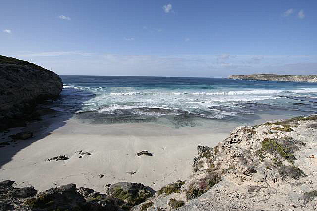
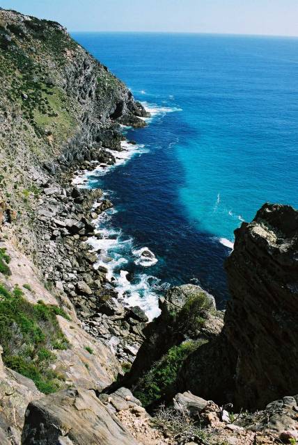
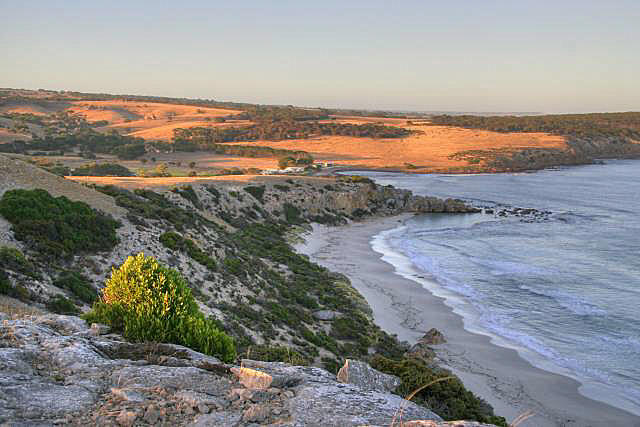
KI has two parts, the small Dudley Peninsula to the east (about 30km x 17km)
and the big bit (about 110km x 40km).
On the southern side of the isthmus between the two sections
is Pennington Bay, one of many beautiful bays on KI.
The southern coast faces the Southern Ocean and has big surf; there is
no more land until Antarctica to the south.
The northern
coast is much more protected because it faces the Australian mainland.
Just north of Pennington Bay is
Prospect Hill, a huge sand dune with a lookout
on its top.
|
|
| |
Some of the steps up Prospect Hill
| |
|
| |
Looking north over Salt Lagoon and American River from Prospect Hill
|
|
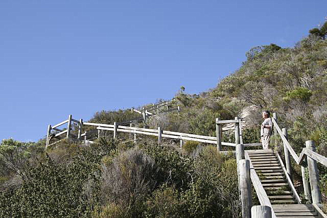
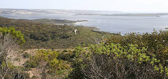
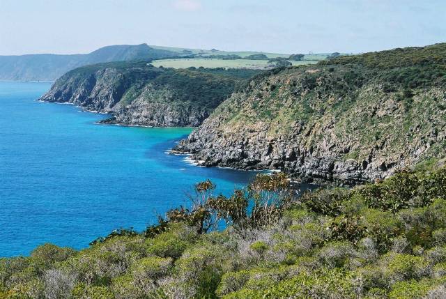
Just north of
Pennington Bay is a huge sand
dune, named Prospect Hill by the explorer Matthew Flinders.
Flinders approached the hill from the north coast and, when he climbed the
hill, was surprised to see how close the south coast was (the isthmus is
only 1km wide at this point).
Prospect Hill, which I think is the highest point on KI at around 85m, gives
great views over Salt Lagoon and Pelican Lagoon to the
north as well as a little of the south coast.
|
|
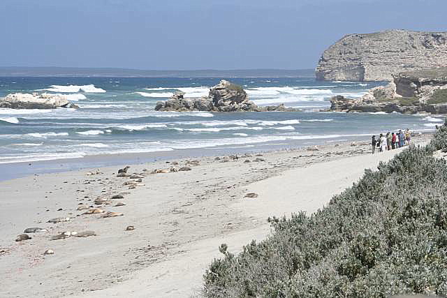
| |
The part of the beach visited by tourists
| |
|
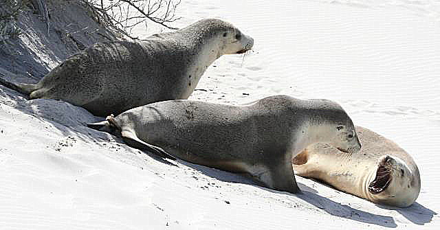
| | Australian sea-lions
| |
|
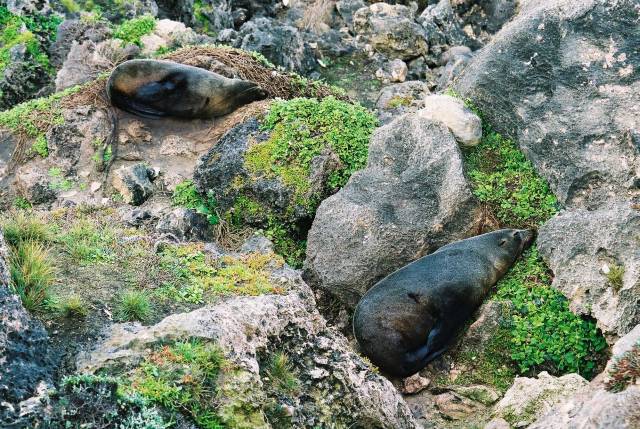
| | The smaller sea-lions are females and cubs, the big ones
are males.
| |
|
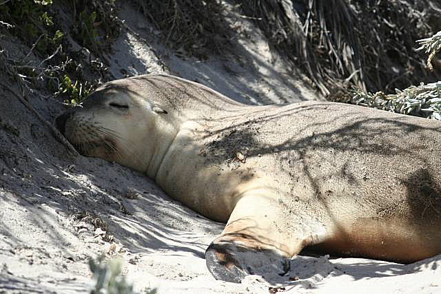
| | Sleeping next to a board walk
|
|
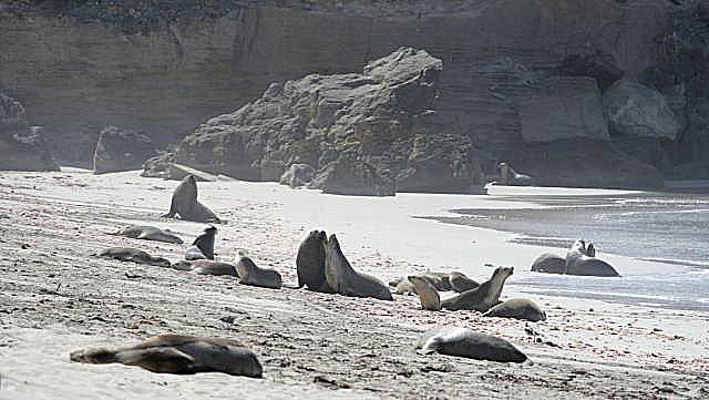
Seal Bay belongs to the Australian sea-lions that live there; tourists
come second and have to keep out of the way of the sea-lions.
We were told that January, when we visited, is in the middle of the breeding
season, which lasts about six months;
the sea-lions have a gestation period of about 17.5 months and mate within
a week or so of giving birth.
(I fail to see how these data add up; seams to me the births would have to
come outside of the breeding season if this were true.)
The sea-lions have largely learned that they can ignore the human visitors.
They come ashore to give birth, breed, look after their pups, and relax.
This seal was sound asleep right next to one of the
board walks, showing that they are fully relaxed with the presence of
humans.
|
|
| |
Kids climbing dune to slide down again
| |
|
| | The poor kid who can just be seen was getting thoroughly
sand-blasted.
|
|
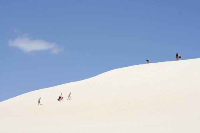
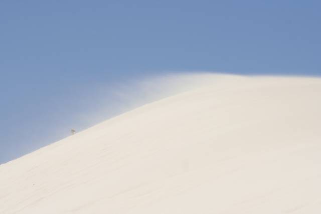
Little Sahara is an area of bare white sand dunes about three kilometres from the southern coast, with quite a bit of densely vegetated land in between.
It is no more a desert than is any other part of KI, the dunes have started
moving for some reason and have locally overwhelmed the vegetation, but you
could imagine that you were in the Sahara.
Kids were sand-boarding down the biggest dune.
Unfortunately for them the wind was strong enough at times to lift the sand;
they packed up and went off soon after this photo was taken.
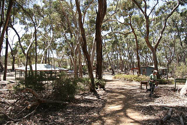
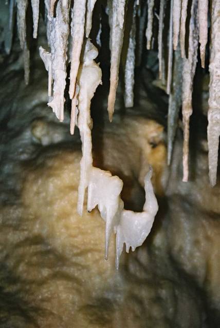
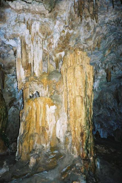
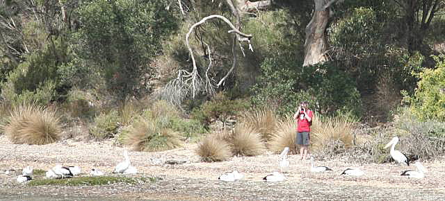
If you are interested in caves, or even if you are not, Kelly Hill Caves is
well worth a bit of time.
There is a beautiful picnic ground and a sign-posted bush walk on which
many of the plants are named.
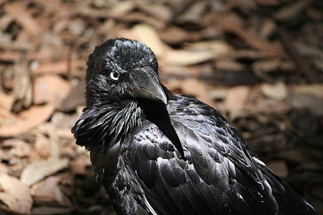
When we were having lunch at the picnic ground this crow was hanging around
looking for a hand-out; something that is not encouraged in national
parks.
He seemed to have been someone's pet that had been released into the bush
and had found a good source of tucker.
Part of the bush walk.
Denece and I were very impressed with the yaccas on Kangaroo Island.
|
|
| | Hanson Bay
|
|
Another of Kangaroo Island's beautiful beaches.
Again, being on the south coast, expect a lot of surf here
Visitors have to call in here to get permits to spend any time in the
national park, but it is normally a great place to see wildlife in any case.
On our last visit (January 2009) there was still a lot of damage from the
bushfires of December 2008 and several of the walks were still closed,
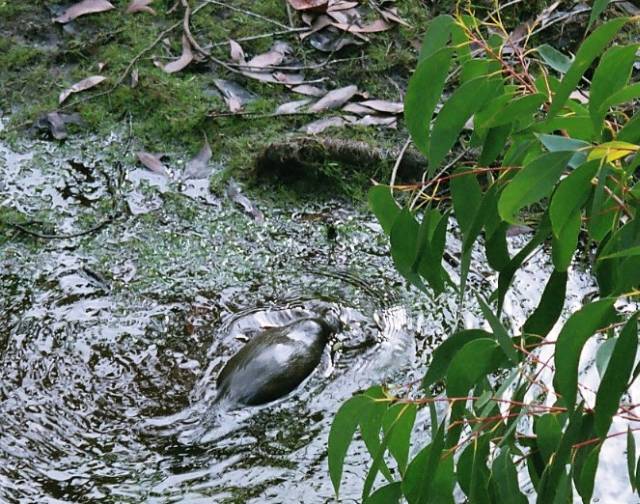
including the Platypus Walk.
I recalled from the previous walk that there were many board walks on the
Platypus Walk.
The timber had probably been treated with copper-chrome-arsenate;
I wonder what
happened to these toxic metals when the board-walk burned?
(I have always been reluctant to use CCA treated timber because of concern
about releasing the heavy metals into the soil.
CCA has become less used recently because of this concern - it's use is
one of the many
ways that we interact with our environment unsustainably I suspect.)
At least we were informed on our last visit that, while we couldn't do the
Platypus Walk, surveys had indicated that platypus numbers had increased.
The numbers of wild life than can be seen on any visit varies.
We saw many more of all species in 2004 than in 2009.
|
|
| |
A conventional view
| |
|
| | A less conventional view
| |
|
| | Looking into the sun
| |
|
Waiting for the sun to set
| |
|
The strip of stone in the centre is almost ribbon-like
|
|
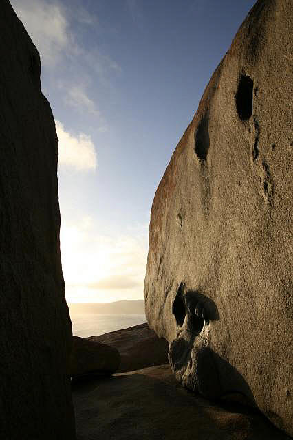
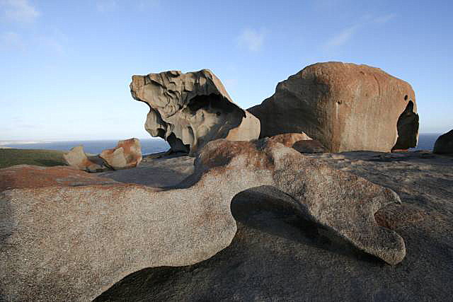
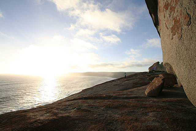
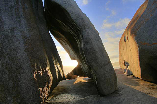
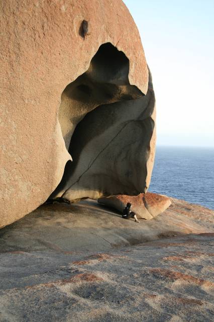
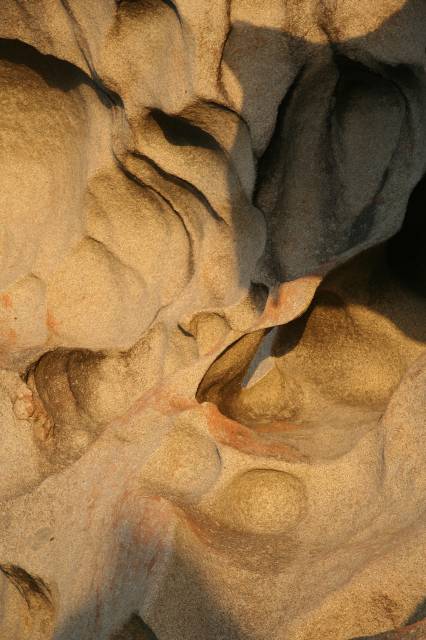
This is almost certainly the most photographed place on Kangaroo Island.
It is the weathered remnant of a granite dome on the southern coast;
the shapes combined with the proximity of the sea and the changing lighting
are wonderful.
The challenge to a photographer is to try to get an original and imaginative
perspective.
|
|
| Admirals Arch
Two or three seals are just visible
| |
|
| | New Zealand fur seals at Admirals Arch
|
|
Just off the road from Flinder's Chase Visitor's centre toward Cape Du
Couedic is this beautiful sea-tunnel eroded through the limestone by the
sea.
There are usually Australian sea-lions and New Zealand fir seals on the
coast in this area.
|
|
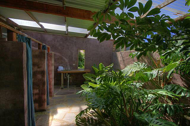
| | Bathroom at Flinders Chase Farm
|
|
Flinder Chase Farm is a working farm with accommodation.
It is out of the ordinary mainly for its tropical-style bathrooms; I have
not seen anything like them except at Bali.
Denece and I stayed here for two nights.
We were unfortunate to strike some exceptionally hot weather; normally
the lack of air conditioning would be little problem on KI.
We were disapointed to see that the farm dogs, that were kept in small
yards, were apparently rarely allowed out and consequently their yards
were covered in shit.
If not for this, I would strongly recommend a stay at Flinders Chase Farm.
|
|
|
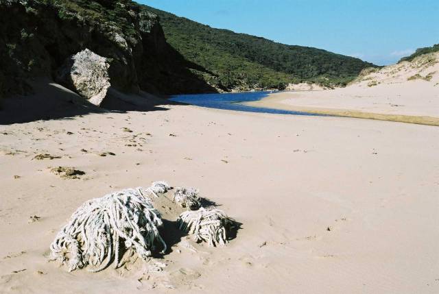
The beach at the end of the walk
Note the fishing net washed up on the beach
| |
|
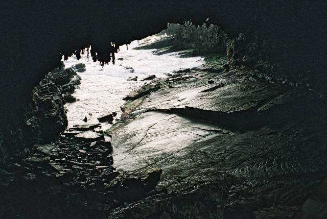
There is a cave on the beach at the end of the walk.
Visitors will need a torch.
| | Casoars cave
|
|
There is a beautiful walk in the north-eastern part of the greater
Flinders Chase reserve; it ends in yet another lovely beach, this time
on the western coast; the loanliest of them all.
Man's rubbish is to be seen here.
There is no beach in the world that has not been polluted.
The walk is approached from the Cape Borda Lighthouse road.
|
|
 Looking west
| |
|
| | Looking east
|
|
Some lovely views of the north coast can be seen from here.
Approach from the Cape Borda Lighthouse road.
|
|
| | The beach at Western River Cove
| |
|
| | Western River Cove general view
|
|
If it were anywhere else other than on Kangaroo Island I might rave about
how beautiful it was, but on KI beautiful beaches are common.
It is a charming little protected cove on the northern coast.
There are toilets and a shelter shed for picnics.
Like most of the beaches it is approached by unsealed roads, these were in
good condition on our visit, but some can become corrugated at times.
There is nothing here for the tourist now but a magnificent view of gum trees,
rolling hills, and the distant coast line.
The Wind In Wings Gallery and Cafe, close by, that used to take advantage
of the view, has unfortunately closed.
It is on the North Coast Road.
|
|
| | Snelling Beach
| |
|
| | Terns on Snelling Beach
|
|
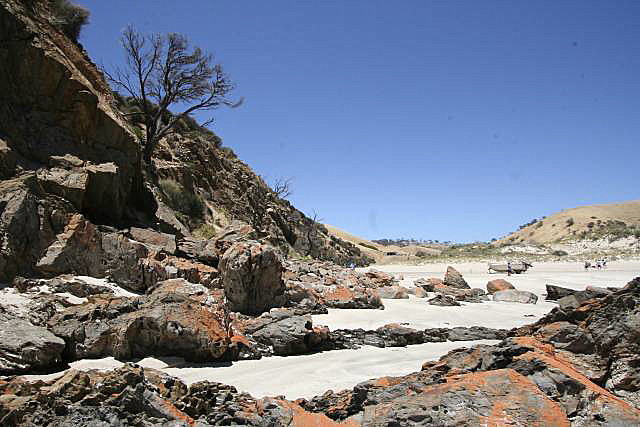
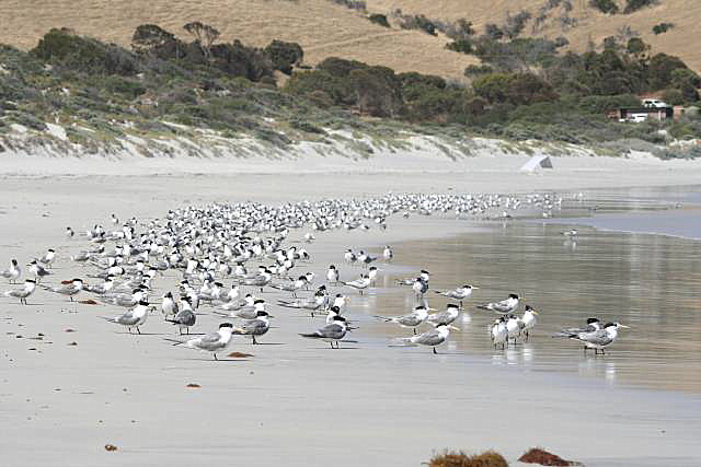
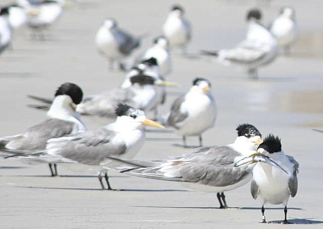
A bay with a long clean white stretch of sand on the north coast.
The North Coast Road passes right by.
When we were there in January 2009 there was a big flock of terns feeding
their young.
There were also signs asking people to not drive cars on the beach because
a rare species of plover nested there; there were several cars on the beach.
|
|
| | Rocks bordering King George Beach
| |
|
| | Perhaps someone left this tractor a bit too long?
|
|
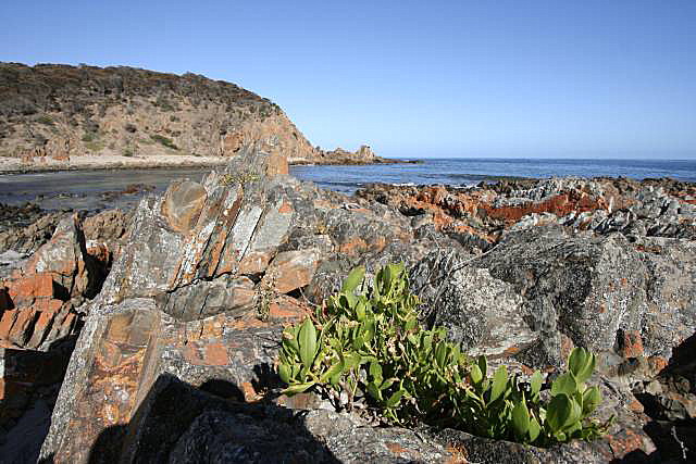
A small beach between rocks on a short road running off the North Coast Road.
Well worth a visit if you have the time
The orange lichen is worth a mention.
It is common in KI and on the adjacent mainland between the high tide
mark and up to some distance from the
sea where there is less salt.
Lichen is a particularly interesting plant because, like corals, it is
actually two organisms living in a symbiotic relationship.
Lichens are made up of an algae (a single-celled organism that
photosynthesises [produces useful substances from sunlight]) and a fungus.
Both organisms gain from the relationship;
the algae produces food for the fungus, the fungus provides a congenial
environment for the algae.
|
|
| | Stokes Bay at sunrise
| |
|
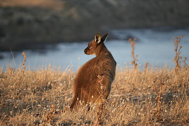
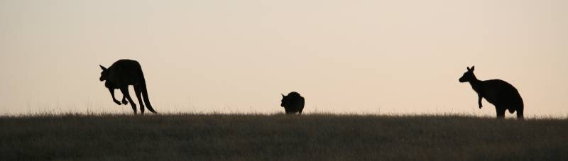
| | Kangaroo at Stokes Bay
| |
|
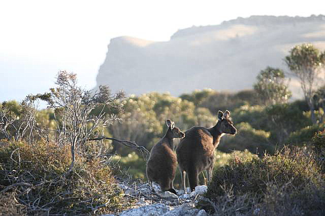
| | Kangaroos at Stokes Bay; looking toward Knob Point
| |
|
| | The hills behind Stokes Bay in the early morning
|
|
Denece and I stayed here for two nights.
There is a good swimming beach that is reached by a walk through a 'rock
tunnel' (a path carved out of a big rock-fall at the base of the cliffs -
an experience in itself), a little cafe, camping ground, and restaurant.
The rock-fall is at the far end of the beach in the photo at the right.
Denece and I stayed in one of the cabins at Waves and Wildlife for two
nights and enjoyed it greatly.
The cabins were well appointed, including a barbeque; they are a short
walk from where this photo was taken.
When we were at Stokes Bay there were also lots of kangaroos; and they were
tame enough that we could get quite close to them, as you can see in the
photos.
|
|
| | Sunrise at Kingscote
| |
|
| | Feeding pelicans
|
|
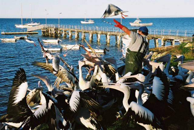
Kingscote is by far the largest town, and the 'capital' of Kangaroo Island.
There is a picturesque anchorage and bay, a good selection of shops,
a good museum (at the top of the hill on the northern side of the town),
cafes and a pub or two.
In 2003 the pelicans were fed with fish scraps around 5pm each day, for
the tourists.
I don't know if it still happens.
|
|
| | Garden at American River home
| |
|
| | Waterbirds at American River
| |
|
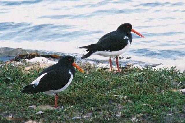
| | Pied Oystercatchers at American River
| |
|
| | Photographing pelicans at American River
|
|
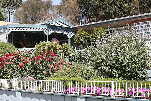
This is a popular holiday destination especially for fishermen.
The garden at the right is remarkable for its lushness.
Few South Australians have gardens like this any more because of the
climate change-induced
drought.
Note the dead trees beyond the house; outside this garden American River
is suffering like the rest of South Australia.
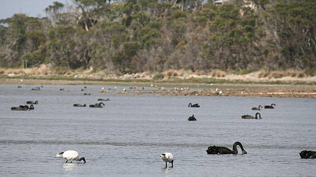
The American River inlet is home to big numbers of waterbirds.
In the foreground are ibis, further away are black swans.
|
|
| | Some of the beautiful gums of Cygnet River
| |
|
 A view from among the Cygnet River gums
|
|
Cygnet River is a locality rather than a town.
I love the majestic gum trees there.
It is about 12km toward the centre of the island from
Kingscote.
|
|
| | Baudin Beach in the evening
| |
|
 Trying his luck in the early morning
|
|
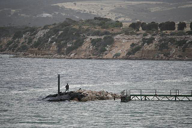
Denece and I stayed at Baudin Beach for two days.
It's a pleasant little place on the north coast 9km west of
Penneshaw.
There is a beach, small jetty, simple lookout on the coastal sand
dunes, and a boat launching ramp - and you might well see a kangaroo or
two on one or another of the streets if you go out in the early morning.
We stayed in a cabin at Baudin Budget, and would recommend it; simple,
but quite adequate.