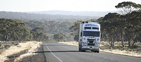
How many photos at what interval would you need to give an impression of
all the landscapes that a traveller between Perth and Adelaide will see?
I have taken at least a pair of images every hundred kilometres.
Of course it would be possible to take a photo every hundred metres and
still not show all the detail and variety that is to be seen, but I think
that 25 photo-points spread across the journey that my wife, my dog, and
I did in late October 2009 gives a fair idea of the various vegetations
and landscapes to be seen.
I have added a few special interest sections in their geographic places in
the sequence.
My wife and I started our journey, and the kilometre count, at Mandurah,
about 70km south of Perth; we finished at Crystal Brook, about 200km north
of Adelaide.
In most cases the photos immediately following the hundred kilometre headings were taken within – so near as I could measure – a kilometre of the given point.
In those few places where I didn't do this I have noted where the photos were actually taken.
The road is sealed all the way and in my experience it is mostly in good condition. There are at least road-houses and refuelling stations about every 200km. Many of these have motel-type accommodation and camping areas with toilets, showers and powered camping sites, most sell basic supplies. Many will also have some facilities for vehicle repairs, although these will be limited and if your car breaks down you could be waiting a while for replacement parts to arrive.
There are also roadside stops with shade and possibly water at more frequent intervals; but don't count on them being where you need them. You can bush camp in many places along the way.
Hints for getting started using this page
Click on the 'Next' link in the box below left, then you will find a
'next' and 'last' link on the top left of every screen.
Continue to click 'next' to go forward or 'last' to go backward.
Scroll as usual at any time.
| |
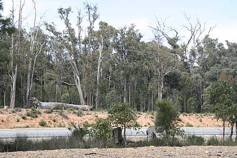
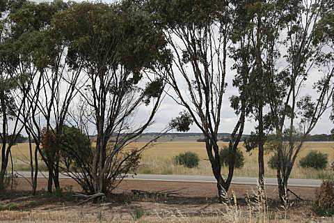
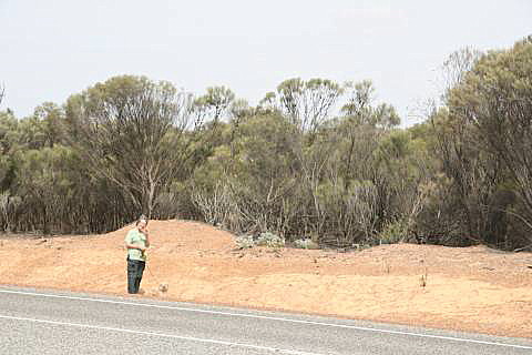
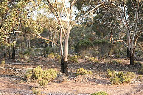
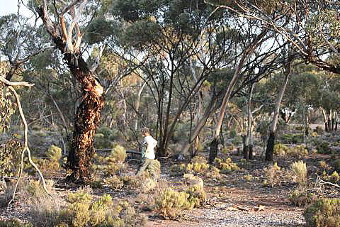
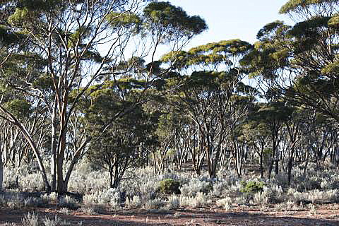
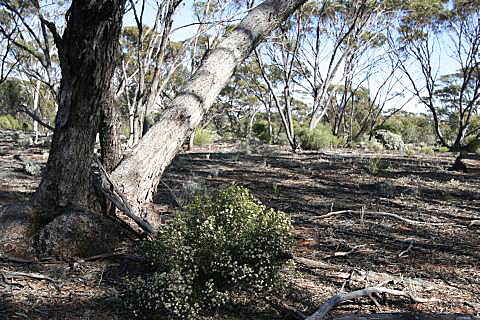
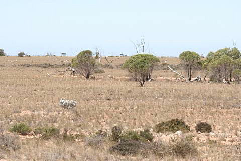
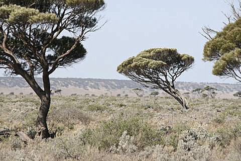
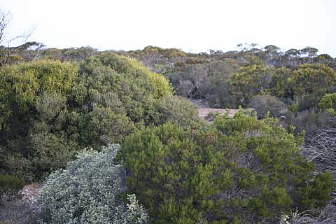
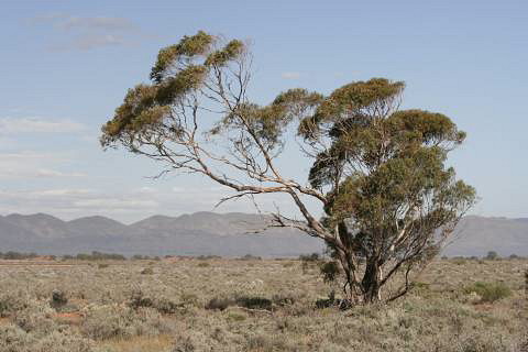
We saw many areas along the highway that had been burned; some quite
recently, some several years previously; this is quite normal.
Eucalypt scrub and forest has developed a tolerance for bushfires,
recovering quickly following a fire.
Trees such as those in the photo above produce epicormic shoots from the
larger limbs (visible on the upper parts of several trees above) of the
burned trees.
Mallee trees often just shoot from a large lignotubor just below ground
level following a fire.
Bushfires are likely to become more frequent and more severe with
climate change.
|
|
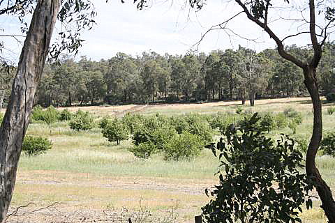
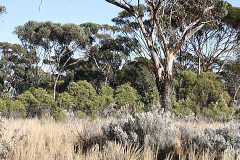
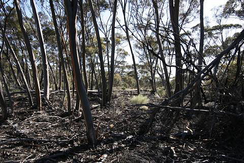
Sawyers Yard
Much of the country through the Perth Hills is still covered with jarrah
( Eucalyptus marginata) forest.
At a little place called Sawyers Yard, 100km from our starting point,
there was also a small orchard in a bit of cleared land.
The first photo was the view on the northern side of the road, the second
photo was of the southern side; this section of forest is showing evidence
of having been burned in the past year or two.
There are similarities between the Perth Hills and the Adelaide Hills; both
run north-south on the eastern margin of the cities, both retain a fair bit
of their natural Eucalypt forest.
The Perth Hills give me the impression of great age (and it has been said
that they are, geomorphologically, one of the oldest landscapes on earth),
they have been ground down by time; the Adelaide Hills are steeper, higher
and more recently uplifted.
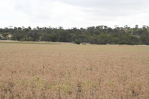
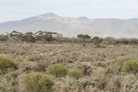
5km east of Meckering
Meckering is in the WA Wheat Belt.
Wheat fields are mixed with areas of Eucalypt scrub and in the lower
ground there are salt-pans (in the middle distance of the first photo).
Whether you start the crossing from Perth or Adelaide, the first few
hundred kilometres of the journey is mainly through grain-growing country,
with wheat being most commonly grown.
The country gets drier as you get further from the ends.
If anyone outside of WA knows of Meckering it would probably be because is was
the site of a severe (by Australian standards)
earthquake in 1968.
A small section of the fault scarp that was created by the earthquake is still
preserved and sign-posted; it was originally 37km long and up to 2m high.
Much of it has been ploughed-over and is inconspicuous.
|
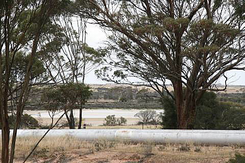
23km west of Merredin
At Merredin you are still in the Wheat Belt.
My 300km came up adjacent to one of the poorer looking grain fields; on the
other side of the road was the
Mundaring to Kalgoorlie pipeline,
which was built in the 1890s to provide water to the goldfields, and another
little salt lake.
The rising saline water table, linked to the clearing of native vegetation,
is a major problem in the Wheat Belt; there is an
Australian
government page on the subject.
Construction of the huge
Collgar wind farm at
Merredin had not started when we passed through, but was underway by July
2010 and the wind farm was fully operational by October 2011.
|
|
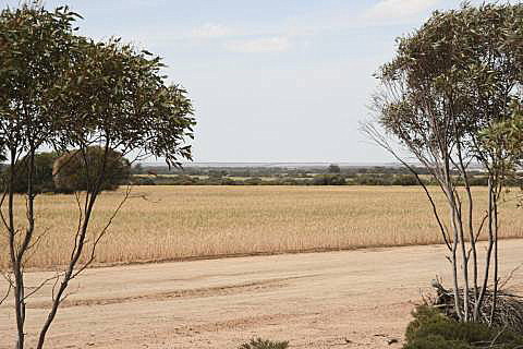
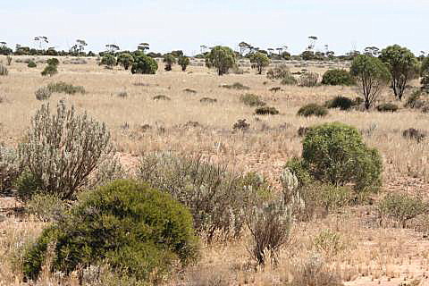
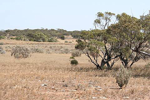
30km west of Southern Cross
Still in the Wheat Belt; there are scrub areas, grain fields, and some
cleared pasture land.
The scrub at this point was shorter than quite a bit of the bush further
to the east; there is not a gradual and continual progression from the
forest of the Perth Hills to the treeless country of the Nullarbor.
|
70km east of Southern Cross
Finally out of the Wheat Belt now, the road is generally bordered by
mallee scrub.
This photo point happened to lie on a water-course where the trees were
larger than those typical of the area.
No doubt because of the trees and the shade that they provided, a roadside
camping area was constructed at this point.
Water would flow through the water-course only for a short time following
rare heavy rains; but flows in water-courses like this can be deep and
dangerous to attempt to cross.
Our car is the blue Honda Jazz.
|
20km west of Coolgardie
The first photo shows a 'typical' view of the scrub in this area, the second
gives a bit of an idea of the road itself.
Coolgardie is one of the WA goldfield towns;
Patrick Taylor has a run-down on the gold rushes on one of his pages.
Most of the gold mining has moved away from Coolgardie; the population
centre of the goldfields is now Kalgoorlie-Boulder, 40km further north-west.
|
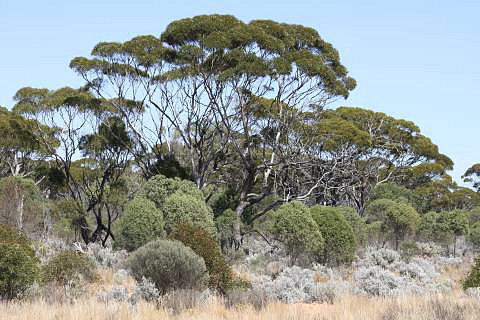
Widgiemooltha
About 90km north of Norseman, the scrub in this area is dominated by some
fairly large gum trees.
The time was approaching the end of our first day's travelling, the sun was
low in the sky making the light more interesting.
There are many turn-offs to mines along this section of highway.
|
10km east of Norseman
The country east of Norseman was moderately hilly and covered with
substantially sized mallee scrub.
The small green trees in the left photo above are quandong trees
( Santalum acuminatum), one of
which had ripe, bright red, edible fruit (not visible on the photo).
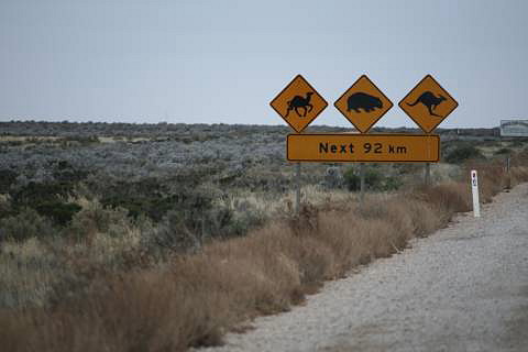
Travelling east, Norseman is the last town for 1000km, until Penong – a very small town before fair-sized
Ceduna, 70km further on.
(There are road-houses, fuel stations and camping grounds every 200km or so along the way.)
Stock up on fuel, water and groceries at Norseman, but remember that you won't be allowed to take fresh fruit or vegetables into South Australia.
| |
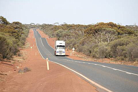
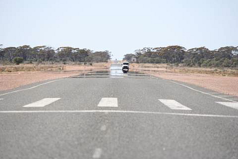
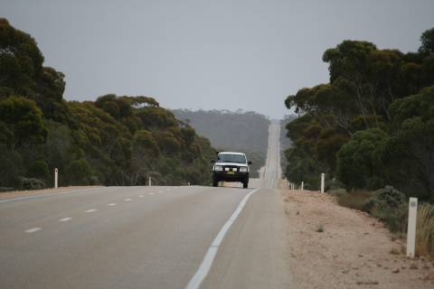
The highway at 800km
|
|
|
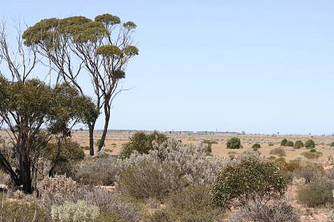
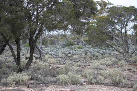
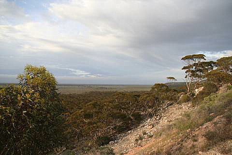
110km east of Norseman
The country in this area was undulating and covered with large mallee scrub.
There are some areas of large and impressive salmon gums (Eucalyptus
salmonophloia, named for the colour of its bark, when fresh) in this
region, although they were not right at this point.
| |
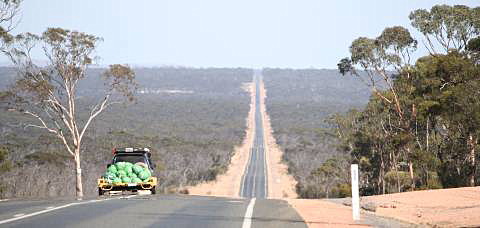
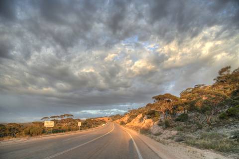
A long straight section at about 940km
|
|
|
|
|---|
|
|
Newman Rock, less than a kilometre off the northern side of the highway about
50km west of Balladonia and 140km east of Norseman.
Well worth a short visit, if you are not pushed for time.
Latitude 32.11498°, Longitude 123.17116°
|
20km east of Balladonia
There are a number of
emergency airstrips along the Eyre
Highway.
It just happened that our scheduled 1000km stop fell on the
western end of this one.
These are available for use by the Royal Flying Doctor Service (RFDS) when required, and are always on a straight and level section of highway.
From about Balladonia the highway traverses flat ground until the Madura Pass.
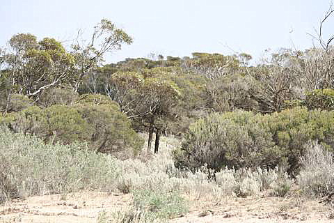
The country was covered with patches of mallee scrub alternating with blue-bush with scattered trees.
|
60km west of Caiguna
This is the first of our stops that was in country that fits the common conception of a desert, although it's a park-like 'desert' in many places, as can be seen in the left photo.
Grassland is mixed with shrubland and occasional small trees.
|
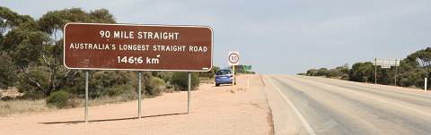
The marker at the eastern end of 'The Long Straight', Caiguna.
At 146.6km it is claimed to be Australia's longest straight road.
|
A few kilometres west of Caiguna is the
Caiguna blowhole, where, as
the atmospheric pressure rises and falls, air rushes
into or out of a hole that connects with extensive limestone caves.
There are many kilometres of limestone caves beneath the Nullarbor, some of
them flooded with water (too saline to be of agricultural or human use), and
there are other blowholes.
|
30km west of Cocklebiddy
Grassland, some blue-bush, scattered trees.
The trees on the right look like quandongs; quandongs (probably including
the kernel) and mistletoe berries
would have been important sources of food for Aborigines in years past.
All this land is on the Hampton Tableland.
|
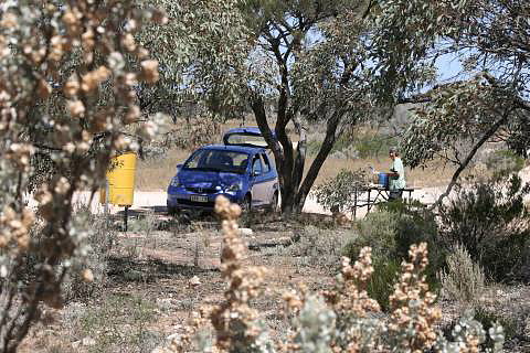
20km west of Madura
This was the second time on the trip when the scheduled stop happened to
coincide with a roadside parking area; we took advantage of it to have lunch.
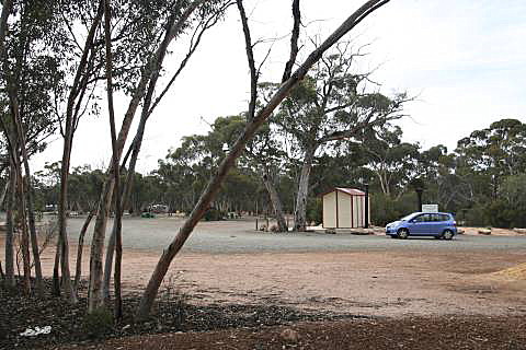
There are quite a few such parking areas along the road, some with picnic
benches such as that in the photo, many with natural shade (in areas where
there are trees tall enough to provide it) and a few (on the WA side of the
border) with toilets.
The Hampton Tableland (above the Baxter scarp and the Bunda Cliffs, all
the elevated country from about Cuiguna to Yalata) is
composed of limestone, has poor soils, and karstic drainage – that is,
the water does not generally erode creeks but drains underground through
cracks and caves.
|
|
|
Left, the Baxter scarp and the Roe Plain;
right, the so-called Madura Pass
Both photos were taken just above Madura
|
At the Madura Pass the road leaves the Hampton Tableland and drops down
onto the Roe Plain.
A couple hundred kilometres further east, at the
Eucla Pass the road climbs back onto the tableland.
|
40km west of Mundrabilla
From Madura nearly to Eucla the road lies on the Roe Plain and follows the
base of the
Baxter scarp
(seen in the distance in the photos above).
The trees looked to me like Acacias, but I could not be sure (there were no
flowers or seed pods); it seemed
to be the same species that was widely scattered over the Roe Plain.
Geologically the Baxter scarp is very similar to the
Bunda Cliffs, the sea was once at the base of the
scarp that you can see in these photos.
|
|
8km west of Eucla
Still on the Roe Plain,
the left photo is looking back west toward Mundrabilla, with the Baxter
scarp in the distance, in the right photo
Eucla can be seen on top of the scarp.
|
| |
The Eucla Pass
|
Like the so called Madura Pass this is not really
a pass, it is a point where the road climbs from the Roe Plain
up onto the Hampton Tableland.
As far as the topography is concerned, many other places would have served
just as well.
There are a number of undulating areas along the Eyre Highway, as the
photos on this page show, but the Madura and Eucla passes are notable by
being within a long, otherwise very flat section of the highway.
|
|
80km east of Border Village
This is the only section of the Eyre Highway that runs close to the coast
and there are a number of roads that allow access to the cliff-tops.
There are few trees, but we are still not on the true Nullarbor.
|
|
|
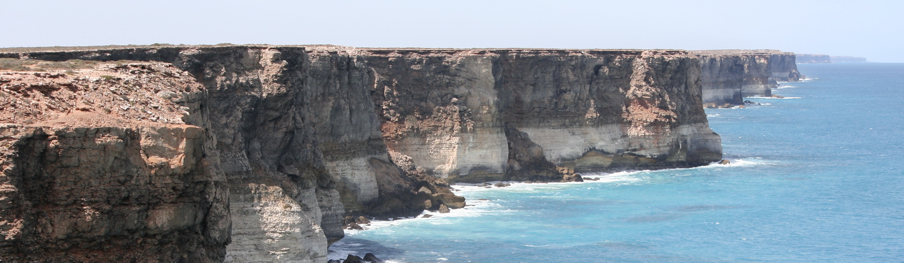
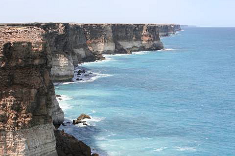
The best view of the
Bunda cliffs
(left) is to be seen from the end of a closed road (right).
The GPS coordinates are: Latitude S31.57778, E130.14634.
When we were there a perfectly serviceable bush track, just east of the
closed graded road, could be used to get to the view point; otherwise it
is a walk of only a few hundred metres.
The track can be found 1.3km west of the western end of a Flyind Doctor
emergency airstrip on the highway.
If you drive, take care because the track leads right to the cliff edge.
|
| |
|
| |
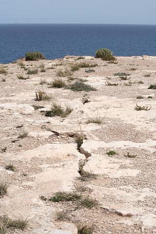
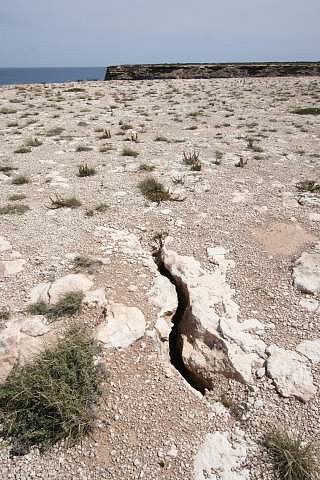
Cracks in cliff-top, see text at left
| |
Travelling-australia record the following about the Bunda Cliffs.
"The light coloured base is Wilson Bluff Limestone, this is white,
chalky material formed as part of an ancient seabed when Australia began to
separate from Antarctica 65 million years ago.
This Wilson Limestone is up to 300 metres thick but only the upper portion
is observable in Bunda Cliffs.
Above the white Wilson Limestone are whitish, grey or brown layers of
limestone or crystalline rock.
Some layers incorporate marine fossils including worms and molluscs
indicating their marine origin; other layers are made up entirely of marine
sediment (foraminifera).
The cliffs are capped by a hardened layer of windblown sand laid down
between 1.6 million and 100,000 year ago."
The shear Bunda Cliffs extend from somewhere east of Border Village to
west of the Head of Bight.
According to Encyclopaedia Britannica they vary from 60m to 120m high.
They are composed of a limestone of Tertiary age.
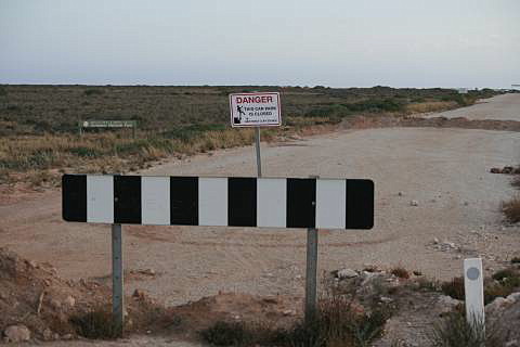
It seems that some intellectually-challenged official has decided that
the cracks in the photos on the right indicate an unstable cliff-top,
and therefore this view point is unsafe and the public should be kept out;
never mind that the risk of collapse is very-very low at any one time and
that this is the best view-point for seeing a long length of the Bunda
Cliffs.
|
|
|
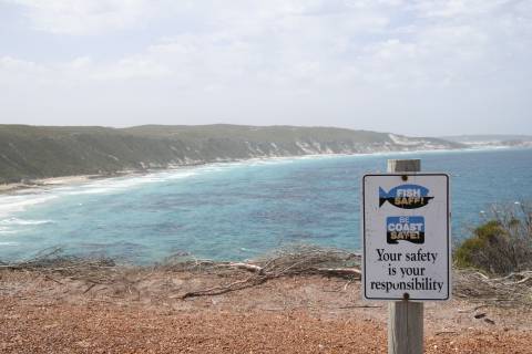
"Your safety is your responsibility"; what a novel idea!
It will never catch on.
|
|
Of course this section of cliff will fall in the next decade or two or three;
most sections of the Bunda cliffs will fall in a similar period of time.
Coastal cliffs are unstable, it is the ocean eroding their bases that
gives them their form;
limestone cliffs are more susceptible to erosion than more resistant rocks.
If the cracks worried the authorities, why could they not just place a
couple of signs like that on the right
(seen on the coast at Esperance) near the cliff
tops; perhaps "These cliffs are unstable and may fall at any time, your
safety is your responsibility"?
The drive across the Eyre Highway is much more dangerous than visiting the
above view-point on the Bunda Cliffs; any drive on any road is more
dangerous.
Why do the authorities allow people onto the roads?
Should there be signs every few kilometres saying "Your safety on the road
is your responsibility"?
We all know that, we don't need to be told; surely we all know just as
well that there are certain risks in visiting hundred metre high shear
cliffs, whether or not cracks are present.
|
|
|
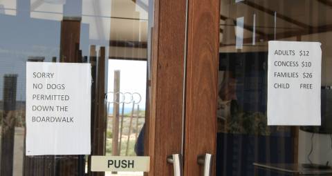
Sign on the entrance to the Head of Bight Information Centre
Is Australia
the least dog-friendly country
in the world?
|
|
The Head of the Bight (the most northerly point on the Great Australian
Bight) is worth a visit from June to October if you'd like to see the
whales that move into the area to calve.
We saw about a dozen, although none were close enough for me to get a
photo worth placing on this page.
On a previous crossing we saw a couple at the
Bunda Cliffs, but they seem much more common
at the Head of the Bight.
|
Around the Nullarbor roadhouse
With the photo on the left we were quickly running out of daylight; for that
reason it was taken about 8km before it was due.
The photo on the right was taken the next morning at the Nullarbor roadhouse
about 9km east of the measured 1700km point.
These two photos show something close to the true Nullarbor, but the
highway just touches on the southern edge of the Nullarbor Plain.
The train line, which is about a hundred kilometres further north, crosses a
much greater length of the Nullarbor.
|
|
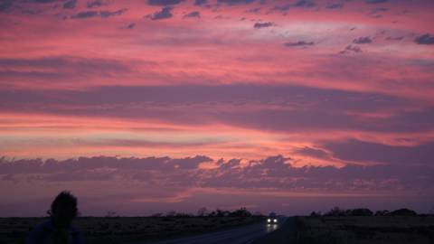
| | The sunset was taken just after the photo above it,
the image on the right was taken several weeks earlier and is typical of
the Nullarbor.
|
According to Encyclopaedia Britannica the Nullarbor plain extends westward
650km from Ooldea in SA into WA and northward from the Great Australian
Bight for 400km to the Great Victoria Desert.
It occupies 260 000 square kilometres and has an average elevation of
180m.
Quoting EB:
Its vegetation chiefly consists of salt-bush and blue-bush, with some
grasses and flowers appearing after rare winter rains (annually averaging
250 mm or less).
The Nullarbor National Park preserves rare vegetation and fauna.
The plain has many limestone caves, including Koonalda Cave, an important
archaeological site.
The name Nullarbor is derived from the Latin nullus arbor ("no tree").
Even the Nullarbor proper is not entirely without trees; there are occasional
small native apricot ( Pittosporum phyleriodies) trees.
Some of the caves of the Nullarbor are below the water table and are filled
with saline water.
Exploring them is challenging and can be dangerous.
Wikipedia has an entry on the
Nullarbor plain.
|
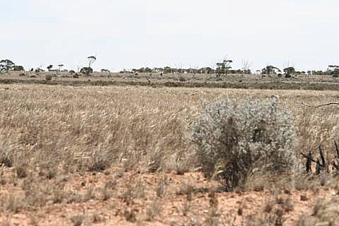
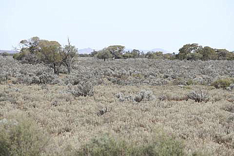
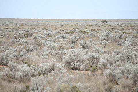
90km east of Nullarbor roadhouse
The 1800km point happened to be on the top of a rise in a straight section
of road through undulating mallee scrub country.
The long-telephoto shot at the left gives an impression that the
scrub is thicker than reality, the right shot is probably a truer impression.
These undulations seem to be the remains of sand dunes that were once
moving with the winds, probably in the last ice-age, when the climate was
much drier.
|
| |
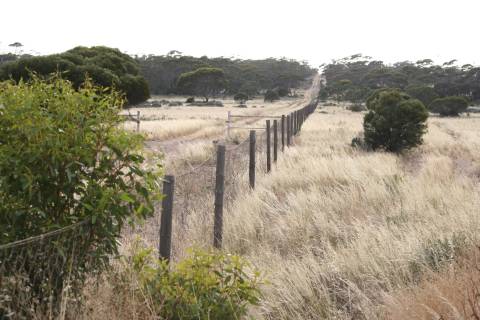
The Dog Fence
|
|
This is claimed to be the longest fence in the world.
It runs beside the Eyre Highway for a short distance about 15km past my
1800km point.
It is recognisable by its unusual height and the wire netting, which makes
for a much more expensive fence than the plain wire usually used for sheep
and cattle in the dry areas.
This section appeared to have an additional short electrified section on
the northern side (not visible in the photo).
|
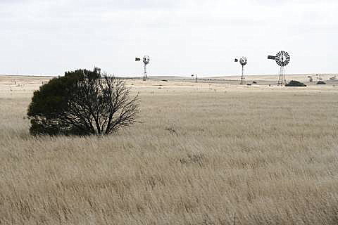
45km east of Nundroo
Travelling east the first cropping land is encountered around about Nundroo.
The windmills were on one side of the road, the lonely farmhouse the other.
This is marginal grain-growing country, the cockies would be lucky to get
one good year in two.
|
| |
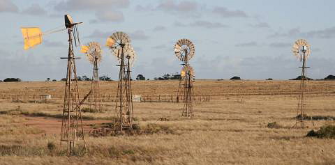
| |
These windmills at Penong symbolise the
scarcity and importance of water to many 'across the Nullarbor'
| |
Penong is about 80km east of Nundroo, the photo was taken on the eastern
side of Penong.
A sign near where this photo was taken reads:
"The picturesque massing of windmills near Penong developed over many years
in order for the town to access one of the small underground water basins
which lies close to the township.
Each household obtained their water supply using their own windmill and the
abundant winds to pump from the underground basin to their homes.
The supplies were also used for water supplies for stock."
"The water supply for Penong township is now also carted by road tanker from
Ceduna to top up local supplies at a cost to the consumers and subsidised
by the South Australian Government."
In fact a pipeline was built to carry water from Ceduna the 70km to
Penong, but we were told that the project ran out of money when the pipeline
reached 7km east of Penong.
Now water is carted from the end of the pipeline.
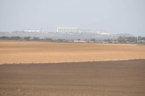
7km west of Ceduna
The silos at Thevenard, the port of Ceduna, can be seen in the left image,
the right shot is typical of the local native vegetation: mallee ( Eucalyptus species), tea-tree ( Leptospermum or Melaleuca species) and blue-bush ( Atriplex or Rhagodia species).
Ceduna is a large town by Eyre Highway standards; there is a choice of
shops for groceries, coffee, lunch, etc., and the fuel prices, when we went
across, were lower than anywhere to the west until about Merredin.
It is also something of a marker; the land to the east is largely agricultural
and moderately settled, while to the west the country is very marginal for
cropping and thinly populated.
|
|
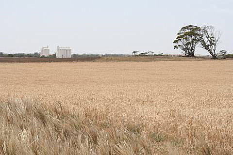
3km west of Wirrulla
The Wirrulla silos are to be seen in the left image.
We were now well into the grain growing country of the northern Eyre
Peninsula; still difficult country to make a living, but less so than
further west.
|
| |
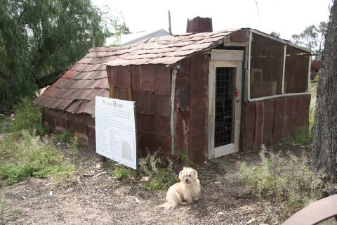
Socrates at Peter's Humpy
|
|
|
Poochera, 46km SE of Wirrulla, is worth calling in to, for two reasons
(three, if you like; there's a good little park for lunching).
It is hard to imagine living in Peter's Humpy, photographed at the left,
but it apparently was the home of Peter Sheridan for some time beginning
in the 1920s.
Peter's story is printed on the sign.
Poochera is also where the world's most primitive living ant,
Nothomyremecia macrops, was discovered.
An interesting story about the discovery is printed in the same park;
the ant was first collected in 1931, but apparently its significance was
not immediately recognised and the location was not recorded.
Forty-six years of fruitless search followed recognition of the importance
of the species, but it was not until 1977 that it was rediscovered at
Poochera.
"They are extremely timid, nocturnal and rarely come out in temperatures
warmer than 20°C.
Since their discovery scientists from all over the world, including the
Soviet Union, Switzerland and America have visited Poochera to study them."
Wikipedia has a page on
Nothomyremecia macrops.
|
|
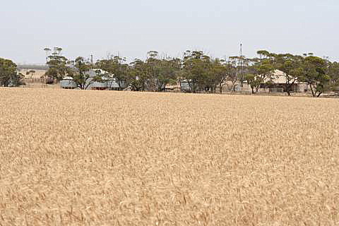
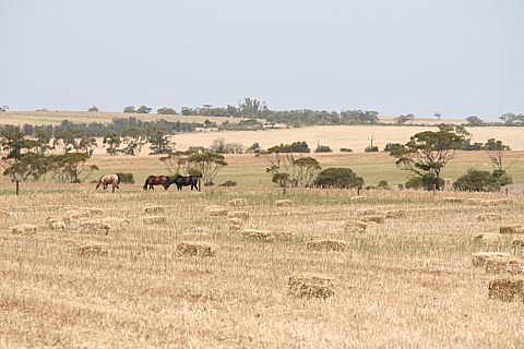
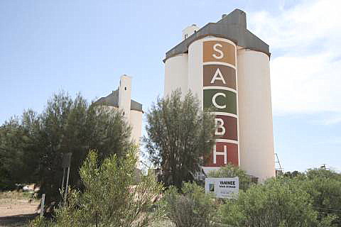
Yaninee, 25km west of Wudinna
Most of the northern Eyre Peninsula seems to be used for continuous cropping,
but there were some paddocks to be seen that had been cut for hay.
Horses were a rare sight.
SACBH stands for South Australia Cooperative Bulk Handing.
|
|
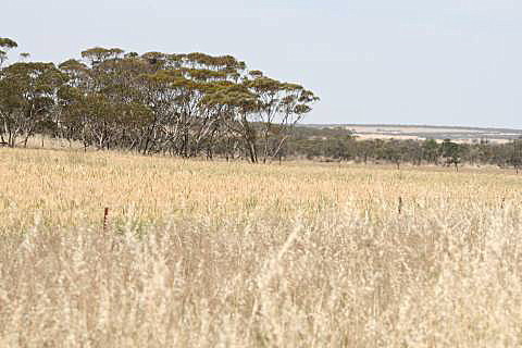
22km west of Kimba
There are some large granite hills, called inselbergs, in the Wudinna-Kimba
area.
Most of the country is used for cropping, but there are substantial areas
of mallee scrub; in fact a large part of the Eyre Peninsula is covered
with scrub, but of course it is in the areas where there are fewest roads.
|
15km west of Iron Knob
Blue-bush and scattered scrub is typical of this area, larger scrub further
west, closer to Kimba.
There is very little cropping land between Kimba and Port Augusta.
The abandoned Iron Knob mine can be seen in the distance in the left photo.
|
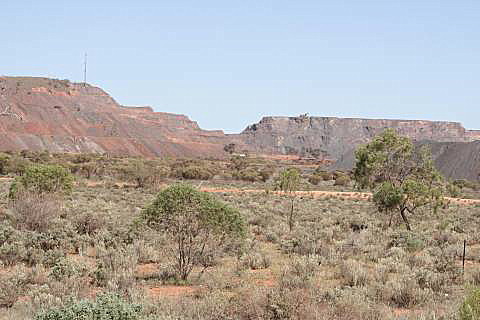
| |
A closer photo of the Iron Knob mine taken a bit further along.
|
The Iron Knob mine is in the Middleback Ranges, whose rocks are about 1.6
billion years old (a third the age of the Earth), the hill probably stood for
several hundred million years, it was knocked down in a few decades.
I believe
the iron-rich formations date from a period in the Earth's history when
the atmosphere was becoming increasingly loaded with oxygen, which caused
iron in solution in the oceans to change form, become less soluble, and
precipitate out of solution.
This sometimes is called "the rusting of the oceans" (strangely and vaguely
evocative of "the churning of the ocean of milk" in Cambodian mythology).
|
|
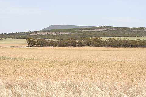
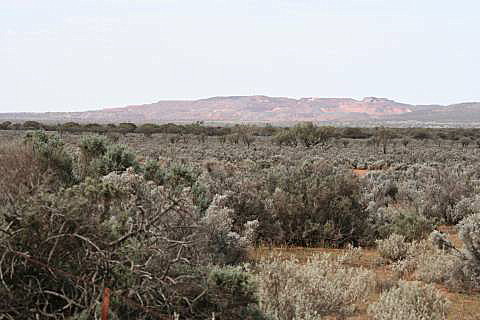
15km south of Port Augusta
Mount Brown of the Flinders Ranges is the prominent point in the left
photo; in this area the larger trees, such as the one in the right photo,
usually occur only on drainage lines.
|
|
|
|
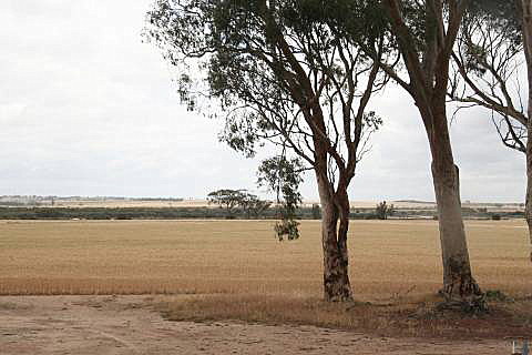
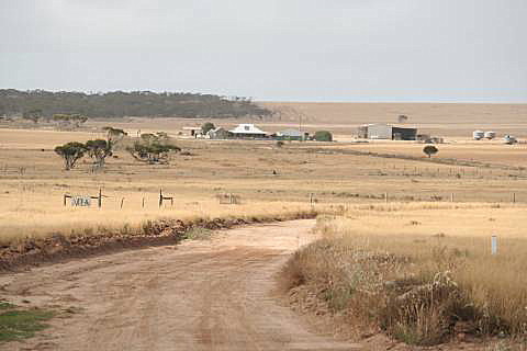
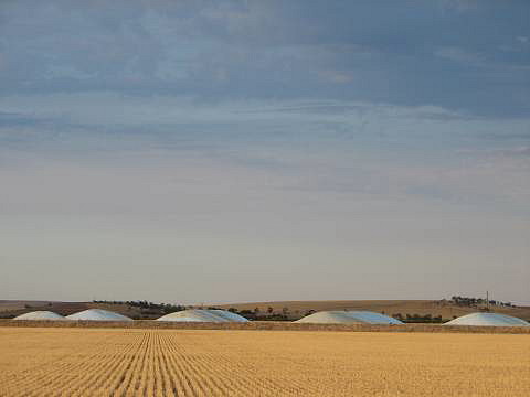
Home: Crystal Brook
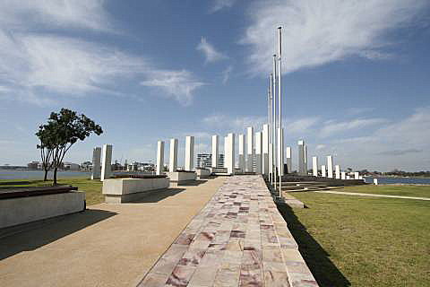
Crystal Brook is about 100km south of Port Augusta and 200km north of Adelaide, the biggest city and state capital of South Australia.
The humps are huge tarpaulins over heaps of grain, the paddock in the
foreground has had a grain crop taken off it.
|
|
Bunda or Baxter
I'm not sure of the correct use of the names 'Bunda Cliffs' and 'Baxter
Cliffs' or, as I have used
' Baxter scarp'.
The two former names seem to have been used interchangeably by some;
indeed, geologically the Bunda Cliffs and the Baxter 'Cliffs' are very
similar.
I have used 'Bunda Cliffs' where the
Hampton Tableland is immediately
adjacent to the ocean, and 'Baxter scarp' where the same geological formation
lies at the northern edge of the Roe Plain.
Accommodation
The cost of accommodation is higher between Norseman and Ceduna than outside
of that section, expect to pay around $120 or $130 for a room with a
double bed (Oct. 2009).
This should not be surprising; the costs of running a business in this
remote area must be high, water is very scarce and expensive for the
business owners, and getting and keeping staff difficult.
Prices are reasonable in SA from Adelaide to Ceduna, and in WA within
a couple of hundred kilometres of Perth, but rise gradually out to
Norseman.
Fuel prices between Norseman and Ceduna are high, expect to pay perhaps
30% more than in a capital city.
Mundrabilla seems to have had cheaper fuel than most other places on the
more remote parts of the Eyre Highway for a number of years.
If you want to reduce your fuel consumption try travelling at 80 or 90km/hr
rather than the 110km/hr that is the legal limit on most sections of the
highway.
We went west at 90km/hr at a fuel consumption of around 4.6L/100km, on the
return trip we travelled at 110km/hr and used 5.6L/100km (Honda Jazz).
Fuel is available from at least the larger towns shown on typical road
maps and all of the roadhouses from Norseman to Ceduna, with the notable
exception of Yalata.
At least some places would not be open for business 24 hours a day, but
most seem to sell fuel from at least 8am to 8pm.
Road quality
In spite of some nonsense one hears about needing a 4WD (SUV) to travel
the Eyre Highway
the road is entirely sealed and we found it to be in
good condition; we have travelled it in several small or medium conventional
cars at various times with no problems.
There are two lanes with overtaking lanes where needed.
The sealed edges were wider in the WA section than in the SA section
(Oct. 2009).
If your car did break down you could expect repair costs to be high, and
times required for obtaining replacement parts to be relatively long, because
of the remoteness.
Traffic
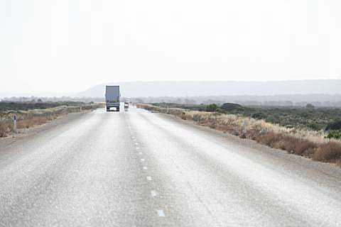
For the length of the Eyre Highway traffic is usually quite light, as can be seen from a number of these photos.
However, the road could not be called lonely.
Quarantine
It is against the law to take fresh fruit or vegetables in either direction
between the two states.
Honey is also not allowed.
These laws are to try to limit the spread of diseases and insect pests.
A huge amount could be said on this subject; I will limit myself.
The feral camels of central Australia could potentially devastate the
blue-bush country near the Eyre Highway.
They don't appear to have done so yet, but it could be simply a matter of
time, if nothing serious is done about their fast increasing population.
The Wheat-belt of WA is suffering from rising saline water tables due to
the clearing of the native bush.
South Australia's grain country west of Ceduna is economically very
marginal; what will happen to it if the farmers give up?
Will introduced weeds take over?
We can hope that the native bush will gradually grow back, but this could
be no more than wishful thinking.
Other than the coastal dunes of Eucla there are no bare sand dunes to be
seen along the Eyre Highway; however, some parts of the road cross country
that long-ago was drifting sand dunes.
With the rising temperatures and declining rainfalls of
greenhouse/climate change it is quite
possible that the vegetation now stabilising these areas will die off and
they will become drifting dunes again.
One notable feature of the journey from Perth to Adelaide is that the
traveller is unlikely to see flowing water anywhere along the 2700km
of road between
the two cities, with the possible exception of near the beginning or end
of the journey.
Some streams in the Perth Hills may flow for extended periods, and
approaching Adelaide flowing water may sometimes be seen in rivers such as
the Broughton and the Gawler, but for 90% of the journey (Northam to
Crystal Brook)
flowing water will only be seen shortly following rare substantial rains.
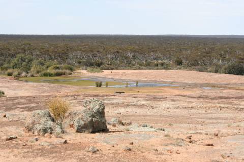
Any water that is seen, other than in rock-holes such as at
Newman Rock and
Disappointment Rock, will most likely be saline
and undrinkable.
Also note that many stopping places along the road have very limited water
supplies, several have to desalinate the saline groundwater at considerable
cost, so take care with water.
You should take water with you any time of the year,
at least a couple of litres per car in the cooler
half of the year, at least a couple of litres per person in the heat,
more if you intend to leave the highway; and keep your water supply topped
up.
If you are relying on finding accommodation along the road and have a dog,
what do you do?
Do you ask if dogs are allowed?
What do you do then if the answer is no? Go on to the next place (maybe
200km away) and try again?
I suspect that many people don't mention the dog when they book a room.
See my page on Is Australia the least
dog-friendly country in the world?
|
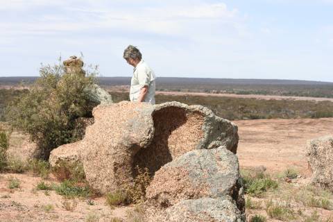
| |
| Disappointment Rock, on the
Granite Woodland and Discovery Trail
|
|---|
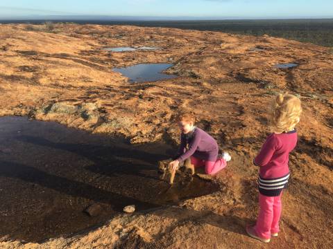 Two of my grandchildren and their new puppy enjoying the rock-holes
|
| |
| |
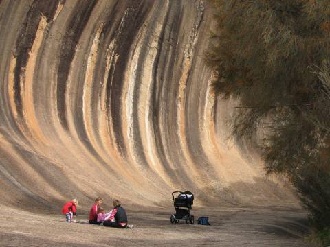
| Wave Rock
|
|---|
| |
This is a more direct route from the Bunbury-Mandurah-Perth area to Norseman and the Eyre Highway than either the Coolgardie or Esperance roads.
I have not travelled on this road but at least three friends (two couples and
one family) have.
One did the drive around 2011, the most recent in May 2016.
All reported that it was in good condition, although mostly unsealed.
I'm told that the route is scenic, among other things worth seeing are
Wave Rock (photo below right) and Disappointment Rocks
(photo on the right).
There are several Internet pages on the route, none that I could find were
particularly detailed or informative.
Perhaps one of the better ones is in
Wheatbelt Tourism.
|
|