|
|
|
|
|
|
|
The view from the top of Saint Mary's Peak is one of the best that I have ever seen; no doubt even more appreciated because it is a tough and long climb.
This image is a digitised copy of a 35mm slide. It is looking toward the south over Wilpena Pound. The view to the north is even better. |
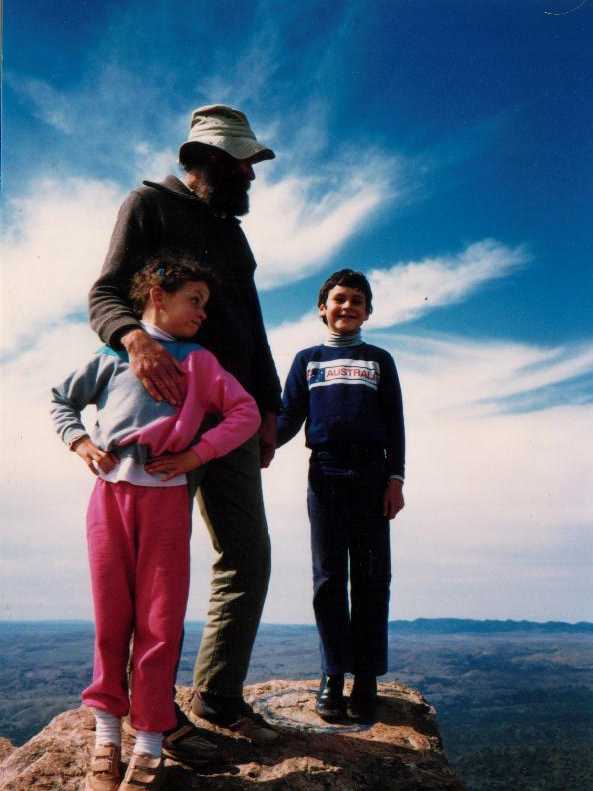
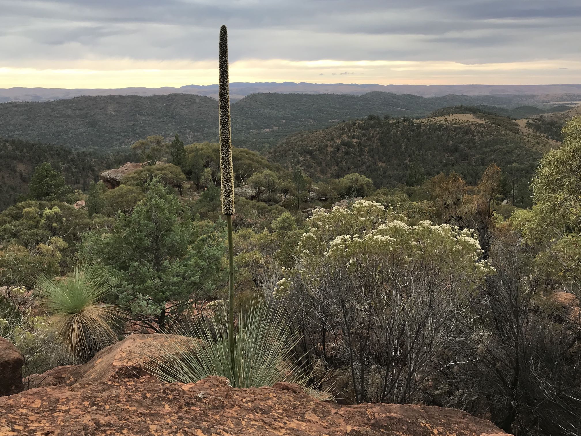
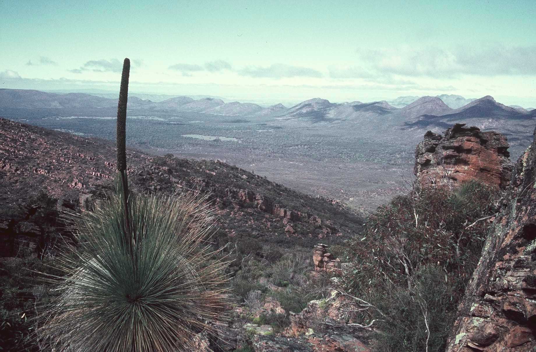
From near the top of Saint Mary's PeakI can't take credit for this photo. While I actually took the photo it was Denece who saw the scene and realised that it could make an outstanding photo.Unfortunately this was taken from an older trail, perhaps around 1976; the new trail doesn't go anywhere near this point so if you use the new trail you won't see this beautiful foreground for the distant view. The century or more old yakka combined with the rock wall in the right frames the "Dragon's Tail" in the distance very nicely. The photo is a digitised copy of a 35mm slide.
Should you climb or not?In places it has been written that the 'traditional owners' were discouraging people from climbing St Mary's at the time of writing (May 2021). I've written about why I do not feel that people should feel bound by this request elsewhere on these pages.It has been suggested that I should respect the beliefs of the 'traditional owners' and refrain from climbing Saint Mary Peak. At the time of writing Muslim Palestinians and Israeli Jews were killing each other in Israel and Gaza while Catholics and Protestants were looking like going back to killing each other in Northern Ireland. Even though they believe in the same imaginary God their differing myths seem to make it impossible for them to live together in peace. The fundamentalist Muslim Taliban, who opposed women's rights, the arts and many freedoms were making advances in Afghanistan and a woman who had been accused of witchcraft had been tortured and killed in Papua New Guinea. All these religious and superstitious beliefs are delusional; it is as simple as that. (Religion is a synonym for superstition. A religious person sees the beliefs of others that he/she does not subscribe to as superstition, while not noticing that he/she is also superstitious.)
No, I have little respect for delusional beliefs. The world would be a far better place if people placed spiritual beliefs in the dustbin of history.
Like most kids Julia and Ken complained about being bored when we took them on long walks so to get them to agree to climb St Mary with us we bribed them with the promise of a bar of chocolate each (and $2?) if they did the climb without complaint. Not only did the do it, but they enjoyed it!
The Jeff Morgan Gallery in Hawker has a magnificent 360 degree painted panorama based on the view from the top of the Peak.
Visit of May 2021The Peak
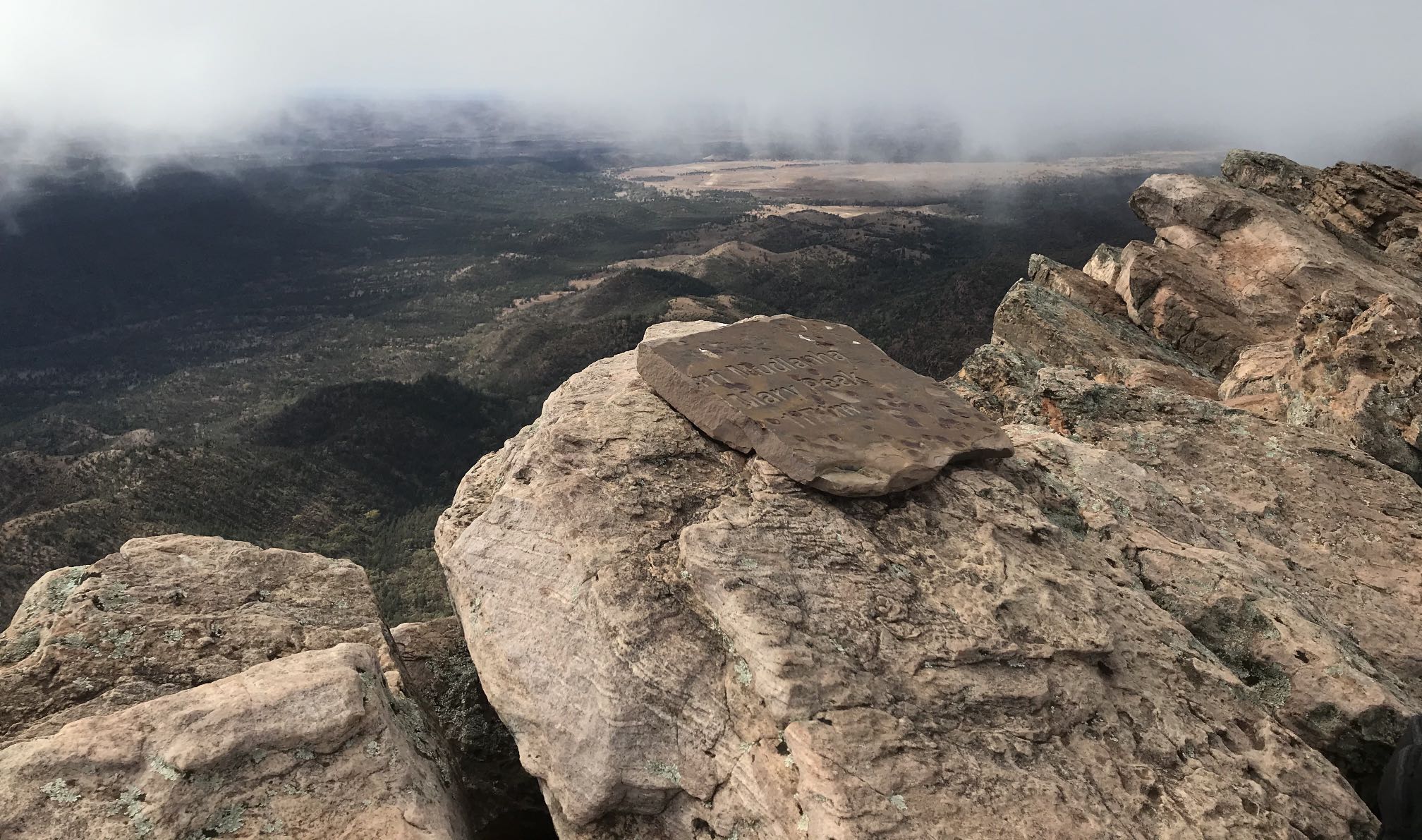
Ngarri Mudlanha
Ngarri Mudlanha is the Aboriginal name for the peak. Various references give the altitude as 1,168 or 1,171 or 1,189 metres.
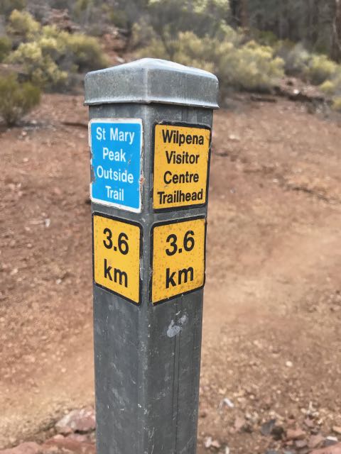
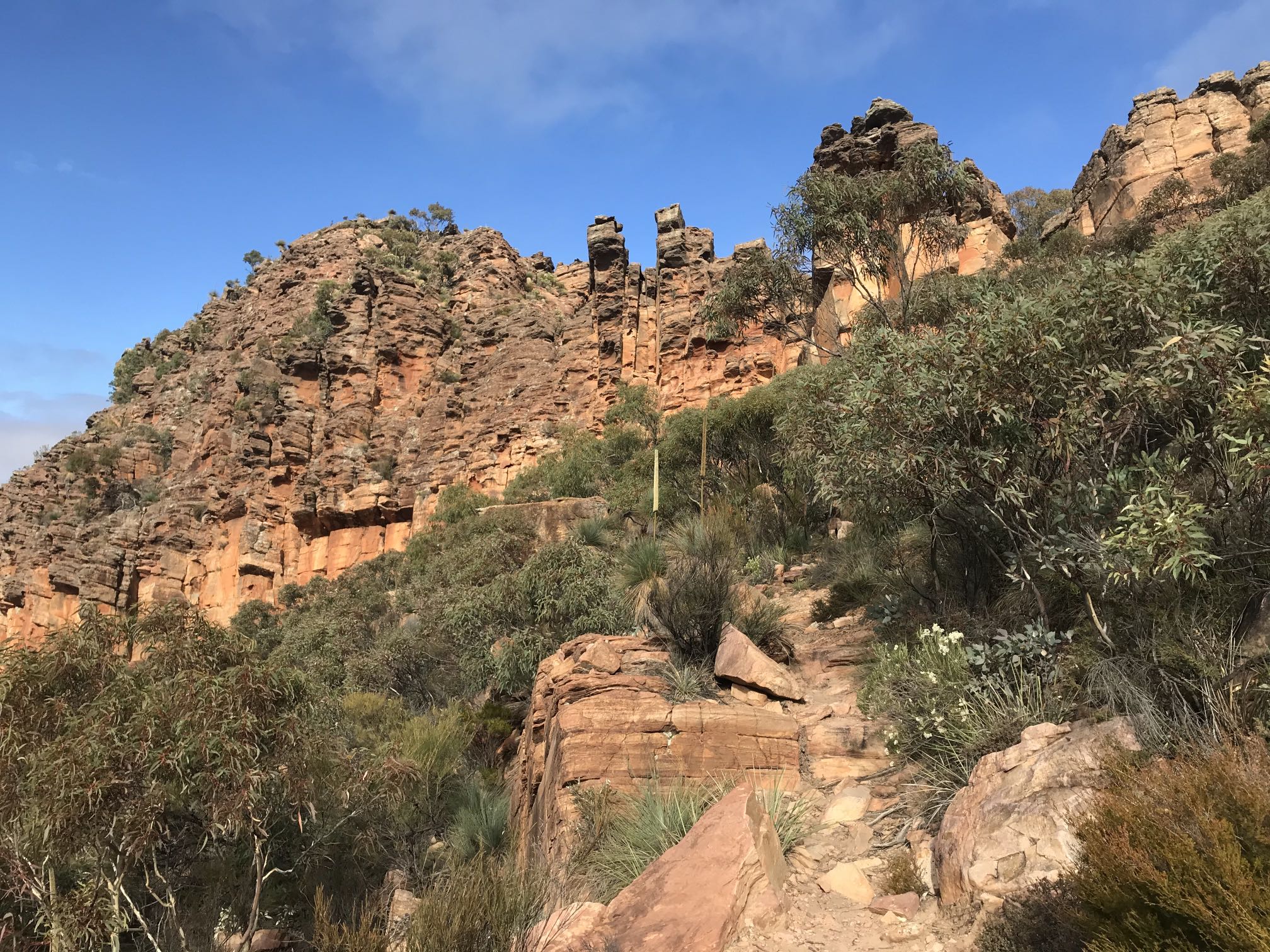
The ascent
There were trail markers such is this periodically. This one, being the half-way marker had a big mound of stones around it. It was half way in distance only, by far the easiest half was behind me and the hardest part ahead.
After an hour's walking I reached the foot of the climb up to Tanderra Saddle.
Interestingly, Bluff Knoll, the highest peak in southern WA is a similar altitude (1098m) to Saint Mary Peak, the highest peak in southern SA (1171m) and the climb up Bluff Knoll (645m) is a similar vertical distance as that up Saint Mary Peak in the Flinders Ranges (630m). Perhaps the main difference between the two climbs is that while Bluff Knoll is mainly a steep climb from the beginning, one must walk more than four kilometres along undulating ground before starting the climb to St Mary Peak.
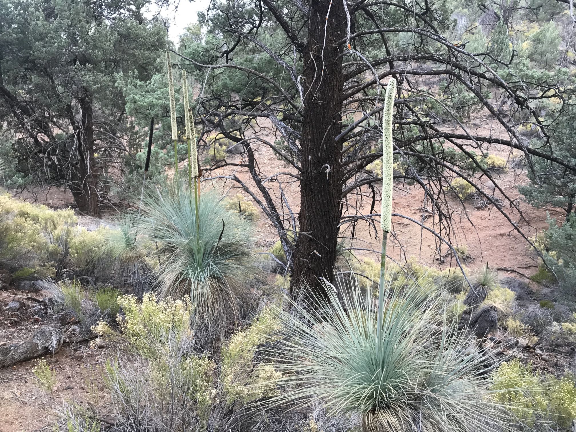
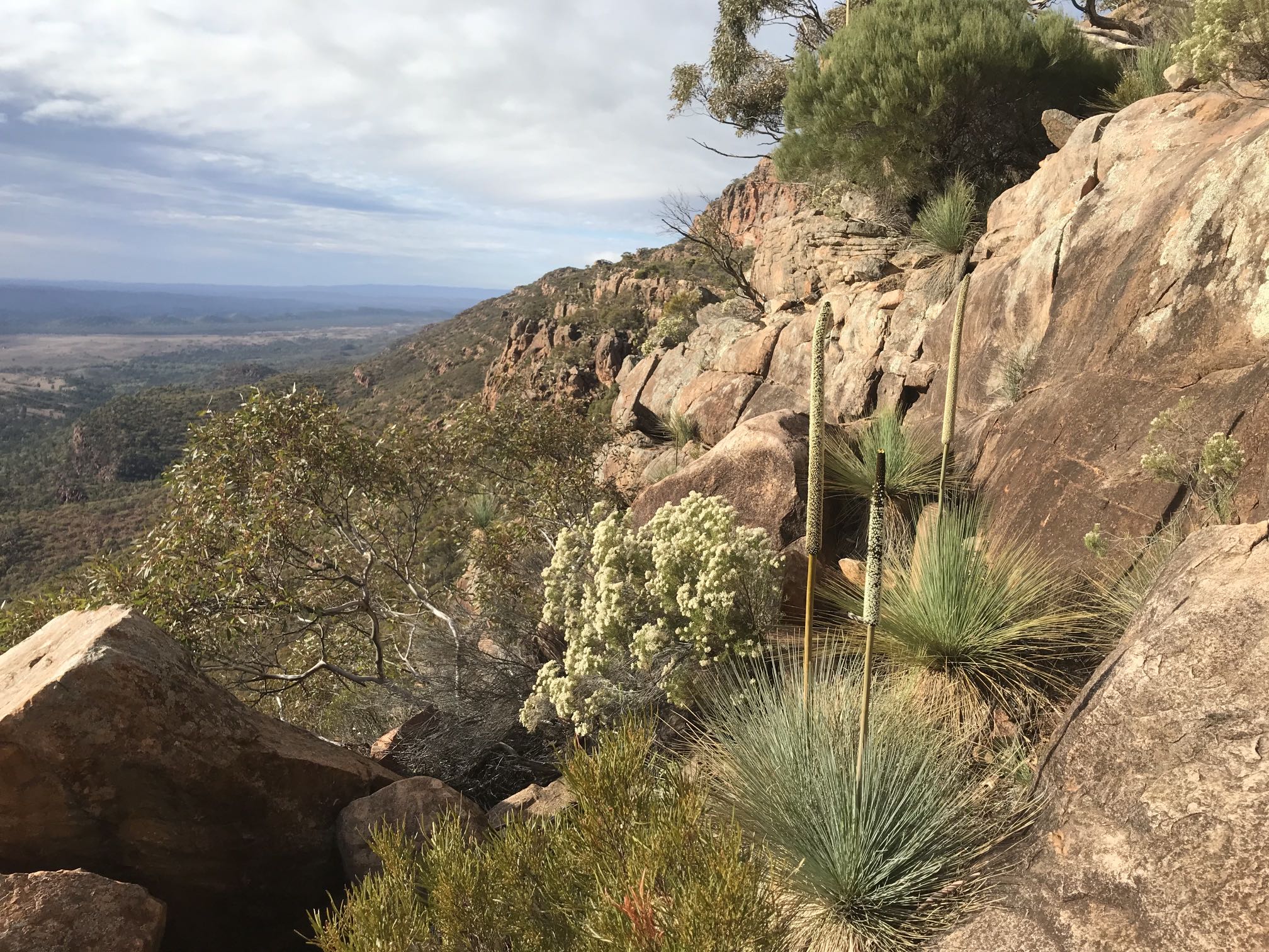
Trailside vegetationThe area had been suffering from drought for several years, most likely linked to climate change. Many of the Callitris (the trees in this photo; commonly called cypress-pines) were in very poor condition, quite a large proportion had died.
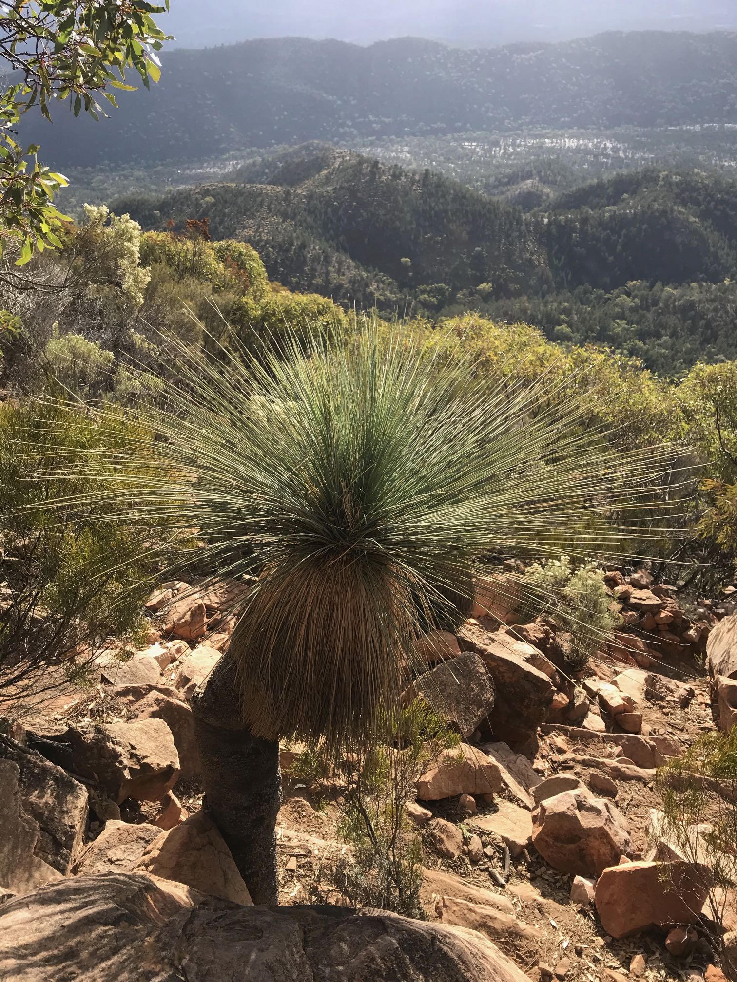
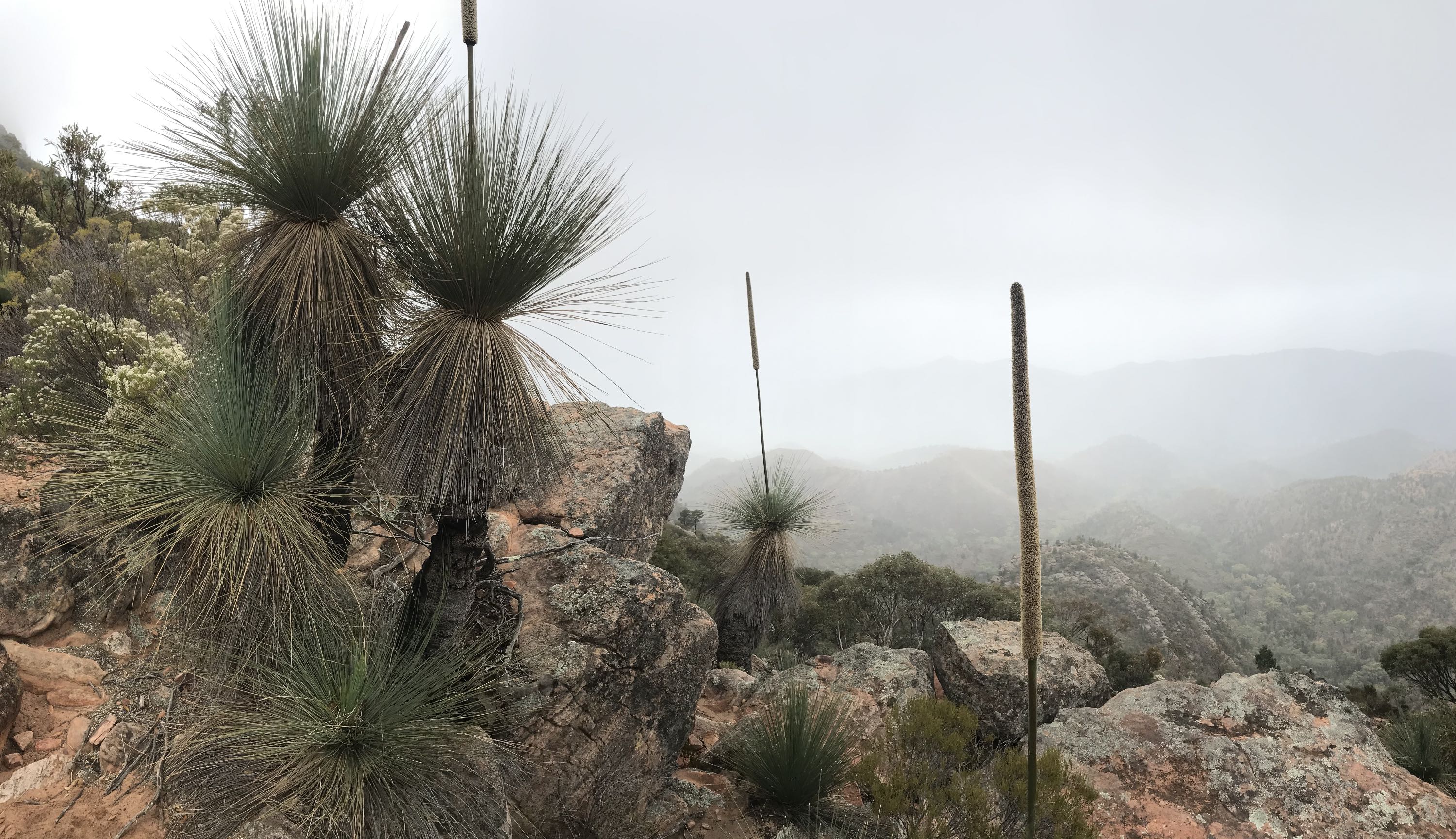
I was pleased to see that the Xanthorrhoea (common name yakka, also spelled yacca or yacka) seemed to be in good condition and were actively flowering.
I'm informed that the white-flowering shrub is most likely Cassinia laevis, common name curry bush. I saw a lot of it in flower on the hike.
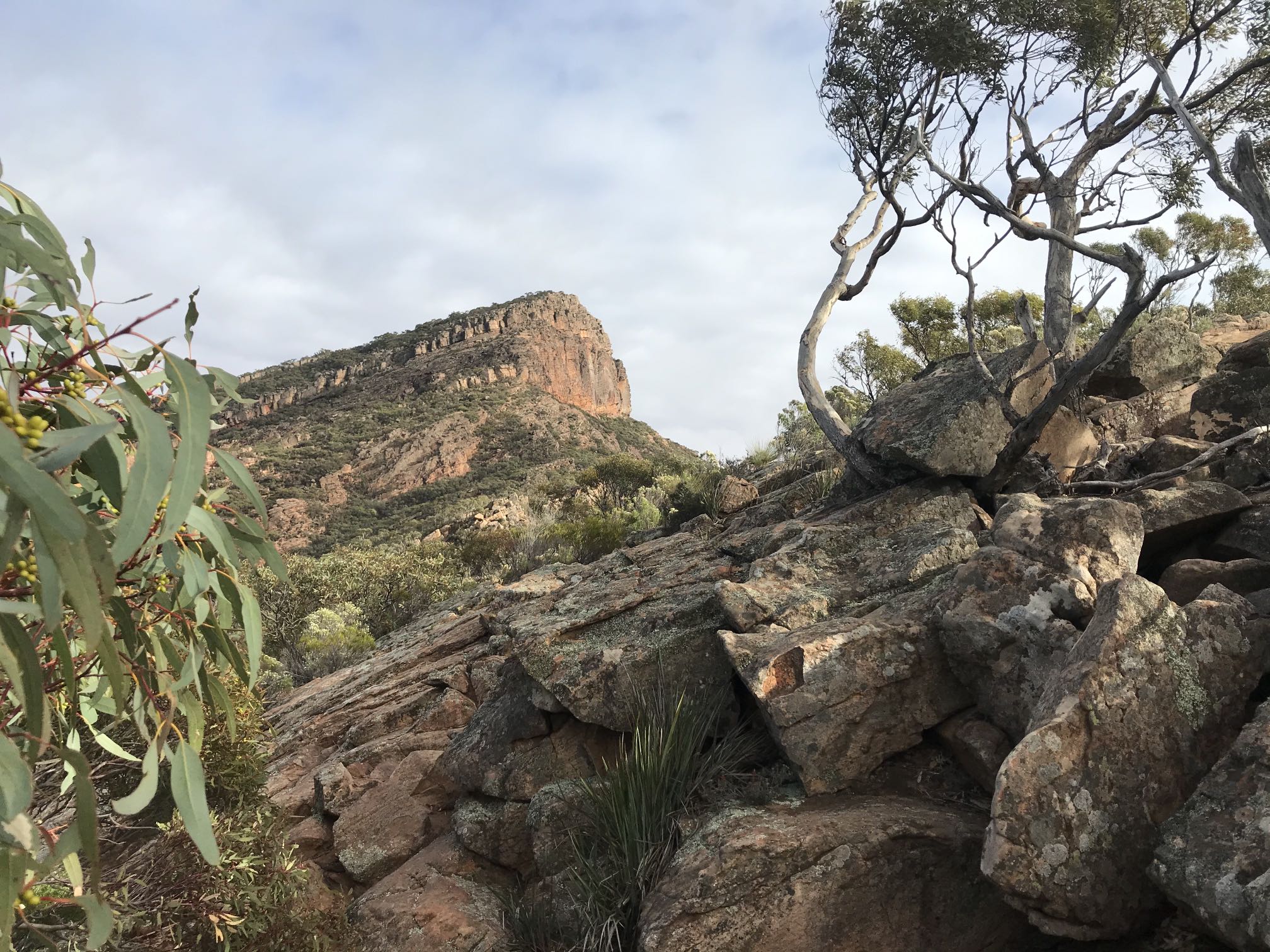
Tanderra Saddle is something like two thirds of the way to the top of the Peak in altitude terms. Getting to the saddle took me an hour from the time I left the relatively level section of trail.
The objective, St Mary's, is peaking over the top of the nearer hills on the right.
Dragon's tailThe "Dragon's Tail" of the Heysen Range is beginning to become visible in the distance on the left as I'm gaining altitude here.
YakkasOne of a great many of the yakkas adjacent to the trail. I've read that the trunk of the yakka grows about a centimetre per year, so this one could be around a hundred years old.
I can well believe that rate of growth. I've planted many yakkas in the last thirty of so years; I don't think any of them have yet reached the point of showing a trunk at all.
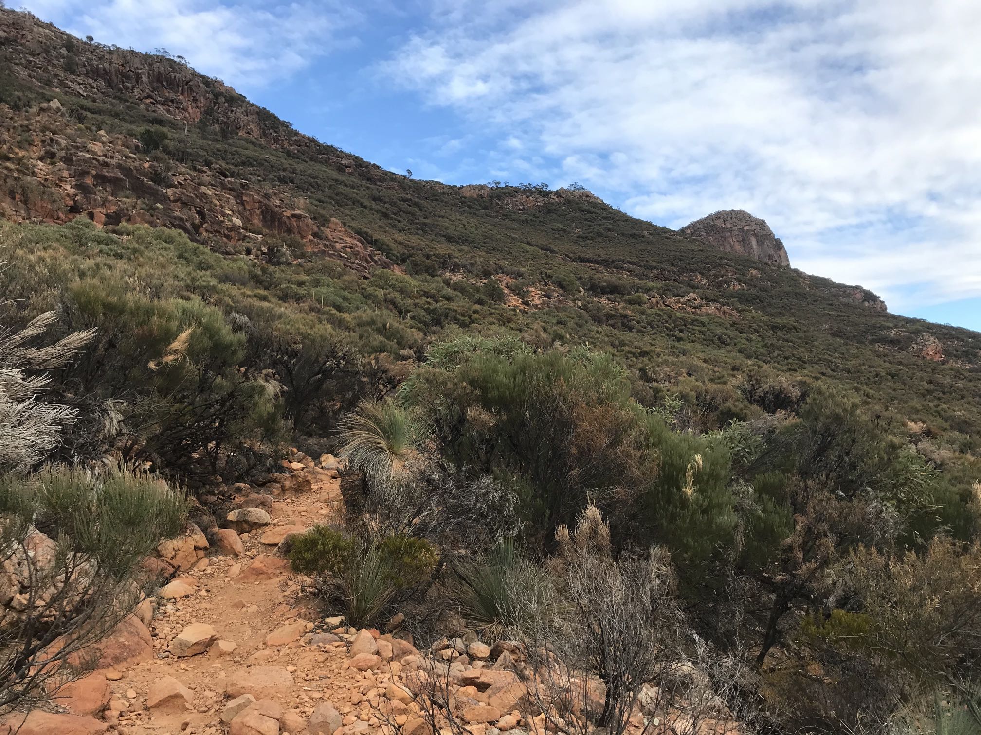
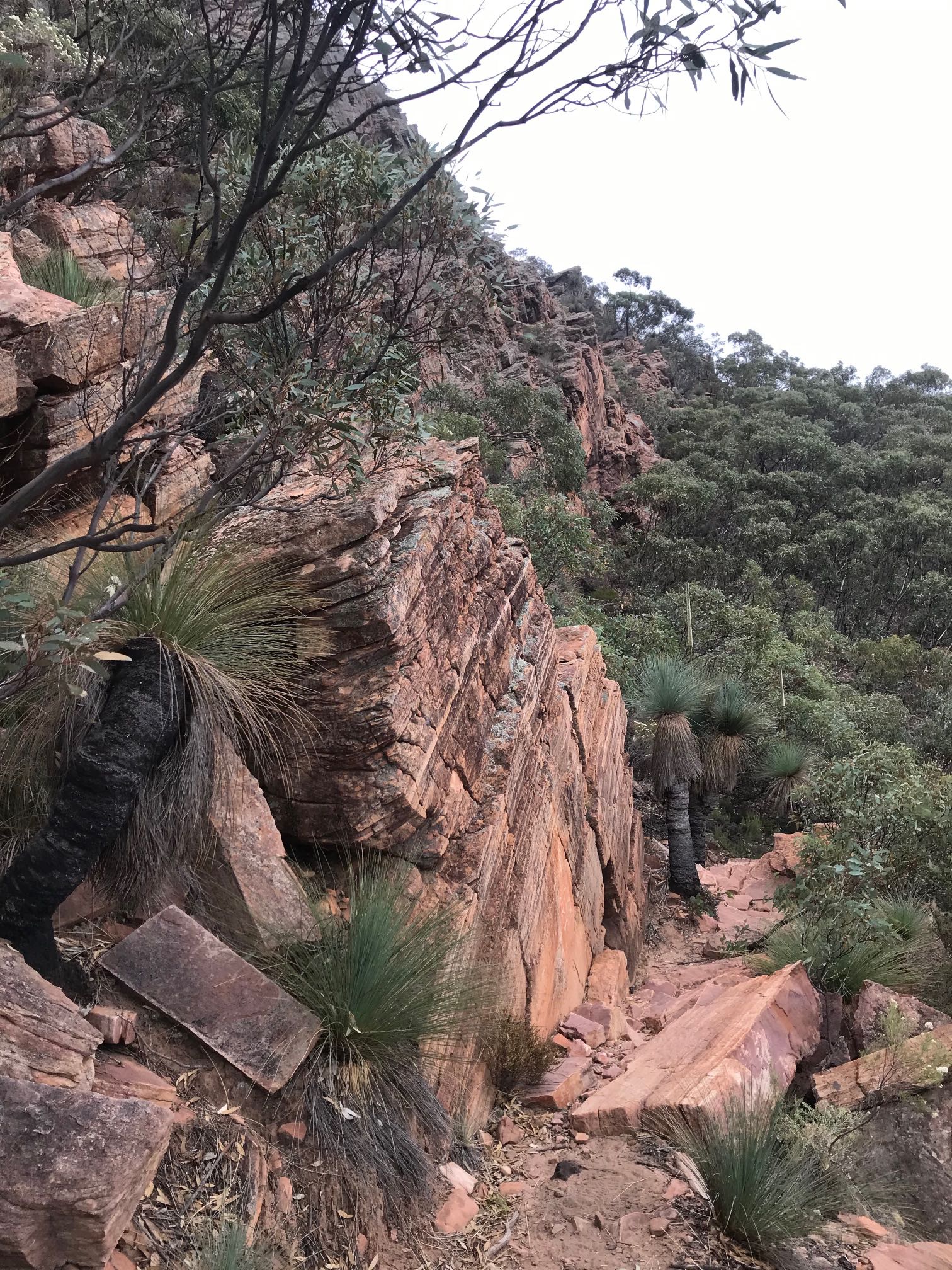
Rock face on the trailOne of the several rock faces that have to be scrambled over on the climb. There is nothing very difficult about getting over them (even for a 75-year-old of moderate fitness), so long as reasonable care is taken, especially on the way down.Take care that you stick to the marked trail. I missed it in a few places and had to go back and find it again. Yakkas with flower spikes and white-flowering curry bushes again.
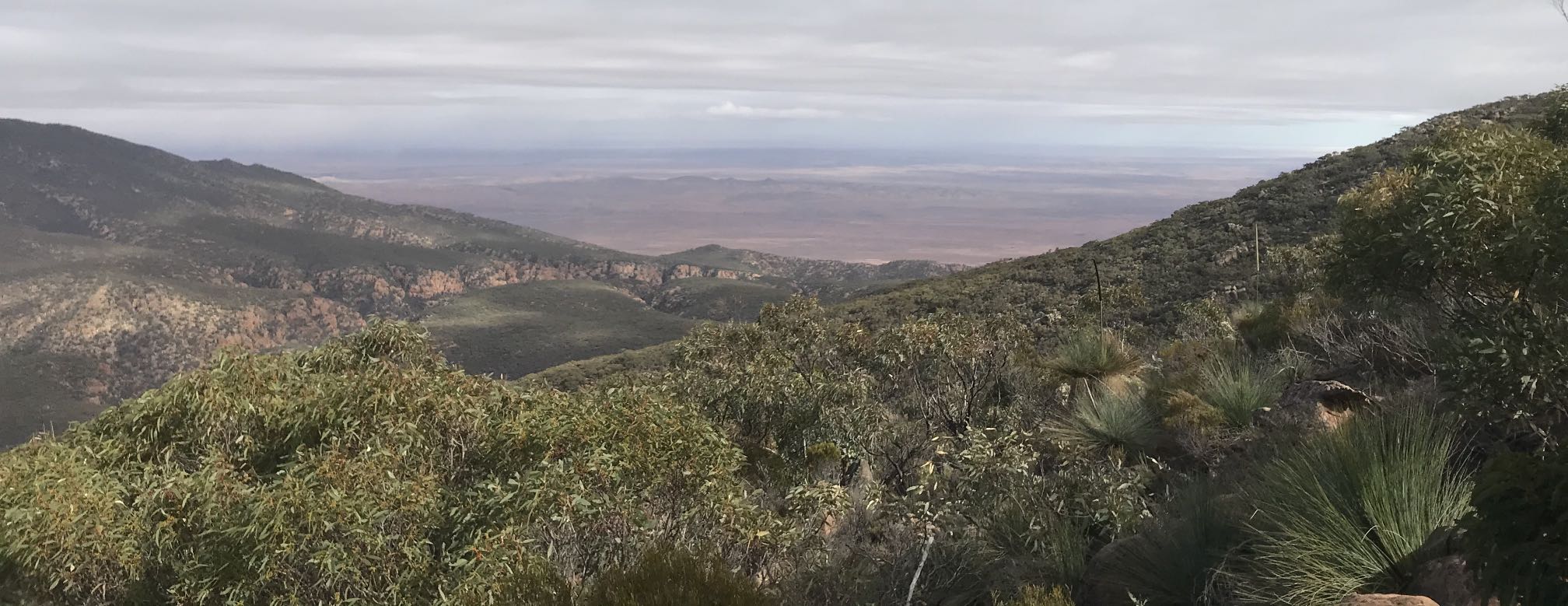
The paler land in the distance is the clear ground of the approach to Wilpena.
Tanderra SaddleSaint Mary Peak from Tanderra Saddle. One trail from the saddle goes on toward the peak, another branches off to become the Inside Track back to Wilpena.
Getting onto Tanderra Saddle is a big step toward the climb of Saint Mary Peak. The climb to the saddle is probably the toughest part of the whole climb, but the remainder is also challenging.
Rocks of WilpenaThe rocks of Wilpena Pound are responsible for the most spectacular of the landforms of the Flinders Ranges.The highest ranges of the Flinders Ranges are made up of sandstones and quartzites of the (Wilpena) Pound Subgroup. Some of the more moderate ranges are composed of limestones, while the valleys are underlain by easily eroded shales and siltstones. The rocks in this image are typical of the more resistant of the Flinders Ranges rocks that make up the highest ranges. The photo was taken looking toward the north. Note that the north-facing rock faces tend to be bare while those facing the south, that get less direct sunlight, are often covered with lichen. |
|
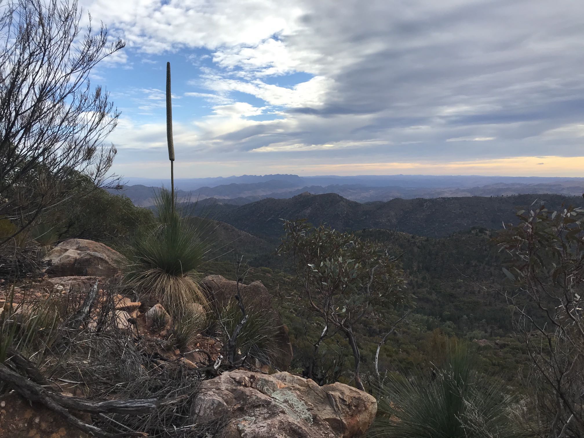
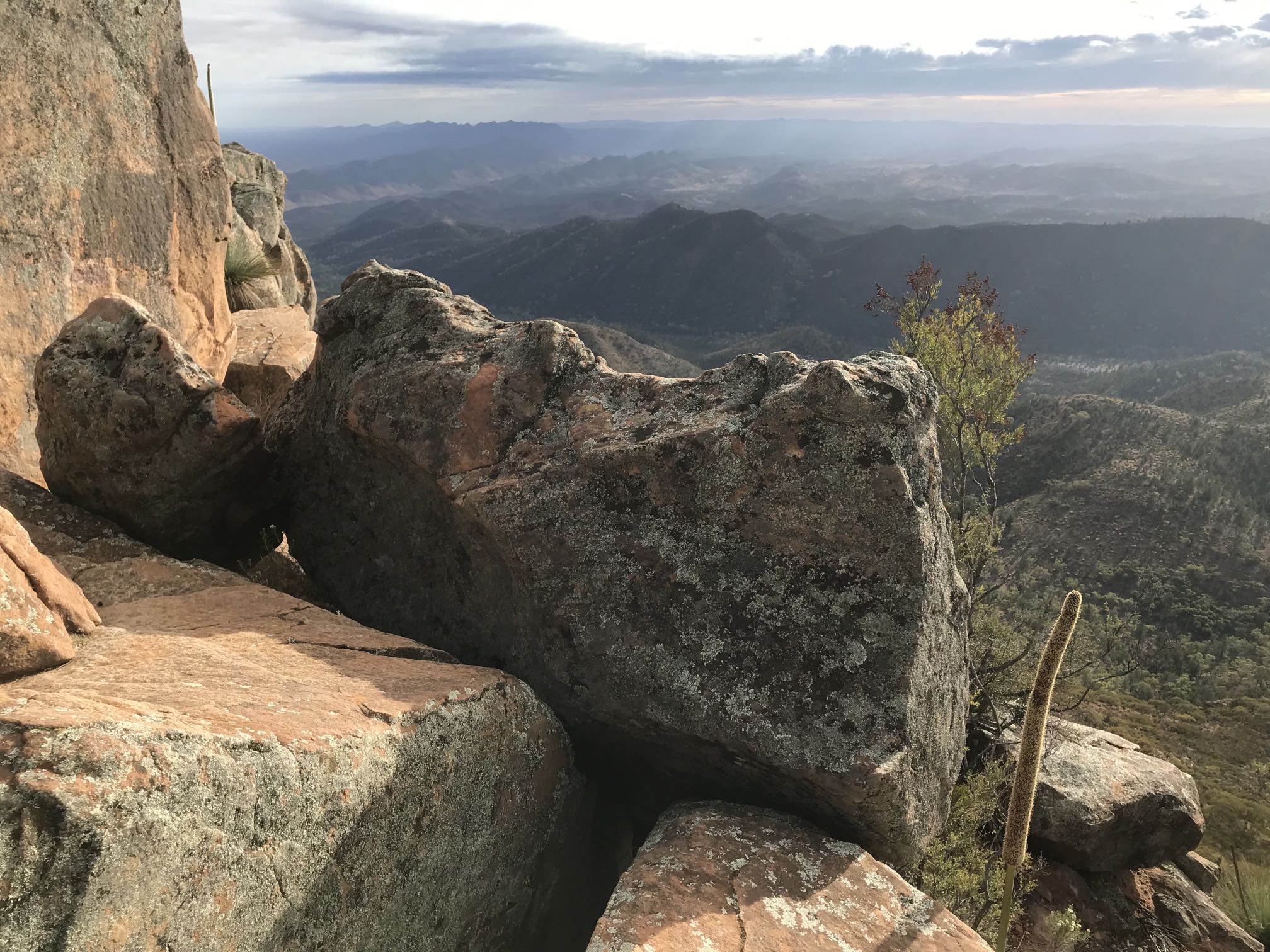
From somewhere near this point the trail went around the southern side of the Peak and the view to the north was no longer available. By the time I got to the top of the Peak, an hour and twenty minutes after leaving Tanderra Saddle, cloud had come in and largely obscured the view to the north.
JointingThere is interesting and conspicuous vertical jointing in the sandstone rocks in the upper centre of this image.The trail is to be seen in the lower right; typically stony and rough. |
|
|
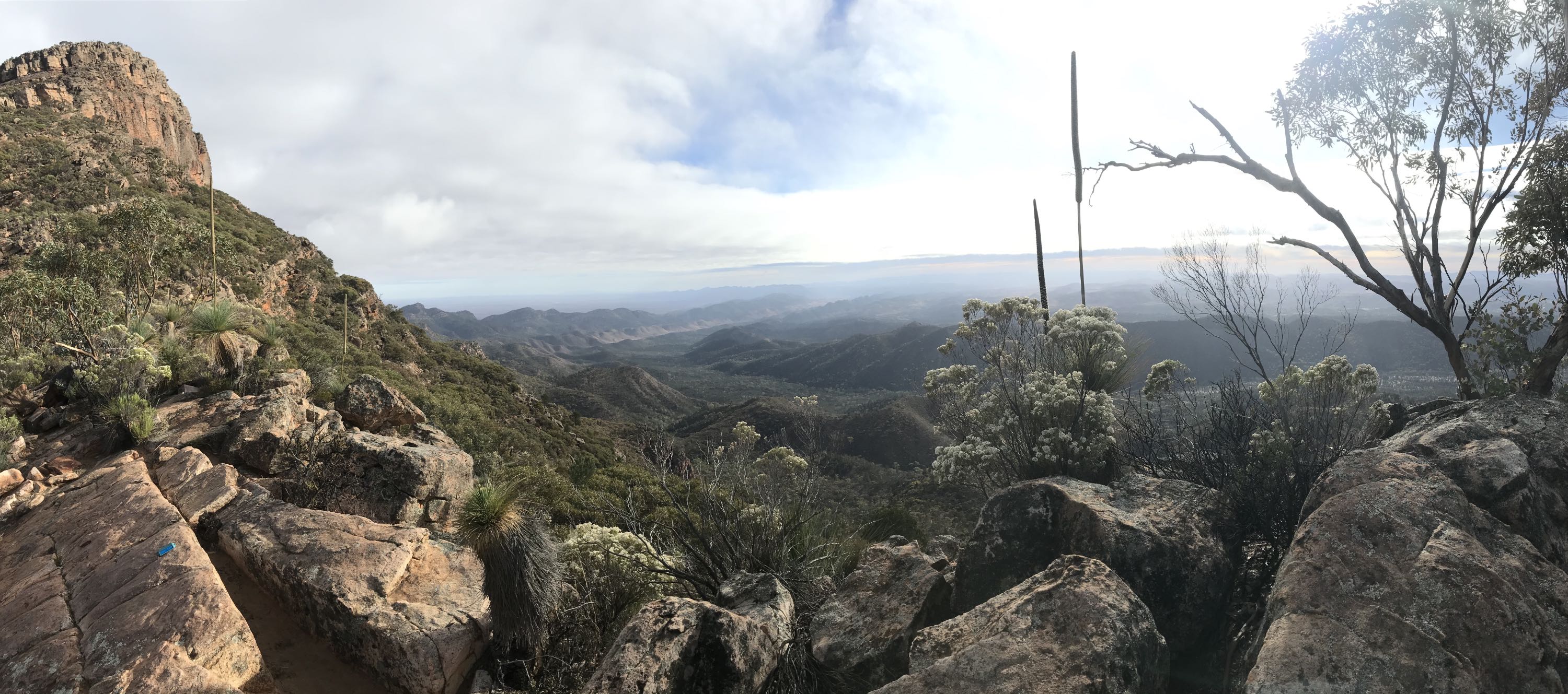
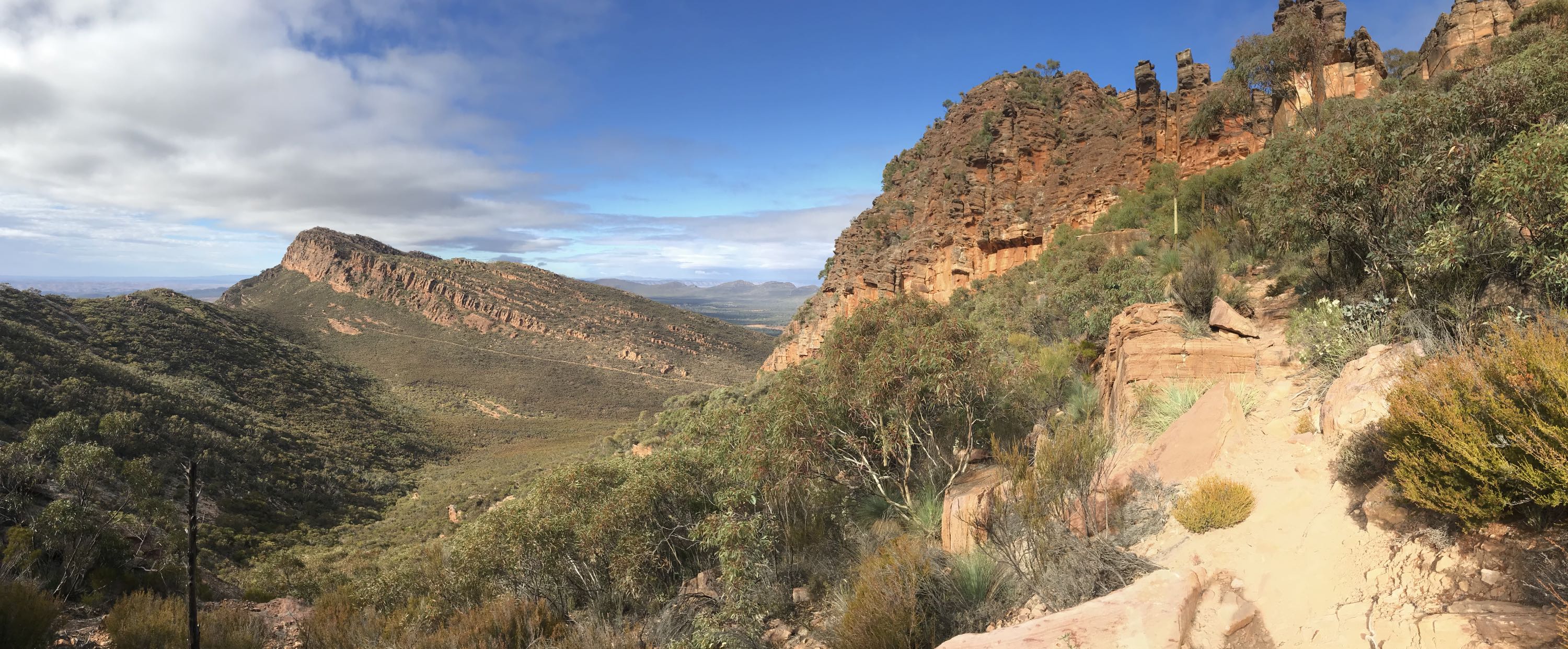
A panorama toward the southeast from the same place as the above image. The southeastern wall of the Pound in the vicinity of Rawnsley Bluff is to be seen in the centre. The Inside Trail is a conspicuous straight line running across the base of the rock-face left of centre (in the high definition image - click on this image to see the high definition version).
Also the cuesta nature of the Pound landforms is clearly to be seen in the same mountain. The gentle slope the follows the bedding on the right of the distant peak contrasts strongly with the steep slope to the left. |
The cliffs surrounding Edeowie Gorge are to be seen lower centre.
I once walked through Edeowie Gorge to the lower land to the west. It is a very difficult walk, one has to scramble along narrow rock ledges to get past two quite high 'waterfalls' (generally dry) along the gorge.
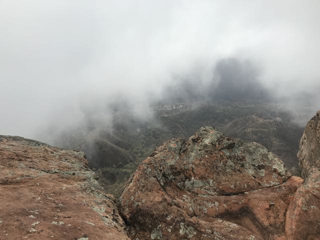
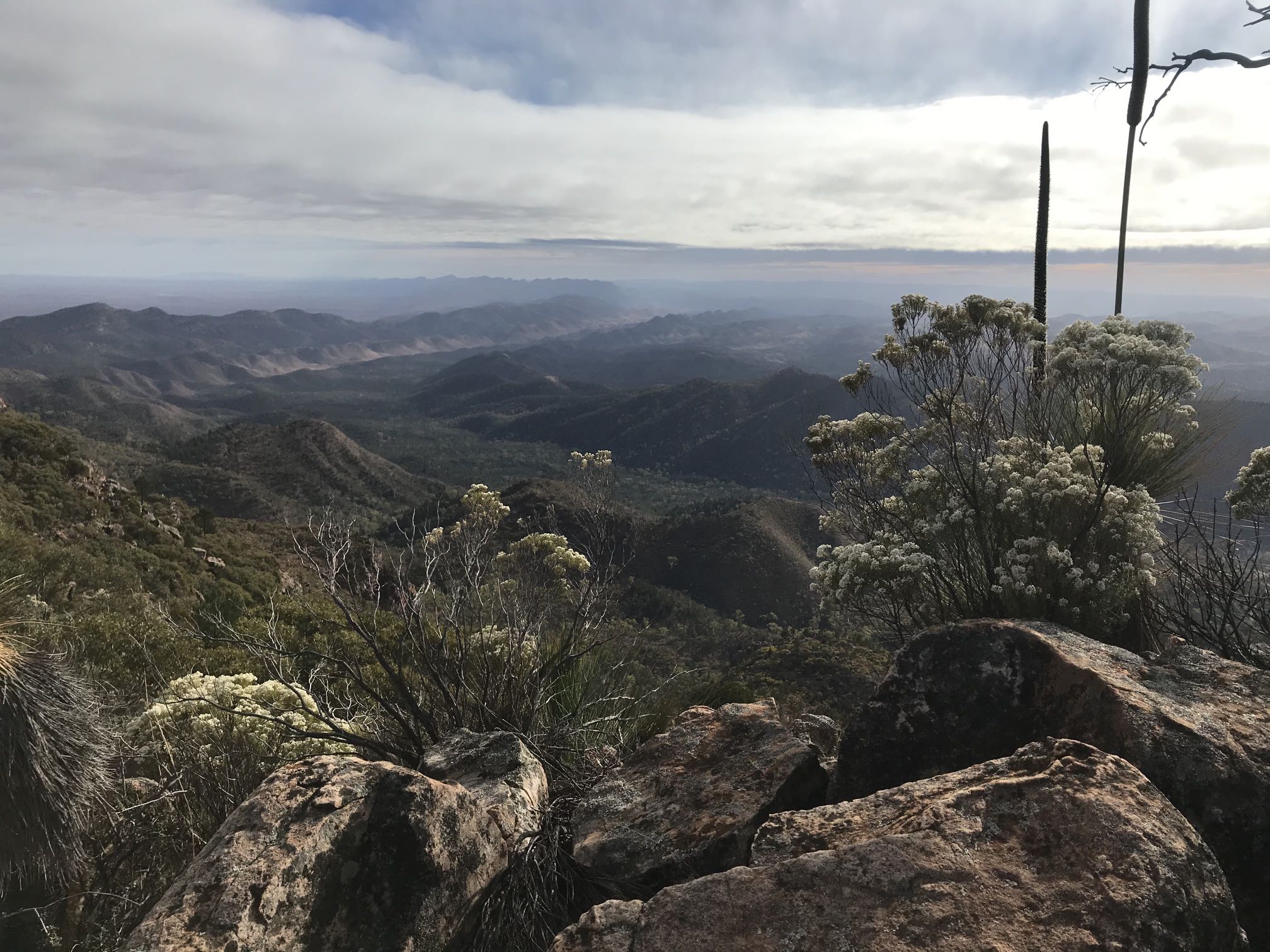
At this point there was a moderate breeze and a cool damp mist. I sheltered among the rocks for a time hoping that there would be a break in the clouds but it didn't come.
As the weather was only getting worse I thought it best to head down.
The descent
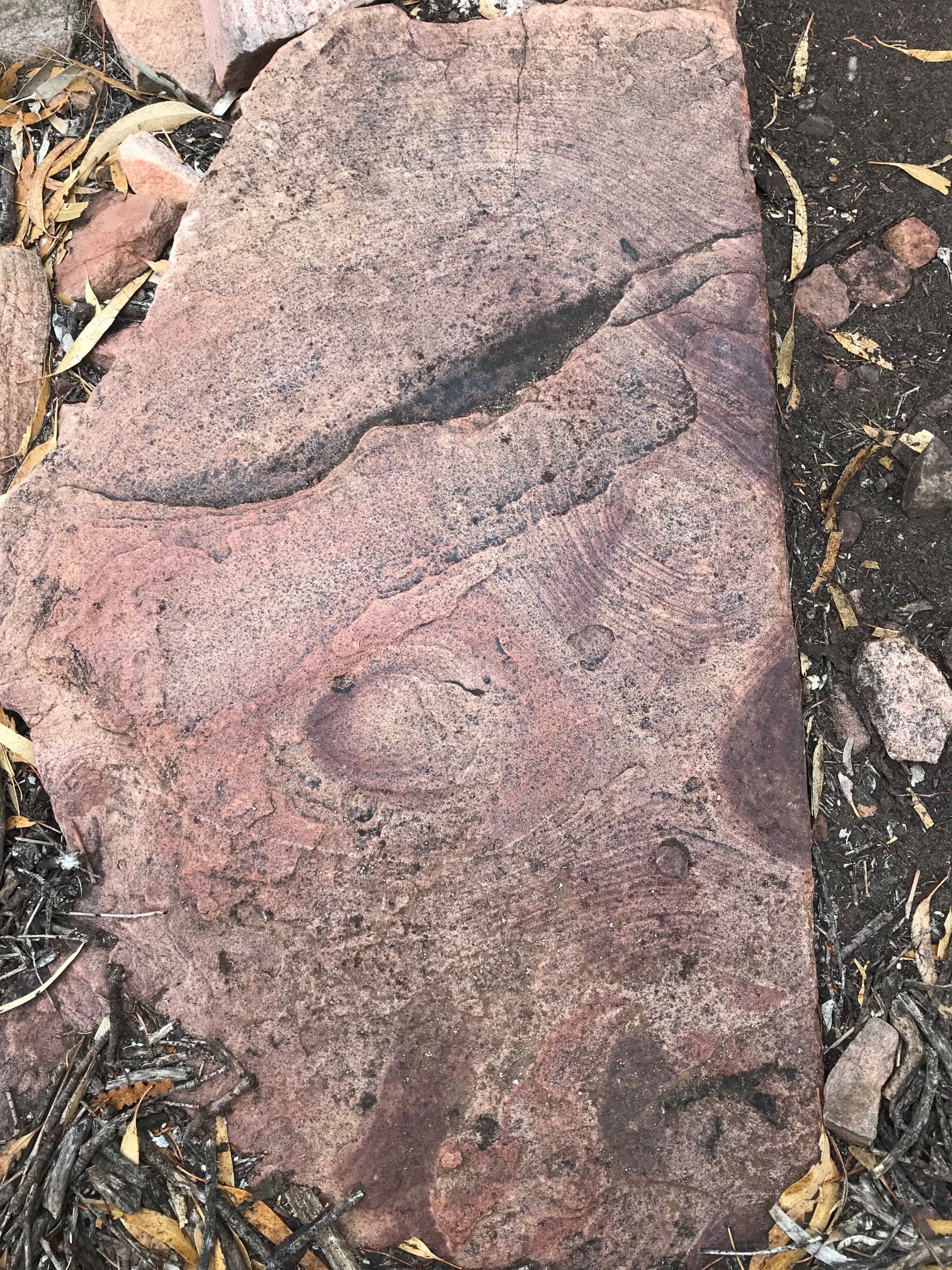
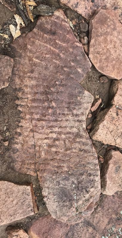
Ripple rock
'Ripple rocks' such as this are common in the Flinders Ranges sandstones. This particular one is near Saint Mary's so more than 1000 metres above sea level.
Also notable is the rectangular slab which could be mistaken for a cemetery headstone and the beautiful old yakkas. |
|
|
At this point there was a continual misty very light drizzle; it was obscuring the hills in the middle distance.
|
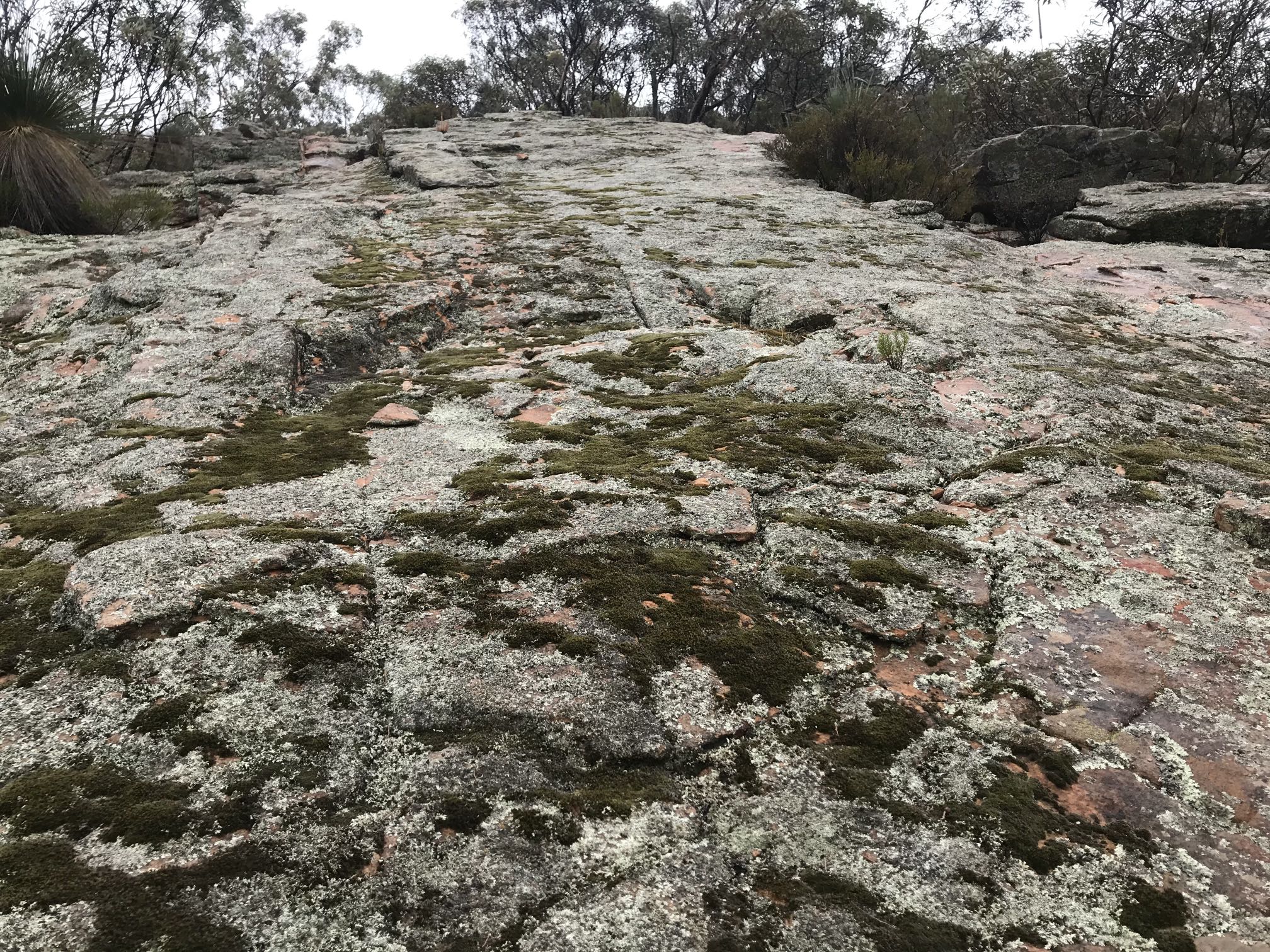
Moss and lichen
One would not usually expect to see moss covered rocks in a climate like that of Wilpena. The altitude of this moss and lichen covered rock-face would have been about 900 metres. It would probably receive substantially more precipitation than Wilpena, including on afternoons like this one when low clouds hug the peaks and there was a misty drizzle. The rock-face is also facing the south, so would get less intense sunlight than slopes facing other directions.
This reminded me of far more lush moss gardens in Japan.
My record of the walk details:
|
|
|
Other pages on the Flinders RangesOn this siteCompanion pages to this one, compiled in 2021Flinders Ranges; the main pageFlinders Ranges, Rawnsley area Other Flinders Ranges pages...Beetaloo Dam; one of the biggest concrete dams in the world at the time it was builtChambers Gorge Chasm; a remarkable geological feature that seems very little known A short visit to the Flinders Ranges, June 2019 A visit to the Flinders at the time of the COVID-19 pandemic |