Kingscote sunrises
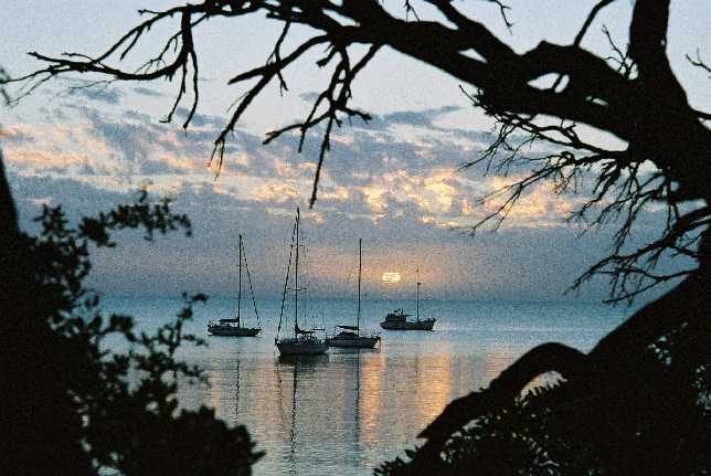 Just after the sun had risen
Placing an obstacle in front of the main subject of the photo seems
counter-intuitive, but seems to have worked to improve this photo.
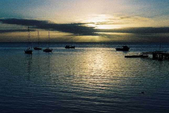 Sunrise on our second morning at Kingscote
The morning was chilly with only a light breeze.
Unfortunately I didn't see any well coloured sunrises.
|
|
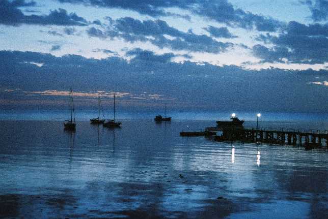 Sunrise on our forth morning at Kingscote
The wind of the third morning had gone again.
A two second exposure.
End of Kingscote sunrises
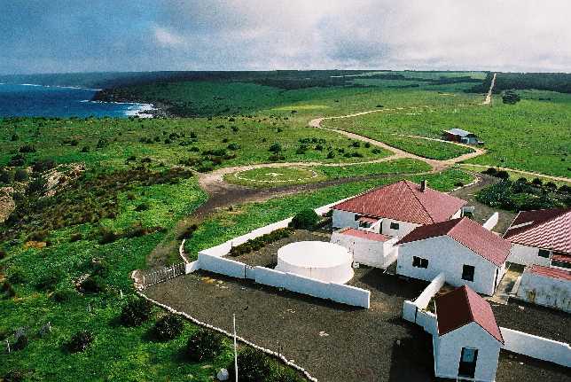
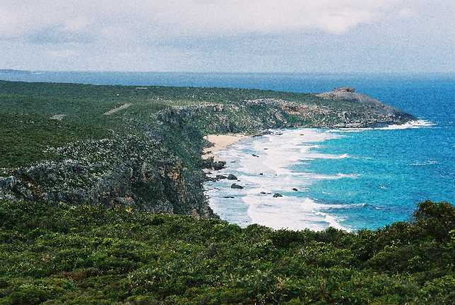
Cape Willoughby
 Willoughby Road
I love roads like this, where the trees reach right over and their folliage intermingles above the road.
This photo could have been improved if I had organised a figure in the
middle distance.
|
|
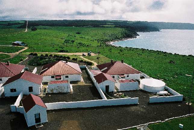
 Cape Willoughby
Looking to the southwest from the top of the Cape Willoughby
lighthouse.
 Cape Willoughby
Looking to the west from the top of the Cape Willoughby lighthouse.
Further to the north Cape Jervis with the wind turbines of
Starfish Hill could be seen.
|
|
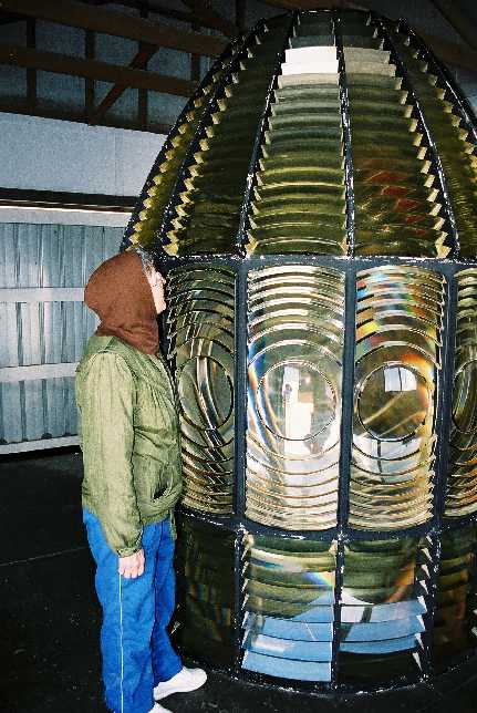 Disused lighthouse lens
This lens was used in the days when it was important that lighthouses have the absolute maximum visibility. In recent times ships are much more left to their own GPSs and radar to look after themselves.
We were told that the Cape Willoughby light now is visible from
about 40% the distance that it used to reach.
End of Cape Willoughby
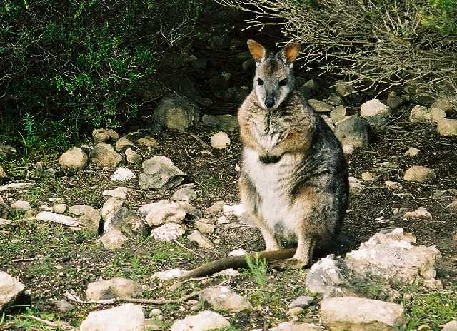 Tamar wallaby
These little blokes are remarkably tame in some areas.
This photo was taken with a 90mm lens.
|
|
Seal Bay
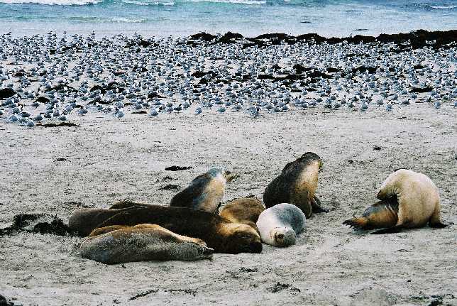 Sealions and terns
The sealions at Seal Bay are one of Kangaroo Island's best known attractions. They, or New Zealand fur seals, can be found at other spots around the coast.
The guide did tell us what type of terns they were, but we forgot. She also said that while they were often there, this was the most she had seen.
There were several board walks with labelled native plants in
this area.
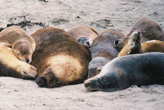 Happy family
There seemed to be quite a bit less squabling between sealions than between seals. The sealions were often in close groups like this.
200mm lens on Canon FT
2nd September 2003
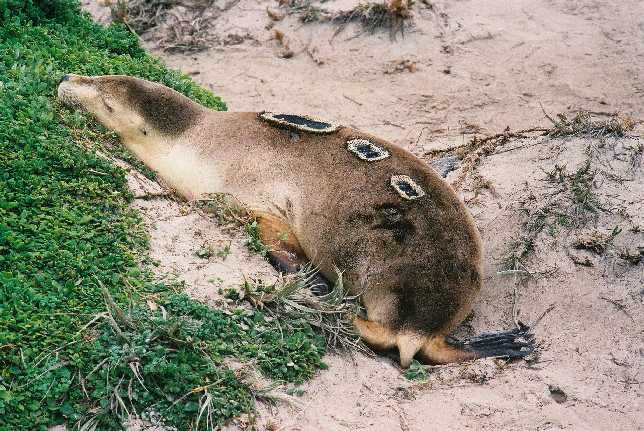 Bugged sealion
This female had had radio monitors attached to her. I have no idea why there had to be three rather than just one.
200mm lens on Canon FT
2nd September 2003
End of Seal Bay
Remarkable Rocks
 Overlooking them from a distance
There is a good sealed road right to the Rocks. This was taken
from a viewing point about a kilometre away. Remarkable rocks
are on the top of the granite dome headland.
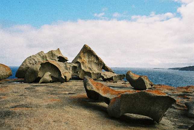 Looks like a sculpture
The orange lichen is the icing on the cake (in two ways). It adds to the beauty of the formation.
Denece and I noticed that this lichen was dominant at places
that got too much salt for other lichens. It also grew a
bit further from the sea, but then was likely to be less
noticable than other lichens.
 The sun shone after a while
When we arived we had the place to ourselves, but the sun wasn't
shining. By the time the sun shone three bus-loads of tourists
came along. It was difficult to get a photo without a bunch
of people in it. There is someone hiden behind the smaller rock.
|
|
End of Remarkable Rocks
Admirals Arch
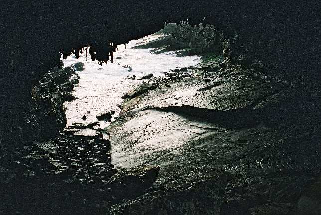 Admiral's Arch
A very challenging place for the photographer; the contrast is very great. I suspect the key would be to try for a time when difuse late afternoon light came into the cave.
A New Zealand fur seal can just be seen in the water on the left.
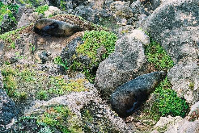 NZ fur seals
Quite a lot of these were lying around. They are not as closely
sociable as Australian sealions. These do not lie in groups.
Whenever they did get close to each other they squabbled.
End of Admirals Arch
Little Sahara
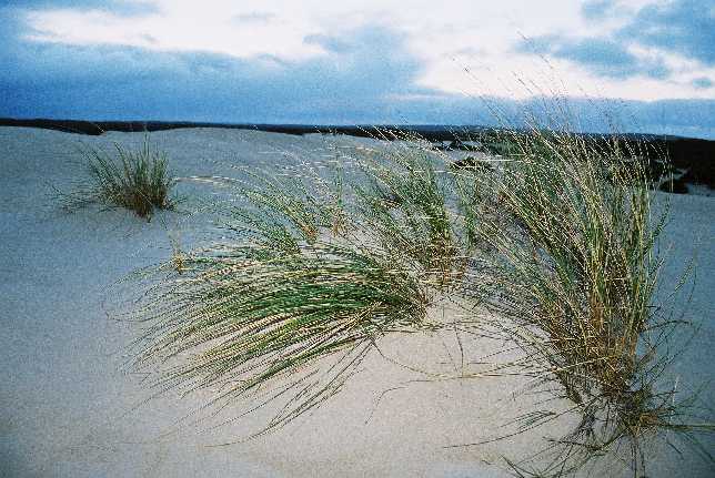 Isolated clump of grass
An area with photographic potential. The weather was not being kind, there was no sunshine and patches of drizzle.
The digital size reduction doesn't do any good for fine straight
lines.
|
|
 Light on the dune grass
I don't think the tracks down the side of the dune do anything for
this composition?
End of Little Sahara
Scott Cove
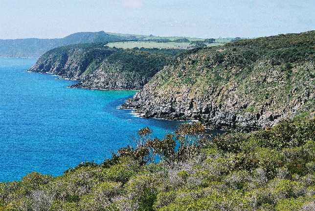 View to the east
This beautiful spot is in the far northwest of the island. There is some farming, but Man's impact is not conspicuous.
This was a perfect day, calm, sunny and warm.
|
|
 View to the west
I suppose this was the actual Scott Cove.
End of Scott Cove
Ravine des Casoars
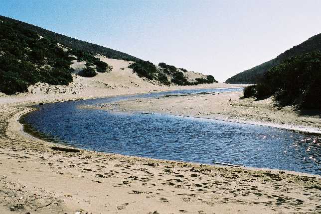 des Casoars beach
A very enjoyable 8km circle walk follows down the Ravine des
Casoars to this beach and then goes back to the car park
over a ridge.
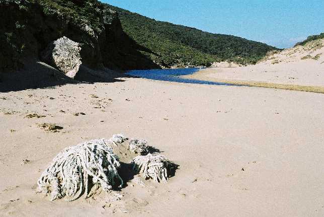 des Casoars beach
That frog-muncher Nicholas Baudan mistook the Kangaroo Island emus in this area for casawaries, hence the name.
The heap of rope in the foreground seems to be from some fishing
net gear. There was also plastic rubbish and one large moring buoy
lying around, obviously it had washed up, presumably from very
great distances.
|
|
End of Ravine des Casoars
Cape Linois
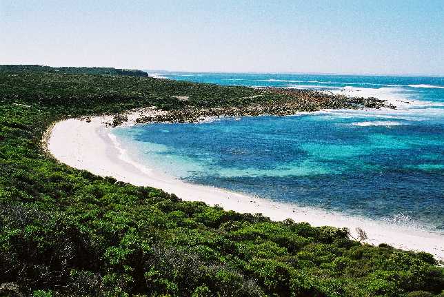 Wheatons Beach
South of D'estrees Bay and north of Cape Linois is this pretty beach in its little bay. The surf was heavy and the wind strong and off-shore.
The vegetation was a salt-stunted mallee heath.
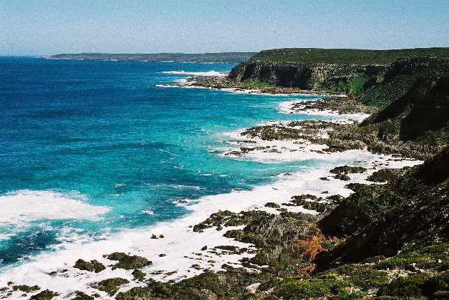 Southwest from Cape Linois
New Zealand fur seals bask on the rocks at the foot of Cape
Linois. I don't think they can be seen in this photo.
|
|
End of Cape Linois
Cygnet River
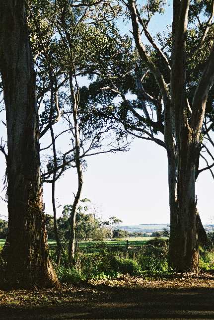 Gum trees at Cygnet River
There is an atractive area on the Playford Highway just west
of the hamlet of Cygnet River.
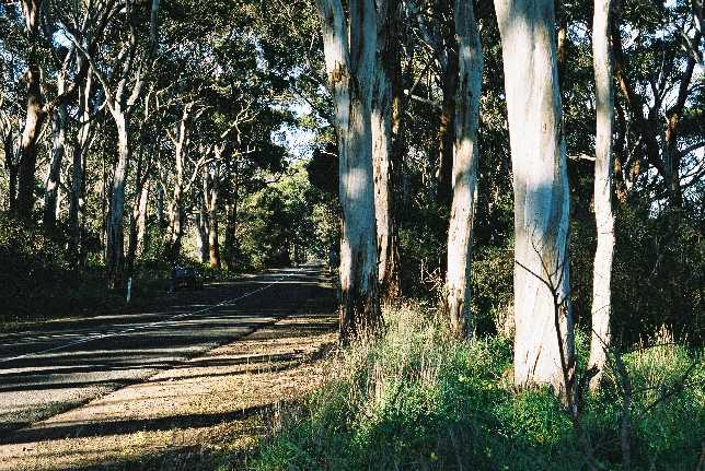 More gum trees at Cygnet River
The road pases through the gum trees. The river itself was not
conspicuous; to judge by the vegetation it must have periodically
flooded this area.
|
|
End of Cygnet River
Pelican feeding
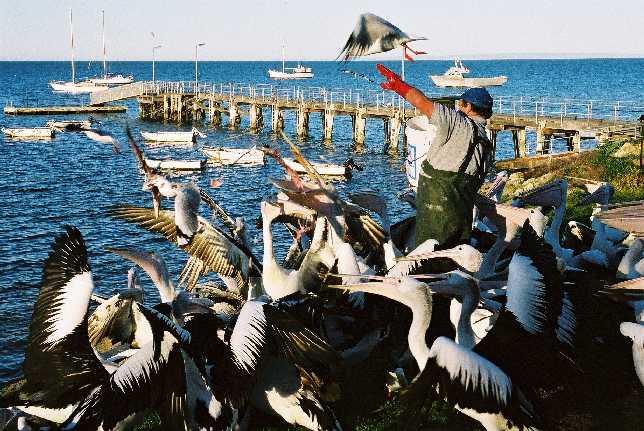 Pelican feeding
At 5 O'clock (I think it was 5) every afternoon the pelicans are fed at Kingscote.
Fish scraps are used. The tourists are asked for a gold coin
donation to cover the costs of keeping the scraps in the
fish processer's chiller.
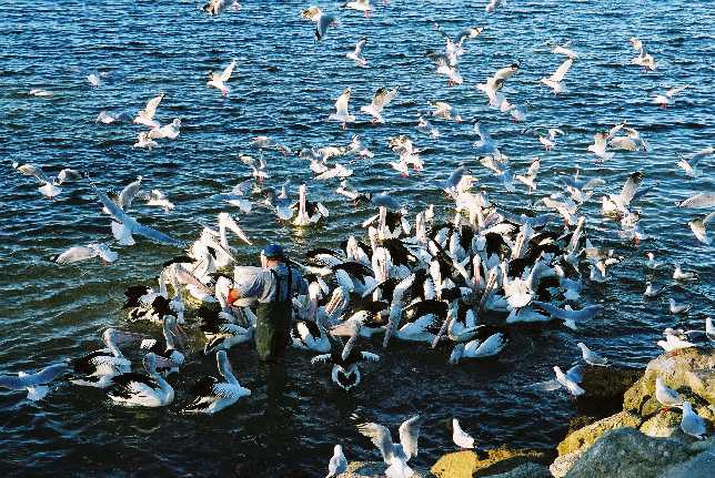 Pelican feeding
Of course it is impossible to feed the pelicans without the seagulls getting in for their share.
There were a couple of pacific gulls
there too, although they were a little less enthusiastic than the
silver gulls. The bloke said that the adult pacific gulls do not
get involved, but we saw an adult have a go.