There is a need for a
safe cycling and walking path from Clare to scenic Armagh
Contact: email me at daveclarkecb@yahoo.com
Created 2006/03/20, modified 2019/11/20
|
|
Most of the road shoulders were sealed from Clare to Blyth in September and October 2019.
While there is not a designated cycling/walking path it is now a pleasure to ride my bike between Scobie Road Armagh and Clare. The greater part of the shoulder has a fairly good surface while it was previously unsealed and very rough in many places.
There's been thirteen years of waiting for an improvement since writing this page, twice that all together. I survived hundreds of bike rides between home and the
Gleeson Wetlands, but at last the road has been greatly improved, if not entirely satisfactorily.
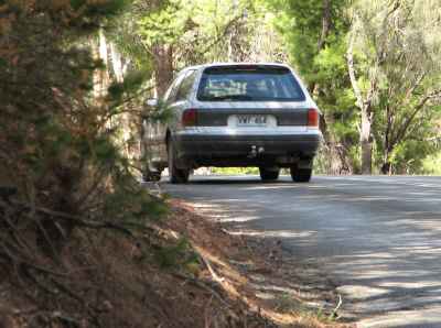
The outstanding black spot is the section shown in the photo on the right.
It is a 'blind corner' and there is still no shoulder there at all.
There is at least one other section with no sealed shoulder, approaching the high school from the west, but at least it is fairly straight with good visibility.
Also, the bridge across the Armagh Creek in Armagh is not wide enough for two cars and a bicycle or pedestrian; see the photo below.
The roughest patches of road are now within the town.
The parts of the road that are the roughest are almost always toward the sides, where cyclists have to ride.
|
The following part of this page was written before the road upgrade of September-October 2019.
| |
| | Scobie road, near Armagh
| |
While there are many quiet and
scenic back roads
ideal for mountain bikes in the Armagh area,
there is no safe connection between the
Riesling Trail at Clare
and Armagh.
The
existing road
is busy, unpleasant, has rough edges, and is dangerous for cycling.
Consequently cycling tourists rarely get to Armagh; this disadvantages the tourists, the people who cater for tourists in the Armagh area, and tourism in the Clare Valley in general.
The purpose of this page is to press for a safe walking and cycling trail
between Clare and Armagh and to point out how scenic the Armagh area is.
I believe this could be done with modest expense by using the existing road shoulder, as detailed
elsewhere on this page.
The 'Clare Valley' is actually a number of small valleys within an
elevated area. It has a higher rainfall than the surrounding areas because
of its higher altitude, and has retained a much larger proportion of
its original native vegetation; see the photo at the right and
Armagh gallery, below.
The road from Clare to Armagh is the responsibility of the state government rather than the Clare and Gilbert Valleys Council.
The popular Riesling Trail follows the path of the old railway line from Auburn to Clare and on to Barinia and is well used by walkers and cyclists.
It connects to the
Lavender Federation Trail, the
Rattler Trail, the beautiful
Gleeson Wetlands and several loop trails, but not to Armagh.
|
Walking or cycling between Clare and Armagh
|
As people become more aware of the greenhouse/climate change problem, and
as fuel prices rise, more will take to walking or cycling, both on holiday
and as a way to get from place to place.
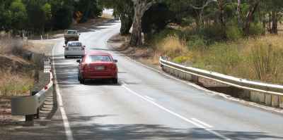
Armagh is 3km from the centre of Clare, but the road carries relatively heavy
motor traffic, is narrow in places, lacking a useable shoulder in other places, windy, very rough in places especially toward the side where cyclists have to ride, not well suited for walking, and dangerous for cycling.
The alternative roads are very indirect and one goes over quite a high hill. Visitors do not know that the road is unsuitable for cycling until they get onto it.
|
|
|
|
The Clare to Armagh road
|
|---|
| |
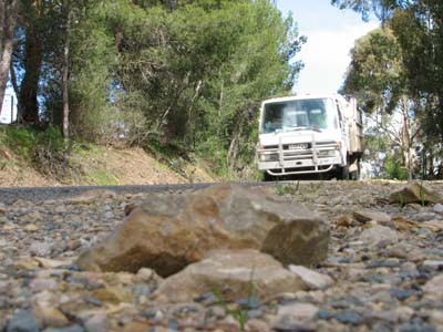
No road shoulder for cyclists
| |
|
| |
On the opposite side of the road from the above photo the shoulder has
scattered stones on it and, as it stands, is dangerous for cyclists.
But there is sufficient width for a sealed bicycle lane.
| |
|
| |
The bridge across the Armagh Creek in Armagh; no space for cyclists or pedestrians.
|
|
Cycling
The photo on the right shows
what is probably the most dangerous section of this road, especially to
cyclists. As you can see, there is no shoulder at all at this point, which
is both on the crest of a rise and a corner. It is impossible for a cyclist
to get off the left side of the pavement and out of the way of overtaking
vehicles.
For the vehicle drivers, forward visibility is very short and they do not
know what is coming from the other direction. There is a double line along
the middle of the road.
At many other points the shoulders of this road are loose, steep, and/or
covered with loose gravel and scattered stones. It is difficult and
destabilising for a cyclist to get off
the road pavement and out of the way of an overtaking vehicle onto this sort
of surface.
There is a double white line on much of this road; while crossing the double line to overtake a cyclist has been made legal, some motorists do not know this.
Walking
The bottom photo on the right shows the bridge over the Armagh Creek at
Armagh. You can see that there is no space for pedestrians. Visibility
is not great in either directions. Even if a pedestrian starts across the
bridge when no vehicles are to be seen, it is quite possible that one or two
might come before he/she can get across. A pedestrian on the bridge and
vehicles coming from both directions creates a dangerously tight situation.
| Bike lane on Fisherman's Bay Road
|
|---|
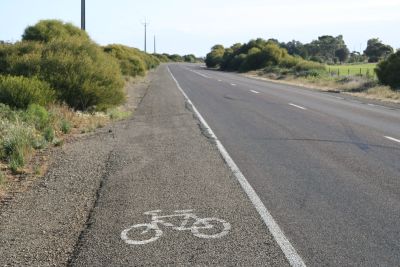
| | It would not be difficult to establish a bicycle lane between Clare
and Armagh similar to this one that runs from Port Broughton to Fisherman's
Bay.
| | |
There is a reasonably wide, but unsealed, shoulder on the right side of the
road all the way from Clare to Armagh. I believe that by sealing this
shoulder, moving the white posts, and painting a bicycle/pedestrian lane
the road could be made much safer for both pedestrians and cyclists.
It would not be necessary to remove any native vegetation, although a few
feral pine trees that are particularly close to the road should be taken out.
A pedestrian bridge would seem to be the best option for pedestrians and
cyclists crossing the Armagh Creek.
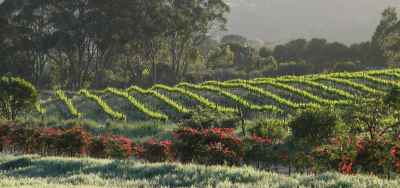
A sample of what you will miss if you don't go on the back roads around
Armagh
More images on
another page
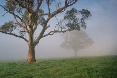
Early sunshine on blue gums partly hidden by a mist;
near Scobie Road, west of Armagh
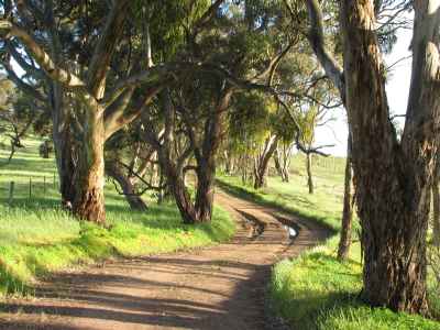
The early morning is the most beautiful time of day.
Jacobs Range road, south of Armagh
One of my farourite roads for a walk or a bike ride
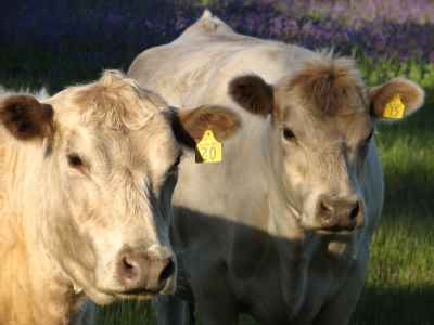
Curious cows on Jacobs Range road, south of Armagh
They were particularly interested in my little dog
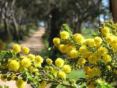
Acacia blossom on Scobie Road, near Armagh
Acacias blossom from mid winter through spring
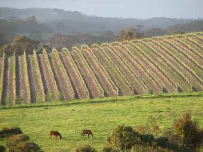
Spring vineyard and grazing horses adjacent Boconnoc Park road,
south-west of Armagh
Blooming callistemon along the Old Blyth Road, west of Armagh
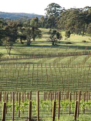
A new vineyard, Jacobs Range Road, south of Armagh
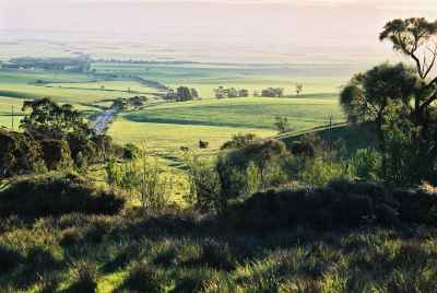
Overlooking the Blyth Plain on a hazy day
From the top of the hill on the Clare to Blyth
road, about 2km west of Armagh
The view from Brooks Lookout, about 2km west of Armagh
Not only is there a beautiful view here, but also a large variety of
native plants are labelled.
On a clear day one can see eighty kilometres or more from here, from Spencer
Gulf to the southern Flinders Ranges.
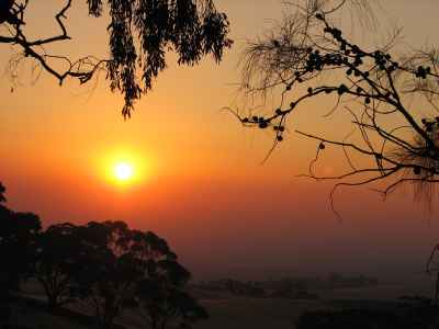
The sun setting over the Blyth Plain
Seen from the Clare to Blyth road west of Armagh
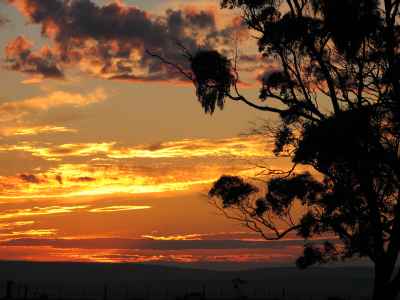
Another sunset over the Blyth Plain
As seen from a minor road that follows a ridge overlooking the Blyth Plain;
north of the Old Blyth road, about 2km west of Armagh