This little train travels along a winding narrow gauge railway through more
than one hundred tunnels on its leisurely way from Chandigarh up the
Himalayan foothills to Simla (sometimes spelled Shimla or Simle).
As the crow flies the distance is only about 60km, but the journey takes
a couple of hours.
Only one compartment of the last carriage contained Westerners.
There was an English couple as well as our family; yet if this railway could
be transplanted to Australia it would be packed.
The track that the train has just passed over can be seen lower down the hill.
The train zig-zags its way up through the mountains.
Simla (Shimla to the Indians) used to be the summer capital under the Raj.
At 2000m above sea level it is comfortably cool.
|
|
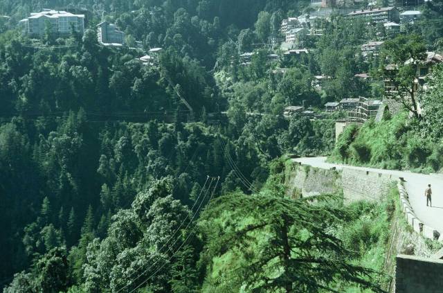
| | One of the steeper parts of Simla
| |
|
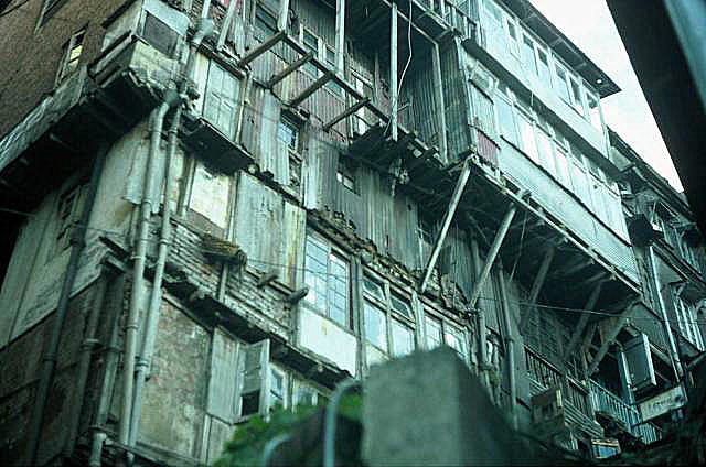
| | A building in Simla
| |
|
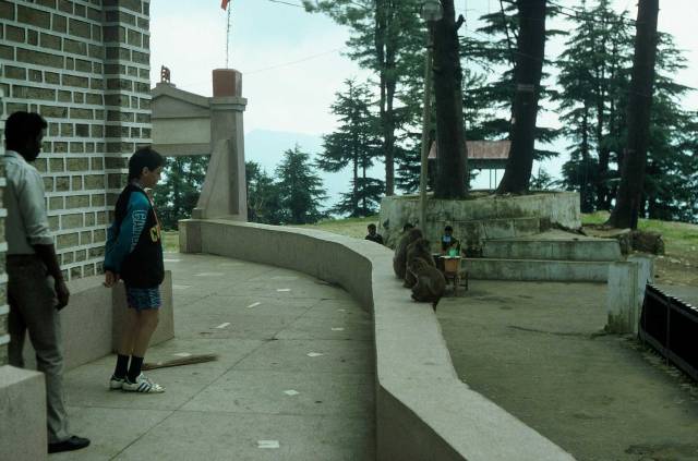
| | Monkeys at temple on Jackoo Hill
| |
|
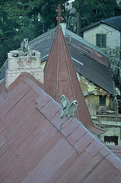 Monkeys on a roof in Simla
| |
|
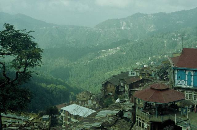
| | A view of Simla
|
|
Built around the side of a hill is well wooded country Simla is attractive
in some ways...
...ugly in others.
One wonders what the history of this building would be.
Who would feal safe living in it?
Jackoo Hill overlooked Simla.
On it was a little temple and around the temple were monkeys.
My son was interested in the monkeys and the local man
was interested in watching what the white sahib boy was doing.
White tourist children were not often seen in India.
Considering the difficulties and upset tummies that
we encountered, that is not surprising.
These monkeys were photographed out of the window of our room in the Simla
YMCA.
They were cheeky enough to come into the room looking for food if
a window was left open.
We had heard that they could carry rabies so were careful not to provoke
them.
If I remember correctly, the octagonal building was a Chinese resaurant,
and quite a good one.
|
|
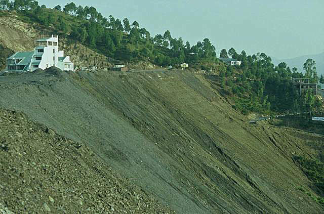
| | Simla airport
| |
|
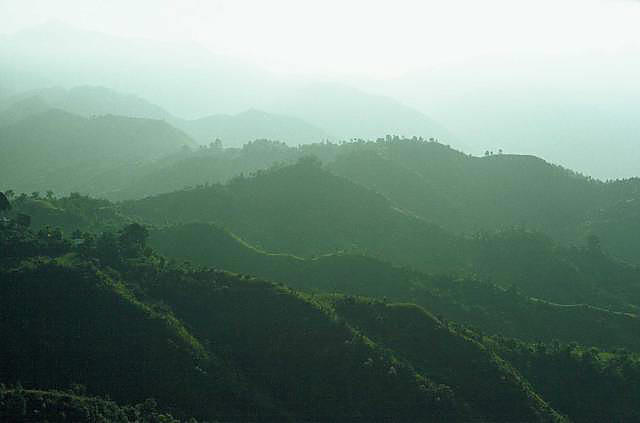
| | View from Simla Airport
|
|
The airport is something like 20km, perhaps more, from Simla; with a
dare-devil Indian bus driver on Himalayan roads it might have seemed
further than it was.
As the airport was close to the Chinese border and relations between India
and China were 'delicate' in 1989, the Indian government ban photography
around the airport.
I didn't notice the signs until after taking several photos.
As can be seen from the Simla photos, the region is
very mountainous; even the airport is built on very steep ground, as can
be seen by the earthworks in this photo.
I don't think I've ever seen hills beyond hills beyond hills to the extent of
these at Simla airport in the foothills of the Himalayas.
|
|
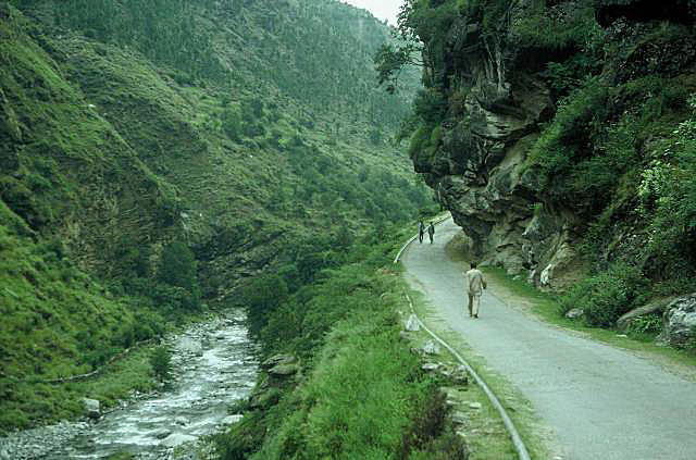
| | A side road at Kulu
| |
|
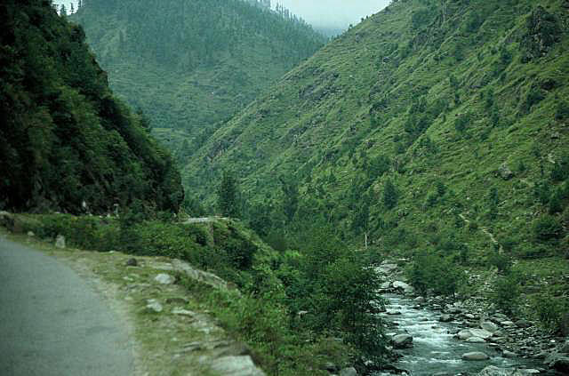
| | Kulu Valley
| |
|
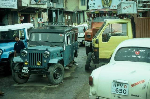
| | The main road through Kulu
|
|
The Kulu Valley is also called the Valley of the Gods; if you visit it you
will understand why.
The valley floor is at an altitude of around 2000m; higher than all but
Australia's highest mountains.
Within sight of some places on the valley floor are mountains up to 6000m
tall.
(Everest is 8800m.)
The road to
Manali, further up the Kulu Valley.
The Bias river that runs through the Kulu Valley is one of the tributaries
of the Ganges.
It might have changed since, but in 1989 the town of Kulu had little to
attract the tourist.
We flew to Kulu from
Simla, stayed one night, then
travelled on to
Manali.
We picked out what looked like a reasonably clean restaurant for dinner,
ordered and ate our dinner, then noticed rats chasing each other through
the crockery stacked in cabinets near our table.
This photo was taken on our bus journey out of the Kulu Valley.
The car had a flat tyre and blocked the road; all the traffic had to
wait while the tyre was repaired and replaced.
|
|
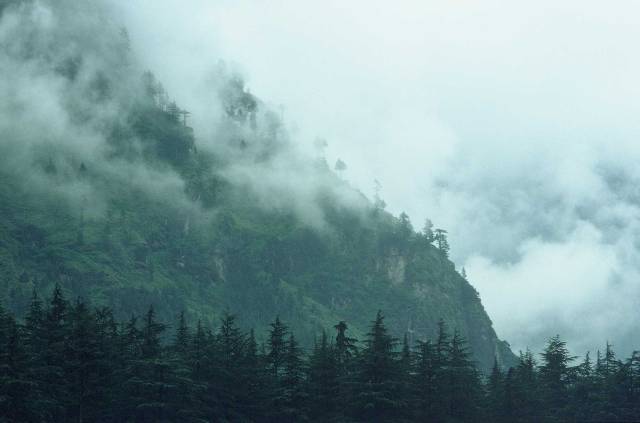
| | A Manali hillside
| |
|
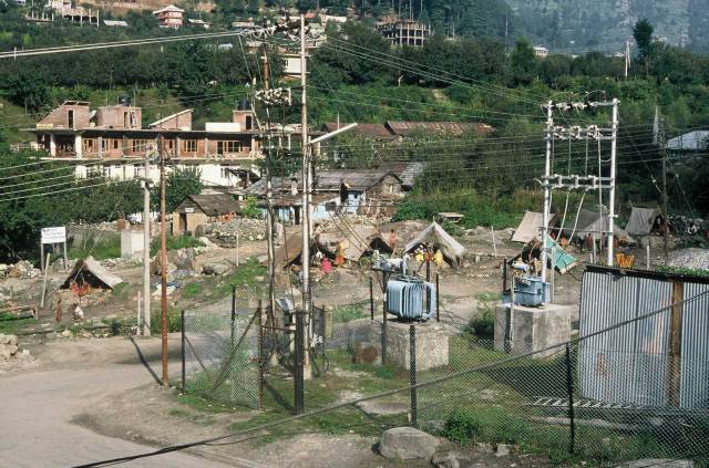
| | Slums on vacant ground in Manali
| |
|
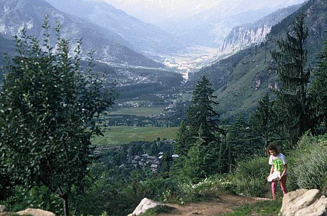
| | Julia doing road maintenance on trail to the holymen's cave
|
|
Low clouds on a hillside at Manali.
Manali is a very popular town with tourists at the top of the Kulu Valley
(the valley of the Bias River).
There were good restaurants in Manali (clean so far as we could tell
compared to those in Kulu).
Seen from the Manali hotel that we stayed in.
From the very simple slum-tents that can be seen in this photo came
immaculately dressed school kids, in uniform, every morning.
How the kids and their mothers managed to get and keep the clothes so
clean and fresh looking was beyond our imagination.
We walked down the valley from Manali and climbed a hill to find a holliman
who lived in a cave.
This was the view part way up the hillside.
In fact there were two holymen in the cave.
One seemed to be low cast, poorly educated and spoke no English; the
apparently senior of the pair asked the other to make tea for us all.
The senior holyman had sworn to not speak; he communicated with us by
writing with chalk on a slate.
|
|
|
|
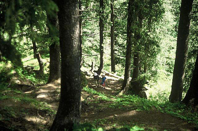
| | Climbing a mountainside, Manali
| |
|
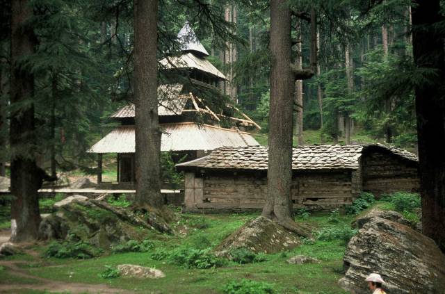
| | Hadimba Temple near Manali
| |
|
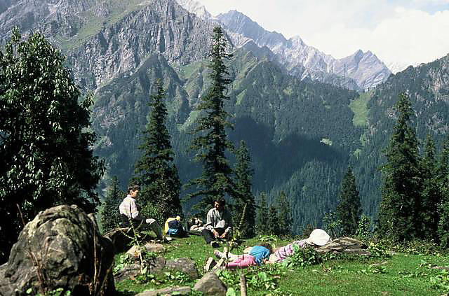
| | Above the Kulu Valley near Manali
|
|
Climb up mountainside from Manali
With a local guide, my family and I climbed a hill.
It was not easy going, the hill was steep and we climbed a long way.
The locals had hard lives.
We saw a few women carrying milk down to the town, presumably from small
dairies in the mountains.
At one place we saw where timber cutters had been sliding logs down a very
steep gully.
Hadimba Temple, on a mountainside above Manali.
There were many intricate wood-carvings on the temple; our guide told us
that the carver had his right hand cut off after he finished, so that he
could never produce a more beautiful work anywhere else.
Such are Man's inhumanities to Man.
The view from the highest point we reached in the walk.
We were nowhere near the top of the local mountains.
|
|
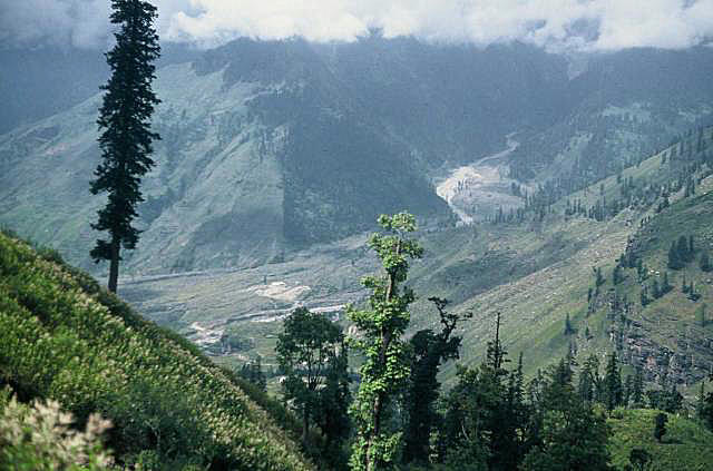
| | The lower part of the climb to the pass
| |
|
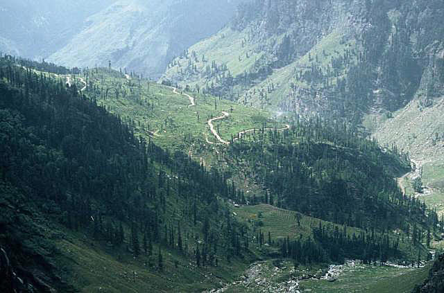
| | A small section of the road
| |
|
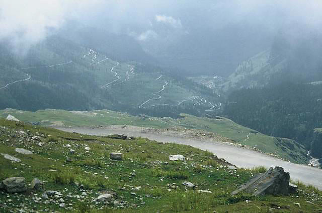
| | Part of the climb up the lower cirque
| |
|
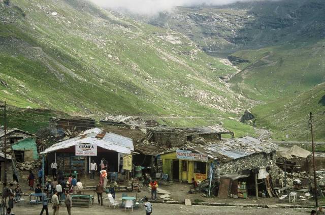
| | Shops half way up the climb to the pass
| |
|
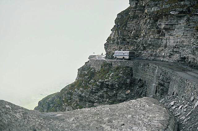
| | Around the side of the upper cirque
|
|
The mountains in the Kulu area are on a very different scale to anything in
Australia; indeed, on a different scale to most other mountains anywhere
in the world.
This road connected Manali, at 2000m, to the Rohtang Pass, at 4000m.
Some of the switch-backs can be seen here.
This bit of the world impressed me more than I can say.
The zig-zag road in this photo climbed up the face of a huge cirque.
The point from which the photo was taken was near the top of the cirque.
Having worked our way up the first cirque we were to discover that there
was another, perhaps even steeper ahead of us.
At the top of the first cirque was this little 'town' of shops that
catered for the travellers.
As can be seen the shops were very basic, living conditions would be hard
for an Australian to imagine I suspect.
Our bus stopped here for tea and snacks.
The lower section of the upper cirque can be seen in the background, with
some sections of the switch-back road just visible on the left.
This is a section of the road around the side of the upper cirque; there
is no room for mistakes by the bus and truck drivers.
|
|
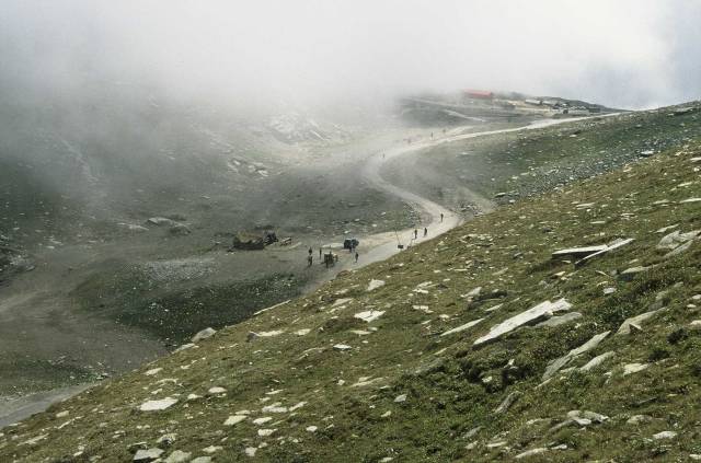
| | Looking down on the top of the pass
| |
|
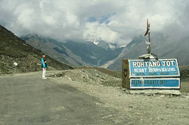
| | Top of the Pass
| |
|
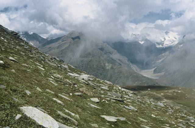
| | View from the top of the Pass
| |
|
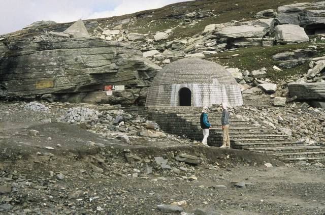
| | Source of the Bias River
|
|
The top of the Rohtang Pass is at 3978m.
My son and I couldn't go to 3978m and not climb up at least another 22m
so that we could say we had been above 4000m.
The wind was very cold here and some people were having some problems
from the thinness of the air, but it didn't seem to effect Ken and I
in the short time we were in the area.
The marker at the top of the pass; note the snow and ice in the distance.
This view is looking away from Manali if I remember correctly.
A view from just above the pass
India is a land of people of many religions.
Some of them are into pilgramages; I suppose the source of the Bias River
has some religious significance; perhaps especially so since the Bias is
one of the major tributaries of the holly Ganges.
|
|
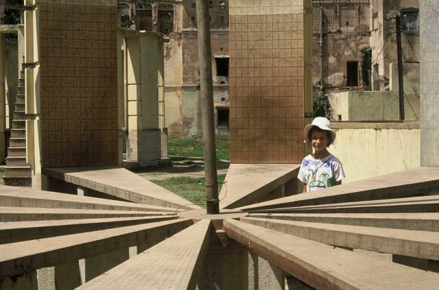
| | A small part of the Jaipur Observatory
| |
|
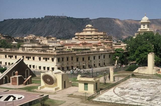
| General view of Jaipur Observatory
Maharaja's Palace in the background
|
|
Typically of India, here is a pre-telescope astronomical
observatory of great historical interest, perhaps the
best example in the world, with badly run-down buildings
adjacent.
India, of course, has huge financial difficulties, but
there seemed to be a great potential for tourism going
to waste.
This photo was taken from a ramp (I forget the technical term for it) like
that on the left of the photo; you can see that the camera is very high,
giving an idea of the size of the structure.
The structure in the background could be the
Ambur Palace, but I'm not sure of
that.
|
|
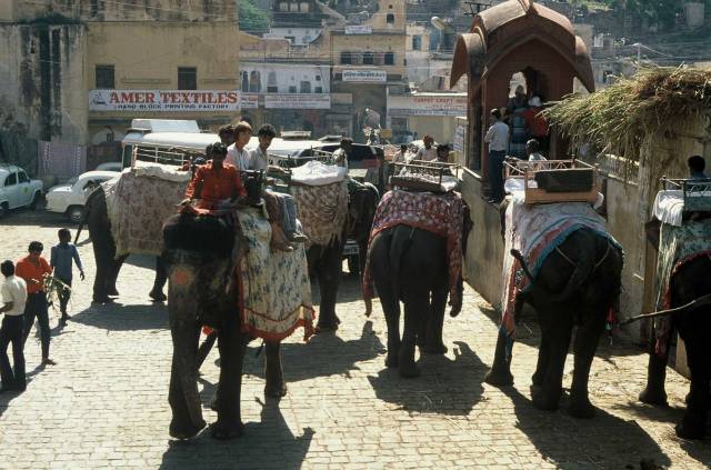
| | Elephants take visitors to the Palace
| |
|
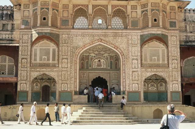
| | Entrance to the Ambur Palace
| |
|
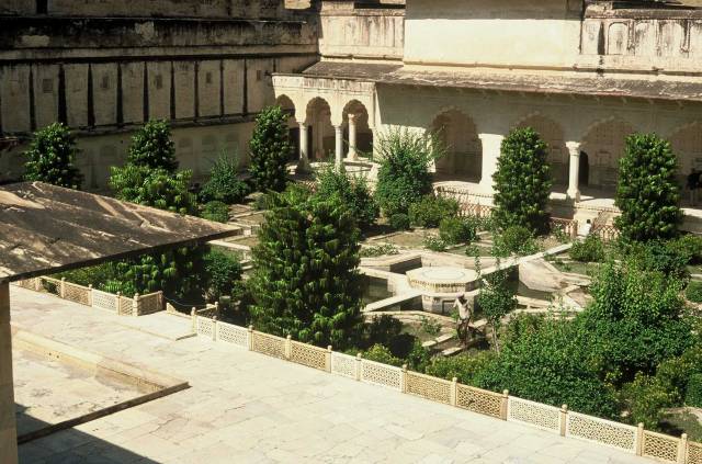
| | A courtyard garden in the Ambur Palace
| |
|
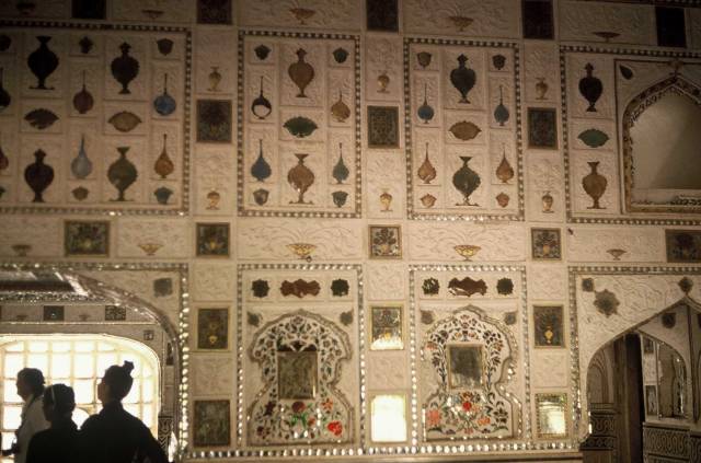
| | Decorated wall in the Ambur Palace
| |
|

| | Ambur Water Palace, in a lake near Jaipur for a little
relief from the heat
|
|
The Ambur Palace overlooked Jaipur from a hill.
Whether it was built on a hill for defensive reasons or for the slightly
cooler climate this resulted in due to more breezes I don't know; probably
it was for both reasons.
Most tourist got up the hill to the palace on the backs of elephants.
Elephants and other working animals are like working people I suppose;
if they don't have employment in this Man-dominated world they suffer.
Some of India's many palaces have been allowed to deteriorate.
Since independence what used to be the ruling class lost most of their
hereditary rights, and could no longer force the common people to work
for them with very little pay.
While tourism often does harm to the places the tourist like to visit,
it is providing some income that can be used to provide employment and
help to maintain the palaces that the tourists come to see.
|
|
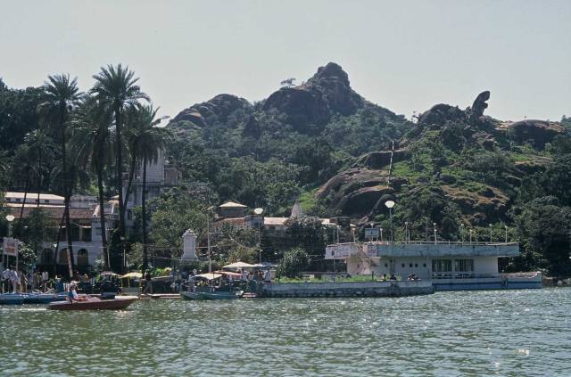
| | Recreation lake at Mount Abu
| |
|
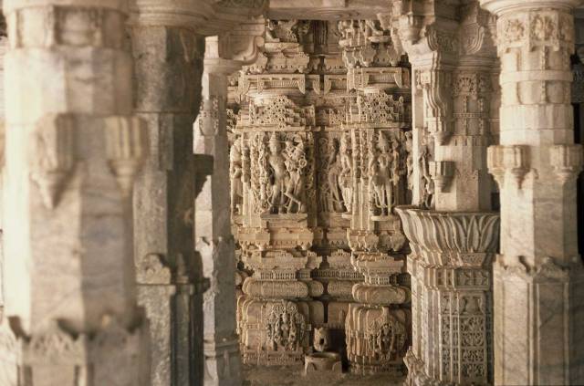
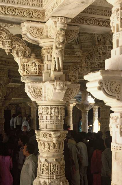
| | Detail of Jain temple in Mount Abu
| |
|
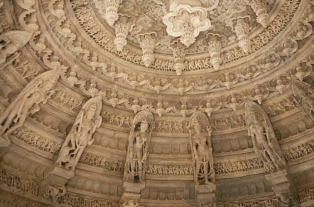
| | Detail of Jain temple
| |
|
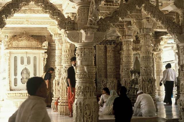
| | Tourists and worshipers in the Jain temple
|
|
Most of India is hot.
The other bits are very hot.
OK, I'm not being entirely honest, there are parts of India in the
Himalayas that are high enough to be cool even in the summer, and some
other parts do have some sort of cool season.
Mount Abu, if I remember rightly, was some distance south of
Jaipur in a lowland part of India.
We travelled most of the way from Jaipur to Mount Abu in a 'First Class'
train with no air conditioning; it was a hot journey.
(Interesting the Second Class train that took us most of the way from
New Delhi to Simla did have air conditioning.)
The train station was at the base of the mountain.
From there the only way to the top seemed to be by taxi.
At around 1200m, Mount Abu is significantly cooler than the surrounding
countryside.
So far as we could see, the biggest claim to fame that Mount Abu had was a
temple built by the Jains.
The stone carvings had to be seen to be believed; neither my words nor
photos can come close to doing justice to the beauty of this temple.
While terrible things have been done in the name of religion (although so
far as I know the Jains and Buddhists both have relatively clean records)
at least some religions have caused beautiful works of art and
architecture.
