| |
Brooks Lookout, Clare, South Australia
|
|---|
| Photo date 2020/02/14
| |
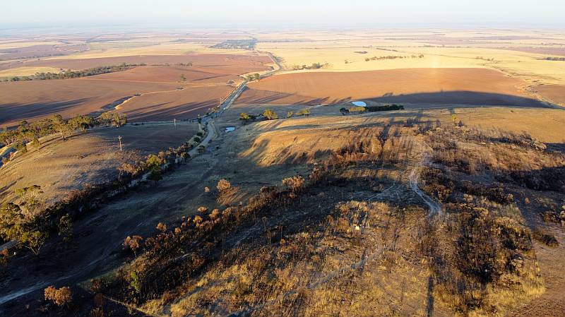
The photo on the right and the one below was taken 10 months after the area was burned in a bushfire.
In this photo my Mavic Mini was looking from above and to the east of Brooks Lookout near Clare in South Australia toward Blyth and the Condowie Plain.
| |
Brooks Lookout, Clare, South Australia
|
|---|
| Photo date 2020/02/14
| |
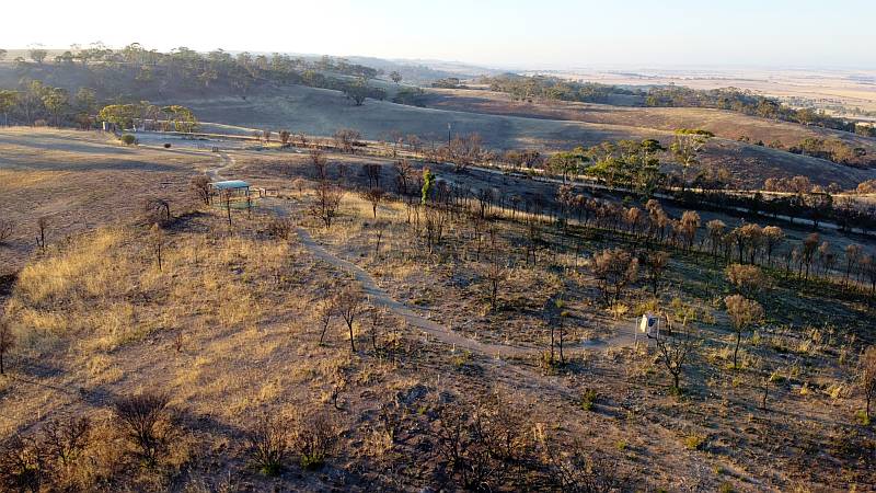
This photo was of Brooks Lookout itself.
The fire came within a few hundred metres of our property.
Another fire a couple of years earlier came within two kilometres in a different direction.
Bushfires in Australia are becoming more fierce, burning larger areas and producing more damage, and fire danger seasons are getting longer, all due to
climate change.
| |
|
|
|
|
|
|
|
|
WA parks
The relevant page seems to be Remotely Piloted Aircraft (Department of Parks and Wildlife, DPAW). From my reading of that page drones are allowed in land controlled by CALM (Conservation and Land Management) with a few provisos:
- You must abide by the general CASA rules;
- Flying is not allowed at Rottnest Island, Kings Park and Bold Park and Perth Zoo;
- The relevant district office should be contacted prior to each RPA flight. There is a list of these on the above DPAW page;
| |
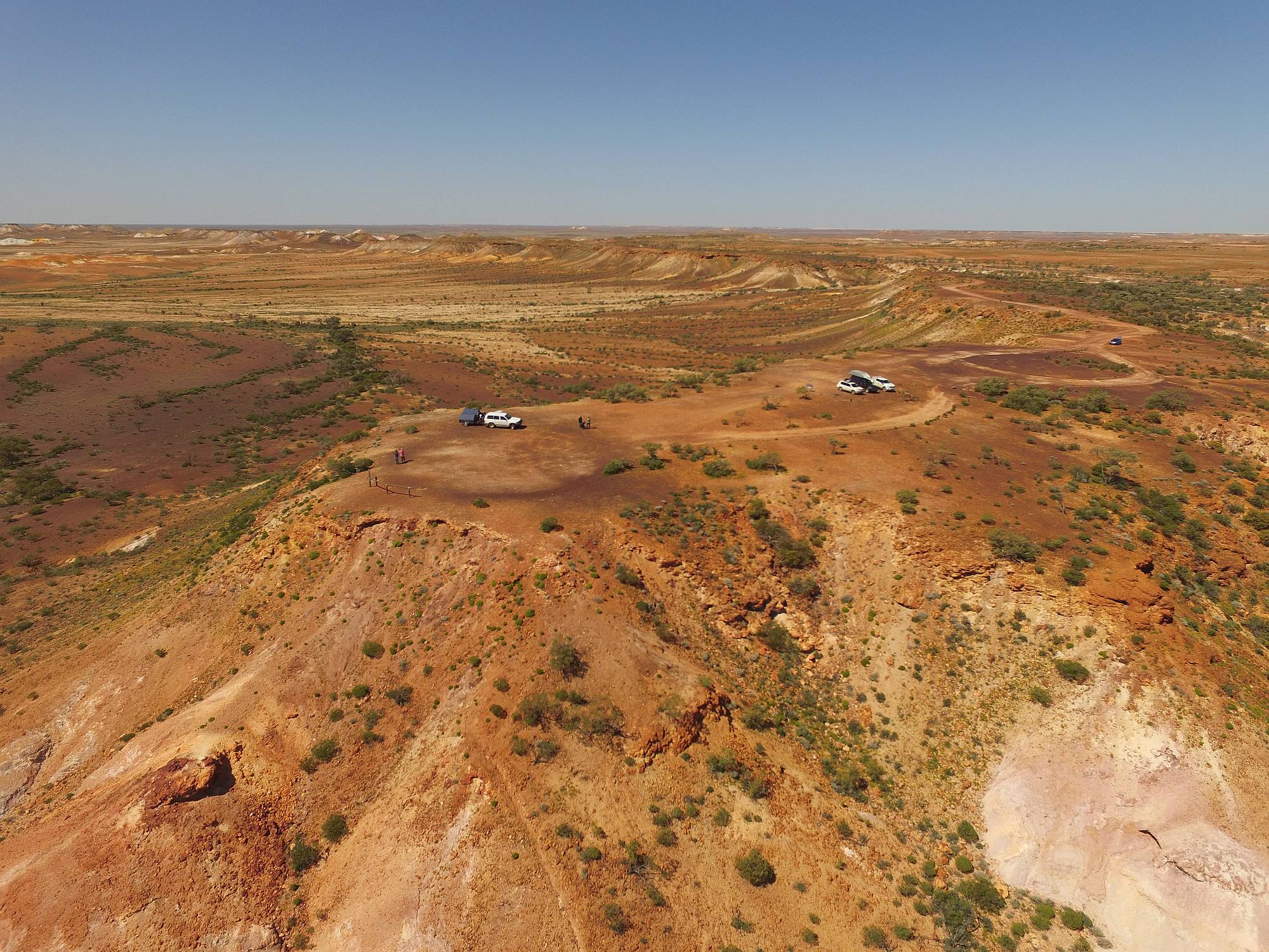
I used a drone to get some photos of
The Breakaways, a striking area of
colourful hills in an arid area near Coober Pedy in South Australia.
Shortly after I flew my drone a woman came and told me that it was illegal
to use a drone in a conservation park.
I asked her what the justification for this was and she replied that it was
to protect Aboriginal sacred sites, which might be visible from a drone
while not from the places where walkers go.
The great advantage to photography that a drone gives in The Breakaways is
that it can get above
the level of the ridge-tops, there is no other way of doing so.
On 2016/09/19 I emailed the Department of Environment asking about this
prohibition.
I received a reply on 2016/09/28.
The reason the writer gave was:
"The use of drones in parks is regulated to protect our native fauna, as well as
the community.
Flying a drone in a park can present a nuisance because of the impact on the
privacy and enjoyment of visitors, but they can also disturb nesting birds
such as osprey and other raptors.
If these birds are disturbed, they may not return to their nests, resulting in
the death of their chicks.
Permission to use a drone in a park may be given as part of an application
to undertake an activity such [as] commercial photography or scientific
research."
The spokesman for DoE did not mention Aboriginal sacred sites; if the banning
of drones in conservation parks is at least partly to do with Aboriginal
sacred sites then it greatly concerns me that everyone should have their
freedoms limited based on the
superstitions of a few.
Since writing this I have been contacted by someone who told me he had been
told to stop using his drone at Kings Canyon National Park.
The same justification about Aboriginal sacred sites was given.
He said that this was absurd because helicopter flights over the canyon were
frequent and they would be looking at the same sites.
Of course there are no ospreys in Australia's inland conservation parks.
Victimless crimes
Flying a drone in a conservation park or national park with reasonable care and consideration does no harm; if it is a crime then there is no victim.
Can anything really be a crime if it has no victim?
Inconsistency
In the Flinders Ranges national park one frequently hears helicopter of fixed-wing aircraft on sight-seeing flights.
These aircraft would make a thousand times the noise of a drone.
Surely noisy large aircraft cause far more annoyance than drones do.
Drones should be used responsibly and with consideration for other people and animals, but the total banning of drones in parks is an unjustifiable denial of freedom.
My Coober Pedy trip was in September 2016; it has confirmed to me the value
of drones for landscape photography.
The photos that were taken with my drone would have been impossible to get any other way, short of hiring a helicopter.
I believe that they have added a lot more interest to my Coober Pedy page than
would otherwise have been.
As of 2016/09/24 there were 65 photos on the
Coober Pedy page; 13 of those were
drone images, the others were taken with a Canon EOS 350D digital SLR camera.
While I thought that 52% of the DSLR photos were worth displaying in
high definition, I used 84% of the drone photos at high definition.
| |
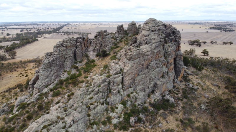
Mitre Peak, a prominent smaller outlier of Mount Arapiles.
|
|---|
| |
| |
Some Australian laws regarding the flying of drones are quite reasonable and should be obeyed. For example:
- You must not fly your drone higher than 120 metres above ground level;
- You must keep your drone at least 30 metres away from other people;
- You must only fly one drone at a time;
- you must not operate your drone in a way that creates a hazard to another aircraft, person or property;
- You must not fly your drone over or near an area affecting public safety or where emergency operations are underway. This could include situations such as a car crash, police operations, a fire or firefighting efforts or search and rescue.
Other laws are not justified, and I believe, would often be disregarded by drone operators.
I've written about the law against flying in conservation parks
elsewhere on this page.
The law that says that you must keep your drone in sight is foolish, impractical and too limiting. It states that "You must keep your drone within visual line-of-sight. This means always being able to see the drone with your own eyes".
- A small drone such as the Mavic Mini is difficult to see beyond a couple hundred metres - beyond a hundred metres in some lighting conditions - yet can often be quite safely flown at a distance up to at least a kilometre;
- If one is in an area where there are a few trees it can be quite impractical to keep one's drone in site all the time.
The law that states "You must only fly during the day and you must not fly through cloud or fog" can at least sometimes be quite safely broken. For example, beautiful views can be obtained by flying above a ground mist. And, while I have not done it, I don't see how flying with care at night could endanger anyone or anything.
I would think that my drone would have been too far away for me to see it when it took a number of photos shown on this page. I believe that no-one and nothing was endangered by my use of it to take the photos.
Laws that are unnecessarily strict, unjustified, and likely to often be disregarded by responsible people are foolish laws and should be rescinded.
| |
This section added
2023/07/25
|
|
The problem of irresponsible people flying drones in such a way as to frighten wildlife if drone flying were allowed in places like national parks is a major one.
However, as far as noise and nuisance is concerned, does it make sense to allow scenic flying in noisy helicopters and fixed wing light aircraft, and not allow much quieter drones?
New Zealand
"...to legally fly a drone above land managed by the Department of Conservation, you need to have a concession or authorisation from the DOC. This means applying for a concession that costs NZ$50 to process." The question arrises, under what circumstances will such a concession be granted?
When I visited Fox Glacier in New Zealand in 2019 I couldn't help noticing that most of the day helicopters taking people on sight-seeing flights could be seen or heard. I don't recall seeing or hearing any drones. Of course helicopters make about a thousand times as much noise as a drone.
The USA
It seems that drones are illegal in 'wilderness areas' in the USA, but are permitted in 'general forest lands'. One supposes that the justification for this is that drones, and the noise they make, might frighten wildlife and annoy other wilderness visitors.
The event that caused me to write this section was reading a book of photographs of 'Wild Yellowstone' by David William Peterson. While reading the book I saw many photos that had been taken from an aerial vantage point. I wondered, did Mr Paterson use a drone. But on the last page there was a note: "No drones were used in the making of this book" and a photo of Mr Peterson and his wife in a light aircraft.
So, Mr Peterson used a light aircraft to get photos in Yellowstone. Did he not use a drone because he preferred to use a light aircraft, or because he could not legally use a drone? I don't know. But I do know that using a light aircraft for aerial photography rather than a drone would have involved far more noise.