The Spirit of Endurance

The Cazneaux Tree, famous for a photo by Harrold Cazneaux, taken 1953/06/19,
Art Gallery of NSW.
|
|
|
|
The Spirit of Endurance
|
|---|
|
|
The Cazneaux Tree, famous for a photo by Harrold Cazneaux, taken 1953/06/19,
Art Gallery of NSW.
|
|
This photo was taken from a slightly different direction to that of Cazneaux's photo but both show a part of Wilpena Pound in the background. Remarkably, the tree seems to have changed little in the 61 years between the two images, other than growing more small branches near the base.
Gum trees usually only produce shoots from the trunk at times of severe stress. This photo was taken 2014/05/27.
|
|
|
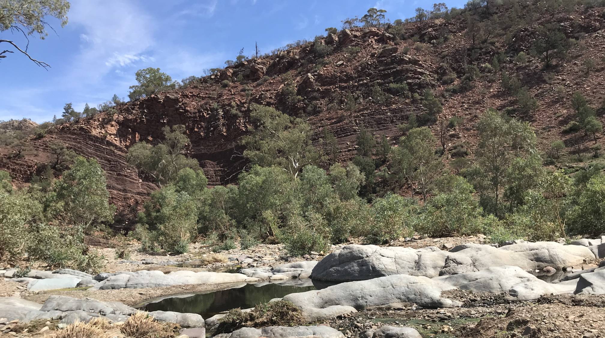
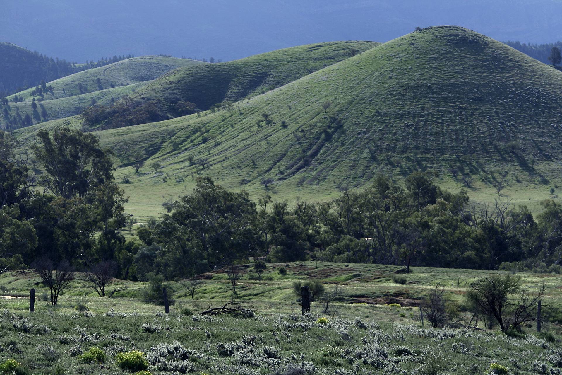
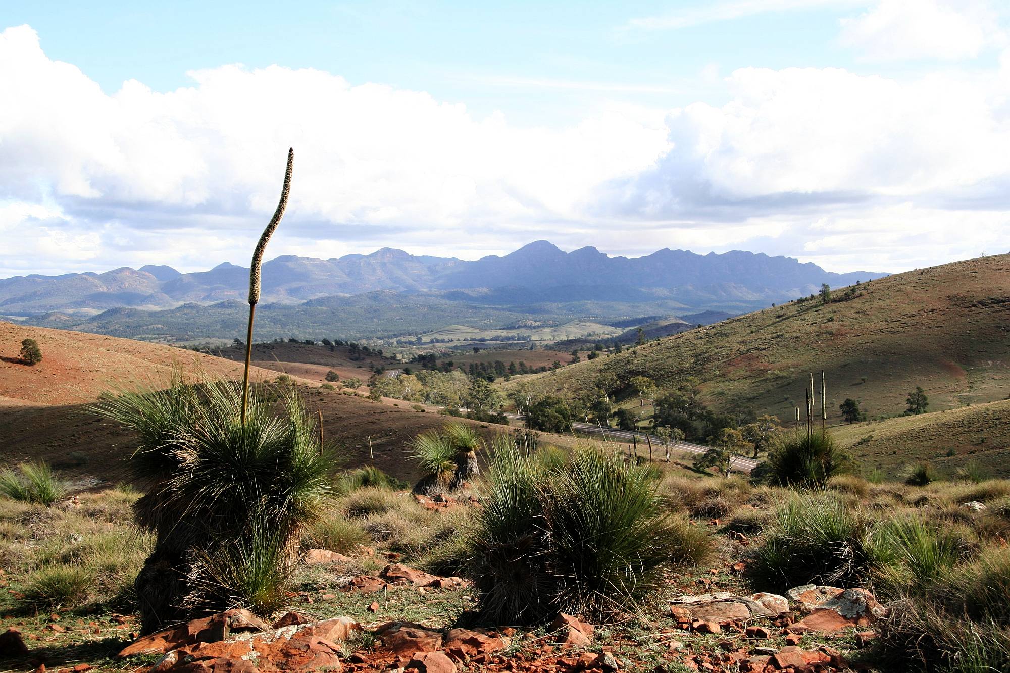
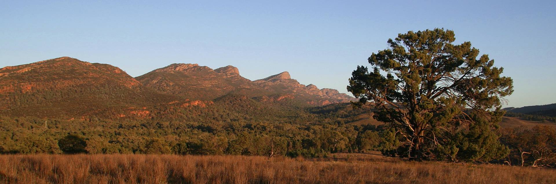
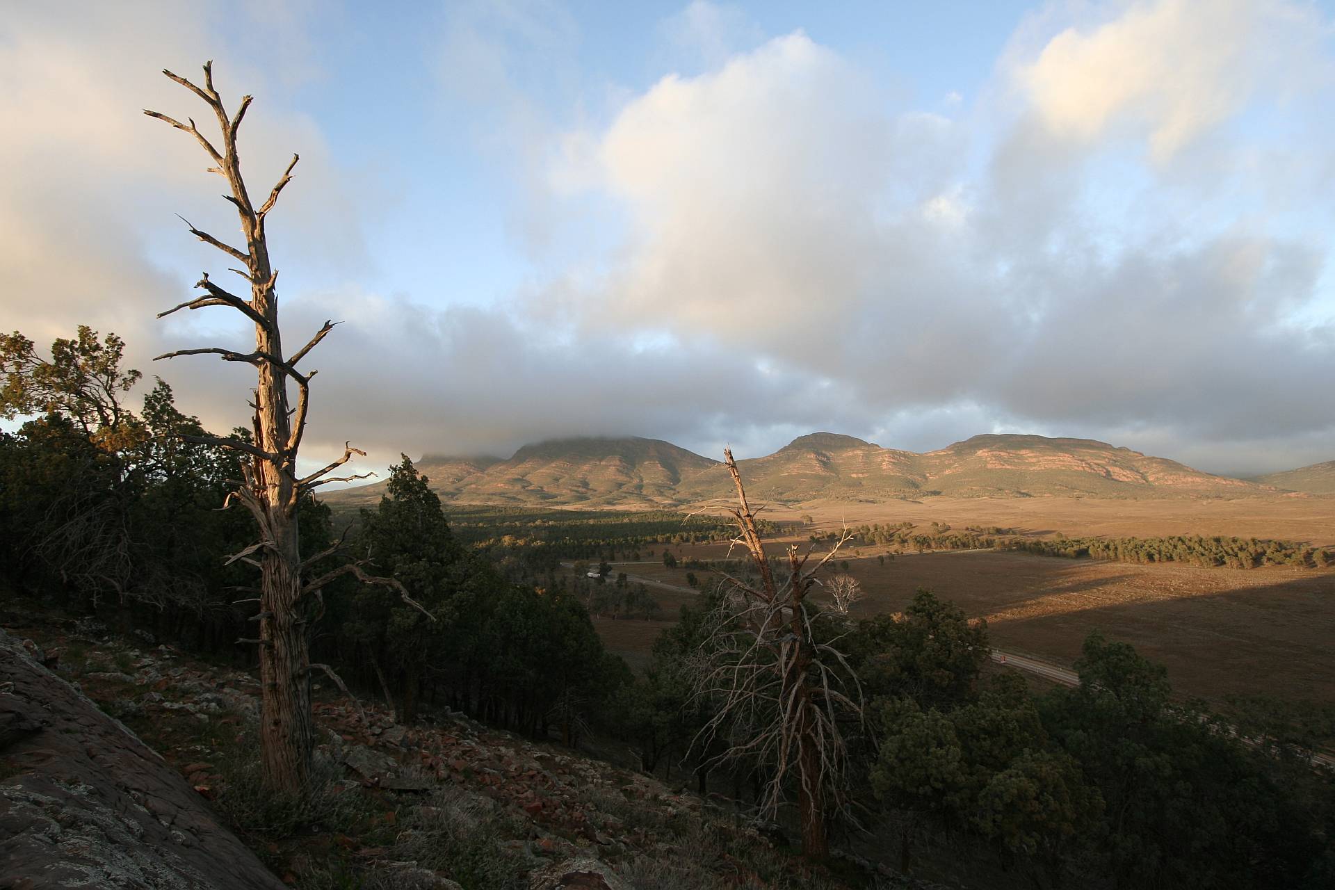
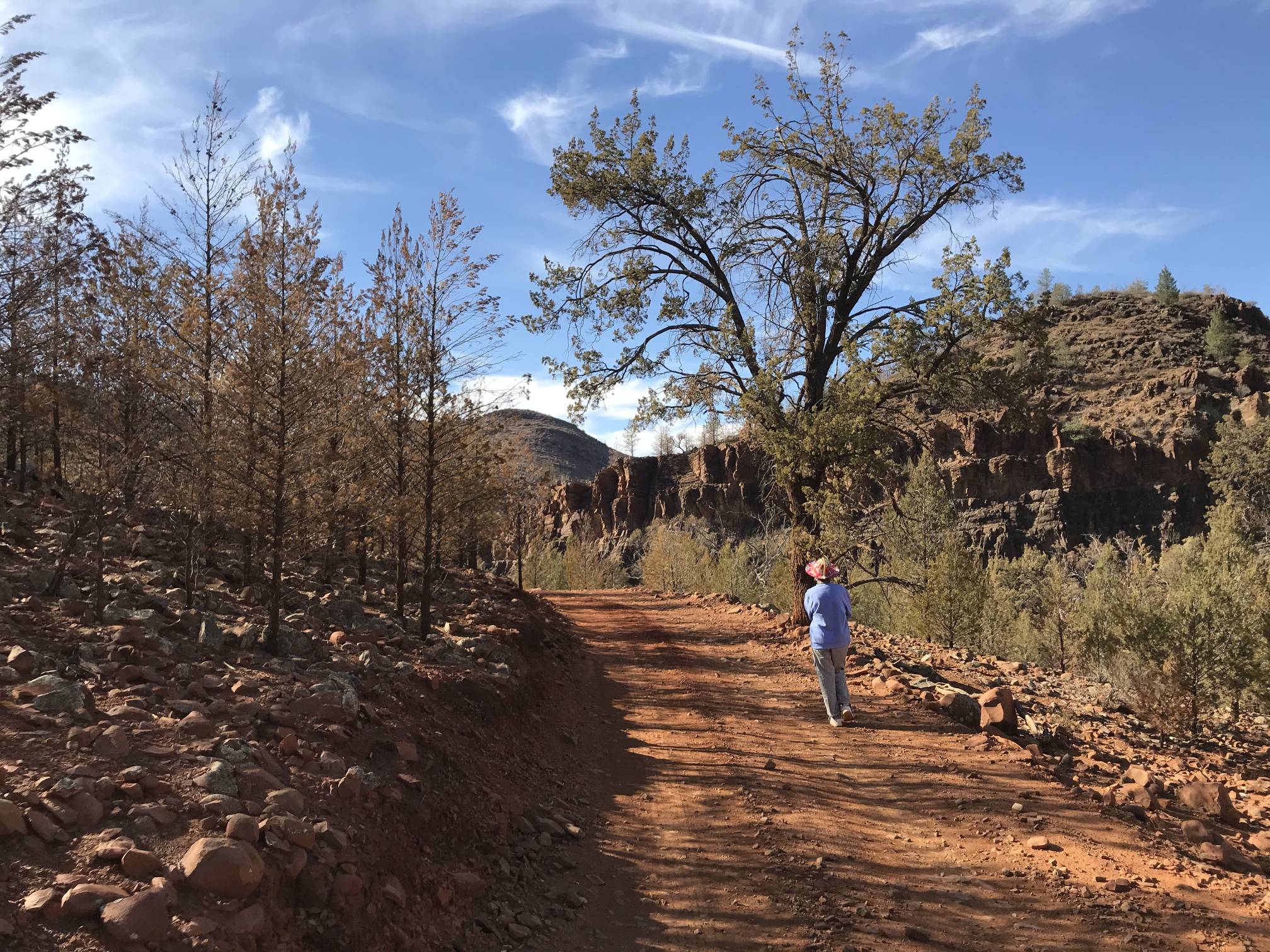
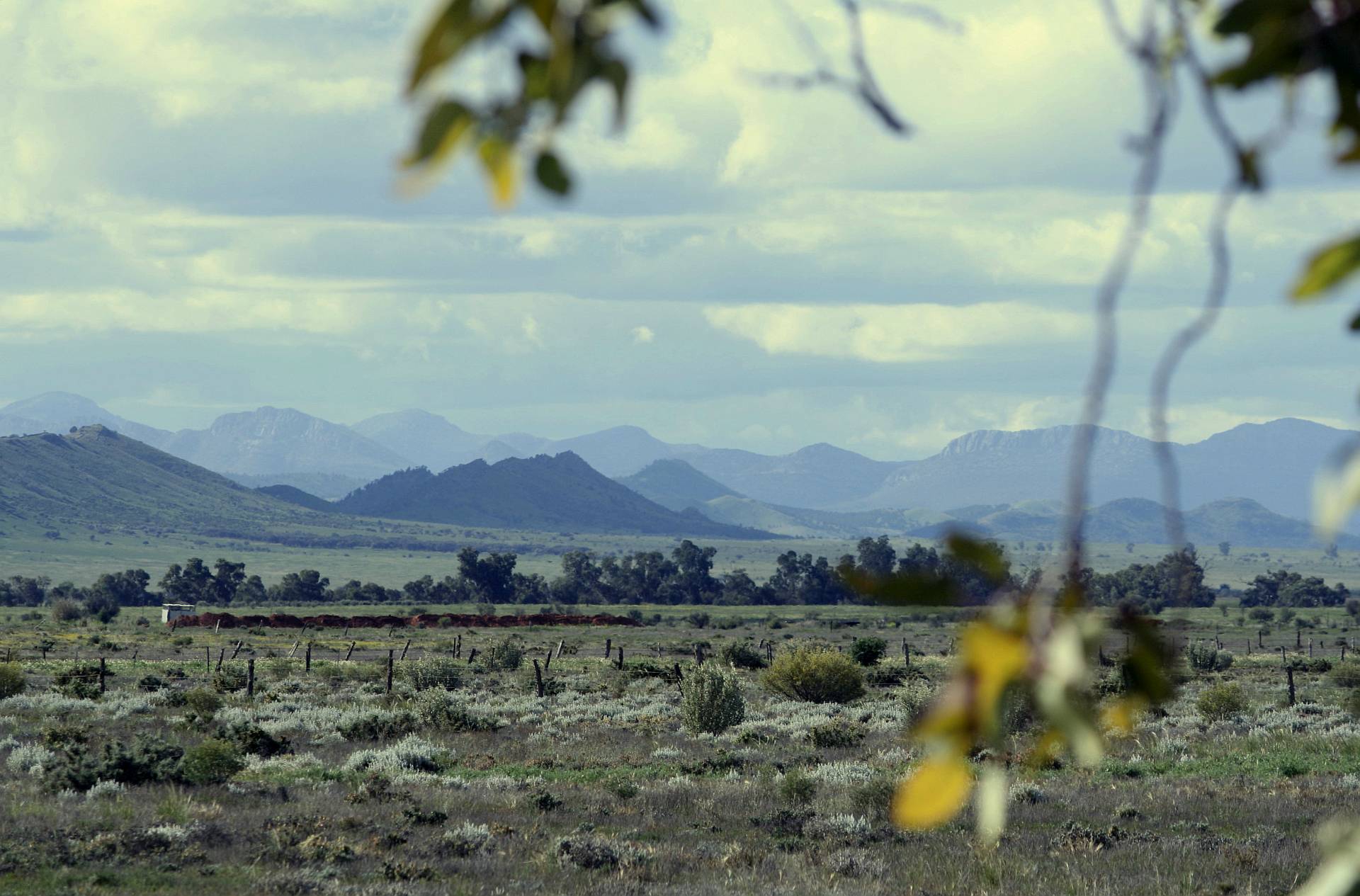
This view, with variations according to the light, greets the traveller to the middle Flinders Ranges just north of Hawker.
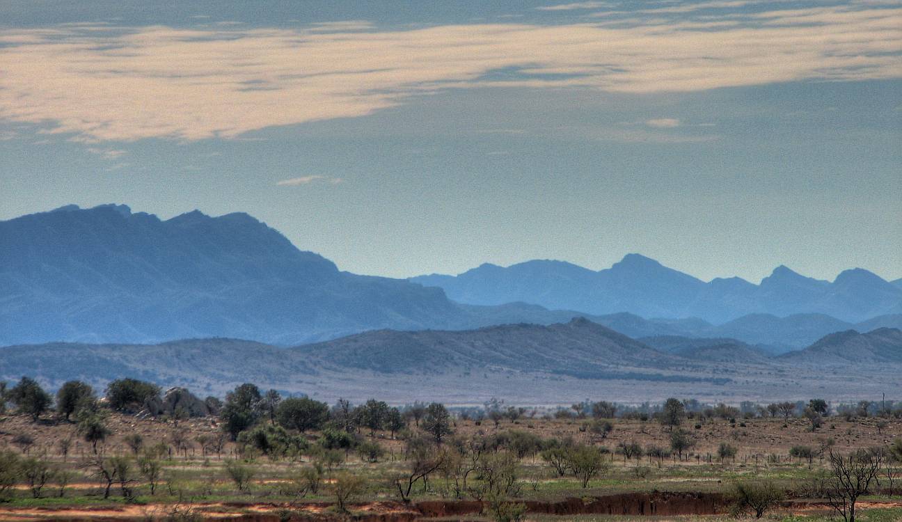
The Elder Range is the big one on the left, the Wilpena Pound range further away toward the right. Mount Aleck is the tallest peak in the Elder Range, 1,128 m; Saint Marys Peak is the highest in the Pound Range and also the highest peak in the southern 90% of South Australia, 1,189 m (although different references give slightly different heights). These two ranges are the tallest in the Flinders, but there are a great many other ranges, all with their own attractions and features. This photo was taken 2007/07/22. |
|
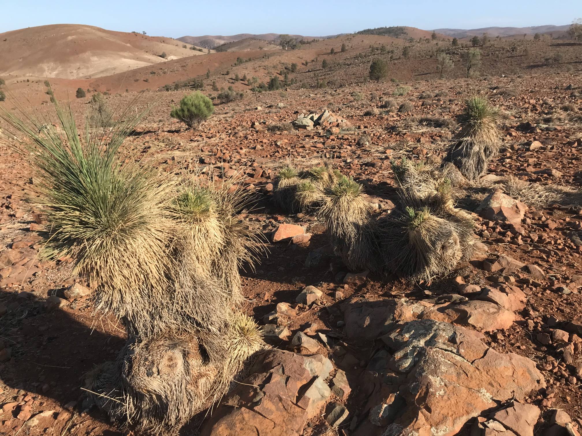
Note the healthy growth of leaves on the yakkas, unlike in the photo below taken six years later. |
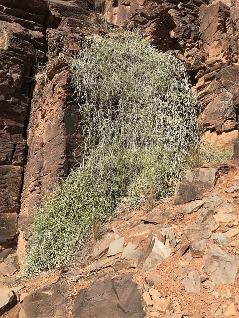
Browsed yakkasYakka leaves are corse and unpalatable to herbivores; they are not browsed except in desperation. I don't recall ever seeing yakkas as heavily browsed as these were.The botanical name for yakka (also spelled yacca or yacka) is Xanthorrhoea, these are probably Xanthorrhoea semiplanar. By the time of this visit much of southern Australia had been in drought for a couple of years. Judging by the lack of annual vegetation and the poor condition of much of the perennial vegetation, the Flinders Ranges were suffering more than areas further to the south. (Any well informed person with an open mind would have to accept that the drought, if not actually caused by climate change, has been made far more likely by climate change.) |
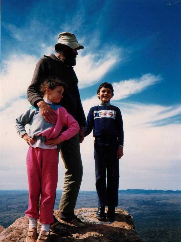
My family's link to the Flinders Ranges
After having children we took them to the Flinders Ranges a number of times, more often than not with friends and their children. The photo on the right was taken the first time that our kids climbed Saint Mary Peak, the highest in the Ranges, about 1987. I've lost track of how many times I've climbed the peak, and I think Denece and I had climbed it together several times before this photo. Denece is not in the photo because she was behind the camera. Like most kids Julia and Ken complained about being bored when we took them on long walks so to get them to agree to climb St Mary's with us we bribed them with the promise of a bar of chocolate each (and $2?) if they did the climb without complaint. Not only did the do it, but they enjoyed it!
Some years after this photo we all camped together for one night on top of the Peak. The view from the top has to be one of the most magnificent anywhere in the world. |
The photo was taken at sunset on one of the walking trails on the Ulowdna Range at Rawnsley Park, where dogs are allowed (dogs are not allowed in the Flinders Ranges National Park).
Since the photo was taken our daughter had two girls, and our son has had one daughter, all of whom have visited the Ranges.
A very brief geological historyThe following is mostly extracted from A biography of the Australian continent written by M. H. Monroe."The rocks composing the Flinders Ranges are believed to have been deposited in shallow seas between about 850 and 500 million years ago."The depression in which the sediments settled is called the Adelaide Geosyncline. "The rocks of the Adelaide Geosyncline that were deposited as sediment along a passive margin of the supercontinent Rodinia form much of the Flinders Ranges. About 540 Ma [million years ago], in the Cambrian, the Delamerian Orogeny thrust up the rocks of the Adelaide Geosyncline, faulting and folding it to form a large range, the eroded remnants of which are now the Flinders Ranges. The rocks of the Ranges are mostly quartzites, limestones, shales and sandstones.In those 60 million years all but the more resistant rocks have been eroded down to the large more-or-less flat areas between the ridges that we see today. The ridges are composed particularly of quartzites, sandstones and limestones that resist erosion, while the shales and siltstones have largely been eroded down to near-flat ground. |

|
|
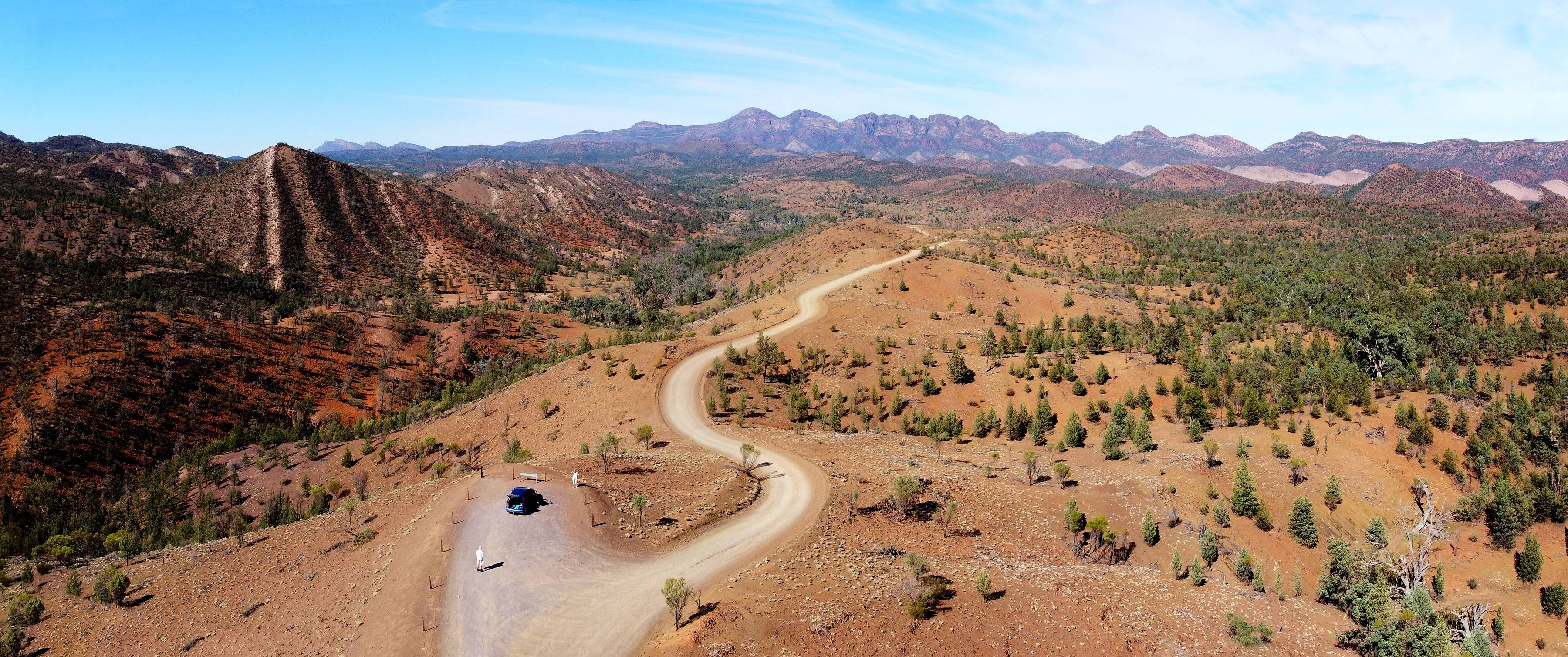
The road to Bunyeroo from Wilpena, looking roughly westward; possibly Mount Heywood in the distance on the left.
A drone photo of 2017/06/21.
|
Bunyeroo and Wilpena Pound
|
|---|
|
Above the Razorback Viewpoint, overlooking Bunyeroo Valley. My wife, our Honda Jazz and I are in the foreground. The image is a 'stitch' of two photos taken by my Mavic Mini drone, 2020/03/28. |
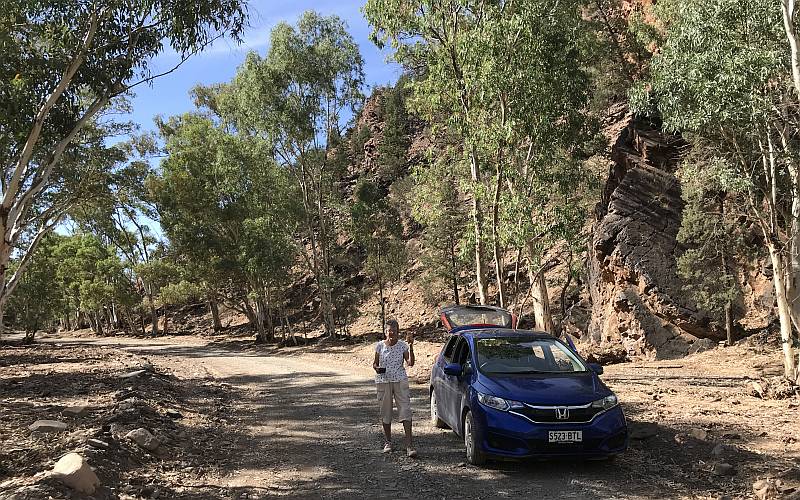
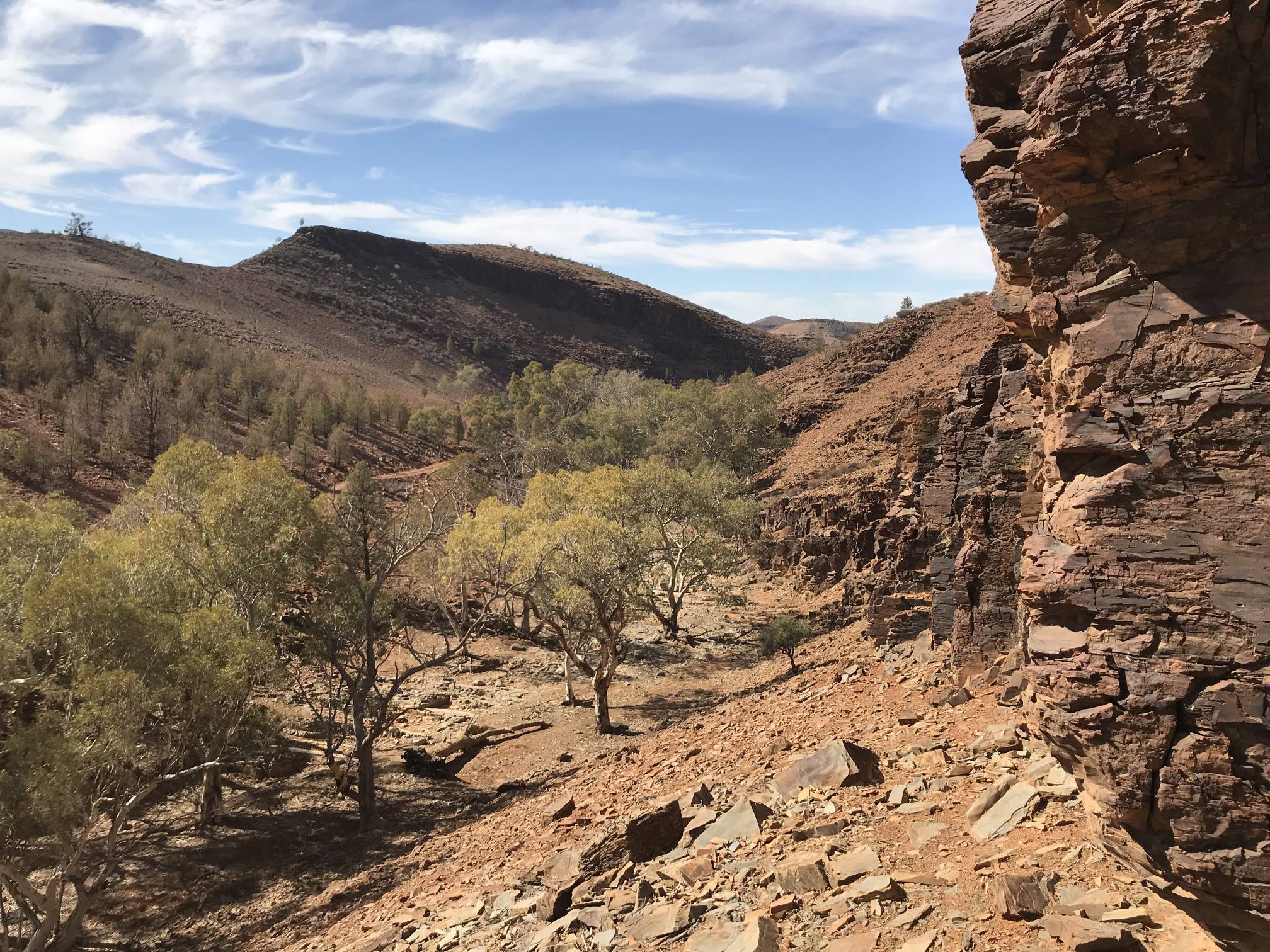
The road goes from this lookout down into Bunyeroo Gorge, through a part of the gorge and then north toward Brachina Gorge. The photo on the right is our morning tea stop in Bunyeroo Gorge. The weather was warm enough for us to pick a shaded spot where we could park the car and sit on a rock to drink our tea. I don't remember ever before driving through Bunyeroo Gorge and not seeing water in the creek bed. |
Between Bunyeroo and Brachina gorges
|
|---|

|
The road between Bunyeroo and Brachina gorges, some of 'The Flatirons' on the left, Wilpena Pound in the distance again. A 'stitch' of two photos. There is a small artefact of the stitching process in the bottom left corner. Photos taken by my Mavic Mini drone, 2020/03/28. |
|
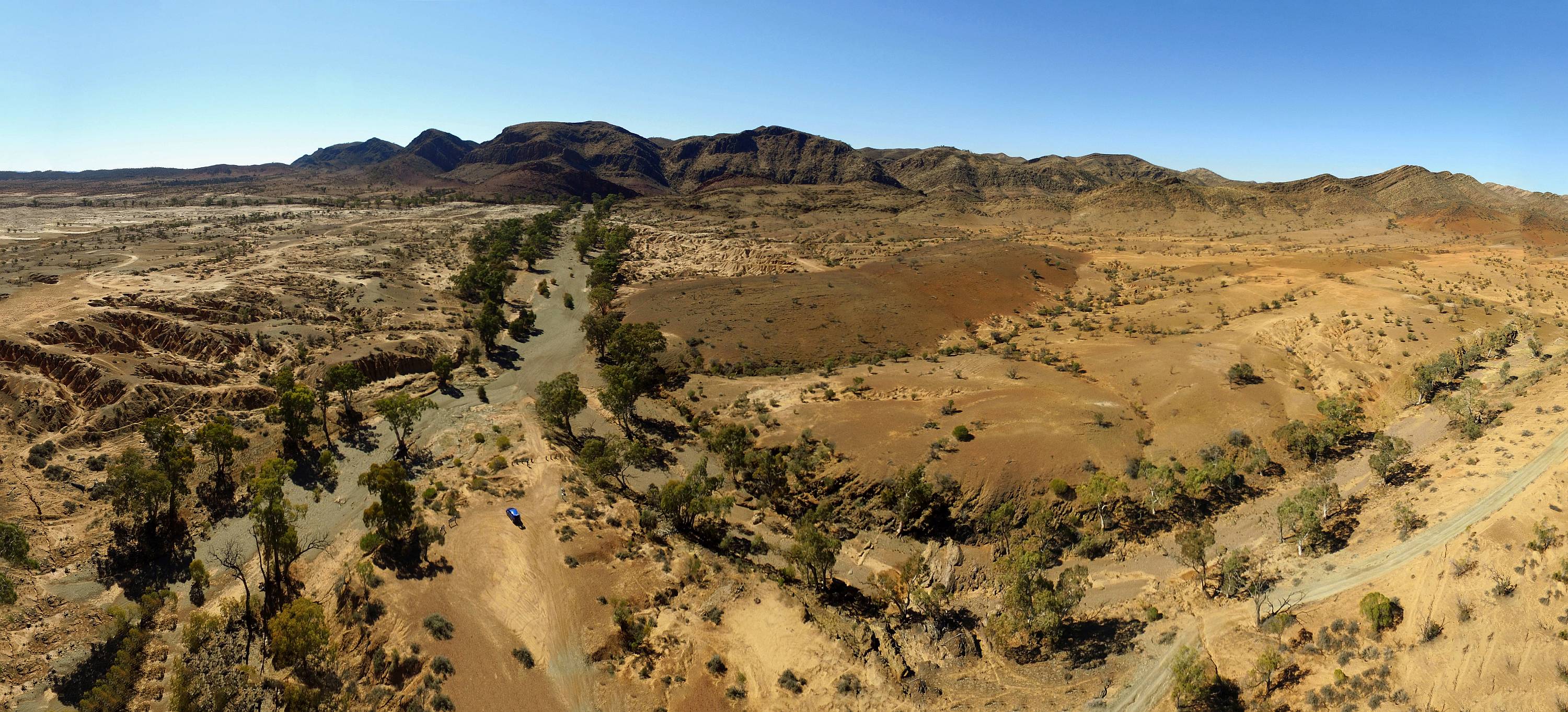
In the drone photo above Bunyeroo Creek passes through the gap between the hills on the left and behind the hill in the middle distance on the right toward Lake Torrens to the west.
We only saw one other car in the whole of the time after leaving Wilpena until we got to Brachina Gorge. Very unusual and due to the pandemic. |
|
|
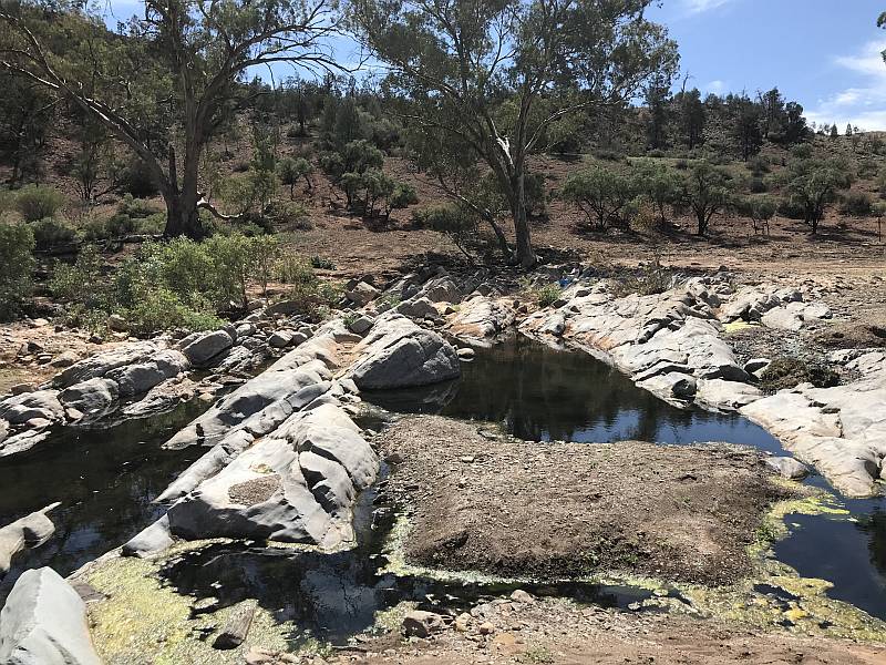
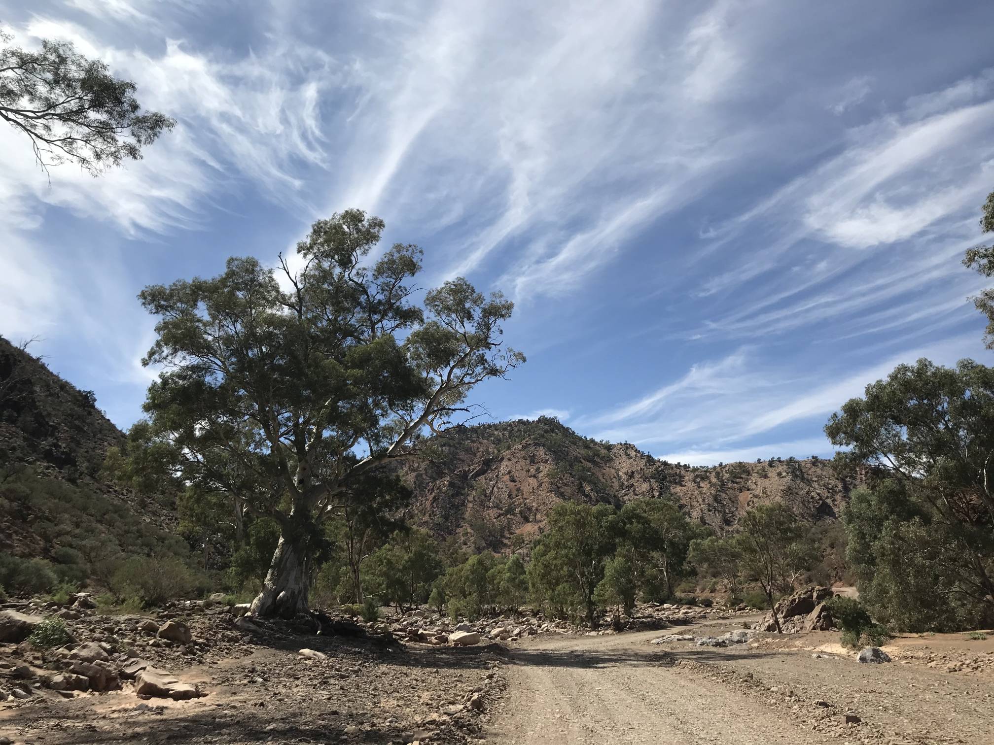
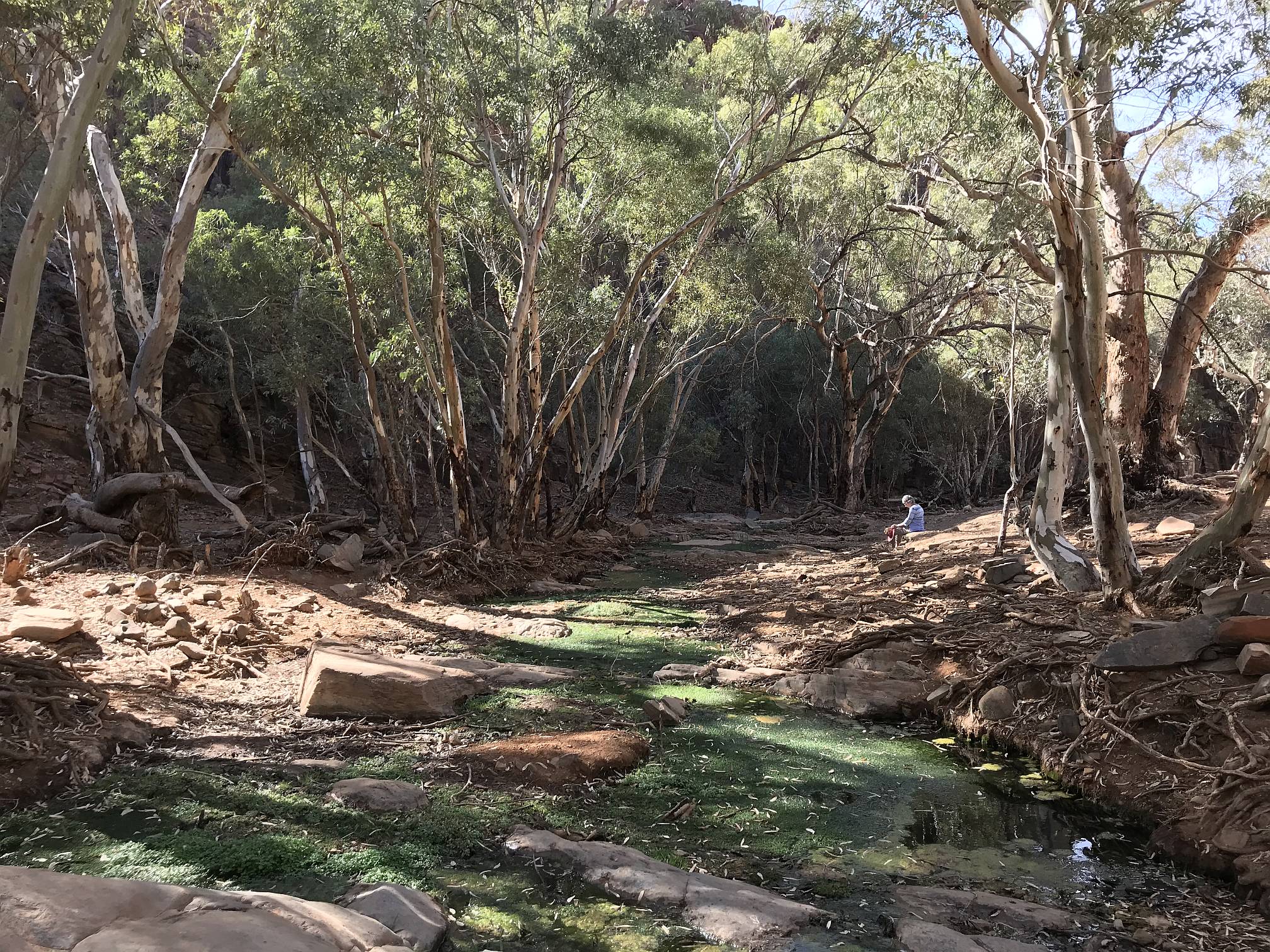
The road follows Brachina Creek through the gorge, in many places right in the bed of the creek.
There is often water to be seen flowing down the creek through the gorge; on this visit we only saw water in one small area in the gorge. This photo was taken 2020/03/28. |
Flood debris in Brachina Gorge
|
|---|

|
|
On the left are logs heaped up by one of the flood flows that occasionally passes through the gorge.
When the land is so dry it is difficult to imagine so much water, 2020/03/28.
|
Brachina Gorge is the home of the Flinders Ranges Geological Trail titled 'Corridors through Time'. Surprisingly and disappointingly I have not been able to find a reference listing the formations that are signposted conspicuously through the gorge. (If a reader can point me to one I'd be pleased to add a reference to it here.) |
|
|
|
|
The northeast wall of Wilpena Pound in the morning light, 2012/09/06.
|
|
|
The eastern part of Wilpena Pound, the top of Point Bonney in the clouds, Mount Ohlssen-Bagge on the right, from the ABC Range in the early morning, 2012/09/07.
I believe that the ABC Range got its name because it 'had as many peaks as the letters of the alphabet'. It is one of the longer ranges in the Flinders, but not one of the highest. |
|
|
Early sunlight on gum trees at wilpena, a case of being in the right place at the right time. The original of this photo was on film, probably about 2005.
There are more photos of Wilpena above and on other pages, including A Short Visit in 2019. |
|
|
|
|
The gorge itself is where the foreground creek goes through the range in the distance.
You can see our car in the carpark area in the lower left-centre. This is as close as one can drive to the gorge. It's about a kilometre walk to get from the car park to the gorge.
Photo taken with my Phantom drone on 2018/09/05. For more information on the gorge see Wilkawillina Gorge Hike. |
Willow SpringsThis visit was in March 2020, just before travel in South Australia was largely shut down because of COVID-19. I've written a little more on the Flinders Ranges and COVID on an other page on this site. |
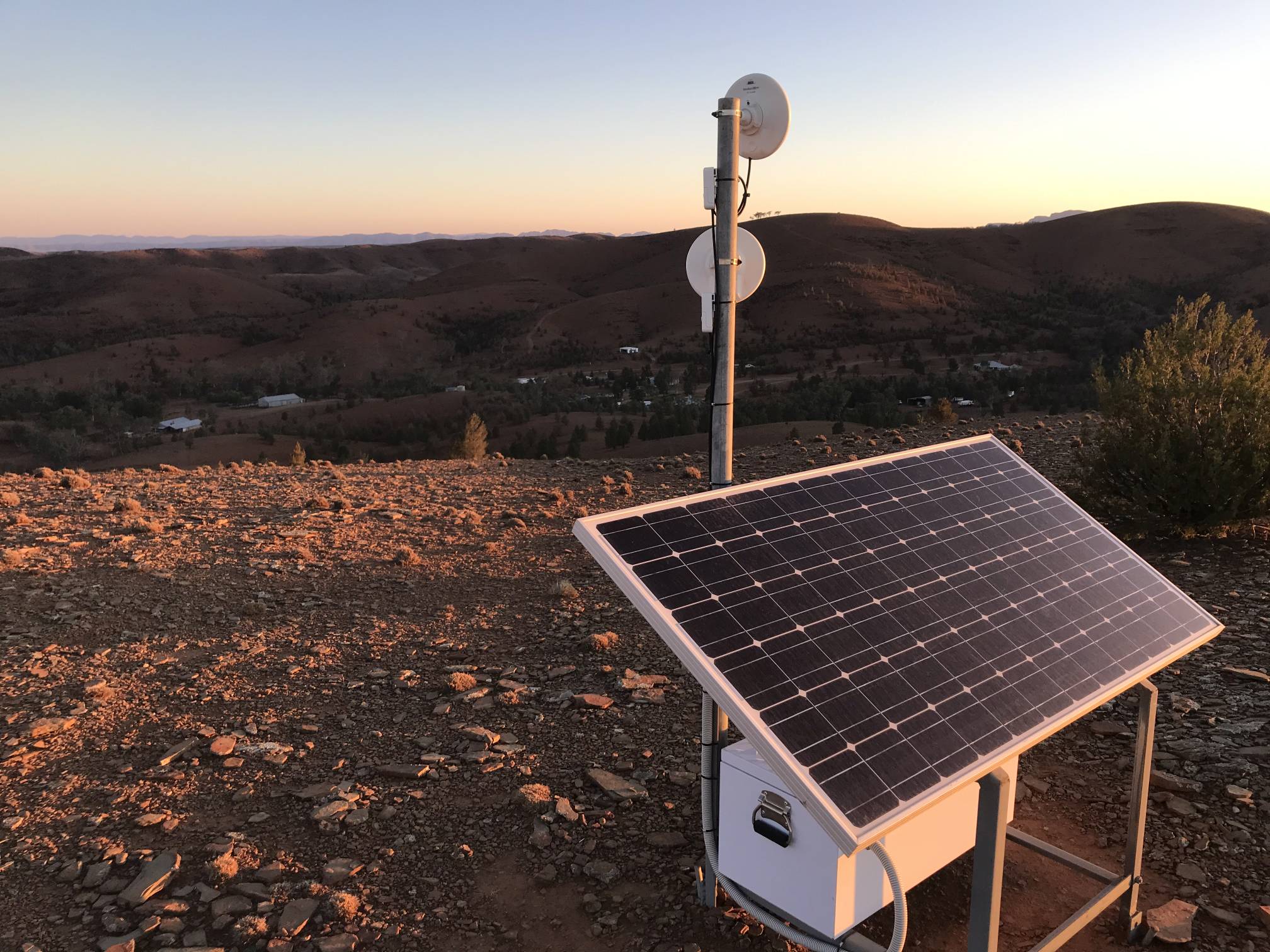
View from aboveDenece and I could see something on this high hill to the north of the Willow Springs resort. It caught the sunlight in the late afternoon. So I climbed the hill to see what was there; it turned out to be some sort of radio or microwave repeater with solar panels and battery to power it.The hill was high enough to allow me to see into the distance over the tops or through gaps in the hills surrounding the resort.
|
Yakka Lookout
|
|---|

|
|
Denece and I walked the Yakka Lookout Trail from the resort; about a 4.4 km round trip.
The Yakka Lookout itself is where the track in the photo leads up to a relatively small knoll in the centre of this photo. I took the photo from a large hill with a cairn on top roughly southwest of the Yakka Lookout. |
Aboriginal petroglyphsThere are petroglyphs (shapes and symbols pecked out on rock faces) scattered through the Flinders Ranges. Perhaps the best known in the Ranges are those at Sacred Canyon near Wilpena.These are close to the creek downstream of the Willow Springs resort. Producing them without steel tools would have required considerable skill and strength. |
Willow Springs; condition of the vegetationOn the morning of 2020/03/26 my wife and I took a long walk down the track that follows the creek to Reedy Creek spring from the Willow Springs resort. The area around Willow Springs station is suffering more from the drought than parts of the ranges further west because they missed most of the substantial rains that fell elsewhere in the beginning of February. It must have been heartbreaking to need rain so desperately, to hear that big rains fell nearby, and to miss out yourself. |
River red gums adjacent Willow Springs creek
|
|---|
|
On the creek, downstream of the resort |
|
The above photo shows river redgum trees, Eucalyptus camaldulensis, on the Willow Springs creek line.
These were in perhaps worse condition than most, but dead or near-dead gums, up to an estimated hundred years old, were common.
|
Callitris trees
|
|---|
|
|
Many of the Callitris (native cypress-pine) trees on Willow Springs and elsewhere in the Flinders Ranges were dead or dying, but as shown in the above photo, where the trees closer to the creek (on the right) were in fair health, the situation was highly variable.
Typically where the Callitris trees were crowded and not near a drainage line they were in very poor condition, where they were sparsely scattered they were often in fair to good condition.
Surprisingly the Callitris trees we saw on Willow Springs were not browsed off within the reach of sheep and/or euros. They are very palatable to animals, on our place at Armagh the kangaroos eat as much as they can reach and they are far from starving. I would have thought that Callitris would be more palatable than yakka leaves, but the latter have been browsed heavily in parts of the middle Flinders Ranges. |
A view from the hillside near Reedy Creek Spring
|
|---|
|
The spring itself is off the picture to the left |
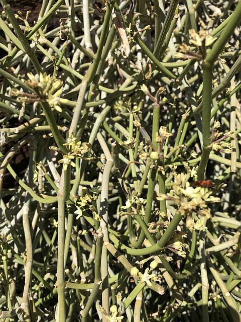
This climbing plant was on a rock wall near Reedy Creek spring. It is Cynanchum viminale ssp. australe, common name caustic vine; it is an Australian native. There were other similar specimens in the same valley; as I recall all on rock walls. It is a very distinctive plant that I don't remember seeing elsewhere in Australia, although it apparently does occur throughout the Flinders Ranges.
|
Reedy Creek Spring
|
|---|
|
This small spring is the only open water we saw on a 3.7 km walk down the creek from Willow Springs resort. |
|
While walking down the valley we had a hint that we were getting close to water when we started seeing sheep and euro tracks and a few euros.
Both sheep and euros were watering at the spring.
|
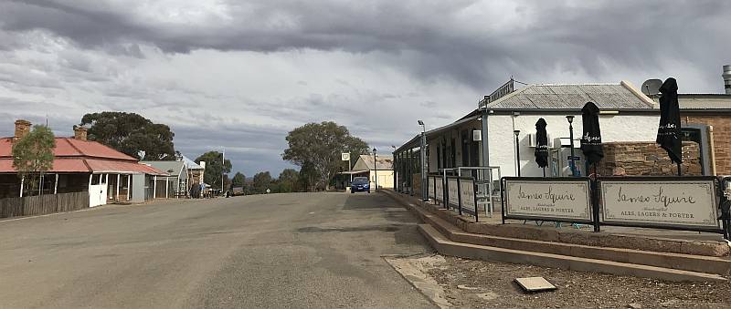
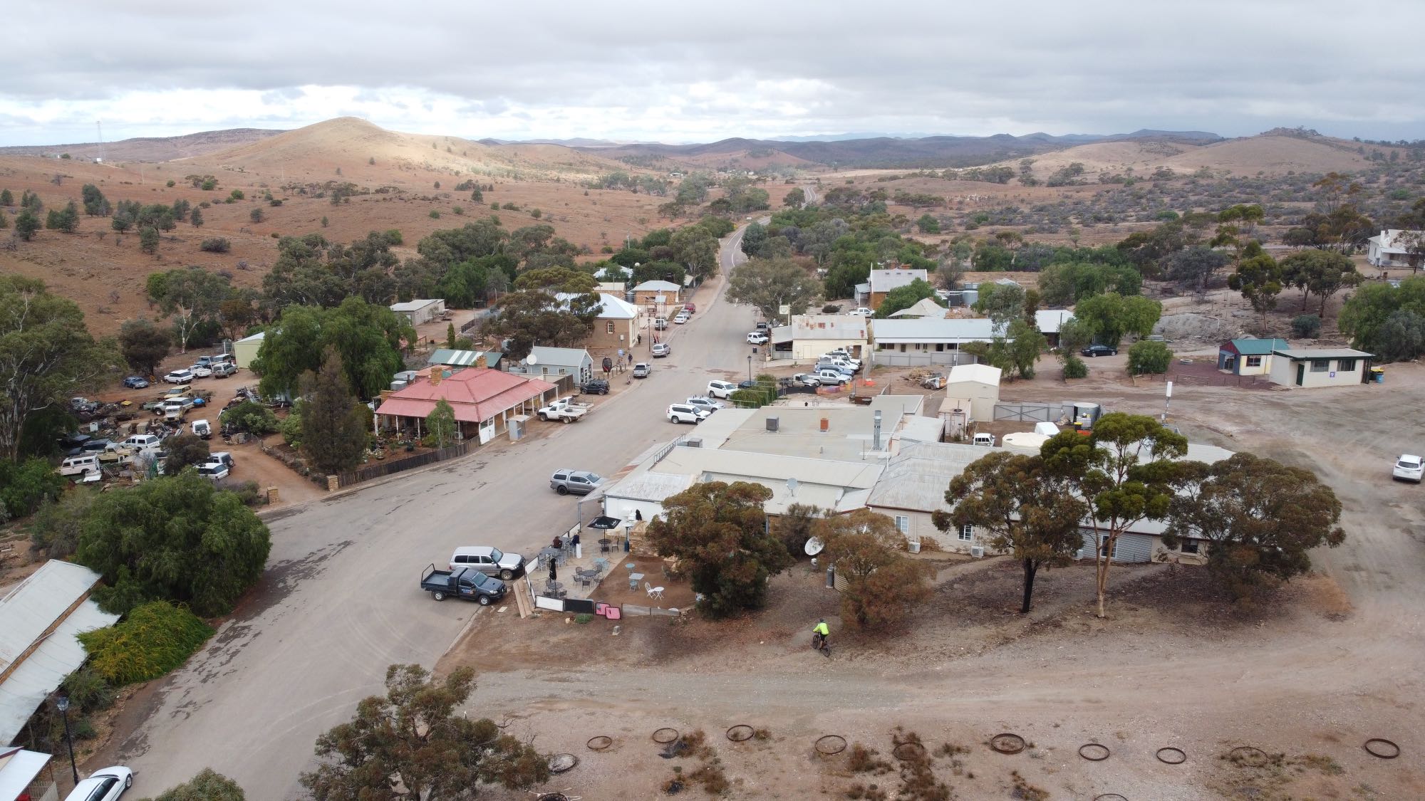
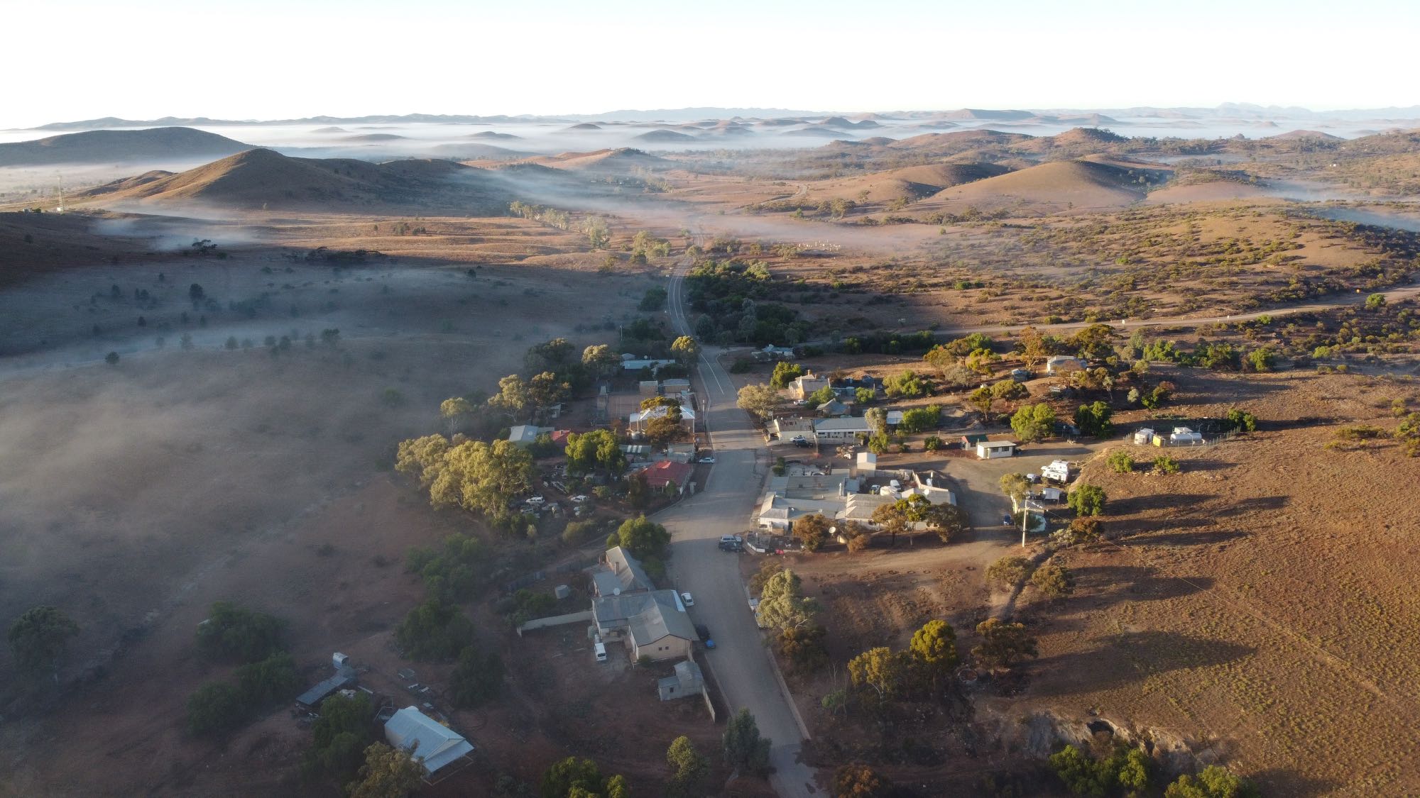
BlinmanMarch 2020
|
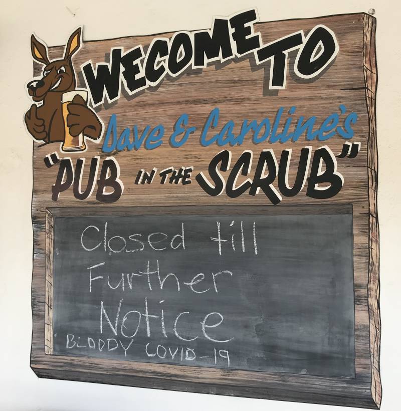
Sign on the Blinman 'Pub in the Scrub'At the time of our visit in March 2020 (during the COVID-19 pandemic) nothing in the town was open for business. There is normally a hotel, cafe/general store and a business that does guided underground tours of the mine.The town cemetery is worth a visit for anyone with an interest in history. It was reported that the Blinman mine supported a population of 1,500 in 1869. Several hundred were buried in the cemetery. The colony of South Australia was established in 1836, so Blinman would have been very remote in the late 1850s and 1860s.
It is a 100 km round trip on a main road from the Willow Springs turnoff to Blinman; we didn't pass a single car in that 100 km. We did see a few cars moving about in Blinman.
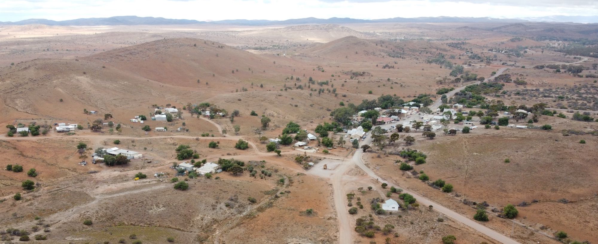
Blinman, May 2021 |
|
|
Blinman North. The Blinman North Hotel is in the foreground. We were told that tourism picked up greatly for Easter 2021 and has continued very strongly since; note the number of cars parked in the Main Street.
|
Photo 2021/05/08
|
|
|
There was a ground-hugging mist on the morning of 2021/05/09 and it lasted for a short time after sunrise.
|
|
Blinman mine
Photo 2021/05/08
|

|
|
The Blinman mine is one of the few that I know of that have a huge opening at the surface like this. Note the 'bridges' (I don't recall the technical term) that are supporting the hanging wall. (They will be easier to see in the high resolution image - click on this image to see the high resolution version.)
The area to the right is where visitors meet the mine tour guide. (I can highly recommend an underground tour.) Photo 2021/05/08 |
I had seen and photographed dendrites elsewhere many times, but most or all had been exposed to the weather or at least to weathering. The sharpness of these immediately struck me.
Dendrites are mineral deposits that formed in narrow cracks (joints) in rocks. In this case the rock face is one side of the original joint. It appears that the minerals have entered the joint through several of the cracks that are visible on the rock face.
Trezona Range
The precambrian limestone of the Trezona Range contain numerous stromatolite fossils. Stromatolites are built by a colonial algae; living examples can still be found in a few places in Australia and elsewhere. They are easy prey to a number of modern browsers so can only develop in places where there is very limited other life, such as in hyper-saline lakes. (I've written more on stromatolites and the related thrombolites on another page on this site.
These drone photos were taken 2021/05/10.
The variable health of the Callitris trees is conspicuous, especially in the high definition image. This image shows again how much of the area of the greater Flinders Ranges is flat areas bounded by hills. |
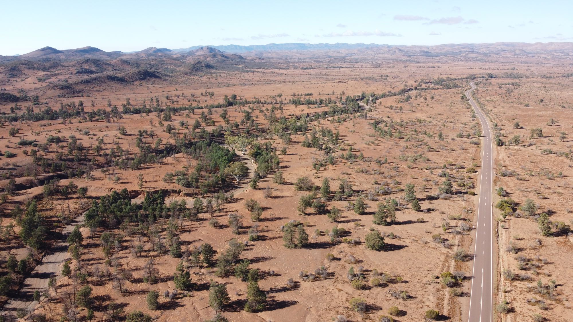
Hawker area
|
Jarvis Hill Lookout
|
|---|

|
|
Jarvis Hill is a few kilometres to the south of Hawker. A dirt road passes over a gap between it and other hills and a walking path goes from the saddle up to a lookout.
This photo was taken from, or close to, the lookout on 2008/09/19.
On the left in the distance is the crescent-shaped Elder Range; from here we are looking along the length of it. Further away, on the right, is the Wilpena Pound Range. The big hill in the middle distance may be Wonoka Hill. The green areas closer than Wonoka Hill could be wheat crops. Hawker gets more rain than most nearby areas of similar latitude because of its relatively high altitude: 315 metres. |
|
|
I'm not sure exactly where this photo was taken but suspect it is looking northward toward the Wilpena Pound Range from somewhere to the north of Hawker.
2015/08/24
|
Miscellaneous subjects in the Flinders RangesTrees
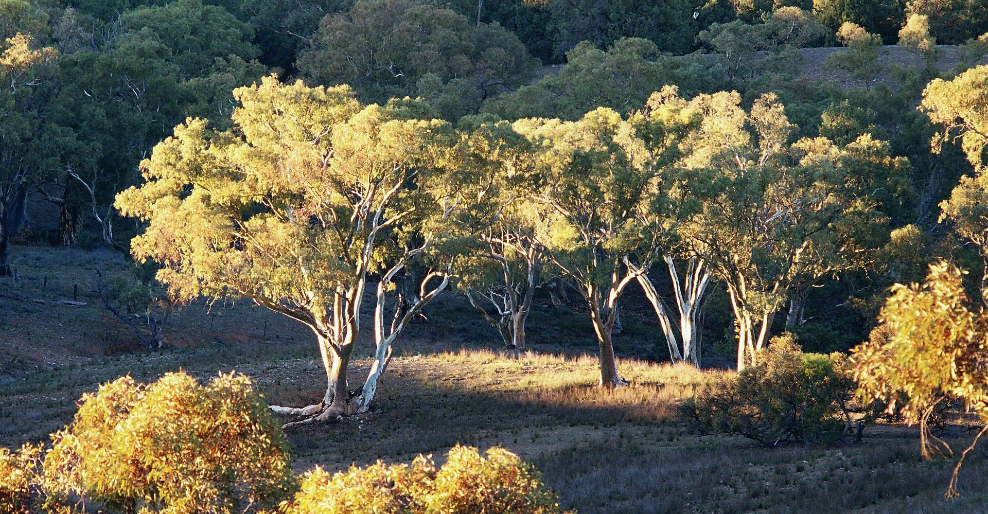
Callitris, common name native cypress pineCallitris trees (common name cyprus-pine), are one of the defining features of the southern and central Flinders Ranges. Even more than with the magnificent Eucalyptus camaldulensis trees (common name river red-gum) the place would not be the same without them.
Where they are crowded together they are especially susceptible to drought. This photo was taken 2007/07/23. As of March 2020 the Callitris trees were suffering greatly from the drought that any reasonable person would have to at least partly ascribe to the effects of climate change. Callitris (and Allocasuarina) trees, in my experience, are very palatable to sheep and kangaroos. In an area where there are hungry sheep or kangaroos the Callitris foliage will normally be eaten off in the sections that the animals can reach. I was puzzled that this browsing had not taken place in the vicinity of Willow Springs at the time of our visit. |
|
|
|
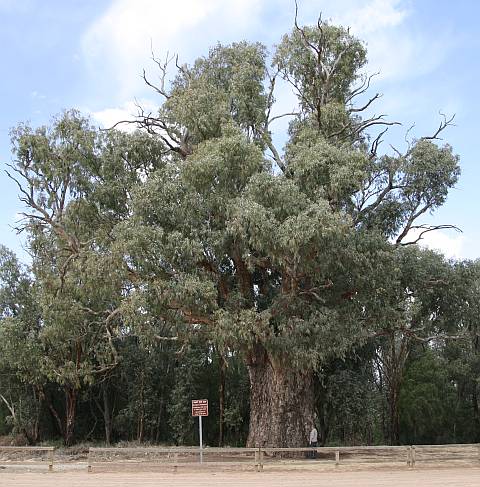
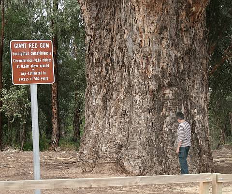
Giant gum tree at Orroroo.
The sign says "Giant Red Gum, Eucalyptus camaldulensis, Circumference - 10.89 metres at 0.61m above ground. Age estimated in excess of 500 years.
The many dead branches indicate that the tree had been badly stressed in the previous few years. |
|
|
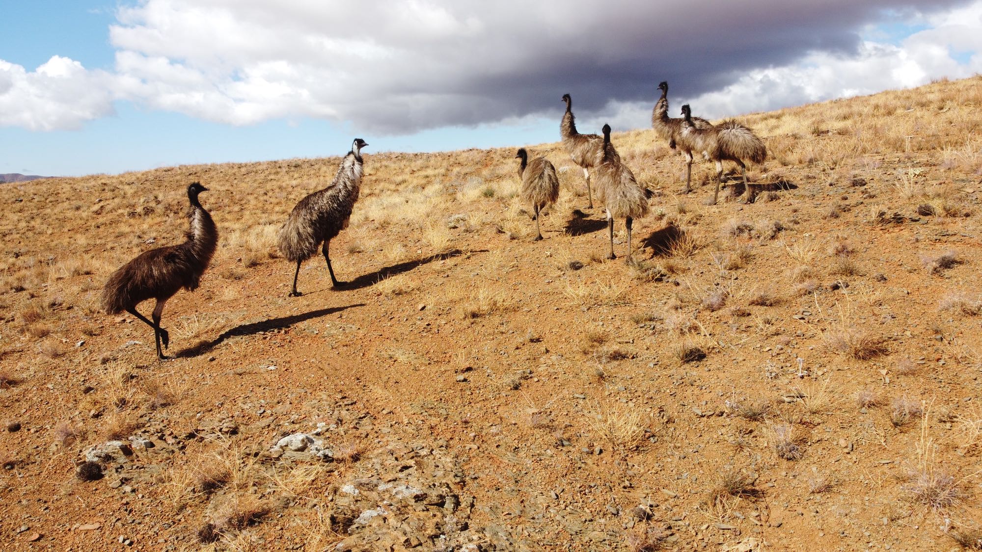
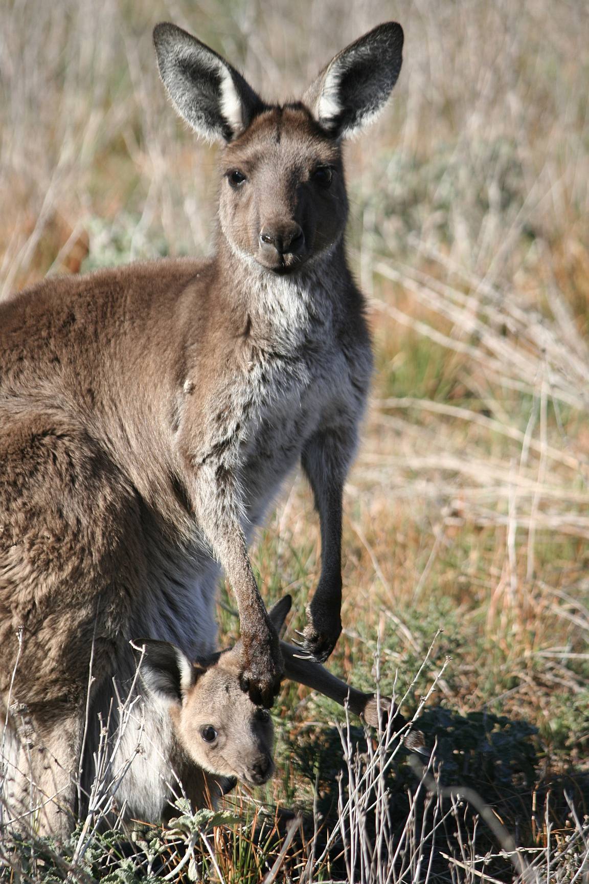
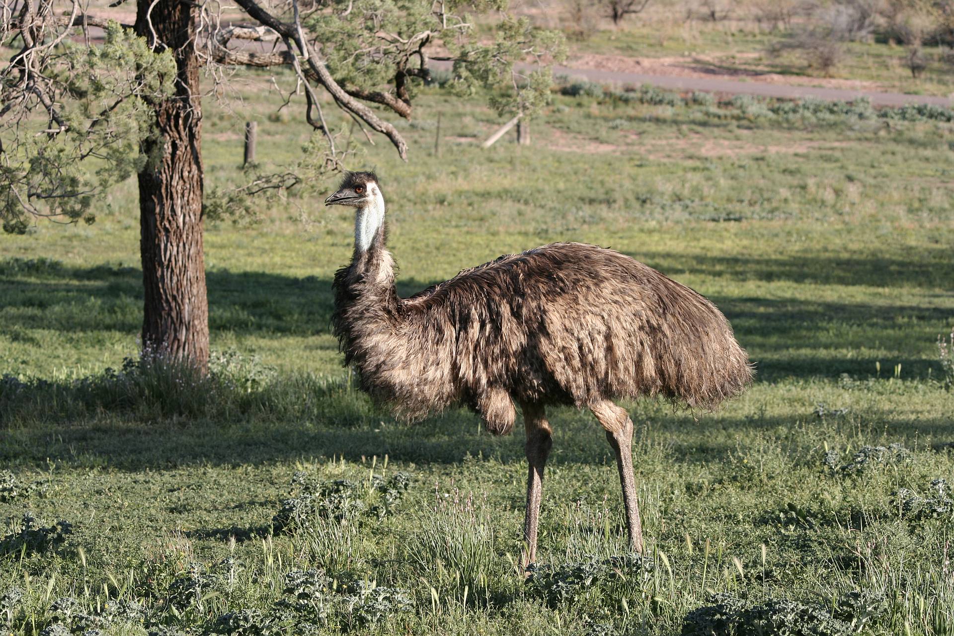
Kangaroos and euros are typically common in the Flinders. Emus can be common or not; they seem to move about over long distances depending on the availability of food.
Unfortunately feral goats are also fairly common, and very destructive to the native vegetation. |

|
The glow of the anti-solar point surrounds the shadow of the drone at the lower left of the image |
|
A flock of emus near Peterborough. This photo was taken on 2018/05/12 when, I believe, drought further north had made many emus move into the cereal growing districts.
Note the shadow of the drone and the brighter light around the anti-solar-point. |
The drought of the last few years has had a big impact.
Kangaroos
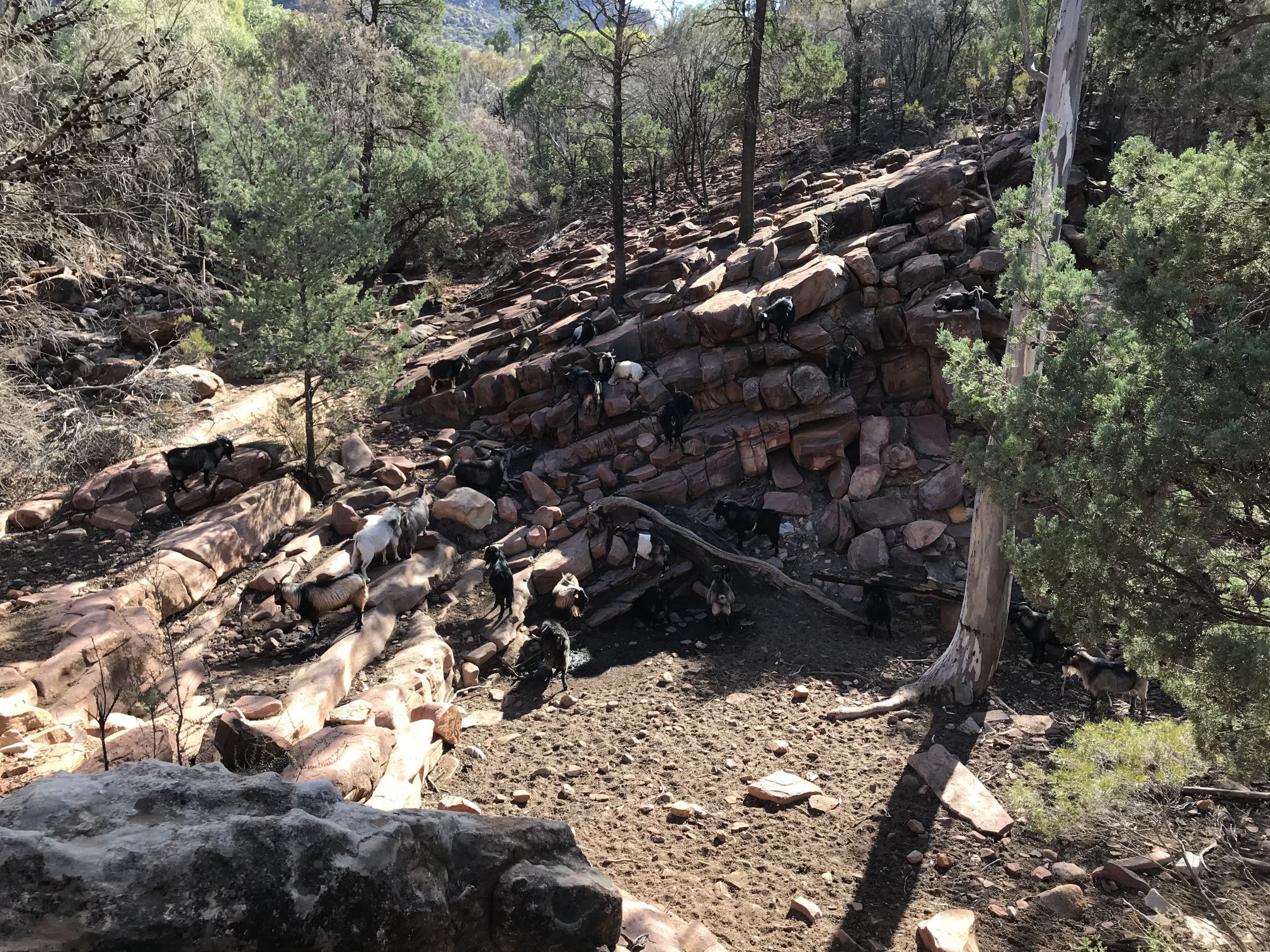
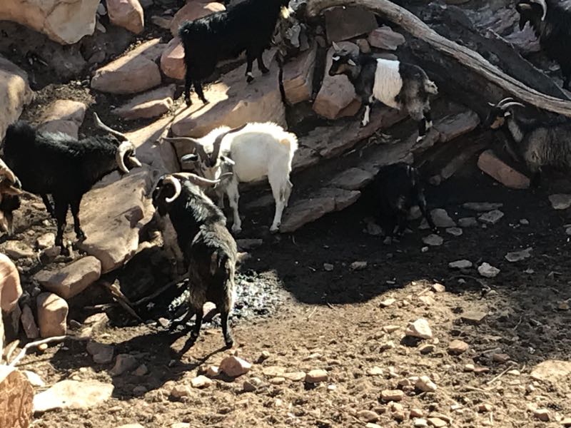
Goats - dying of thirst?
It seemed to us that they were desperate for water but that the tiny trickle that was coming into the soak was quite insufficient for the number of goats in the flock.
We had previously visited Black's Gap where, for the first time that I can recall, the spring was dry. It is possible that these goats didn't know of any other source of water within their range.
Feral goats normally run away when people get anywhere within a hundred metres or so. These were so desperate to get a few drops of water that they let us get within a few metres of them. We informed the Parks authority suggesting that the goats should be killed humanely rather than being allowed to die of thirst slowly. We didn't get a reply. |
|
|
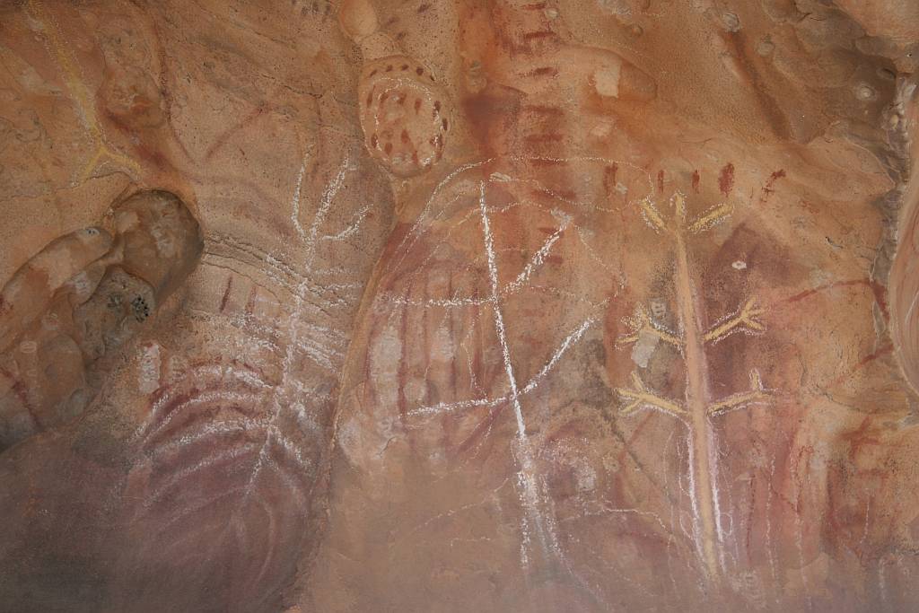
These Aboriginal paintings are at Arkaroo Rock at the southeastern end of Wilpena Pound.
There are also petroglyphs at a number of places, including at
Willow Springs, Sacred Canyon, and on Moolooloo Station.
|
|
Related pagesOn this siteA list of photo galleries of places outside of AustraliaA list of photo galleries of places in Australia Other pages on the Flinders RangesCompanion pages to this one, compiled in 2020 and 2021Southern Flinders RangesFlinders Ranges, Rawnsley area Saint Mary Peak Other Flinders Ranges pages...Beetaloo Dam; one of the biggest concrete dams in the world at the time it was builtChambers Gorge Chasm; a remarkable geological feature that seems very little known A short visit to the Flinders Ranges, June 2019
A visit to the Flinders at the time of the
COVID-19 pandemic
Related pages on external sitesAustralia: The Land Where Time Began; The Flinders Ranges. "A biography of the Australian continent" |