|
|
|
|
|
|
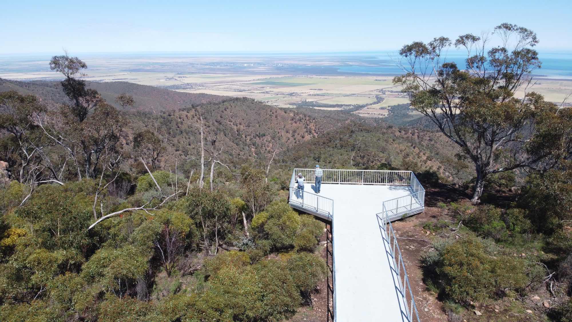
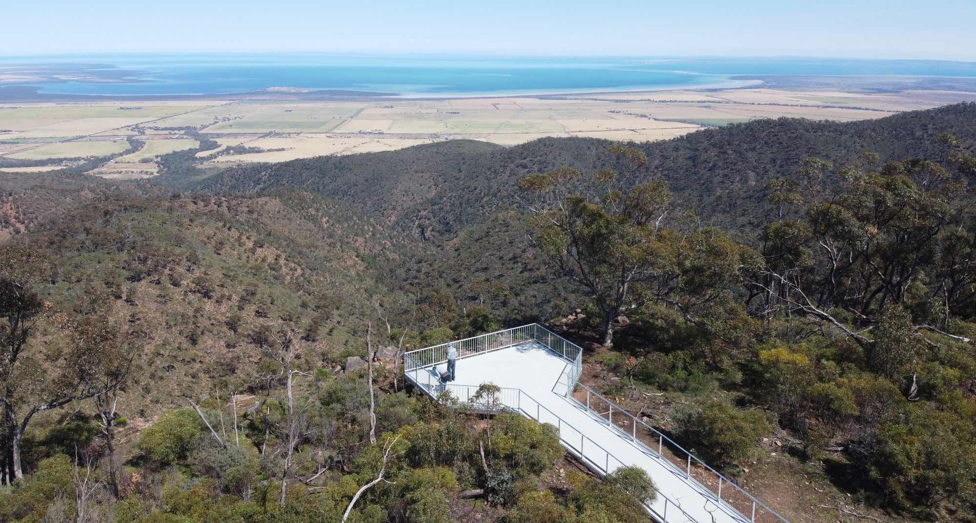
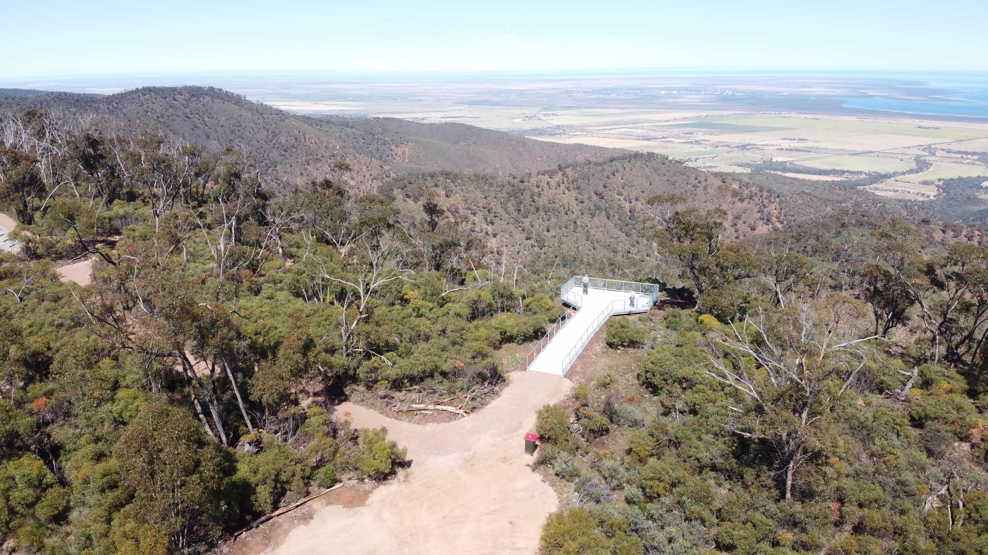
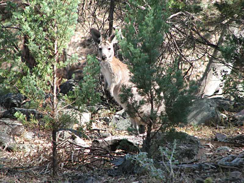
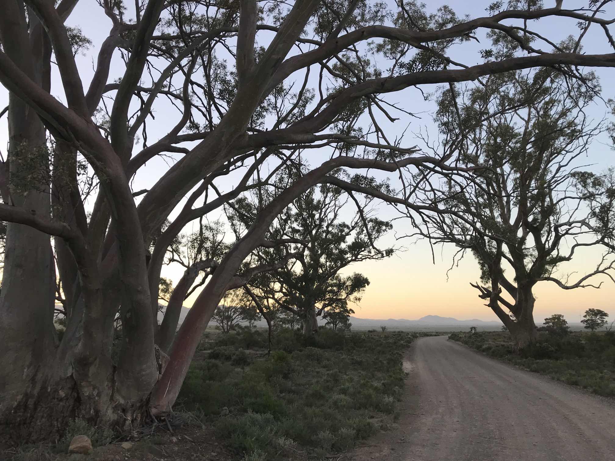
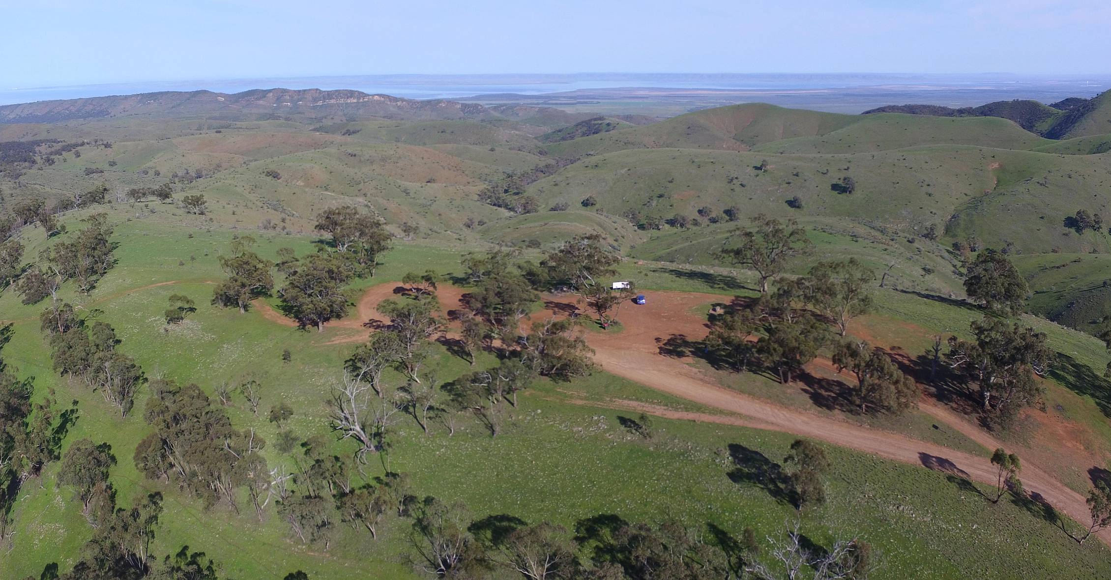
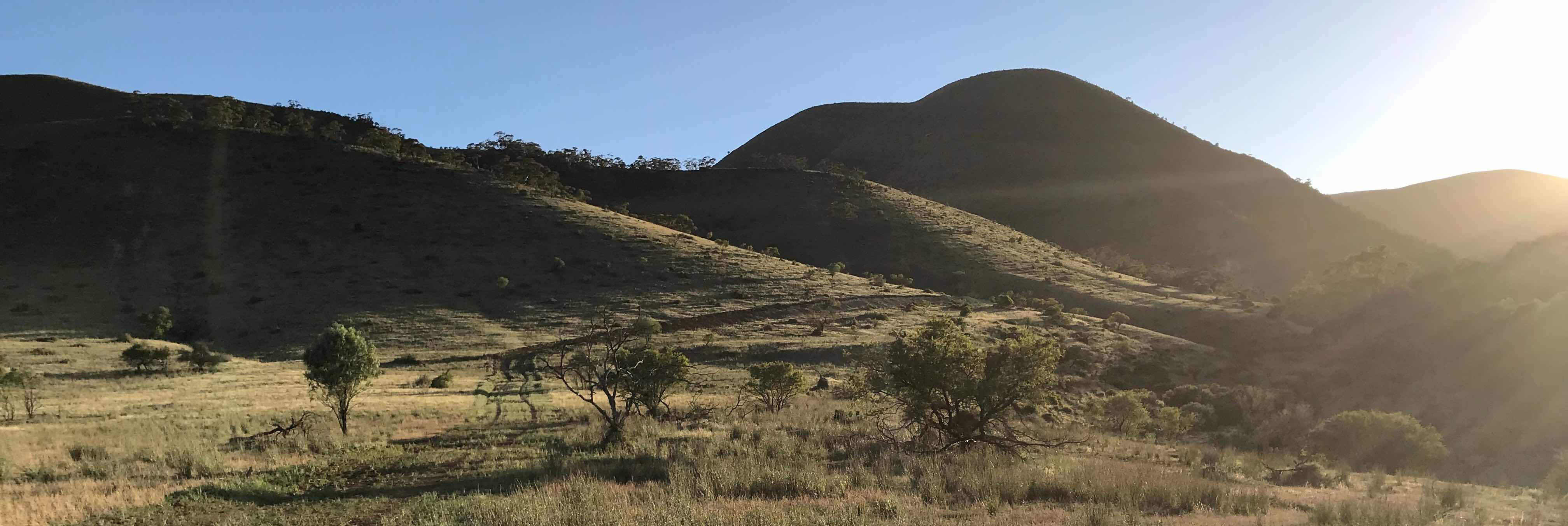
The Bluff Lookout is northeast of Port Pirie. This view shows part of the southern Flinders Range and upper Spencer Gulf with Port Pirie itself visible on the left in the high definition version of the image.
The road to The Bluff Lookout has been upgraded and opened to the public in the middle of September 2021. The observation platform was built sometime before that. This photo was taken with my iPhone 7 on 2021/10/02. |
There has been a private access road to the top of The Bluff ever since a TV tower was built more than 40 years ago. At times it has been legal for people to walk on that road, at times not. The Heysen Trail also goes to the top of The Bluff.
Photo DJI Mavic Mini drone, 2021/10/02.
The Bluff, where the TV tower is, has an altitude of 721 metres and is the highest point in the vicinity. The Bluff Lookout is 2.4 kilometres further north and has an altitude of about 667 metres. The newly opened road starts at a gate where the altitude is 488 metres.
Photo DJI Mavic Mini drone, 2021/10/02.
We got to the Lookout before 10am on the Saturday of a long weekend. There was only one person and one car there at the time. When we left, about three quarters of an hour later there were seven cars filling about half the marked spaces in the car park. I suspect that parking could have become a problem later in the day and weekend.
Photo DJI Mavic Mini drone, 2021/10/02.
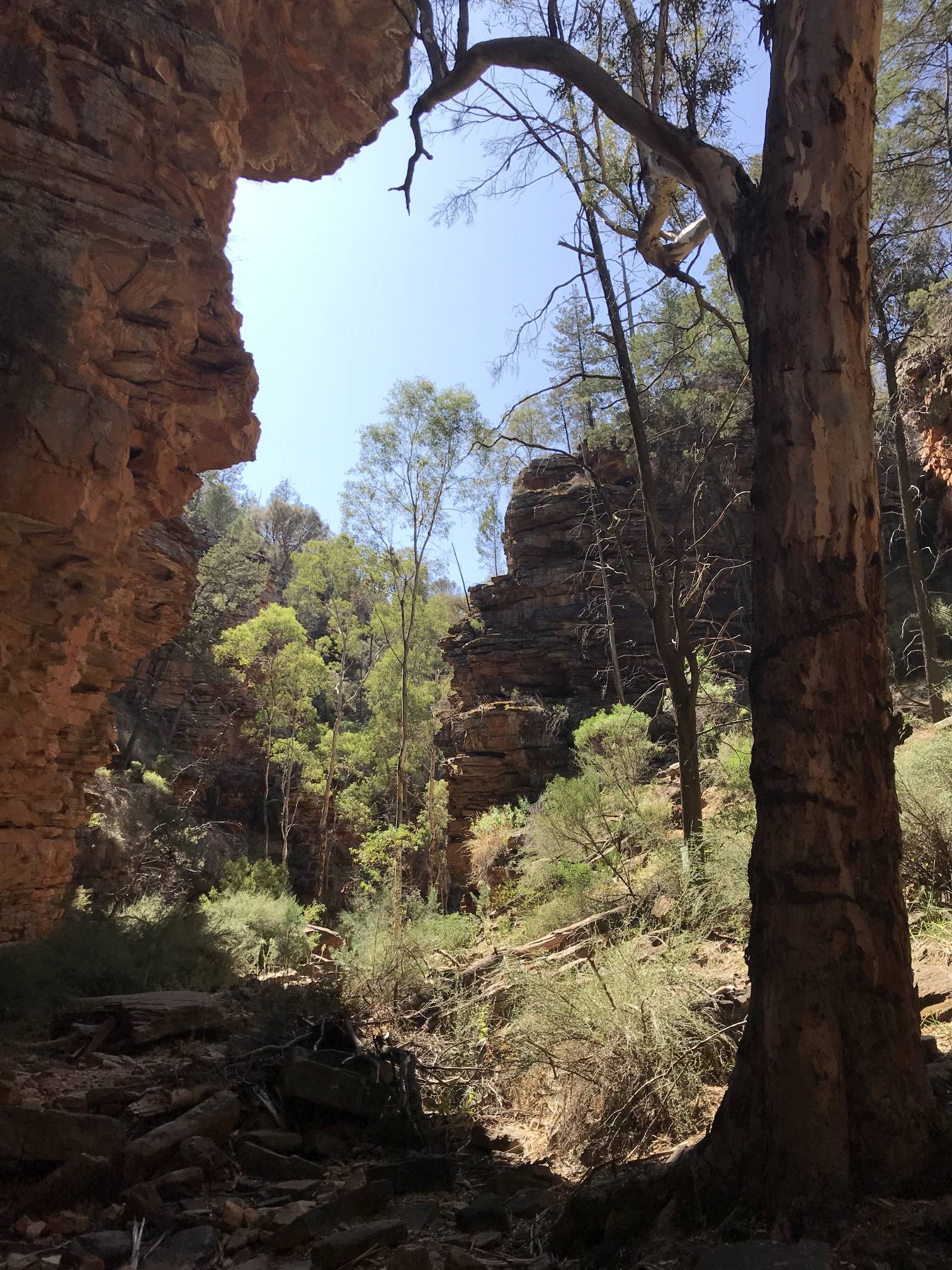
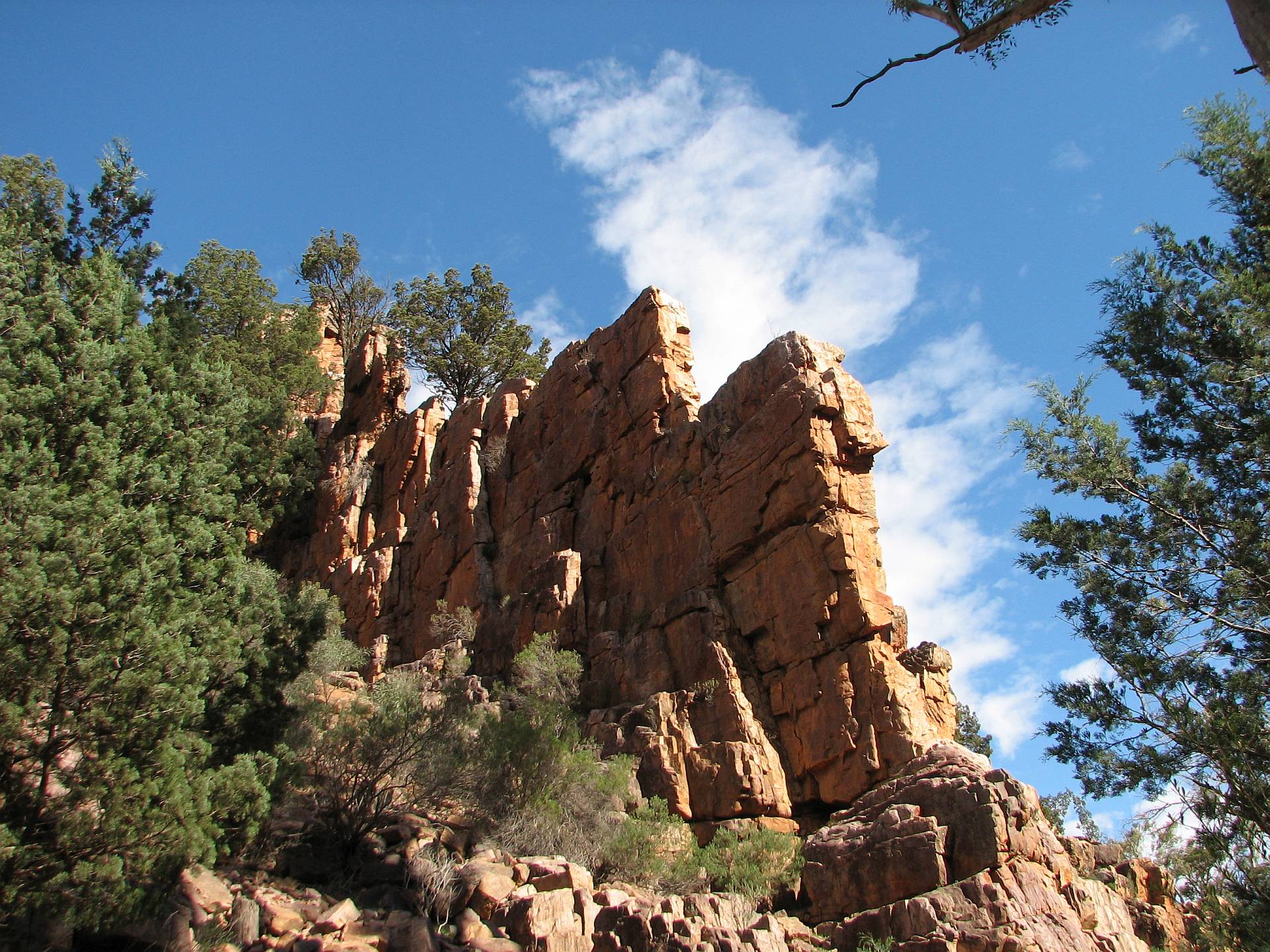
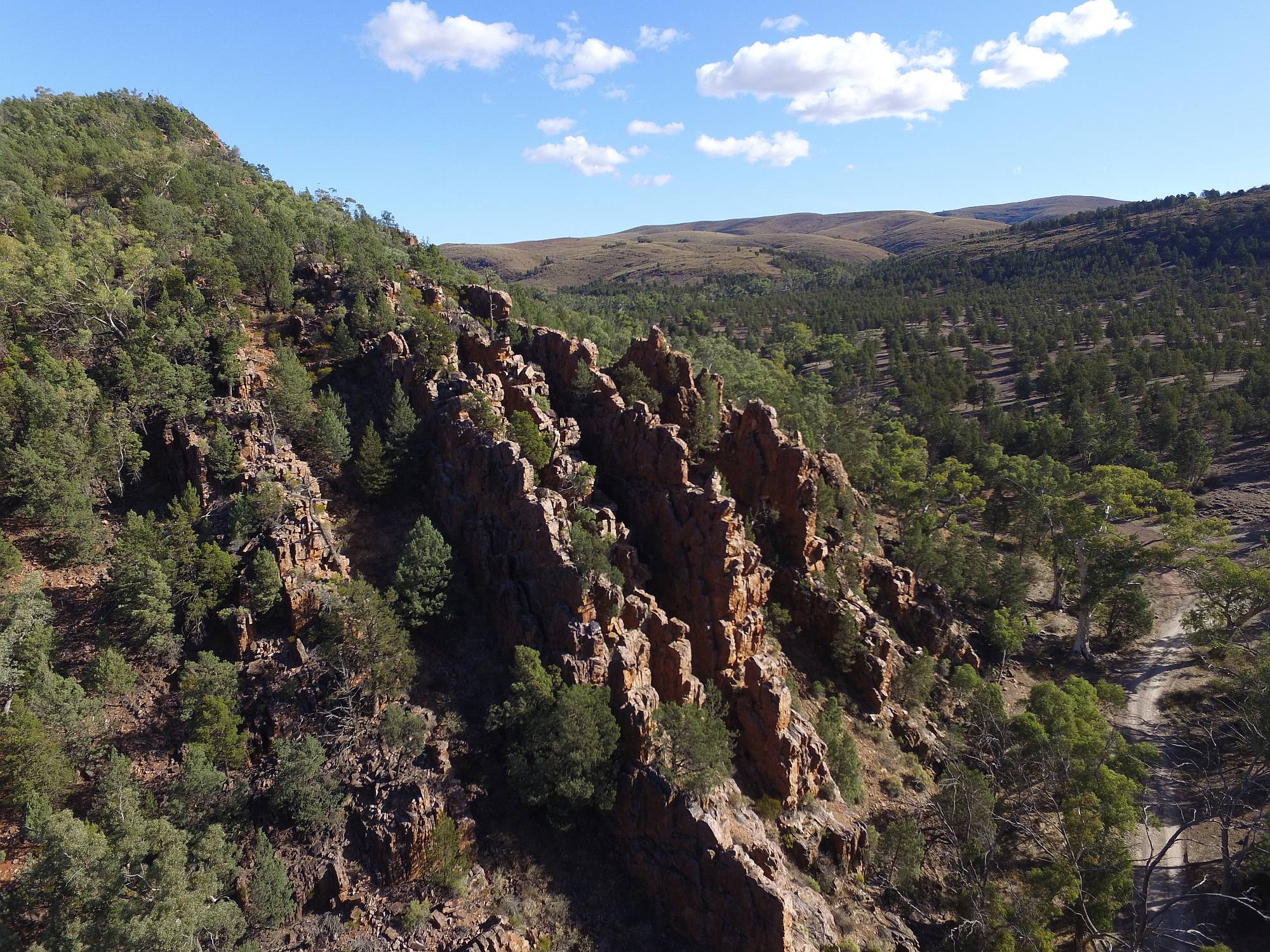
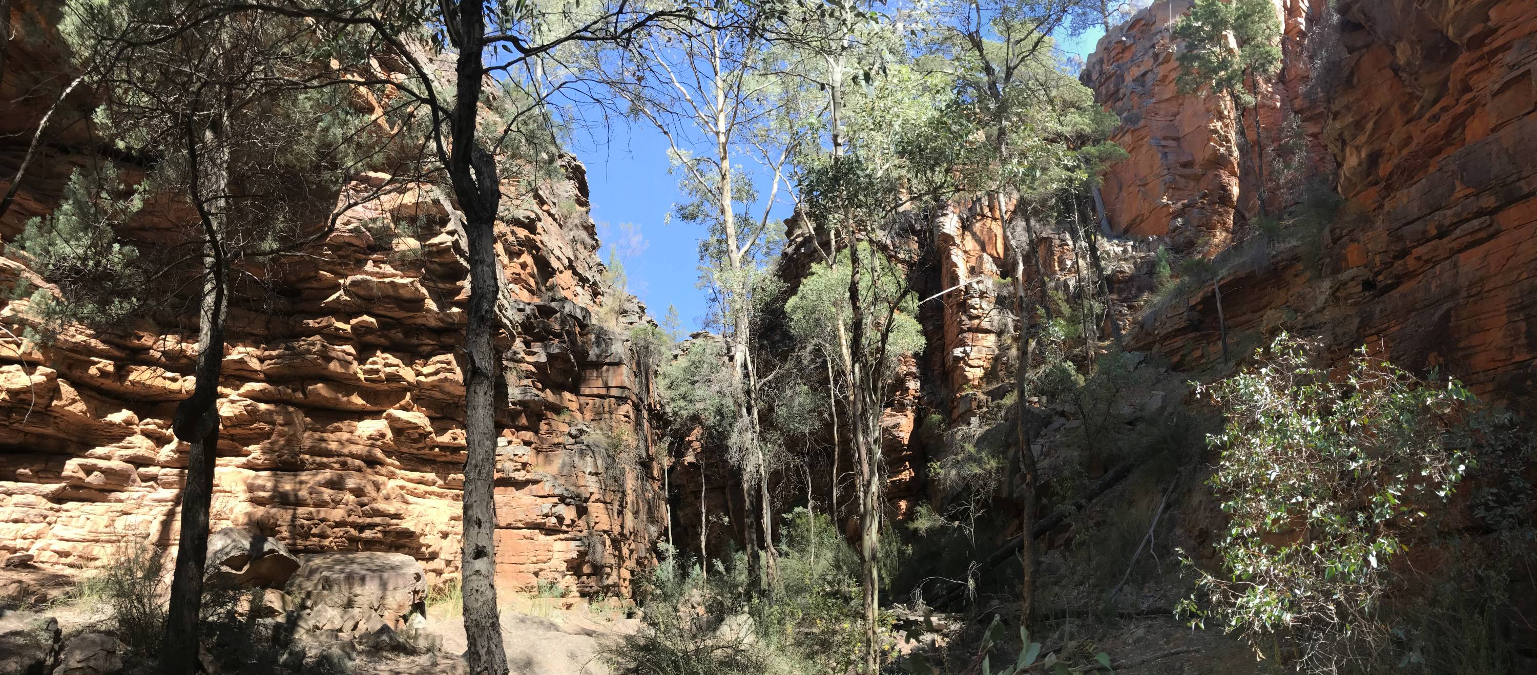
Alligator Gorge
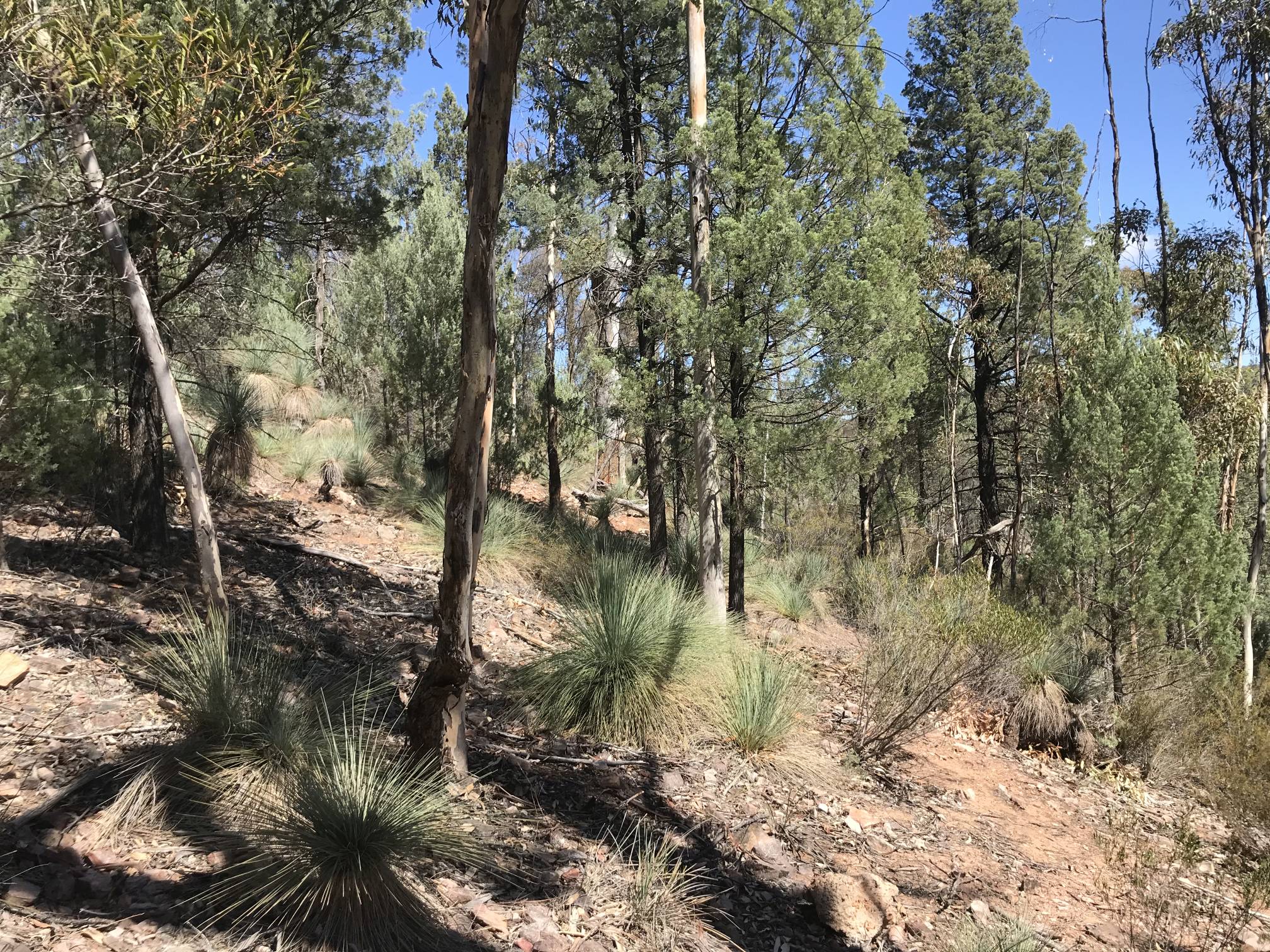
The yaccas in this area showed little sign of any of the browsing that we saw at Hucks Lookout and Willow Springs. This photo was taken from the steps that go from the main car park to the bottom of the gorge.
|
|
|
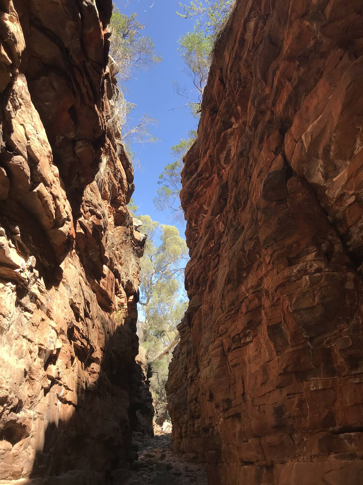
In the beautiful Alligator Gorge...
Was this the first time ever that we have visited Alligator Gorge and not seen any water at all? |
The trees in the bottom of the gorge are much taller and straighter than trees of the same species elsewhere in an effort to reach the light. The high walls of the gorge would protect them from the stronger winds, but some would be flattened or broken off by the occasional flood flow.
|
|
|
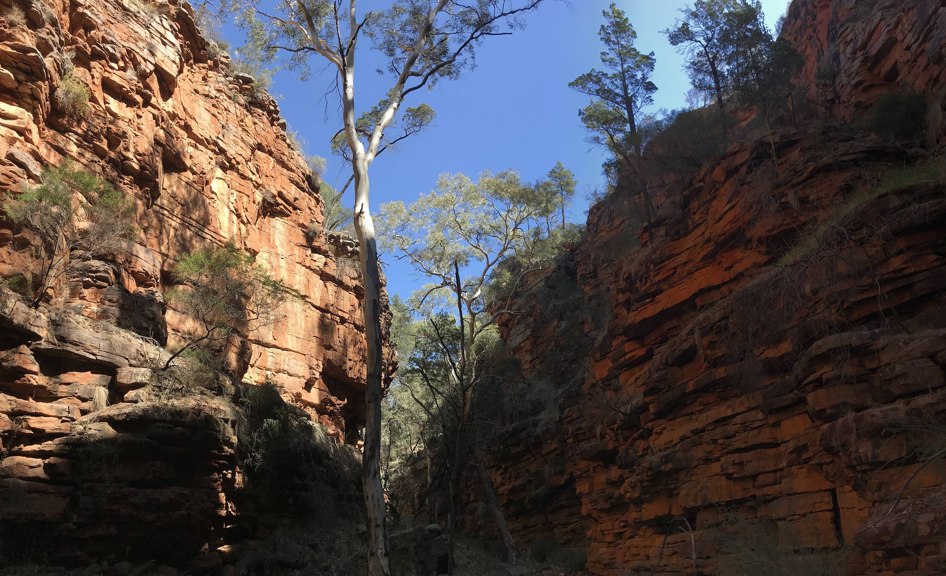
Getting down toward The Narrows...
|
If the sun is shining on one side of the gorge radish light is reflected to the other side, accentuating the colour. |
|
|
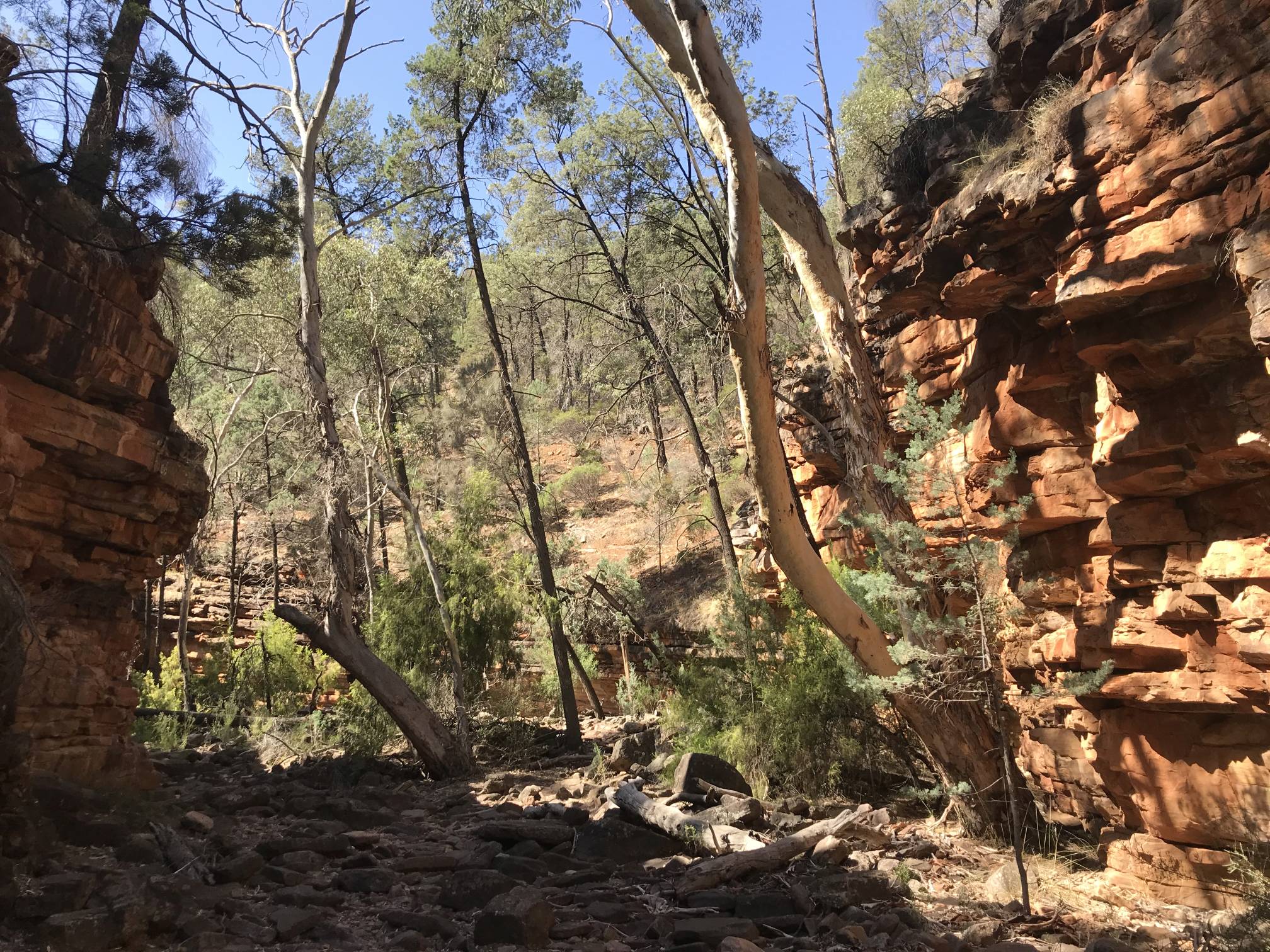
This is where the gorge opens out.
It is possible to follow the creek all the way down to Mambray Creek camp ground, a distance of about 15 km. My wife and I, a couple of borrowed kids, and some other friends once did the walk over a two day period about 38 years ago from the other end up to Alligator Gorge. Our own kids were too young to do the walk so we did a temporary kid swap with our neighbours. |
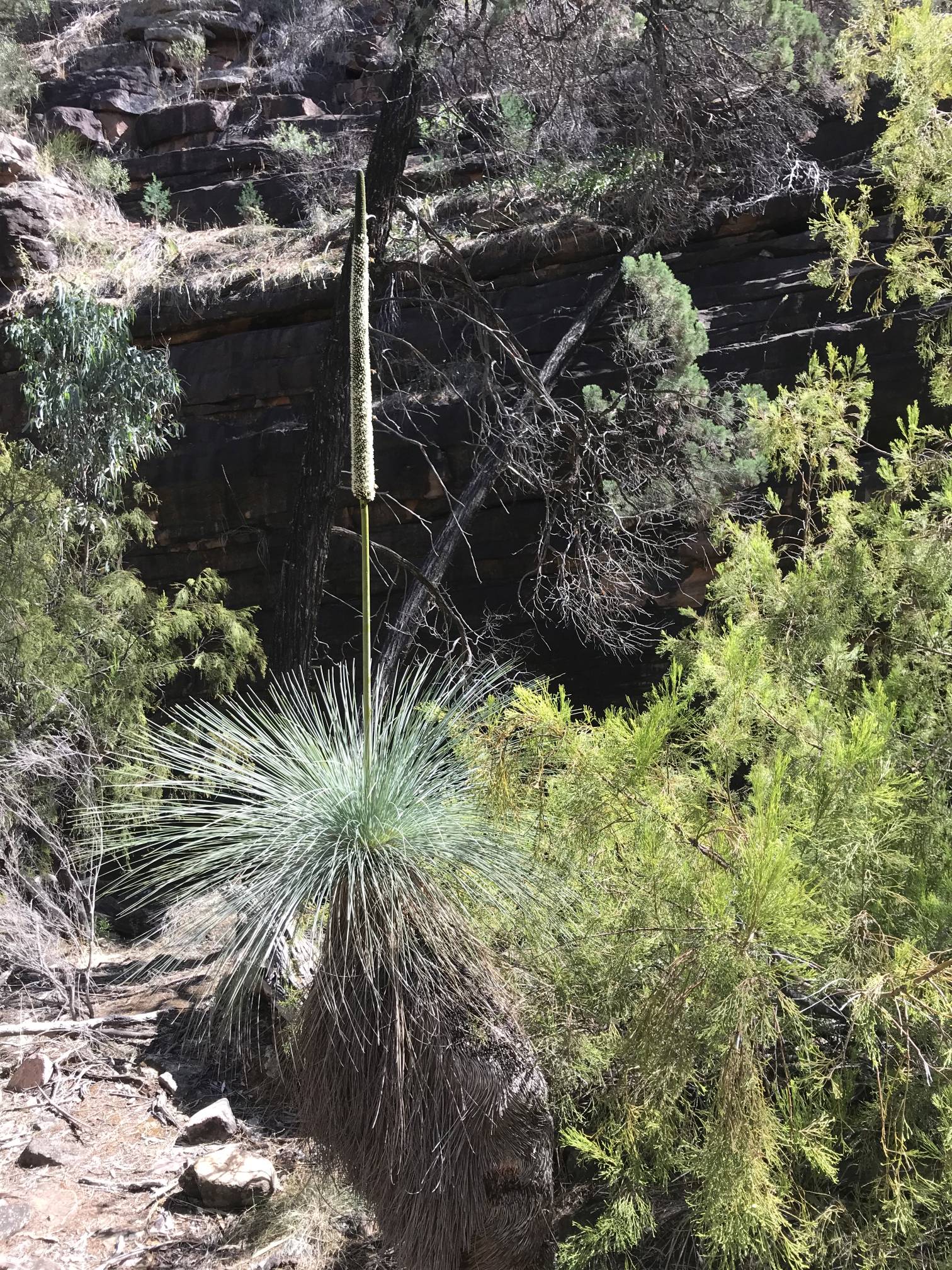
Yacca; a striking specimen
The photo was taken between the point where the steeply walled part of the gorge ended and the trail left the gully to go up to Bluegum Flat Picnic Area.
|
Mount Remarkable
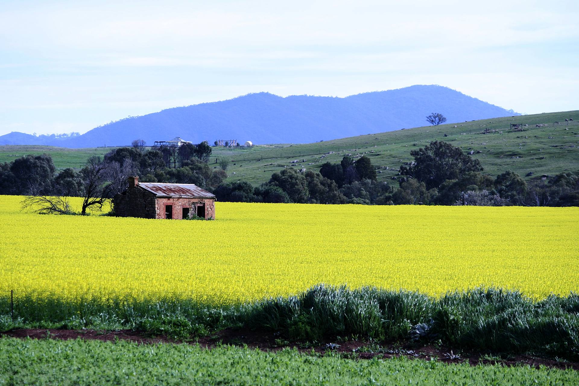
We happened to be passing this place, near Murraytown on the road from Wirrabara to Melrose, when the canola crops were in flower. The ruined cottage provided an interesting focal point for the composition. 2015/08/24 It is worth mentioning the excellent silo art at Wirrabara at this point. There is a photo of it on another of my Flinders pages.
Warren Gorge
The quartzites and sandstones of the Flinders Ranges are always tilted from the near horizontal orientation in which they were laid down more than five hundred million years ago, but Warren Gorge is the only place I know of where they are tilted right up to the vertical.
|

|
This and the above photo were taken using my Phantom 2 Advanced drone on 2016/04/11. |

|
|
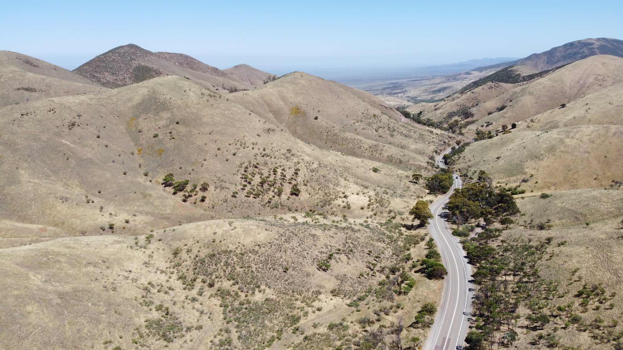
A drone view above the Horrocks Pass road looking toward the east and the highest point of the Pass; 2018/05/10. (Photo Phantom 2 Advanced drone)
|
|
Shortly after I took these photos I saw a wedge-tailed eagle. Wedgies don't like drones, they have been known to attack them. Perhaps they see them as competitors in their air-space. |
Photo Mavik Mini 2021/12/20
The eastern side of the pass is less steep and the surrounding hills do not rise to highly over the road. Photo Mavik Mini 2021/12/20 |
Hancock's LookoutA side road running about eight kilometres off the Horrocks Pass road leads you to Hancock's Lookout, which overlooks the southern Pirie-Torrens Basin and northern Spencer Gulf. |
|
|
If there was a lookout overlooking Hancock's Lookout this is the view you'd get. Photo 2016/09/05, Phantom drone.
|
|
|

|
|
Baroota Dam has been in the news in Australia recently because it is being investigated as a part of a potential pumped hydro energy storage system.
(Photo 2018/08/21)
The facility would involve a new water storage being built at the top of the hill in the background, about 200m above the lower storage. Water would be pumped from the existing dam into the top storage when there was plentiful and cheap electricity being generated by renewable energy sources, solar and/or wind power. The water would flow back down through turbines into the lower storage when more electricity was needed. I've written about pumped hydro power in general and the proposed Baroota pumped hydro scheme in South Australia's Energy Future. Another interesting dam in the southern Flinders Ranges is Beetaloo which, when built from 1886 to 1890, was one of the biggest concrete dams in the world. |
|
|
Mambray Creek
This is one of the more beautiful walks in the southern Flinders Ranges, and it is an easy one, being along a gently sloping dirt track. As I recall, on this occasion there was no water to be seen in the creek.
Photo iPhone 7, 2018/09/04.
The only water we saw on this visit was some fairly stagnant small ponds with a little trickling flow at the day visitor parking area. My family and I have visited Mambray Creek many times over the last more than 40 years. Our recollection is that in the past there used to be much more water than in the last ten or so years. I have noted, in some more detail, reduced flows in the Crystal Brook on another page on this site. Photo Canon Powershot S3 IS, 2021/12/19
Photo Canon Powershot S3 IS, 2021/12/19
|
|
|
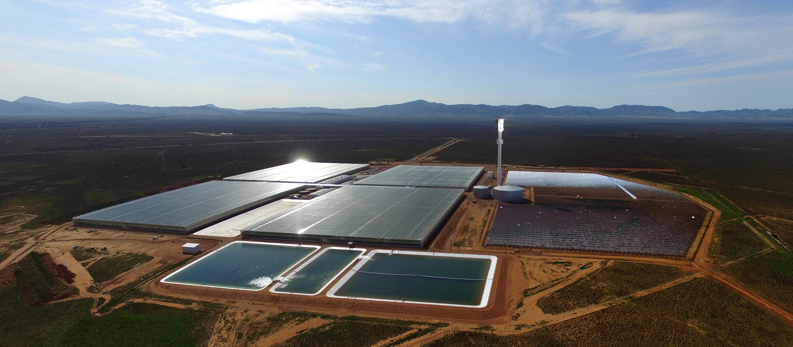
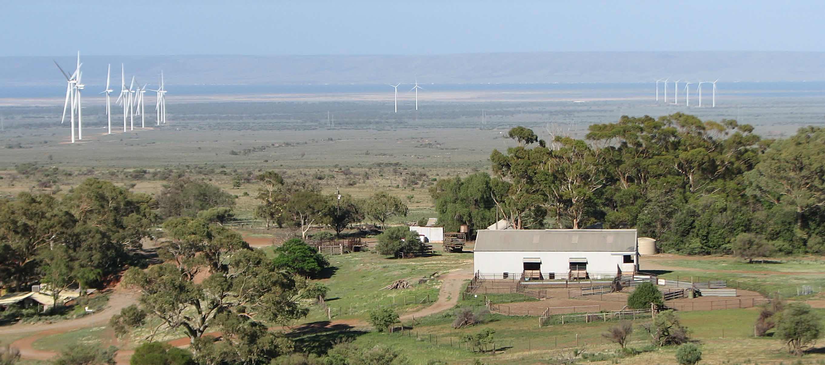
Sundrop Farm is a highly innovative and productive food producer using saline water and sunlight to supply Australia with tomatoes.
The southern Flinders Ranges are in the background.
I've written more about Sundrop Farm
elsewhere on this site.
Photo taken with my Phantom 2 Advanced drone on 2016/09/05.
|
|
Photo taken with my Phantom 2 Advanced drone on 2016/03/14. |
|
|
|
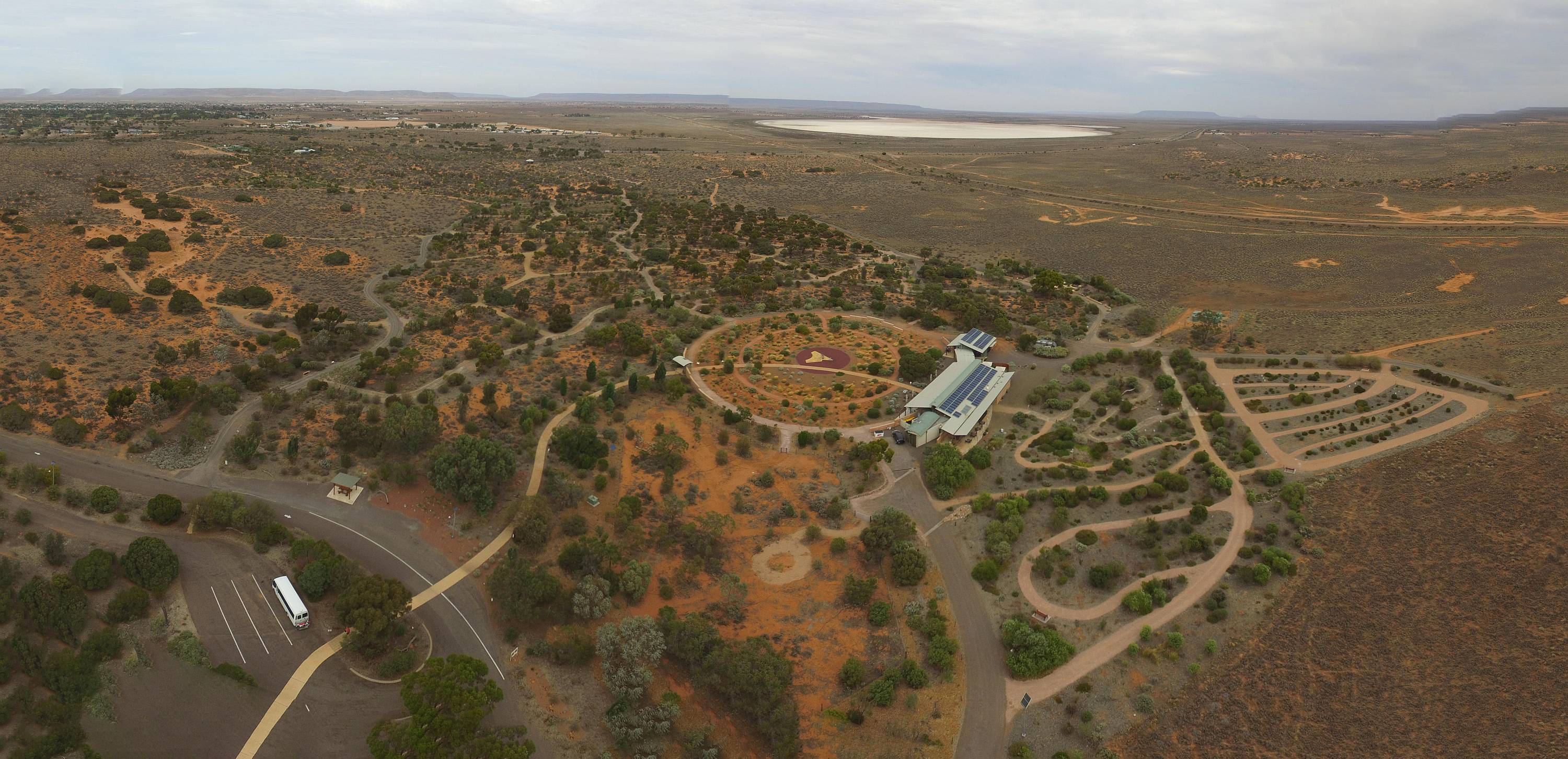
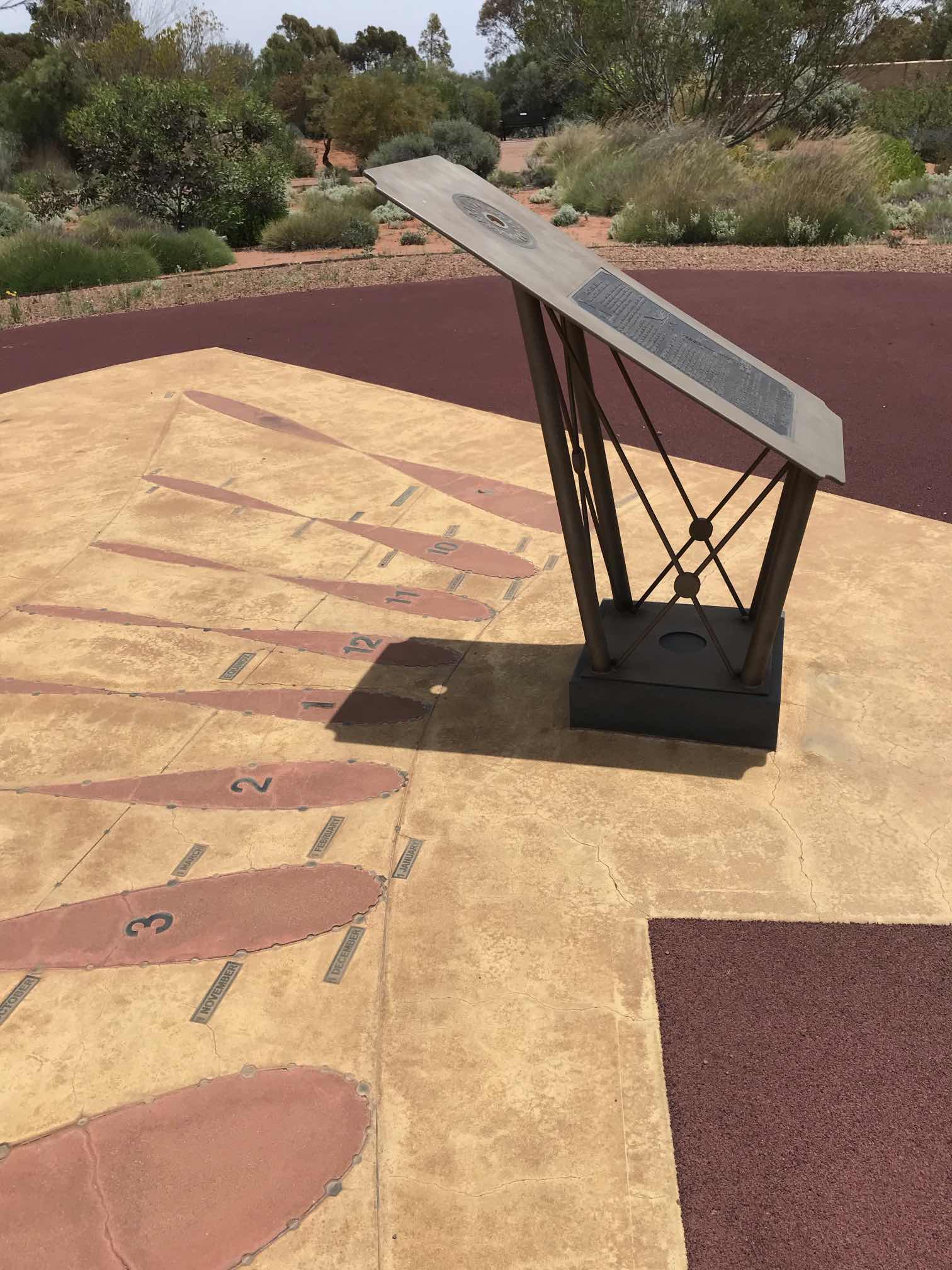
The sundial at the Arid Lands Botanic gardens three days before the summer solstice. Notice that the spot of sunlight that has passed through the small hole in the sundial is very close to the curved solstice line beneath the gnomon and that the sun is very nearly overhead.
This is the best sundial that I can remember seeing anywhere.
Photo 2021/12/19
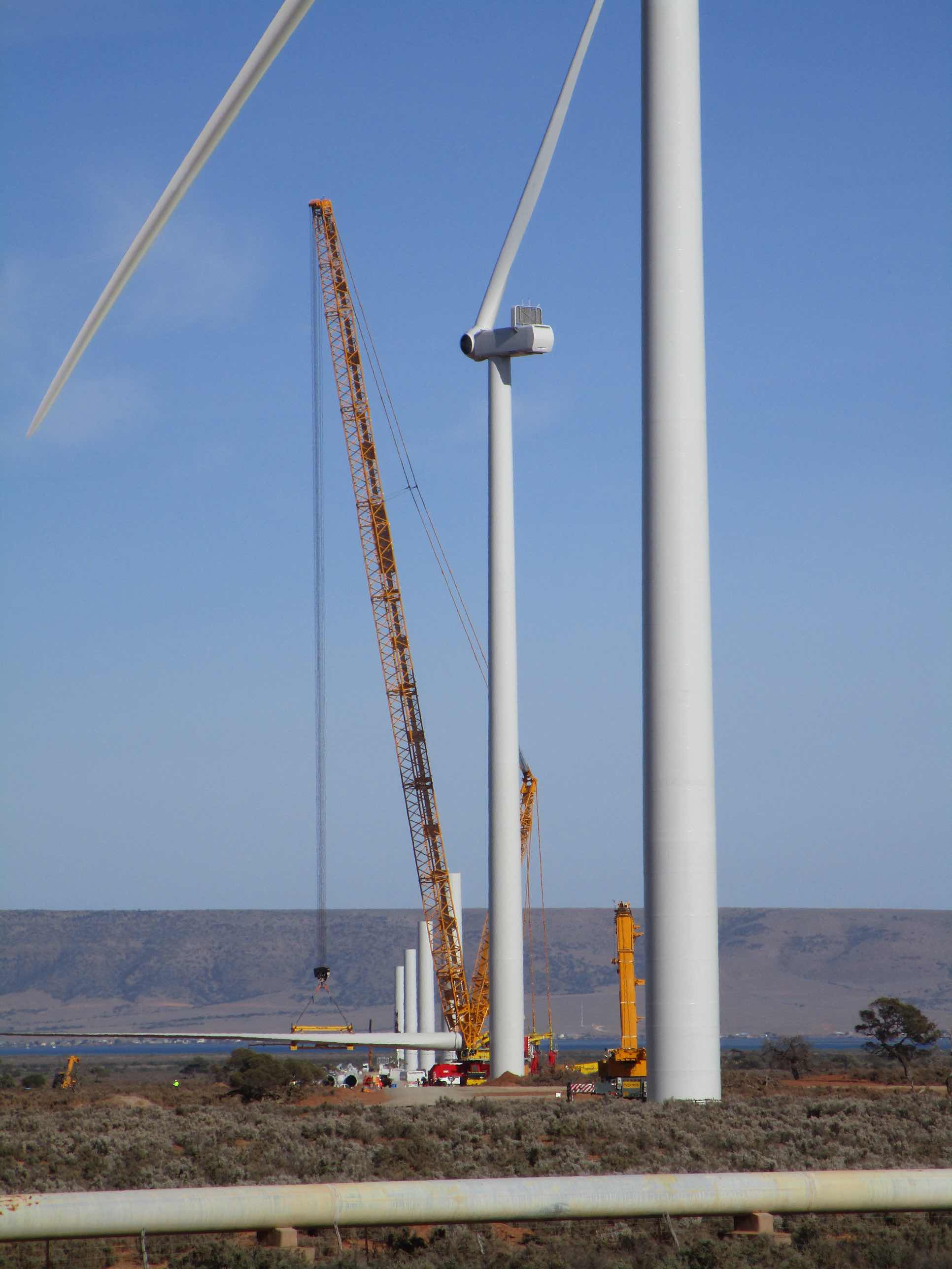
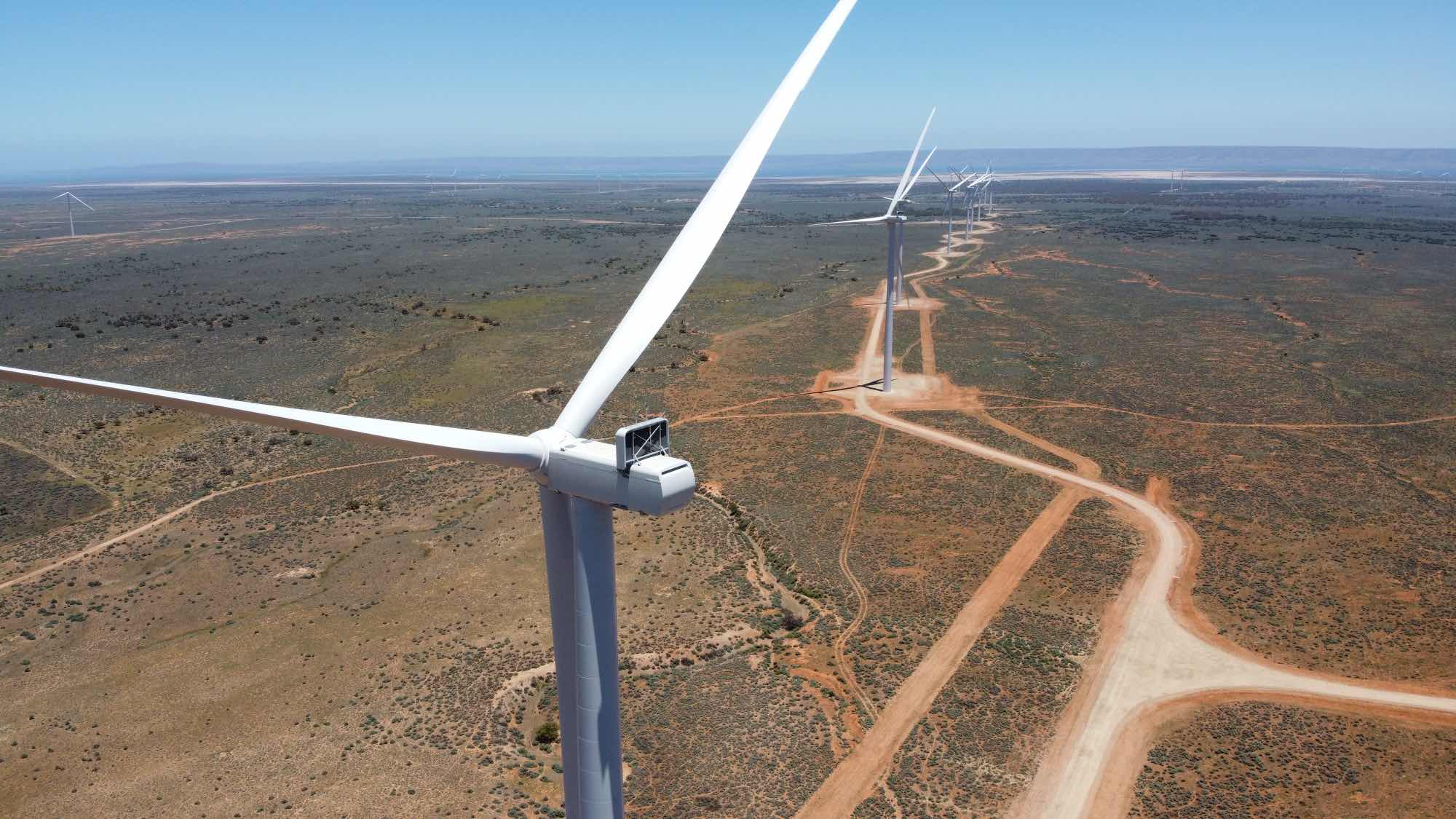
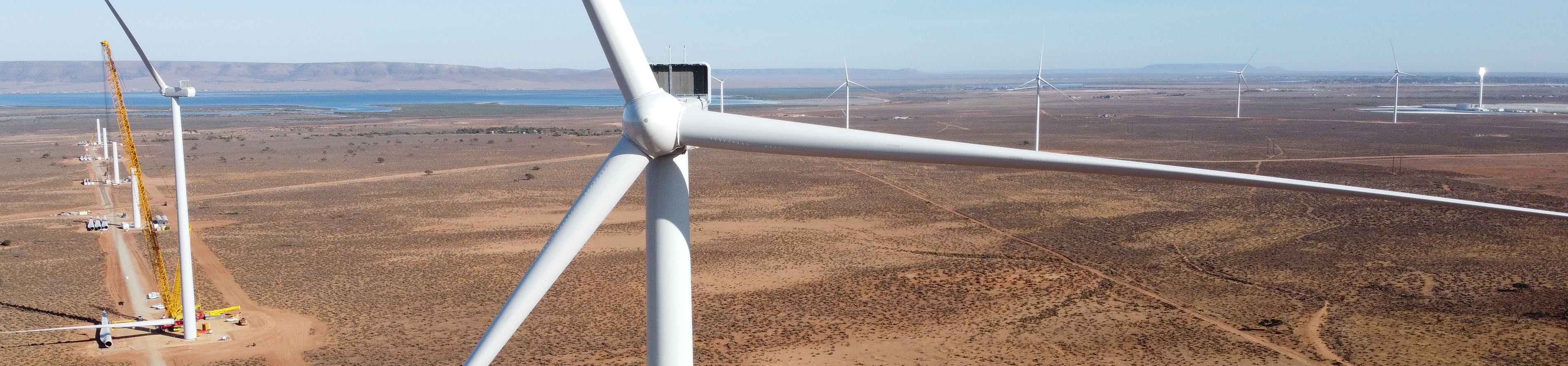
Port Augusta Renewable Energy Park (PAREP)When completed the 50 wind turbines, each of 4.1MW, will have a total capacity of 210MW. In addition there is to be 107MW of solar photovoltaic power.Under construction 2021/05/05 |
|
Photo taken using my Mavik Mini drone. Sundrop Farm can be seen on the far right. (Click on the image to see in high resolution.) |
A solar farm was also to be built. In the image on the right the crane is lifting the second blade that will be attached to the turbine in the foreground. Photo Canon Ixus 190 |
PAREP, construction nearing completion, 2021/12/19 |
A part of Port Augusta Renewable Energy Park
|
|---|

|
Photo taken using my Mavik Mini drone.
At this time all 50 wind turbines (4.2MW each, a total installed capacity of 210MW) were apparently completed but not yet operating; the other 46 were to the left of this field of view. It looked like the solar farm (110MW) was also fully built. But one area was cleared with very little on it; perhaps ready for the battery?
Sundrop Farm can be seen on the far right. (Click on the image to see in high resolution.) |
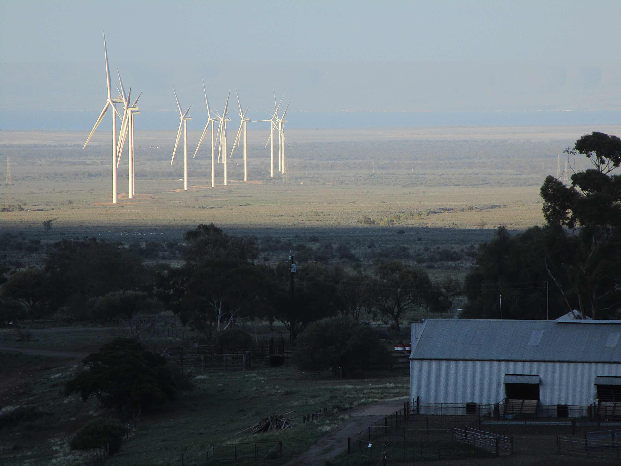
Looking further to the left than the above view, and showing more of the PAREP wind turbines. PAREP is one of only two significant South Australian wind farms that have been constructed of flat (or gently sloping) ground, the other is Wattle Point WF on southern Yorke Peninsula.
A photo of a part of the PAREP wind farm taken from near the junction of Spear Creek road and Boully Road, that leads into the Spear Creek camping area. I found it interesting that the PAREP wind turbines were in rows, but the rows weren't straight, they were only nearly straight; as can be seen here. Most South Australian wind farms are on the tops of ridges, but one that does have turbines in straight lines, and very straight lines, is Wattle Point WF. Spencer Gulf and the hills on the eastern side of Eyre Peninsula can be seen in the distance. Photo Mavic Mini drone, 2021/12/20
|
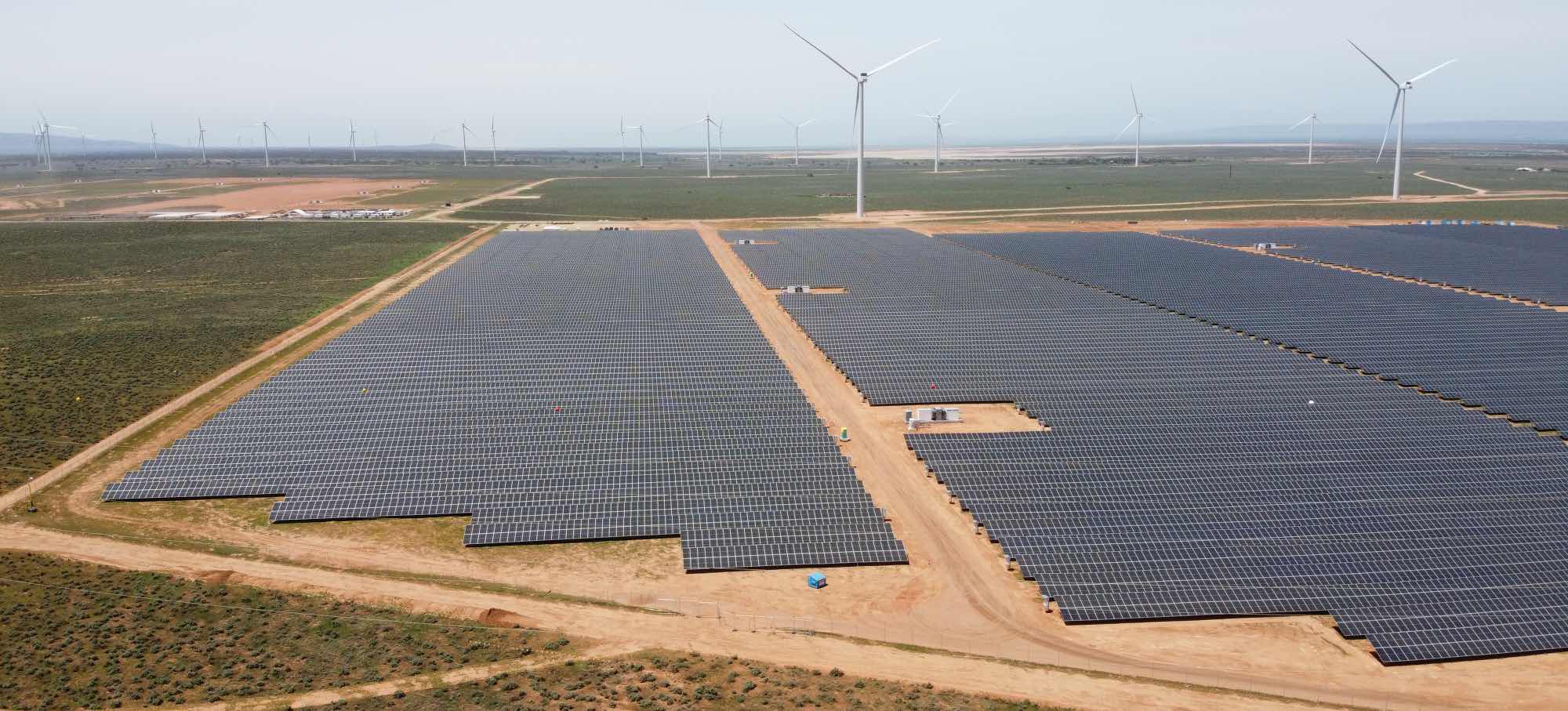
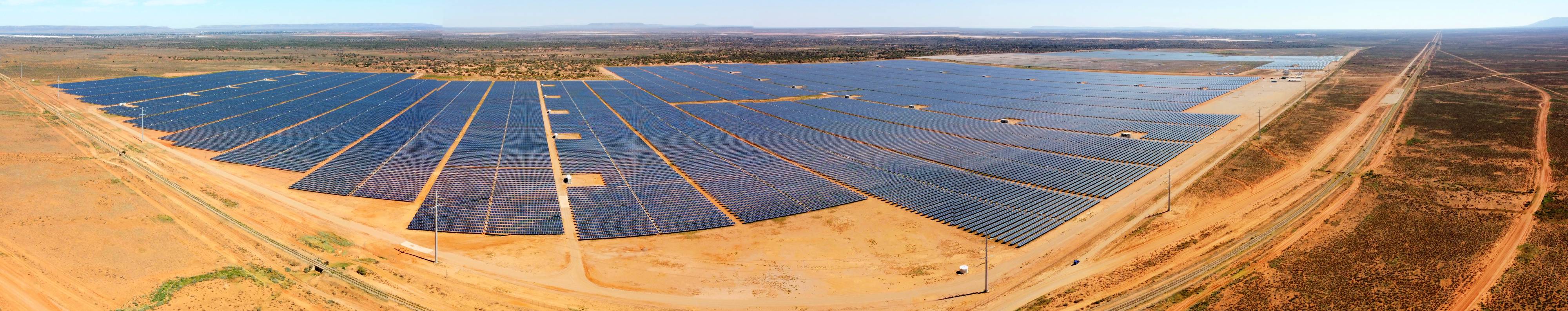
Bungala solar farm, completed
|
|---|
|
Photo taken by my Mavic Mini drone, 2020/03/26.
Click on image to view full size, 'back' to return |
|
Bungala solar farm is about 15km east of Port Augusta. In 2020 it was either the biggest or one of the biggest solar farms in Australia.
There is a map showing the location of Bungala Solar Farm and a short note on how to get to it on
another page on this site and on
Power Technology's web page.
|
|
Spear Creek
|
|---|
|
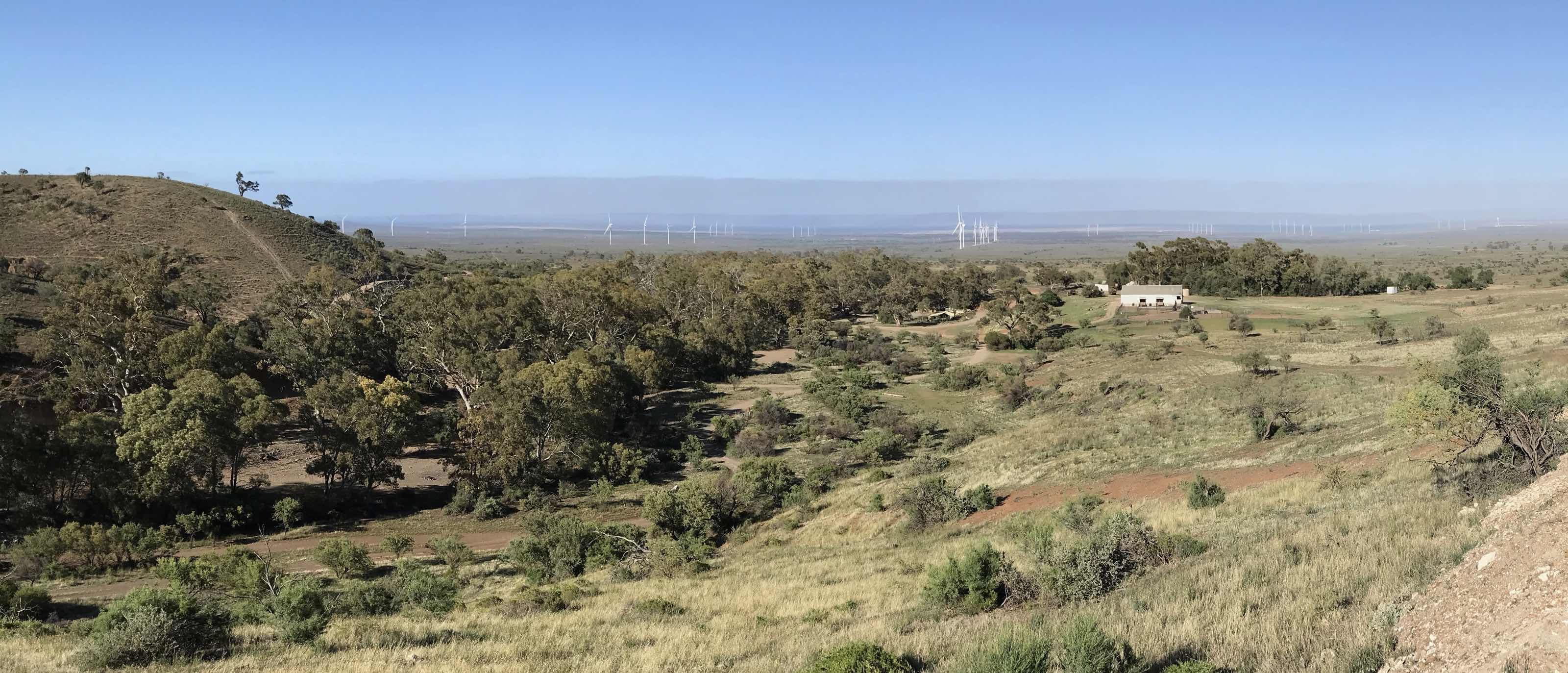
The Spear Creek shearing shed is on the right, many of the wind turbines of the Port Augusta Renewable Energy Park in the middle distance. Photo 2021/12/20, iPhone. |
|
Spencer Gulf is in distance with the hills on the eastern Eyre Peninsula beyond. Above that is a layer of smoggy air. Spear Creek is about 250 metres above sea level and that seems to have been about the same height as the top of the smog layer.
The solar power-tower of Sundrop Farm can just be seen on the far right in the high definition image. |
From the Spear Creek trail, up the gorge from the homestead and the junction with Deep Creek. There are trails up both Spear Creek and Deep Creek. Photo 2021/12/20, iPhone.
Further up the gorge from the last image.
Photo 2021/12/20, iPhone camera.
I went for a walk down the Spear Creek road before sunrise on the morning of 2021/12/21. This image was recorded on my iPhone where Spear Creek crosses the road. Looking south along the Flinders Range. The red gums (Eucalyptus camaldulensis) were obviously struggling to recover from defoliation due to drought. We were told that they had suffered badly, many having died, during the drought of 2004-12. With climate change such problems are only going to get worse.
The hills above Spear Creek a little later the same morning, while the Sun was still low in the sky, taken from a few hundred metres above the Spear Creek camping area. iPhone camera.
|
|
|
Again, looking toward the ranges to the east from a few hundred metres above Spear Creek campground, early morning. Photo 2021/12/21, iPhone.
|
|
|
A telephoto shot looking west over the Spear Creek shearing shed over the northern Spencer Gulf. A number of the Port Augusta Renewable Energy Park wind turbines are conspicuous. The range of hills on eastern Eyre Peninsula is visible in the distance. Canon Powershot S3 IS photo, 2021/12/21.
|
Again, Spear Creek shearing shed and some of the Port Augusta Renewable Energy Park wind turbines. Some of the holiday homes on the far side of Spencer Gulf are just visible in the high definition image. Photo Canon Ixus 190
Pichi-Richi Pass
The Devil's Peak in right of centre.
Photo taken by my Mavic Mini drone, 2021/05/05.
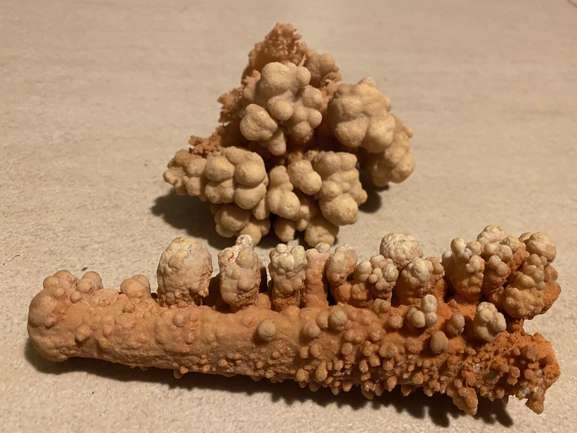
Bagalowie Cave
I visited it with a group of the Adelaide Bushwalkers. We were instructed by the leader to not in any way damage the cave or the cave formations - rightly so. I picked up these two pieces that were broken and lying on the floor of the cave. They are unusual types of cave formations. I went back a decade or more later and found that the cave had been badly damaged, apparently by someone who was mining the bat guano; a great pity and a loss that can never be recovered. |
|
Photo 2018/05/11 |
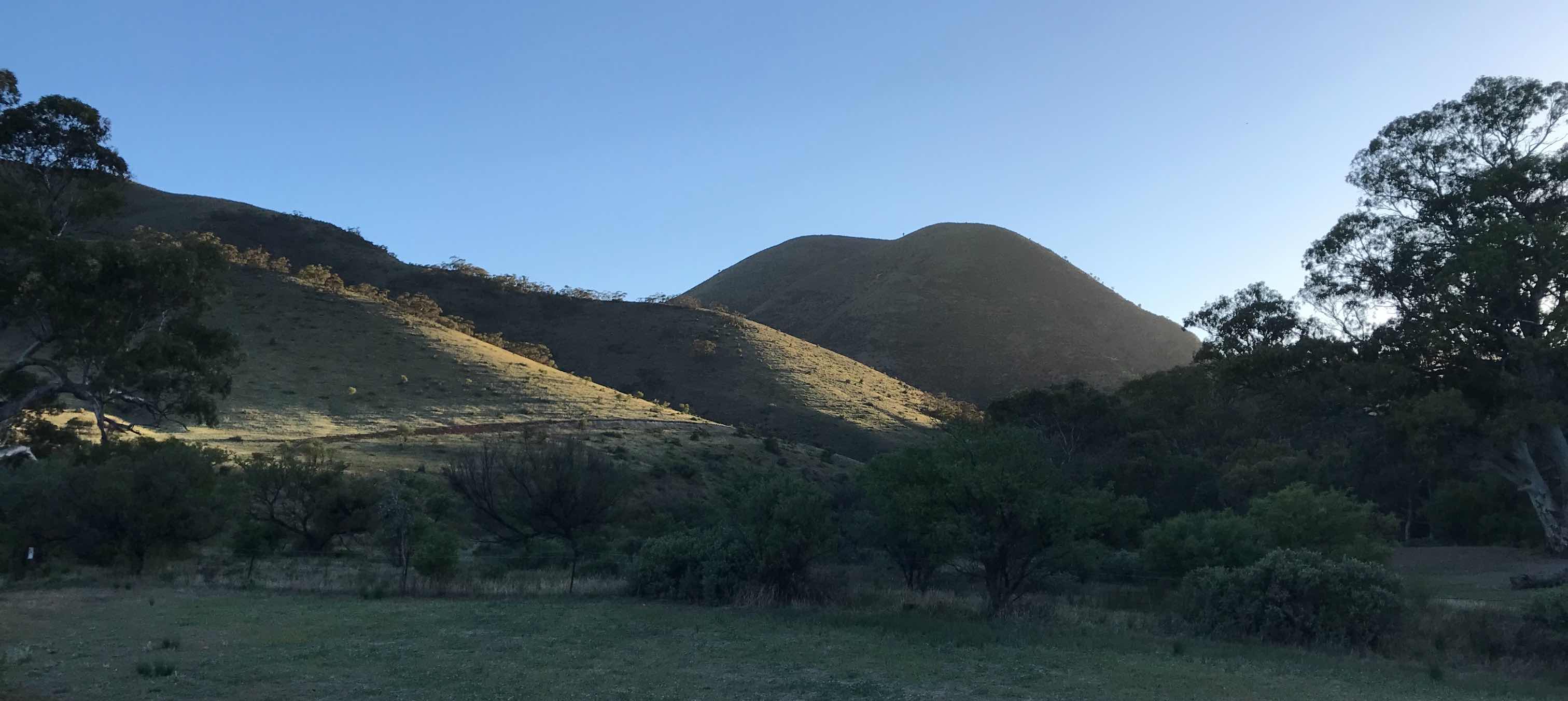
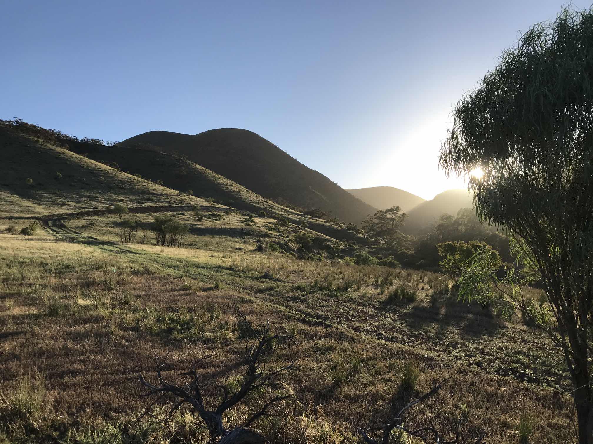
While the ranges in the Bendleby area are not so spectacular as those of the central Flinders, they are attractive. |

|
|
My wife Denece and dog Socrates on the Hidden Valley Bushwalking Trail, Bendleby Ranges.
This trail follows a creek bed for a few kilometres and connects with another trail that gets you back to your starting point; perhaps six kilometres total. |
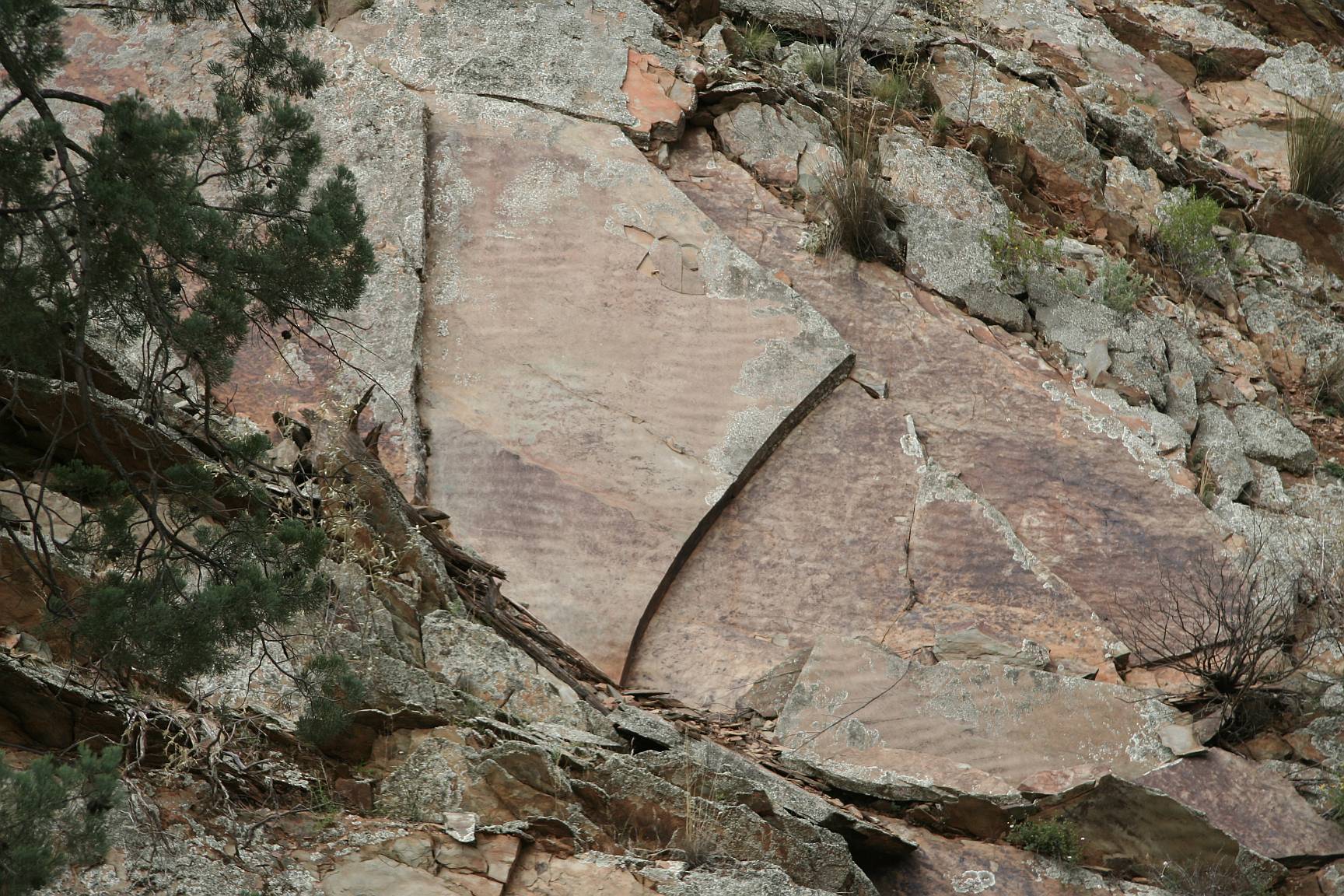
'Ripple rocks' like this are common in the Flinders Ranges, but such large slabs are unusual.
The sands that ultimately became sandstone after being buried at great depth and brought back to the surface by earth movements were laid down on an ancient beach.
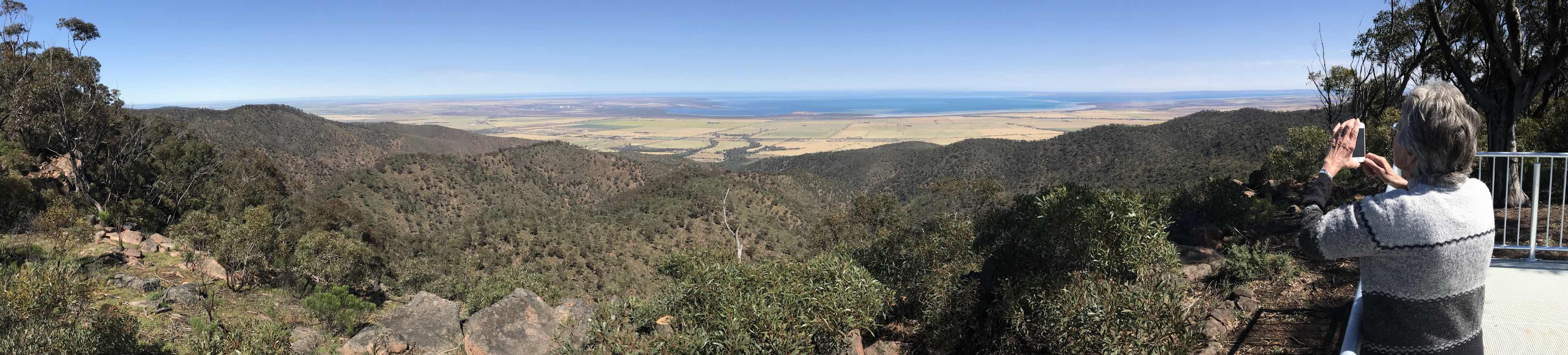
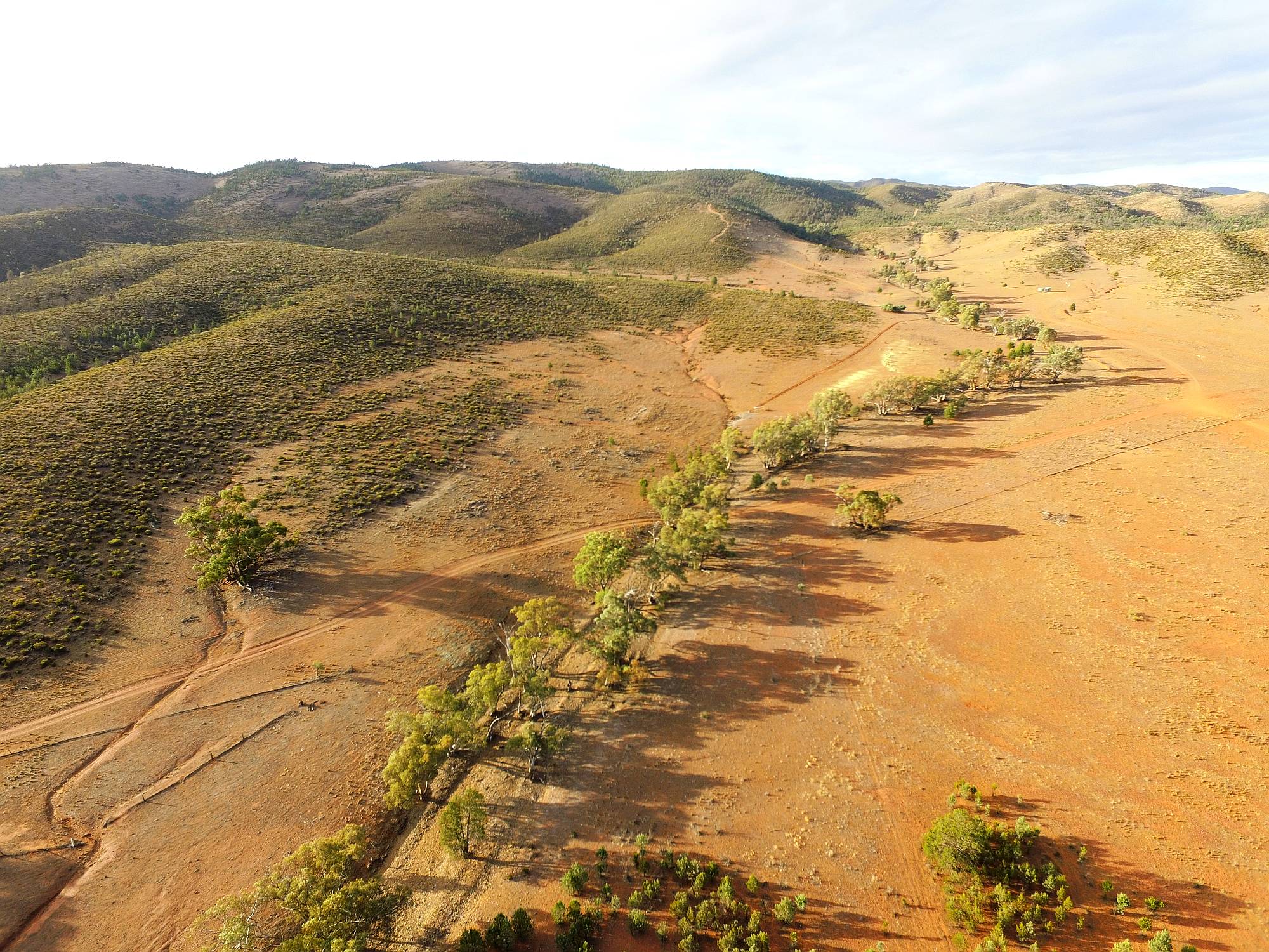
Intermountain plain |
|
|
Between Bendleby and Hawker. Within the greater Flinders Ranges area there is a lot of flat land and many individual ranges.
As mentioned in the heading note the greater Flinders Ranges area is about the size of nations such as Albania, Solomon Islands, Armenia, Lesotho and Belgium. There is no shortage of flat land between the individual ranges. The one that most visitors would see is the Willochra Plain between Quorn and Hawker. While a few of the main roads in the Flinders Ranges are sealed you have to be willing to get onto the unsealed roads if you are going to see anything like the whole area. There is no need of a 4WD (SUV) on the great majority of the unsealed roads but at times some of the unsealed roads can be badly corrugated and unpleasant to drive on. |
Other pages on the Flinders RangesOn this siteCompanion pages to this one, compiled in 2020Flinders Ranges main pageFlinders Ranges, Rawnsley area
A short visit to the Flinders Ranges, June 2019
Older Flinders Ranges pages...Chambers Gorge Chasm; a remarkable geological feature that seems very little knownExternal sitesWalking and cycling trails on Rawnsley Park |