|
|
|
|
|
|
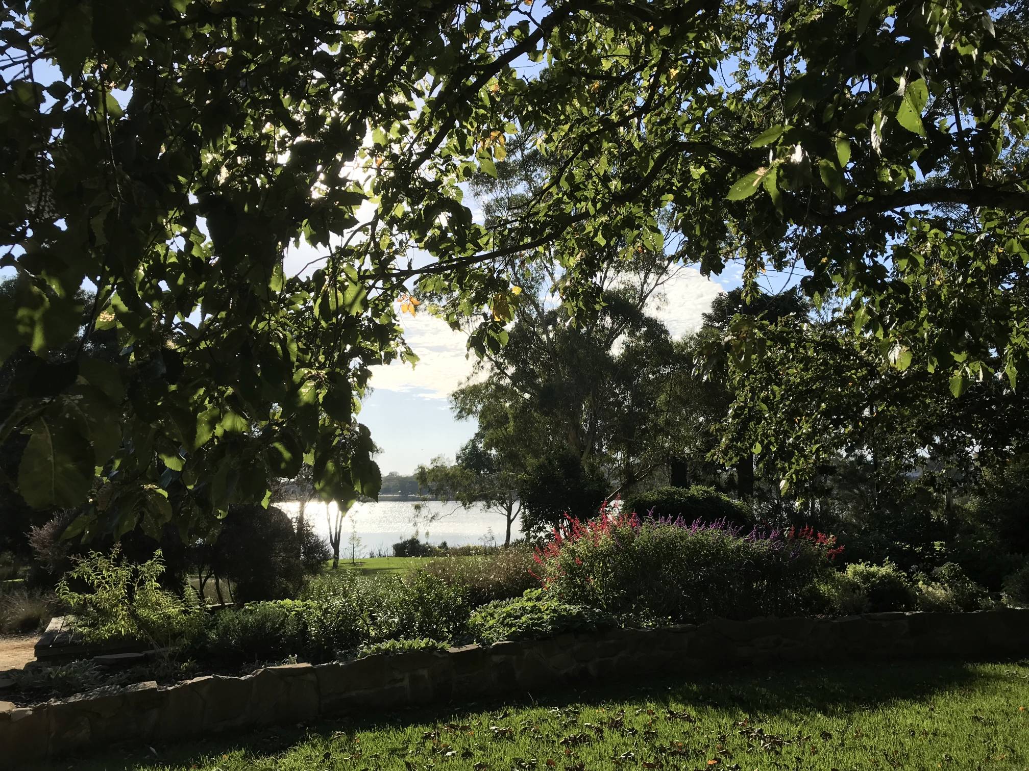
Our trip followed the exceptionally dry winter of 2018, the very hot and dry summer of 2018/19, and an exceptionally dry first three months of 2019, yet the Pinaroo wetlands were full of water. They are probably kept topped-up with treated waste water. I do volunteer work at Clare's Gleeson Wetlands where the water levels were getting very low at the same time. Photo 2019/04/02 |
|
|
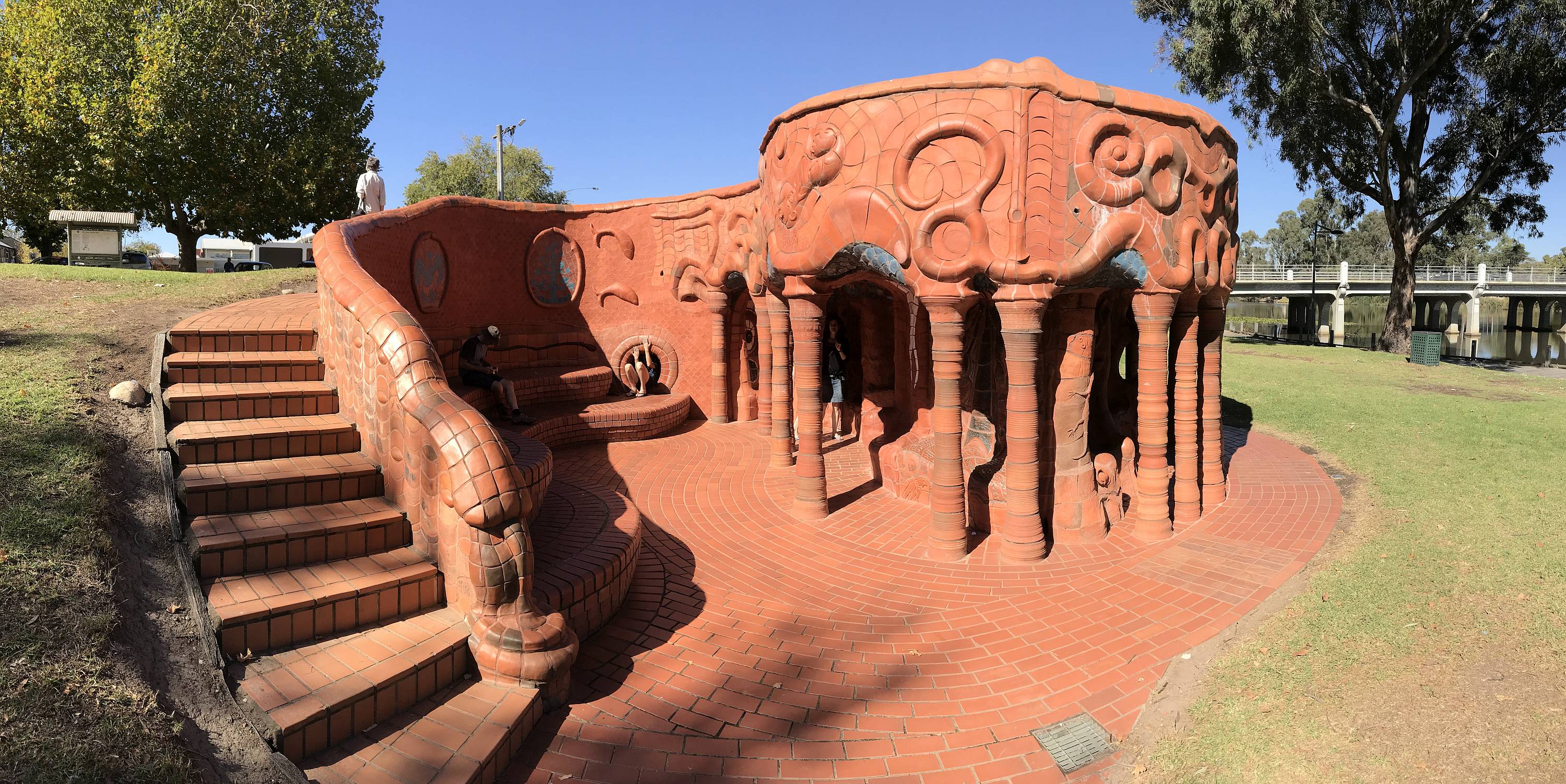
Murrayville is a very small town just east of the South Australian Victorian border.
It has an excellent camping ground for such a small town, the best lawned sites we came across on the whole trip; we stayed there on the first and last nights of our holiday.
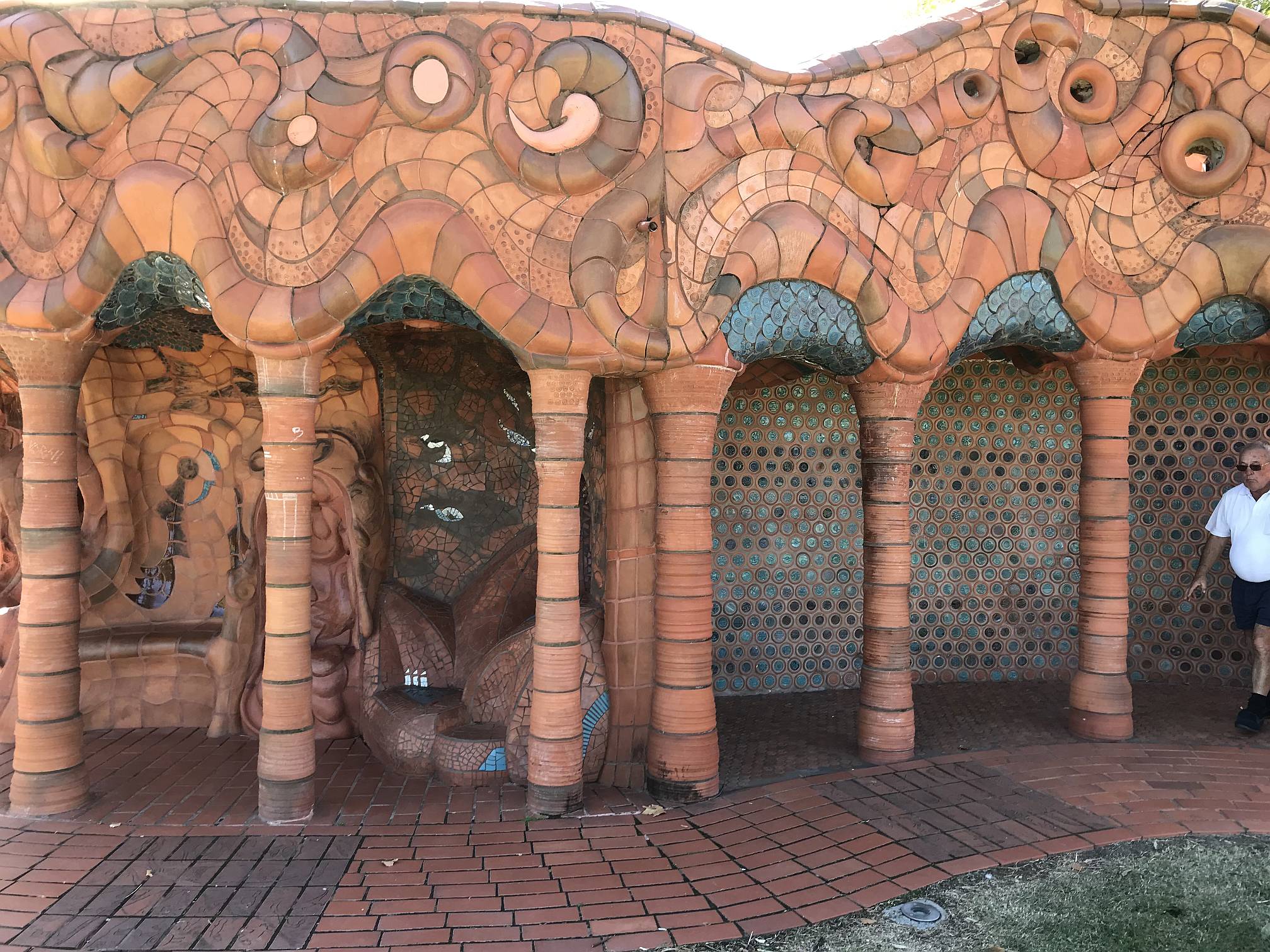
There is a supermarket, a fuel station, and notably, this beautifully decorated toilet block. Photo 2019/04/03 |
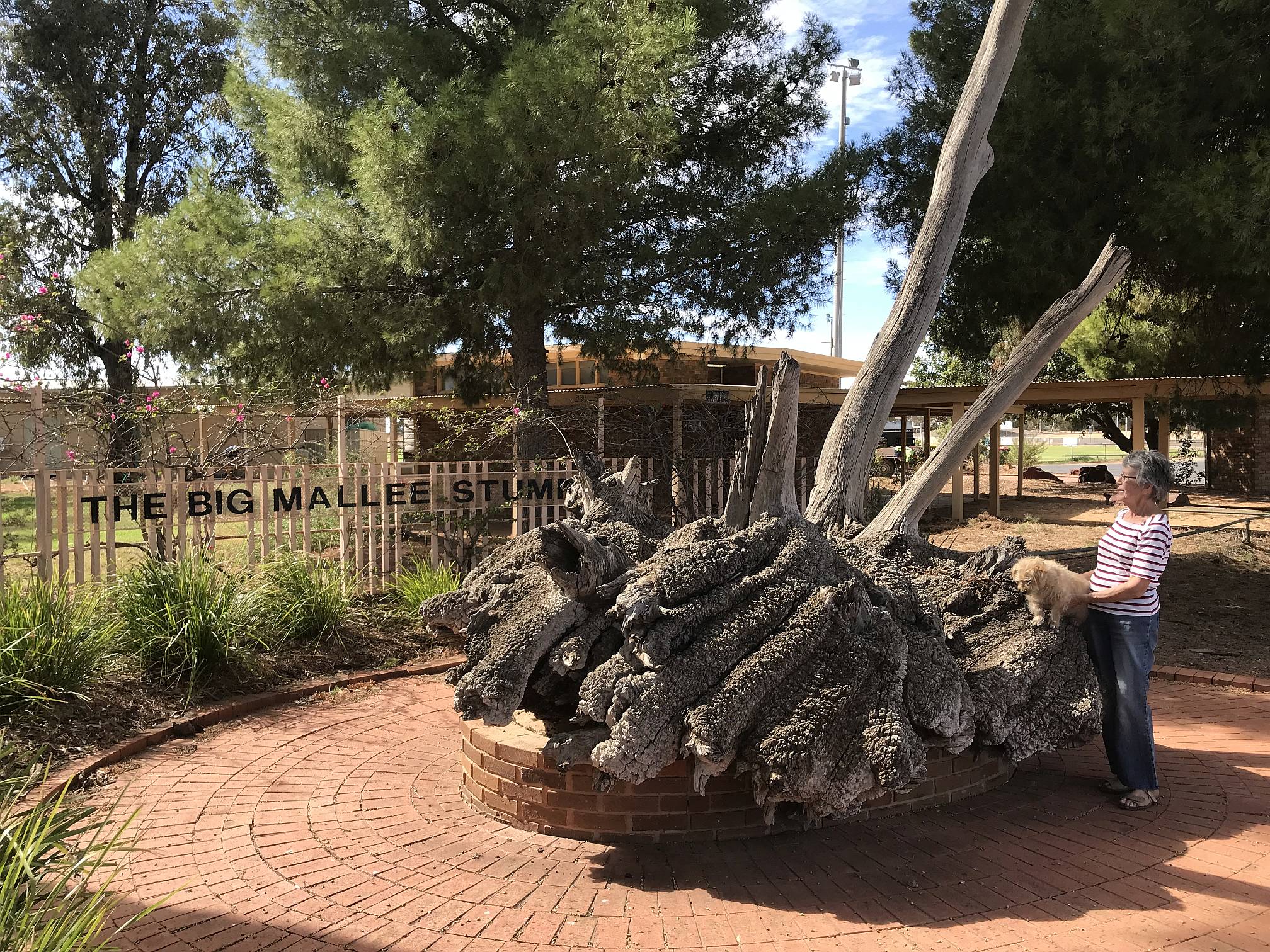
It is certainly far, far bigger than any I had ever seen before.
Photo 2019/04/03 |
Swan Hill areaSwan Hill is a major town on the Murray River, it has a history in paddle steamer commerce and more recently in the irrigation industry. |
|
|
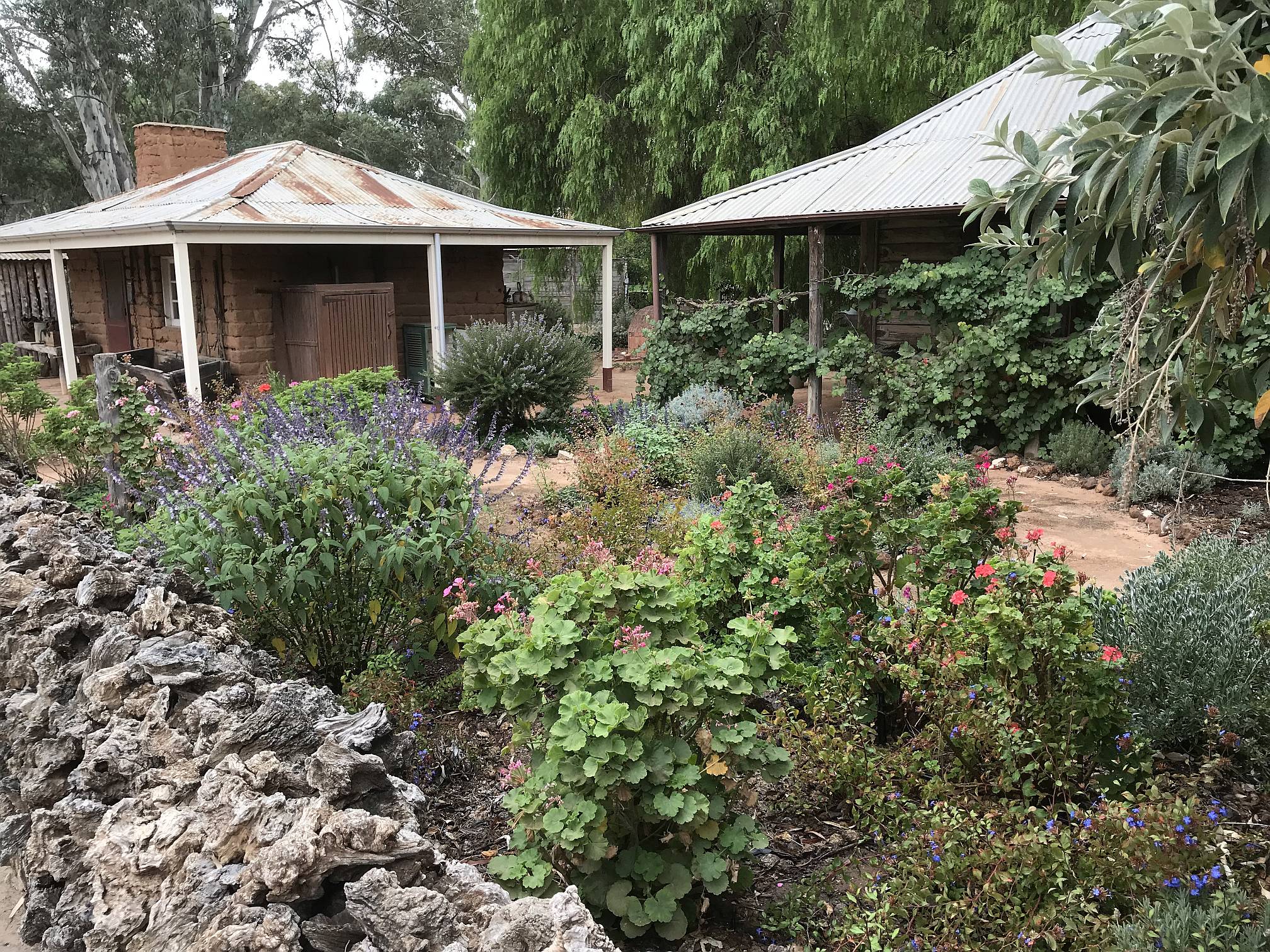
A visit to the Pioneer Settlement in Swan Hill is worthwhile.
These are two reconstructed cottages within the Settlement, on the left is one built of mud brick (mud brick is a good building material so long as you protect the walls from the rain) and on the right is one built of wooden beams. Note the innovative mallee stump fence in the foreground.
Photo 2019/04/04 |
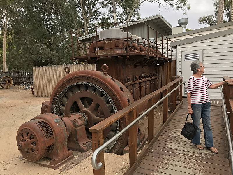
Also in the Swan Hill Pioneer Settlement was this town power supply generator.
The nameplate on this machine rated it at 450kW, about a tenth of the power of a single modern utility scale wind turbine.
Photo 2019/04/04 |
|
|
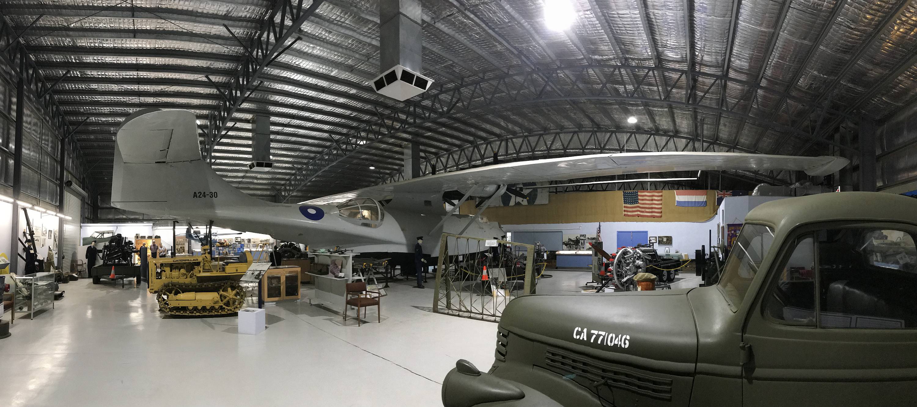
The restored Catalina A24-30 aircraft in the
Flying Boat Museum at Lake Boga, just south of Swan Hill.
Photo 2019/04/05
BendigoThere is a lot to see in Bendigo, the restored tourist tram which provides recorded information as it runs up and down the main street, the well stocked art gallery, a gold mine offering underground tours of various lengths from 90 minutes up, several attractive parks (one of which is home to a big population of fruit bats), the Chinese Joss House, the magnificent Sacred Heart (Catholic) Cathedral, the Golden Dragon Museum of Chinese/Australian culture, and, perhaps most impressive and interesting of all, the Buddhist Great Stupa of Universal Compassion.Bendigo was one of the main centres of gold mining during the gold rushes that started in the early 1850s, it also has a strong connection with Chinese culture due to the many Chinese gold miners who came to mine gold. Denece and I were surprised to see very few people of obvious Chinese decent; there are many more in other parts of Australia. |
|
|
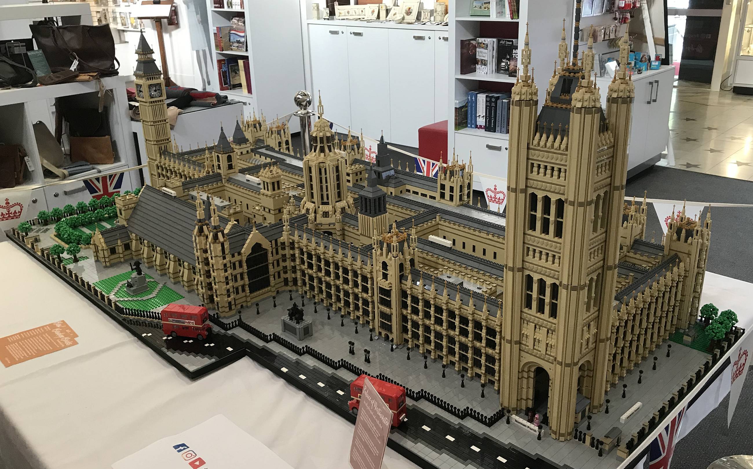
An amazingly detailed Lego model of the Palace of Westminster (otherwise known as the houses of parliament) in London.
This was in the Bendigo Tourist Information Centre. Photo 2019/04/05 |
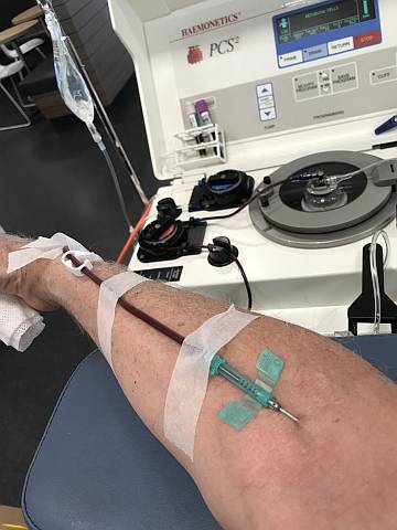
Donating plasma in Bendigo
Only 3% of Australians donate blood or blood products. Donating blood is easy, painless, and takes little time. You can donate whole blood every three months, plasma every two weeks. I donated at Bendigo again during this same holiday on our way home. If you can do some good, at very little trouble to yourself, why would you not? I have written elsewhere about compassion, contributing to your society and ethics. Another way that you can do some good anywhere you go is by picking up rubbish; there's no shortage of it on most roadsides and picnic areas. And all of us should be doing everything we can to try to minimise climate change if we have any care for those who will come after us.
Photo 2019/04/06
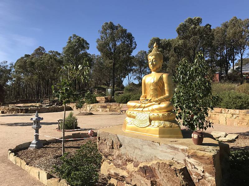
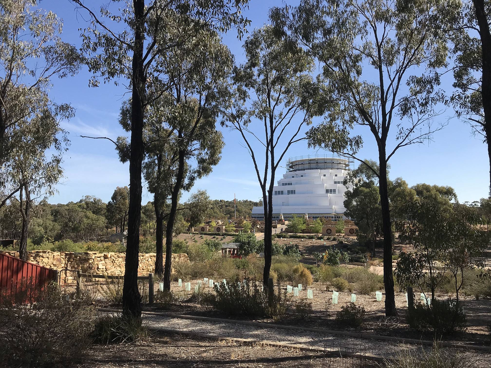
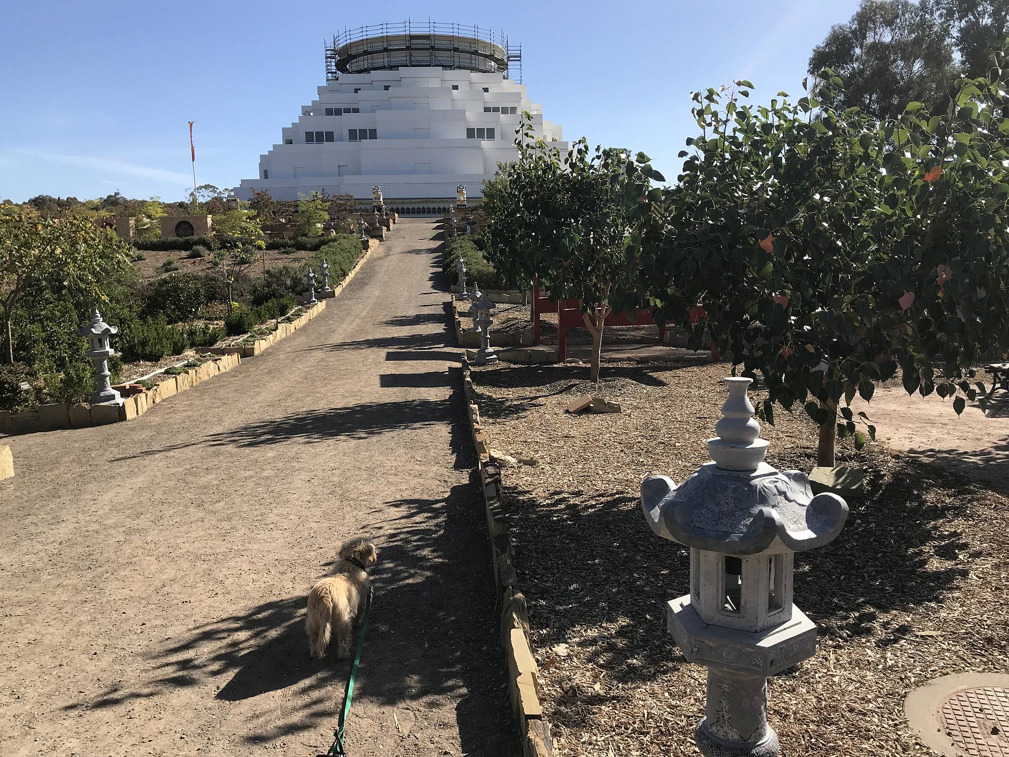
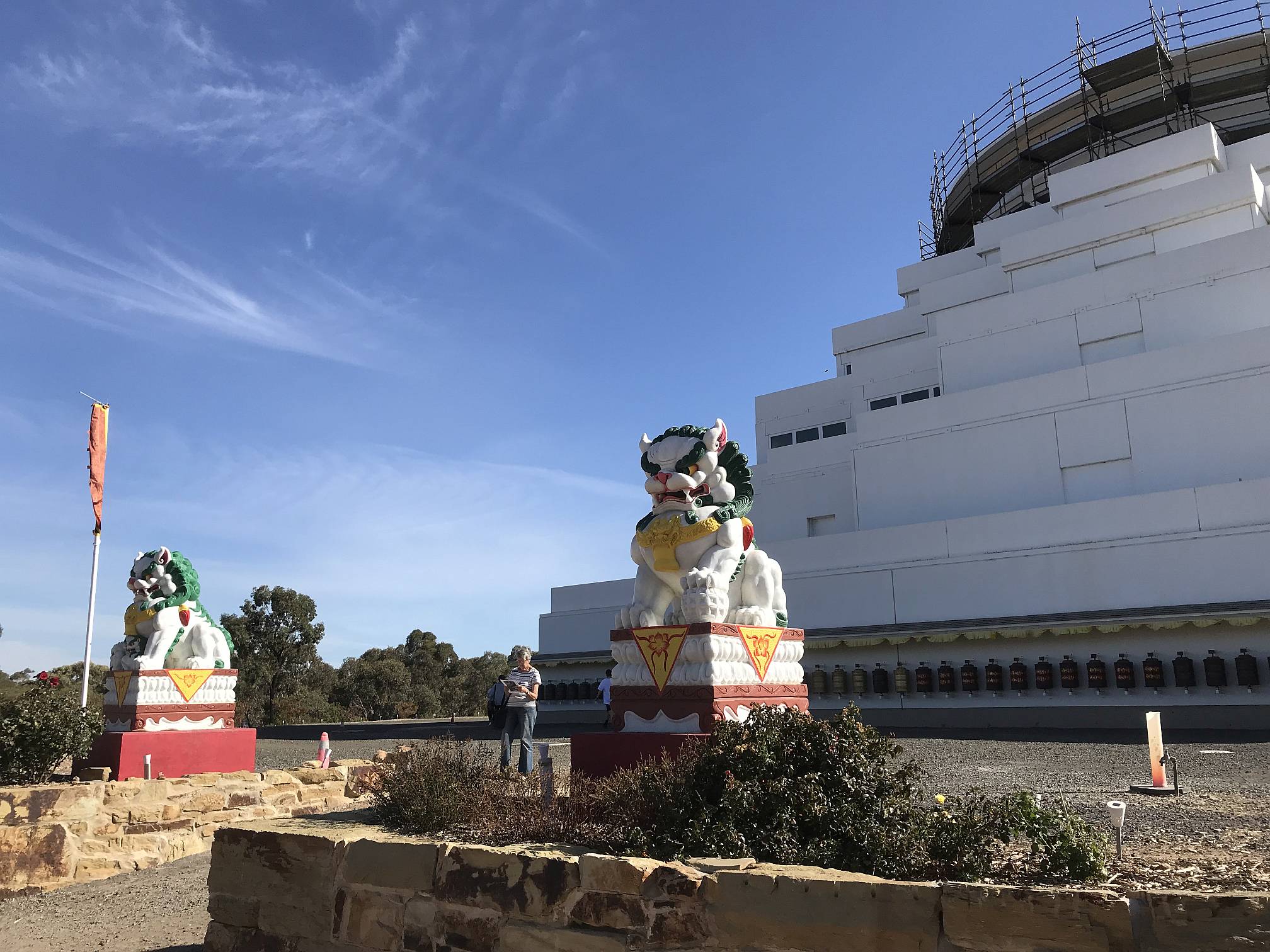
Great Stupa of Universal Compassion, Bendigo |
|
|
Denece and I were very impressed with this building and its grounds.
I think we were told that it has been under construction for 15 years, it is plainly nowhere near finished yet. (Buddhists don't seem to feel any need to rush things.)
It aims to cater to not only Buddhists but to people of all religions. Photo 2019/04/06 |
|
|
Another view of the gardens and the Stupa, our dog Socrates in the foreground.
Note the many (Japanese or Chinese?) stone lanterns.
Photo 2019/04/06 |
A golden Buddha in the grounds of the Great Stupa.
There were many stone lanterns like the one on the left of this photo. I had the impression that the Stupa was most strongly influenced by the Tibetan version of Buddhism, while these stone lanterns seemed to me of the Japanese style. Is the headdress of the Buddha of the Thai style? Photo 2019/04/06
|
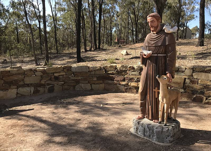
A statue of Saint Francis of Assisi in the grounds of the Great Stupa, Bendigo.
Of all the Catholic saints Francis of Assisi is the one I admire the most (the philosopher Bertrand Russell felt much the same way). Francis recognised the close links between all living things; a concept that should get much more acceptance and attention in the twenty-first century. We generally recognise that humans have rights, but we often neglect, or at least don't take a lot of care of animal rights. Photo 2019/04/06 |
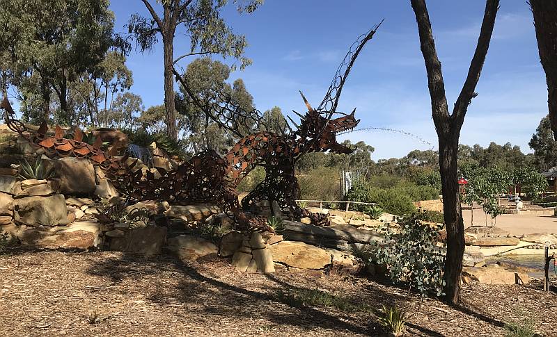
Also at the Great Stupa is this dragon; what its significance was to the Stupa or to Buddhism I have no idea, but it makes quite a nice spout for the fountain.
Photo 2019/04/06
|
|
|
Guardian dogs/lions in front of the Stupa.
Photo 2019/04/06 |
|
|
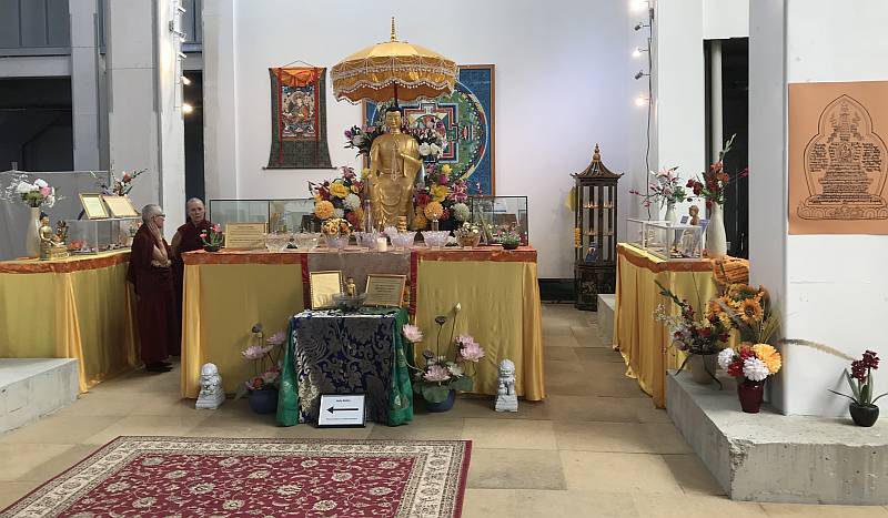
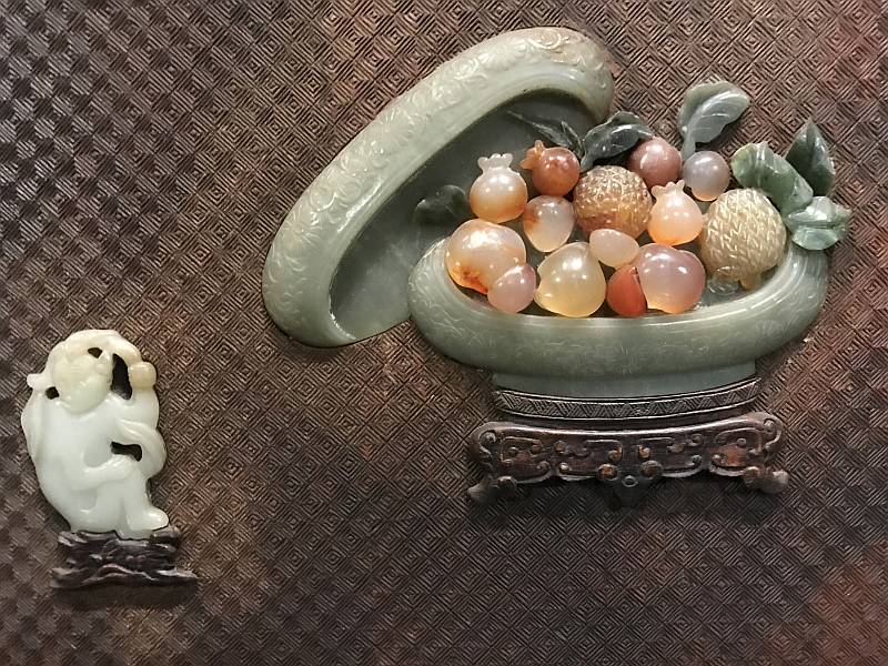
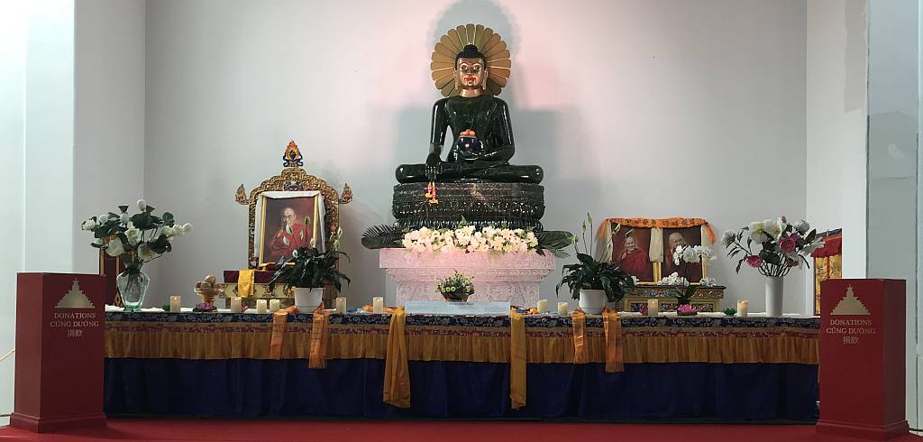
One of the treasures of the Bendigo Great Stupa is this
jade Buddha; claimed to be the biggest made of gem-quality jade in the world.
It is said to weigh about four tonnes and was cut from an 18 tonne jade boulder.
It is a form of true jade, the mineral nephrite (the other mineral that can justly be called jade is jadeite; serpentine, a mineral of similar colour and lustre but that is much softer, is often improperly called jade too). Photo 2019/04/06 |
Another part of the interior of the Stupa.
Note the chipped concrete slab on the right. There is still much work to be done; when finished a floor will be added at the level of the top of these concrete slabs. We were told that particularly strong concrete had been used so that the Stupa would last a thousand years. My wife and I were surprised to be told that we could take our dog into all the gardens and the parts of the stupa and the display area at the main entry that were open to the public.
Photo 2019/04/06 |
|
|
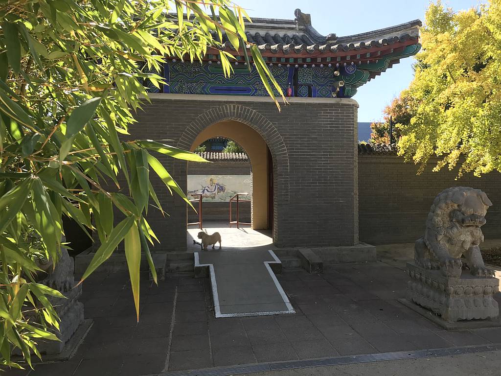
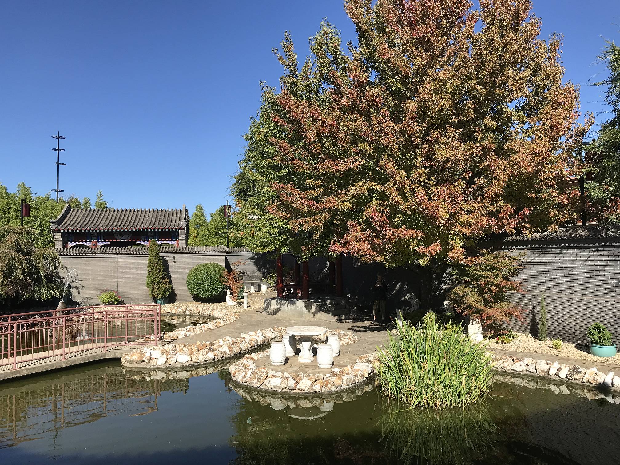
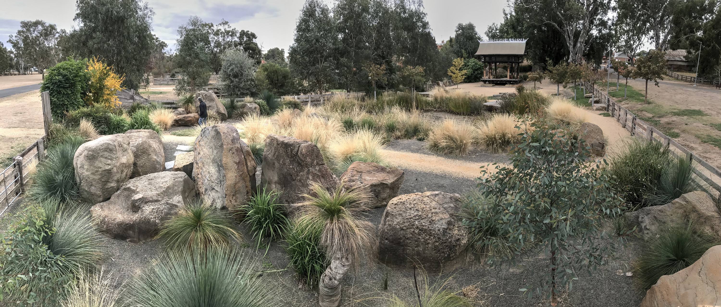
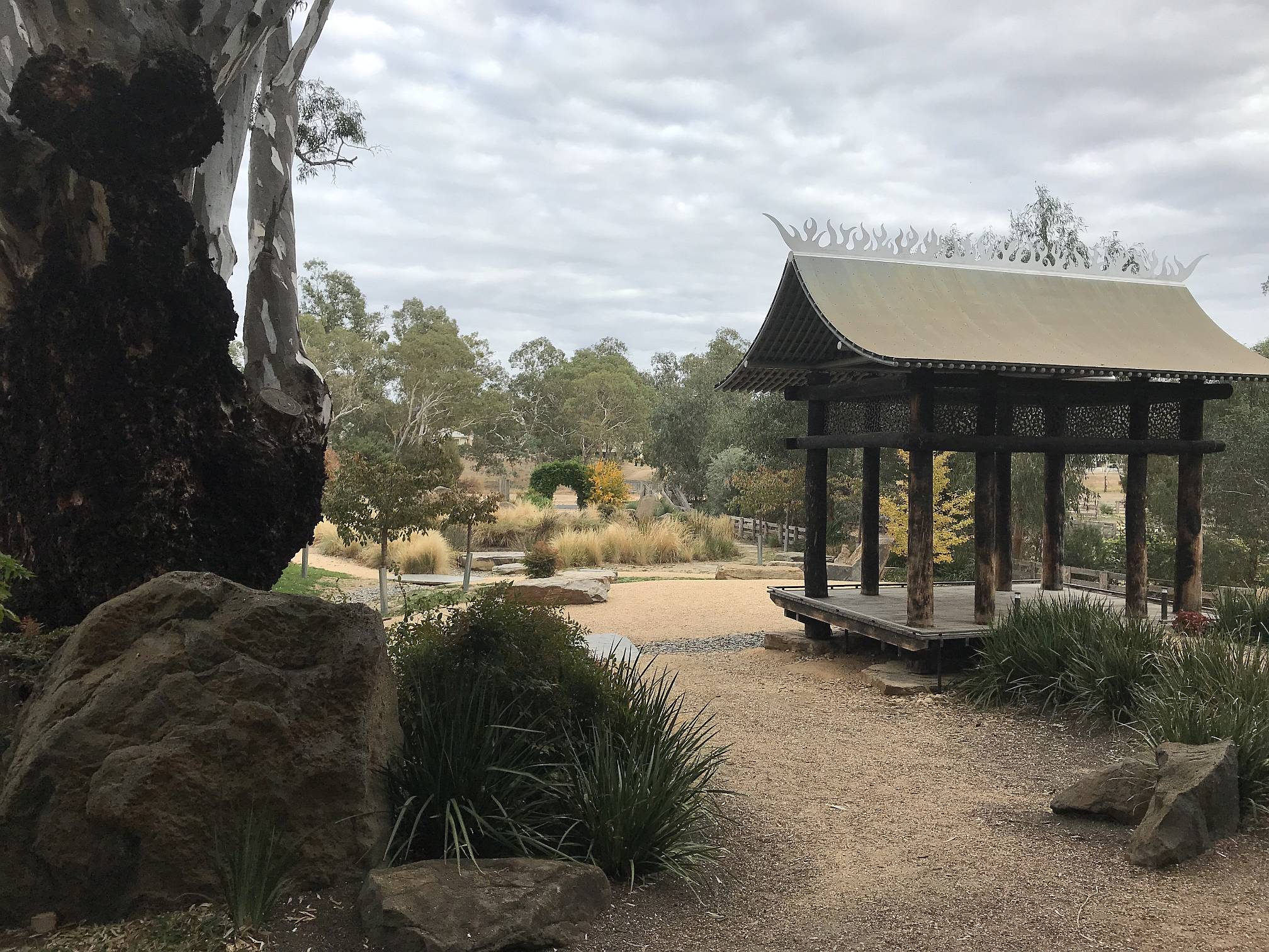
The entrance to the Chinese Garden.
Dogs are allowed; there are so many places in Australia where dogs are not allowed!
Photo 2019/04/07 |
|
|
|
|
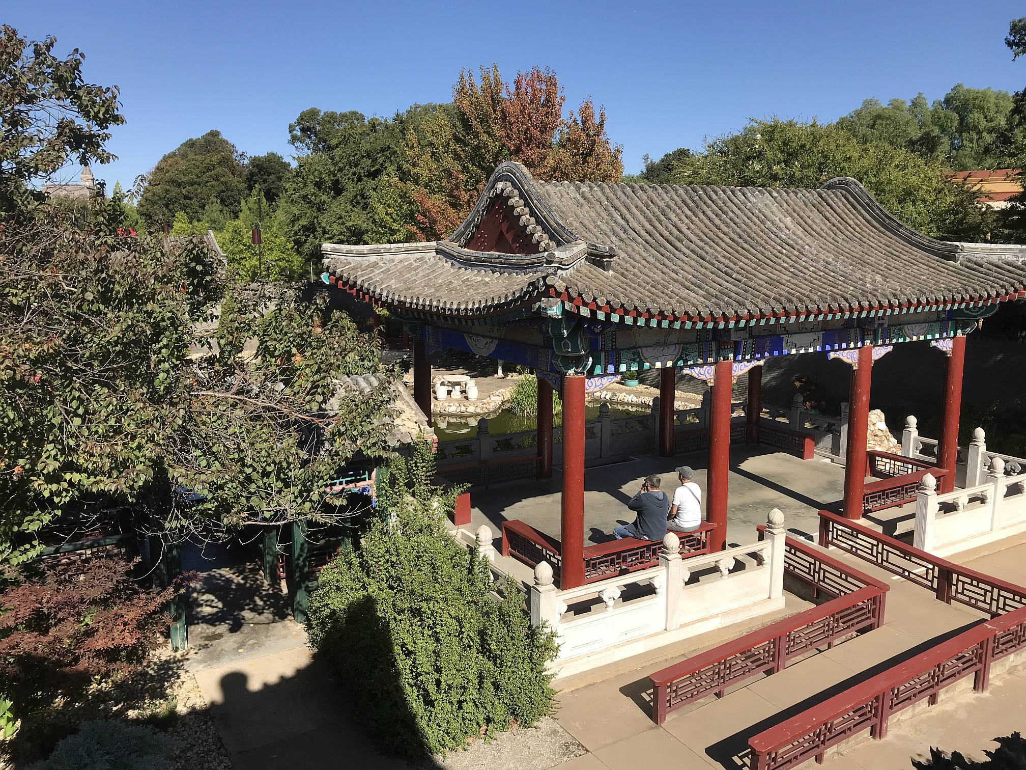
The Chinese Garden is adjacent the
Golden Dragon Museum.
It is well worth a visit if you are at all interested in oriental gardens, or just in gardens.
Photo 2019/04/07 |
|
|
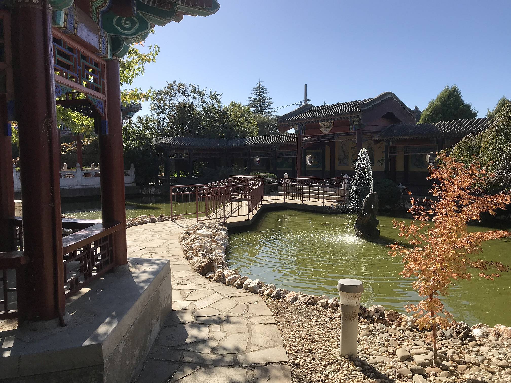
Another view of the Bendigo Chinese Garden
Photo 2019/04/07 |
|
|
|
|
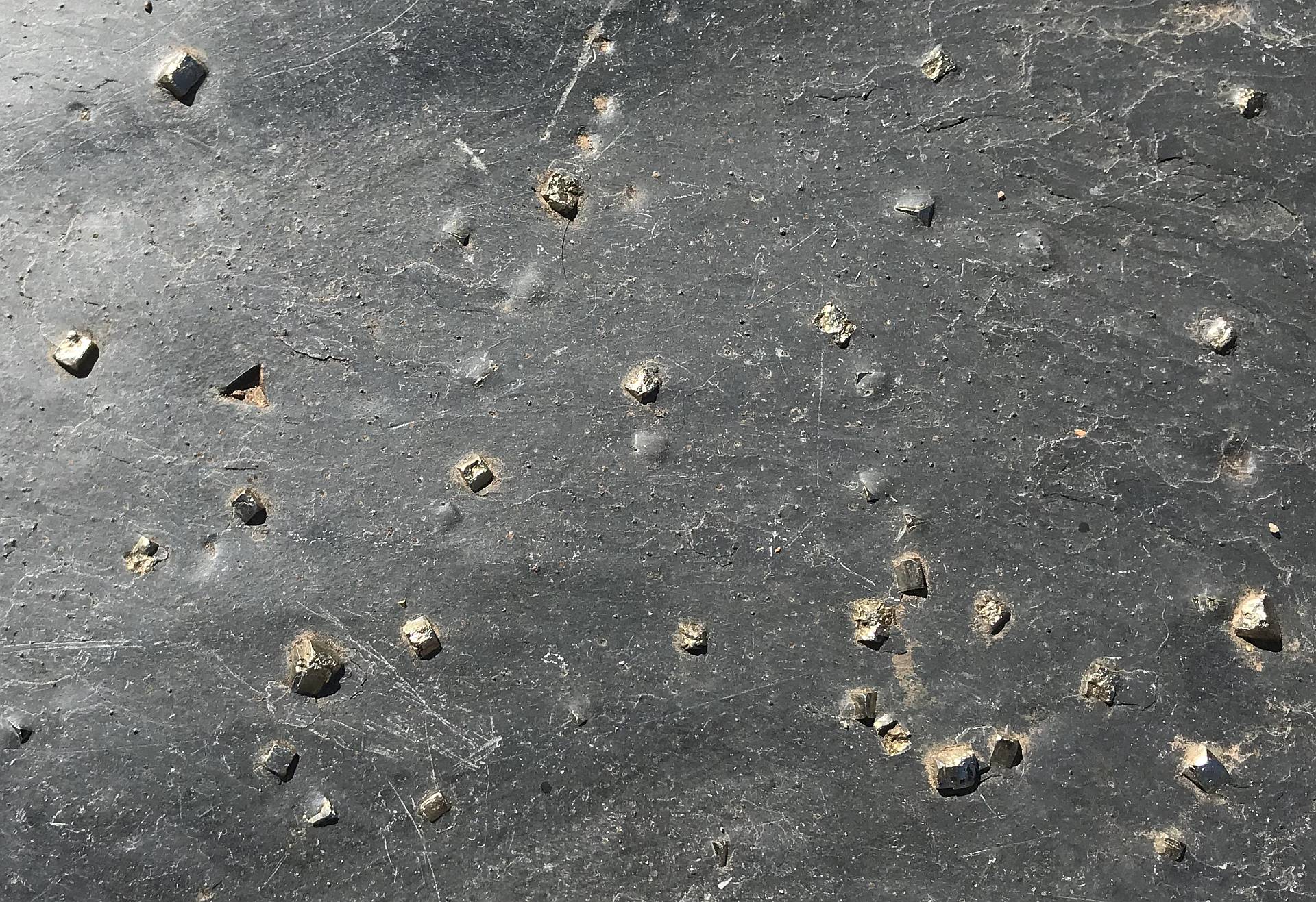
An interesting paving slab in the area of the Chinese Garden.
It contains cubic crystals of pyrite (iron sulphide).
Photo 2019/04/07 |
|
|
Looking over the Chinese Garden from the elevated view-point that is strategically placed in one corner.
Photo 2019/04/07 |
|
|
This is a very impressive museum containing many items that a state capital museum would be very pleased to have in its collection.
A must-see for any visitor to Bendigo.
Is is adjacent to the Chinese Garden. |
|
|
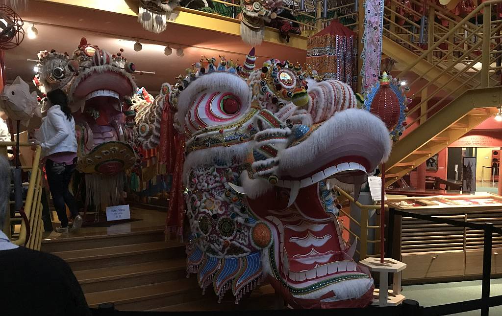
This new dragon, Dai Gum Loong (loong is apparently Chinese for dragon), was installed the day before our visit; there was quite a celebration.
The dragon is the star of the Chinese New Year celebration held annually in Bendigo. Photo 2019/04/07 |
|
|
|
|
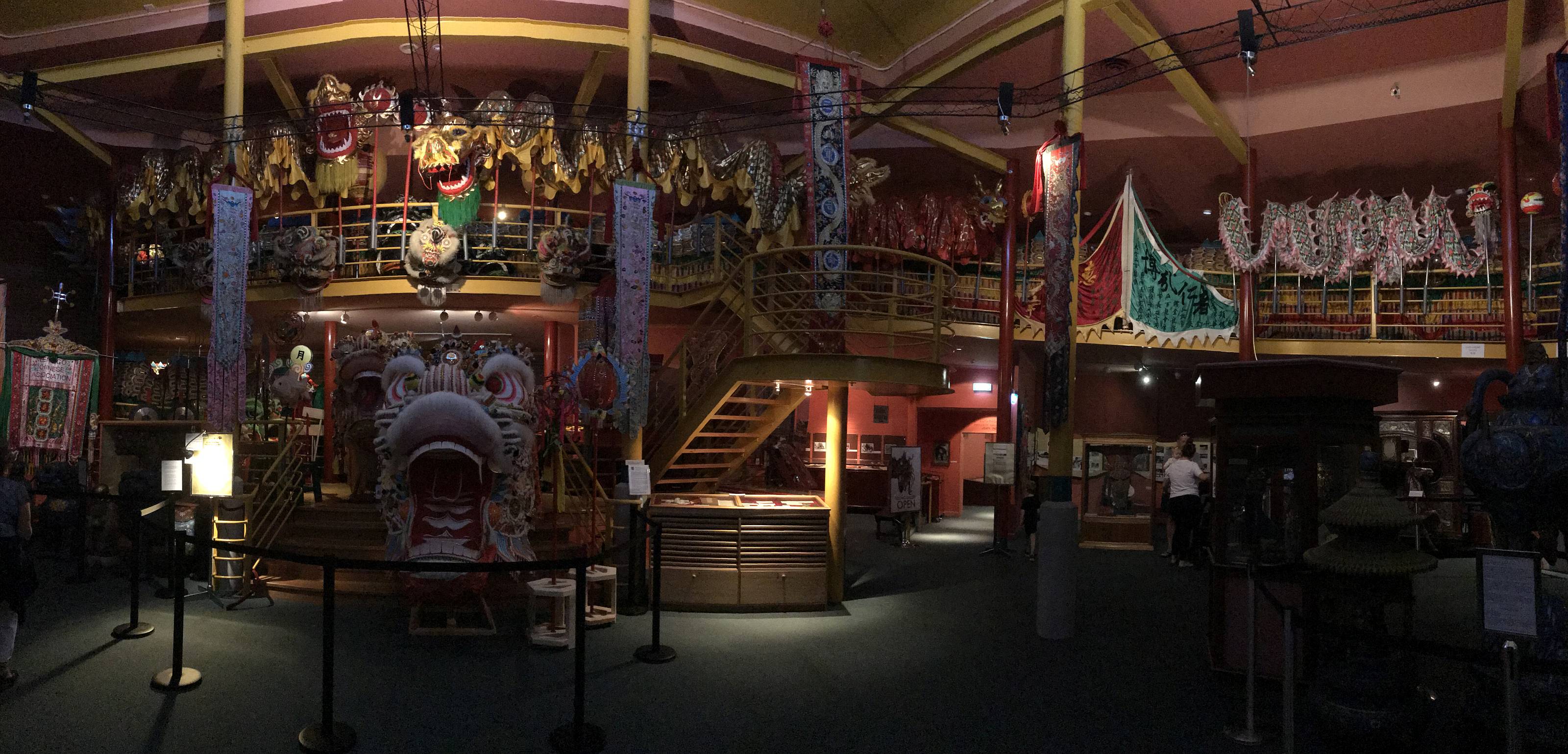
A panorama of the museum.
The body of Dai Gum Loong is displayed along the upper level.
Photo 2019/04/07 |
|
|
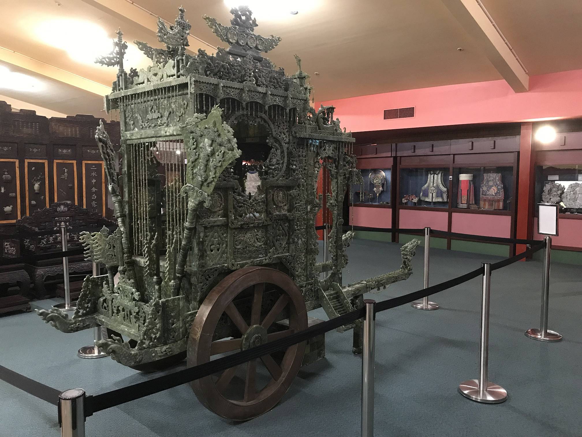
Dragon Chariot of ten thousand sages carved of 'serpentine jade'.
An information board states:
"Carved with Chinese symbols comprising of 188 dragons (auspicious), 18 phoenixes (wish-fulfilled) and 36 bats (good fortune). There are also 155 strands of beads. This is quite an amazing work of art that would probably have taken thousands of hours of work by skilled craftsmen. Photo 2019/04/07 |
|
|
|
|
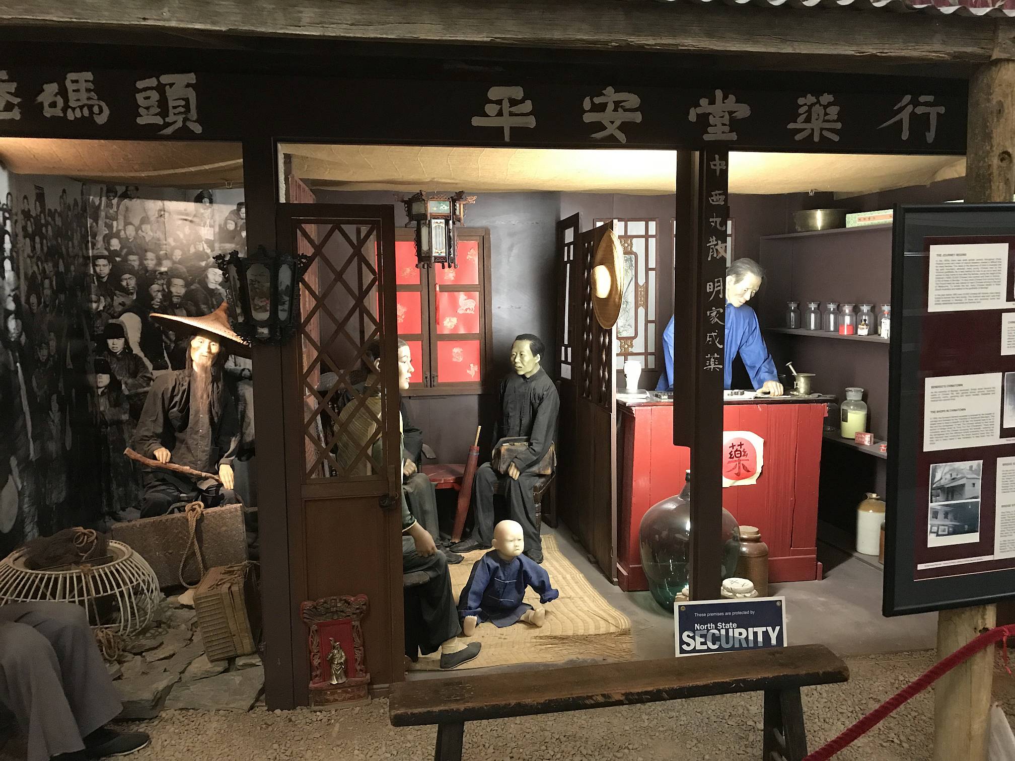
Reconstructions of Chinese businesses as they might have been in early Bendigo.
In the Golden Dragon Museum.
Photo 2019/04/07 |
|
|
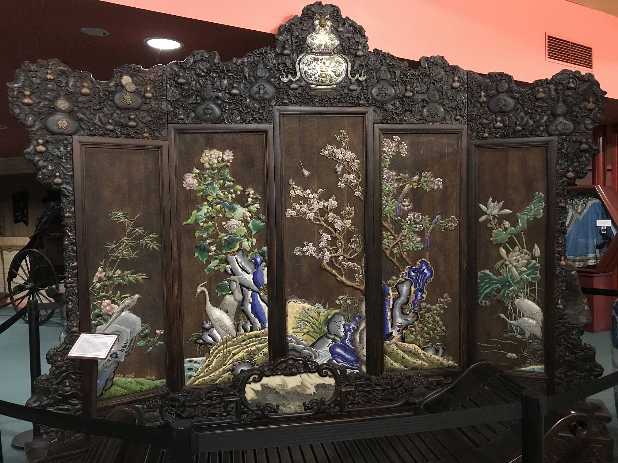
A screen with (apparently) jade and other stone carvings as decorations.
Photo 2019/04/07 |
|
|
|
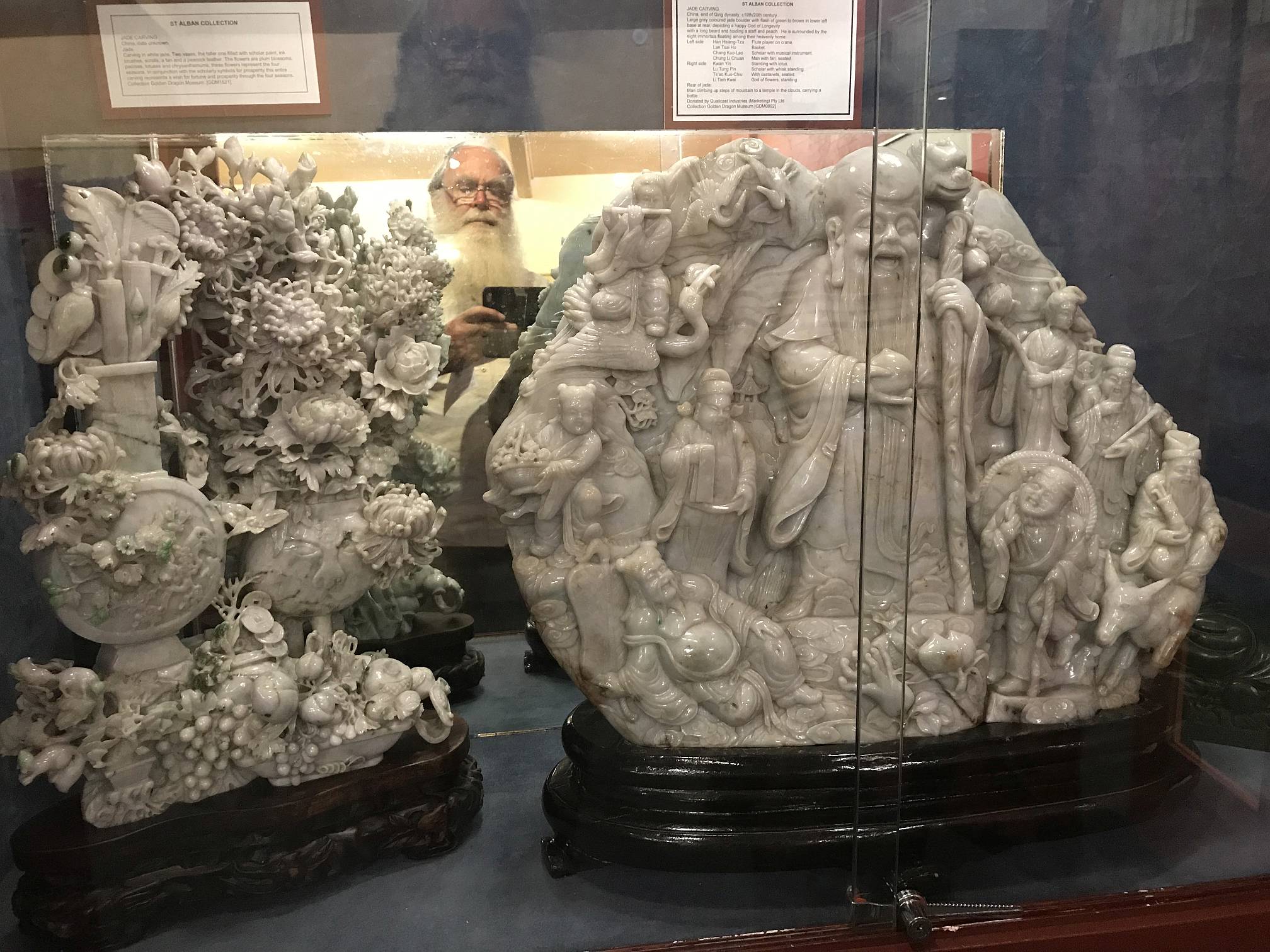
Two beautiful and intricate jade carvings (and my reflection) in the museum.
Photo 2019/04/07 |
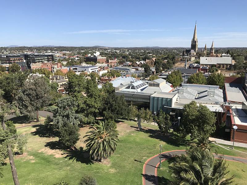
A view from the top of a poppet-head that was moved to the highest point in central Bendigo and converted to a public lookout.
The big church is the Sacred Heart Cathedral (Catholic). In the right foreground is the art gallery. Photo 2019/04/07
|
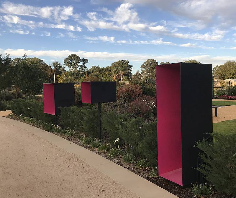
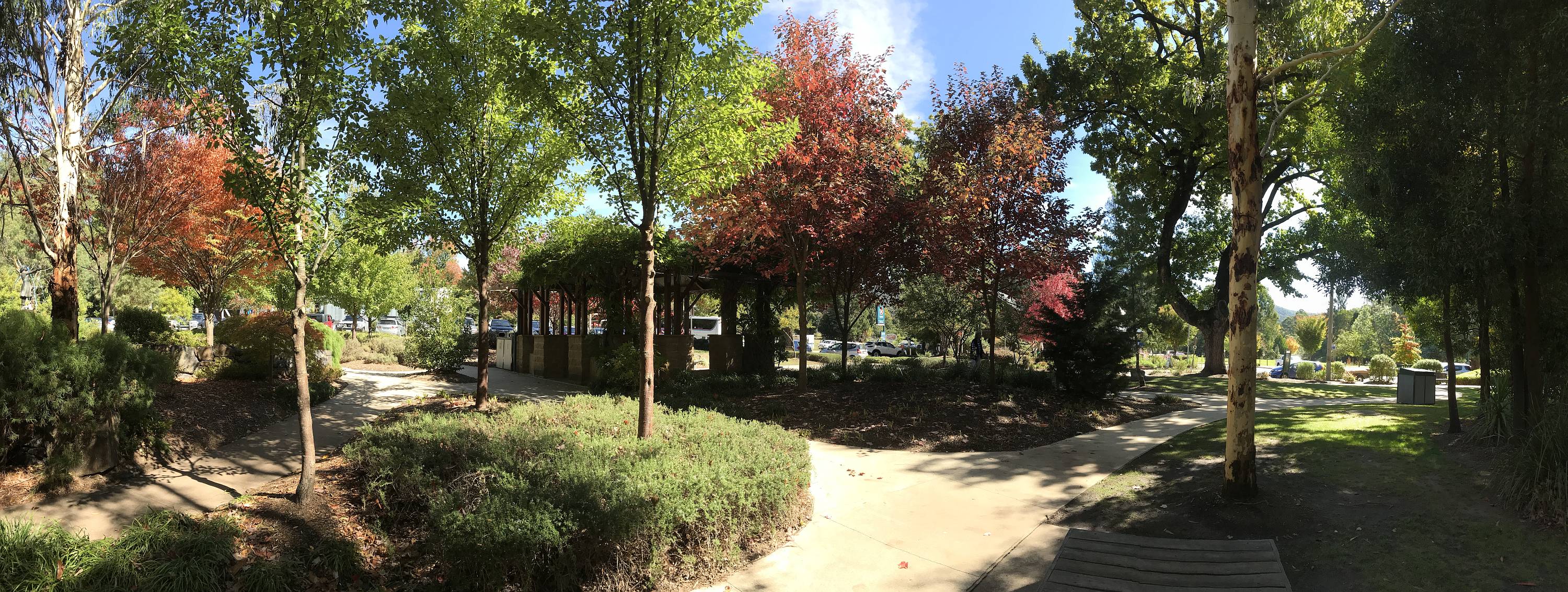
The Bendigo Botanic Garden is attractive and we enjoyed our visit.
This nearby 'Garden of the Future' was still under development. It included about 40 'boxes' such as those in the photo, all painted the same colours; my wife and I thought they added nothing of value to the garden, in fact they detracted from it. Still, "beauty is in the eye of the beholder". Photo 2019/04/07
|
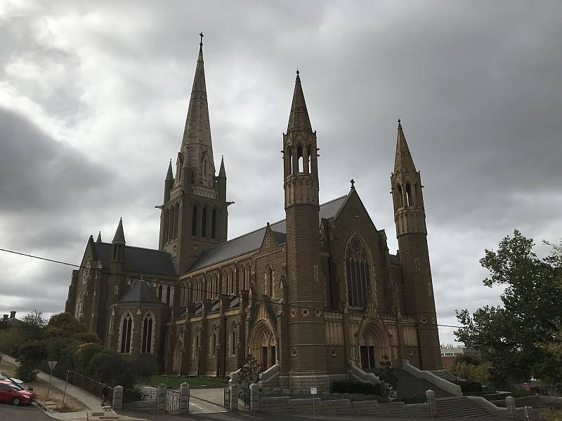
This beautiful and impressive piece of architecture is near the centre of Bendigo.
A huge amount of human time and effort has been wasted on religion, and a great deal of harm has been done in the name of religion, but some lovely buildings have been built for the same delusion. Photo 2019/04/08
|
|
|
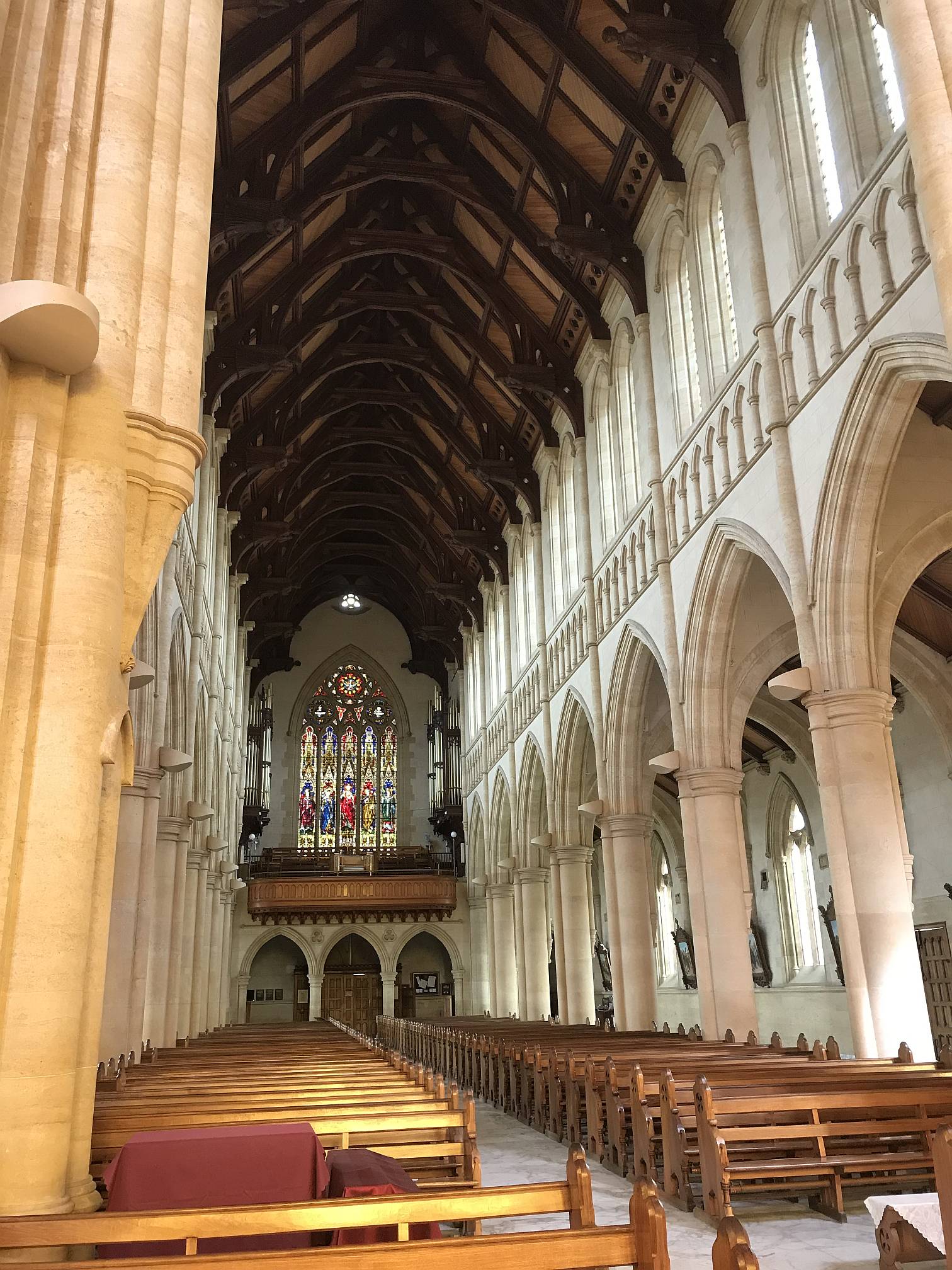
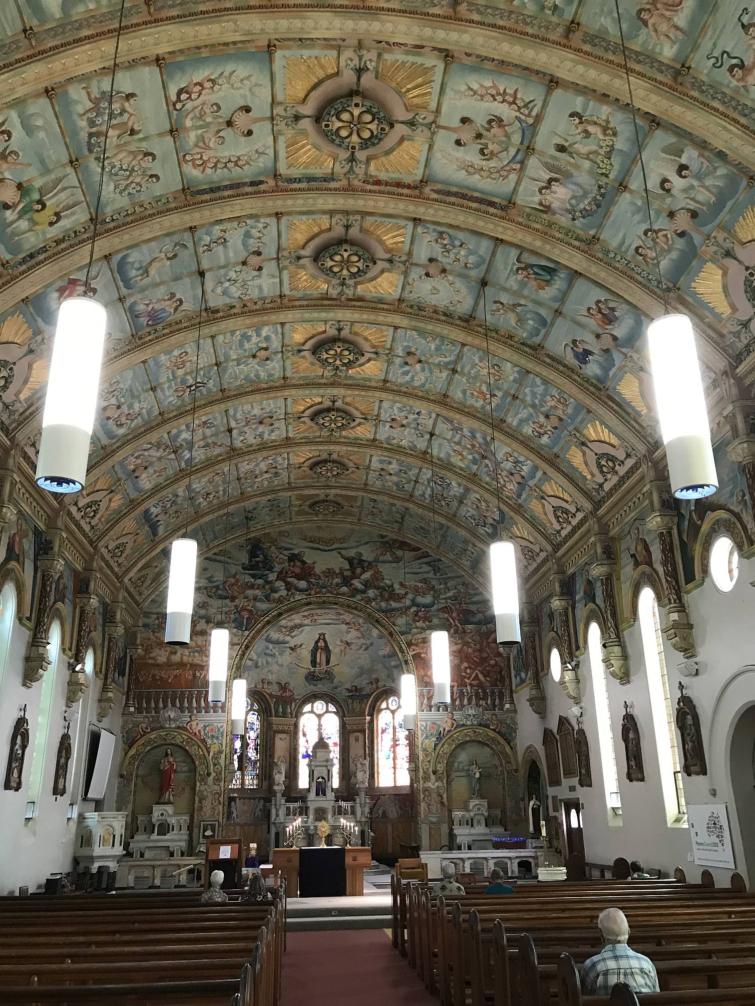
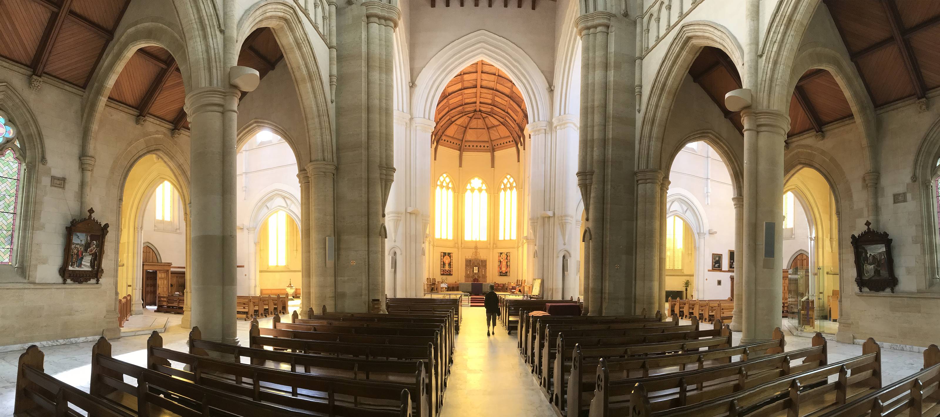
A panorama of the interior of the Sacred Heart Cathedral
Photo 2019/04/08 |
|
|
|
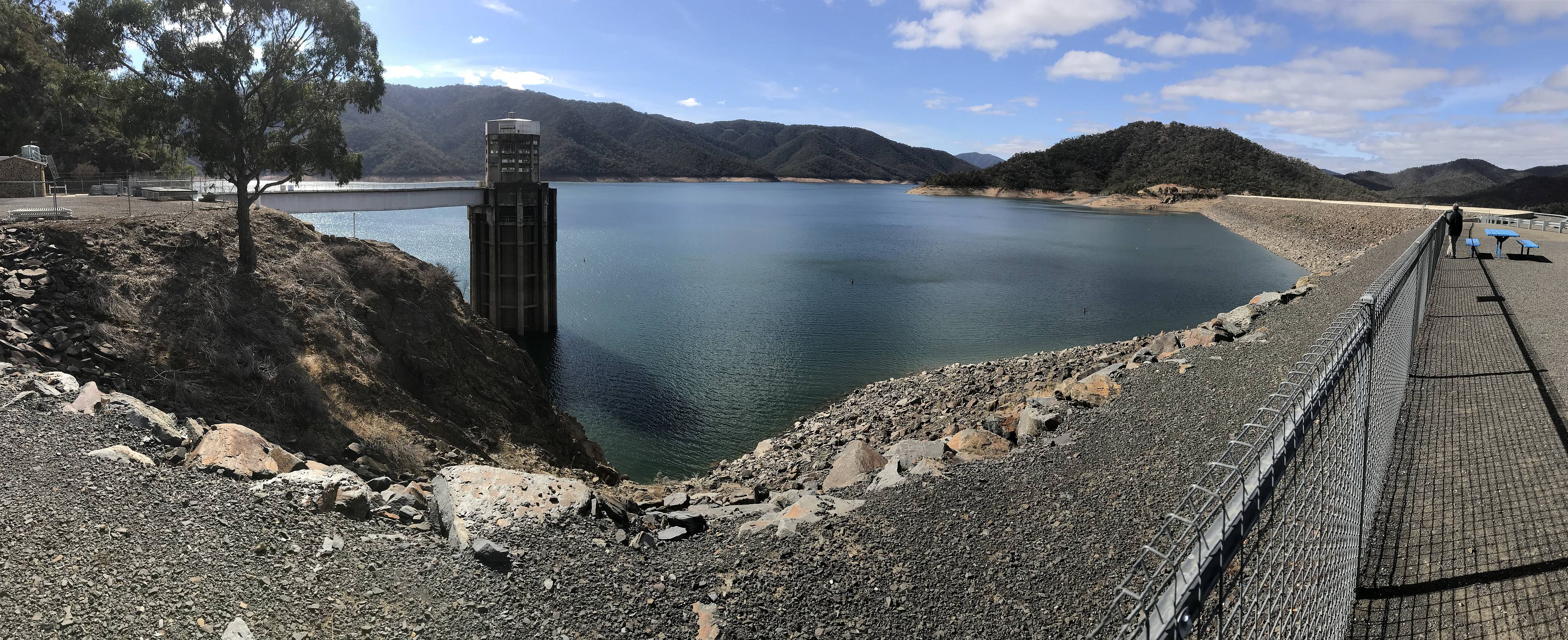
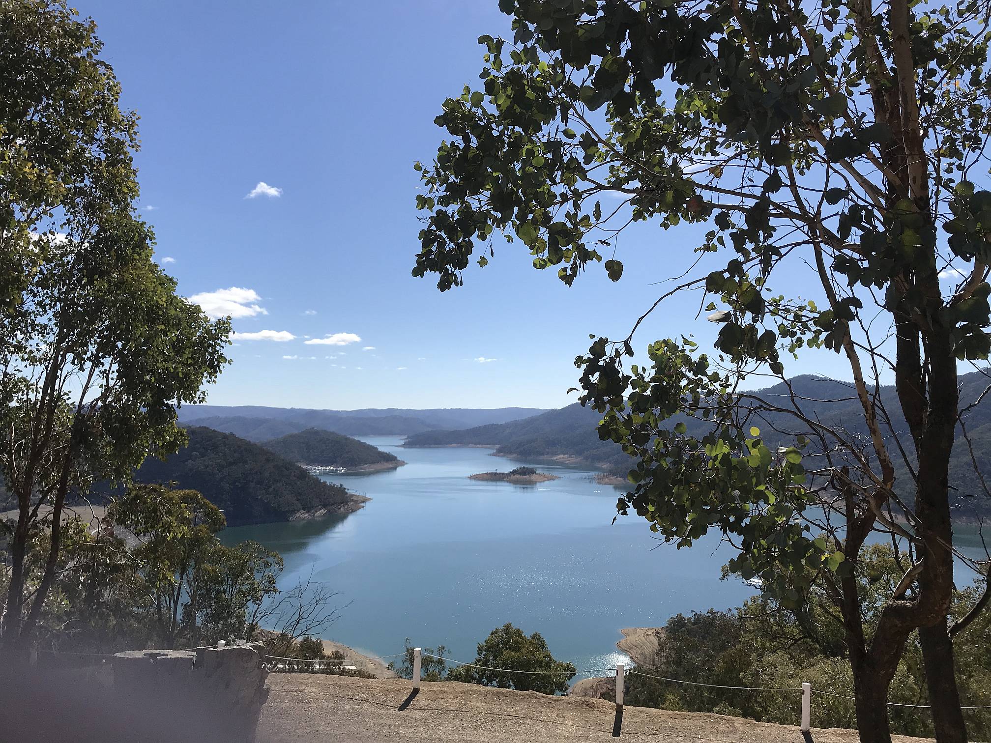
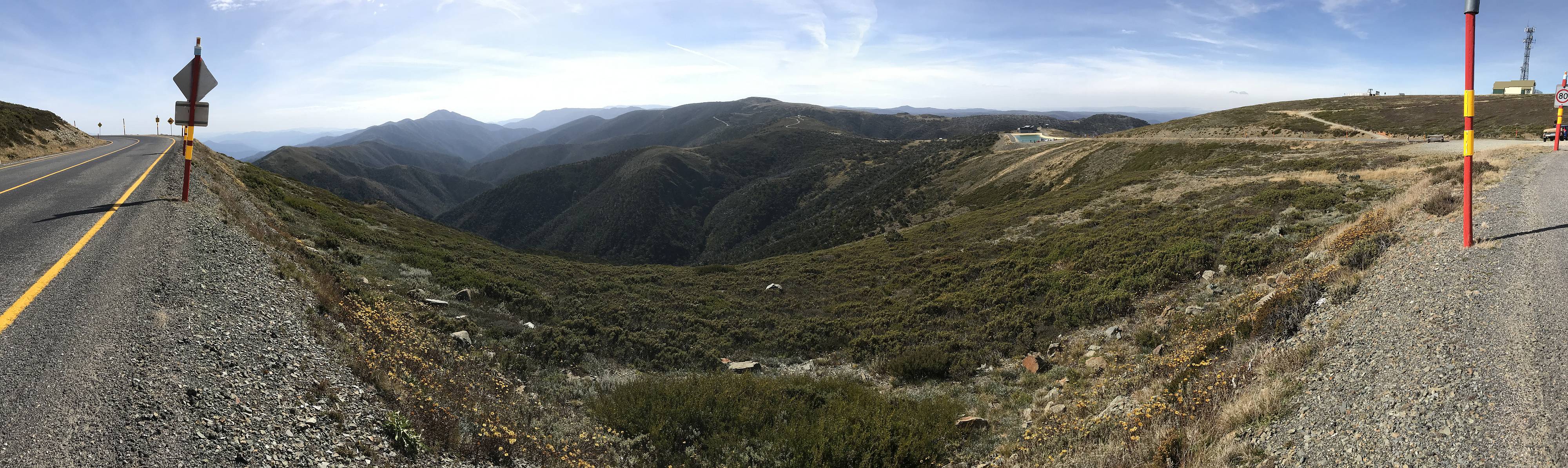
Eildon is one of Melbourne's main water supply reservoirs; at the time of our visit the water level was fairly low, around 37% of full capacity.
Photo 2019/04/10 |
|
|
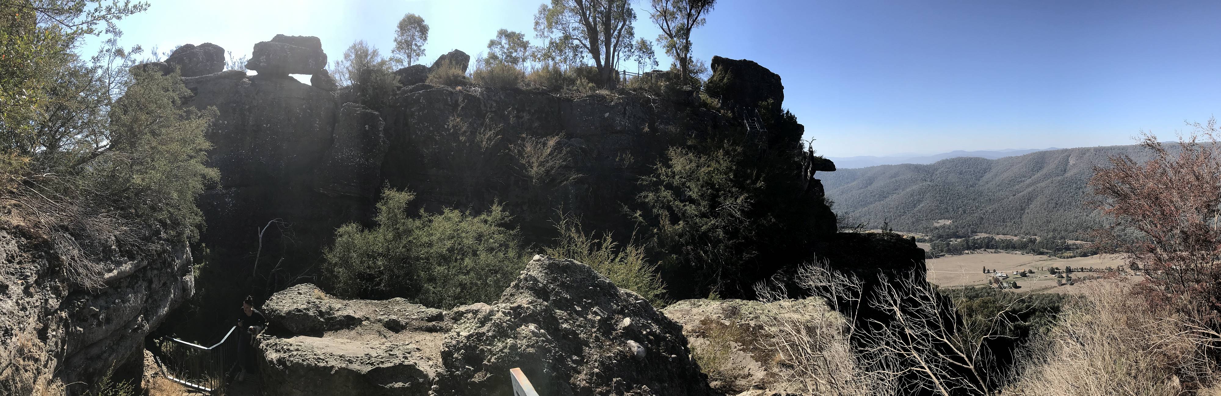
Eildon Reservoir from Mount Pinninger Lookout.
It was peaceful to just sit and admire the view, especially when the bloke with the jet-ski stopped. Photo 2019/04/10 |
|
|
|
|
On our way from Eildon to the
Latrobe Valley we took a short detour to Marysville to see the autumn foliage, which we had read is outstanding if you get there at the right time of year.
As it happened, we were probably a little early for the autumn foliage, but serendipitously, while we had a coffee break we happened to notice a sign to Bruno's Sculpture Garden; more on that below. Photo 2019/04/11 |
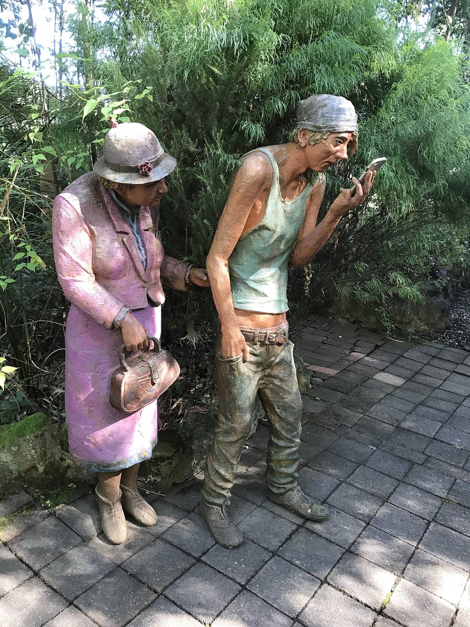
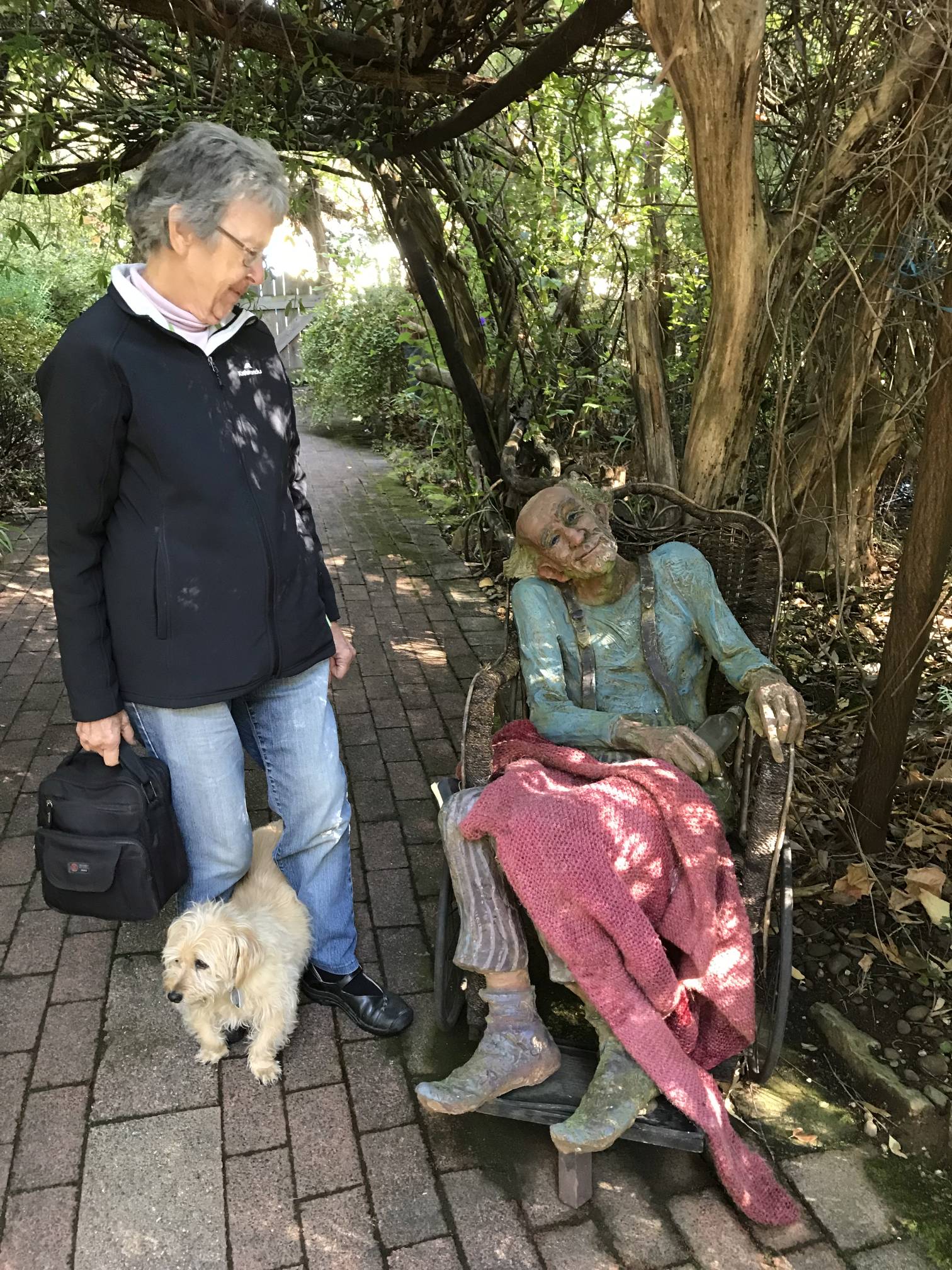
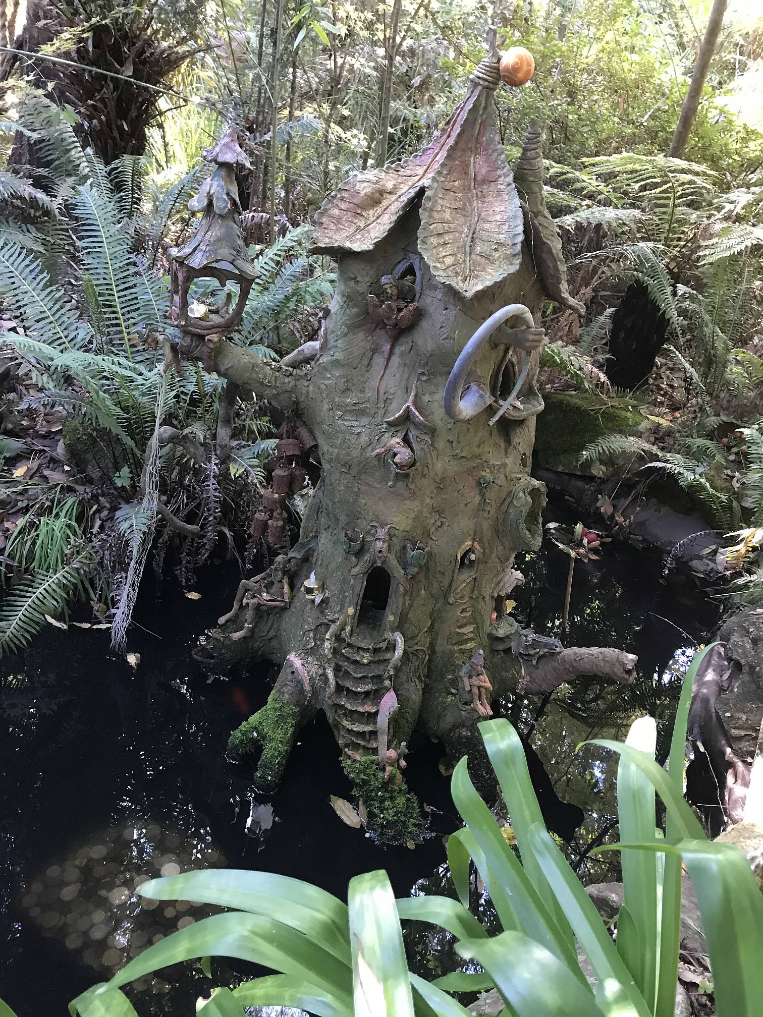
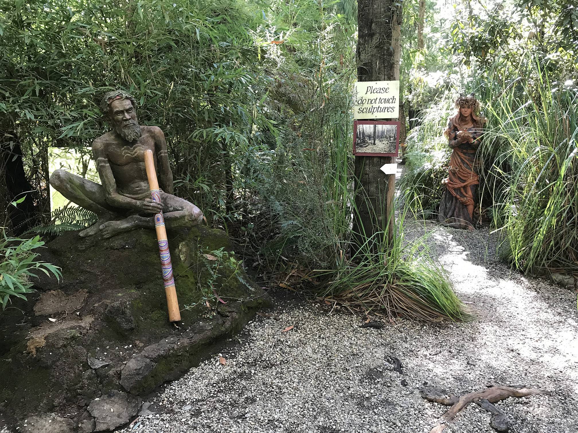
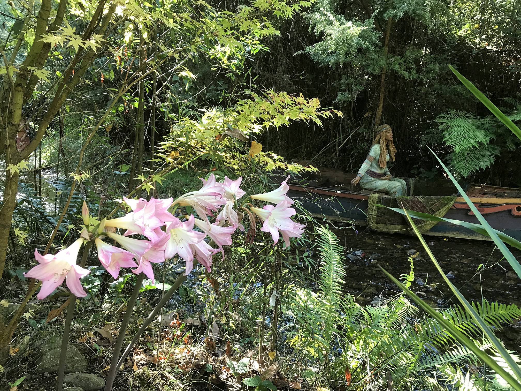
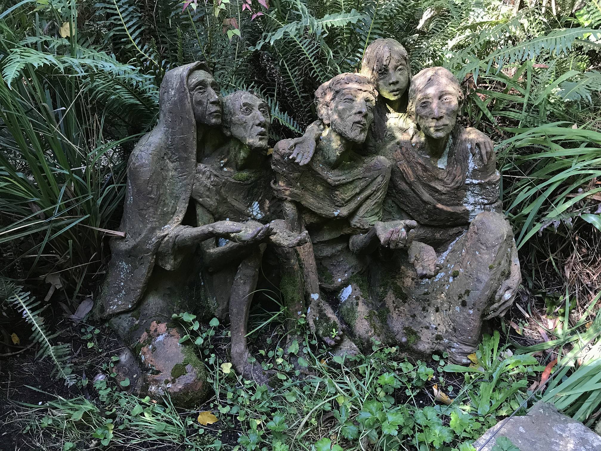
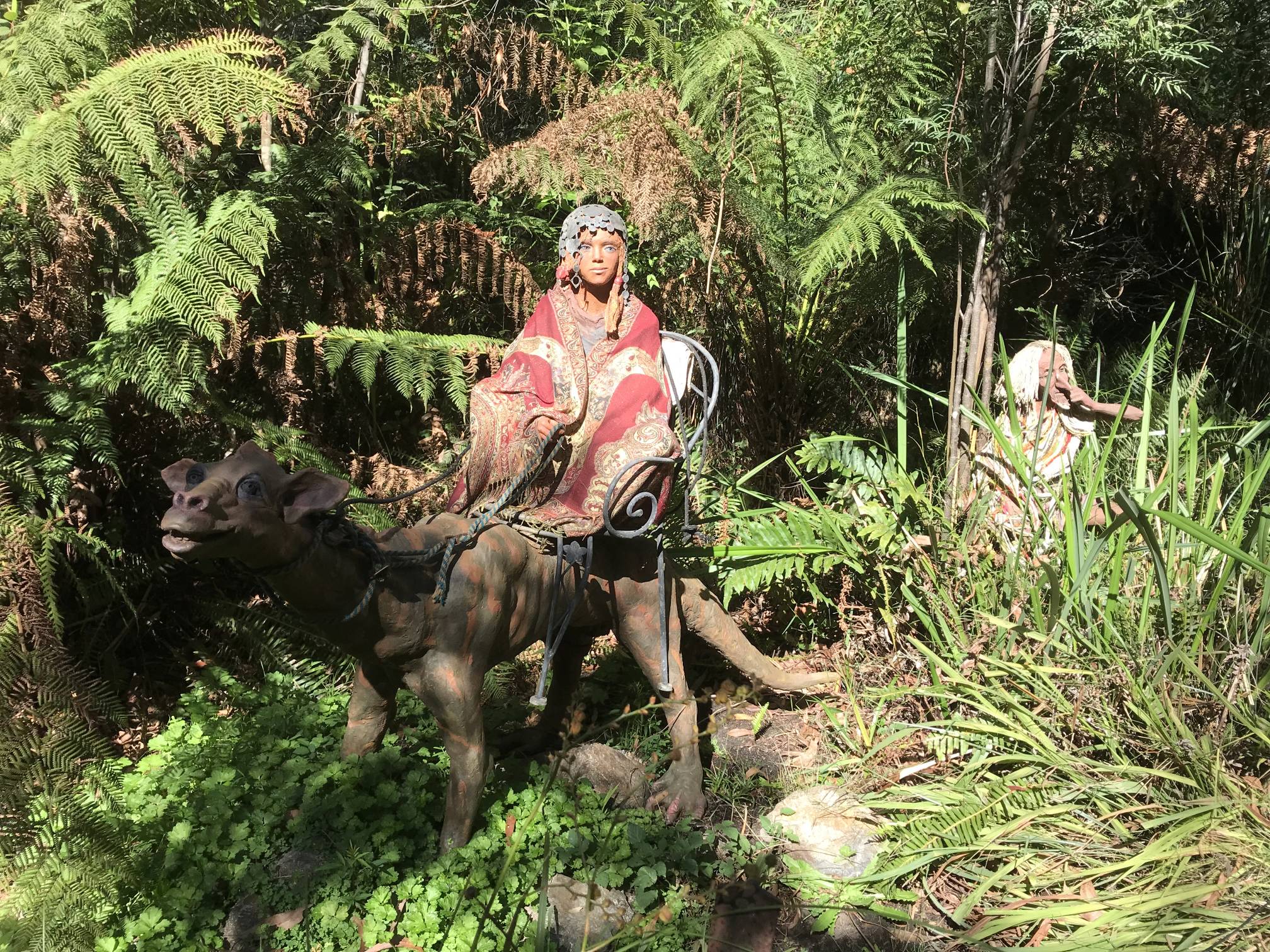
Bruno's Sculpture Garden turned out to be one of the highlights of the whole trip; it was truly outstanding.
The figures are formed in clay and fired in Bruno's on-site kiln. If you ever go within a hundred kilometres of Marysville and you have any appreciation for art you shouldn't miss Bruno's wonderfully imaginative, creative, and highly skilled creation. Bruno has had a DVD made of the story of the park, and his life leading up to the creation of the park. It's worth getting a copy. Photo 2019/04/11
|
|
|
Many of the sculptures were based on cultures of south east or south west Asia, many were fantasy-based, this one based closer to home.
Photo 2019/04/11 |
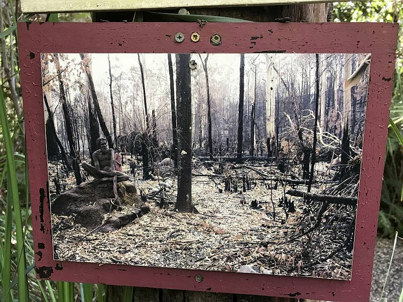
A photo of the sculpture above following the catastrophic fires of February 2009.
There were a number of similar photos scattered about the park.
Compare this image with the one above.
Bruno told us that it took around five years to get the sculpture park back into good shape; they did a lot of planting in addition to the natural regeneration. Photo 2019/04/11
|
|
|
The Lady of Shalott; based on the poem by Alfred, Lord Tennyson.
On either side the river lie Photo 2019/04/11 |
|
|
|
Beggers
Photo 2019/04/11 |
|
|
|
One of Bruno's fantasy sculptures
Photo 2019/04/11 |
|
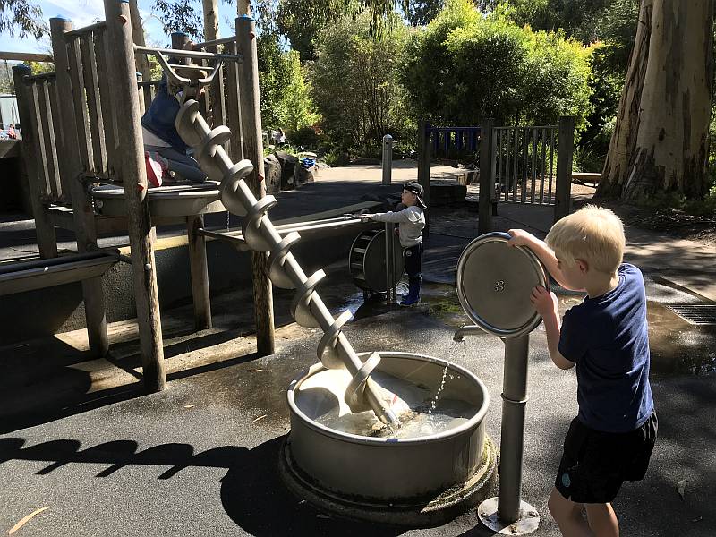
A part of the playground in Gallipoli Park
An interesting 'naked' Archimedes Screw; a great idea to show kids how it works in practice. The kid in the foreground is turning a wheel to pump water into the basin; the kid on the platform was then turning the screw to raise the water into the trough from which it would turn the water-wheel on the right. Photo 2019/04/11
|
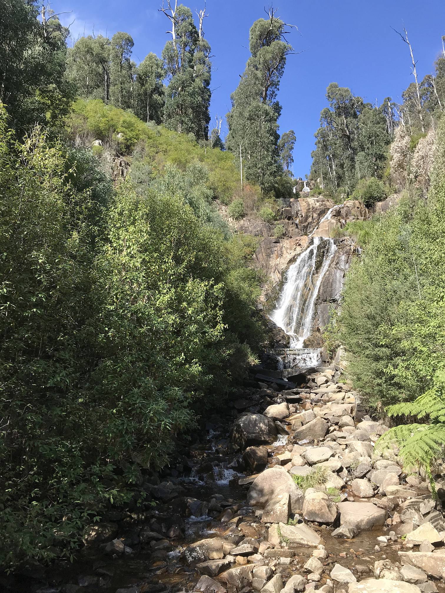
This waterfall was a few kilometres (a short drive followed by a walk of perhaps half a kilometre on a slight slope) from Marysville.
When we visited the weather had been exceptionally dry for months, yet there was still a fair flow of water. It would be spectacular in wet weather. Photo 2019/04/11
|
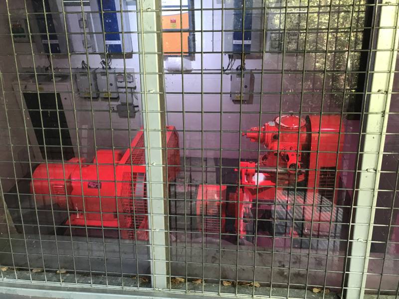
A small hydro power generatorThis small turbine, said to be a cross-flow turbine, the only one of its kind in Australia, was in a small shed a few hundred metres downstream of the waterfall.
From a sign on the shed: "Technical details, Photo 2019/04/11
|

|
|
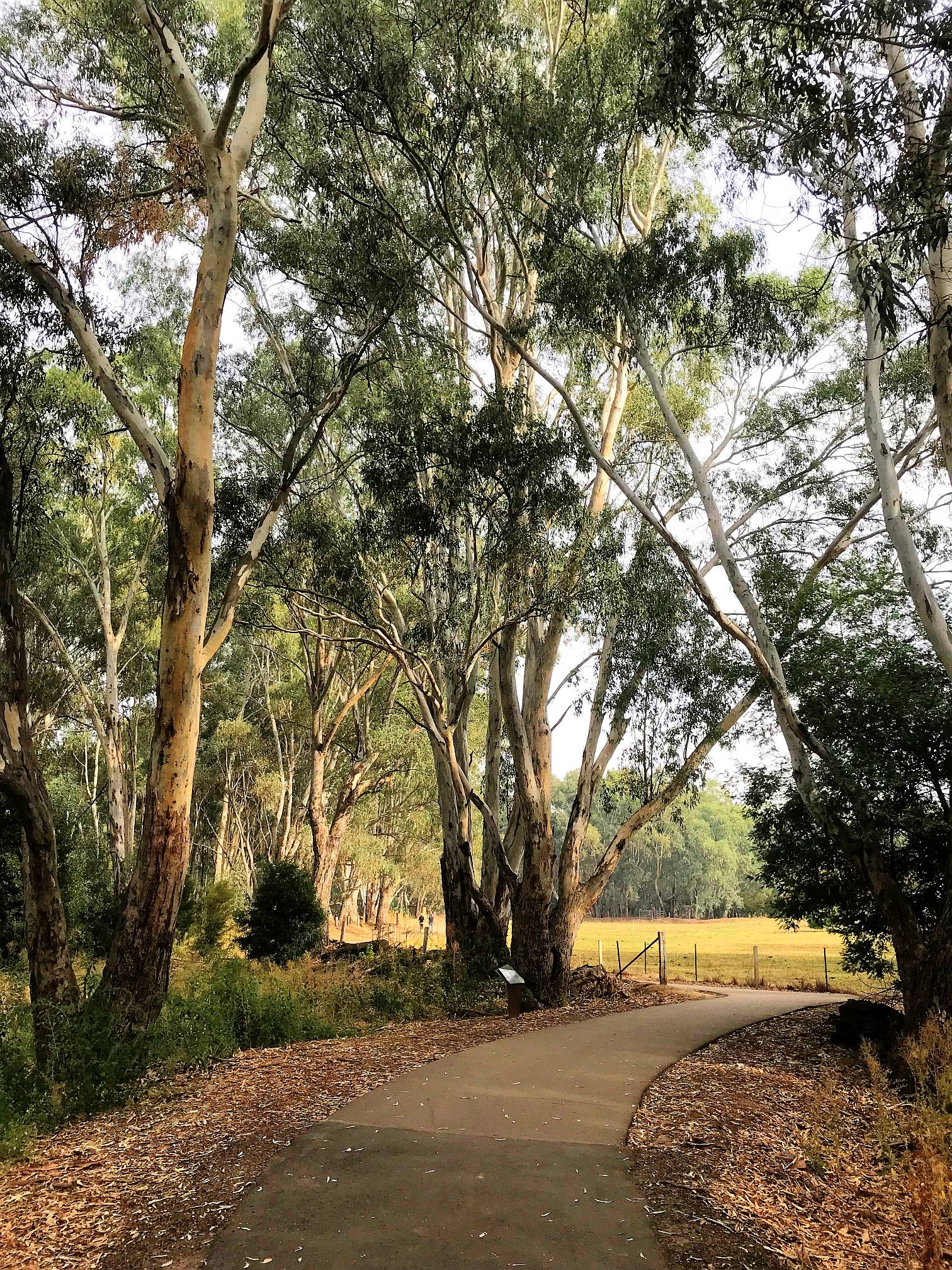
These magnificent trees (mountain ash, Eucalyptus regnans?) and tree ferns (probably Cyathea species or Dicksonia antarctica) were in the mountains south of Marysville and north of Healsville.
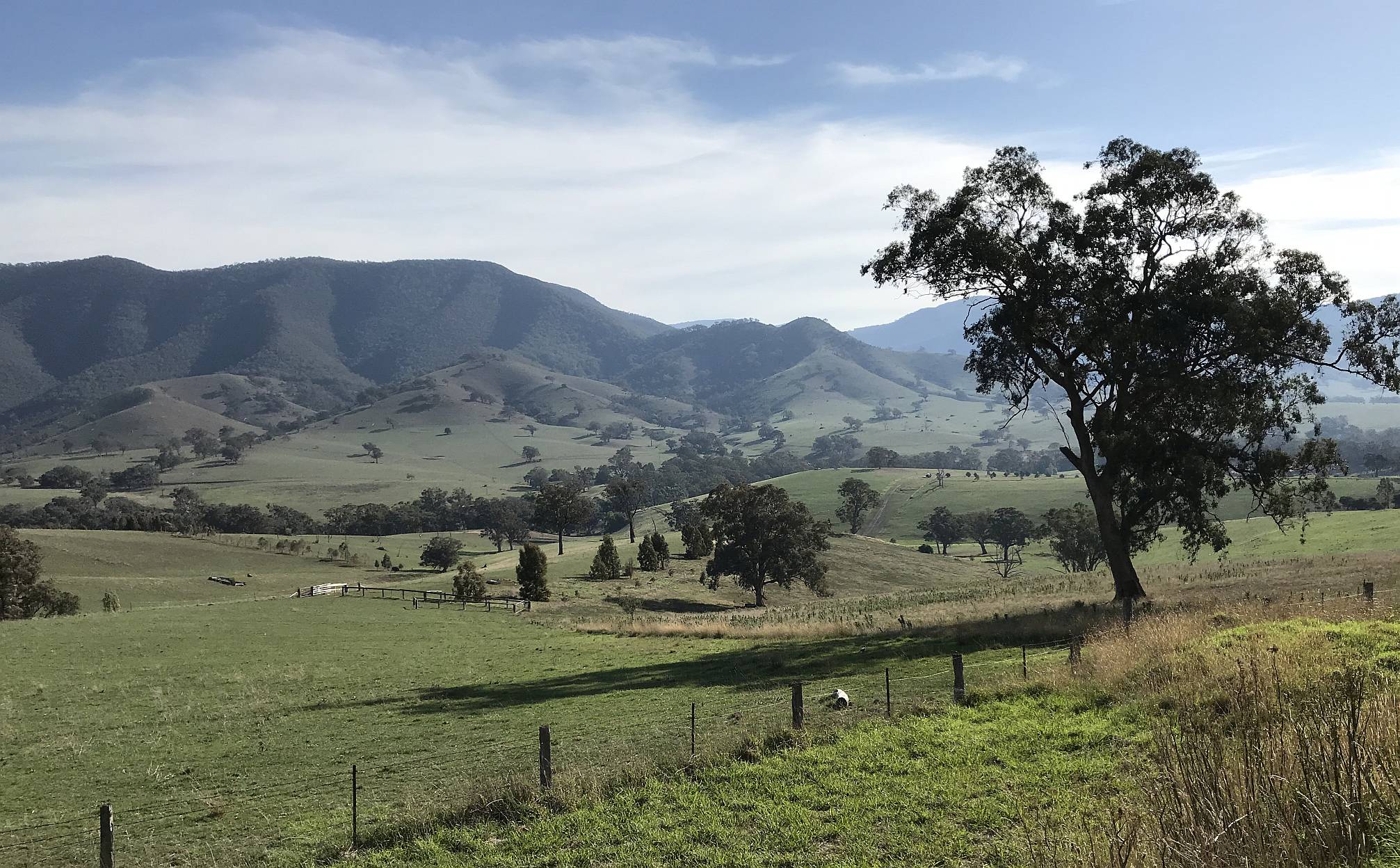
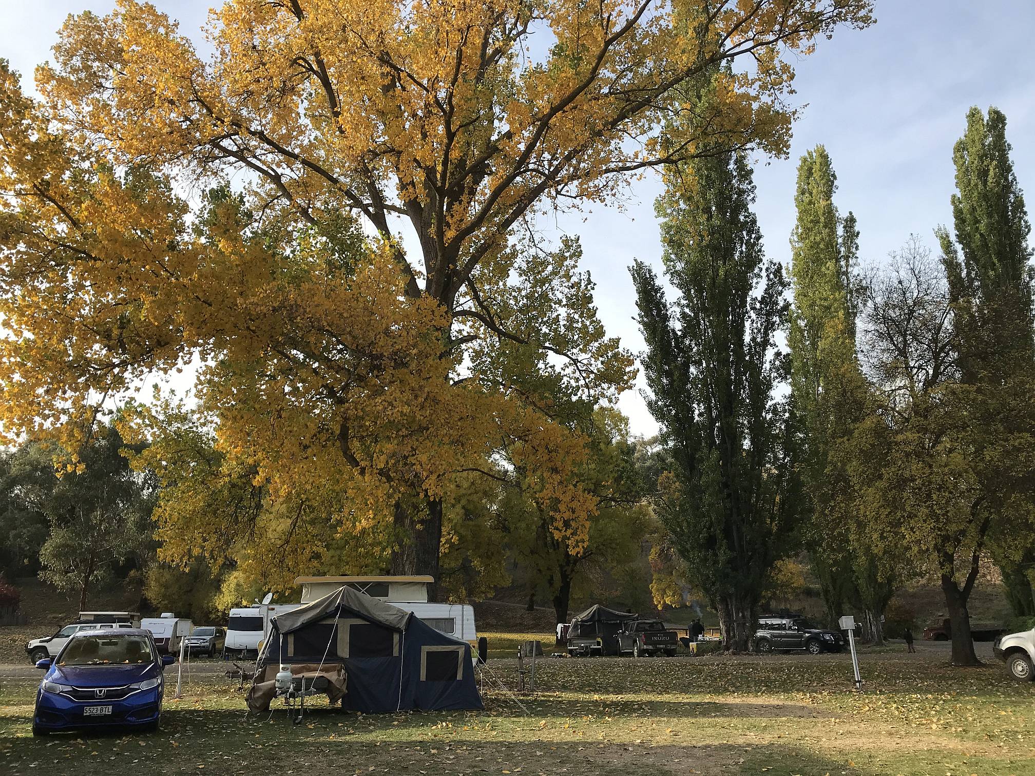
Honda JazzOur Honda Jazz and tent-trailer in the foreground. The Jazz was often about the smallest car in many of the caravan parks that we stayed in. It easily towed the trailer over Mount Hotham on the way north a few days later. I would far prefer towing a little camper like this on winding narrow roads than the big caravans or camper-vans that many people were using.The Jazz averaged about 7L/100km when towing the trailer, 5.5 at other times. We found that, when towing the trailer, the Jazz used about 83% as much fuel per kilometre at 90km/hour that it used at 110km/hour. Surprisingly, it used little more fuel in hilly country than in flat country; it would consume more fuel on the uphill bits, but that was largely compensated for by the smaller consumption on the downhill bits. Photo 2019/04/11 The Yarra Ranges, and the adjacent Baw Baw Ranges to the east, are parts of the Great Dividing Range. |
In the same area as the above photo; looking straight up.
Photo 2019/04/11 Another beautiful area of tall trees is the SW of Western Australia.
|
|
|
Latrobe ValleyThe Latrobe Valley is bounded to the north by the Great Dividing Range and to the south by the Strzelecki Ranges.Neerim South |
|
|
The view from our camper in the Neerim South Caravan Park.
While it had the disadvantage of being 'out in the bush' and not near any particular tourist attractions it was in a beautiful, very quiet place and had excellent camp kitchen and toilet facilities.
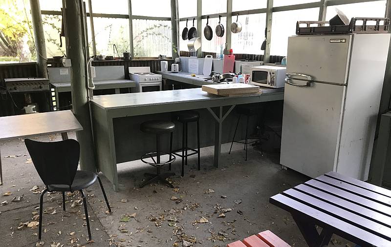
We stayed two nights and used the day between to have a look at the Latrobe Valley. Neerim South is a small town a bit north of the Latrobe Valley and the caravan park is a couple of kilometres east of the town. Photo 2019/04/12 |
|
|
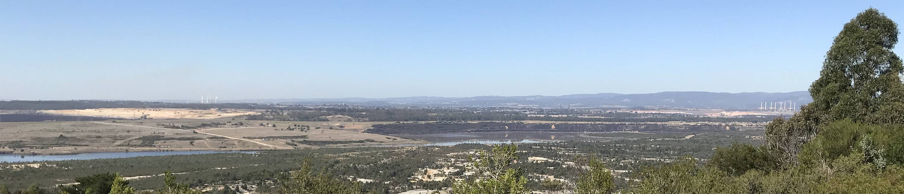
The view of the Latrobe Valley from Yallourn Lookout.
The remains of coal mines fill the foreground while two coal-fired power stations can be seen in the distance (far left and far right).
Another coal-fired power station, Yallourn, was much closer, but hidden by a nearby hill off to the left of this view (see the photo below). Photo 2019/04/12 Of course the burning of coal is one of the main causes of climate change, ocean acidification, sea level rise and ocean warming. |
|
|
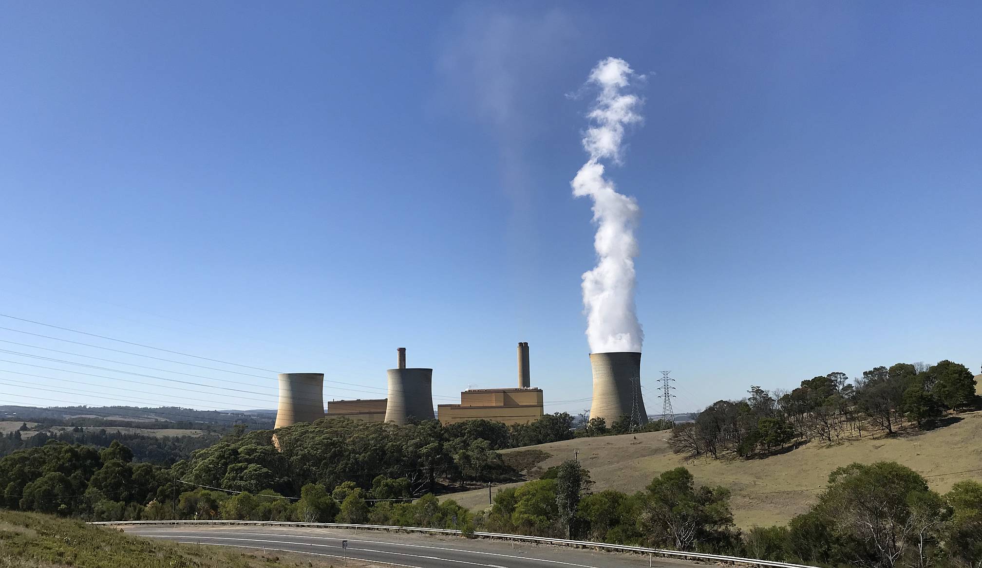
Yallourn coal-fired power station, Latrobe Valley.
The burning of coal kills millions of people world-wide each year. In Australia the coal industry, particularly in the Latrobe Valley, also has major adverse health impacts. The ill health is mainly, but not entirely, due to the air pollution resulting from burning the coal. The white cloud coming from the cooling tower is steam, not smoke. Some of the coal-fired power stations of the Latrobe Valley, like this one, are air cooled, others use water from artificial lakes. Typically about 70%-75% of the energy released from the burning of coal is lost; only 25%-30% is converted into electrical energy. Photo 2019/04/12 Quoting from Wikipedia in July 2023: "Yallourn PS was a complex of six brown coal–fired thermal power stations built progressively from the 1920s to the 1960s; all except one have now been decommissioned. Today, only the 1,450 megawatts (1,940,000 hp) Yallourn W plant remains." It has been reported that all the Latrobe Valley coal fired power stations could close by 2032. Wind farms are to be built in the area and in Bass Strait to the South. |
|
|
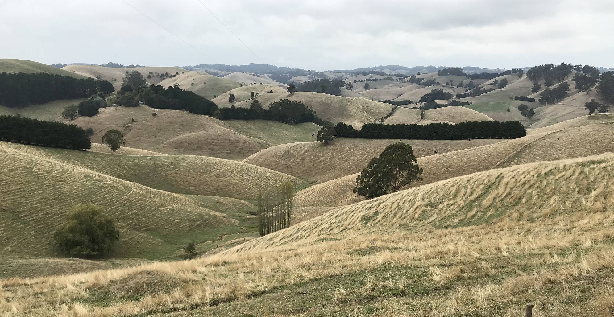
The road from Warragul in the Latrobe Valley, through the very small township of Strzelecki, to Leongatha, largely follows the ridge-tops of the Strzelecki Ranges which separate the Latrobe Valley from Gippsland.
This photo was taken a few kilometres north of Strzelecki, there were many similar views from the road, but not many places where a car could safely stop.
Photo 2019/04/13 Few places where it is safe to stopWe found it very difficult to safely stop, either to take photographs or to allow someone to overtake, on many of Victoria's roads in the hilly areas. We were often in the position of having someone driving behind us and wanting to go faster than we felt comfortable with but having no place we could safely slow down and stop to allow overtaking.
GippslandToora camping and wind farm |
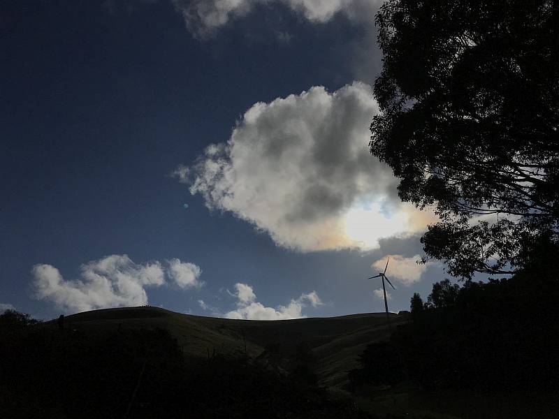
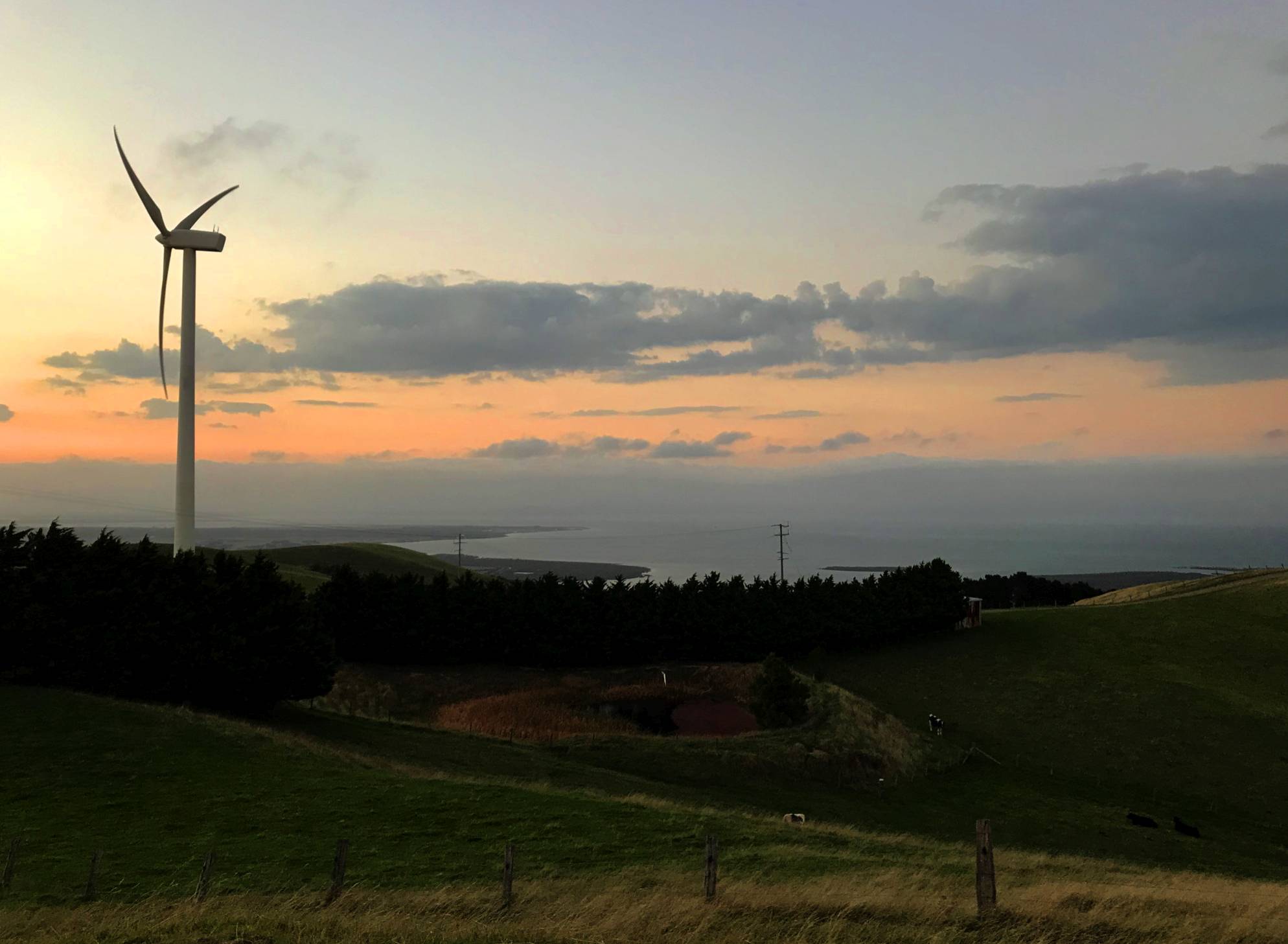
We stayed in the Toora caravan park (Toora Tourist Park) for our first three nights in Gippsland. The turbine in this photo is one of the Toora turbines, the photo was taken from the Tourist Park.
Toora Tourist Park particularly interests me because it is only 850 metres from the nearest turbine of the Toora Wind Farm. (More details of the Toora Wind Farm are on another page on this site.) I have spent many hours in debunking the lies of the less scrupulous of the opponents of wind power. One of the most common complaints from people who have learned that a wind farm is to be built close to them regards the alleged 'noise' from the turbines. There are very few houses less than one kilometre from a wind turbine in Australia; I'd be very surprised if there was another caravan park or camping ground as close to a wind turbine as is Toora. (In my investigations of wind farms I have slept beneath turbines many times.) Wiki Camps is an iPhone app that allows people to post comments on the camping grounds at which they stay. In all of the 106 comments posted about the Toora Tourist Park on Wiki Camps, from November 2012 to March 2019, there was not one complaint about turbine noise. There was one complaint about noisy cows, two about road noise, one about noisy drunks, one about fishermen chatting into the early morning, and one mention of a turbine being 'audible but not a problem'. There were many other complaints about matters not relating to noise or the wind turbines. My wife and I noticed that we could hear the turbines some of the time, but the sound did not disturb us.
Photo 2019/04/14
Wilsons Promontory, Gippsland |
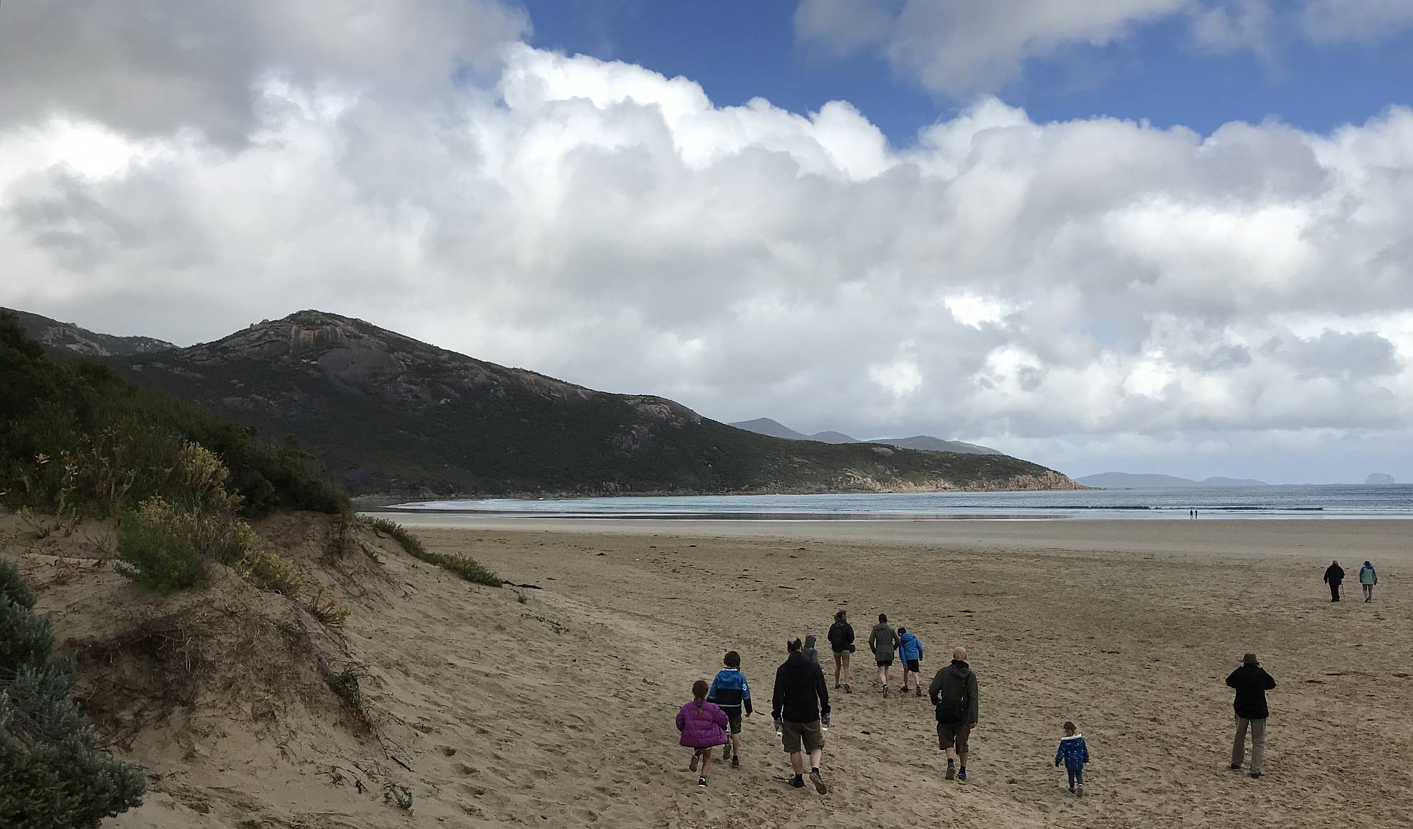
Wilsons Promontory is a peninsula running from Gippsland south into Bass Strait; it includes the most southerly point of the Australian mainland.
The photo is of the beach near the main (only?) settlement in the Wilsons Promontory National Park, Tidal River. Photo 2019/04/14 |
|
|
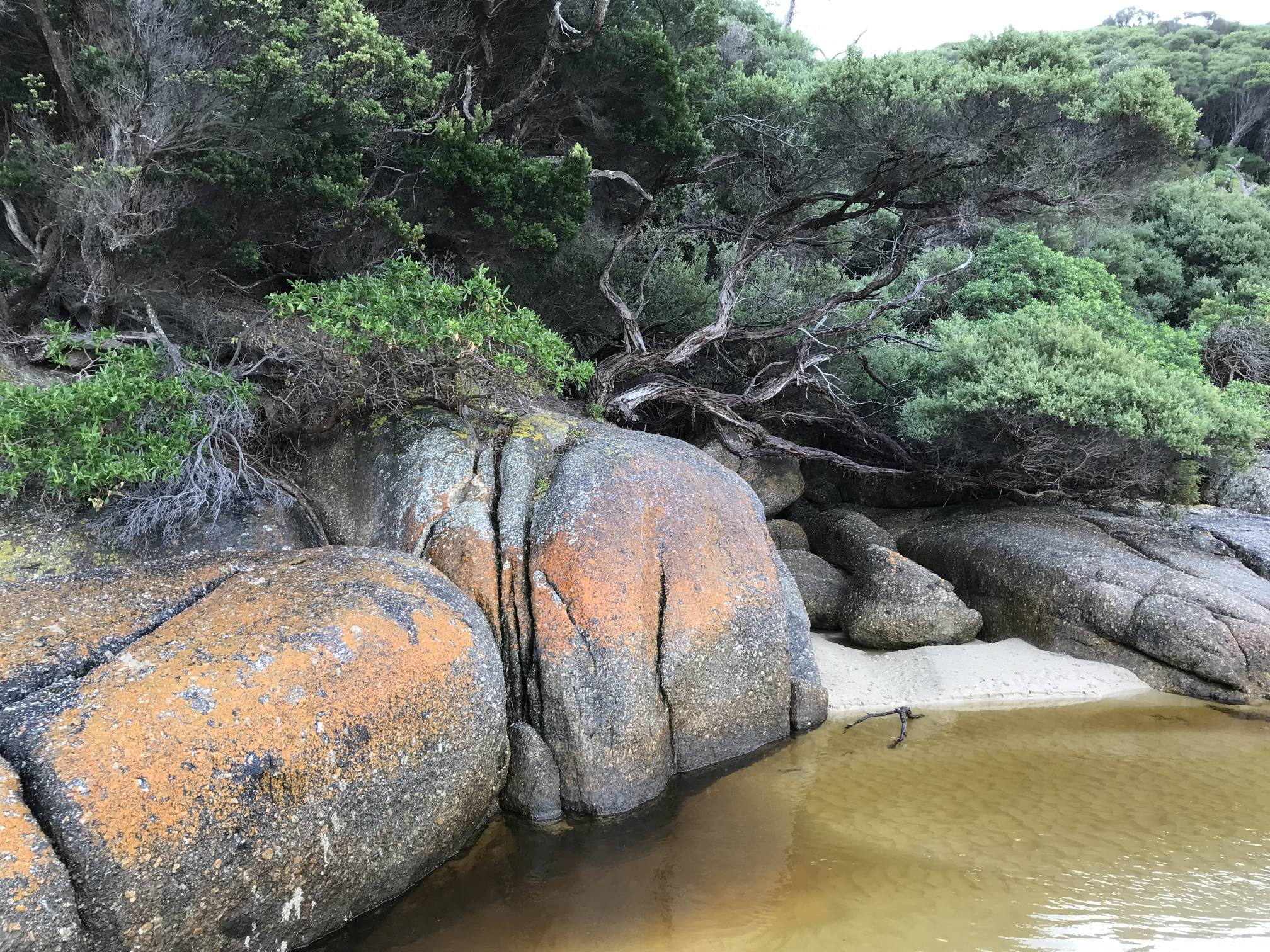
Lichen covered rocks and scrub at the outlet of the Tidal River.
I have noticed orange-coloured lichen like this at many places in southern Australia, always within a few metres of sea level.
Photo 2019/04/14 |
|
|
|
|
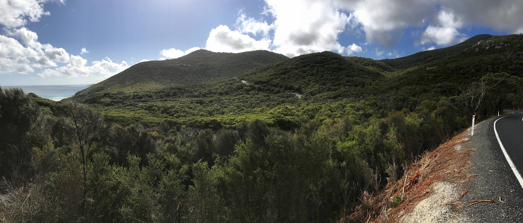
A view of some of the Wilsons Promontory hills and scrub from the main road.
The southern part of the peninsula is hilly while the northern part is fairly flat. Photo 2019/04/14 |
|
|
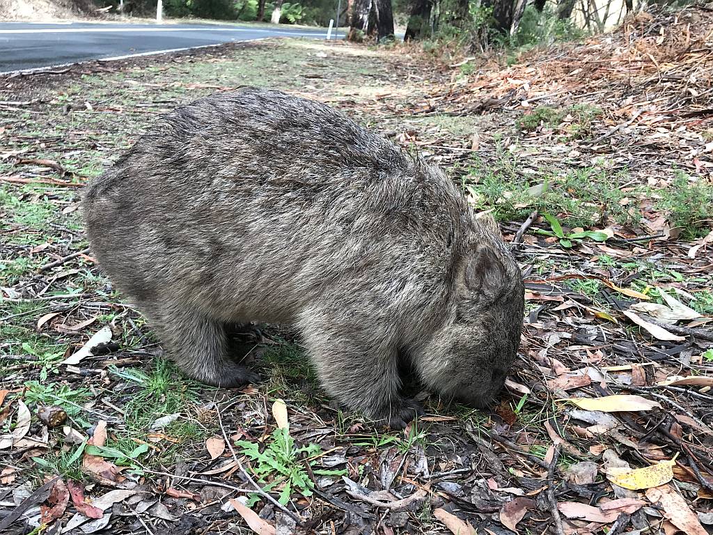
We happened to see this wombat on our way north from Tidal River.
It was not at all concerned about our presence.
We had also seen kangaroos and emus, elsewhere in the National Park.
Photo 2019/04/14
Fish Creek, Gippsland |
|
|
|
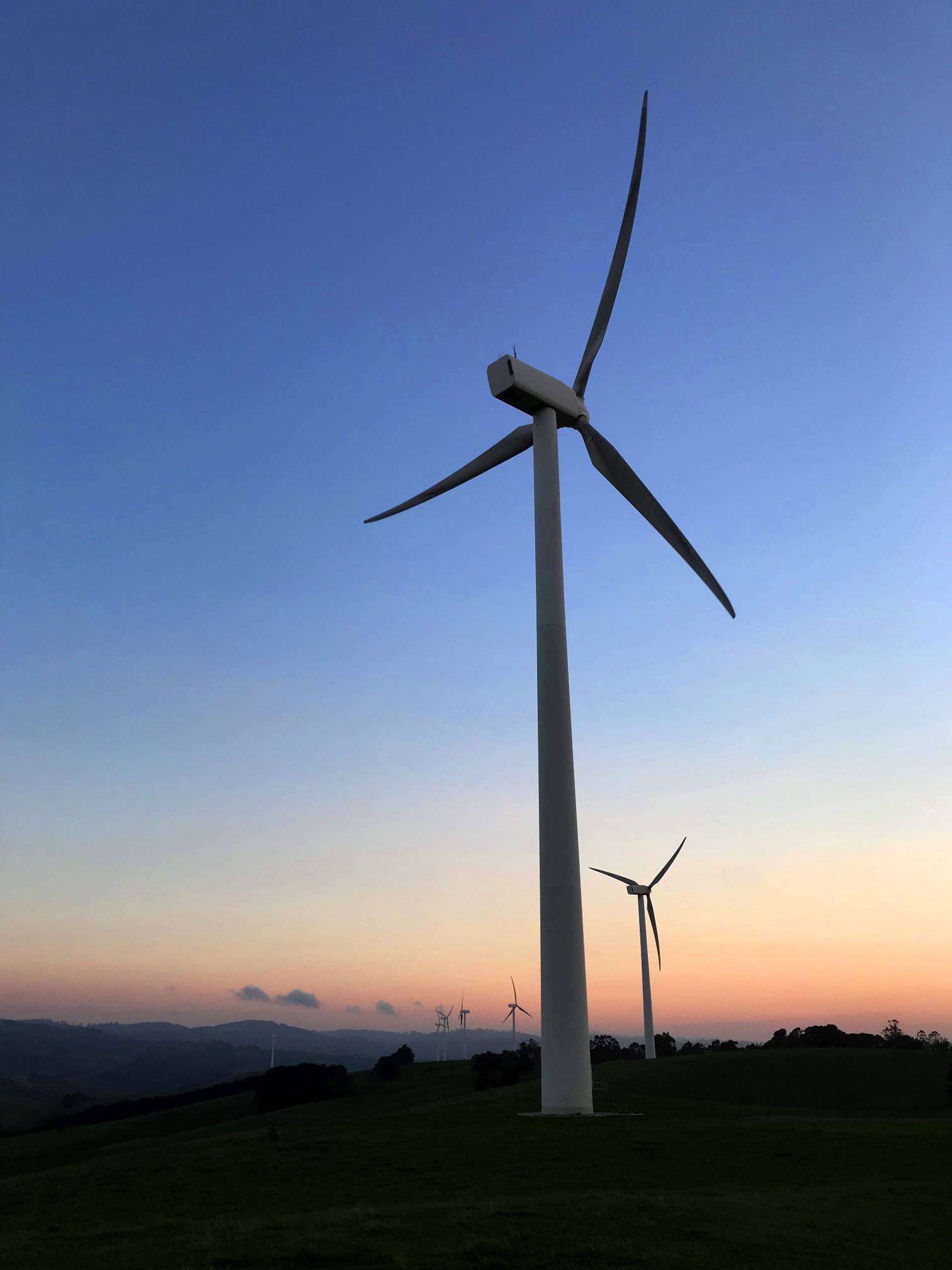
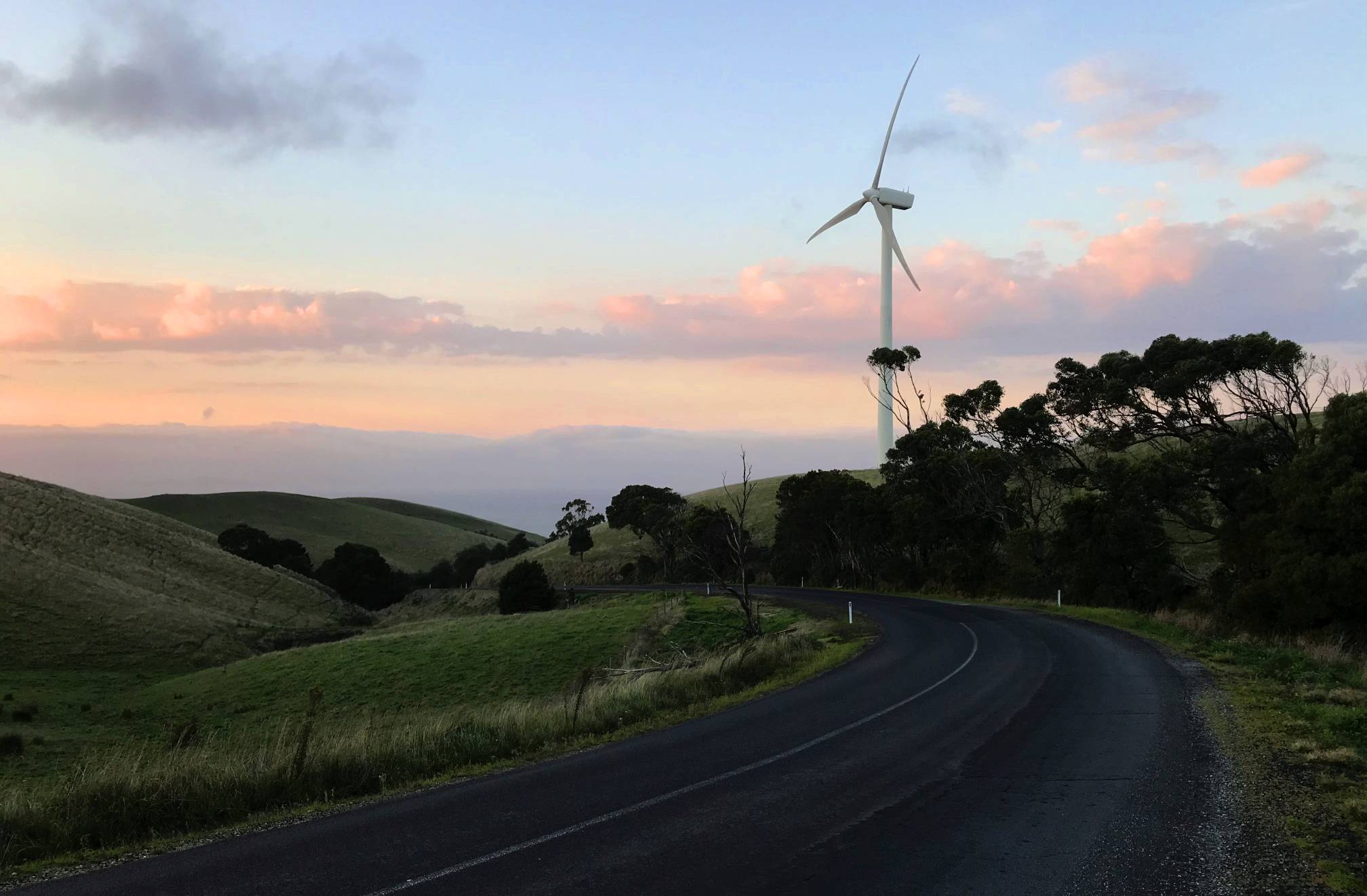
One of the Toora Wind Farm turbines, early morning; the big shallow Corner Inlet is in the background.
Photo 2019/04/15 |
|
|
|
Early morning again with one of the Toora wind turbines; Corner Inlet can just be made out in the notch of the hills.
I walked up the hill from the caravan park in the early morning to get these photos. Photo 2019/04/15 |
|
|
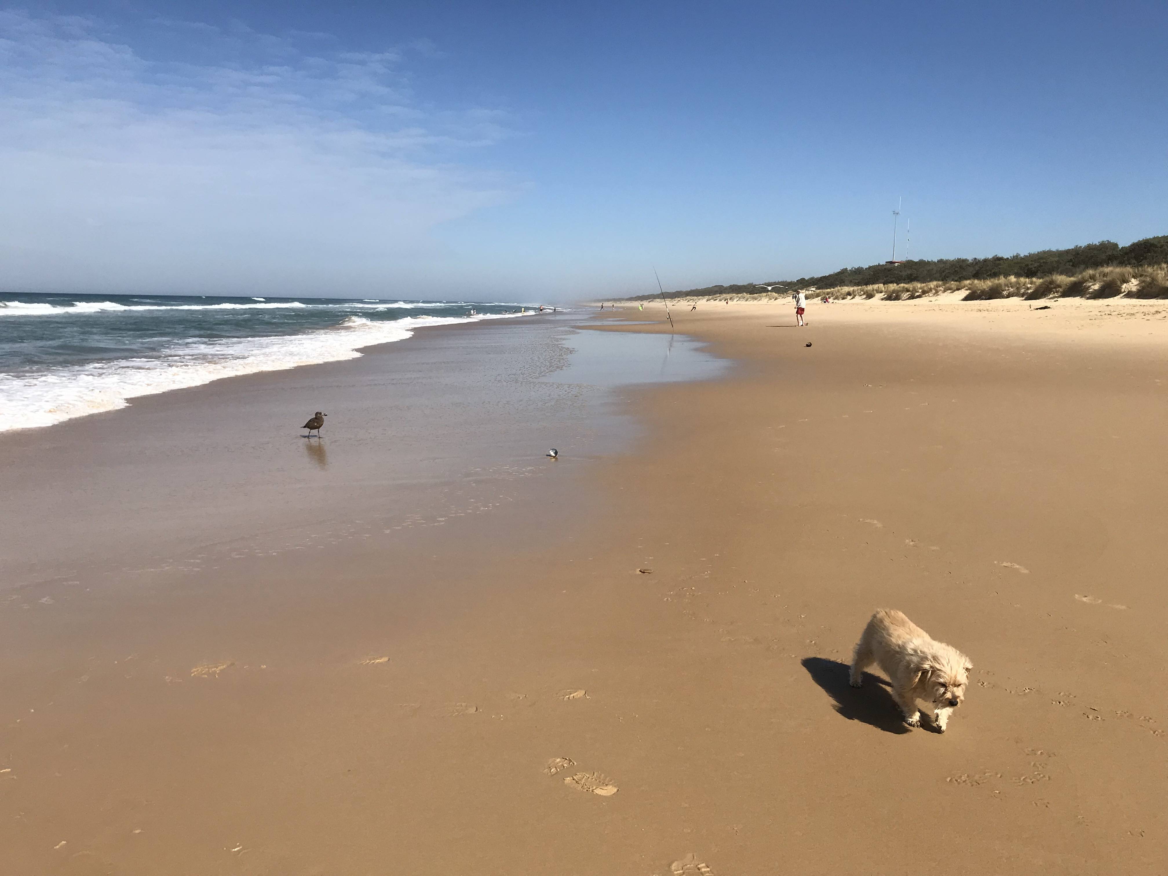
Woodside Beach is a very small part of
Ninety Mile Beach on the south coast of Gippsland.
What more needs to be said? A picture is worth a thousand words. Our dog, Socrates, is in the foreground. He was 12 years old with liver cancer at the time, probably with not a lot longer to live. Photo 2019/04/16 |
We could easily have spent a lot more time in and around Sale.
Just the 'inland port' seemed particularly interesting.
The gardens of the Robert Wain Reserve were well worth our short visit. It was while we were here that we were informed that there was a bushfire that came within a few hundred metres of our property near Armagh, Mid-North SA earlier the same day. Photo 2019/04/16 |
Robert Wain Reserve, Sale
Photo 2019/04/16 |
Bairnsdale, Gippsland
Saint Mary's Catholic Church was very impressive, especially for its frescos. Photo 2019/04/17
|
Great Alpine RoadThe Great Alpine Road crosses the Great Dividing Range from Bairnsdale in the south to Wangaratta in the northwest. The only town of any size along the way is Omeo (where we stopped for one night). The highest point is north of Omeo, near Mount Hotham where the road reaches 1845 metres. From there it is a continuous winding decent until the road reaches a valley bottom at Harrietville. |
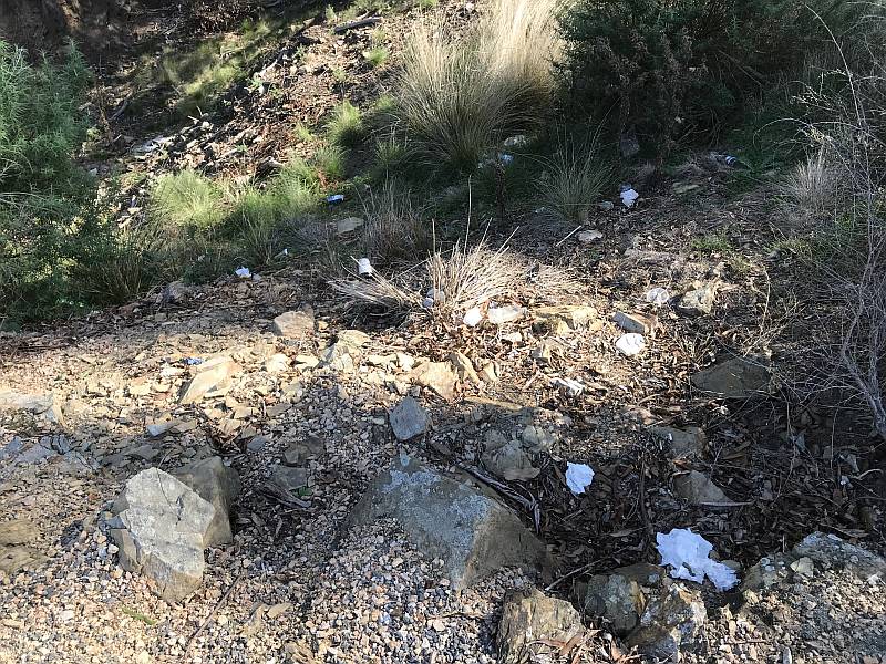
If you want to do something to improve the world you can pick up rubbish like this. I didn't in this case. Photo 2019/04/17
|
|
|
Near Swifts Creek, south of Omeo; from a view-point on the Great Alpine Road.
Photo 2019/04/17 |
Omeo, Great Alpine Road
The road from Bairnsdale to Omeo goes mostly northerly; from Omeo it tends toward the west. Photo 2019/04/18
|
|
|
Omeo Caravan Park, one of the best we stayed at; good camp kitchen, relaxed, plenty of space, beautiful location.
Photo 2019/04/18 |
|
|
|
|
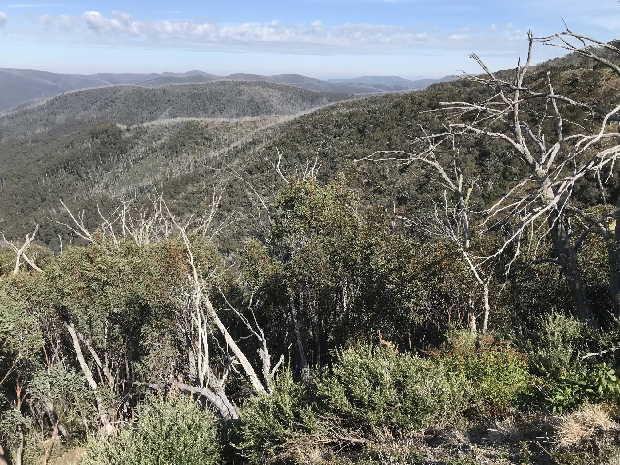
A view over the mountains just east of Mount Hotham.
The forest is showing the after-effects of being burned, the silvery dead branches sticking up above the living parts of the forest.
Photo 2019/04/18 |
|
|
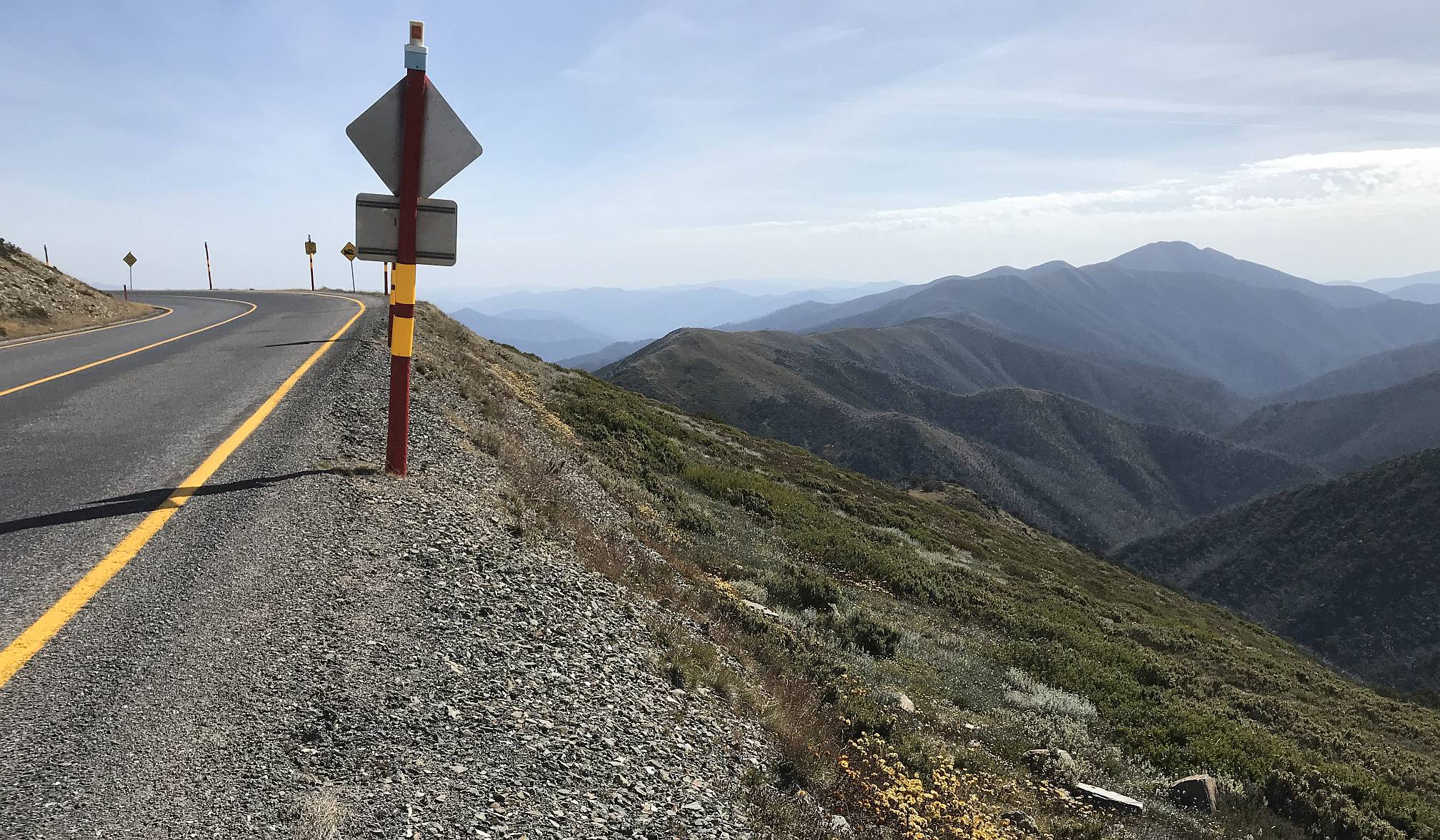
The highest point reached by the road, 1845 metres above sea level.
From this point toward Wangaratta the road is a continuous winding decent to the valley bottom at Harrietville; from there it follows the valleys all the way to Wangaratta.
Photo 2019/04/18 |
|
|
A panorama taken from the highest point in the Great Alpine Road; the same point as the above photo.
Photo 2019/04/18 |
Wangaratta regionIt can be very difficult getting a powered site in a caravan park during Easter, so we booked into Wangaratta for the four nights over Easter, and used that as a base to visit Benalla, the Silo Art Trail to its north, and the King Valley. |
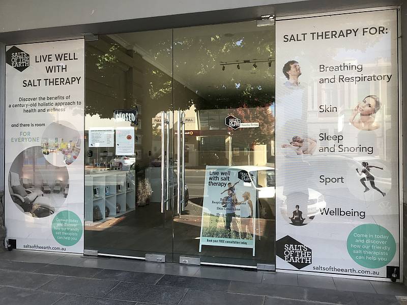
In an age in which science has allowed humanity to discover an enormous amount of truth and understanding of how the Universe works it is depressing how so many people cling to delusions (such as religion) and nonsensical 'alternative medicines'. For information on salt therapy, also called halotherapy, see Science based medicine. Photo 2019/04/19
Benalla; in the Wangaratta region
Photo 2019/04/19
Photo 2019/04/19
|
|
|
This amazing work of art is beside the main street and adjacent to Lake Benalla.
For more information see
Benalla Ceramic Mural.
Photo 2019/04/19 |
|
|
|
|
The ceramic mural from a different angle.
Photo 2019/04/19 |

|
|
Closer in to a part of the ceramic mural, to show some detail.
Planning it and putting it all together must have been a huge job.
Photo 2019/04/19 |
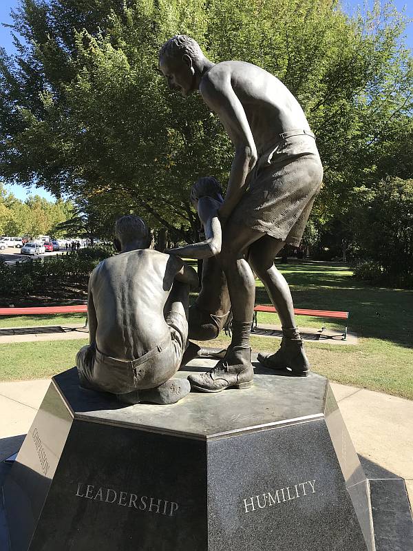
Sir Edward (Weary) Dunlop statue, Benalla
In a grotesque tern of history the statue to Dunlop, a man who showed great compassion to his fellow POWs, was unveiled by Prime Minister John Howard, a man who involved his country in the unjustified, immoral, destructive and counter-productive Iraq War that resulted in hundreds of thousands of Iraqi deaths and millions of Iraqis becoming refugees. While Dunlop alleviated suffering, Howard ignored the Australian people's opposition to the nation's involvement in the invasion of Iraq, and caused far, far more suffering than Dunlop was able to alleviate. Prime Minister Howard is one of the world's criminal leaders. Photo 2019/04/19
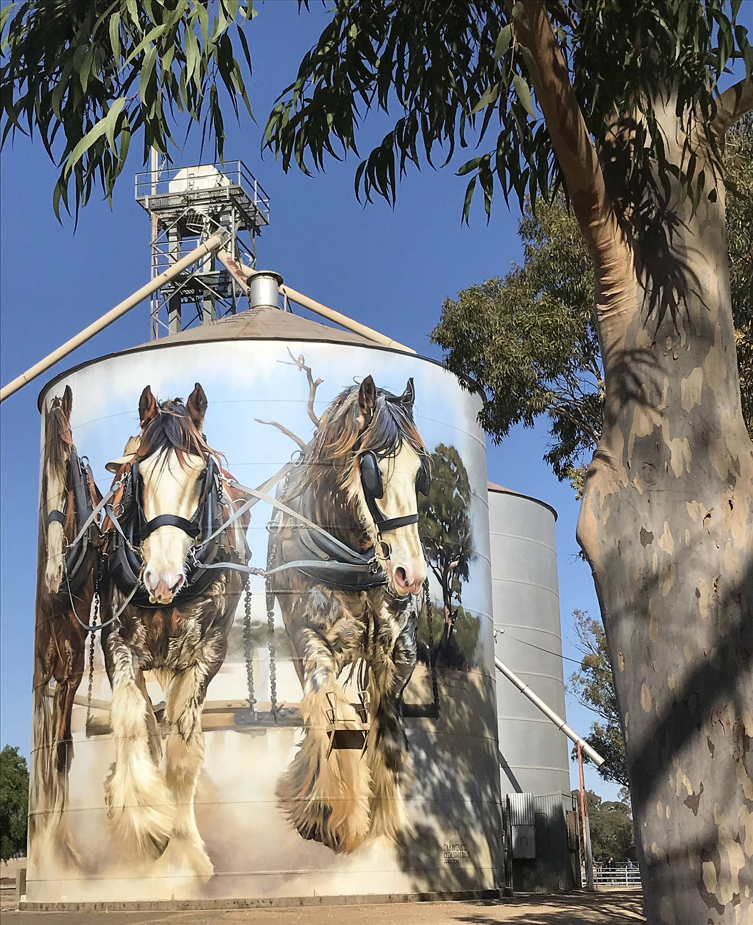
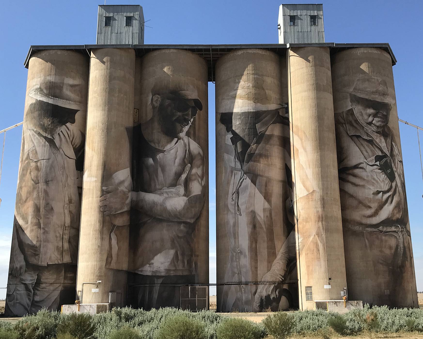
Silo art trail 1, north of BenallaGoorambat, Silo Art Trail 1
In Goorambat there were art works on two sides of one silo and one side of a second silo. These were painted by Dvate. There was also a beautiful large mural in the local church, which seems often to be open for public viewing. Photo 2019/04/19
Goorambat, Silo Art Trail 1
You can sit outside the Goorambat pub sipping a beer or glass of wine and enjoy admiring this mural. Photo 2019/04/19
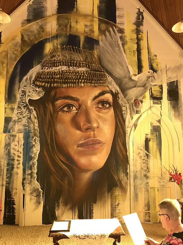
Sophia of Goorambat
Whatever one might think of Christianity and religions (I have a low opinion of them generally) they have inspired many great works of art, this is a beautiful example. Photo 2019/04/19
|
|
|
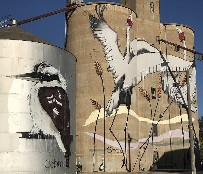
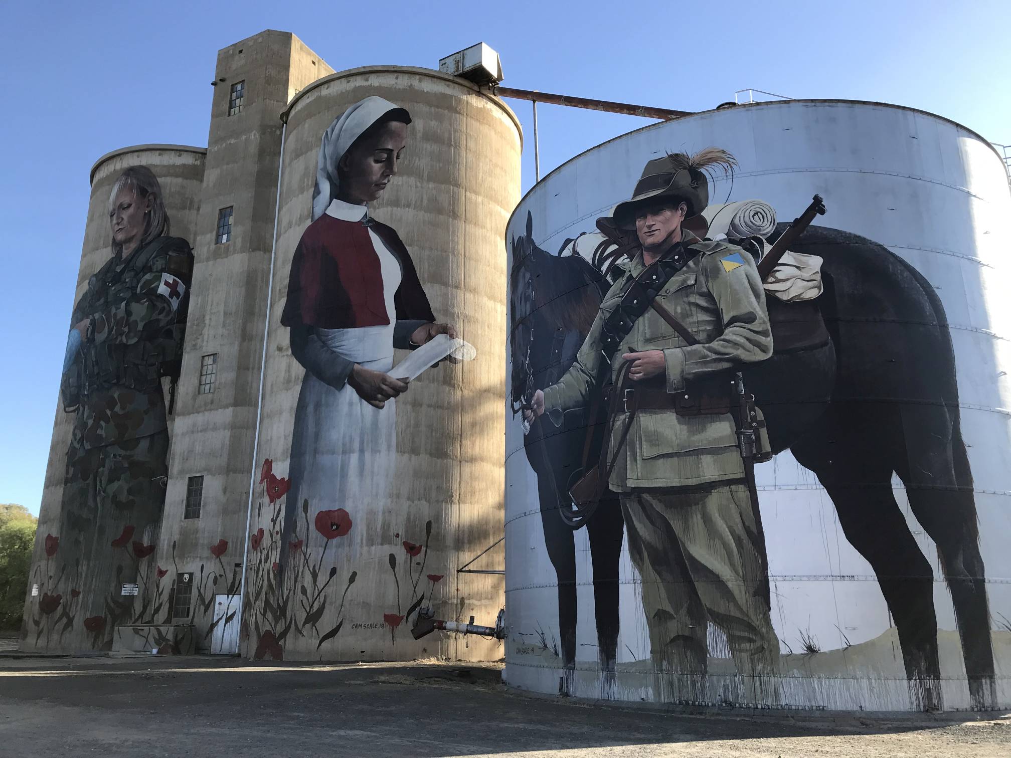
The Devilish silos had art that commemorated the Australians who served in wars.
Photo 2019/04/19
St. James, Silo Art Trail 1 |

|
|
Our third stop for this silo art trail; the St. James silo was painted by Tim Bowtell.
Photo 2019/04/19 |
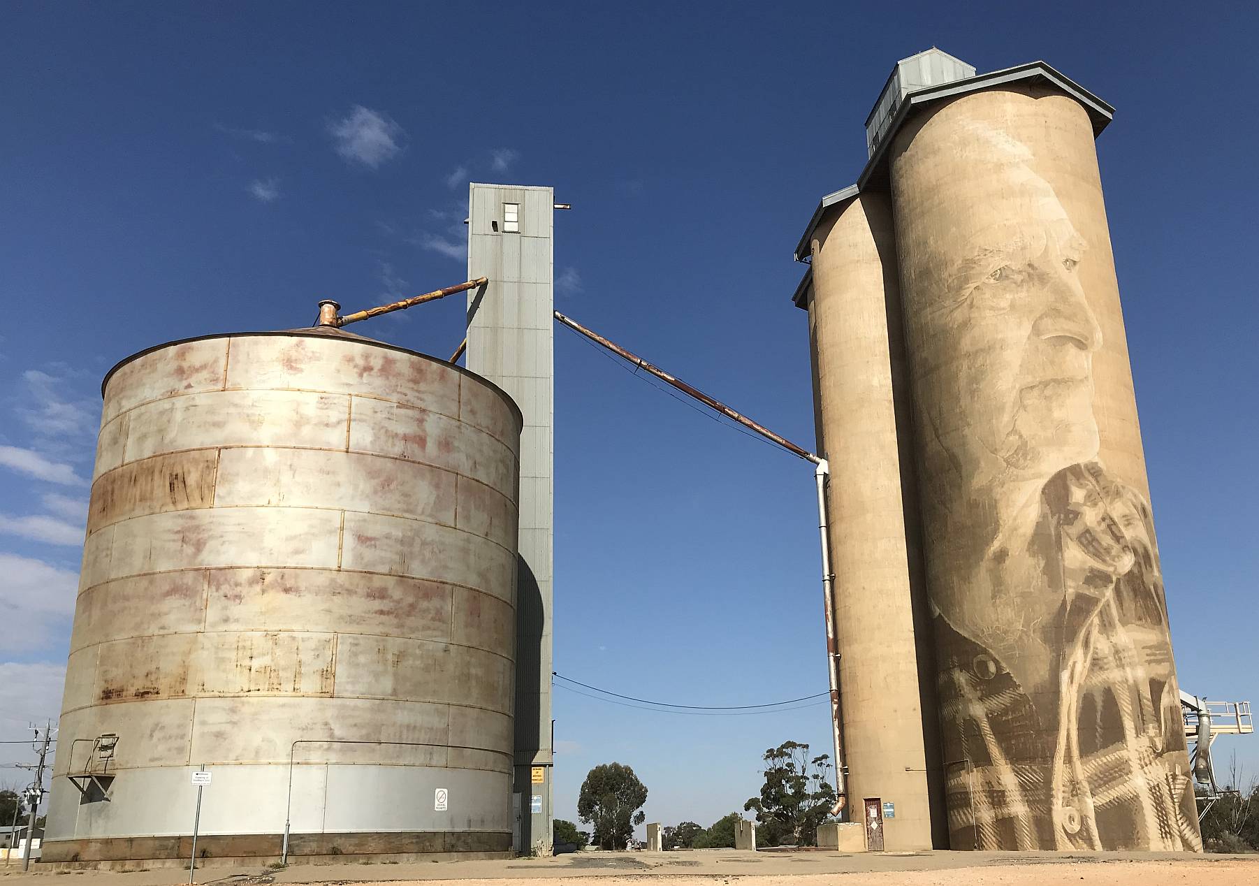
Tungamah, Silo Art Trail 1
Photo 2019/04/19
|
|
|
A popular drive south of Wangaratta is up the King Valley.
The tourist literature is mainly about the winery cellar doors, but the highlight of the day's drive for us was Power's Lookout.
To get there you turn off at the tiny town of Whitfield and follow a winding road high up into the hills.
We visited on Easter Saturday, so there were many people doing the same thing. Photo 2019/04/20 |
|
|
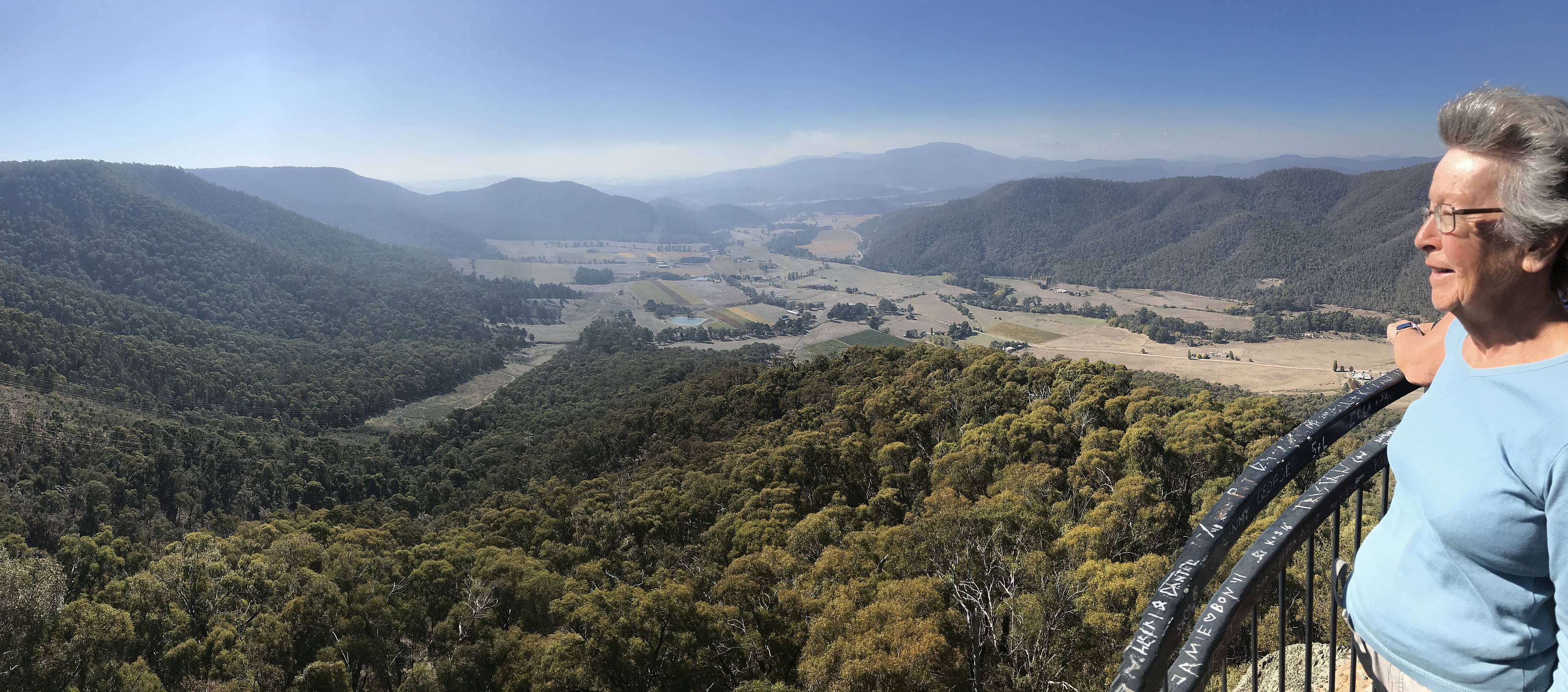
My wife, Denece, admiring the view over the King Valley.
There are two view-points at Power's Lookout; the first is right at the car park, the second is a few hundred metres away and requires climbing quite a few steps. The second lookout provides by far the better views. Photo 2019/04/20 |

|
|
The second viewpoint of Power's Lookout.
Information boards near the carpark talked of the lookout being named for a bushranger who supposedly sometimes used this natural lookout to watch for police who might be coming to get him. Photo 2019/04/20 |
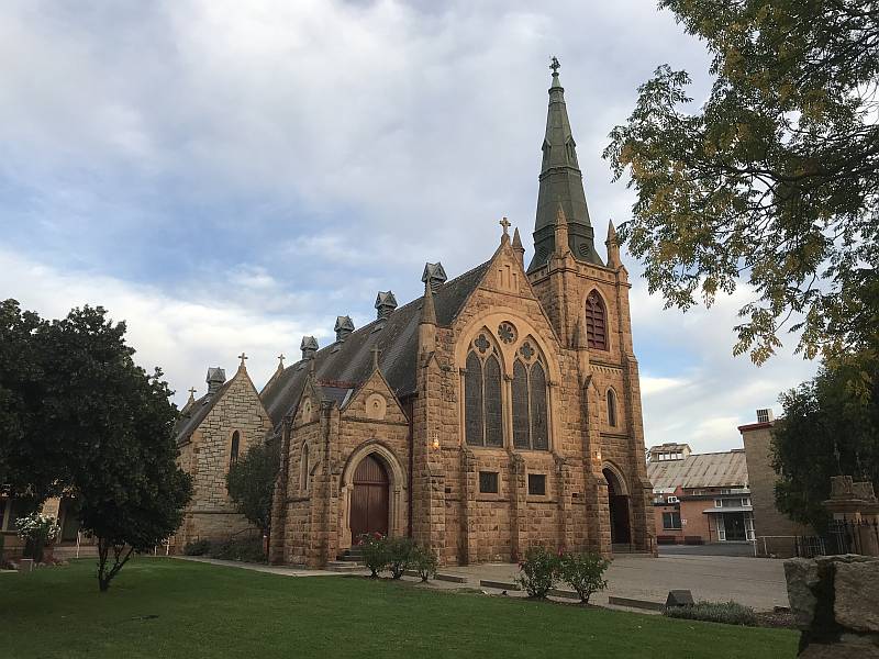
St. Patrick's Church, Wangaratta
The original part was built of granite and sandstone. There is a large extension at the rear (not shown in this photo) that must about double the seating of the original part. Photo 2019/04/21
|
|
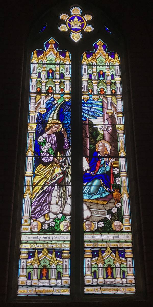
|
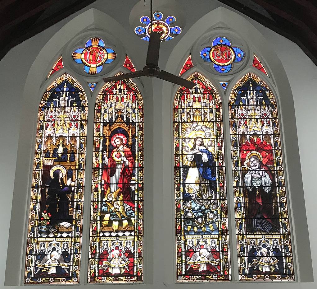
Stained glass windows in St. Patrick's Church.
Photo 2019/04/21 |
The photo has been enhanced using Photomatix. Photo 2019/04/21
|

|
|
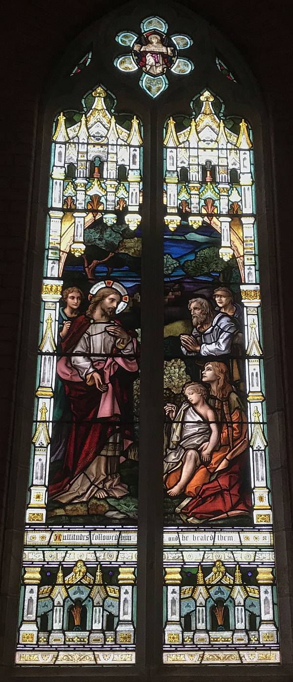
Denece and I did not have a high opinion of the exterior design of the Holy Trinity Anglican Cathedral, but the stained glass inside was very good (see below).
Photo 2019/04/21 |
Two of the windows of Holy Trinity Cathedral; I thought that the flesh tones were excellent.
Photo 2019/04/21
|
|
|
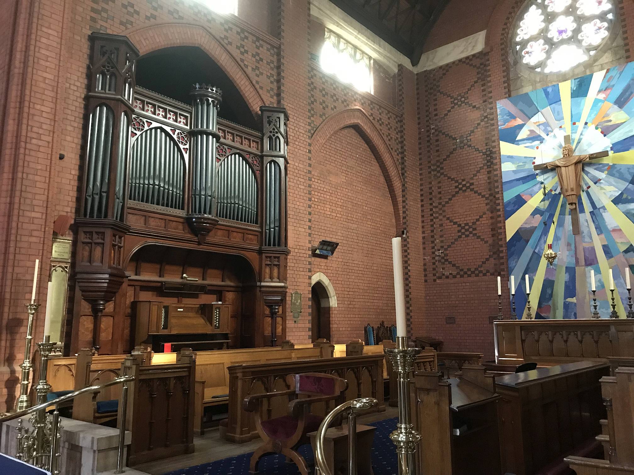
A part of the interior of Holy Trinity.
There is another pipe organ in a side chapel; how many pipe organs does one church need?
Photo 2019/04/21 |
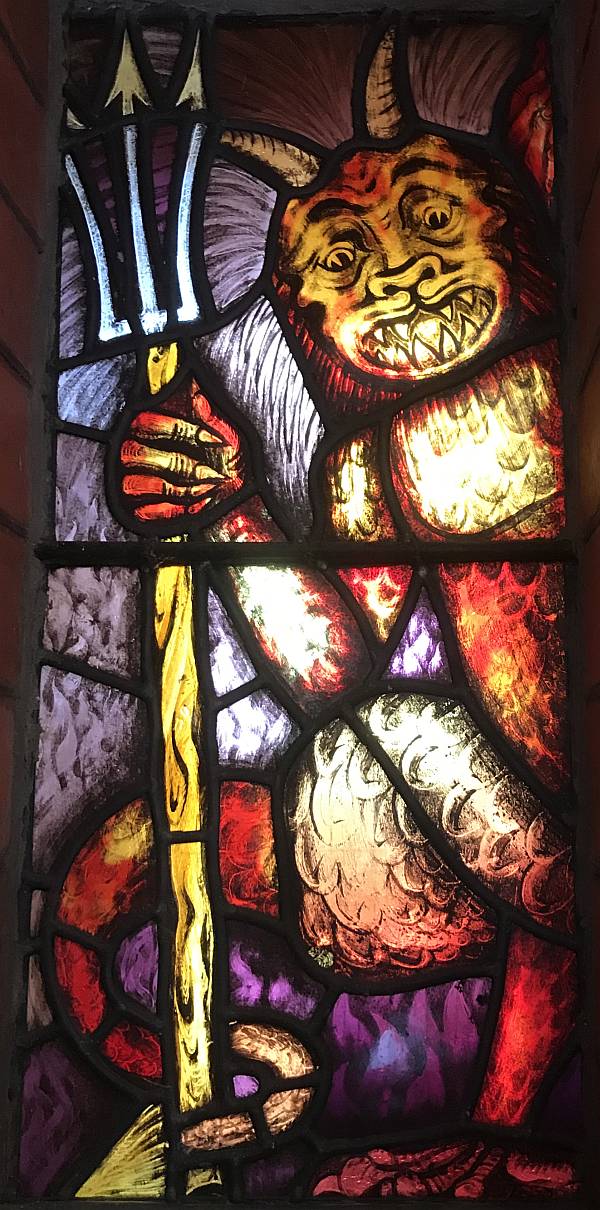
Take care to follow Jesus or this little blighter will poke you with his trident! (If you find that sort of fantasy believable.) Photo 2019/04/21
|
|
|
We had two nights and a day at Avoca, quite a nice little town.
The best feature of the town is the Garden of Fire and Water. When we were there, toward the end of a very hot and dry summer, there was some mud in the pond but no water. Adjacent is the forested Pyrenees Range. There is a good road to Governor Rock on which is a lookout tower giving good views over a part of the countryside. Other roads, apparently more like bush tracks, lead to Mount Avoca, the highest peak in the Range. We didn't go there. Photo 2019/04/23 |
|
|
Another view of the Chinese Garden of Fire and Water.
Photo 2019/04/23 |
|
|
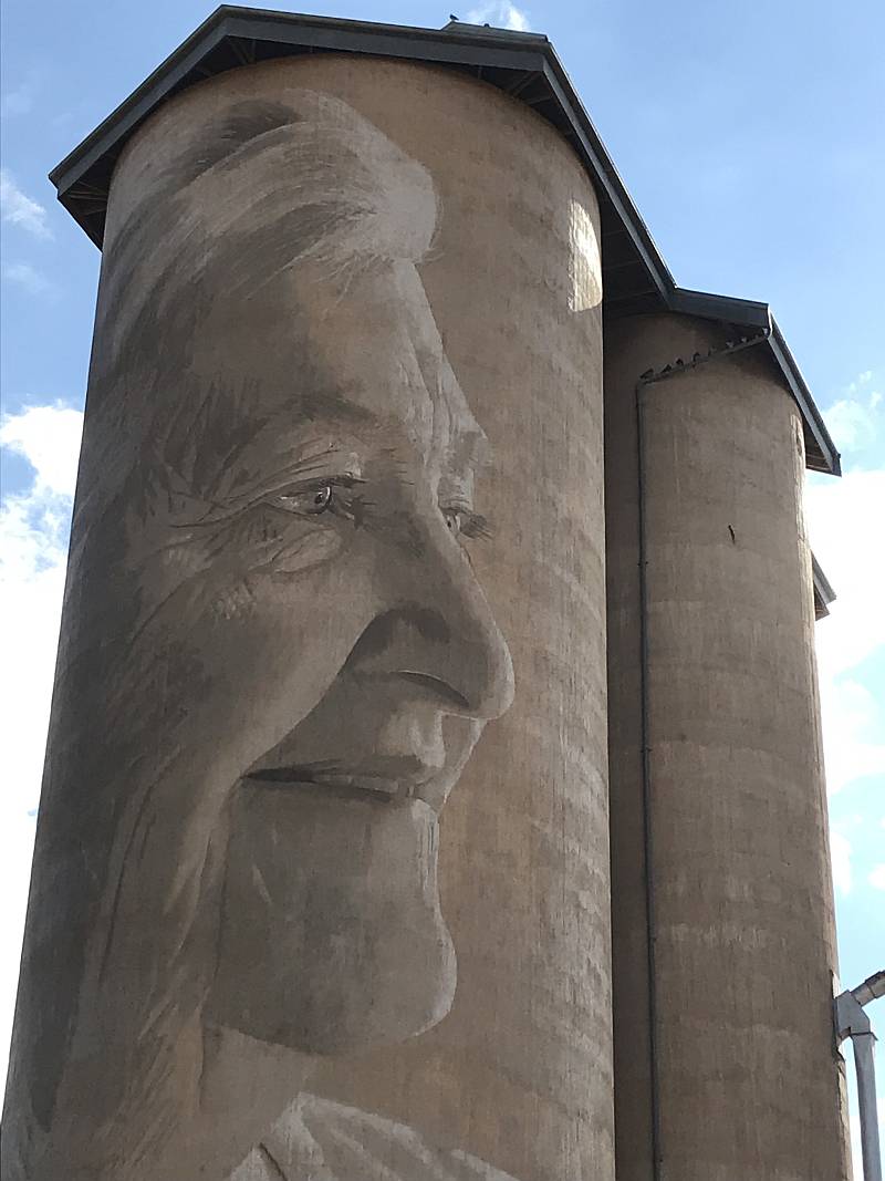
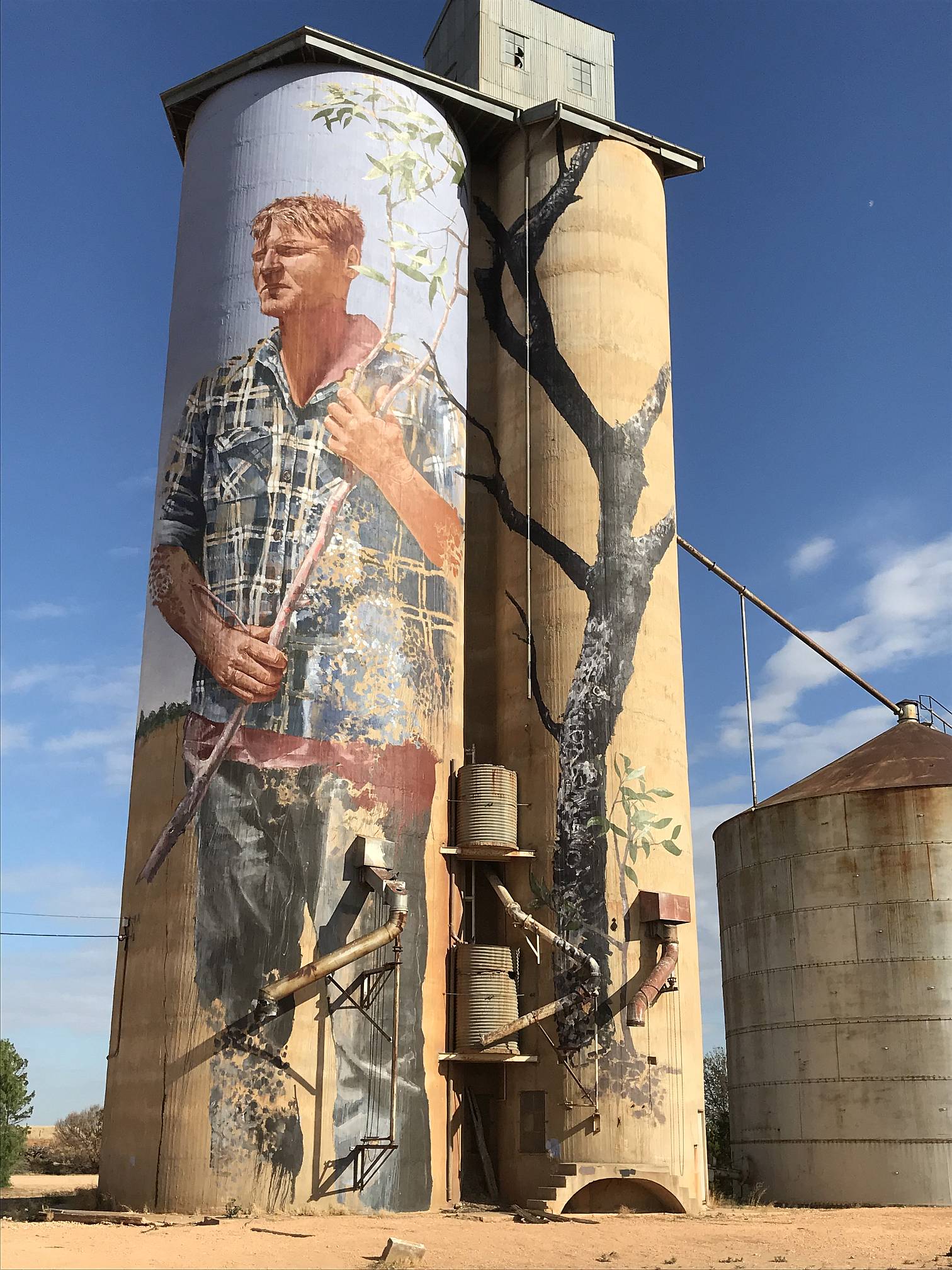
Silo art trail 2, north of HorshamThe Wimmera Silo Art Trail stretches some 160km north from Rupanyup (NE of Horsham) northward to Patchewollock (SW of Ouyen). To judge by the number of tourists that we saw it is a popular attraction.Rupanyup, Silo Art Trail 2 |
|
|
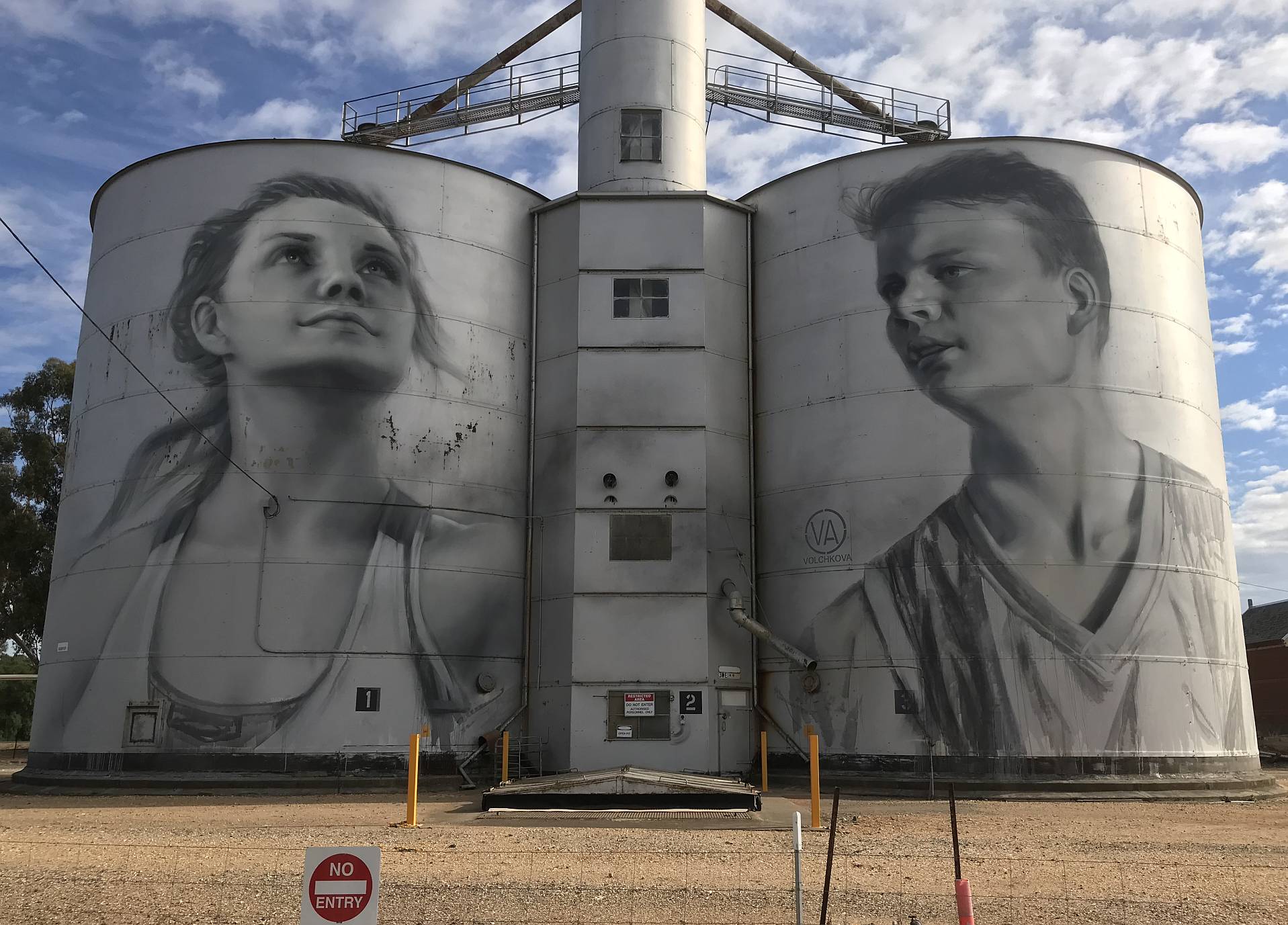
The first of the silo murals, Rupanyup; the artist was Julia Volchkova.
At some of the silos (such as this one; note the No Entry sign), people were not allowed to go near the art. At others we could walk right up to them.
Photo 2019/04/24
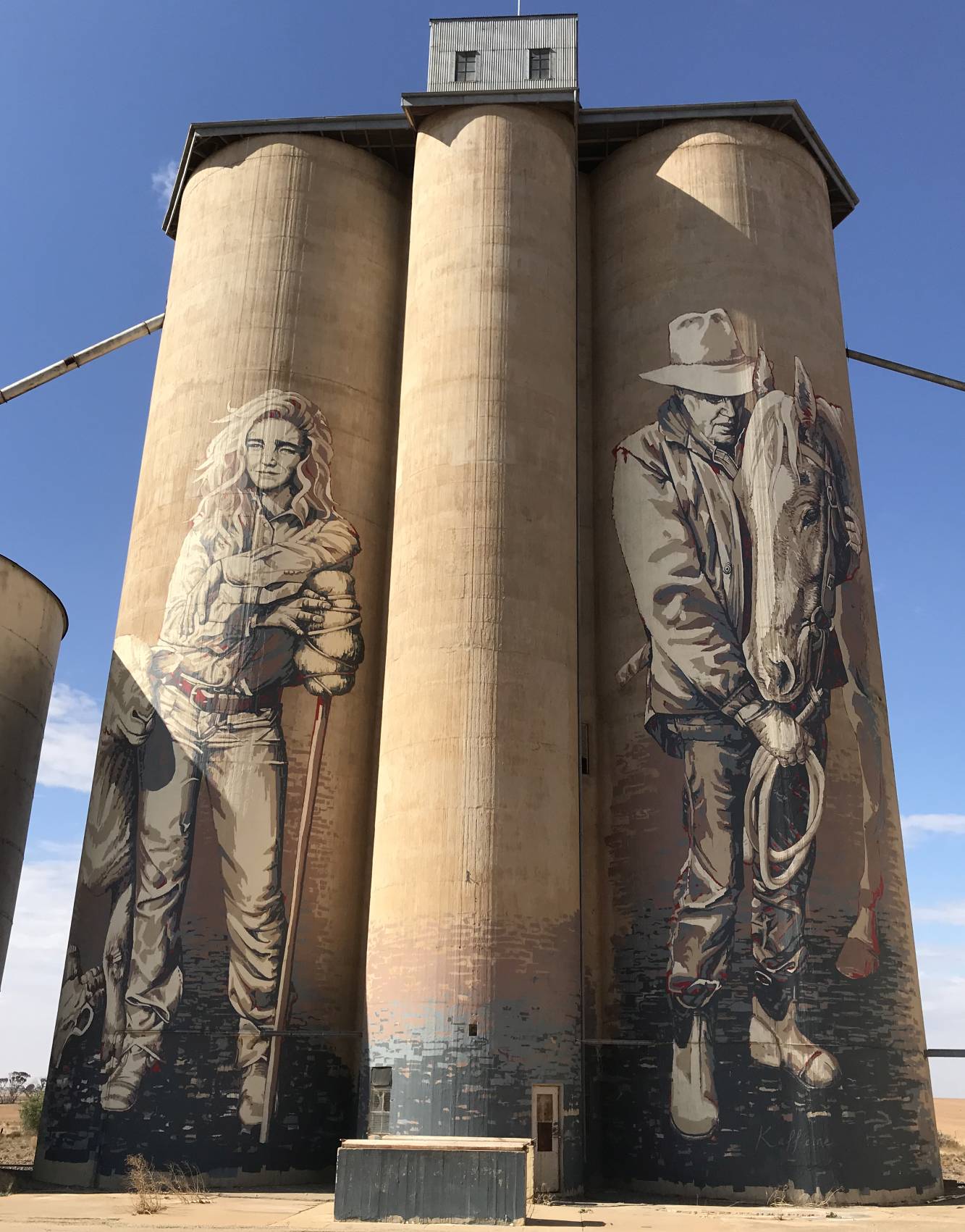
Sheep Hills, Silo Art Trail 2 |
|
|
The Sheep Hills silos, art work by Adnate.
Photo 2019/04/24 |
|
|
The Brim silos, art work by Guido van Helten.
Photo 2019/04/24 |
Rosebery, Silo Art Trail 2
Photo 2019/04/24
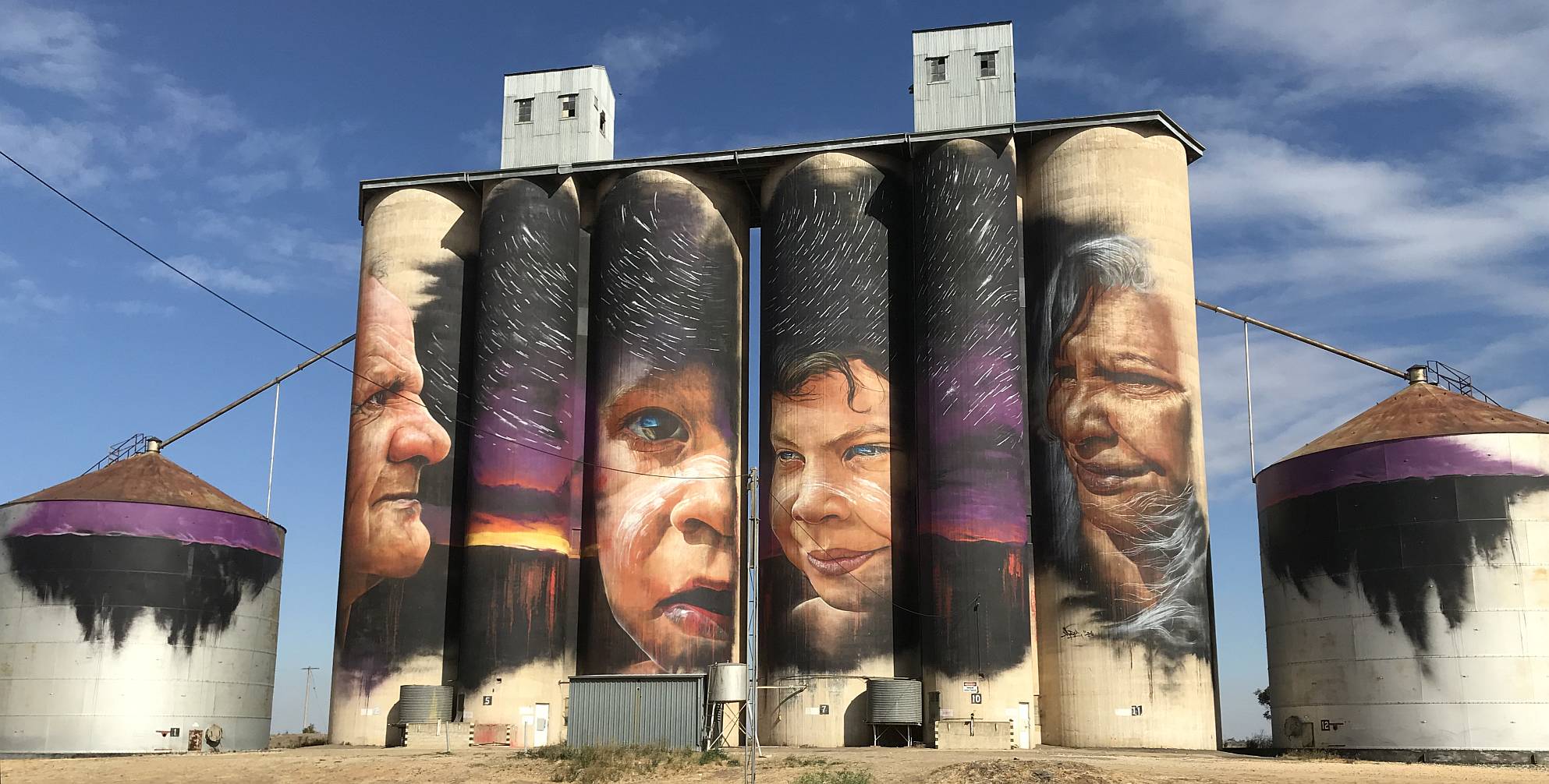
Lascelles, Silo Art Trail 2
Photo 2019/04/24
|
|
|
More of the Lascelles silo art.
Photo 2019/04/24 |
Patchewollock, Silo Art Trail 2
Photo 2019/04/24
|
|
|
This is not on any of the Silo Art Trails; we just happened to see it while looking for fuel in Waikerie back in our home state of South Australia.
Photo 2019/04/25 |
Photo Apple iPhone 7, 2021/09/09
|
Related pagesPhoto pages inside AustraliaBeetaloo Dam, 2014Clare Valley, 2007 Clare Valley, a collection started March 2021 Coober Pedy: photos and observations, 2016 Central NSW, March-April 2017 Flinders Ranges, 2006 Flinders Ranges 2019 Flinders Ranges, a collection started March 2020 Kangaroo Island, 2009 'Across the Nullarbor', 2009 South eastern Australia, November 2016 South eastern SA and Victoria 2018 A visit to Victoria, 2021 Wind farms... A development opportunity, the view from the top, 2018 Canunda/Lake Bonney, 2006 Hallett, 2008 Mount Millar, 2006 Snowtown, 2008 Starfish Hill, 2007 Turbine images with messages, 2014 Victoria, 2008 Wattle Point, 2007 Photo pages outside of AustraliaIndia; visit 1989; modified 2009Indonesia; visit 1994; modified 2009 Japan, 2017 New Zealand, 2019 Vietnam, visits 2004-08; modified 2017 Cambodia, Laos, Vietnam, 2011 Singapore and Malaysia, 2015 |
|
|