|
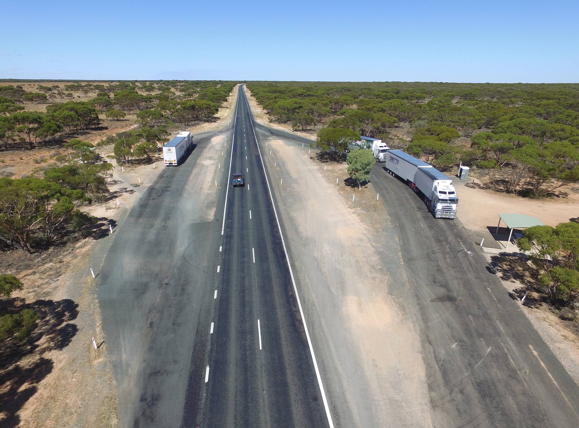
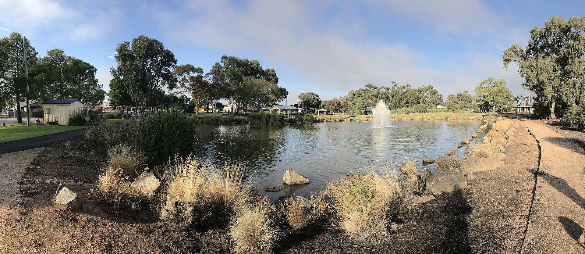
A parking bay near Barmera
This drone photo shows country typical of the non-irrigated land close to the Murray River in South Australia; it is flat, has limestone just beneath the surface and is largely covered with mallee scrub.Mallee is a type of Eucalypt that has multiple trunks coming from a lignotuber, a woody lump just below ground level. Fires typically kill the parts of a mallee above ground and they re-shoot from the lignotuber relatively quickly.
Click (or tap) on the image to view full size image.
2017/03/19
|
|
|
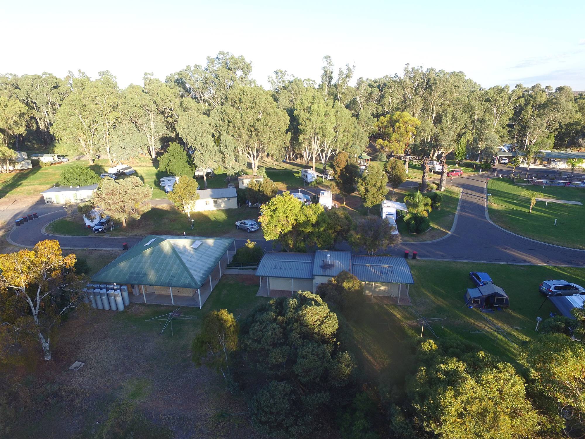
Balranald caravan park
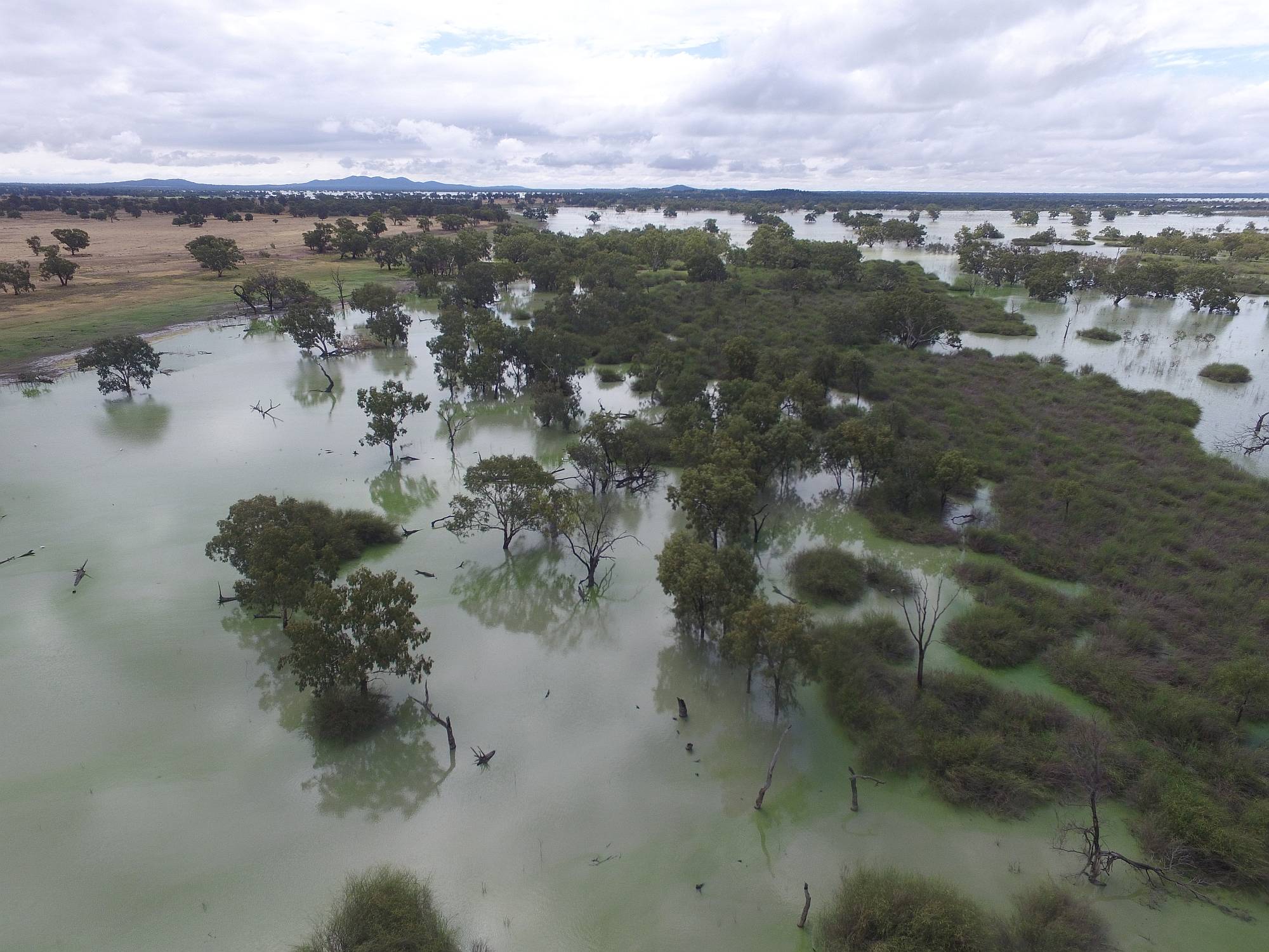
Balranald is the first town on the Murrumbidgee when travelling east across the Hay plain.On our earlier trip in October and November of 2016 the Murrumbidgee was in flood at Balranald. On this trip the river was flowing sedately.
It was a hot day, I swam in the river, which is beneath the trees in the background. Most people used the swimming pool in the caravan park instead; the river bottom was soft mud.
Balranald caravan park was one of the nicer ones that we stayed in. Our camper and car are in the lower right of the photo; just to the right of the (well equipped) camp kitchen.
The cylindrical objects on the left of the amenities block are heat-pump water heaters. I would have thought that it would be well worth having solar water heating in a place as consistently sunny as Balranald.
2017/03/20
|
|
The Hay Plain
In the Murray Basin the Hay Plain surrounds the Murrumbidgee River. It has to be one of the flattest regions in Australia.Trying to get a grasp of the length of geological times is difficult. Most people live less than a century; a thousand centuries is a very short time geologically. Perhaps it might help to try to imagine how long it would take for a plain like this to form from occasional floods bringing silt down the river and very slowly filling up the lower-lying areas.
All the Earth's surface has been uplifted into hills and mountains at one time or another. Some time in the geological past this plane would have been hilly or mountainous.
The river would initially follow the lowest lying path.
Over the millennia it would leave silt and sand and gradually build up the
area around its course.
It would very slowly move around as one path was raised and dump alluvium in
other areas.
Imagine it wandering backward and forward over the land, gradually raising
the lower areas, until the whole region was as flat as shown in these photos.
|
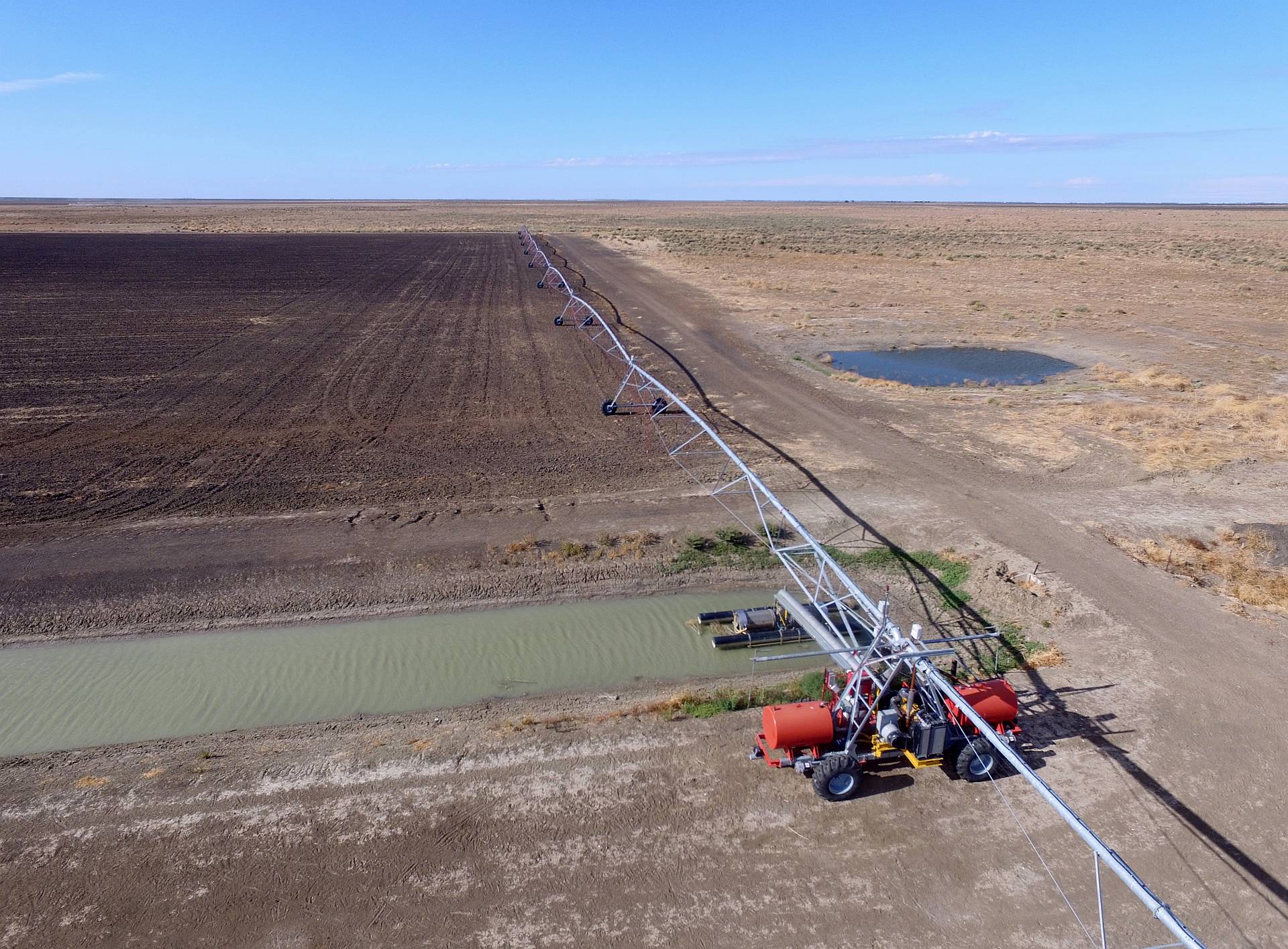
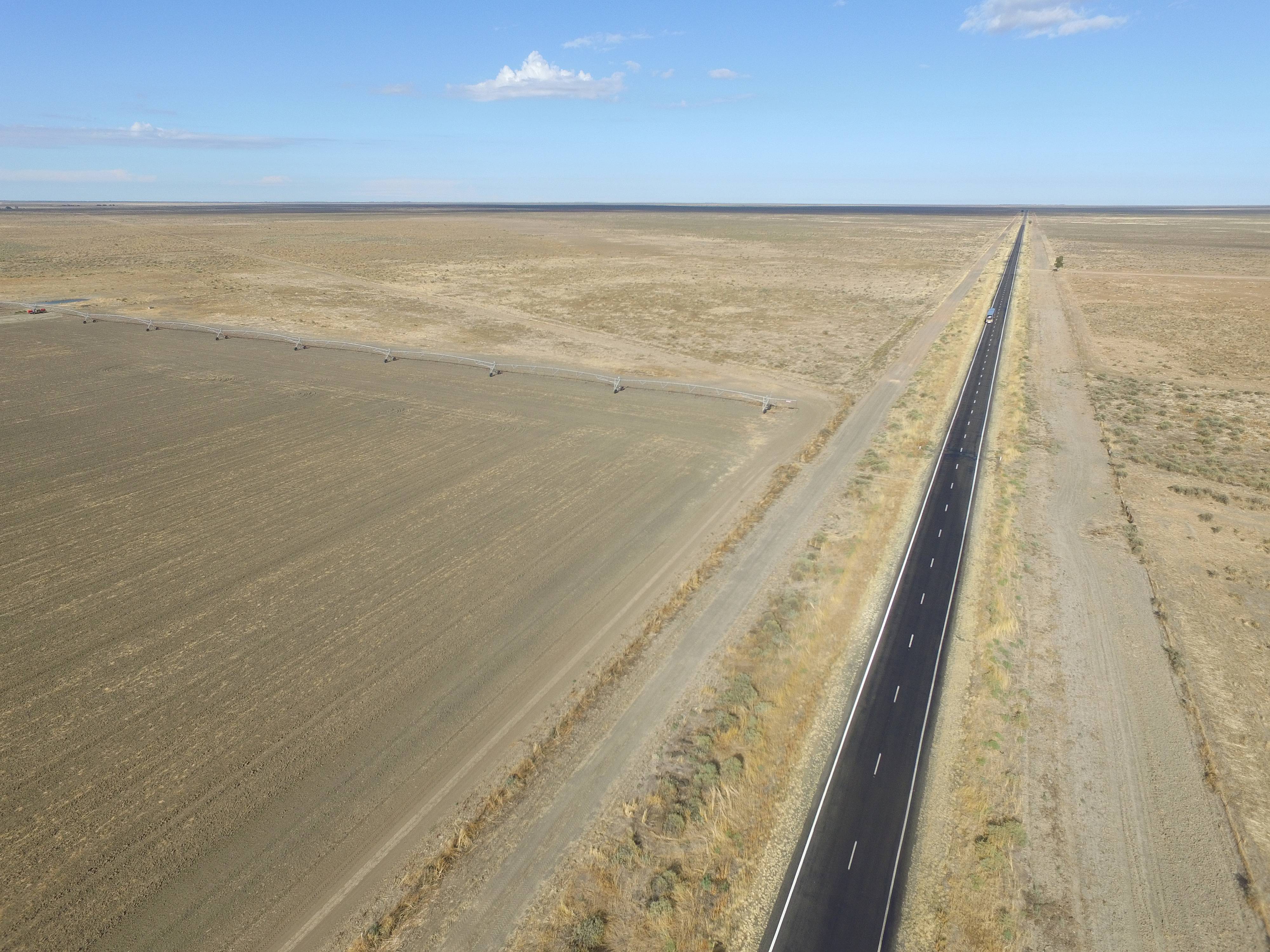
A travelling irrigator west of Hay
On a previous trip I photographed an irrigation channel that crossed the main road. I thought that the water would have been used for flood irrigation, which is a very inefficient way of using water to grow plants.This drone photo shows a more efficient method. The machine in the foreground pumps water from the ditch through the pipeline and out through sprinklers; it slowly moves along the channel, the long elevated pipeline follows it, watering as it goes.
|
|
Click (or tap) on the image to view full size; use back-arrow to come back.
2017/03/20
|
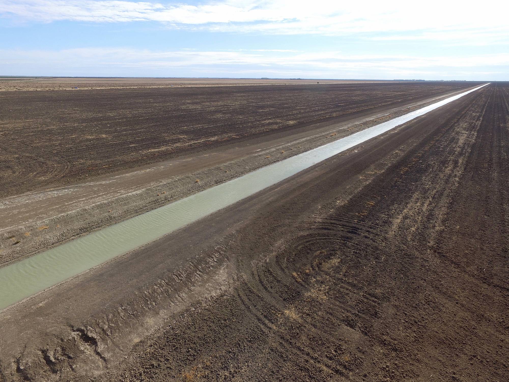
Irrigation channel
The channel from which the travelling irrigator pumps water; losses by soakage would be substantial, but much lower than if flood-irrigation was used. Flood irrigation over-waters the areas first to be flooded and underwaters the last areas to be flooded, and results in very high evaporation losses.The irrigator shown in the previous photo would move along this channel.
2017/03/20
|
|
|
Straight road
A part of the travelling irrigator discussed above can be seen on the left of this photo. The road is the one that goes from Balranald to Hay (behind the camera).2017/03/20
|
|
|
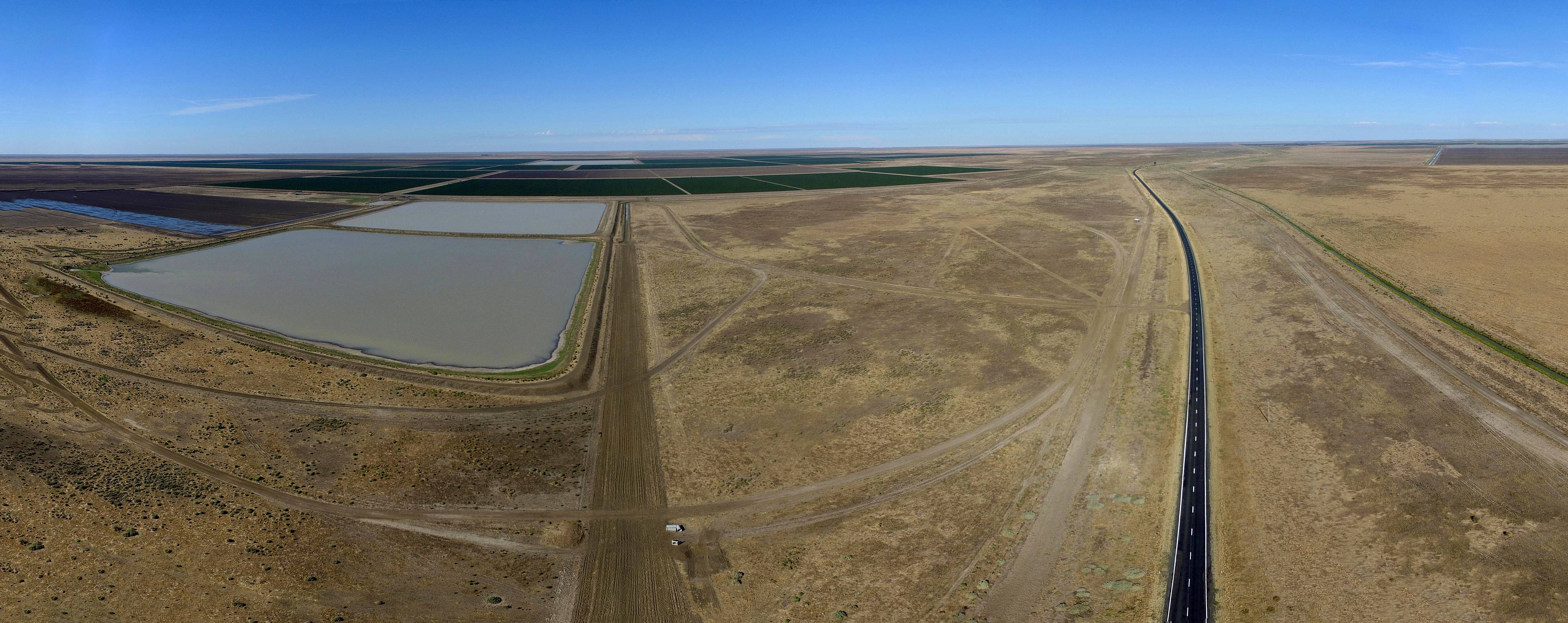
Big dams
We saw a number of these big shallow dams on the forty or so kilometres approaching Hay.I suppose they must be filled when there is a good flow in the Murrumbidgee and then the water taken out as needed for irrigation.
|
|
There is plainly plenty of scope for using Australia's very limited water resources more economically and intelligently.
2017/03/20
|
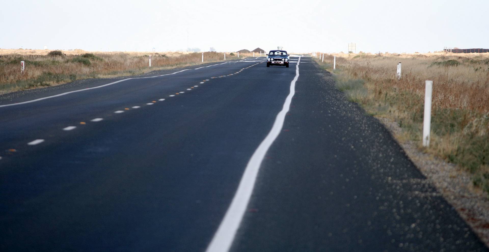
The Hay Plain
How do you show how flat an area is in a photograph?This is a long telephoto shot of a car approaching on one of the many straight sections of the Balranald to Hay road on the plain of the Murrumbidgee (a major tributary of Australia's biggest river, the Murray).
|
|
2017/03/20
|
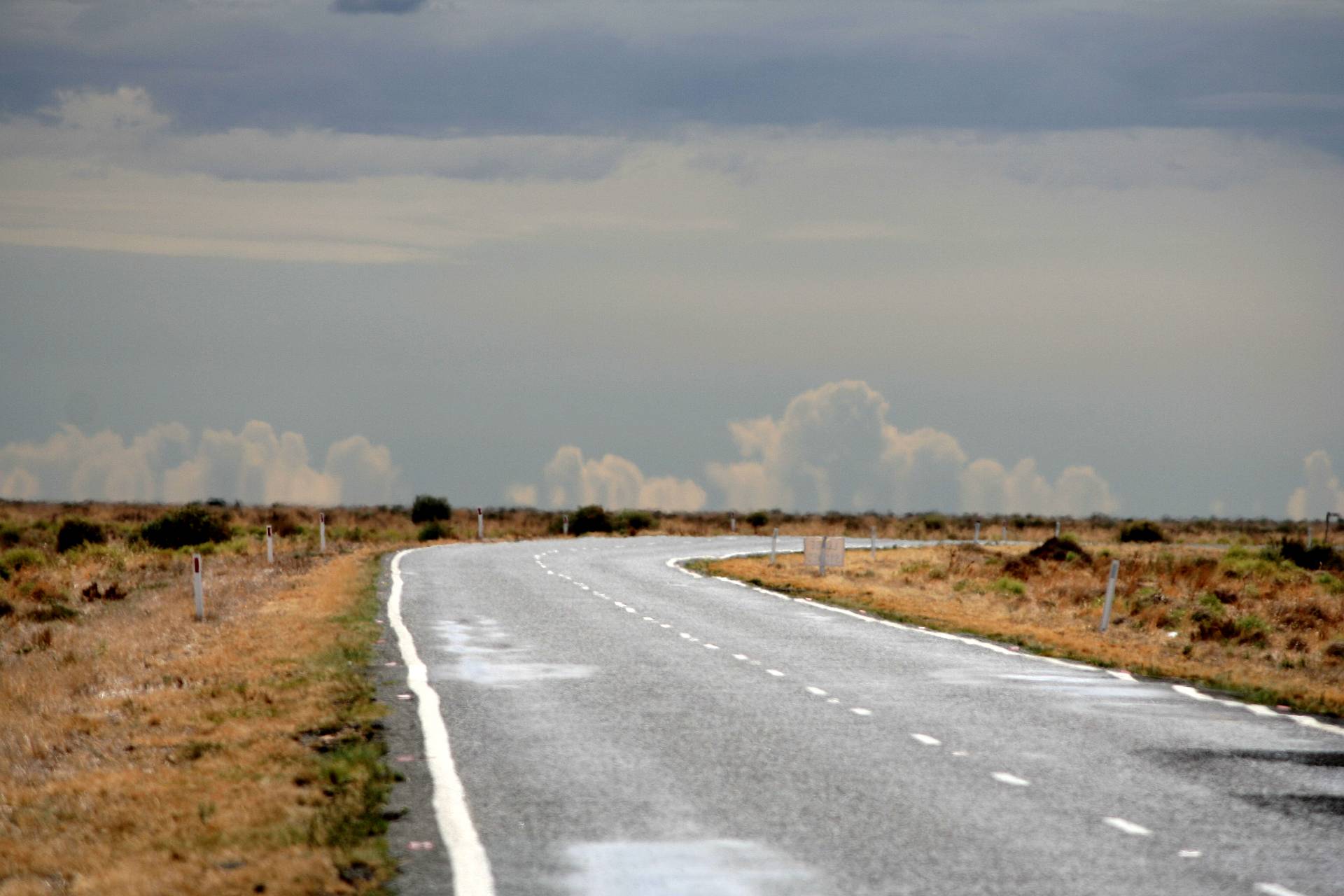
Clear air
While most of Australia's electricity is generated by burning coal we are fortunate in having a big country with a low population and no neighbouring countries from which polluted air can come our way. Australia's air is clearer than most of the world's and there were no coal-fired power stations for thousands of kilometres on the windward side of this location.This is no credit to Australian governments, the Turnbull Government for example, which was in power at the time of this trip, strongly favoured coal over renewable energy.
The prevailing winds in this area tend to come from the west. There were no coal-burning power stations within a couple of thousand kilometres to the west of this (and no bushfires at the time?), so no air pollution. The last coal-fired power station in South Australia was shut down in May 2016.
|
|
Heat-haze makes the long-telephoto image blurry.
As with the above image, this photo was taken using the longest telephoto lens I had, 250mm (about 400mm in 35mm equivalent).
2017/03/20
Central NSW
Everything changes when travelling east at Goolgowi (on the road from Hay to West Wyalong); from the very flat land, grey soil, scattered patches of Eucalyts of the Murrumbidgee basin, to undulating, red soiled, mixed species (at least a half dozen genera) forests; from flood irrigated to dry grown cereal country surrounded by hills.West Wyalong
|
A West Wyalong Park
Denece and I were impressed with some of the parks in West Wyalong; this one in particular, it was well planned, well layed-out and well maintained.2017/03/22
|
|
|
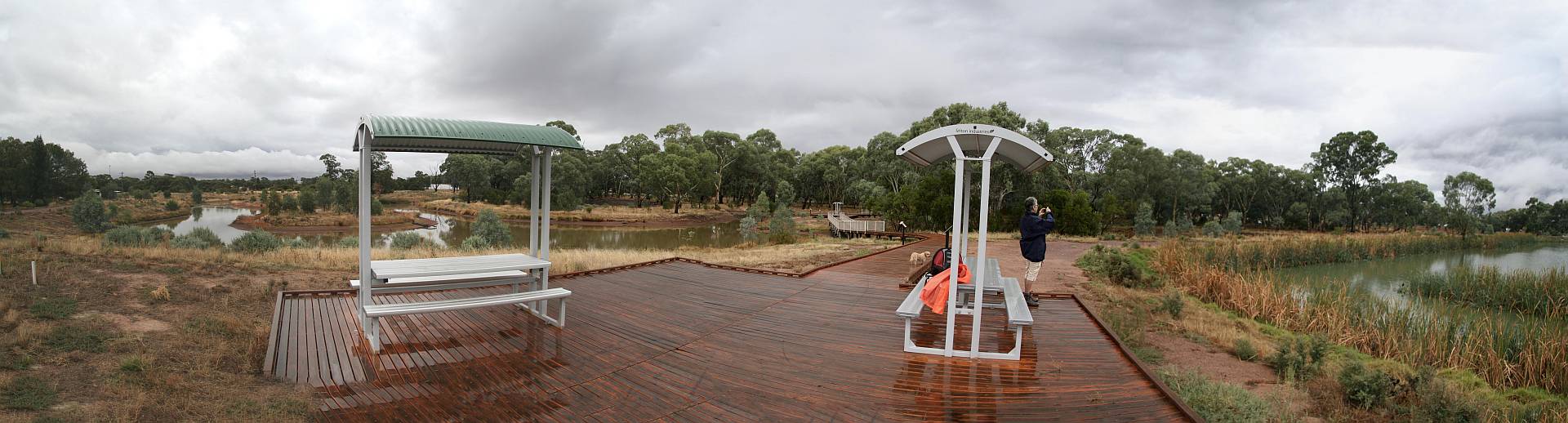
West Wyalong Wetlands
|
|
It happened that there had been rain overnight which continued into the morning, so the wetlands were wet in more ways than one.
2017/03/21
|
Lake Cowel
This is the biggest inland lake in NSW and is about 50km NE of West Wyalong. It is in quite flat country, so photographic possibilities from the ground are limited.There was a huge open-cut gold mine, right on the edge of the lake, a few kilometres away from this point (next photo).
Click (or tap) on the image to view full size; use back-arrow to come back.
2017/03/21
|
|
|
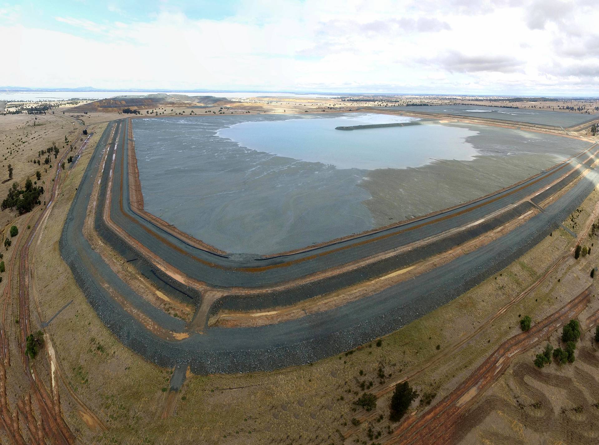
Lake Cowel mine slurry pond
My drone is limited to 120m above the launch point. To get a view of the whole mine area it would have to go much higher (a good image is available from Google Earth), but this image gives a grasp of the size of the slurry pond (where the fine material from ore processing goes).Lake Cowel is visible in the distance, the mine itself is in the middle distance. Click (or tap) on the image to view full size; use back-arrow to come back.
This trip brought to my mind how much mining is going on in Australia. While mining is essential to modern life, it damages our environment and mining consumes large quantities of fossil fuels.
The most worrying (and unnecessary) is the coal mining, but we could also reduce the amount of metal mining by increasing recycling and reducing consumption.
|
|
2017/04/21
|

Stamper battery
A stamper battery at the site of an old gold mine at Grenfell, which is east of West Wyalong, on the way to Cowra.The West Wyalong/Grenfell area was one of the first places where gold was discovered in the Australian Goldrush of 1851.
|
|
2017/03/22
Cowra area
Canowindra
|
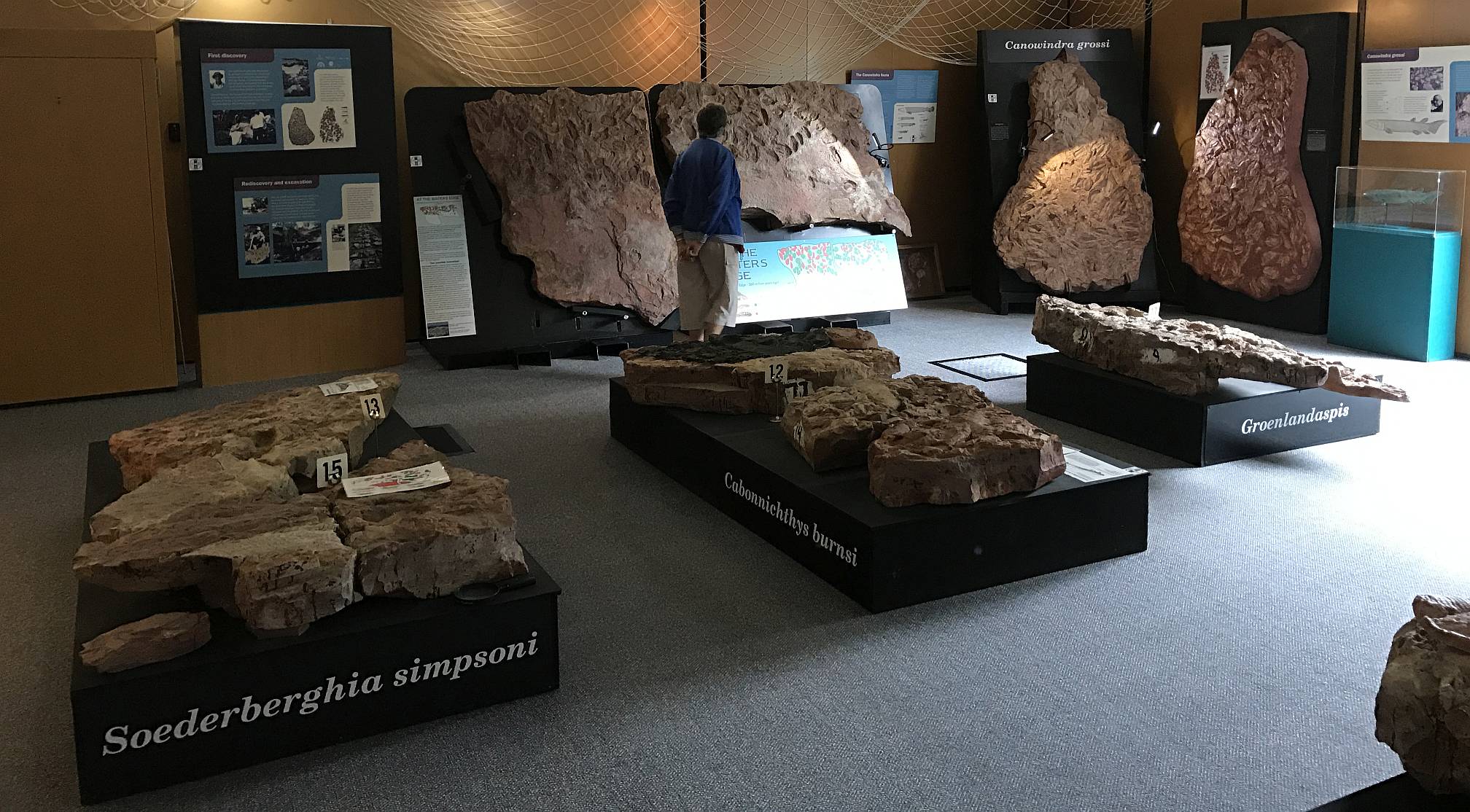
Age of Fishes Museum
The Age of Fishes Museum at Canowindra is well worth a visit; in my opinion certainly the most interesting feature of Canowindra. To not be fascinated by the evolution of life on Earth is to not want to understand the world and the Universe.Canowindra (pronounced Canowndra) is about 40km north of Cowra.
|
|
There is a good Net site on the museum.
2017/03/23
|
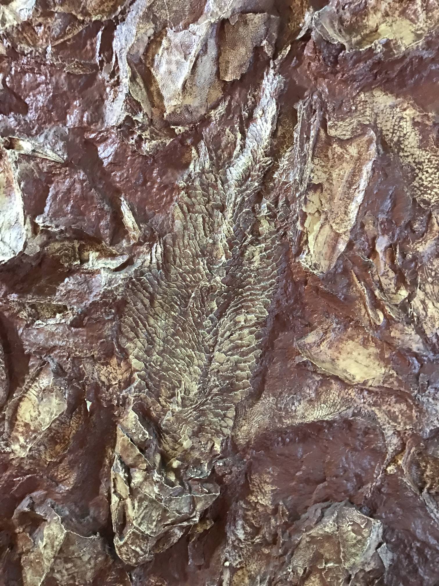
Age of Fishes Museum
One of the fish fossils at the museum. A quote from the Web site:"Long before dinosaurs roamed the Earth, the mighty rivers of the Central West teemed with bizarre ancient fishes – armoured fishes, fishes with lungs, and some huge predators with jaws like crocodiles. Thousands of their fossils were found at Canowindra and give us a unique glimpse into life during the Devonian Period – the 'Age of Fishes'.2017/03/23
A chance discovery in 1955 revealed an extensive fossil bed dating from the Devonian Period. This 360-370 million year old fossil deposit contains the remains of thousands of freshwater fish. Many were new to science. The best of the fossils so far recovered are now on public display at Canowindra, at the Age of Fishes Museum."
|
|
Cowra
Denece and I greatly enjoyed our visit to Cowra, for its Japanese garden in particular, but it seemed to be a pleasant, progressive town.
Something I came across after our visit confirmed this opinion:
Renewables roadshow – Cowra: 'It goes from being waste to a resource'.
|
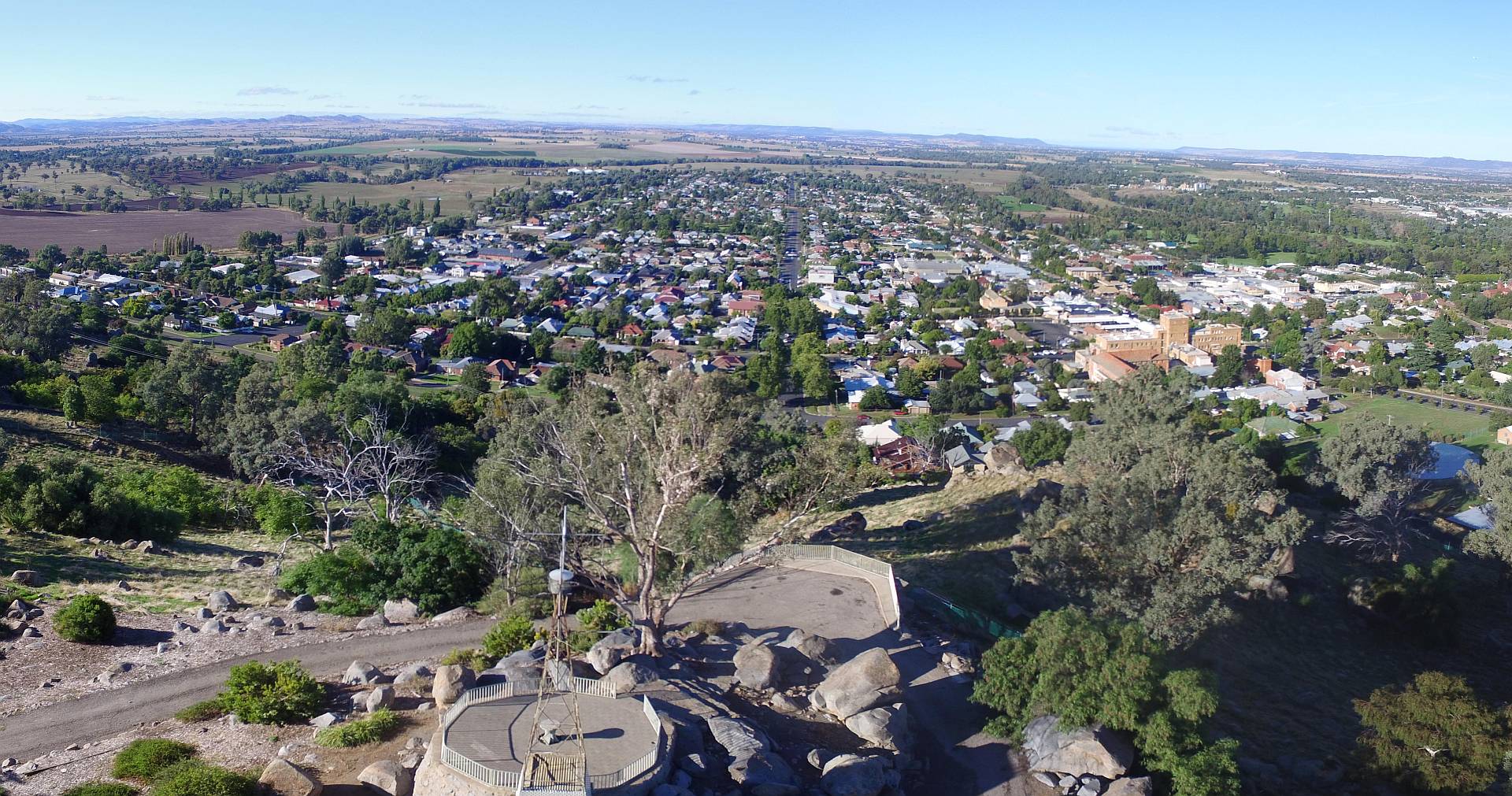
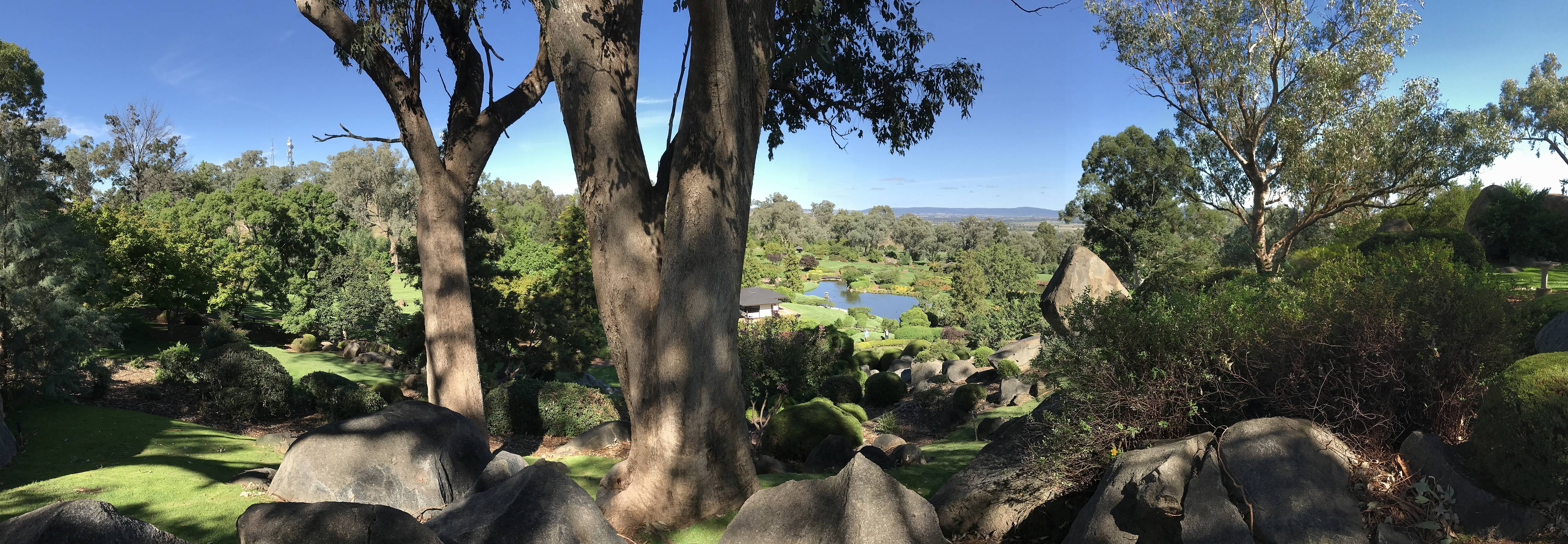
Cowra from the lookout
A stitch of two drone photos from above the lookout on the big hill near the Japanese Garden.2017/03/24
|
|
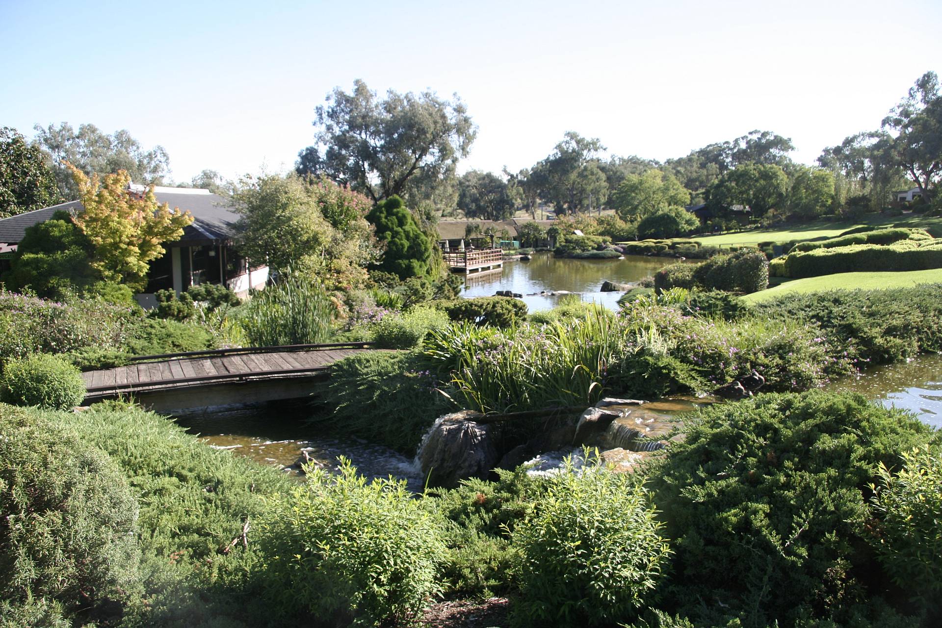
Cowra Japanese Garden
|
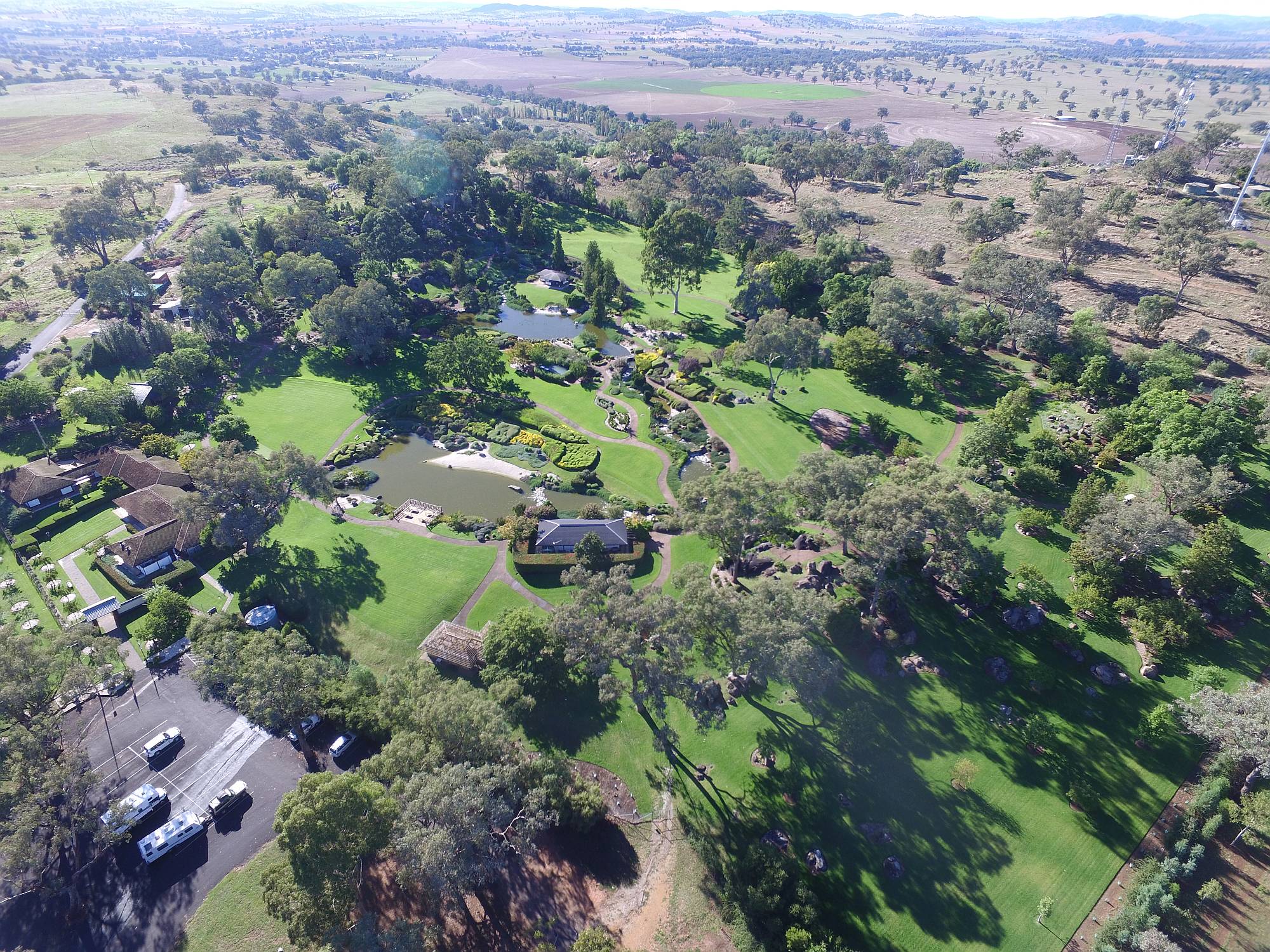
Cowra Japanese Garden
This is one of the most beautiful gardens my wife and I had ever seen. We had two mornings at the gardens, the first morning was completely overcast, so we came back the next day when the sun was shining. The photos shown here were taken on our second morning in the gardens.The gardens were designed by Ken Nakajima. There is a Net site about the garden.
This photo was taken with my drone.
2017/03/24
|
|
|
Japanese Garden
A picture is worth a thousand words...2017/03/24
|
|
|
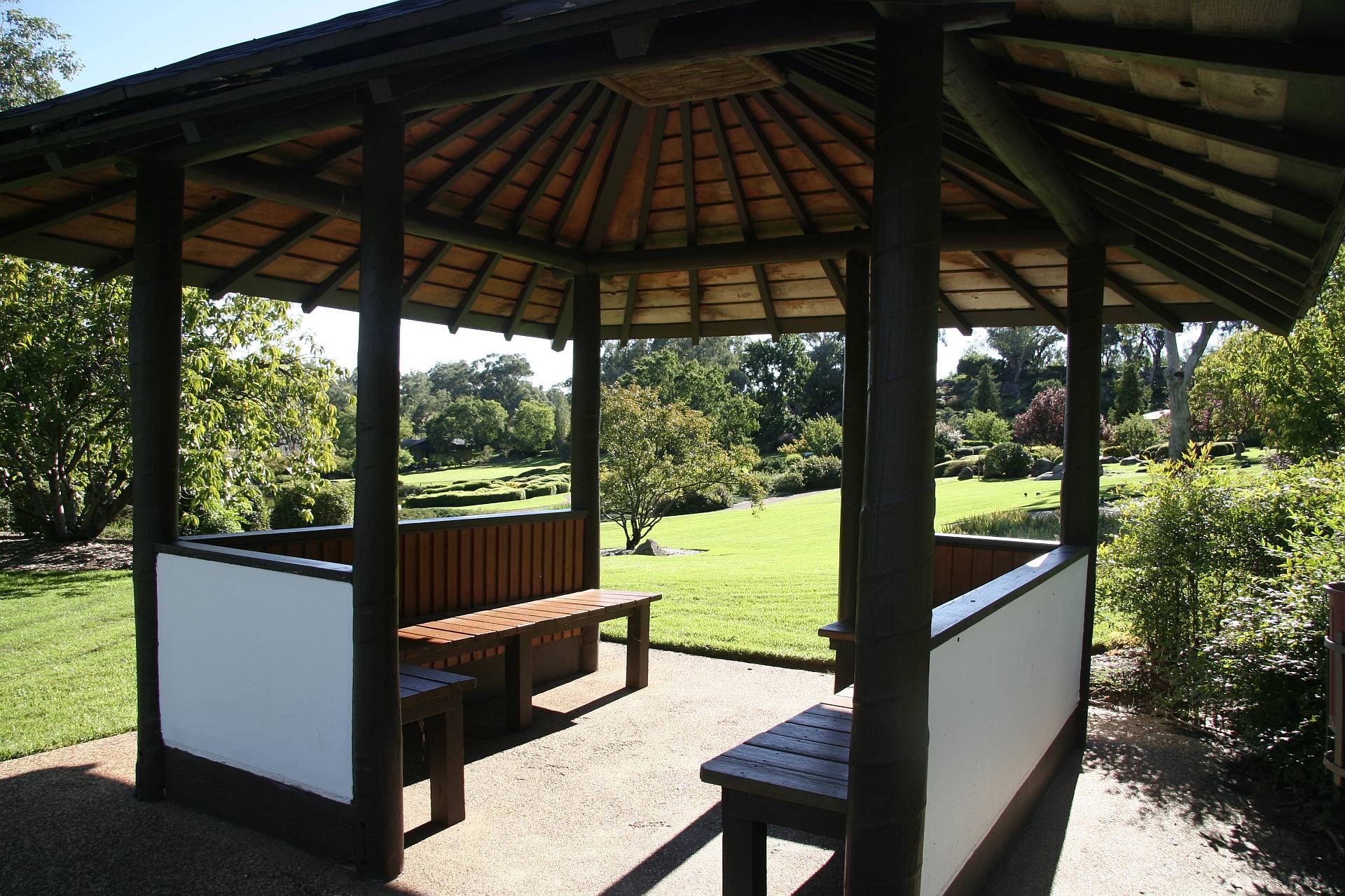
Japanese Garden
One of the typically Japanese pavilions in the gardens2017/03/24
|
|
|
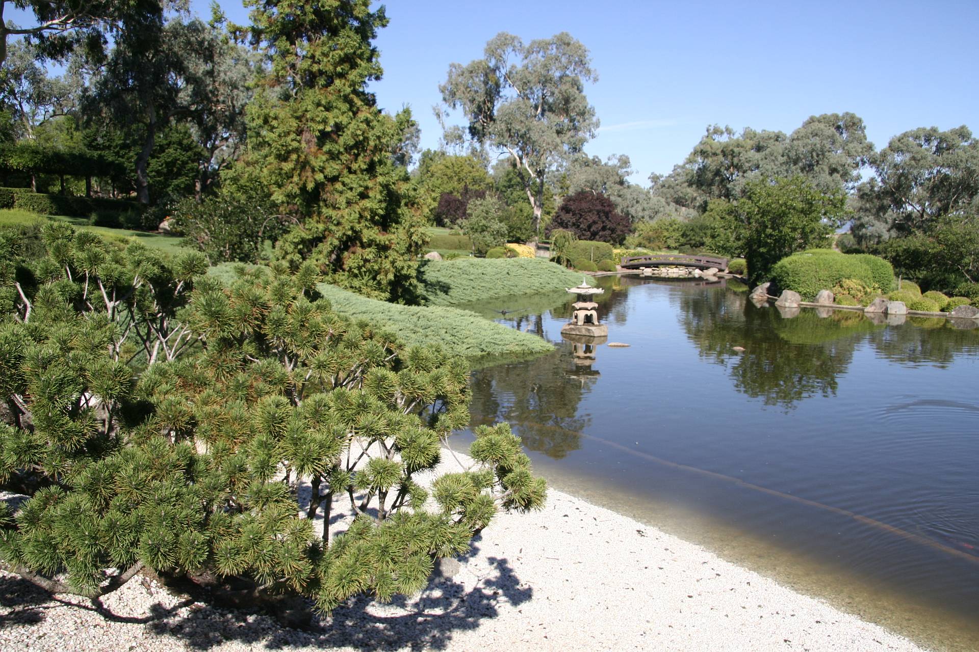
Japanese Garden
One of the ponds and gravel beaches2017/03/24
|
|
|
Japanese Garden
From the lookout at the northern end.Taken with an iPhone.
2017/03/24
|
|
Cowra World Peace Bell
|
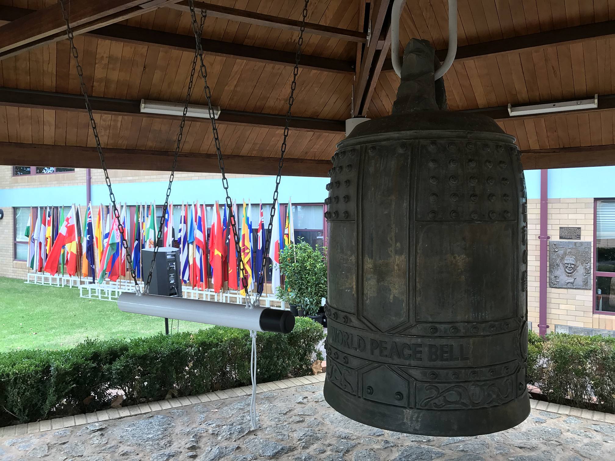
Cowra World Peace Bell
There are Peace Bells like this around the world; Australia's World Peace Bell is at Cowra. They are said to have been cast from melted-down coins that have been donated.Cowra Tourism has a Net site on the Cowra World Peace Bell.
2017/03/24
|
|
East from Cowra
|
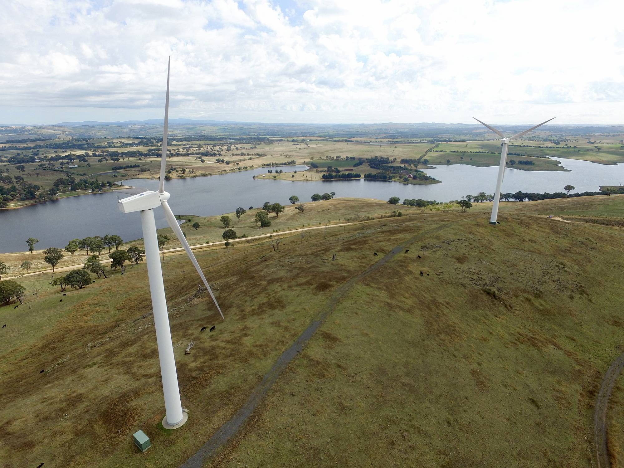
Blayney Wind Farm
This small wind farm is visible from the main road from Cowra toward Bathurst. It is in a picturesque area near Carcoar Lake and Carcoar caravan park.This photo of two of the Blayney turbines and Carcoar Lake in the background was taken using my drone.
It is interesting that the 15 Blayney turbines are rated at 0.66MW. Others installed only a couple of years later were up to 1.75MW. Blayney Wind Farm was completed in the year 2000.
2017/03/25
|
|
Bathurst
|
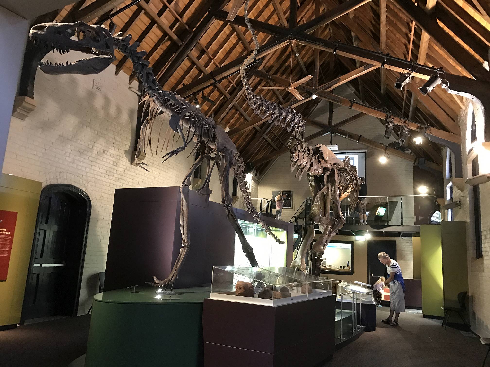
Bathurst Fossil and Mineral Museum
This museum is devoted to the collection of Warren Somerville and is brilliantly displayed. The museum is, in my opinion, the best feature of Bathurst; anyone interested in how life on Earth came to be the way it is should love this and the Age of Fishes Museum in Canowindra.There is a Net site about the museum.
2017/03/26
|
|
|
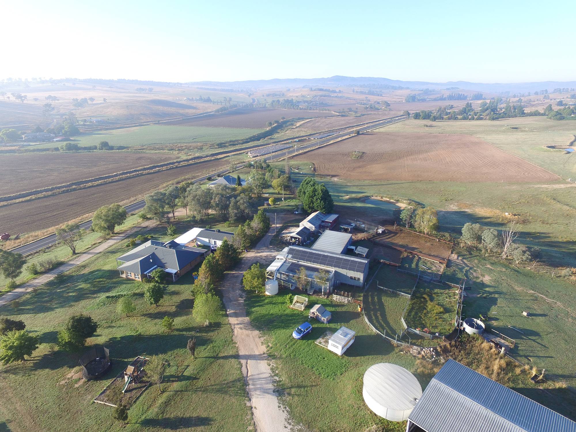
Barcoo's Farmstay
This place, just out of Bathurst, was the most pleasant place we stayed at the whole trip, and the only place we stayed as long as four nights. We had a powered site on lawn, a very well equipped camp kitchen, mostly to ourselves, and it was very quiet. (For more information, see Barcoos Barn.)Our Honda Jazz and tent trailer are visible below the centre of the photo.
2017/03/27
|
|
Curiosities in Lithgow
The following two photos are out of character for this page. My wife and I stopped in Lithgow for a coffee break on the way to the scenic area of the Blue Mountains.
I thought that these two images showed something about human nature.
|

Lithgow curiosity 1
This gold chain was in the window of a Lithgow jeweller's shop as part of a closing down sale.Give it a bit of thought. No jeweller would sell a gold chain for less than the value of the gold in the chain, so we can safely assume that the gold value is no more than $3900. He was trying to sell it for $9750. The chain would be machine-made, so workmanship would be $100 at the absolute maximum.
The jeweller was trying to sell a chain worth no more than $4000 for $9750; that's a 144% mark-up! Is this typical of jewellers?
2017/03/27
|
|
|

Lithgow curiosity 2
This marker was in a newsagent in Lithgow.Astrology is the opposite of science; astrology is superstitious mumbo-jumbo, science is by far the most reliable way we have to discover the truth about the world around us. Why on earth would any reasonable person place the two in the same section?
It also seems common for book stores to place philosophy books in the same section as religious books. Much the same applies here: philosophy deals with reason, logic, sound argument; religion is baseless belief.
2017/03/27
|
|
Blue Mountains
|
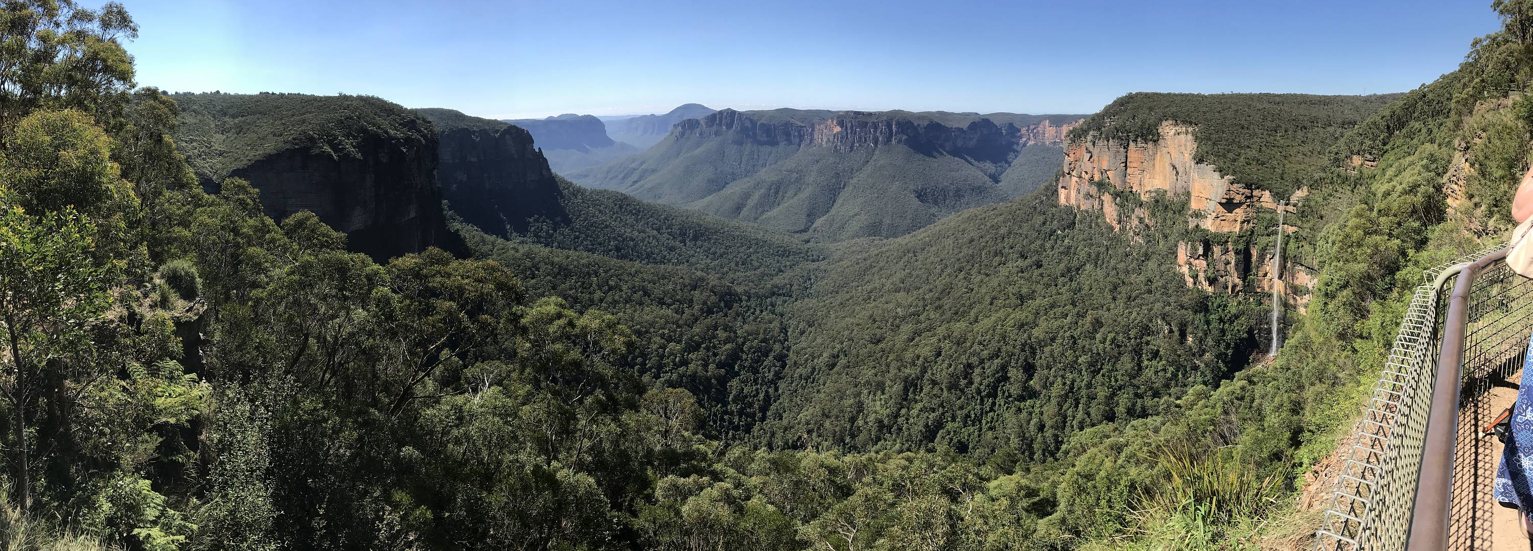
Govert's Leap
Denece and I had a limited time in the Blue Mountains. This was the first view-point we visited, and the most impressive. There were far fewer tourists here than at the 'iconic' Echo Point.
|
|
2017/03/27
|
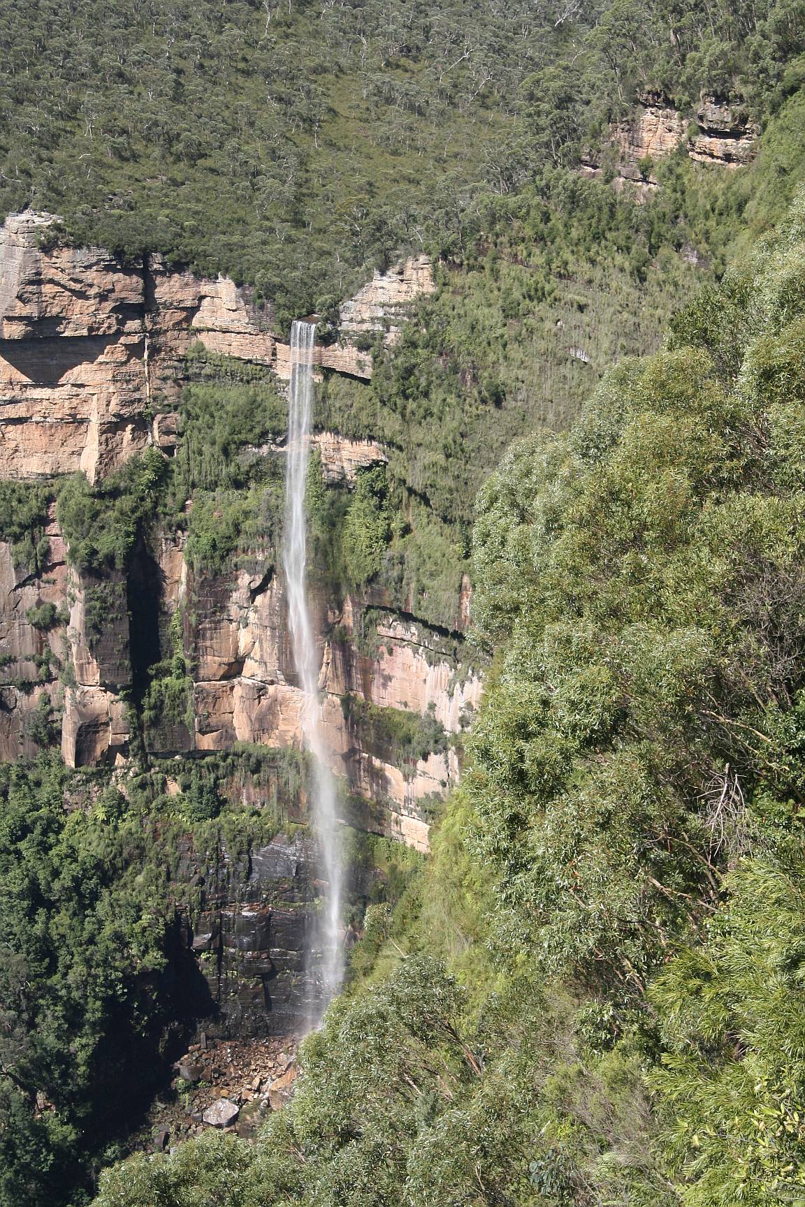
Bridalveil Falls
This is the same waterfall as shown on the right of the previous photo.2017/03/27
|
|
|
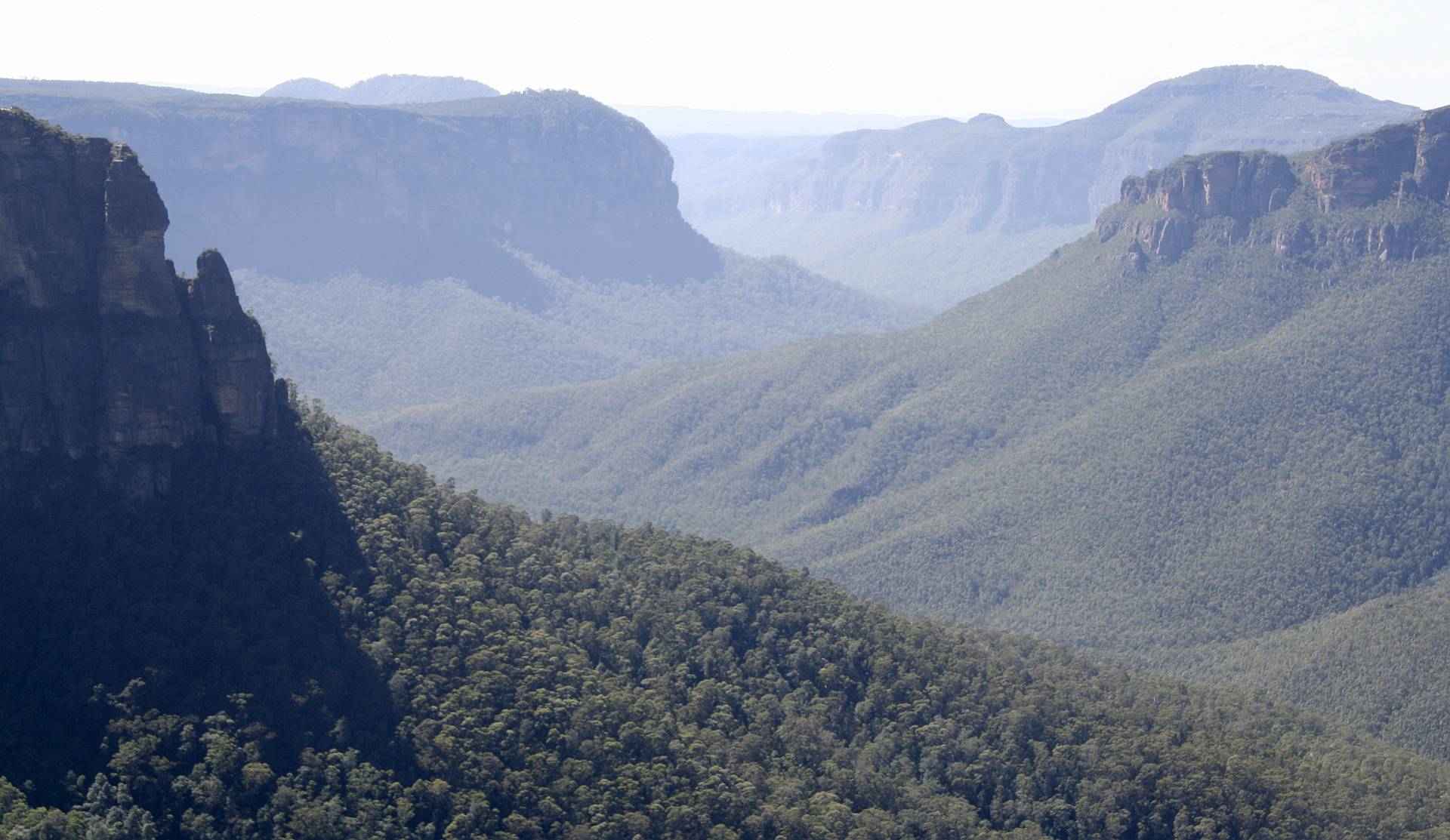
Grose Valley
Looking down the same valley as shown in the panorama above; the view from Govert's Leap.2017/03/27
|
|
|
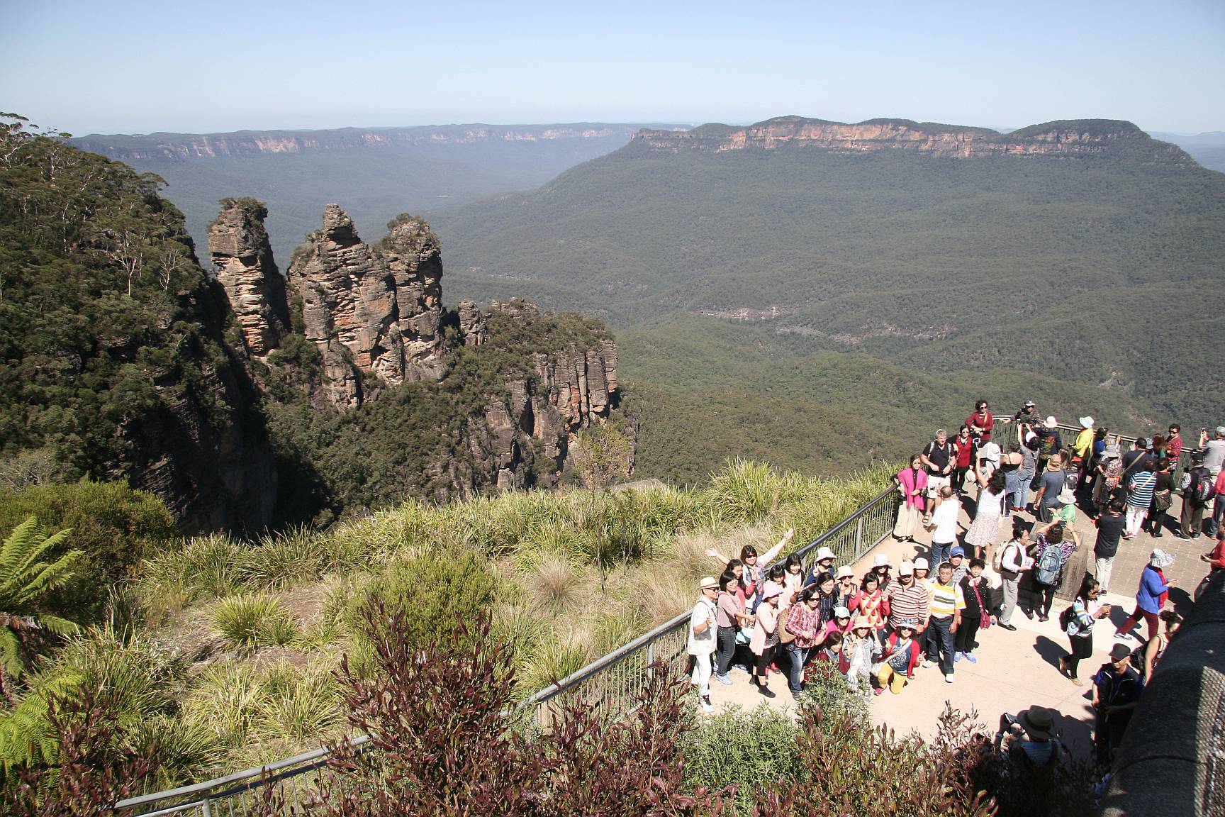
Echo Point
The most popular site to visit in the Blue Mountains, as can be seen by the number of visitors. The pillars on the left are called the Three Sisters.The viewing area shown is the lower of two. There wouldn't be room for all the visitors with only one platform.
2017/03/27
|
|
|
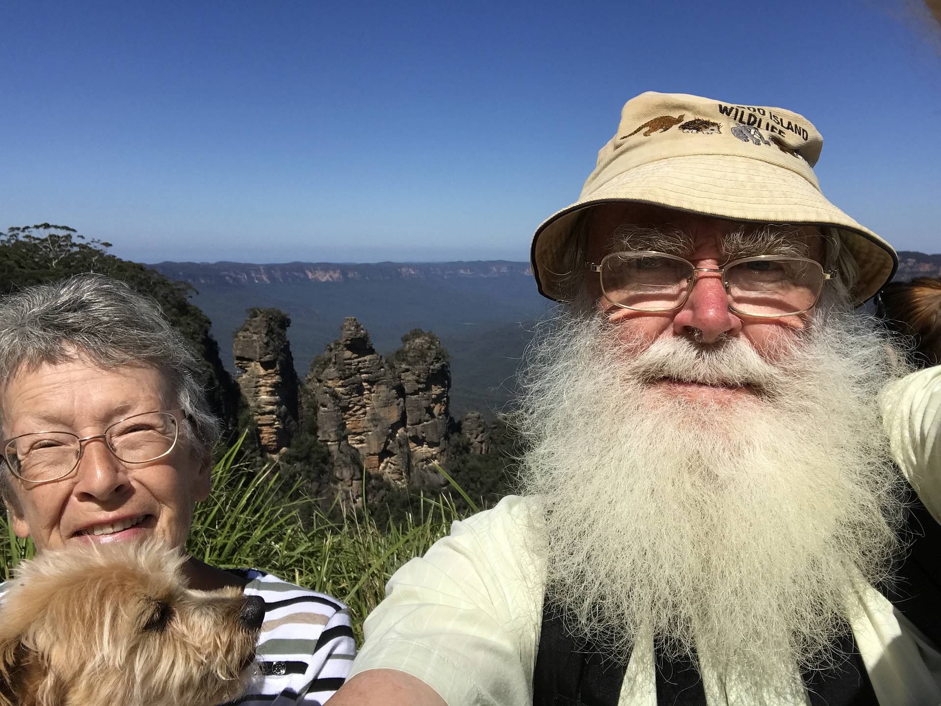
Selfie
It seemed that almost everyone at Echo Point was taking selfies with the Three Sisters in the background. I joined in, jokingly, just to be in the 'in group'.Perhaps the most interesting thing about this was that two other people kindly offered to take photos of Denece, Socrates and me with the Three Sisters in the background. Both of them got quite acceptable photos of the three of us, but with the Three Sisters almost entirely concealed behind us.
2017/03/27
|
|
A day trip to Sydney
|
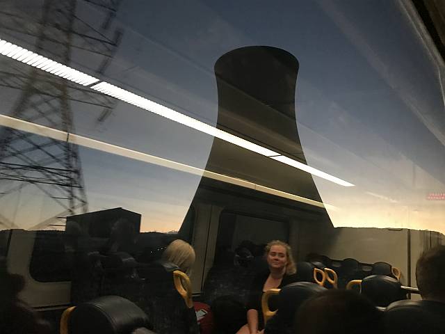
From a train; coal-fired power station
Denece and I took the Bathurst Bullet train to Sydney for a day trip. The train left Bathurst at 0549, arrived in Sydney at 0927; left Sydney at 1752 and got back to Bathurst at 2135. It was right on time at every departure and arrival!Dawn was breaking as we passed Wallerawang Power Station near Lithgow. Reflections from inside the brightly lit carriage competed with the view of a cooling tower and power pylon outside.
Technically this photo is rubbish but something about it aesthetically apeals to me, and it showed a technology that was fast coming to an end; coal fired power generation (which, by the way, is responsible for killing millions of people each year through its air pollution).
|
|
The permanent closure of this power station was announced by Energy Australia in November 2014.
2017/03/28
|
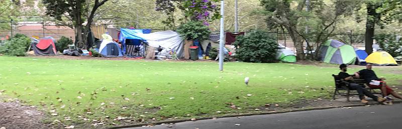
Camps
Illegal camps of homeless people in a small park close to the Sydney Central Railway Station.2017/03/28
|
|
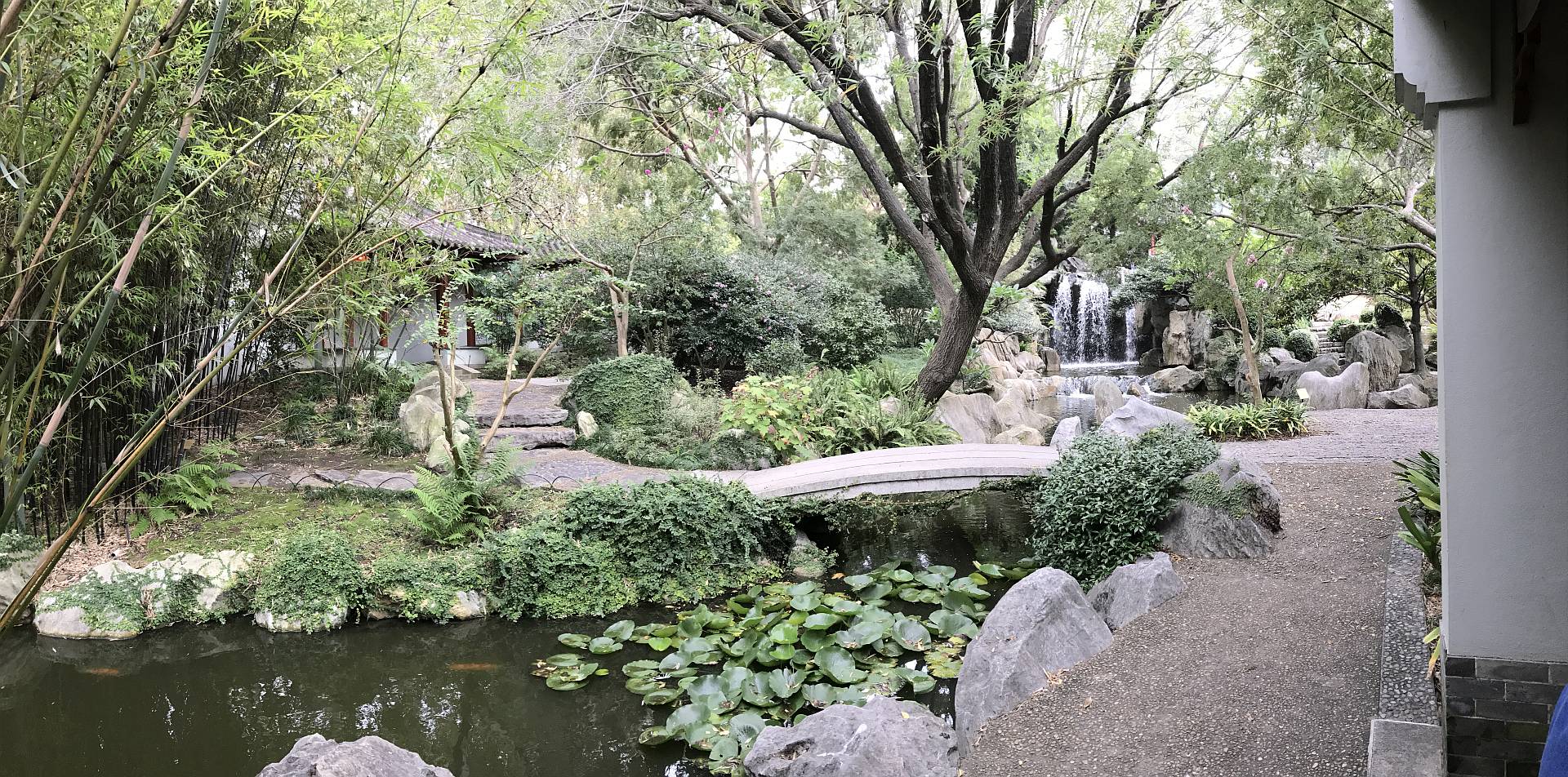
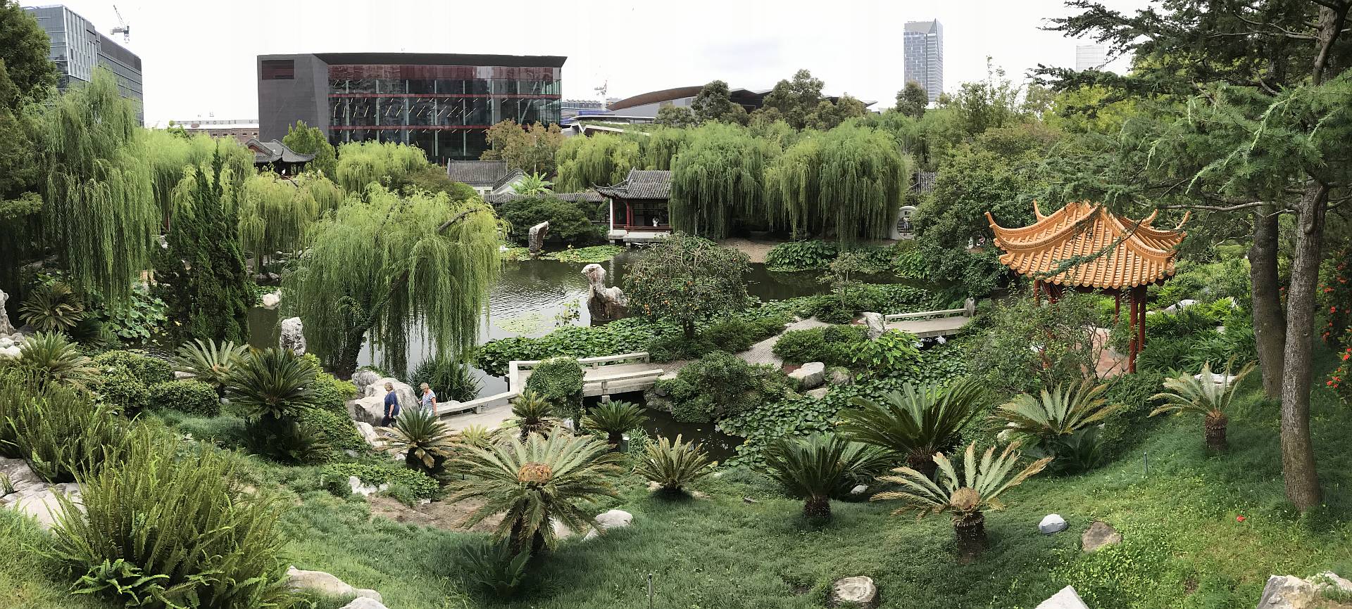
Sydney Chinese Garden of Friendship
|
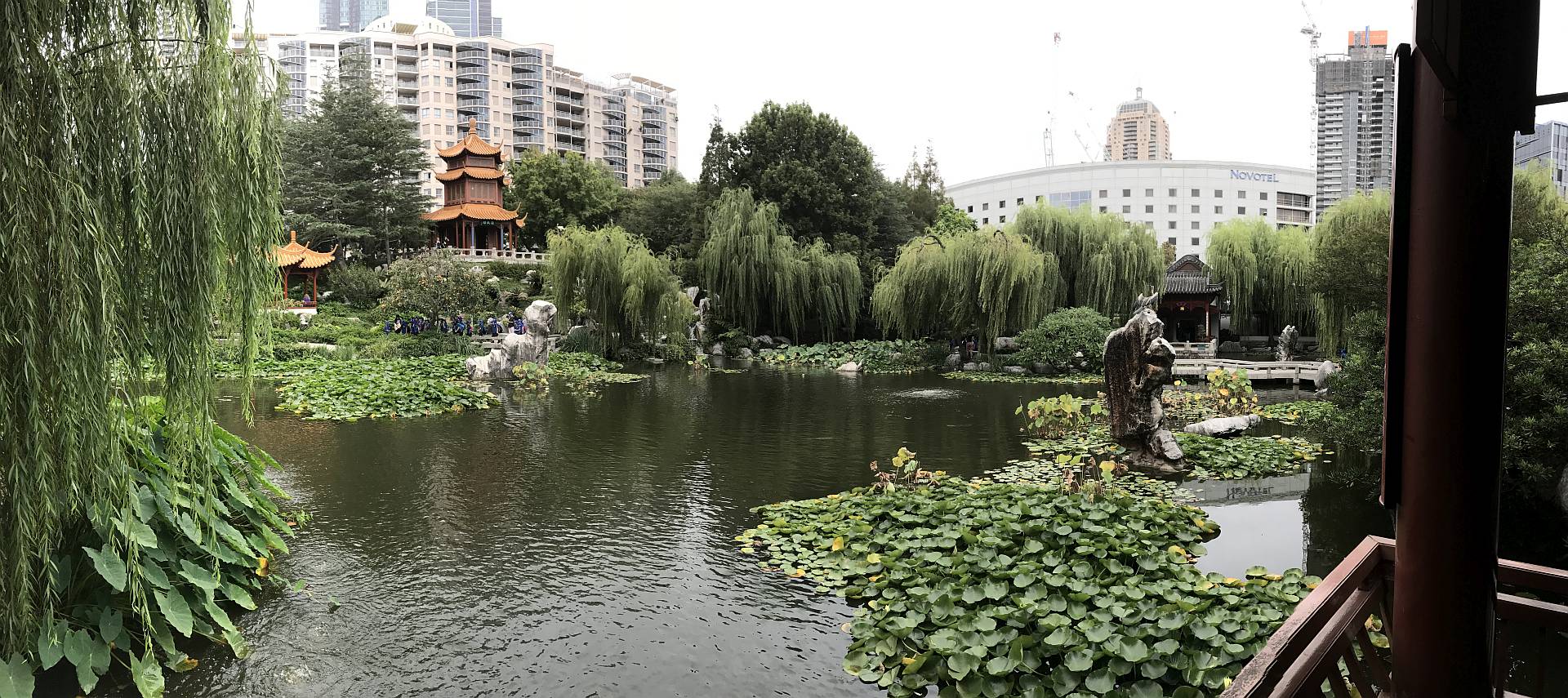
Panorama
This garden is well worth the modest entry fee. Highly recommended.2017/03/28
|
|
|
Panorama 2
We were only in Sydney for a few hours; I cannot imagine a part of Sydney that I would have preferred to see in that limited time.2017/03/28
|
|
|
Panorama 3
Very different to the Japanese Garden at Cowra and much smaller, but equally enjoyable.2017/03/28
|
|
|
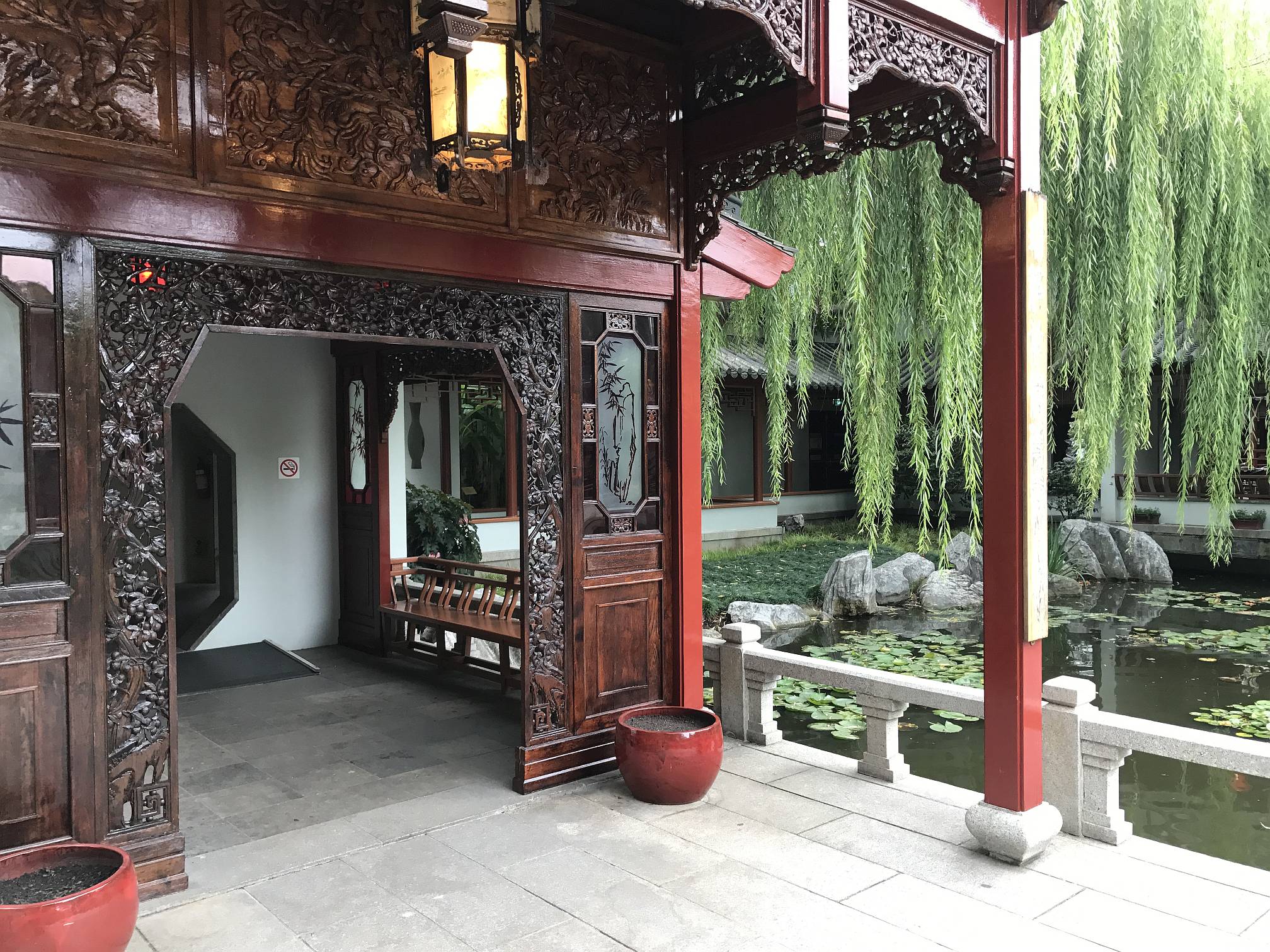
Building detail
The Cowra Japanese Garden contained beautiful, but very simple, buildings. Those in the Sydney Chinese Garden of Friendship were much more elaborate and detailed; note the carved panelling and windows with art-work.2017/03/28
|
|
|
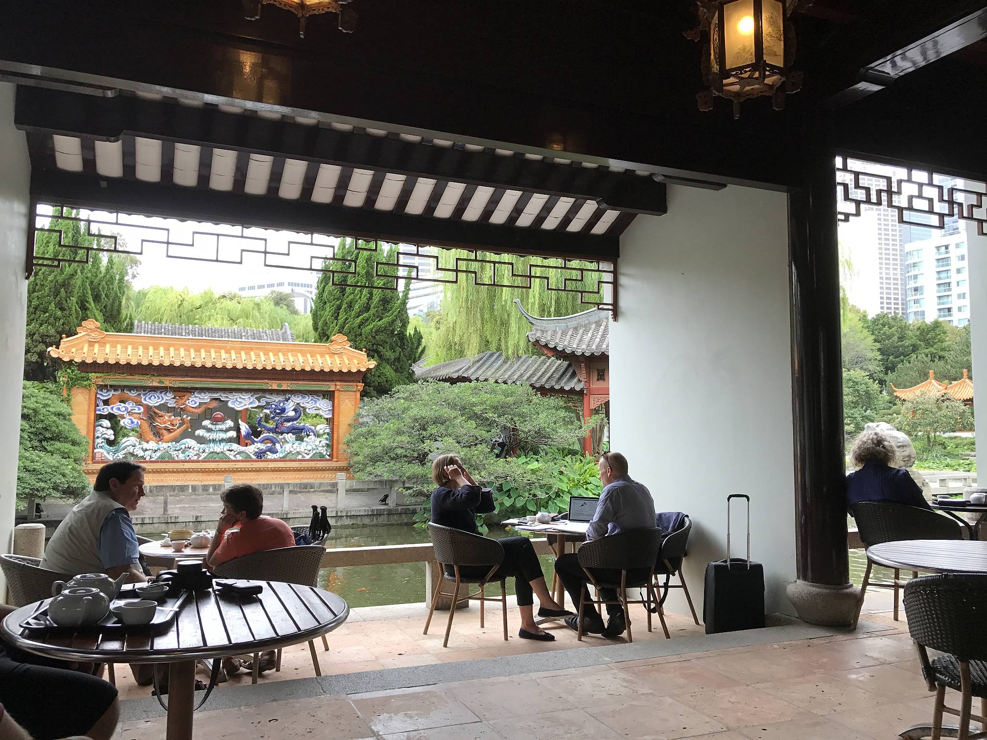
Coffee shop
What better place for a relaxing coffee or light lunch?2017/03/28
|
|
|
Dragon rock
This rock seems to have been chosen because it looks like a dragon. It seems that rocks that have some resemblance to animals are popular in Chinese gardens and dragons are much loved by Chinese traditional types.Note the water dragon on the left side of the dragon rock.
2017/03/28
|
|
|
Water dragon
A very appropriate dragon on a rock near one of the ponds.2017/03/28
|
|
|
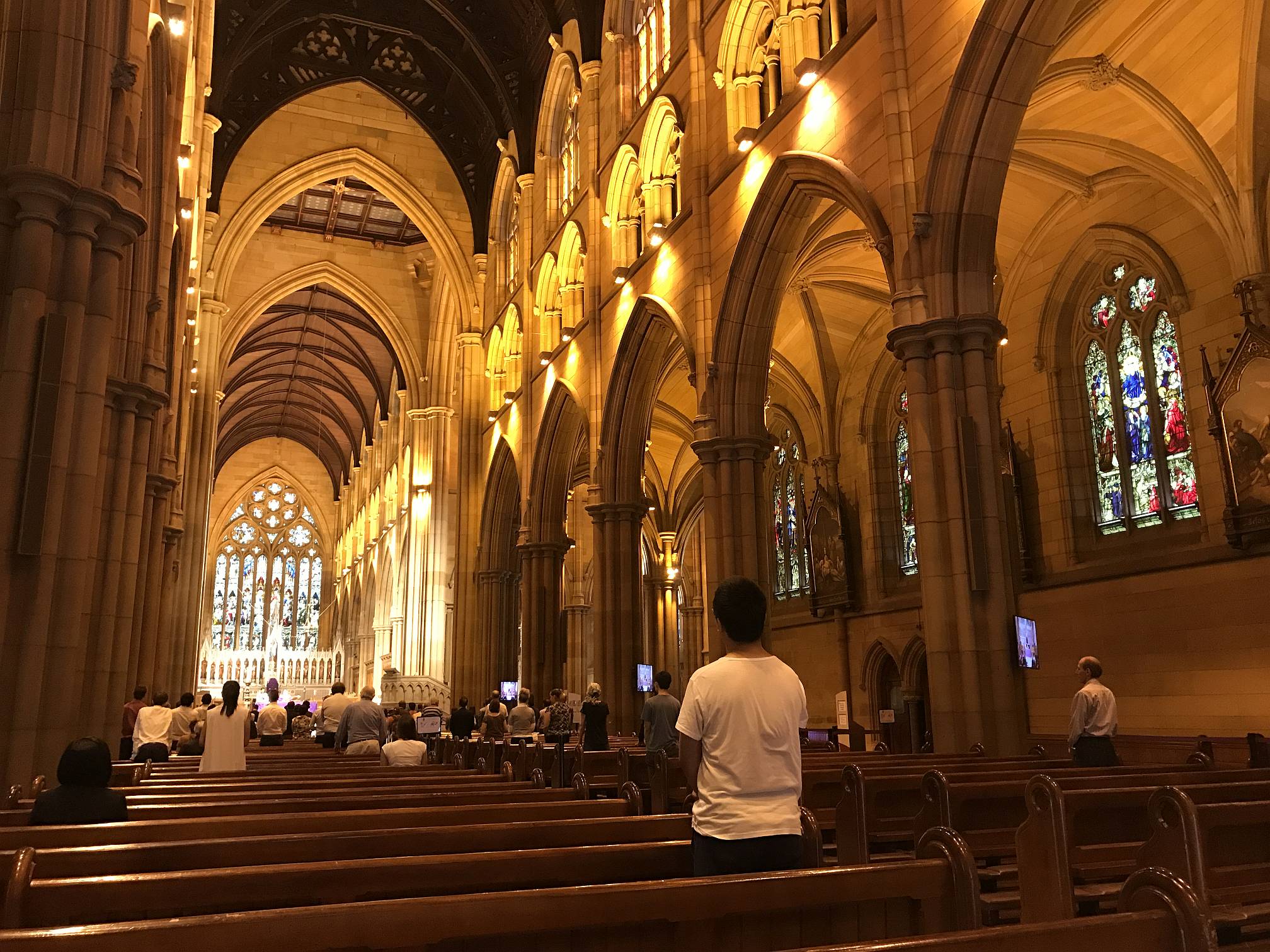
St Mary's Cathedral
A very impressive church. Possibly the biggest I've seen in Australia?Formal name "Cathedral Church and Minor Basilica of the Immaculate Mother of God, Help of Christians" (Atheists, stop laughing!)
Wikipedia has an article on the church.
There has to be irony in the fact that some of the world's most beautiful architecture has been justified because of a totally unfounded belief in non-existent gods.
Interestingly the photos I got in the cathedral with my iPhone 7 were of better quality than those I took with a Canon EOS 350D digital SLR.
2017/03/28
|
|
|

Monkey sculptures
These sculptures, at the Sydney Botanical Gardens, had 'hair' that was actually living grass.2017/03/28
|
|
Mudgee area
Dunn's Swamp
|
Dunn's Swamp
Not a swamp at all, but an attractive winding lake behind a dam on a river in fascinating sandstone 'pagoda' country about 30km east of Kandos.It was quite a hot day. Denece and I both had a swim.
2017/03/29
|
|
|
Dunn's Swamp area
Some of the interesting rock formations immediately adjacent to Dunn's Swamp.2017/03/29
|
|
|
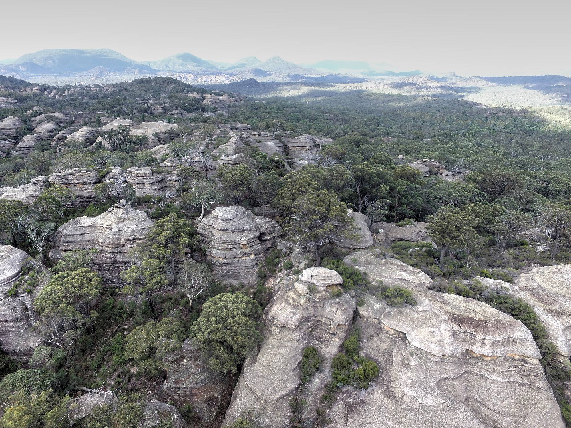
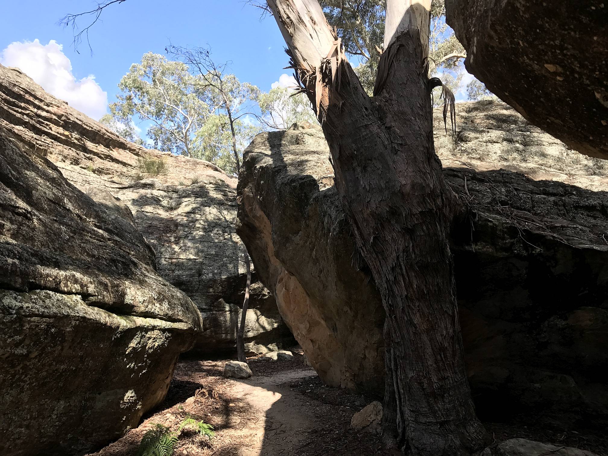
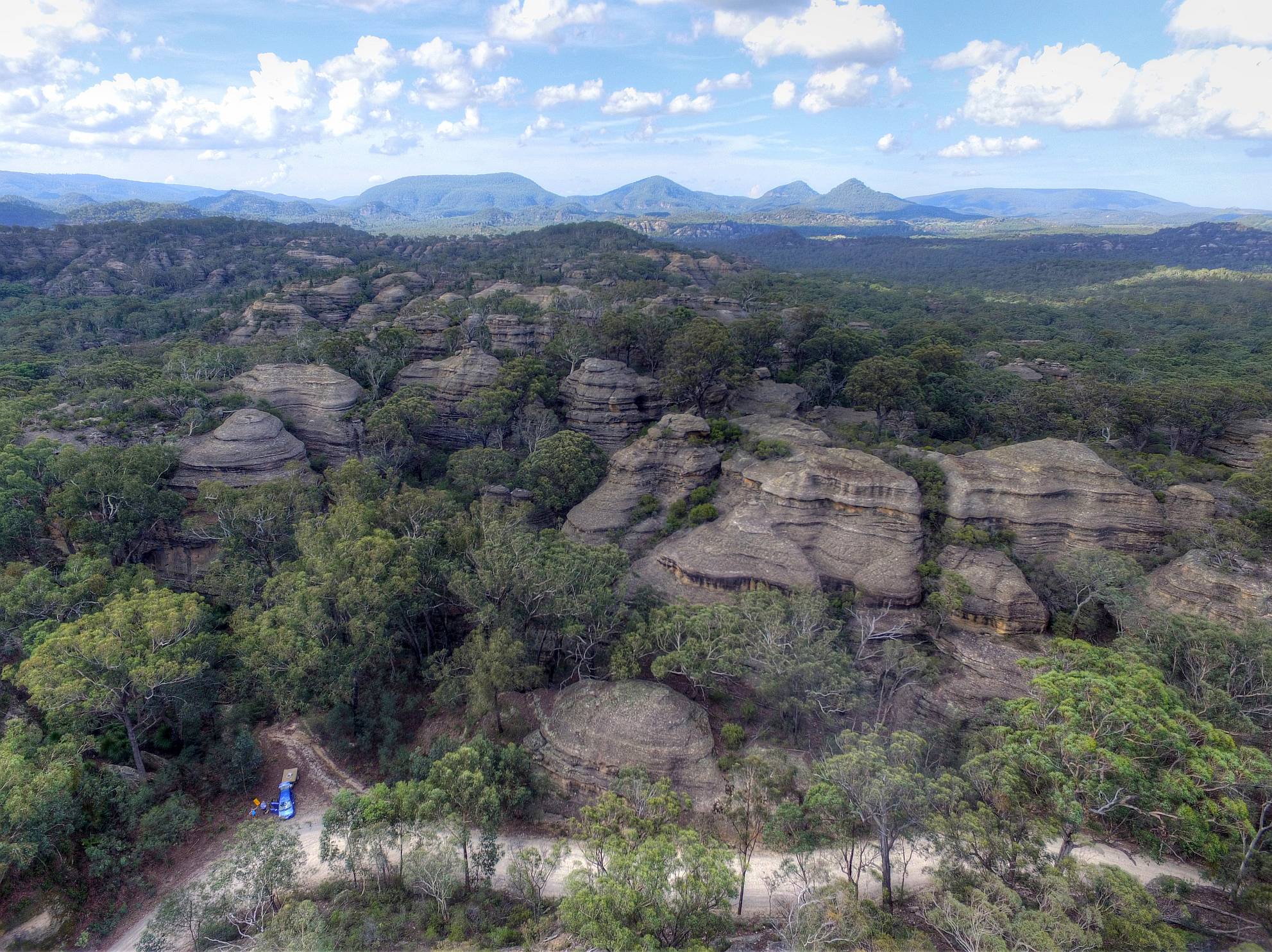
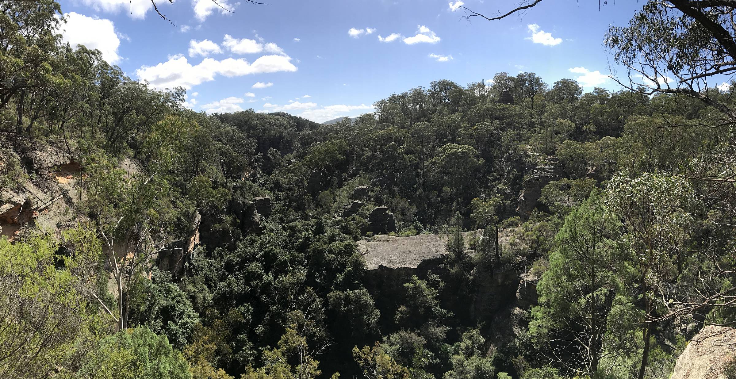
'Pagoda' formations
These unusual sandstone 'pagodas' are on the road to Dunn's Swamp. However, the view from ground level is very limiting and they are difficult to climb. They are very difficult to photograph effectively without a drone.
|
|
I don't know of anything similar in southern Australia; perhaps the Bungle Bungle Ranges in northern Western Australia have some similarities.
2017/03/29
|
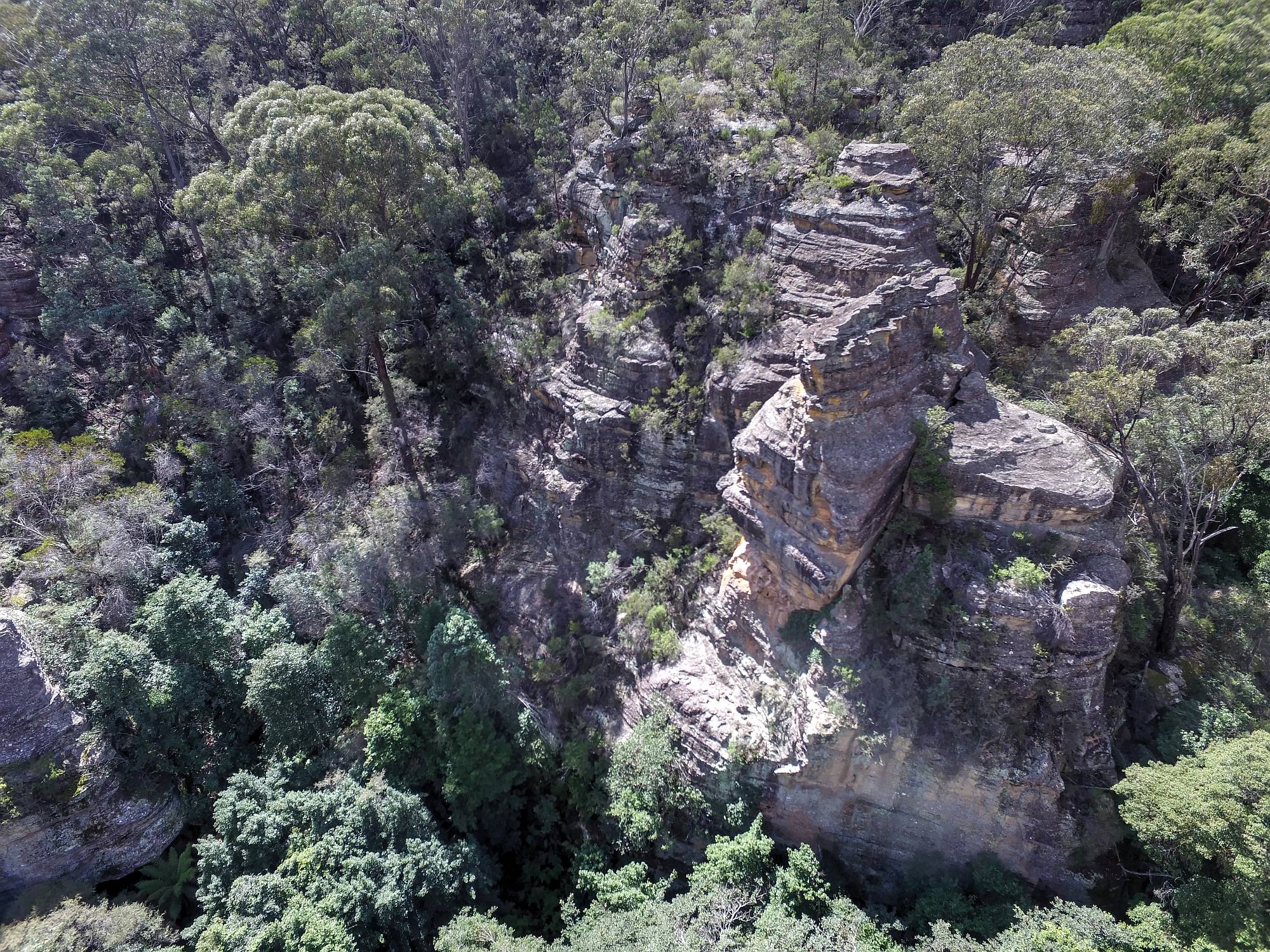
Pagodas 2
This image was compiled from two that were taken at different exposure settings, using high dynamic range processing (Photomatix Pro).Our Honda Jazz and tent trailer are visible in the lower left.
2017/03/29
|
|
Bylong Valley loop
When we inquired about visiting Ferntree Gully we were told that there was a very scenic road that went past Ferntree Gully, on to the Bylong Valley and to Mudgee via Munghorn Gap. We took this rout and were not disappointed.
There were conveniently spaced shops at Bylong (where we had lunch) and Wollar
where we stopped for a coffee.
I'd recommend the kumquat marmalade from the little shop at Wollar.
|
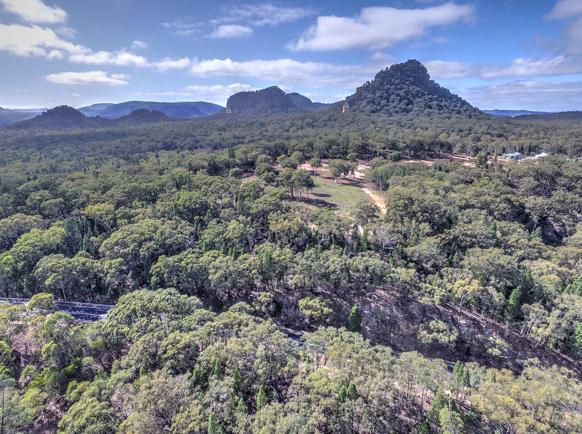
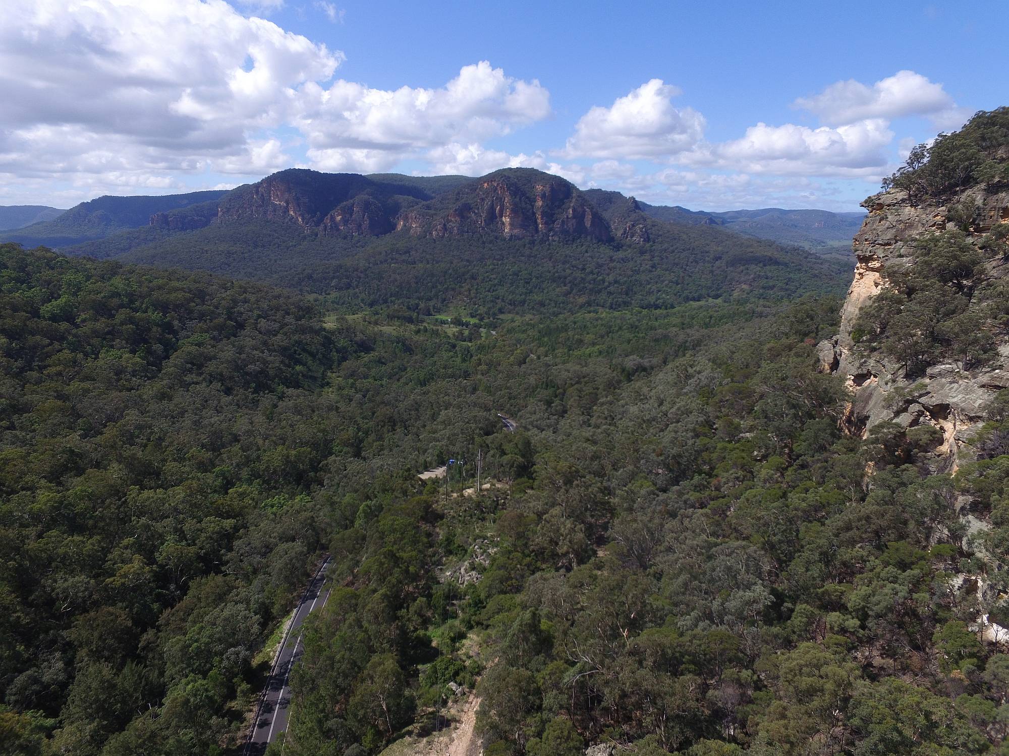
North of Rylstone
We could see glimpses of these hills from the road, but I had to resort to my drone to get a satisfactory photo.2017/03/31
|
|
Ferntree Gully
|
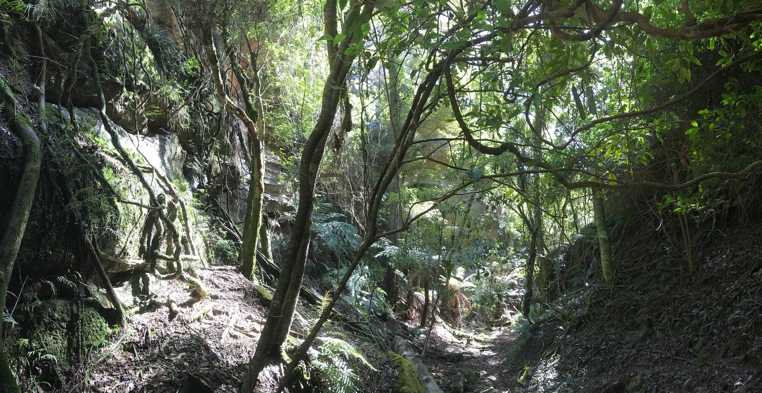
On the floor of the gully
This beautiful place is off the Bylong Valley road about 17km north of Rylstone.2017/03/31
|
|
|
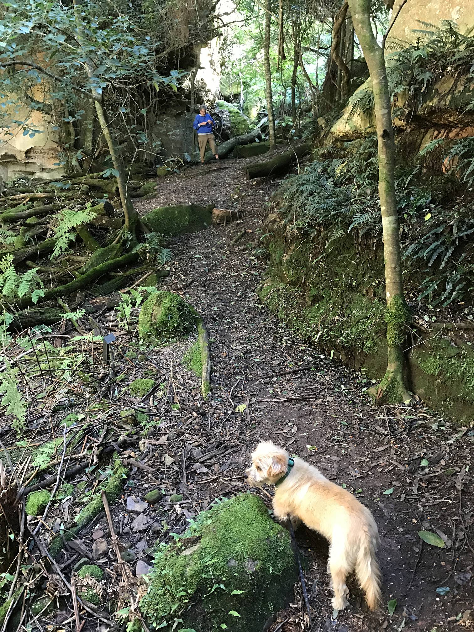
On the trail
Denece and Socrates on the trail in the floor of the gully2017/03/31
|
|
|
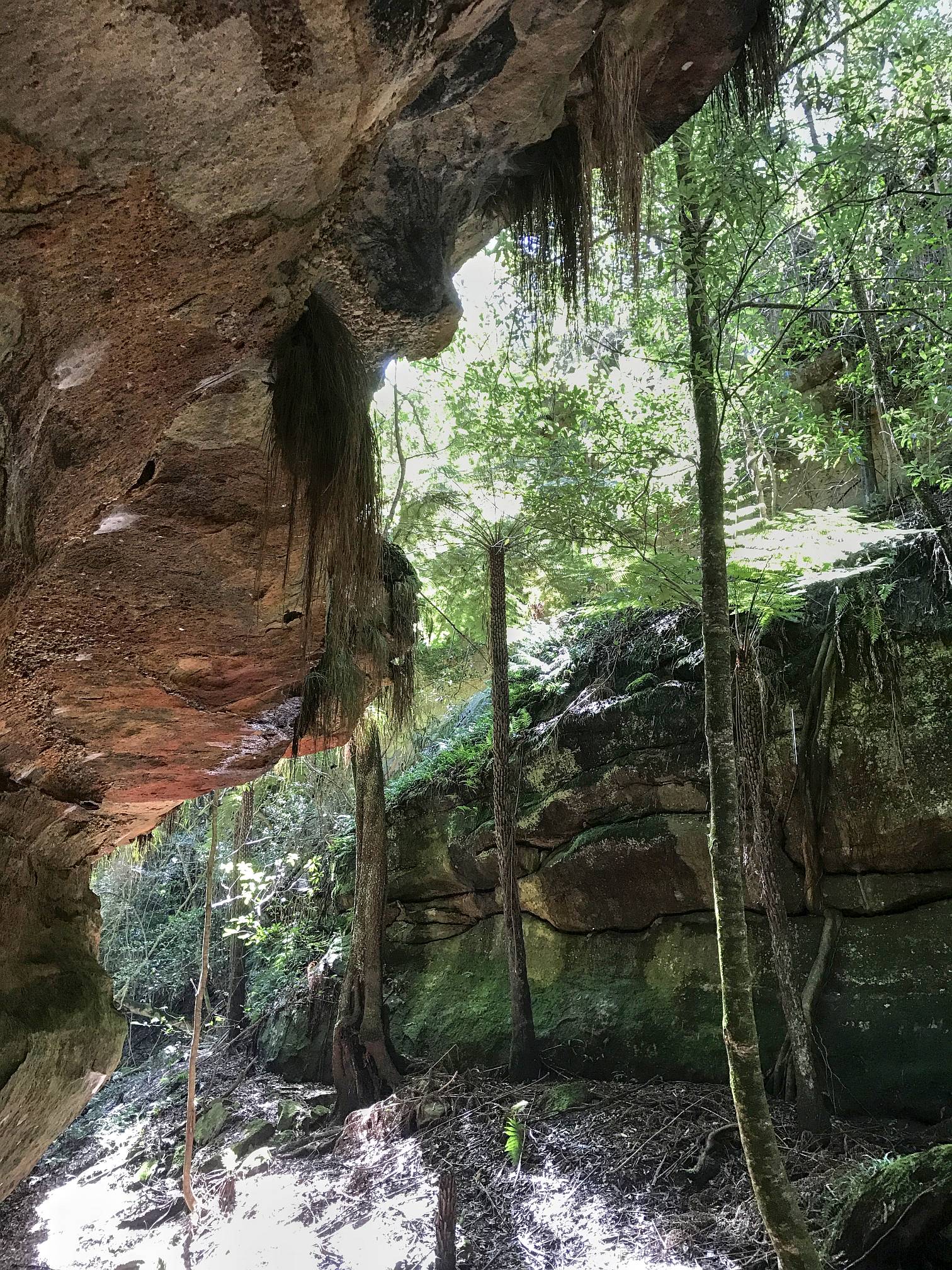
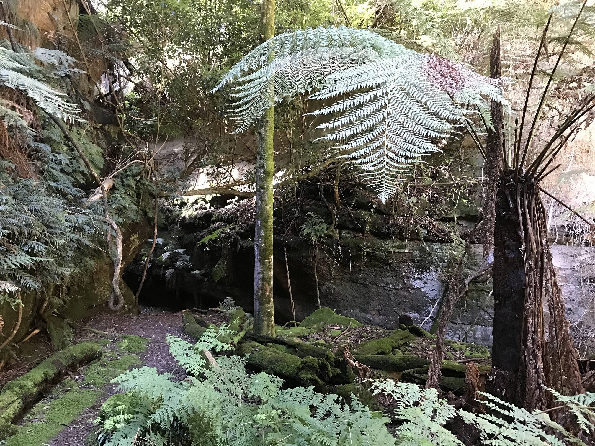
Overhanging wall
Ferntree Gully is deep and narrow; at this point the wall on one side is even overhanging.It is a difficult place to photograph because of the high contrast between sunlit places and deep shade.
2017/03/31
|
|
|
Ferntree Gully Panorama
The gully is an isolated micro-environment; its vegetation is very different from that of the country around-about, because of the shading and dampness.Taken with my iPhone 7
2017/03/31
|
|
|
From the lookout
Ferntree Gully from Ted Daniels Lookout.
|
|
2017/03/31
|
From my drone
The view from Ted Daniels Lookout was great, but a drone gives a much more flexible choice of view-points.2017/03/31
|
|
Bylong Valley
|
Entering the valley
When travelling from Rylstone to Bylong the road drops down steeply. There are glimpses of views, but nowhere on the road did we see a place we could stop and get photos from the road. We stopped our car where there was a bit of space and used the drone to get this photo of the beginning of the Bylong Valley proper.2017/03/31
|
|
|
Bylong Valley; and coal mines
The Bylong Valley is roughly half way between Mudgee and Muswellbrook.A view of the valley looking back to where the road enters from the south.
We saw many signs placed by local people who were opposed to allowing coal mining in the valley. It certainly would be a pity to destroy such a beautiful valley with an ugly coal mine, especially in a time when the coal industry is in terminal decline.
|
|
2017/03/31
|
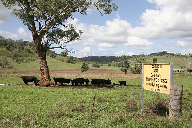
No coal
It seems the people of the Bylong Valley don't want a coal mine, they think that the valley is more suited for cattle grazing.By the way, did you know that the meat from grass-fed cattle (like these) has more of the healthy omega 3 fatty acids than grain-fed cattle? (And, of course, if you are at all concerned about animal rights, you'd be opposed to the factory farming of any animals.)
|
|
|
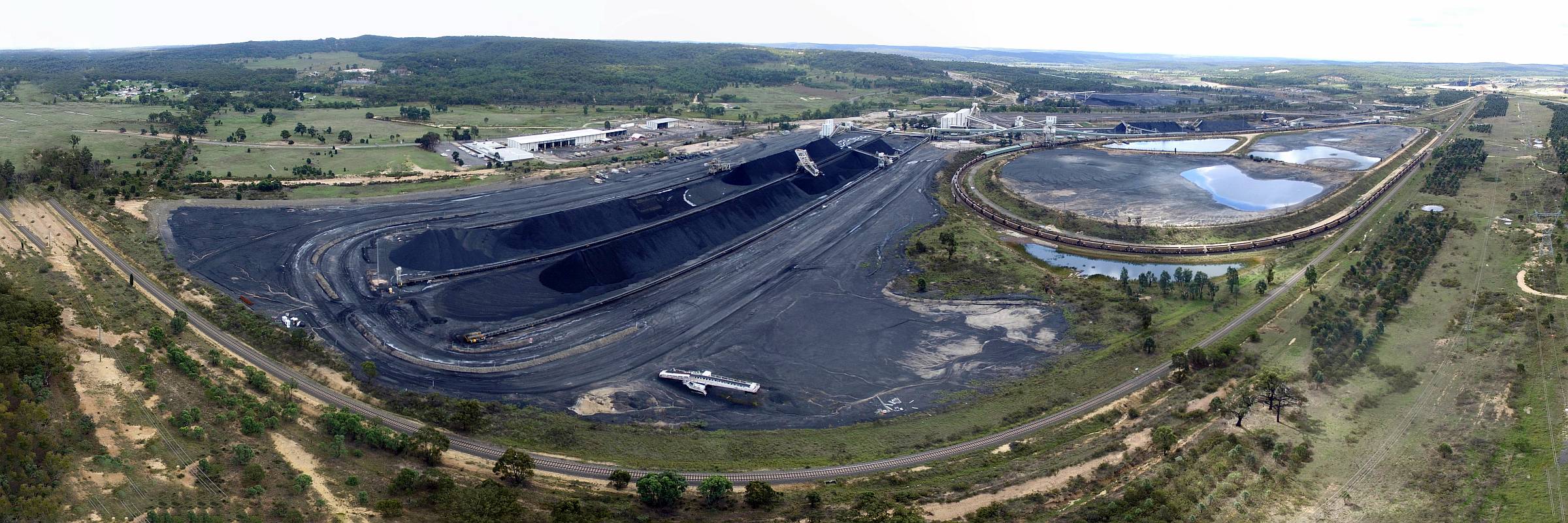
Ulan coal
This is the coal train loading area of the Ulan Coal Mine. The mine, or mines, are much bigger (see below).It is no wonder that the people of the Bylong Valley (above) don't want their beautiful pastureland turned into something like this.
|
|
2017/04/01
|
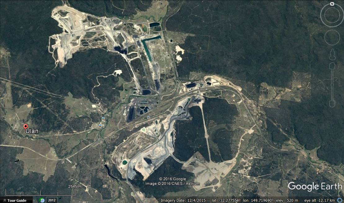
Google Earth image
This is an photo of some, not all, of the Ulan Coal Mines. The coal train loading area that I photographed (above) is a very small loop left of centre on this image.Note the scale bar on the lower left. The whole of this image is about 14km from left to right.
Image recorded 2017/04/15; click (or tap) to enlarge.
|
|
Coal mines or renewable energy?
The Australian Federal Government under Tony Abbott, Malcolm Turnbull and then Scott Morrison were obsessed with coal. The alternative, that the world needs if we are to limit climate change, is renewable energy.
Apart from the
climate changing emissions factor, the air pollution that
kills millions of people each year, how could anyone support the damage done to
our country by coal mining (as seen in this and the above photo) compared to
benign
wind farms and
solar power stations?
The Warrumbungles and Coonabarabran
|
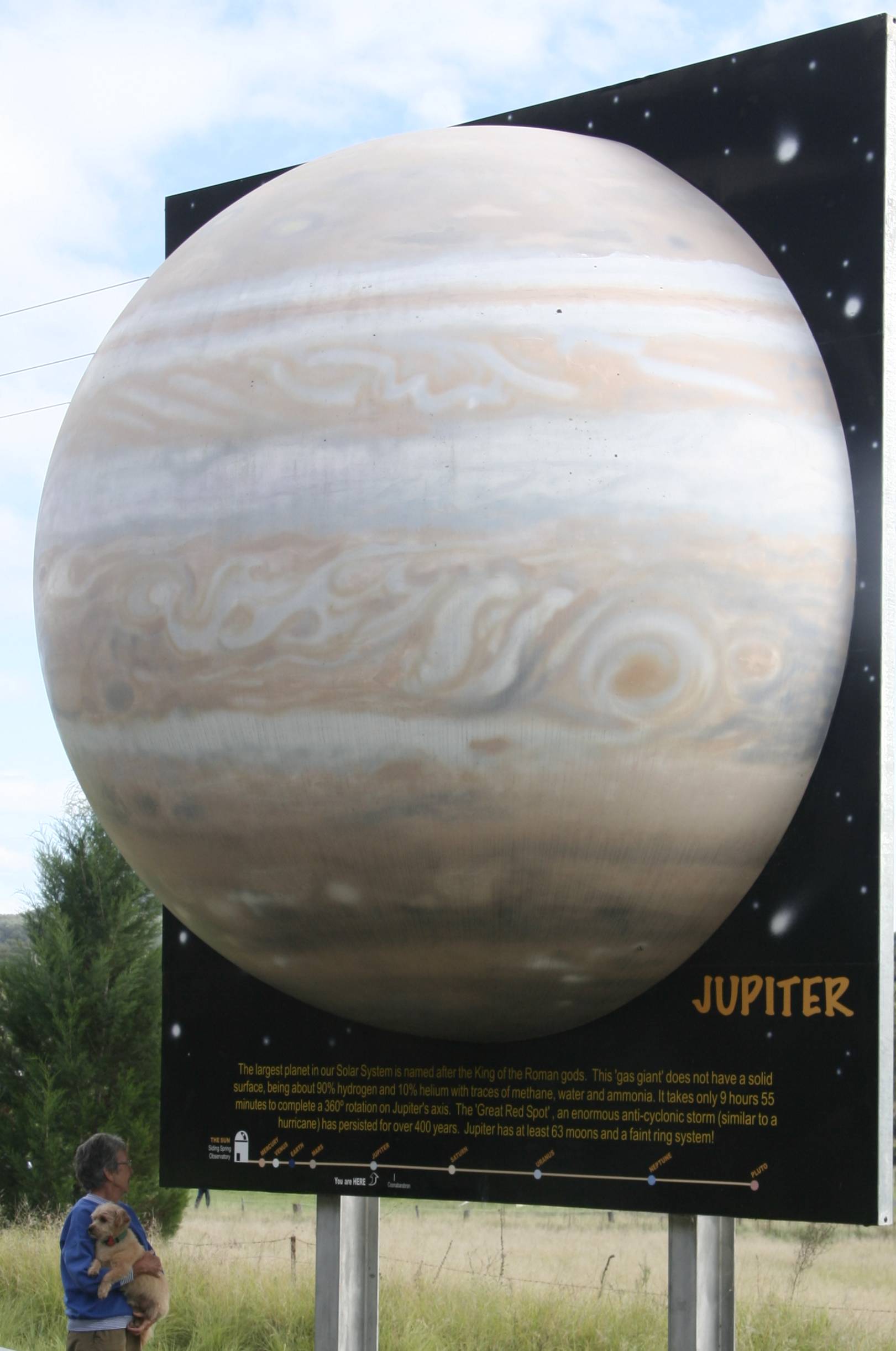
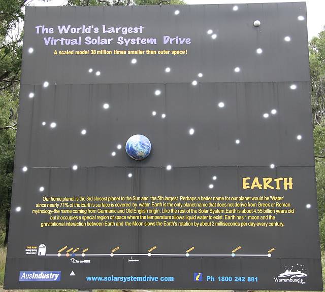
Scale model of Solar System
This is a part of what is said to be "The World's Largest Virtual Solar System Drive". Models such is this (Jupiter, the biggest of the planets) are 38 million times smaller than the real thing, and 38 million times closer to the centre of the virtual solar system, in this case, Siding Spring Observatory.It gives a much better feel for the scale of the Solar System than you can get from simply reading the dimensions of planets and their distance from the Sun.
On the scale used in the Virtual Solar System the Sun would have a diameter of about 37m.
You can read more about the Virtual Solar System at Solar System Drive.
2017/04/02
|
|
|
Earth
Earth, to the same scale as Jupiter, above.2017/04/02
|
|
|
Anglo-Australian Telescope
at Siding Spring Astronomical Observatory
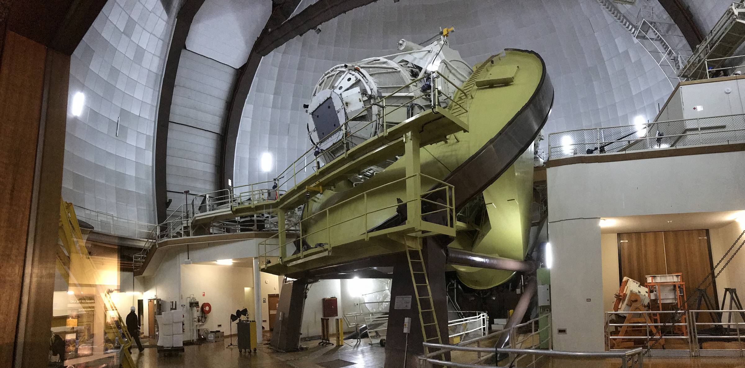
This is the biggest optical telescope in Australia, called the
Anglo-Australian Telescope, although I believe it is now entirely owned
and run by Australia.
|
|
2017/04/02
|
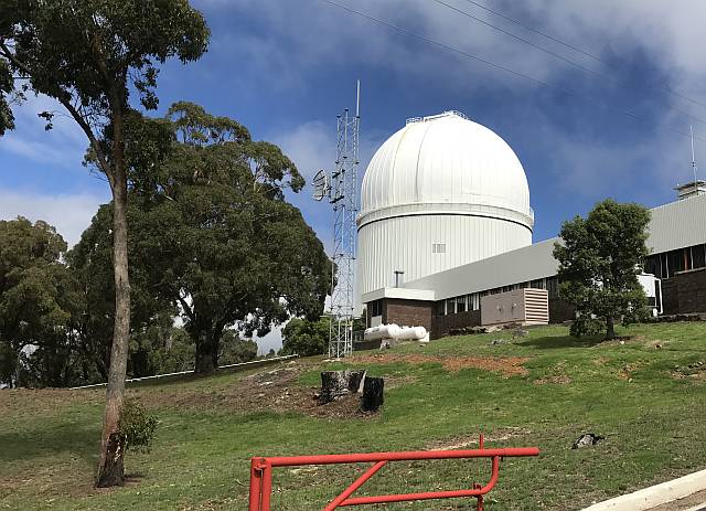
AAT Observatory
The observatory housing the Anglo-Australian Telescope on Siding Spring Mountain.I would like to have flown my drone to get some more panoramic views of the observatories on the mountain top but the wind was too strong.
2017/04/02
|
|
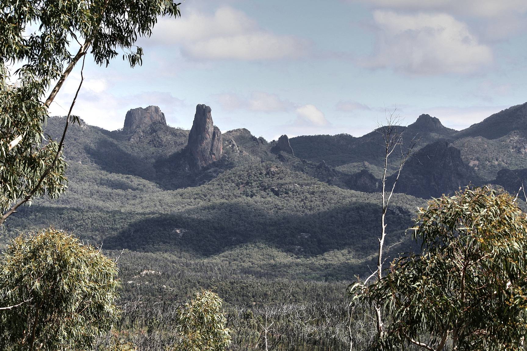
Warrumbungle Mountains
|
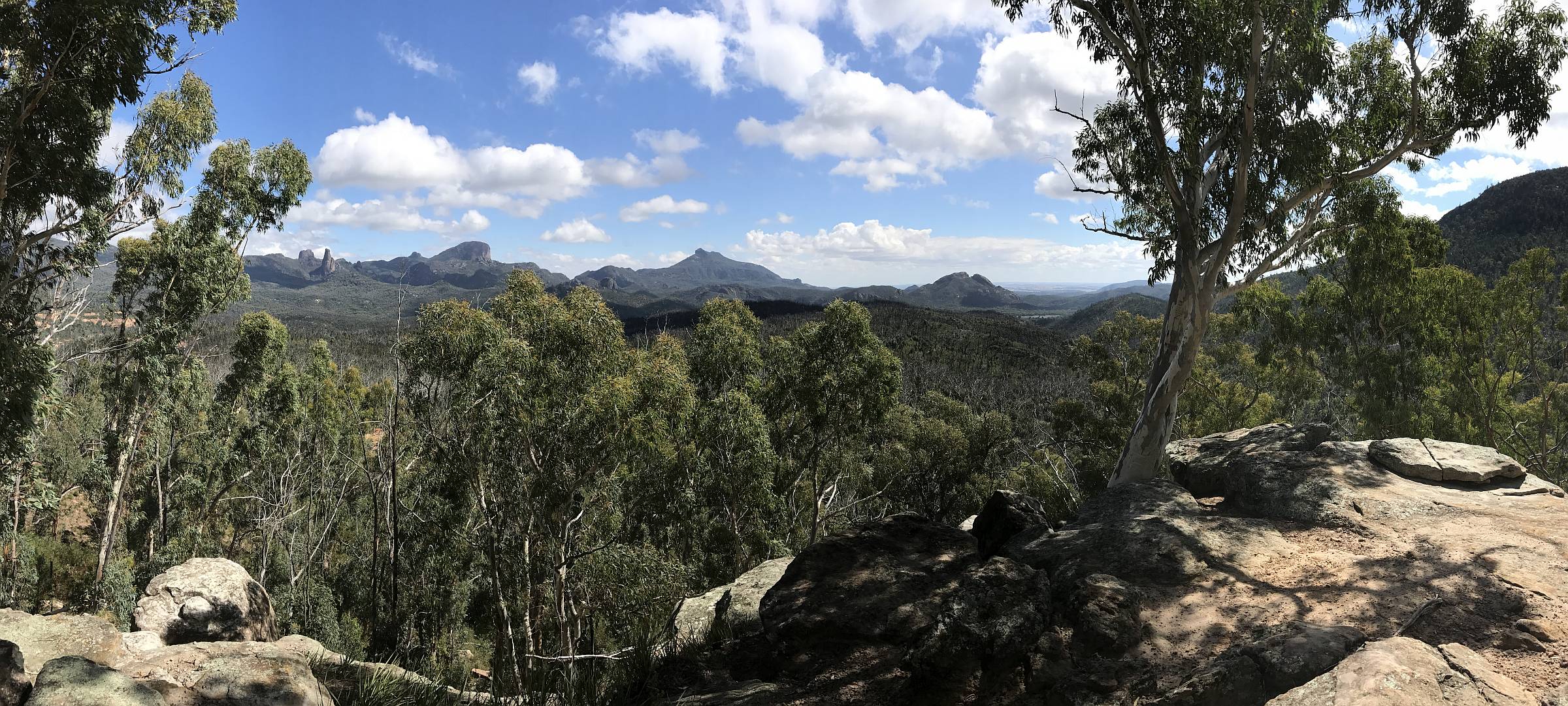
White Gum Lookout
The view of The Grand High-Tops from White Gum Lookout, on the eastern side of the National Park.A panorama taken with my iPhone.
|
|
The Bread-Knife is seen (in the full-sized image) somewhat side-on. In other images, below, it is seen more nearly edge-on.
2017/04/02
|
Some of the Grand High-Tops
Again, from White Gum Lookout; Belougery Spire is left of centre, the Bread-Knife is in the centre.2017/04/02
|
|
|
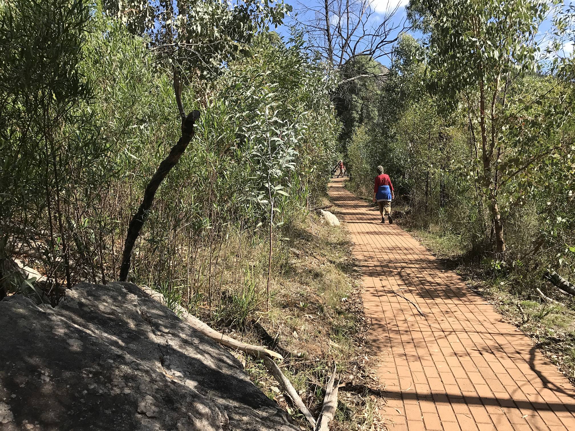
Trail to Spirie View
The walk to Spirie View was about three kilometres. On two of the slightly steeper sections the trail was paved with bricks.There were about six wooden bridges over creek crossings. These must have all been built since the fires of 2013 when, we were told, 95% of the national park was burned. The fire burned for about 41 days.
Fortunately the Warrumbungle National Park did not burn again in the terrible fires of late 2019, early 2020.
2017/04/02
|
|
|
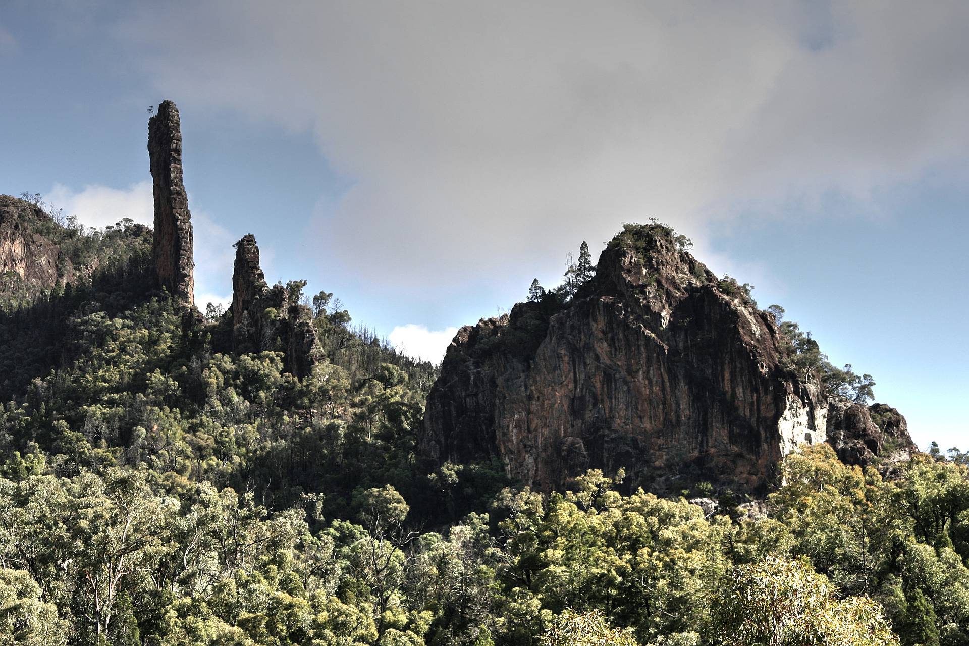
Bread Knife
The Bread Knife, on the left, is a narrow slab of rock that was originally magma that filled a vertical fracture. The surrounding rock has since eroded away.From Spirie View Lookout.
|
|
"The Warrumbungles are the remnants of a large heavily-eroded shield volcano which was active from 13 to 17 million years ago. The volcano is estimated to have been 1,000 metres high and 50 kilometres wide. It formed as volcanic explosions occurred over millions of years. The remaining complex rocky formations are what is left after millions of years of erosion."
2017/04/02
|
Spirie View Lookout
The trail to this point was just over three kilometres of mainly gently sloping smooth surface. The last 200m or so was steep and uneven, but not difficult for anyone who is reasonably mobile.The lookout itself was on the rocky outcrop seen here.
2017/04/02
|
|
|
Xanthorrhoea
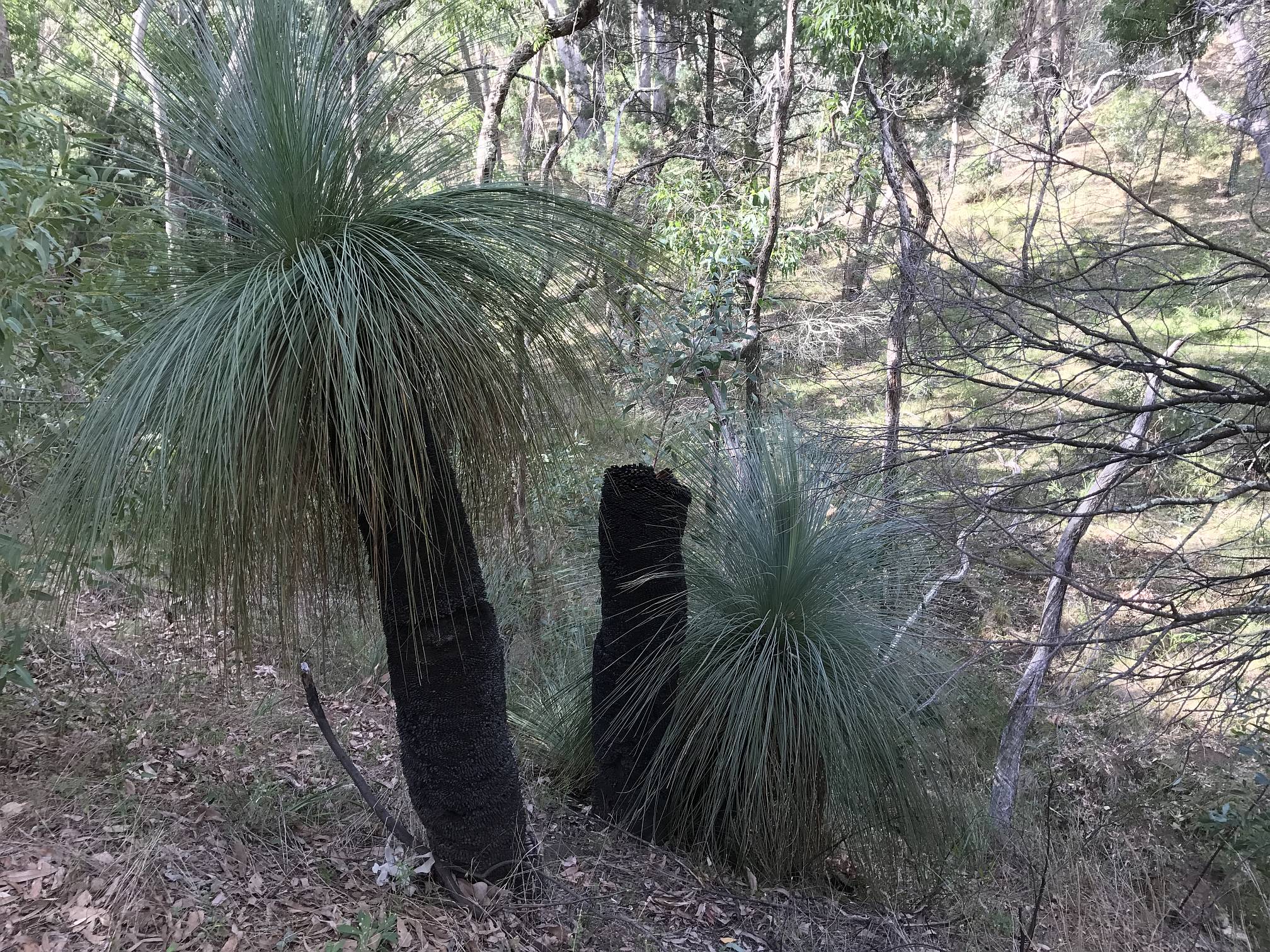
These yackas, aka grass trees, aka black boys (not politically correct), were on the side of the trail to Spirie View. They are tolerant of bushfires, but not immune. Most had recovered from the 2013 fire, as the two on each side here, but some had been killed, as the one in the centre.With climate change bushfires are going to become more frequent and more fierce.
2017/04/02
|
|
|
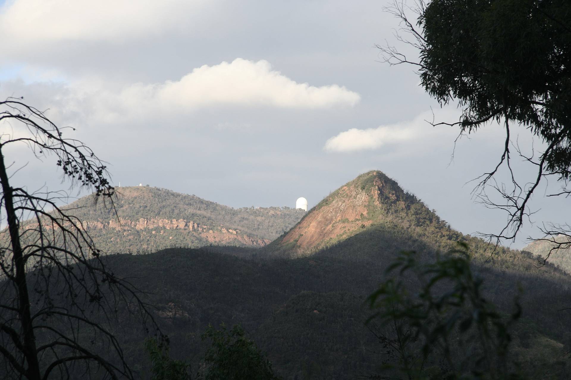
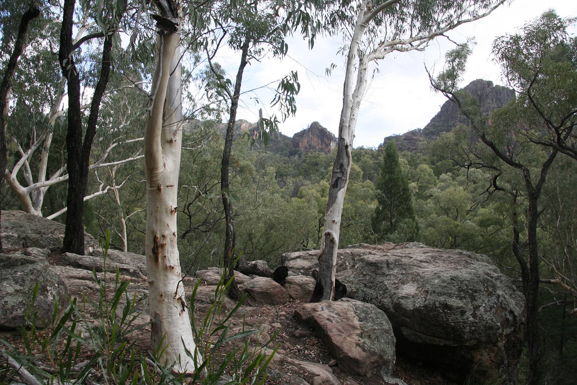
Siding Spring from the National Park
The observatory building that houses the Anglo-Australian Telescope and a couple of other observatory buildings are visible in this photo of Siding Spring Mountain from the National Park.2017/04/02
|
|
|
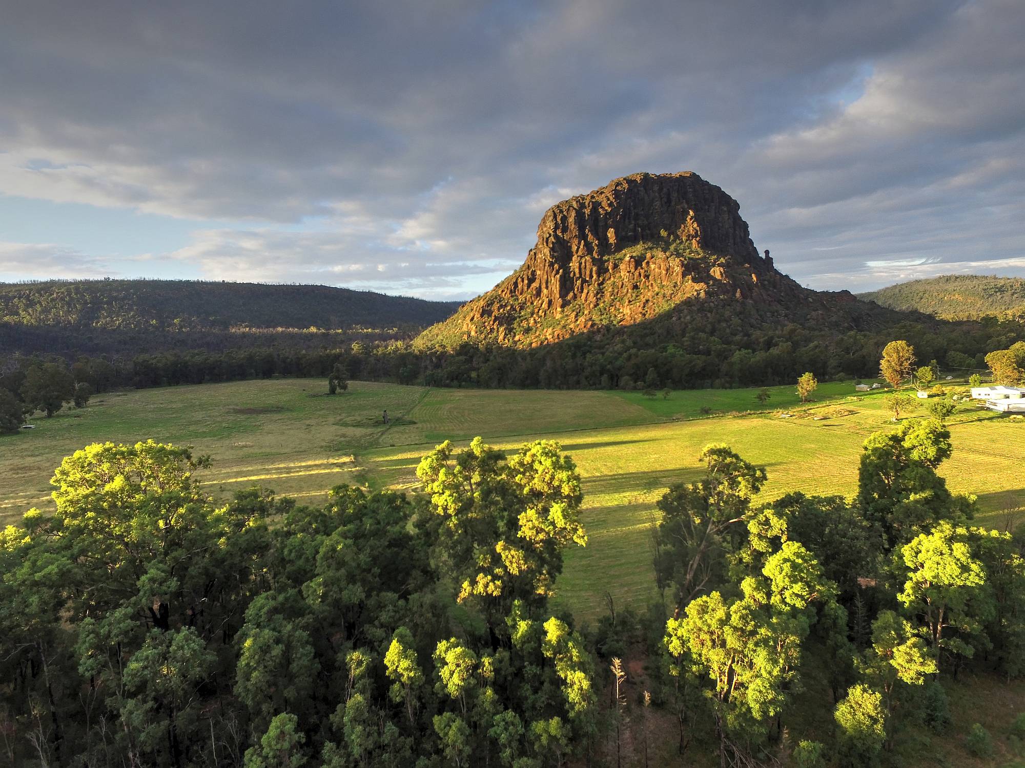
Volcanic peak
I used my drone to get this and the next photo of this volcanic peak 11km west of Coonabarabran on the road to Siding Spring.We were lucky to catch a short period of sunshine late in the day.
I have tried to find out its name, unsuccessfully.
2017/04/02
|
|
|
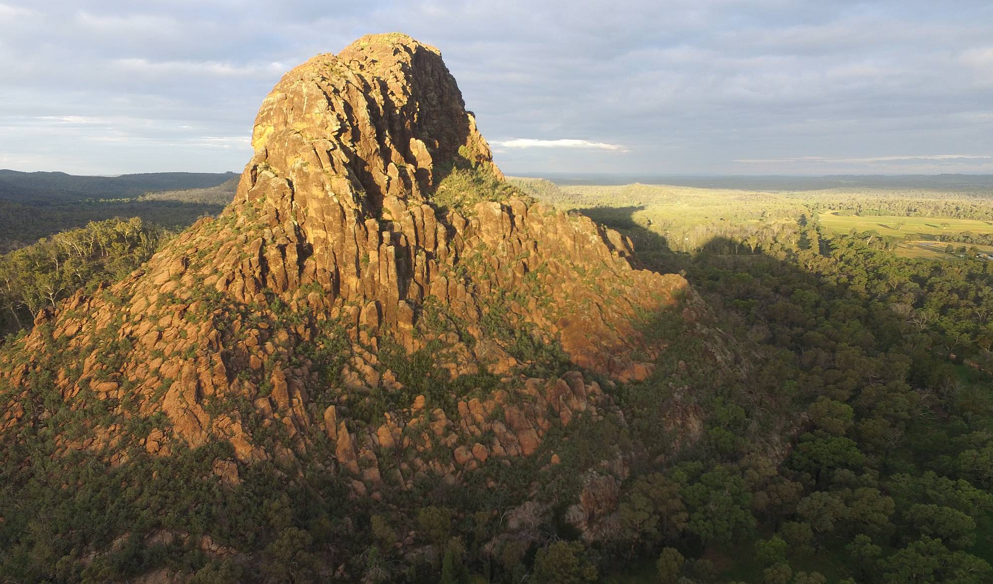
From a different angle
The peak is fairly long and narrow. This view, again using my drone, is of the narrow end of the peak.The columnar basalt pillars are conspicuous in the lower-central part of the peak.
2017/04/02
|
|
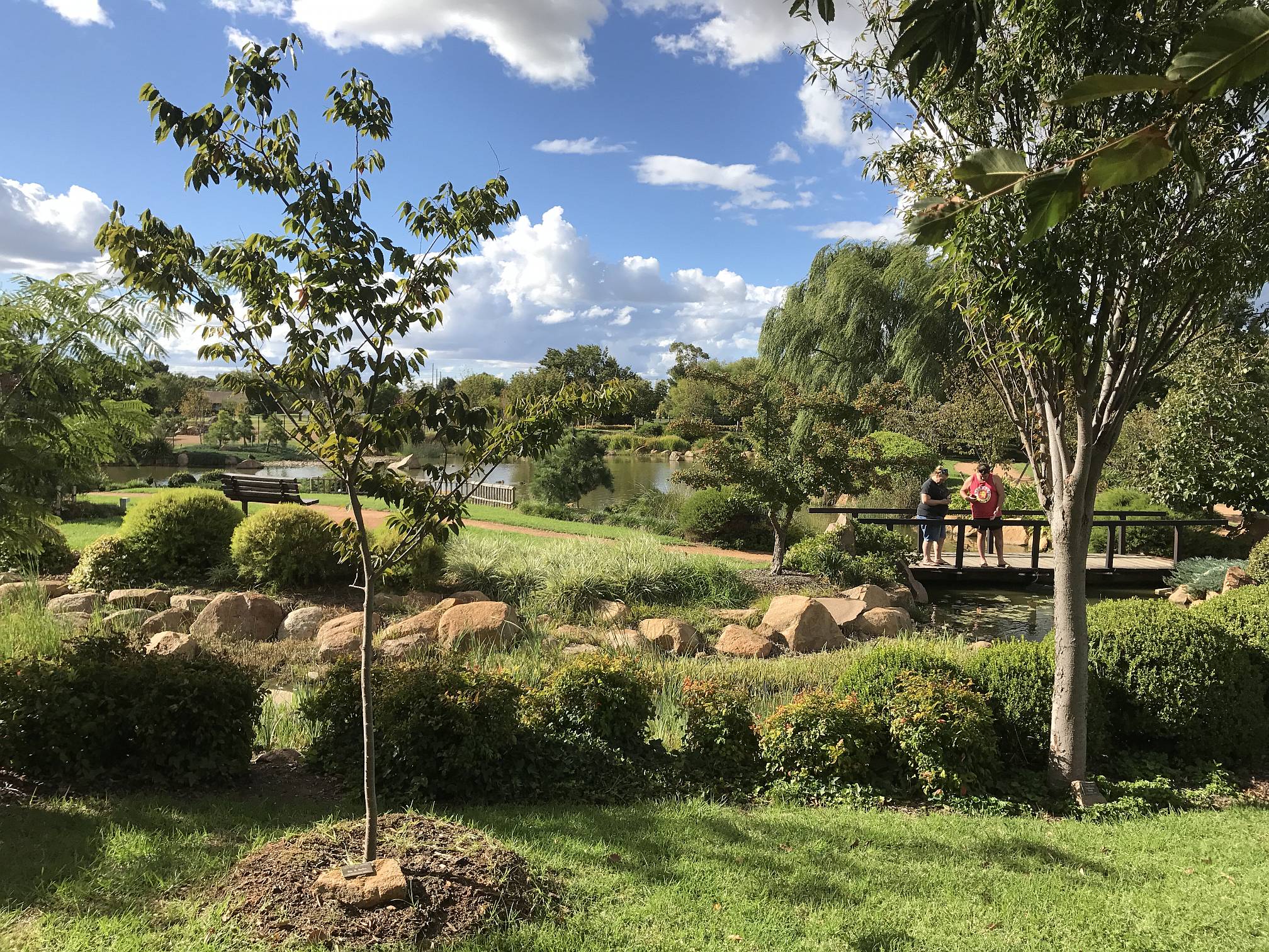
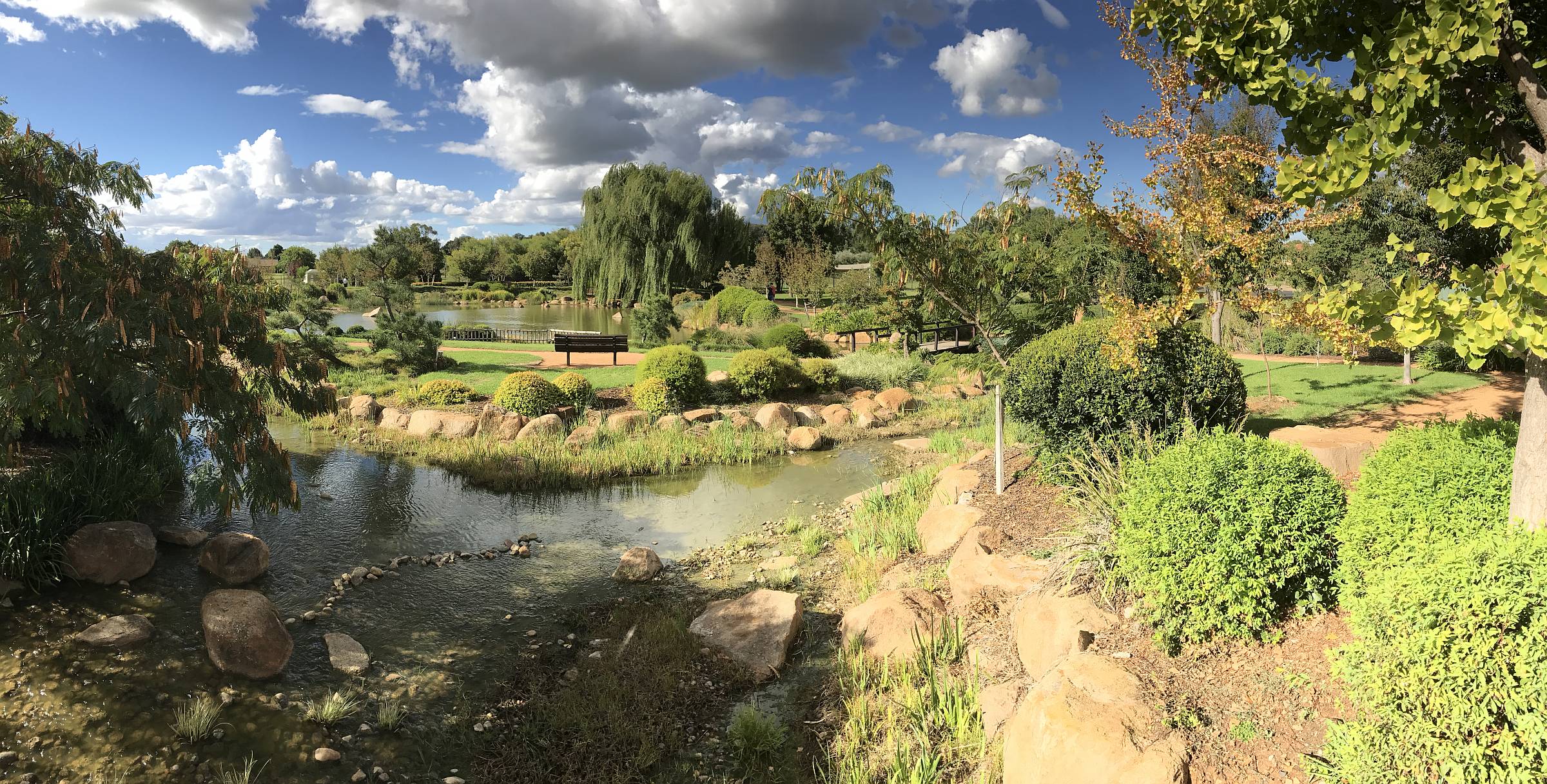
Dubbo Japanese Garden
|
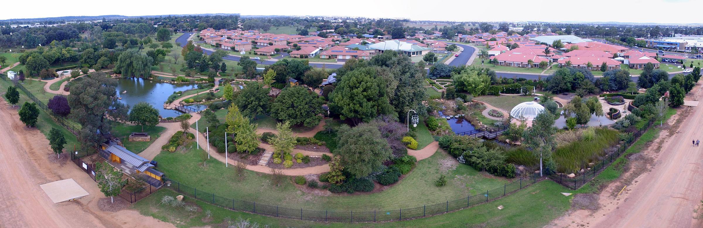
Drone stitch
The Dubbo Japanese Garden was much smaller than the Cowra garden, but was very attractive and we found it worth a couple of visits.
|
|
|
Dubbo Japanese Garden
My wife and I find we appreciate beautiful gardens more in our old age than we used to.I have become heavily involved with three near my home in South Australia:
- Crystal Brook's Central Park;
- near Crystal Brook, Bowman Park old homestead garden;
- and at Clare, Gleeson Wetlands.
This photo taken 2017/04/03
|
|
|
Japanese Garden
A panorama taken on my iPhone.2017/04/03
|
|
|
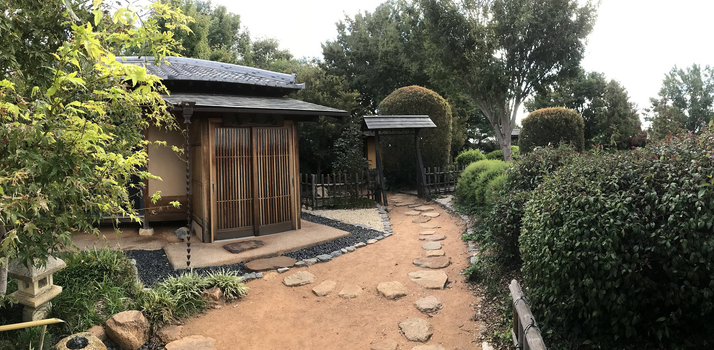
House in Japanese Garden
I suppose that this represents a traditional Japanese house within a garden. It was not possible to go into the house or to see inside.Note the string of little funnels that take rainfall from the roof down to the ground, on the left, presumably with little splashing (unless the rain was heavy?)
|
|
|
Detail
A small part of the garden in the front of the house, including a pretty little water feature.2017/04/03
|
|
|
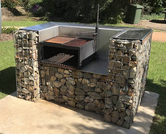
BBQ
An interesting, unusual and attractively designed wood-fired barbecue in the grounds of the Dubbo Botanical Gardens.2017/04/04
|
|
|
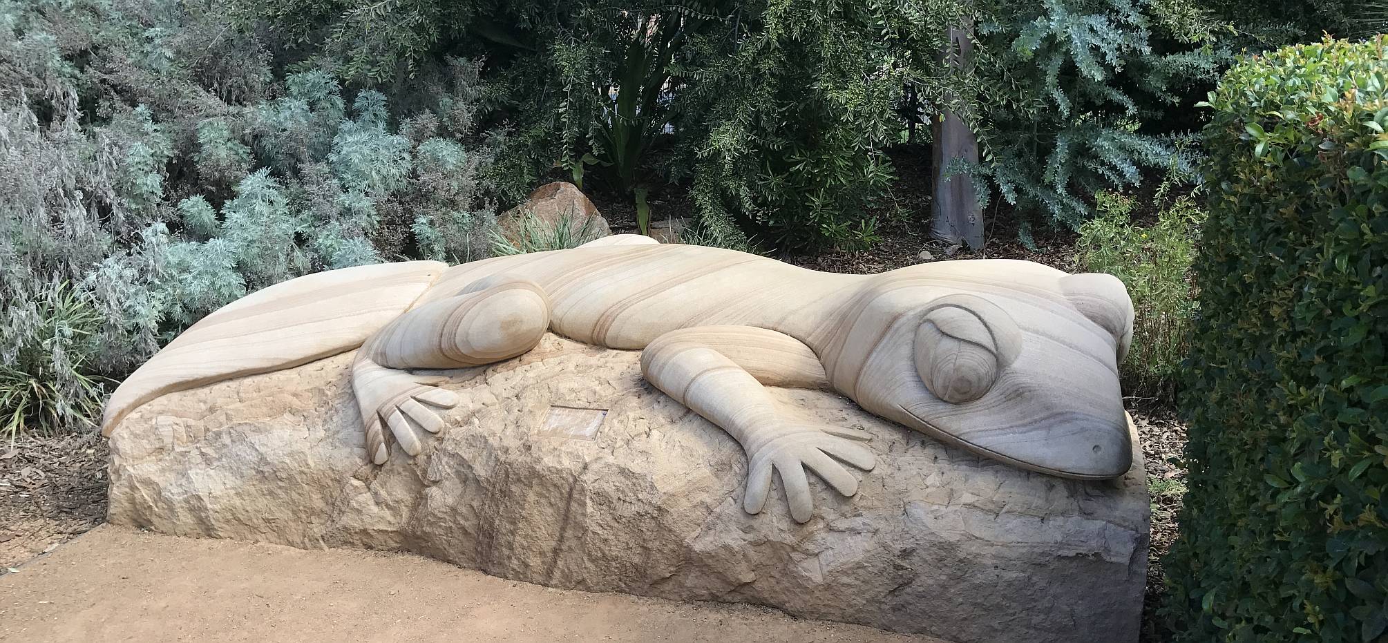
Gecko sculpture
This beautiful sculpture was in the Botanical Gardens. It was about two metres long.2017/04/04
|
|
|
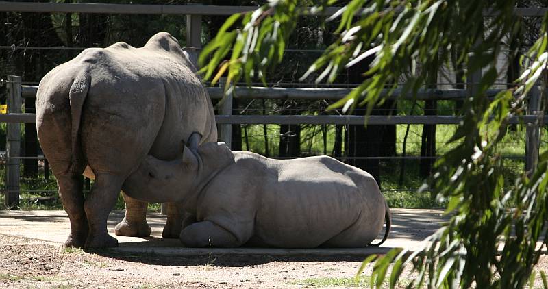
Dubbo Zoo
No visit to Dubbo would be complete without a bit of time at the open-planes zoo.This is a 'baby' white rhino getting a bit of milk from its Mum.
|
|
2017/04/04
Toward home
Nyngan solar farm
|

You might think that, in a small country town like Nygan, the people would make a big feature of it – a major tourist attraction? Not at all.
There was a sign on the side of the road, and a gate with another sign saying 'entry to authorised vehicles only'. It was not possible to even see the solar farm from the public road. My drone got this shot.
|
Click (or tap) on the image to view full size; use back-arrow to come back.
Solar PV and wind are the main new sources of renewable energy (where hydro is not an option). In my opinion, solar farms such as this and the one at Broken Hill have no aesthetic apeal, while wind farms can be majestic and graceful. These solar farms are just aesthetically bland. Of course we should still be building more solar (and wind) farms.
|
|
2017/04/05
|
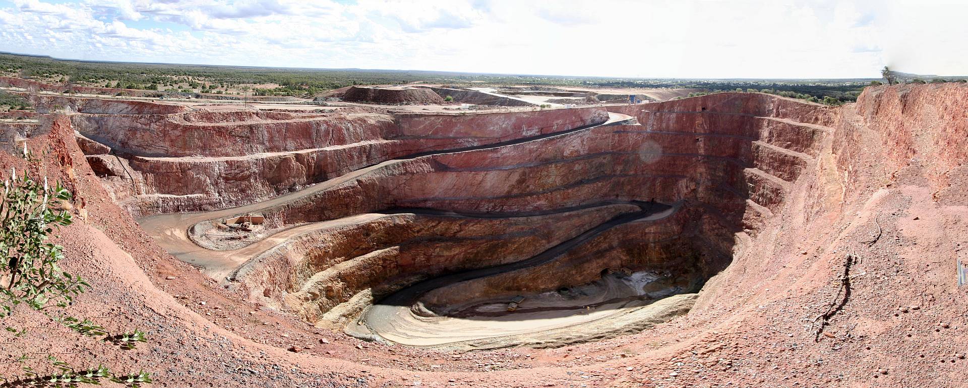
Peak Goldmine at Cobar
|
|
Cobar is a convenient and pleasant town to stop in overnight. It is a long, but not uncomfortably long, days drive from the next good stopping point travelling west, Broken Hill.
2017/04/05
|
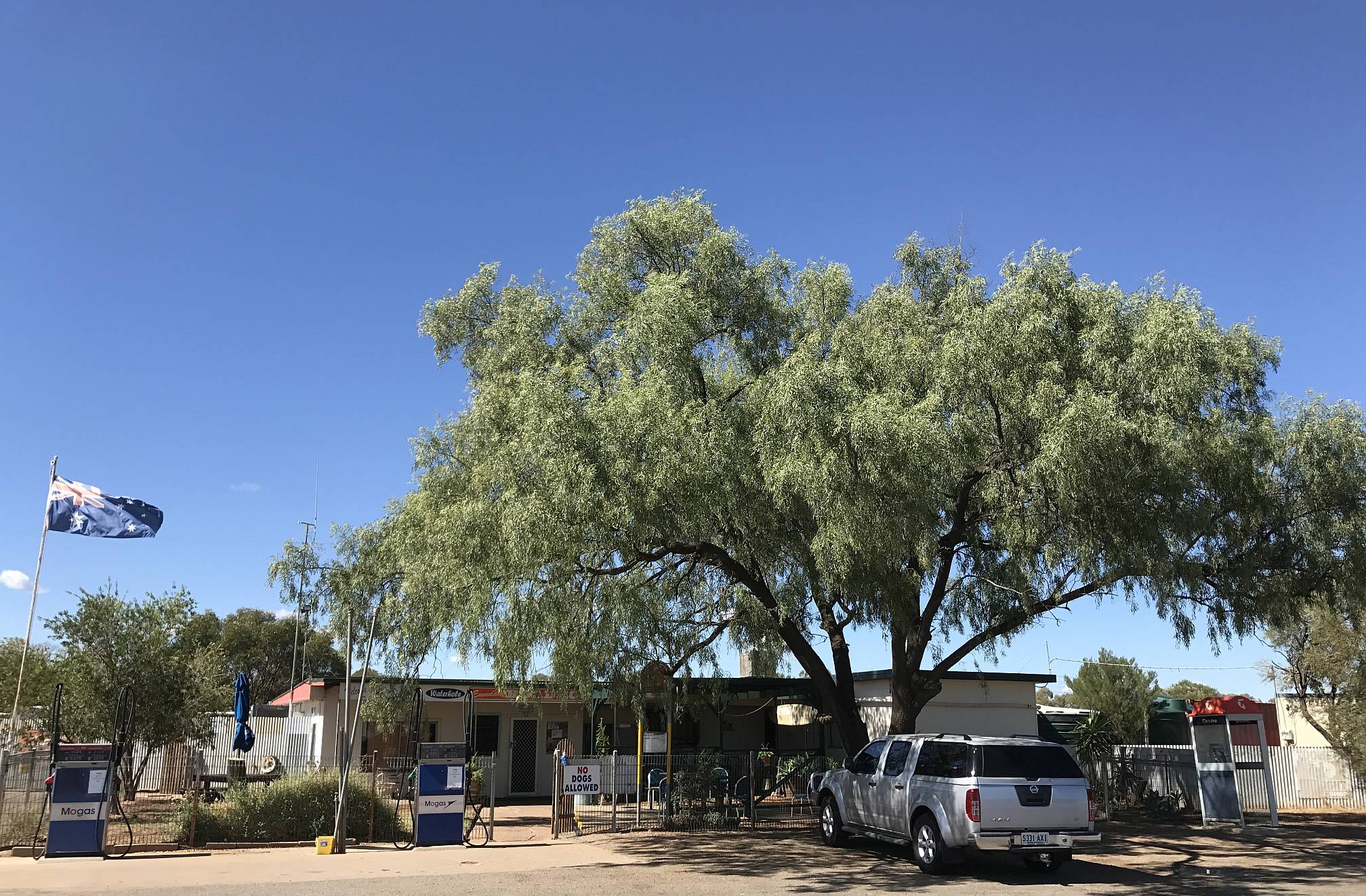
Emmdale
We were expecting to have to travel the 260km from Cobar to Wilcannia before finding any place to stop for a coffee (apart from the frequent roadside parking bays), so we were pleasantly surprised to find the Emmdale Waterhole Roadhouse.
|
|
The shady tree, too, made sitting in front of the roadhouse very pleasant.
2017/04/06
|
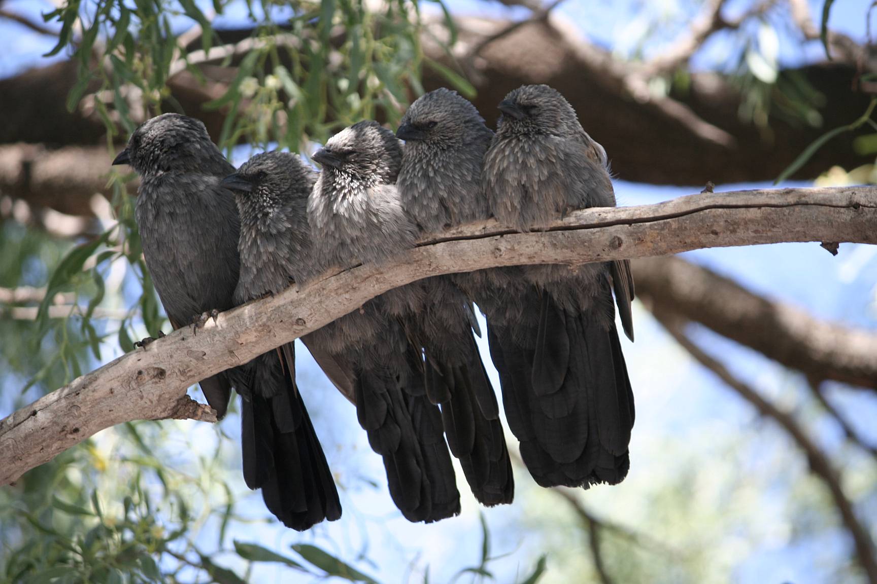
Apostle birds at Emmdale
After amusing us with their antics for a few minutes the birds flew up to a dead branch and got together for a rest. In my experience it is unusual for birds to sit so close together, they seem to more normally want a bit of 'personal space'.2017/04/06
|
|
Broken Hill
|
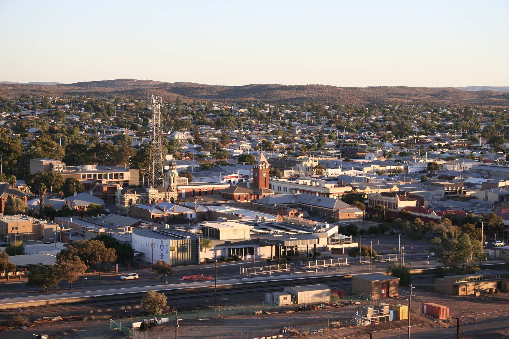
Broken Hill in the early morning
The city centre area from the main lookout.2017/04/07
|
|
|
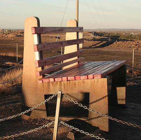
Art?
A sign hanging on the chain around this construction, in the area of the town lookout, informed visitors that this was a "work of art", and warned them not to climb on it "as this could result in injury". It's scale is difficult to judge by the photo, but it would be about 70% taller than a normal park bench.I suppose beauty, and art, are in the eye of the beholder, but this to us was definitely neither beauty nor art.
If a sign is needed to tell people that a thing is a work of art, maybe it isn't really?
2017/04/07
|
|
|
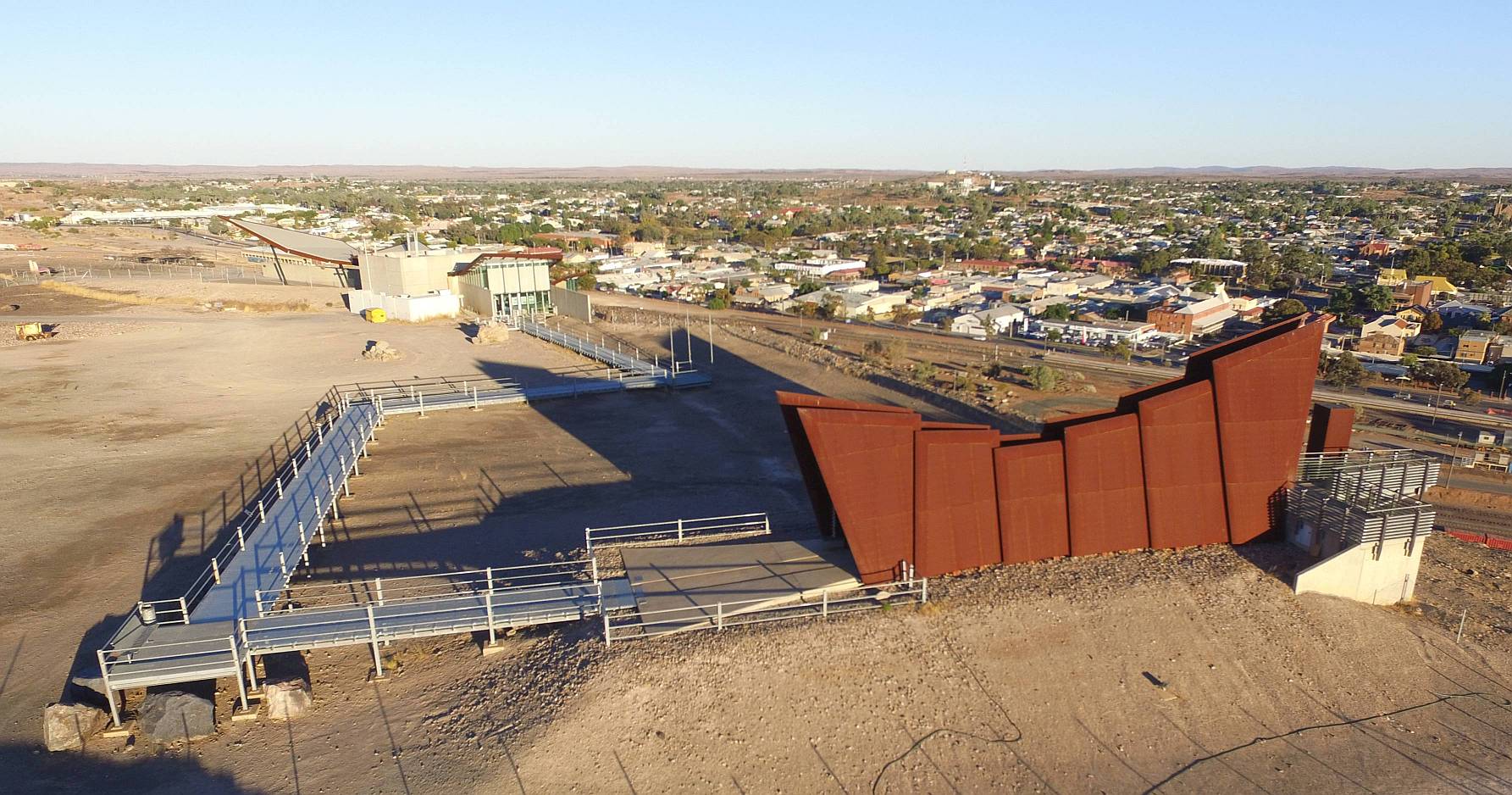
Miner's memorial
On the same lookout as the previous photos, the miner's memorial (on the right) records the names of all the miners who have died due to mining, and the causes of their deaths, so far as it was recorded and known. There were a great many deaths.
|
|
We were keen to get home and resolved to spend more time in Broken Hill on a later trip; it seems to be a very interesting city.
This photo was taken by my drone.
2017/04/07
Broken Hill Solar Farm
|

Broken Hill Solar Farm
This is about three kilometres out of Broken Hill just off the Adelaide road. As the bloke in the Tourist Information Centre told us, you could miss it when driving west, it is easier to see driving east. There is an unsealed public road along one boundary, making this solar power station more approachable than the Nyngan one.There were 670,000 panels with a total installed capacity of 53MW, so while it was only around half the size of its Nyngan counterpart (both were owned by AGL, and were built around the same time) it was one of the biggest in Australia at this time.
There were plans for a viewing platform, but nothing had been built by the time of our visit.
2017/04/06
|
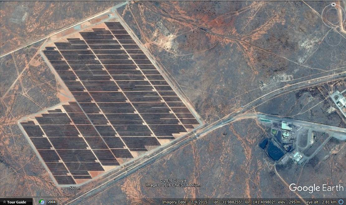
Google Earth Image
The Broken Hill Solar Farm on Google Earth.Image recorded on 2017/04/06
Click (or tap) on the image to view full size; use back-arrow to come back.
|
|