
Photo Canon Ixus 190, 2022/02/20
|
|
|
|
|
|
Photo Canon Ixus 190, 2022/02/20 |
I was very fortunate to get these photos. We just pulled up at our home in our car and this little bloke was feasting on the nectar of the Banksia.
The scientific name of the New Holland honeyeater is Phylidonyris novaehollandiae. The plant seems to be Banksia victoriae. The image and description on Wikipedia fits well except the leaves on this specimen are up to 40cm rather than the '15 to 30cm' of Wikipedia. It is apparently one of the most popular Banksias in local gardens.
Mandurah is a great place for viewing many species of birds, particularly water birds. I've images of Mandurah water birds elsewhere on this page and on another on this site.
Peel estuaryLen Howard Reserve, in the Peel Estuary region |
Len Howard Conservation Park
| |||
|---|---|---|---|

| |||
The Len Howard Conservation Park, I believe, is roughly the area surrounded by the red line running from bottom left toward the centre. Mandurah Quay is toward the upper right corner of the image where Boundary Island Brewery is marked.
The area surrounded by the yellow line on the right could be a part of the Conservation Park.
The roughly figure of eight shape near the centre of the image is what I call the Big Seasonal Paperbark Swamp, for want of a formal name. It is unclear whether the inner part of this is part of the LHCP. |

|
|
Mandurah Quay at sunrise.
The contrast was very high, so I used ChatGPT to combine two images (3275 and 3276) made at different exposure levels, into one. The result is better than either original.
Photo 2026/08/23;07:10, iPhone 11 Pro, Telephoto Camera — 52 mm ƒ2 |

|
A calm morning with hazy air on the Peel lagoon near the Len Howard Conservation Park picnic area. The sun is just out of the picture on the upper left. Normally I look for balance between the right and left sides of a composition. This image lacks that balance, all the detail is on the left side. But I liked the composition, so here it is. There are no rules in art. It is all about what is pleasing to the eye. And what pleases the eye of one viewer may not please the eye of another.
Photo iPhone 11 Pro, 2026/08/12, 08:54
|
A calm summer's morning on the Peel - from the Len Howard Conservation Park trail - five photos |

|
The Allocasuarinas must be salt tolerant, although, to judge by where they grow, not quite so salt tolerant as the Melaleucas of the Len Howard Conservation Park.
Photo iPhone 11 pro, wide angle lens, 1.54mm, 2023/01/23
|

|
|
Vegetation bordering the Peel estuary in Len Howard CP, as viewed from the walking trail.
Photo iPhone 11 pro, wide angle lens 1.54mm, 2023/01/23 |
Photo iPhone 11 pro, telephoto lens, 6mm, 2023/01/23
Some feral Nasturtiums in Len Howard Conservation Park |
1 | 2
|
|---|---|

|

|
3 | 4
|

|

|
I've worked at eradicating several invasive weed species in the parks and reserves near my home; these are in a park near my home, but I have no intention of eradicating them because they are attractive and I don't think terribly invasive. Photos, iPhone 17 Pro, 2026/09/01, about 8:25am. |
Further north in Len Howard Conservation Park
The smaller trees are paperbarks (Melaleucas), the large one possibly a marri (Corymbia calophylla)
As discussed elsewhere on these pages, the great many dead trees are likely the result of increased water salinity as a result of climate change.
Photo iPhone 11 Pro, standard lens 4.25mm fl, 2024/09/22
|

|
|
A view through the paperbark bush, with a minor lagoon in the middle distance and the main Peel lagoon just visible in the far distance, from the trail through Len Howard Conservation Park adjacent to the Big Seasonal Paperbark Swamp. I thought the early morning light shining through the trees was particularly attractive.
This is one of those many photos that is more about opportunity and good fortune than photographic skill. And it again shows that the early morning is at least one of the best times of day to try to find those opportunities (together with evenings, although I strongly prefer mornings, everything is fresher then, and I'm a morning person). Photo iPhone 11 Pro, 2025/12/29;05:50 |
The bird in the upper left is an Australian white ibis, Threskiornis molucca which I was fortunate to catch as it flew over. They are common in the area.
Photo iPhone 11 pro, 6mm standard lens, early morning 2023/01/01
Early morning in the Len Howard Conservation Park, south of Mandurah Quay. I find the colour contrast between the green algae and red samphire pleasing. The blue sky is largely taken for granted in southwestern Western Australia. Some people find algae repugnant, I don't. It is a fellow life-form and an important part of our environment.
Photo iPhone 11 pro, 2025/06/09
Some drone photos of Len Howard Conservation Park
This pond is south of the large waterbird roosting pond that abuts the Mandurah Quay housing area. It can't be seen from either the walking path or from Chatsworth Drive.
I've written about drones in general and my personal experiences with drones elsewhere on these pages.
Minor lagoons in the foreground, Boundary Island and the main Peel lagoon in the distance.
These three photos were all taken from above a point on the LHCP path that runs south from Mandurah Quay.
The boardwalks south of Mandurah Quay.
If you take the LHCP walking trail south of Mandurah Quay you encounter these boardwalks after a few hundred metres.
Some wildflowers in Len Howard Conservation Park
A 'common' fringe-lilly (Thysanotus tuberosus). Wikipedia states that it grows in south-eastern Australia, but there are quite a few specimens in the LHCP. A strikingly beautiful tiny flower in an eye-catching colour.
Photo 2022/11/02, iPhone 11 Pro, standard camera 4.25mm focal length
Hemiandra pungens, on Boundary Island, in the Peel lagoon.
Photo 2022/11/20, iPhone 11 Pro, standard camera 4.25mm focal length
Trachymene coerulea, blue lace flower These flowers had become common in parts of Len Howard Conservation Park in December.
Photo 2025/12/12;05:49, iPhone 11 Pro
A cloud of Trachymene coerulea blue lace flowers, like the couple in the above image. On the side of the narrow walking path in the western section of Len Howard Conservation Park. Photo 2025/12/22;09:36, iPhone 11 Pro |

|
|
Kangaroos at a feeding station that someone maintains adjacent to the Len Howard CP
The kangaroos that live in the Len Howard CP are very relaxed around people. Many times we have seen them grazing on someone's front lawn. I've seen one hop through a front gate to do some grazing in mid morning. Photo taken 2022/03/16, Canon Ixus 190 |
The next few photos include some of the many birds in the Mandurah areaOsprey in Len Howard Conservation Park
Photo Canon Ixus 190, 2022/02/18
|

|
|
An Egret, either a little egret, Egretta garzetta or a great egret, Egretta alba, in the Peel wetlands; Collins Pool in the background.
(I believe I've seen both little and great egrets in the area.)
Photo Canon Ixus 190, 2022/02/18 |
There is a photo of many spoonbills in their communal roosting area on another page on this site.
Photo Canon Ixus 190, focal length 43mm, 2022/07/06
There is one or more of these birds in an area on the eastern side of the big seasonal paperbark swamp. Photo Canon Ixus 190, focal length 43mm, 2022/07/20 |
Waterbird roosting areaThis particular lagoon is at the extreme northern corner of the Len Howard Conservation Park. It always contains a great many roosting water birds of many species. |

|
There are many dead trees in the conservation park; the most likely cause would seem to me to be increased salinity possibly due to reduced flushing with fresh water resulting from lower rainfalls. Photo Canon Ixus 190, early morning 2022/02/18 |
Shorebird or Waterbird?The following is extracted from a Mandurah Environment and Heritage Group pamphlet..."Waterbirds are basically birds that are mostly seen feeding, breeding or resting in or around water. The shorebirds are a specific genetic grouping of waterbirds, comprising of the Sandpipers and Plovers, within which there are sub-groups such as the Stilts, Avocets, Stints, Godwits, Curlews, Dotterels and Lapwings. The Egrets, Herons, Ibises, Spoonbills, Ducks, Cormorants, Terns, Grebes, Pelicans, Swans and a few others are not shorebirds but simply waterbirds." |
The Duck PondThis little lagoon is close to my home. As it does not seem to have any official name and can contain hundreds of ducks I've taken to calling it the Duck Pond. |

|
|
A pond in the Len Howard reserve. The water birds in the middle distance are Pacific black ducks (Anas superciliosa, they can be identified by the black steak through the eye area), at least some of those in the distance are grey teal.
This pond is impossible to access in winter without wading through water. I found that the water level had fallen enough by early November 2022 for me to access one end of it without wading through water. Photo Canon Ixus 190, 2022/02/22 |
Photo Canon Ixus 190, 2022/03/27
Hardenbergia probably comptoniana on the edge of the Len Howard reserve.
Photo iPhone 11 pro, 2022/06/26
An evening view looking west from the Nature's Eye shelter area taken when I placed the first dog and kangaroo watering point. The bright 'star' is probably Venus.
I continue to be impressed at the capabilities of the iPhone cameras. It would be quite impossible to take a photo like this hand-held with a conventional camera. |

|
|
An early morning view toward the rising Sun from the lagoon foreshore reserve east of the Novara boat ramp.
A distinctively Australian Casuarina tree on the right, Melaleucas further away; the Darling Scarp in the distance.
Photo 2022/05/28, iPhone 11 Pro, 4.25mm (standard) focal length.
On a previous occasion I sat on the bench between the two trees on the right, a car was parked some distance on my left. The driver then moved his cat to about its position in this photo and, again, turned his headlights on, shining them on me. He left them on for some minutes, not pleasant for me. Weird.
Photo 2022/07/18, iPhone 11 Pro, 4.25mm (standard) focal length.
On a day with scattered showers and short sunny periods. Note the dead paperbark trees, killed, it would seem, by the increasing salinity of the Peel estuary, due to climate change.
Photo, iPhone 11 Pro, ultra-wide lens, 1.54mm focal length
Photo, iPhone 11 Pro, telephoto lens, 6mm focal length
Swan family in the Len Howard CP |

|
|
A swan family in the Len Howard CP just south of Mandurah Quay. They seemed to be sheltering from the wind, which was exceptionally strong on the day. They may also have been sheltering their cygnets from predators; I'd been told that pelicans predate cygnets and ducklings.
There were another couple of pairs of swans not far away. Photo Canon Ixus 190, 2022/08/03 |
Big seasonal paperbark swamp (BSPS)
While the Parks and Wildlife Service take responsibility for the part of this area inside the concrete paths, they do not include it in their map of LHCP on their web page.
|
|
|
|
The Google Earth image on the right, dated 2018/11/14, shows water in two places in the swamp. It seems that at most times of a typical year there is no surface water present.
I have spent many hours controlling fleabane and onion weed in this area through much of 2022 and up to at least September of 2023. It and the Len Howard Conservation Park are my favourite places within a kilometre or so of my home.
|
|
|
|
I offered to mark the small Xanthorrhoeas with pegs to try to avoid similar accidents in the future, but received no answer from Council. I have marked many with bamboo stakes anyway; I think it is giving them some protection.
|
Curiously there is very little middle story undergrowth in the BSPS while the part of the Len Howard Conservation Park that is close to the Peel lagoon is densely covered with undergrowth, to the point where much of it is difficult to walk through. It is relatively easy to walk through most of the BSPS, watching out for low branches, fallen trees and cobwebs; the great majority of walkers stay on the concerts paths.
In the BSPS there are grasses and low groundcovers, some rushes in places and there are the trees; very few shrubs. There are some grass trees (Xanthorrhoeas) and Zamia palms (Macrozamia riedlei) in the more open areas.
|
Photo iPhone 11 pro, 4.25mm standard lens, early morning 2023/01/02.
|
|
|
Western grey kangaroo (Macropus fuliginosus)
Photo Canon Ixus 190, 2025/02/28

|
|
The Big Paperbark Swamp Mob in the northern end of the BSPS.
Photo iPhone 11 Pro, standard lens, 2023/01/23 |

|
|
Most of the Big Paperbark Swamp Mob. There are at least 24 kangaroos in the photographed area.
Photo iPhone 11 Pro, telephoto lens, 6mm, 2022/07/26 |
The paperbark swamp through the seasons
A particularly big paperbark tree in the 'big seasonal paperbark swamp' (see Google Earth image, above). It is probably a swamp paperbark, Melaleuca rhaphiophylla, but possibly a saltwater paperbark, Melaleuca cuticularis.
Photo 2022/04/27, iPhone 11 Pro, wide angle camera
The swamp begins to fill
A view of a part of the paperbark swamp that was flooded for a part of the winter of 2022. The swamp was not full at this point. The swamp area is home to 25 or so kangaroos, possibly more. They are not shy, a person can walk within several metres of them at times. Photo iPhone 11 pro, 2022/06/22
I've kept some records of when the BSPS starts and stops overflowing in the time I've lived in the vicinity on another page on this site.
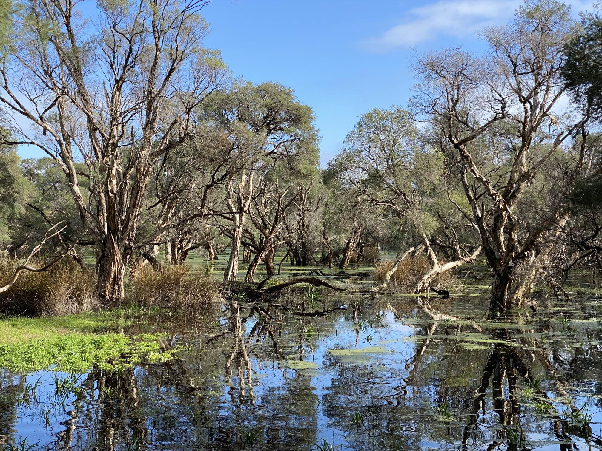
Duckweed grows on the water in the paperbark swamp; winter of 2022 |
|
|
Erskine had a wet winter, at least up to the time of photographing this, 2022/07/24. By my records there had been 129mm of rain in May, 148mm in June and 109mm up to 24th of July. Consequently the swamp was full and overflowing into the main estuary pool. (I don't seem to have recorded when the swamp started overflowing, it was probably at least a couple of weeks before I took this photo, but surface flow into the estuary stopped on 2022/09/28.)
The floating plant is common duckweed, Lemna minor. It is not native to Australia. Photo iPhone 11 Pro, focal length 6mm (telephoto), 2022/07/24 |
From a distance, and in the lower definition version of these photos, the duckweed could be mistaken for algae.
Duckweed close-up
Photo iPhone 11 Pro, standard lens (4.25mm), 2022/08/04
The leaves (if that is what they were) seemed smaller and more fleshy than in the above photo. Perhaps they were fruits rather than leaves?
Photo Canon Ixus 190.
BSPS drone images
Photo - DJI Mavic Mini drone, 2024/08/20
Photo - DJI Mavic Mini drone, 2024/08/20
Mandurah Quay area, Peel Estuary |

|
(Also see Mandurah bicycle rides elsewhere in these pages.) Photo iPhone 11 pro, 2025/02/16, standard camera, 4.25mm focal length |

|
|
Looking across the Peel estuary on a misty morning, Boundary Island on the right.
Photo iPhone 11 Pro, telephoto lens, focal length 6mm, 2022/06/02.
This is a very attractive place to walk, and a very popular place for dog walking. Photo iPhone 11 Pro, standard lens, 4.25mm focal length, 2022/08/11 The trees in the distance would be on Boundary Island, and beyond them, in the far distance is the Darling Scarp. |

|

|
|
Again, sunrise over the Peel, seen from an early morning bike ride, a little to the north of Mandurah Quay and a very little further north than the previous image.
Photo iPhone 11 pro, telephoto lens, 6mm, 2023/02/05 |

|
This is a stitch of three images from my Mavic Mini drone, recorded on 2024/11/11. |
Peel lagoon, sand bars and islands off Mandurah Quay. Boundary Island is on the extreme left. The foreground sandbar can be crowded with water birds in the afternoon and evening, but there were few around when I took this photo. Mavic Mini drone, early morning 2026/06/06.
It was a perfect morning for the drone and photography, not a trace of a breeze.
The artificial bays east of Mandurah Quay
This string of very artificial-looking bays is just to the east of Mandurah Quay and to the south of Osprey Waters Reserve. The main entrance to the Peel Estuary is in the distance on the left. The Darling Scarp is just visible in the distance in the high-definition image. This view is looking toward the ENE.
There were a number of dune onion weed plants on some of the little headlands, I believe I have eradicated them.
Osprey Waters and Samphire Cove Reserves
The northern end of Osprey Waters is at the bottom of this image, part of the Estuary Bridge (including a small section of the new bridge under construction) is right-centre, Samphire Cove Reserve upper centre and central Mandurah can be seen in the distance. Another drone image of the Estuary Bridges is on my Peel and Mandurah observations page.
The southern part of Osprey Waters Reserve is on the right of this image.
Both the above images were taken using my Mavic Mini drone.
East side of main channel, Soldiers Cove
A view of the main Peel estuary channel from the eastern side. There is a path along the channel for rather over half the distance between the two bridges.
Novara Beach Reserve, Peel Estuary |

|
|
The Peel lagoon from the Novara Reserve.
On the left is, I think, a club rush (Ficinia nodosa).
Mount William
I did climb the only one of the other towers that had an accessible ladder, but found the view from there to be disappointing too, with nothing but featureless bush nearby and any interesting areas off in the far distance.
Coincidentally there is another Mount William in Australia, at 1,167m it happens to be the highest mountain in The Grampians of Victoria. It is a far more impressive mountain and the views from the top are magnificent.
The Novara Beach Reserve is west of the Len Howard CP and Novara boat ramp. It has attractive lawns, barbecue areas, ponds and beaches such as this. Occasionally a bandicoot can be seen near one of the many patches of dense native bush. Our dog Monty is in the foreground in the photo. Photo 2022/04/27, iPhone 11 Pro, standard focal length camera
Photo Canon Ixus 190, 2022/10/15
Serpentine area, Peel EstuaryBandicoot
Seen just below the boardwalk, northern end of Riverside Gardens Reserve, Greenfields, Mandurah. The area is densely populated (with humans), there are lots of pet dogs, many of which are walked off their leashes. I've seen a few free-roaming cats. I don't think I've ever seen a wild bandicoot in South Australia. It has surprised me that they have managed to persist in this area; the very dense undergrowth in a number of places would certainly be an important factor in giving them protection.
Photo Canon Ixus 190, 2022/02/28
Serpentine area on a smokey morning |

|
|
The Serpentine on a smokey morning near St Ives Lifestyle Village. The smoke added a very pleasing 'atmosphere' to the views on this morning.
Photo iPhone 11 Pro, wide angle camera (focal length 1.54mm) 2022/05/09
The smoke was probably from a controlled fire load reduction burn.
Photo iPhone 11 Pro, wide angle camera (focal length 1.54mm) 2022/05/09
Frasers Landing pond area
Frasers Landing Pond I occasionally take my daughter's two dogs and my dog to some interesting place for a walk, to give them, and me, a change from waling in the vicinity of my home. Native ducks are often skittish and fly off whenever one gets close to them. These were the opposite. I suspect that they are used to being fed.
Photographed using my iPhone 11 Pro, 2026/05/08;07:49
The Serpentine River near Frasers Landing Pond. Plainly on a very calm and beautiful morning.
Photographed using my iPhone 11 Pro, 2026/05/08;07:16
Dawesville Foreshore Reserve, Peel estuary
Photo iPhone 11 Pro, telephoto lens, 6mm focal length
Creery Wetlands, Peel estuary |

|
Photo DJI Mavic Mini, 2026/02/07;09:48 |

|
|
Some more of the wetlands, and some of the Casuarina obesa forest. Looking further to the left from the previous image.
Photo DJI Mavic Mini, 2026/02/07;09:47 |

|
Photo DJI Mavic Mini, 2026/02/07;09:47 Parts of the wetlands reserve are badly infested with fleabane, as shown on another page on this site. |
More on Creery WetlandsA friends group has been formed with the control of the weeds as one objective.Another objective is revegetating some of the barer areas. Bare ground is an invitation for weed infestation. Men of the Trees, Peel Branch, have become involved, and they have a page on the Creery Wetlands. The area shown in the Google Earth image on the right is approximately where the fenced revegetation area will be. It will be fenced to keep out the numerous kangaroos that would otherwise eat the seedlings. The path at the top of the image connects with the wetlands gate at the end of Dotteral Drive, Dudley Park. |
Unnamed reserve near our houseFor my own reference I've called it the WS Reserve (it's at the western junction of Wattleglen Avenue and Silverton Crescent), and I've written a dedicated page on it.
Banksia blossom (probably Banksia ashbyi) in a little unnamed park near our house. This park or reserve is one of the areas that I have been working on with the aim of controlling feral weeds including fleabane and false onion weed.
Photo 2022/11/04, iPhone 11 Pro, standard camera 4.25mm focal length
Another banksia blossom on the same tree. This one is not quite fully mature. Photo 2022/11/04, iPhone 11 Pro, standard camera 4.25mm focal length
Granny Bonnets or Lamp Poison, Isotropis cuneifolia, of the family Fabaceae These exquisite little flowers were about 15mm across. They were in the little reserve at the western end of Wattleglen Avenue and Silverton Crescent, Erskine. The part of the reserve where these were was burned in 2023/11/15.
Photo iPhone 17 Pro, 2026/09/08;17:57
Caladenia flava, common name cowslip orchid. Also in the little reserve at the western end of Wattleglen Avenue and Silverton Crescent, Erskine. They were rather larger than the Isotropis cuneifolia above. Photo iPhone 17 Pro, 2026/09/08;17:57
Mandurah centre
When it wasn't stealing food it was chattering loudly. Rhipidura leucophrys, common name Willie wagtail. They are one of the more common of Australian birds and often show very little fear of people, or of anything else.
Photo iPhone 11 Pro, telephoto lens, focal length 6mm.
Nankeen night herons
Photo Canon Ixus 190, focal length 18mm, 2022/03/01.
Photo Canon Ixus 190, focal length 37mm, 2023/02/12
On this particular morning there were eight night herons in the area for a short while, in front of The Bay Cafe, Mandurah. A fisherman who comes here frequently ('every day' he told me) feeds them and has made at least two very tame. Photo Canon Ixus 190, focal length 43mm, 2023/03/05 |

|
|
Looking west from the footbridge at Dolphin Quay shortly after sunrise
Photo iPhone 11 Pro, 2022/05/07, wide angle lens, focal length 1.54mm
Drone images in central MandurahI took the following three photos from a point above western foreshore near the playground area. All were taken by my Mavic Mini drone on the morning of 2024/11/17.
Much of the area immediately behind the foreshore is fenced off and has been for many months and is likely to be for many more months. It was a very pleasant area, but apparently Council decided, for some reason, it was unsatisfactory. I suspect the at the resulting ugliness and big 'no go' area has kept many visitors away from Mandurah.
The Estuary bridge is in the middle distance.
The Canals
Bicycling in Mandurah is very pleasant, there are many shared (bicycle/pedestrian) paths and many attractive parks and gardens. (I am trying to enhance the attractiveness of several areas). There are weeds in many of the parks, one of particular note is tall fleabane partly because it could be controlled by hand pulling if only people wanted to make a little effort at times. One of my projects is controlling fleabane in parks near my home.
Photo iPhone 11 Pro, telephoto lens, focal length 6mm.
Mandurah ocean beaches |
|
Mandurah has some beautiful beaches. Limestone reefs close to the shore in many areas do make getting into the water for a swim tricky, especially when there is a larger than usual surf, but there are a number of places where there is no reef, just sand.
The photos below were taken on the beaches of Endeavour Island, between the natural inlet to the Peel Lagoons and the Dawesville Channel.
See also a section on the Mandurah ocean beach on my Peel Estuary and Mandurah Observations page.
|
The stairs to the beach near the end of Daydream Plaza, Halls Head
|
|---|

|
|
This image was recorded just over an hour before sunrise, 2026/03/27:05;17. The iPhone 11 Pro is not only a remarkable mobile phone, it contains a remarkable camera. For the image to be captured on a colour film camera an exposure of at least ten minutes would have been needed with the camera on a tripod. I hand-held the iPhone for the photo.
The light in the clouds is reflected from the city lights of Mandurah and Rockingham.
|

|
Mandurah is a very popular place for boating. I often see people towing their fishing boat off for an outing. There are also many larger and, no doubt far more expensive boats (power and sailing) to be seen in the various marinas. The remarkable thing about the big boats is that I very rarely see them when I visit the beach (the lagoons are too shallow for large sailing boats); my impression is that they are more for show or for impressing business associates than for use. I've written about this conspicuous consumption on another page.
Photo 2023/05/05, iPhone 11 Pro, telephoto lens, focal length 6mm
Photo iPhone 11 Pro, standard lens, 4.25mm fl, 2022/03/29
More of the strange solution formations in the aeolian (formed in wind-blown dunes) limestone of the beach south of the Seascape area. There was a fair surf at the time. Most of the Halls Head coast is not well suited for surfing because there is a short distance between the break and the beach.
Photo, iPhone 11 Pro, 2026/08/13:07;20
Seascape Beach, Erskine, Mandurah; drone images |
A drone photo of a part of Endeavour Island
|
|---|

|

|
The Seascapes Reserve area, from a higher altitude and at a different time of the year than the above image.
Photo - DJI Mavic Mini drone, 2026/06/06, about an hour after sunrise
Looking north from Seascapes. A little of the shared-use path that follows much of this part of the coast can be seen in the middle distance.
Photo - DJI Mavic Mini drone, 2026/02/09;06:30
Mandurah area generally |

|
|
A rainbow over the Peel estuary photographed from the shared-use path on the east side of the channel, south of the town bridge.
Photo iPhone 11 Pro, wide angle lens, 1.54mm focal length |
The smaller branches have been cut off, I suppose so that they don't drop off and make the street untidy. I suspect that the bulk of the tree has been left because it has hollows that serve as homes to wildlife. There is a shortage of nesting hollows in Australia because so many trees have been cut down for one reason or another. It takes many decades for a tree to develop hollows suitable for nesting.
There was at least one pair of galahs living in one of the hollows in this tree.
Photo iPhone 11 pro, 2022/06/16
|

|
|
A home front on a street otherwise filled with dull, featureless, continuous concrete blanks, as I recall, without even a gap between them.
This was very much a silk purse in a street of pig's ears. (I won't identify its location for the privacy of the occupants.)
For the photo I was fortunate in that the early morning sun was catching the home front just right; the lane was narrow and the buildings on both sides were several stories high. Photo iPhone 11 Pro, 2025/12/12;07:13. |
Leaves of a tree that looks to me to be deficient in iron (leaves with deep green veins with the sections between the veins yellowish is symptomatic of iron deficiency). The photo is on this page not because of its indication of iron deficiency, but because I thought it attractive.
Photo iPhone 11 Pro, 2025/12/12;07:07; taken near the end of The Palladio and adjacent to the Mandurah Ocean Marina.
Some of Mandurah's wildflowers
These wildflowers were common adjacent to a path in the Len Howard Conservation Park close to my home in Erskine, Mandurah. I had trouble identifying them, but a friend helped out, they are Trachymene coerulea, common name blue lace flower. The WA Botanic Gardens and Parks Authority has a page on the species.
Photo iPhone 11 Pro, 2025/12/12;05:49
A Eucalyptus ficifolia flower and several capsules in the landscaped gardens fronting the Mandurah Council buildings. Photo iPhone 11 Pro, 2025/12/12;06:51 |
Eucalyptus ficifolia
|
|---|

|
Photos iPhone 11 Pro, 2025/12/21, just before 9am.
I happened to come across another, perhaps even more spectacular Corymbia ficifolia tree in an otherwise expanse of dry grass near Brinkworth in South Australia back in 2022/01/06, very shortly before moving to Mandurah.
The image shows a couple of flowers from a native hibiscus (Alyogyne species). I first came across Alyogyne species huegelii growing on farm land on the Eyre Peninsula of South Australia when assisting in geophysical mapping of the extent of an aquifer. To grow wild on Eyre Peninsula, with its poor soils and low rainfall those shrubs must be hardy. This specimen in our backyard struggles, the soil of the Perth coastal plain has to be among the least fertile in Australia. As Australian wildflowers go these are large, about 70mm across. Photo iPhone 17 Pro, 2026/09/10;17:22 Why do humans find flowers beautiful?It surely is remarkable and intriguing, that humans find flowers beautiful. You can see that pollinating insects and birds need to be attracted to flowers, but surely there is no advantage to the plant for humans to find it beautiful (at least until the last few thousand years, during which time our ancestors might have cultivated them).
Grasstrees (Xanthorrhoeas), yaccas
Yacca is a common name for Xanthorrhoea species, especially in South Australia and Western Victoria; if used in Western Australia the name invokes blank looks. The word is of Indigenous South Australian origin, likely from the Kaurna language. I gather the WA grass trees are mostly either Xanthorroea preissii or X gracilis. I'd guess that these are the former. The University of South Australia noted (2023/07/22) that "grass skirts [of yaccas] are a life saver for many animals, but fire and disease threaten their survival". Animals can shelter from both high and low temperatures beneath the grass skirts of the yaccas. The remarkable Kingia australis looks superficially similar, yet is unrelated.
Photo iPhone 11 pro, 2022/06/26
Xanthorroea, Wattleglen Avenue
Xanthorroea are remarkable plants. The trunk grows about a centimetre per year, yet it puts up a flower spike, like these, in a month or so. Preissii seems to be the main Xanthorroea species in WA. I recorded the growth of a yacca seed spike in SA just before moving to WA. It grew 53cm in eleven days.
Also on this page is a reference to a remarkable patch of grass trees, with images, between Pinjarra and Dwellingup. Other references to, and photos of, Xanthorroeas on this site:
Xanthorrhoeas, Peppermint Drive
Most often the seed-heads grow straight up. Why these are so curved I don't know. Possibly caused by some agricultural chemical?
Photo 2024/11/03, iPhone 11 Pro, telephoto camera 6mm fl. For some reason the sharpness of the image was insufficient to allow higher detail than in this copy.
Sundew
Sundews are carnivorous plants that trap tiny insects in the sticky substance at the ends of the little hairs surrounding the leaves. They then digest the insects and absorb nutrients from them, particularly the nitrogen. Photo Canon Ixus 190, 2022/06/13
I've photographed sundews in Spring Gully Conservation Park in the Clare Valley of South Australia too.
Photo iPhone 11 Pro, standard lens, 2023/08/02
Mandurah's Giants |
|
Danish sculptor Thomas Dambo built six wooden giants, five were constructed in the Mandurah area and one at Subiaco in Perth. The wood that was used in the construction was mainly recycled.
By the time I added the image below to this page my wife and I had visited all six. Not long after this, one of the giants (at Coodanup) was burned by low-life. |
Halls Head Giant, Santi Ikto
I was out for an early morning bike ride and took this photo soon after sunrise. I had spent some time taking a half a dozen rolls of toilet paper off the statue. The Mandurah Christmas pageant had taken place the previous evening and much of the population of the town was in central Mandurah to see it. Quite possibly the people who wrapped the statue in toilet paper had taken advantage of the minimal chance of interruption to do their work.
It happens that this giant is adjacent our favourite dog-walking beach. It's also on a shared-use cycling-walking trail that goes about three kilometres through the sand dunes beside the beach.
|
The Halls Head giant welcoming the sunrise
|
|---|

|
Photo iPhone 11 Pro, 2023/04/30, extra wide angle lens, focal length1.54mm
|
|
Mandurah Council arranged the planting of several thousand natives in an effort to rehabilitate the damaged area. The planting must have taken place in the winter of 2024. This drone image shows the area planted better than an image taken from on the ground could. The higher definition version of the image shows more detail (click on the image on the right). The Darling Scarp and Peel Lagoon can be seen in the upper left. I can be seen on the far right in the high definition image.
The DJI Mavic Mini camera takes a very high quality image of 4000 x 2250 pixels. I usually reduce the image size to 2000 x 1125 for the 'high definition' version on this web site to reduce the file size; the full definition image file of this photo is 4.0MB, this small image is 700 x 294 pixels, 75KB and the higher definition image is 3000 x 1688, 1.2MB.
Photo DJI Mavic Mini, 2024/11/17
This view is looking roughly ENE.
Santi Ikto again. He, together with his setting, are great photographic subjects. I periodically ride my bicycle along the coastal trail, usually, like this, in the early morning. The views change with the angle, shooting location, focal length, and importantly where the sun is in the sky, and that varies not only by the time of day but also the time of year. And then of course there is the sky, is it clear or are there clouds, and are the clouds themselves interesting? In this photo the sun was behind Santi.
Photo, iPhone 11 Pro, 2026/08/13:07;40
A story of the local environment around Santi Ikto
People trampled the vegetation around the giant and onion weed got established, as shown on another page on this site. Later people took a short cut from the main trail immediately below the giant and made a new path (this too can be seen in photos above). Council tried to use traffic cones and tape to deter people using that path. Later again council replanted hundreds of native plants as shown in a couple of photos above. Council upgraded the original path, first adding steps, then a good path for people to wheel their bikes and scooters up. After more attempts to make people use only the original path with limited success, council fenced both top and bottom as shown in this photo.
How much better it would have been to build the fences right from the start! It is easy to be wise in hindsight!
Coodanup Giant, Vivi Cirklestone
It was reported on the ABC (2022/12/19) that there were hopes that the giant could be rebuilt. (It was rebuilt, see below.)
Coodanup Giant mark 2, Yaburgurt Cirklestone
Denece and I just happened to visit when there was a bit of ceremony going on including a smoking ceremony and some Aboriginal dancing. The man in the grey coat in the photo is Mandurah Mayor Ryse Williams. Yaburgurt seems to be looking at the small group. I was told that the name Yaburgurt had some significance to the local Aboriginies and that the Aboriginal Corporation had given permission for the name to be used for this giant.
Photo, iPhone 11 pro, telephoto lens, 6mm focal length, 2023/05/27
Dawesville Giant, Seba
Overlooking the Dawesville channel. I believe this giant is named Seba (or Seba's Song). Photo, iPhone 11 pro, standard lens, 4.25mm focal length, just after sunrise, 2023/01/29, 5:45am
On this particular day I had decided to go for a very long walk, and started very early in the morning. Unlike my first visit (see below) there were only a couple fishers nearby this time.
This visit was this only a week or so after the Giants trail was officially opened. That was probably a mistake because there was very limited parking anywhere nearby and a big traffic jam - which we managed to mostly avoid by walking about twice as far as would have been necessary at some other time.
Lake Clifton Giant, Jyttes Hytte
I suspect that at least a part of the thinking behind this location would have been to attract more tourists to the thrombolite reserve at Lake Clifton and so spend more time (and money) in the Mandurah area. The giant was quite a long walk from the thrombolite viewing area. On the way Denece and I were impressed at the huge number of jewel spider (Austracantha minax) webs in the bush beside the track. They must catch countless millions of small insects, most likely including (a majority of?) mosquitos.
Subiaco Giant, Billie Bob
I suspect that the reasoning was that Perth people would visit the Subiaco Giant because it was not far away, then would decide they needed to see the other giants, and visit Mandurah.
Photo, iPhone 11 pro, standard lens, 4.25mm focal length, 2022/11/23
Marlee Reserve Giant, Little Lui
Denece and I walked around quite a large part of the reserve before we found the giant. We came across a large patch of fleabane on our walk. Fleabane is a very widespread and invasive weed in the Mandurah area; I have made a project of removing it where it occurs on paths or reserves within a kilometre or so of my home.
Photo, iPhone 11 pro, standard lens, 4.25mm focal length, 2022/11/15
Marlee Reserve
Photo iPhone 11 Pro, 1.54mm wide angle lens
Photo iPhone 11 Pro, wide angle lens fl 1.45mm, 2023/09/24
Bridgewater-North Reserve
On the right is a Google Earth image of the Bridgewater-North Reserve.
In winter the water level rises much higher than where it is in summer. The water level in this Google Earth image is that of summer. In winter you can't walk around the western side of the northeastern most pond without wading and the ponds join up, or almost do; the path across the centre of the image sometimes has shallow water over part of it. If the ponds overfill the water exits through the water-course in the lower right of this image.
The small white spots in the image are fountains for oxygenating the water to prevent bad smells resulting from anoxic decomposition of algae. There are some in the southern pond too, but apparently they were not operating when this image was recorded.
|
Drone image of most of Bridgewater-North Reserve from the south
|
|---|

|
When the ponds fill - which seems to usually happen in late winter - they overflow through a small water-course that passes beneath the big trees at centre right. Image by DJI Mavic Mini drone, 2026/01/30 |
Drone image of the northern part of Bridgewater-North Reserve, from the south
|
|---|

|
|
Mandurah Road runs across this image beyond the ponds. The Peel lagoon main connection to the sea in in the upper right, city of Mandurah upper left.
Image by DJI Mavic Mini drone, 2026/01/30 |
Black Swan Lake Reserve, Lakelands
Black Swan Lake, immediately to the east of Lakelands Railway Station.
Photo iPhone 11 Pro 4.26mm standard lens, 2023/10/27
Unfortunately the Black Swan Lake Reserve is infested with the invasive weed fleabane. I've written more on this on another page on this site. The weed would not be very difficult to control if someone was willing to make a consistent effort in their spare time.
Photo iPhone 11 Pro 6mm telephoto lens, 2023/10/27
Photo iPhone 11 Pro 6mm telephoto lens, 6mm fl, 2024/01/09
I rode my bike the length of Marlee Reserve, through the underpass and along the eastern side of Black Swan Lake. Only a part of the path is paved, but it is all in fair condition.
Photo iPhone 11 Pro 6mm telephoto lens, 6mm fl, 2024/01/21
Drone images of Black Swan Lake
Interestingly this death seems to have been fairly recent. In the Google Earth image of the same area recorded November 2018, that I have inserted below, most of the trees were still alive.
On another page I have commented on the tree deaths in the seasonal swamps near the Peel lagoon.
Click on the image for the higher resolution version. That provides about the highest resolution I could get from Google Earth. In the Google Earth image, while a number of tree near the central area appear to be dying, most seem to still be alive. I can only speculate that it is likely to be the drying climate that has killed the trees, most likely through increasing salinity due to reduced flushing of salts.
North is at the top of this image.
This photo was taken 2024/01/25;06:59.
More drone images, 2026/10/30 |

|
|
Black Swan Lake again, looking from the NE toward the SW; the area of dead trees is in the upper centre of the image.
The ground in the green area on the left was covered with shallow water. There are several animal trails running through it. Photo Mavic Mini drone, 2026/10/30:07;52 |
From near the northeastern corner toward the west. I was a little surprised at how high the water level still was. There had only been minor rains over the last couple of months. Part of the path at the northern end of the lake was under water.
Photo Mavic Mini drone, 2026/10/30:07;50
The straight section of the path on the left is made so that water can flow through the gravel base - there was water on both sides of it when I walked through. Note the two trails through the swamp, running from the bottom to the middle left of the image. I'd guess that they were made by grazing kangaroos. The small foot bridge at the upper right was under water. Walkers had to use the trail further out, near the top of the image.
Photo Mavic Mini drone, 2026/10/30:08;33
My back yard
The first birds we saw eating the seed block were ring-necked parrots.
This and the following two photos were taken on my iPhone 11 Pro on 2023/05/18.
Galahs are considered to be cockatoos. So far as I know, cockatoos are just larger forms of parrots and these galahs were bigger than the ring-necked parrots.
Finally, our dogs chased away the corellas, and after a short time the ring-necked parrots came back.
Just beyond my back yardThe eight photos below were taken in several little reserves within a few hundred metres of my home in Erskine, Mandurah, all on a short early morning walk. They are included on this page more for, I hope, pictorial interest than botanical or ecological interest.
Old dried Banksia seed pod. I've always found it curious that while there must be a very large number of inflorescences in the big Banksia flowers, there are only a few seeds that seem to come to maturity in each.
Photo iPhone 11 Pro, standard lens 4.25mm focal length 2023/10/28
Photo iPhone 11 Pro, standard lens 4.25mm focal length 2023/10/28
Jarrah, together with marri (Corymbia calophylla) and tuart (Eucalyptus gomphocephala) are the most common large endemic Eucalypt trees in the Mandurah area.
Photo iPhone 11 Pro, standard lens 4.25mm focal length 2023/10/28
Photo iPhone 11 Pro, standard lens 4.25mm focal length 2023/10/28
Xanthorrhoea leaves
More complete photos on grass trees (aka yaccas or yackas or yakkas) are on this page here and here and on other pages here, here, here, here and especially here. At this point I will probably not surprise the reader if I say that Xanthorrhoeas fascinate me. The plant is very slow growing, taking a decade or more to produce a trunk which then grows about a centimetre a year. But the seed spike can grow more than ten centimetres in a day, as I've recorded on my page about plants that grow in Crystal Brook, South Australia.
Photo iPhone 11 Pro, telephoto lens 6mm focal length 2023/10/28
The flowers on the flower spike produce a lot of nectar. It can be licked off and, I believe, was once a favourite sweet treat for Australian Aborigines. I've licked yacca flowers myself.
Photo iPhone 11 Pro, standard lens 4.25mm focal length 2023/10/28
Photo iPhone 11 Pro, standard lens 4.25mm focal length 2023/10/28
Lane Poole ReserveI visited on 2025/09/09 with my dog and new tent. Lane Poole Reserve is one of the most attractive and enjoyable places anywhere near my home in Mandurah, and I wanted to try out my tent. |

|
|
This cascade is at the most popular spot in Lane Poole Reserve. On the upstream side is a great swimming hole and just a bit downstream is a foot bridge that crosses the (Murray) river.
The flow was much greater than usual because of a wet winter and substantial rains in the preceding few days. Photo - Mavic Mini drone, 2025/09/09 |
Dogs are allowed, but must be kept on a leash at all times. My dog Monty, a Russell Terrier is in the foreground.
Camp sites must be booked in advance.
Photo 2025/09/09, iPhone 11 Pro
This was the morning following a long night in my sleeping bag. The amount of stuff one needs for breakfast is surprising; getting it out of the tent onto the table takes time. Food can't be left out because of birds such as the magpie (Gymnorhina tibicen) on the table. I heated up my food and drinks on the Trangia that can be seen on the table. I had not used one for quite a few years. It uses methylated spirits as fuel, is quick, safe and convenient.
Photo 2025/09/10, iPhone 11 Pro
Photo 2025/09/09, iPhone 11 Pro
I believe that most of these trees are jarrahs, but I think there were also some tuarts Eucalyptus gomphocephala in the area. (I am not good at identifying the many species of Eucalyptus tree species.
Photo 2025/09/09, late afternoon, iPhone 11 Pro
More photos of grass trees (aka yaccas or yackas or yakkas) are here, here, here, here, here, here and especially here on these pages. A plant that looks very much like the Xanthorrhoeas is Kingia australis. I've written on these on another page on this site.
Photo 2025/09/09, late afternoon, iPhone 11 Pro
|

|
|
A view of the Murray River on a very cold early spring morning with just a trace of mist on the water.
Photo 2025/09/10, early morning, iPhone 11 Pro |
The air was very cold and very calm, hence the mist on the water and the mirror-like reflections.
Photo 2025/09/10, early morning, ßiPhone 11 Pro
Another visit to Lane Poole ReserveI went back to Lane Poole Reserve very early in the morning of 2025/12/27.
I arrived before the sun had risen, the air was very cold in spite of it being December and there was mist on the water; the water must have been quite a lot warmer than the air. I noticed that fleabane was present in a number of places in the reserve, as was St John's wort (Hypericum perforatum), a declared pest plant in WA.
Photo iPhone 11 Pro, 2025/12/27;05:28
|

|
|
Remarkable mechanical erosion on the rocks immediately downstream of the main recreational area and upstream of the suspension bridge. The pits are worn into the rocks by boulders being rolled around and gradually grinding the holes during periods of high water flow.
The rocks are gneisses of the Yilgarn craton and are several billion years old. Photo iPhone 11 Pro, 2025/12/27;07:16 |
This photo shows the area just to the right of the previous one. The main recreational swimming hole is on the right. Photo iPhone 11 Pro, 2025/12/27;07:19
I visited with two dogs, my own dog Monty and my daughters dog Haggis. We walked, on the south side of the river, from the suspension bridge via the Murray River Car Park to Bob's Crossing and back on the north side of the river. The dust that makes this photo more interesting than it would otherwise be was left by one of the very few cars that passed us on our way. The driver slowed right down but there was still quite a bit of dust left hanging in the air. The trees would be mainly (or entirely) jarrah (Eucalyptus marginata).
Photo iPhone 11 Pro 2025/12/27;07:54
Lane Poole Reserve, 2026/07/04
Early on a winter's morning, with a low mist.
The rock bar in the middle distance seems to have formed a natural dam holding back the water in the foreground pond, a cascade, spectacular in winter, flows though a gap on its left side of the rock bar.
Photo iPhone 11 Pro, 07:43. Sunrise was about 7:20.
|

|
|
Looking upstream from the pedestrian bridge into the sun. The white stuff on the right is foam from the cascade that can be seen in the distance.
I love the clouds in this image. I edited this image using ChatGPT to bring out the details in the dark shaded areas in the bush on both sides. It is tricky to edit an image like this one without making it unrealistic. The edited version, I believe, is close to how it looked to my eyes at the time. The original, unedited version, can be seen on another page on this site. |
Three crazy dogs on the pedestrian bridge.
Sprout's lead was around my waist, I held the other dog's leads in my hand most of the time. When taking some of the photos I put those two leads on the ground and put my foot on them. That was useful, but then the dogs saw something that they had to suddenly try to chase, and they pulled the leads out from beneath my foot. Haggis disappeared into the bush for about a quarter of an hour - came back when he felt like it. This was concerning. I knew that he would try to come back after some time, but there is the possibility that his lead would get tangled in something. If it had, he would just sit there quietly. Finding him could be very challenging.
Photo iPhone 11 Pro, 07:57
The native forest in Lane Poole Reserve is beautiful, but I found it challenging to get an image with pleasing lighting and composition. This is the best that I managed.
Photo iPhone 11 Pro, 09:02
Pinjarra areaA remarkable patch of grass trees
Grass trees fascinate me. Below are several other references to Xanthorrhoea, aka yaccas, including images, on this site:
I moved the drone to a lower altitude and got closer in, partly to better show the exceptionally tall Xanthorrhoea in the centre of this image, partly just to give more detail.
The trunk of Xanthorrhoeas typically grow at a rate of one or two centimetres per year, so the tall specimens in the centre would have to be several hundred years old. It is interesting that apart from this and one or two others all the other Xanthorrhoea were of a similar, considerably younger, age; but still at least several decades old.
Another Christmas tree can be seen further away on the right. There were a few more out of the photo.
Photo iPhone 11 Pro, 2025/12/27;12:20
Wikipedia tells us that Nuytsia floribunda "is a root hemiparasite, is photosynthetic, and mainly obtains its water and mineral nutrients from its hosts. The haustoria arising from the roots of Nuytsia attach themselves to the roots of many adjacent plants, drawing water and nutrients from them."
Araluen Botanic Park, in the Perth Hills |

|
Photo iPhone 11 Pro, 6mm (telephoto) lens, 2022/09/27
The fact that it shows another aspect of Araluen beyond just the flowers is a bonus.
Photo iPhone 11 Pro, 6mm (telephoto) lens, 2022/09/27
Photo iPhone 11 Pro, 6mm (telephoto) lens, 2022/09/27 |

|
I include the photo here as a curiosity. Is the yellow natural? If so, what would cause it? Or was it painted on? If so, for what purpose?
Photo iPhone 11 Pro, 6mm (telephoto) lens, 2022/09/27
I suspect that this lichen is probably the yellow on the photo above taken in Araluen Botanic Park. The small dark green buttons left of centre are interesting. Possibly very small lichen plants?
A couple of my granddaughters in the centre. Photo iPhone 11 Pro, 4.25mm (standard) lens, 2022/09/27
Kings Park, PerthMost of my photos of Perth are in a dedicated page elsewhere on this site. |
View toward Perth CBD from Kings Park
|
|---|

|
|
Taken from near the Old Tea Pavilion on the beautiful avenue up to the Kings Park main parking area, restaurants, souvenir shop, etcetera.
Photo iPhone 11 Pro, 2025/01/28, standard camera, 4.25mm fl |
The Subiaco Giant, one of the Mandurah Giants, is not far from Kings Park.
Photo iPhone 11 Pro, 6mm (telephoto) lens, 2022/09/30
Photo iPhone 11 Pro, 4.25mm (standard) lens, 2022/09/30
Photo iPhone 11 Pro, 4.25mm (standard) lens, 2022/09/30
Photo iPhone 11 Pro, 4.25mm (standard) lens, 2022/09/30
Lake Clifton Thrombolites
I have written at a little more length about the significance of the thrombolites on another page on this site. Photos on that page show them at a lower tide, when they were partly exposed above the water.
Photo, iPhone 11 pro, wide angle lens, 1.45mm focal length, 2022/12/02
Bunbury and AustralindFurther to the south from Lake Clifton and the thrombolites is the seaside town of Australind and then the city of Bunbury.Denece and I had previously visited Bunbury in August of 2022. On this occasion my main reason for the visit was for a meeting about action on climate change and wind farms. The subject of wind farms had particular relevance to Bunbury because of the declared WA offshore wind farm zone between Mandurah (where I live) and Bunbury. Big Swamp Reserve, Bunbury
On this occasion I rode my e-scooter around the reserve. Part of it can be seen in the foreground.
The swamp would be an ideal place for canoeing, there are many small waterways winding through the wetlands vegetation.
Photo iPhone 11 Pro, wide camera, 1.54mm fl.
This boardwalk is in the northern part of the Big Swamp Reserve.
Collie River, Bunbury |

|
|
6:46, 2025/07/19, about a half and hour before sunrise. The morning was very cold, very calm and the river and sunrise very beautiful.
I rode my e-scooter along the paths of the Pratt Road Reserve on the south side of the Collie River, and in spite of being very warmly dressed got quite cold. But the ride was well worth it. (Photo iPhone 11 Pro, wide camera, 1.54mm fl.) |
Photo iPhone 11 Pro, standard camera, 4.25mm fl.
Australind 'Jetty'
I used inverted commas because it's a very unusual type of jetty. It starts, as you see here with a pedestrian and cyclist bridge. That leads onto an earth and rock embankment that runs about a kilometre, perhaps half-way across the Leschenault lagoon. At the end of the embankment is a little jetty to which people are not allowed to moor their boats. I walked the entire length of the 'jetty' before reading the explanation of how it came to be built. I was speculating all the time, and couldn't come up with an answer that seemed even remotely likely. I'll give the explanation at the end of this section. See if you can come up with a possibility before you read it.
Photo iPhone 11 Pro, standard camera, 4.25mm fl.
The bridge to the embankment. The embankment, or 'jetty', itself fading into the distance on the left.
Photo iPhone 11 Pro, standard camera, 4.25mm fl.
I was very fortunate to be in the right place at the right time. Photo iPhone 11 Pro, standard camera, 4.25mm fl.
As with the photo above I was fortunate to be in the right place at the right time with the right weather conditions.
Photo iPhone 11 Pro, wide camera, 1.45mm fl.
Casuarina trees were planted at fairly frequent intervals along the SE end, fewer were further along. There were three small gaps in the embankment, each with foot bridges over them. And there were two small artificial islands, one on each side of the embankment/jetty. One of them can just be seen in the distance in the previous photo.
Photo iPhone 11 Pro, standard camera, 4.25mm fl.
|

|
|
At the end of the kilometre or so long earth and rock embankment there was this little jetty.
Note that there is nothing there that anyone can moor a boat to, and there is even a sign saying that you are not allowed to moor on the jetty. Strange. Why? Photo iPhone 11 Pro, telephoto camera, 6mm fl. |
The purpose of the Australind 'jetty'
Why the pipe could not have been laid on the bottom of the lagoon, without the great cost of the embankment I can't imagine. (Between 1963 and 1967 a pipeline from Morgan to Whyalla, including a 14-kilometre section across Spencer Gulf, was built in SA. The Leschenault lagoon is only about two kilometres across.)
Some information on the titanium dioxide operation is given in a page titled Report and Recommendations of the Environmental Protection Authority
MyalupMyalup is a small seaside village between Mandurah and Bunbury. The following photos were taken from a place my family and I took for a couple of nights several kilometres east of the village. |

|
Birds on and near the lake that I recorded included: Eurasian coots, dusky moorhens, shelducks, black-ducks, white ibis, swans (black, of course), white-faced heron, pukekos (that's the NZ name, which is more attractive than the Australian name, purple swamp-hen), pied cormorant, hoary-headed grebe, musk duck?, welcome swallows, galahs, great egret and grey fantail. The area would probably originally have been covered with open woodland. The margin of the Lake has been cleared and subdivided for private homes. In the distance on the left is pine plantation. Photo - DJI Mavic Mini drone, 2026/04/11:07;33 |

|
|
An early morning (the sun was just high enough to light up most of the western bank) view of the lake.
Photo iPhone 11 Pro, 2026/04/12;07:15 |

|
|
Grazing land north of Lakeside Drive near Myalup. The low evening sunlight and the white trunks of the Melaleuca trees made a beautiful scene.
Within walking distance, it this general direction, is the Old Coast Road Brewery and restaurant. Photo iPhone 11 Pro, 2026/04/11:17;15 |
|
A gum tree in splendid isolation, also by Lakeside Drive, near Myalup.
Photo iPhone 11 Pro camera, 2026/04/11;07:17.
Rockingham and Warnbro
On the morning of 2025/12/16 I went from Warnbro railway station along the coast to Rockingham foreshore and then to Rockingham station on my e-scooter. Unfortunately paths well suited to bicycles and scooters don't go all the way from Rockingham foreshore to the railway station.
|
Shoalwater Bay from Point Peron
|
|---|

|
|
Penguin Island, which is an important sea bird habitat, is in the distance on the right of this photo.
This image is looking back over Shoalwater Bay toward Warnbro Beach from the lookout hill on Point Peron. Photo iPhone 11 Pro, 2025/12/16;08:45 |

|
Photo iPhone 11 Pro, 2025/12/16;08:46 |
A small part of the Rockingham Beach. Garden Island is just visible in the distance on the right. Behind the beach are a number of very good cafes and restaurants.
Photo iPhone 11 Pro, 2025/12/16;09:58
|
Rockingham City ParkI visited this park early on the morning of 2026/04/02. I was very impressed with how attractive it is and the number of birds and the number of bird species present. |

|
|
A view of the lake through a few of the peppermint trees (Agonis flexuosa) that are prominent in the park.
A few of the many bird species that I saw in the park can be seen in this photo. Those species that I was able to identify were: spoonbills (right of center in this photo and in another photo, below), black ducks, shell ducks, egrets, purple swamp hens, Eurasian coots, corellas, wattle birds, seagulls and one Peking duck.
Looking into the light through some more peppermint trees toward one of the sprayers that help to keep the lake aerated.
A spoonbill, on the right, and a little egret. Spoonbills are filter-feeders; they swing their bills backward and foreward in the shallows and somehow pick out the edible bits from all the muck. Egrets are fishers; they wait patiently and spear small fish with their sharp bills.
The photo was taken using quite a bit of digital zoom; there is insufficient definition for a larger image.
A purple swamp hen.
Little corellas
These birds get their food by picking around in the grass and soil. They sometimes dig for edible roots.
John Forrest National Park
Swan View tunnel
I tried to look up on the internet how to get to the elevated walkway in the NP and came up with a direction to the western end of the Swan View tunnel. Because of my advanced age and low confidence in my driving I don't drive in Perth. So I travelled by train to the Midland train station and took a Uber from there. I was dropped off at the western end of what turned out to be the rail trail that apparently traverses the park from west to east.
This photo shows a section of the approach to the western end of the tunnel.
Here is the western end of the tunnel, and you can see the eastern end in the distance.
Wikipedia has a very interesting page on the tunnel.
Marrinup Pridoner of War campMonty, Haggis, Sprout (my and my daughter's dogs) and I visited the old prisoner of war camp, which is near Dwellingup, on October 14th, 2026. The photos below were taken using my iPhone 17 Pro (that I've recorded here as much for my own benefit as for any other reason).Much of the text that follows was copied from the information signs scattered around the camp site. As I recall the POW camp was in use from August 1943 to April 1946. "Rural labourers were scarce by 1942 and the shortage of manpower was becoming increasingly self-evident in country areas. Production in primary industries was threatened while demand for vital supplies increased.
"Skilled Italian stone masonry is one of the lasting physical legacies remaining on site at Marrinup. Despite the passage of time, two major wildfires and reclamation of this site by the forest, the stonework remains distinct. Renowned for excellence in stonework and carpentry, Italian prisoners worked with dedication on these projects such as a goldfish pond and shaped garden beds.
A view typical of the area of the POW camp as it was on my visit on 14th October 2026.
"Prisoners were grateful for any break from the monotony. They threw themselves into activities that nourished the sense of their homelands. Italian prisoners made their own vermicelli and macaroni and supplemented their diet with vegetables grown in the camp's vegetable garden.
This was the base for the water tanks, at about the highest point of the old camp.
"Marrinup POW Camp closed forever in July 1946. By August 1947 the camp buildings and equipment had been auctioned or returned to Army stores. After the end of the war, repatriation of POWs was executed quickly. Western Australia's last POWs sailed from Fremantle on 31 December 1946 on board S.S Ormonde.
The trees in the camp area must all have been regrowth that followed after the camp was abandoned. One of the information signs mentioned that there were six watch towers with flood lights at the corners of the camp. Trees would have had to have been removed to give the guards clear views. "Camp life - Rank, routine and reveille
Here is one of the many Pimpernel sundews I saw: Drosera glanduligera.
These were growing on area covered with laterite gravel that was, apart from the sundews and mosses, almost bare
Cowslip Orchid, Caladenia flava "Bids for freedom - Escapees The cameras used for the photos on these pages
I have written my impressions of the iPhone 7 camera elsewhere on these pages. It seems that I got my (hand-me-down?) iPhone 7 about early 2017. I mentioned it as being new in my page on A visit to Central New South Wales dated April 2017. There is an informative article on the iPhone 7 in appleinsider. I upgraded to an Apple iPhone 11 Pro about mid 2022: a hand-me-down from my daughter Julia.
I bought the Canon Ixus in January 2021 because it has 10x optical zoom (useful for wildlife and other situations where a long focal length is valuable) and it comfortably fits into a pocket. I was surprised to find it also useful for macro photography. Of course when using long telephoto the depth of field is shallow, as it is in the macro shots; this is simply a matter of physics. Its main, and very important shortcoming, is that it has no viewfinder and its screen is not bright enough to allow it to be used in bright light. Effective resolution
In the past one could buy a camera that took photos with a given number of pixels. In most cases the resolution achieved was effectively about a quarter of the pixel count. In the case of the iPhones, Mavik Mini and Canon Ixus every pixel can count. Some specifications of the iPhone 11 Pro camera(s)The following were extracted from Apple's list of the specifications of the iPhone 11 Pro.Camera:
Features of the iPhone 11 Pro that I've found impressive are:
Some specifications of the iPhone 17 Pro camera(s)Google search gave me the following:"The Apple iPhone 17 Pro features a triple 48MP Pro Fusion rear camera system and an 18MP Center Stage front camera.I see that some of the photos are 4032 x 3024 while others are 5712 x 4284. I don't know why it switches from one to the other. I would think that the iPhone 17 would share things like the sapphire lens covers with the iPhone 11. A bit of the ugly side
I walk through this area when I have to wait for someone, either from the adjacent Riverside Primary School or from the medical centre. I came across this on 2022/05/09 and was shocked and disgusted at the amount of rubbish scattered about. I normally have a lot of sympathy for anyone who has to sleep rough, but whoever has this camp should be thoroughly ashamed of him/herself for this mess. We all make some sort of a contribution to the society in which we live. And we should all make an effort for that contribution to be positive, rather than this very negative contribution. Photo iPhone 11 Pro, normal camera (focal length 4.25mm) |
|
|
Related pagesOn this site...
Bowman Park, Crystal Brook, SA Cameras used for the photos in these pages Climate change, the world's greatest threat and challenge
Contibuting to our communities Crystal Brook's Central Park, SA Destruction of roadside vegetation by a body that should be protecting it
A list of my Australian photo gallery files Peel Estuary and Mandurah - Observations Why I support the local wind farm Reliable information; where you can find it
Wetlands; vitally important, critically endangered
Names and abbreviations I've used
|
|
|


