|
|
|
|
|
|
|
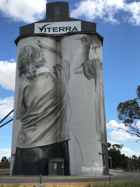
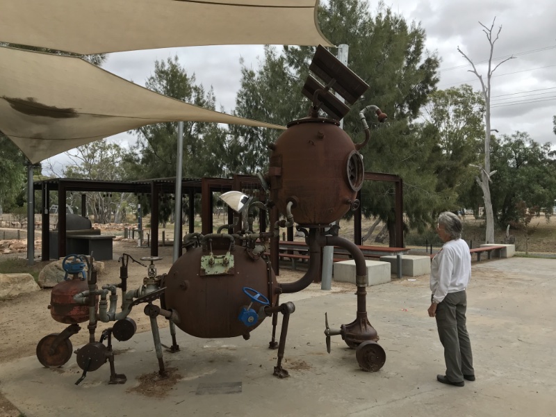
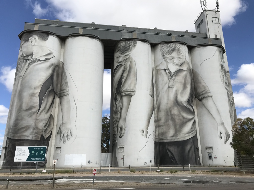
Silo art
Photo 2021/03/14 |
I have recorded more silo art on a previous page. Photo 2021/03/14
Click on the image to see in higher resolution. Use return to come back. Photo 2021/03/14 |
|
|
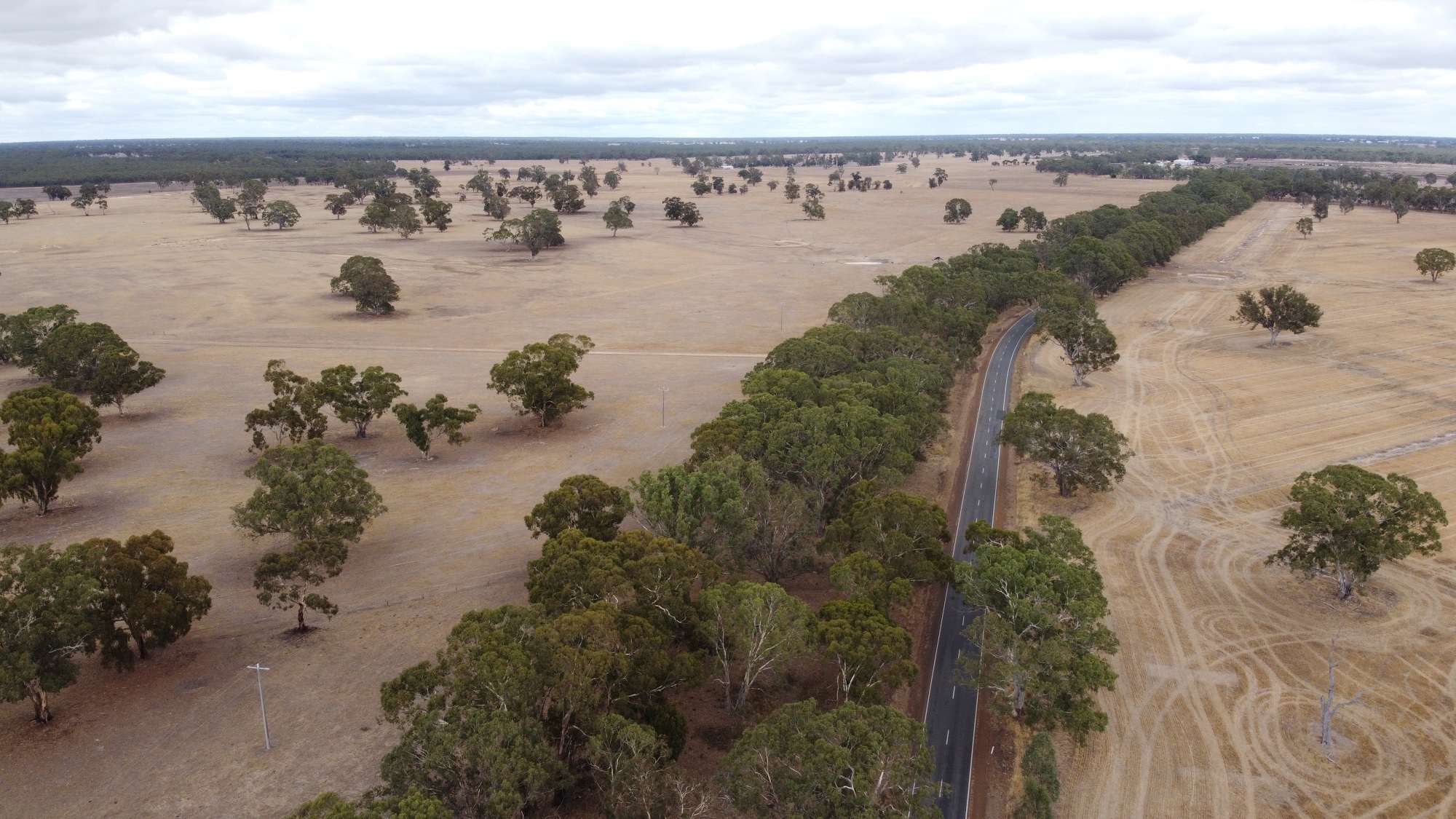
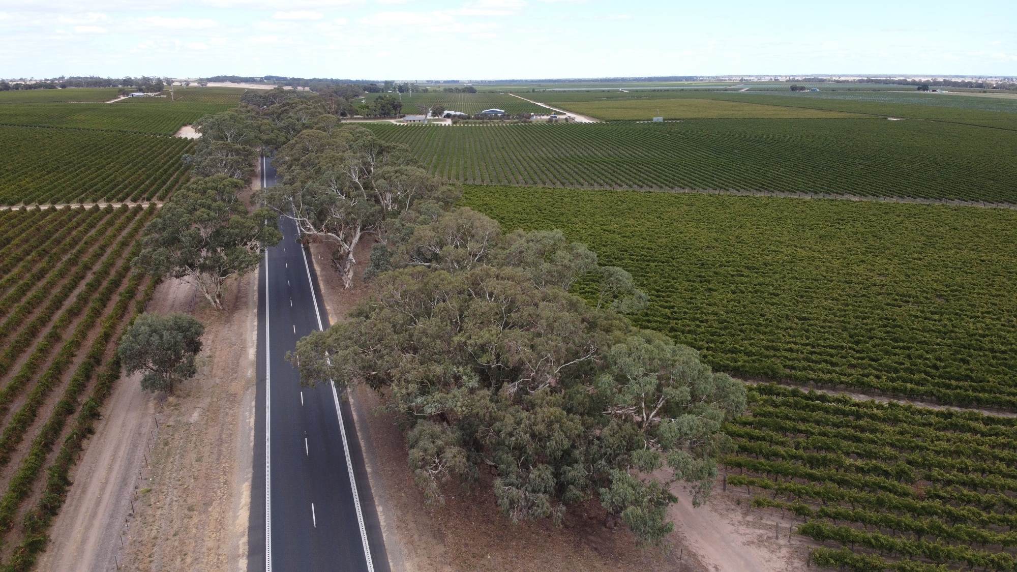
Vineyards line both sides of the highway in the Padthaway area north of Naracoorte, but unlike Mid-North South Australia, which is terribly over-cleared, quite a few big gum trees have been left. We found that this continued through much of western Victoria.
Photo 2021/03/14 |
VictoriaCOVID-19
In Victoria we were surprised to find this all far more lackadaisical, many places had no QR code, some had neither QR code nor a manual check-in. In some places there was a QR code for checking in, but it was not recognised by the check-in app. This was all particularly surprising since Victoria was hit with a far worse 'second wave' of the pandemic than any other Australian state; you'd expect them to take it more seriously than other states. Apsley area
Photo 2021/03/15 |
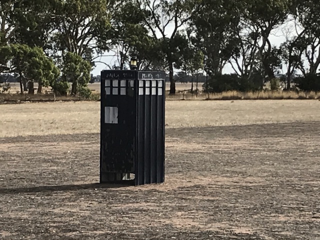
Seen in a paddock in the middle of nowhere near Apsley. We travelled eastward from Naracoorte, where we stayed overnight, through Apsley to Edenhope, Natimuk and Mount Arapalise to the Grampians. Photo 2021/03/15 |
|
|
|
|
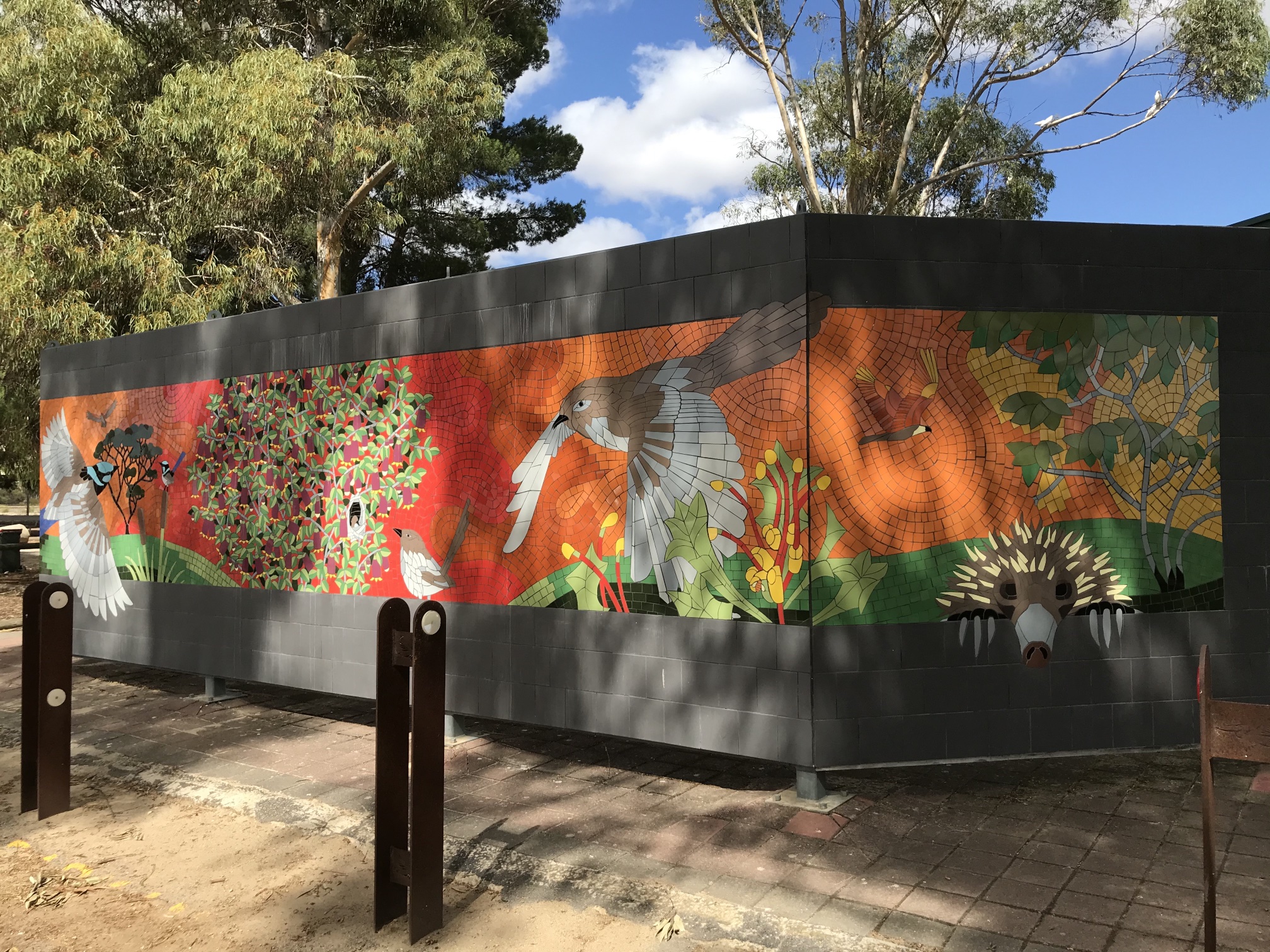
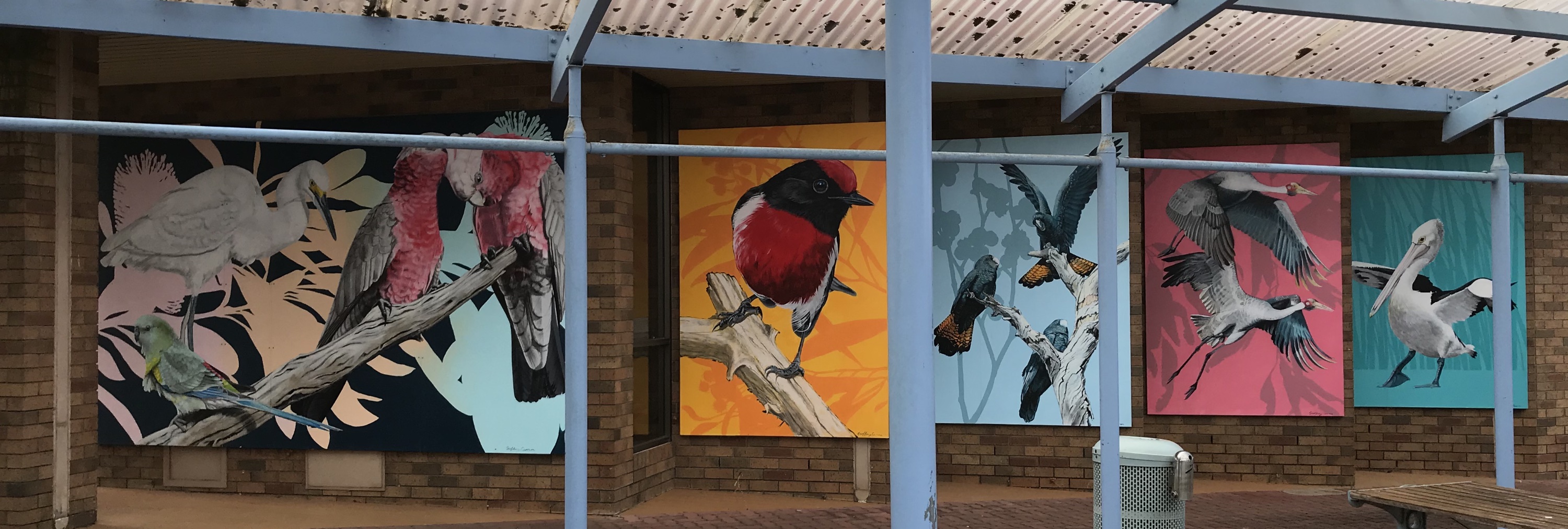
This beautiful mural was in Edenhope.
It is unfortunate that the framework of the shelter in front of it partly obscured the view.
Photo 2021/03/15 |
Natimuk and Mount Arapiles
The town has several shops, a pub, a very interesting store that sells mahogany sculptures made in Java, and a nice little park. The bloke who runs Mahogany House said that his factory in Java employs about 40 people and that he also has several other shops around the country. We saw some very similar carvings at Beaufort several hundred kilometres to the east. The photo is of a sculpture in the park. Photo 2021/03/15 |
Photo 2021/03/15 |

|
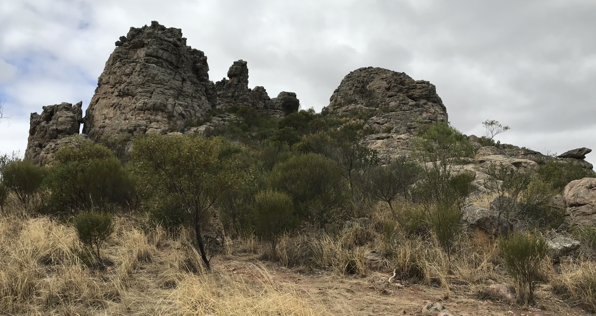
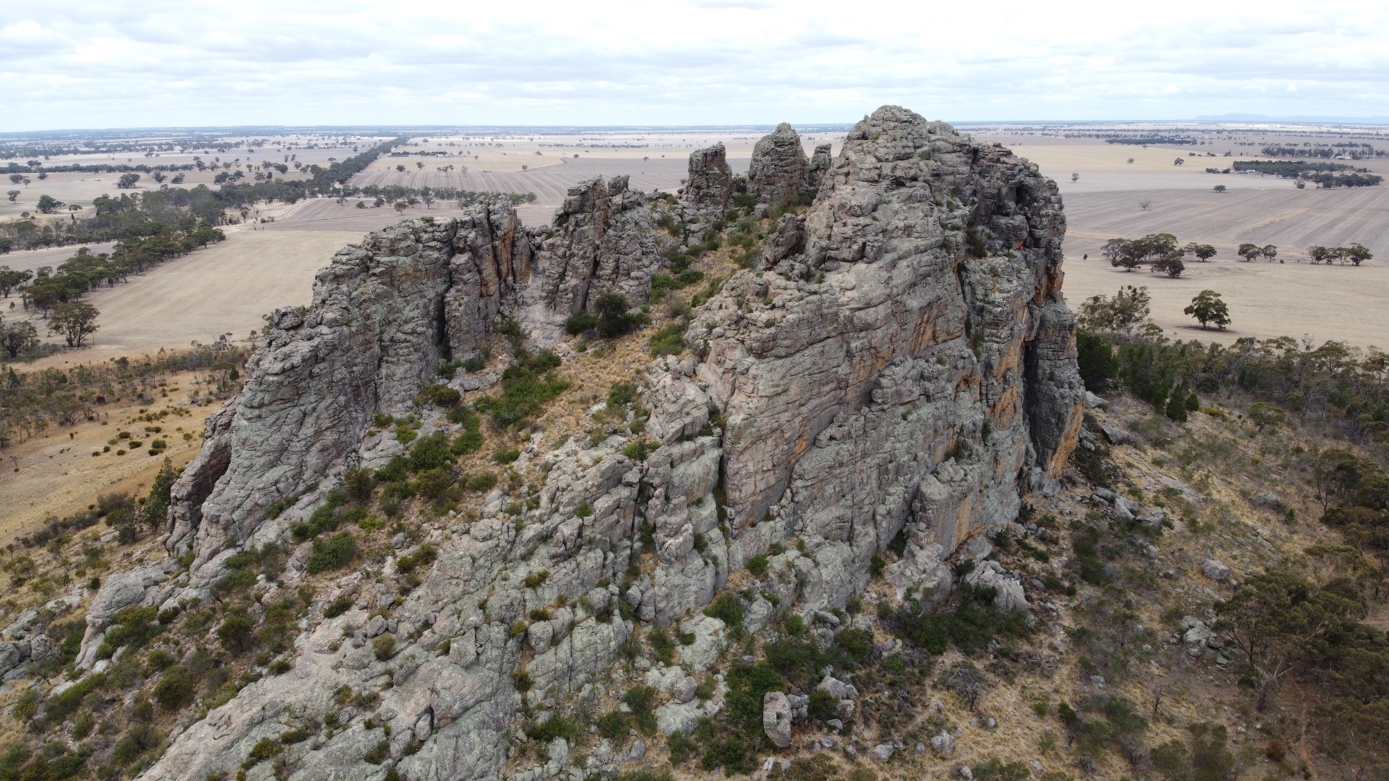
Another drone view; Mitre Peak in the foreground with Mount Arapiles in the distance.
Photo 2021/03/15 |
|
|
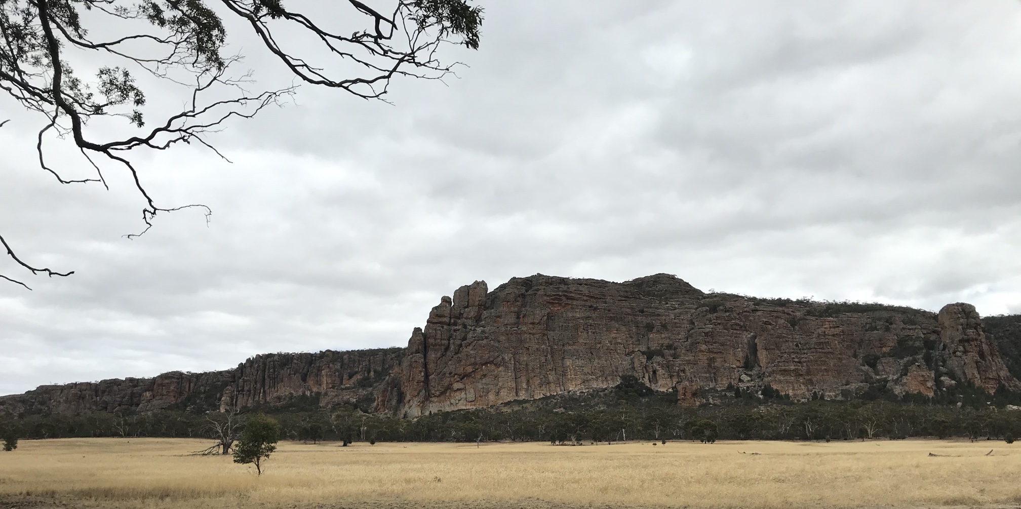
Mount Arapiles is a very popular attraction for rock climbers, with rock faces like this one can see why.
Photo 2021/03/15 |
|
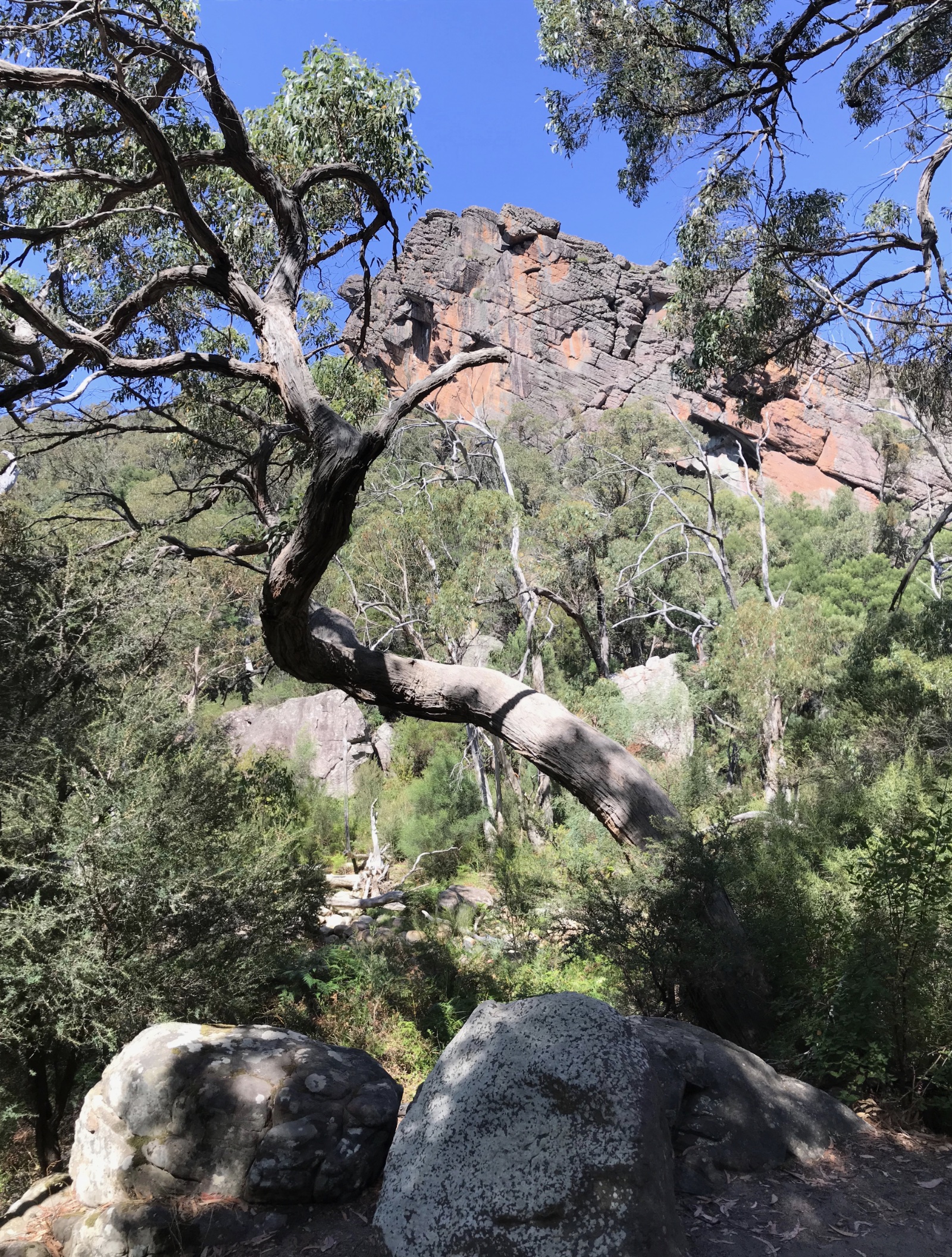
An ealier visit to the Grampians is recorded on another page on this site.
|
|
|
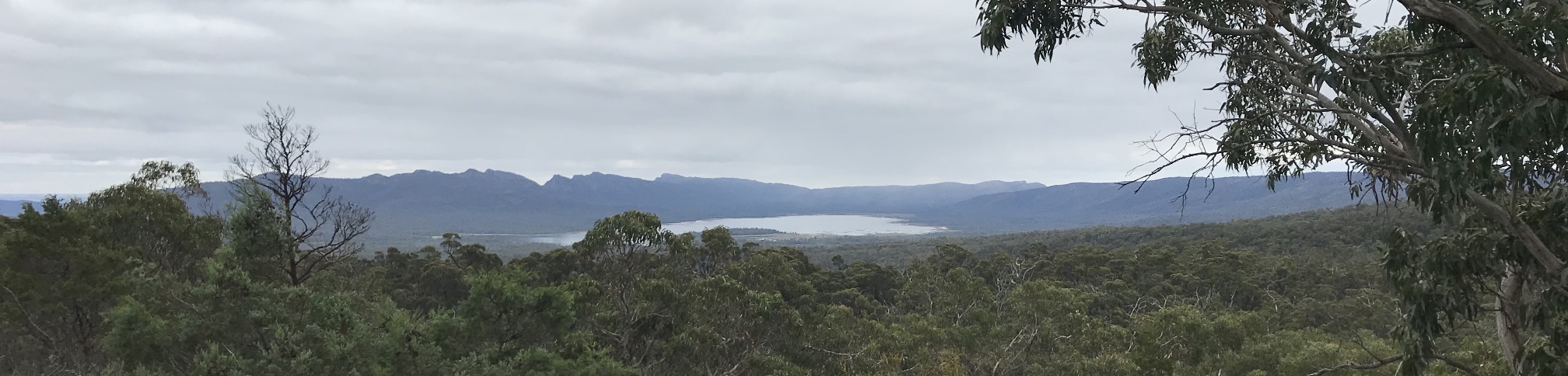
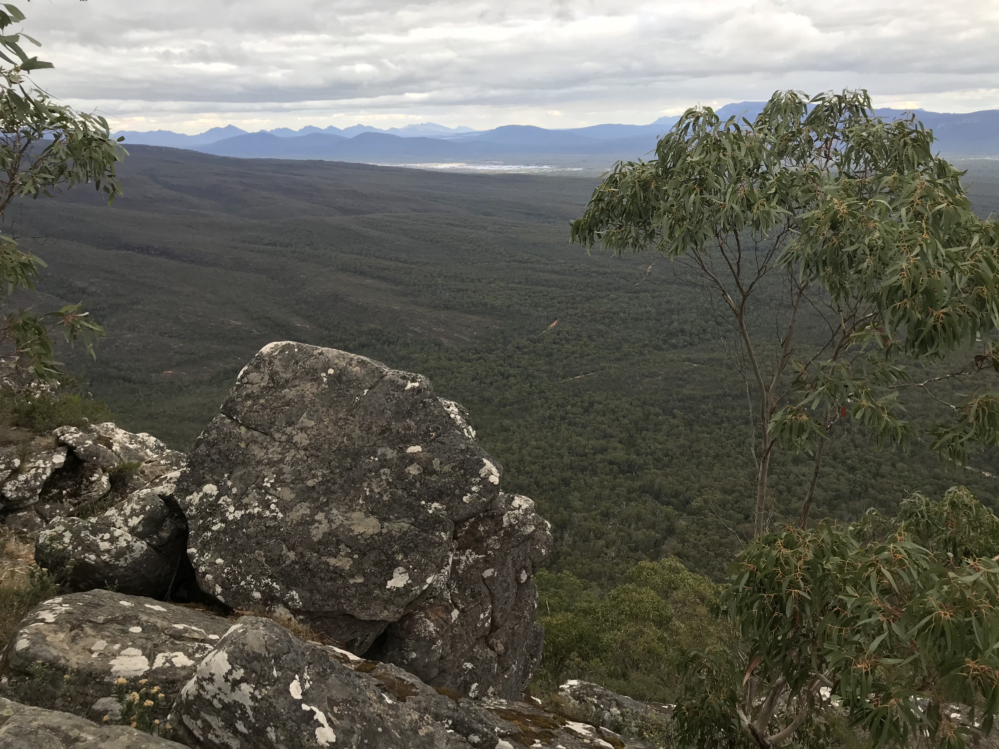
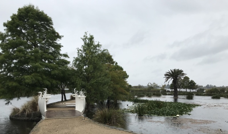
Looking north from Reed's Lookout, with artificial Lake Wartook in the distance.
The lake is on a plateau, and water is released for district water supplies, flowing over the MacKenzie waterfalls on its way down from the plateau.
Photo 2021/03/15 |
Much of the forests of the Grampians ware burned in intense and extensive bushfires of January 2014. We saw lingering signs of the fires in many places, but the bush had recovered very well.
Photo 2021/03/15
Photo 2021/03/15 |
Grampians, Hall's Gap
A number of the wildlife photos shown on this page were taken in Hall's Gap. Photo 2021/03/15
|
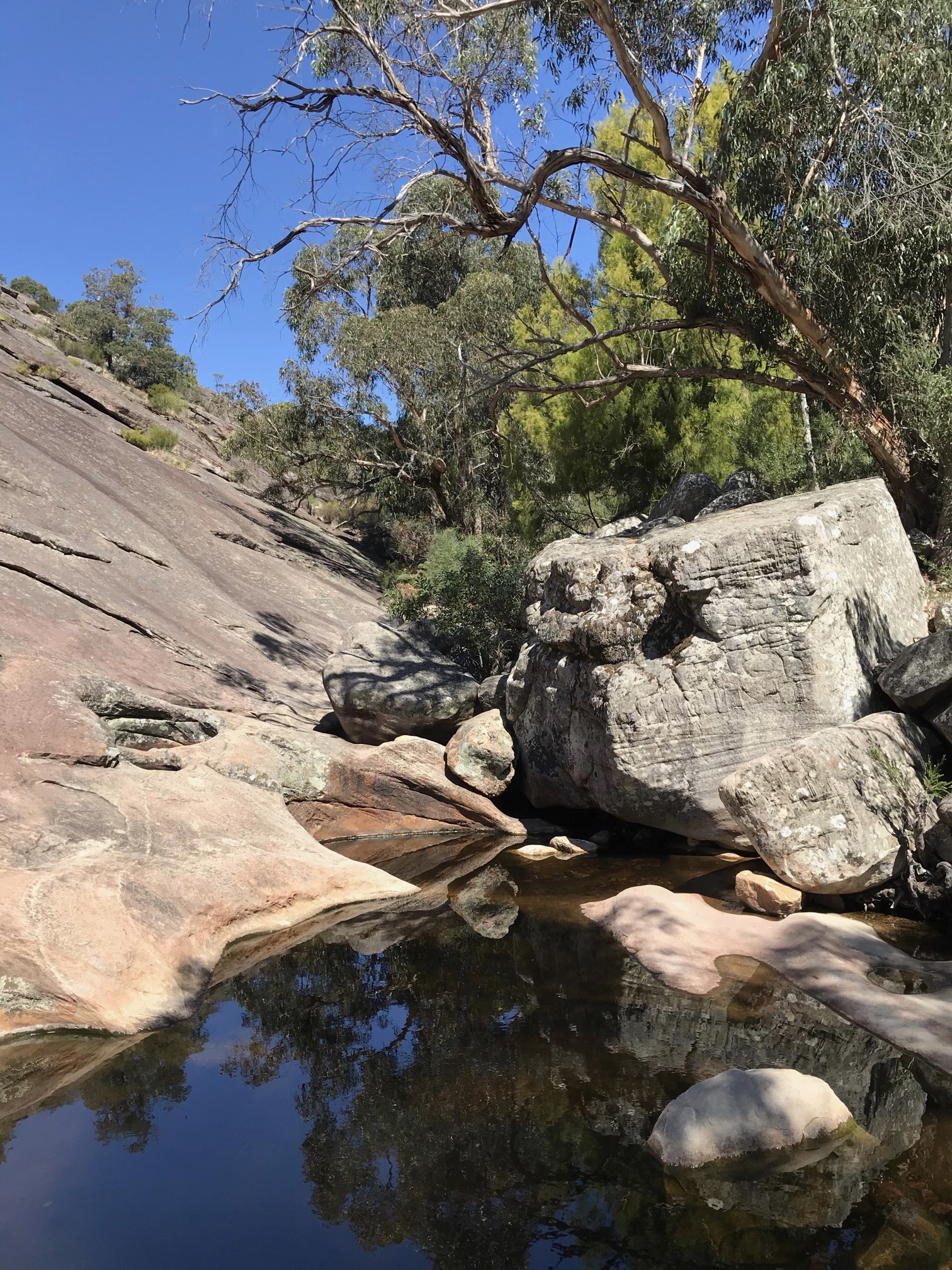
Venus Baths, GrampiansThis is an easy walk starting from Hall's Gap and following a small creek. There is a trail on each side of the creek, the one on the left bank has few steps, the one on the right bank has many steps. |
|

|
|
On the walk up to Venus's baths
Photo 2021/03/16 |
Photo 2021/03/16
|
|
|
|
Venus Baths
Photo 2021/03/16 |
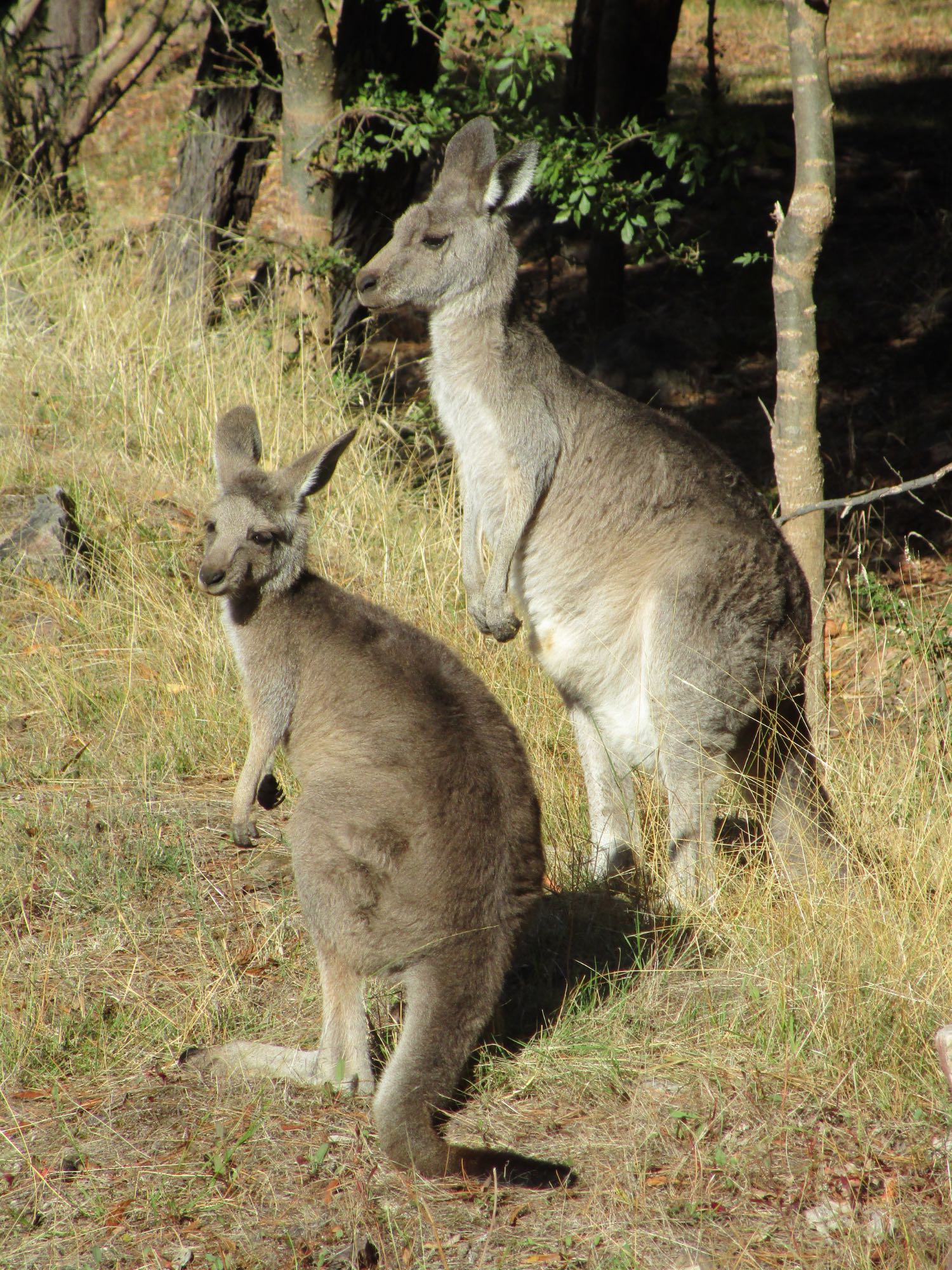
Grampians wildlifeThe amount of tame wildlife in the Hall's Gap area of the Grampians is exceptional. The cockatoos, ducks, currawongs, kangaroos and emus were particularly tame.The birds I managed to identify (or partly identify) included: emus, sulphur crested and gang gang cockatoos, crimson rosellas (race Adelaidae), grey currawongs, wood ducks, laughing kookaburra, magpies, wagtail, emus, crested pigeon, crow (or raven), New Holland honeyeater, long-billed corella, black duck (and another species), wren (species unknown), straw necked ibis, lapwing, a wattle bird (species unknown). |
|
|
|
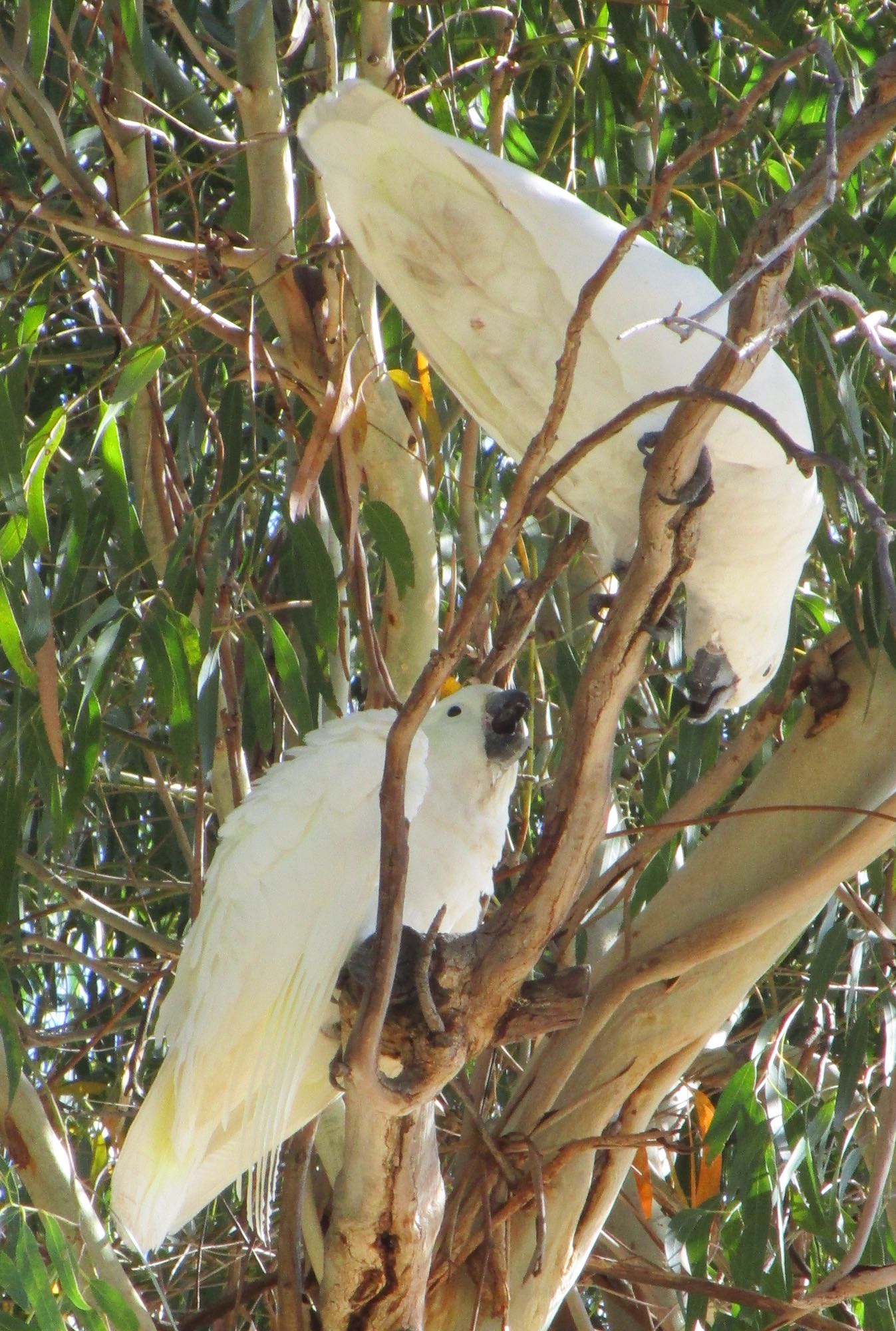
Mother and joey eastern grey kangaroos and a pair of sulphur-crested cockatoos. We saw a few black wallabies in the bush, they are less tame than the eastern greys and apparently don't go into Hall's Gap.
Photo 2021/03/16 |
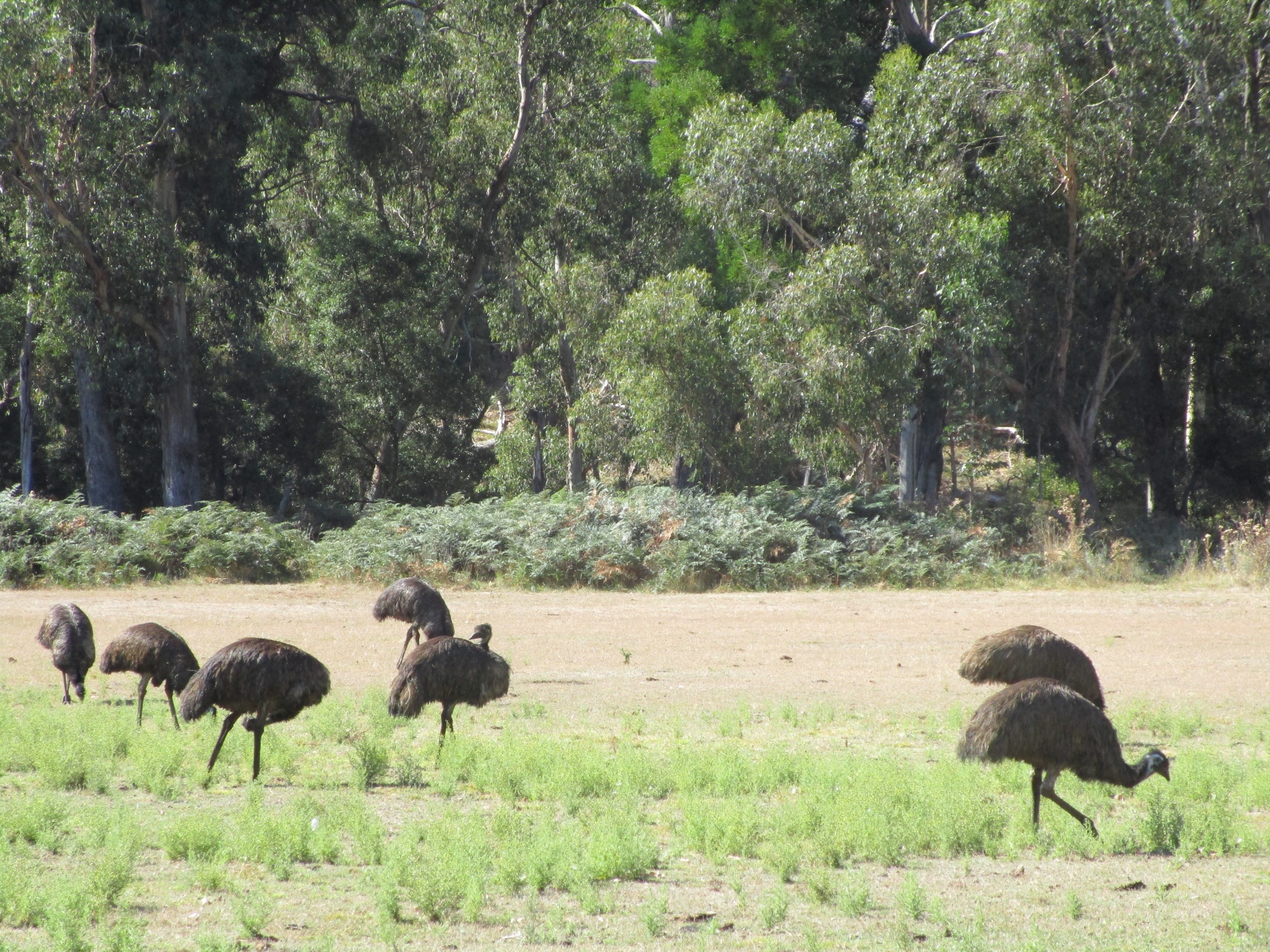
A group of emus could reliably be seen grazing in a cleared area to the north of the caravan park we stayed in near Lake Belfield.
Photo 2021/03/16
|
|
|
Long-billed corellas near the bridge in Hall's Gap. I don't recall seeing the long-billed species before (little corellas seem to be far more common). These seem to use their long bills to dig in the soil for food, while the common variety live of seeds that they find on the surface.
Photo 2021/03/18 |
A kookaburra at the cafe area in Hall's Gap. The sulphur crested cockatoos, kookaburras and wood ducks were all very alert for anyone who was willing to share food with them (this was discouraged because it is not good for their health and causes a nuisance) or any food left on tables or dropped on the ground.
Photo 2021/03/18 |
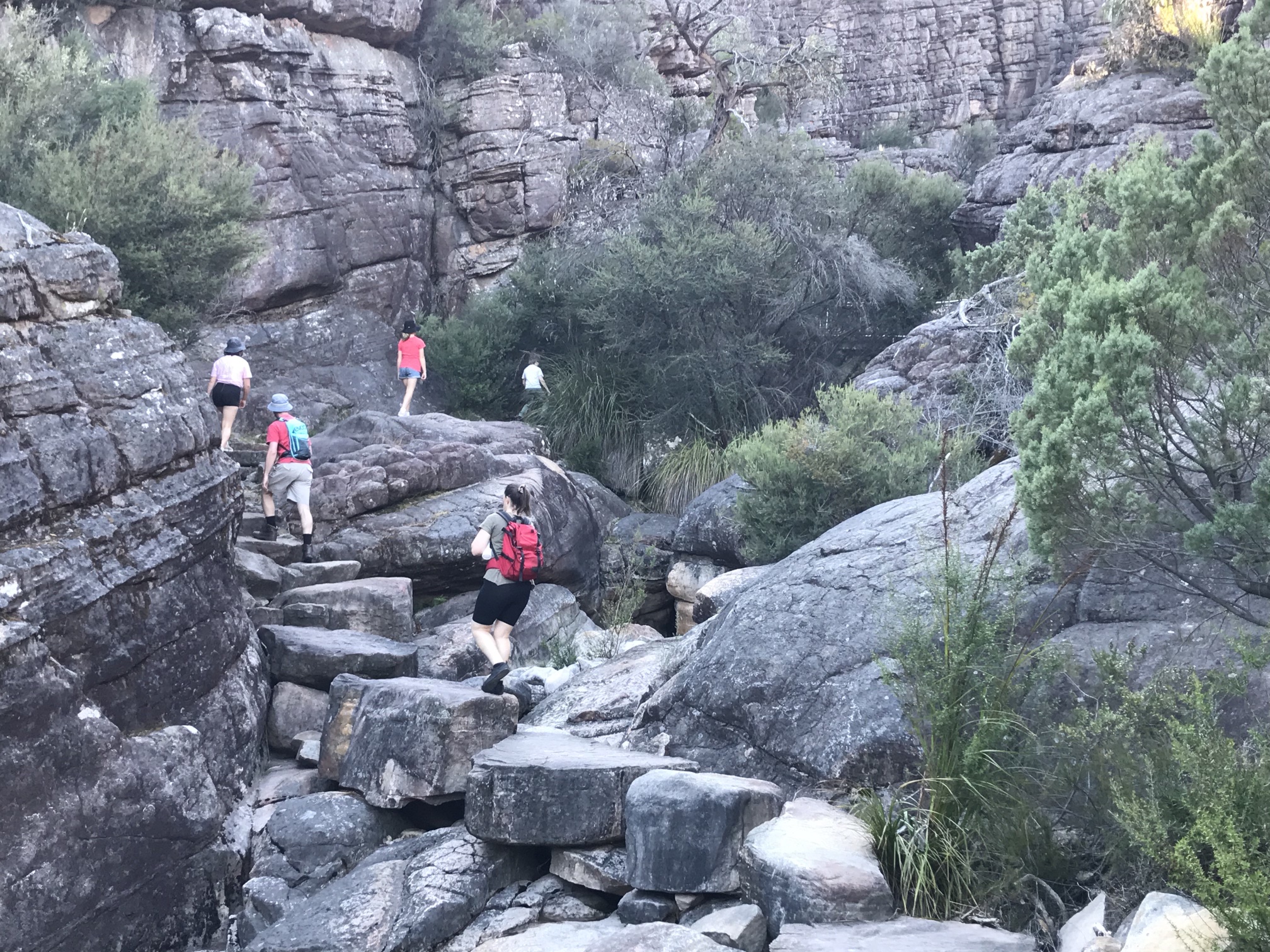
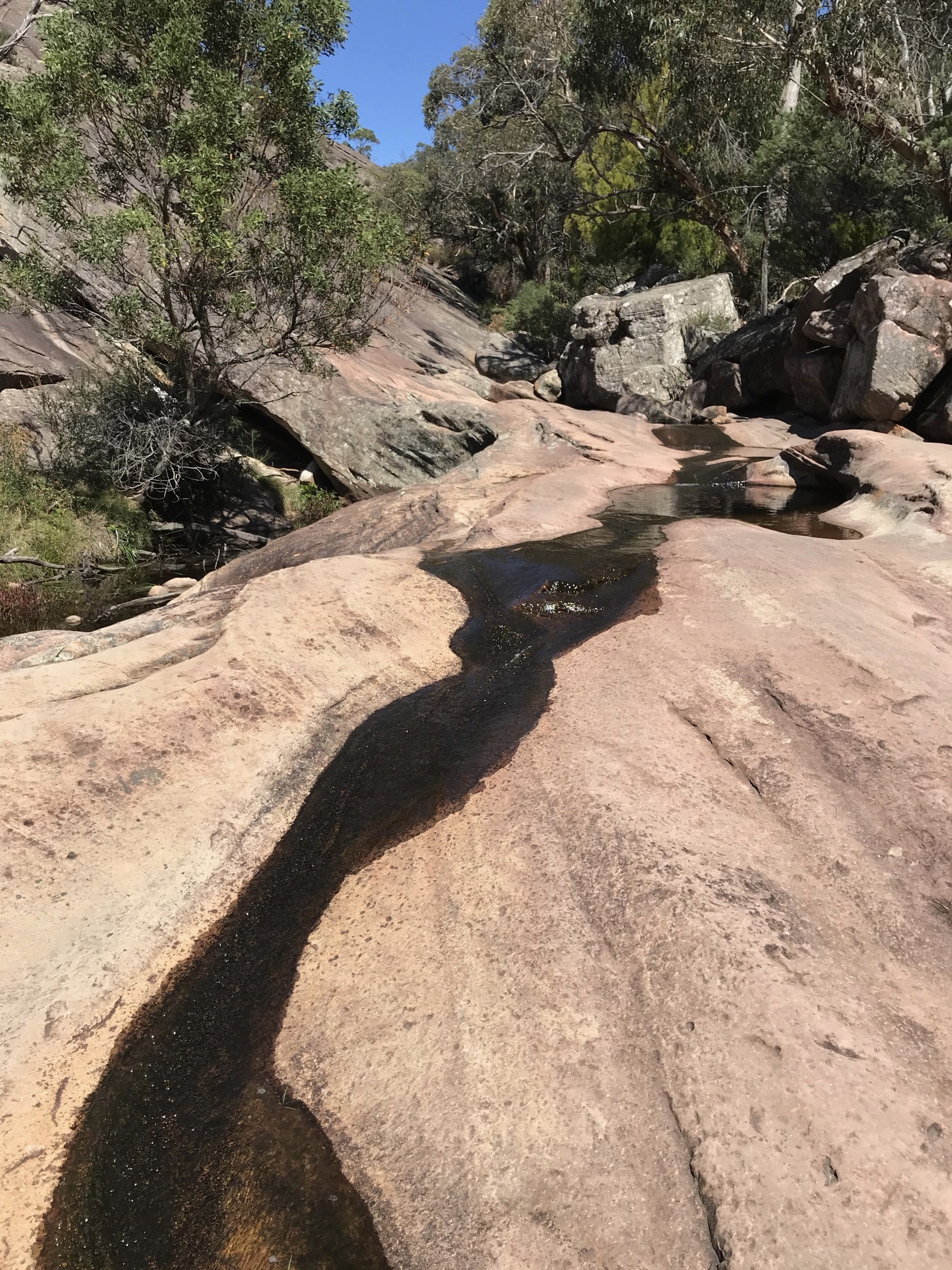
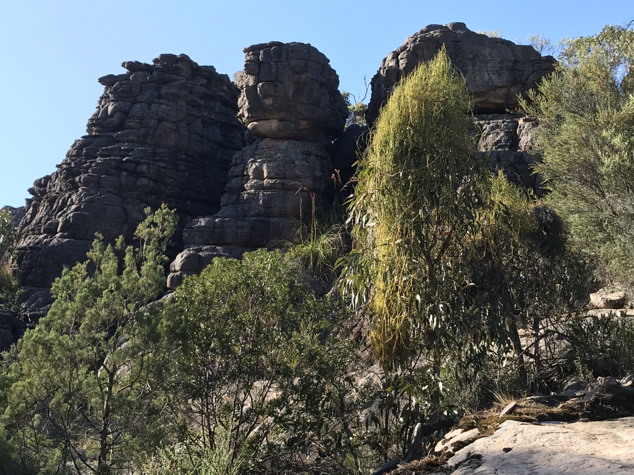
Photo 2021/03/17
Many of the stone blocks shown in the photo above showed drill holes such as this.
It would be interesting to know when this was done, how the holes were drilled (with a hammer and drill, or with a pneumatic drill) and whether explosives were used (either blasting powder or high-explosives) were used to split the rocks.
We also saw drill holes in paving blocks in places around western Victoria. Photo 2021/03/17
|
Photo 2021/03/17 |
Photo 2021/03/17 |
|
|
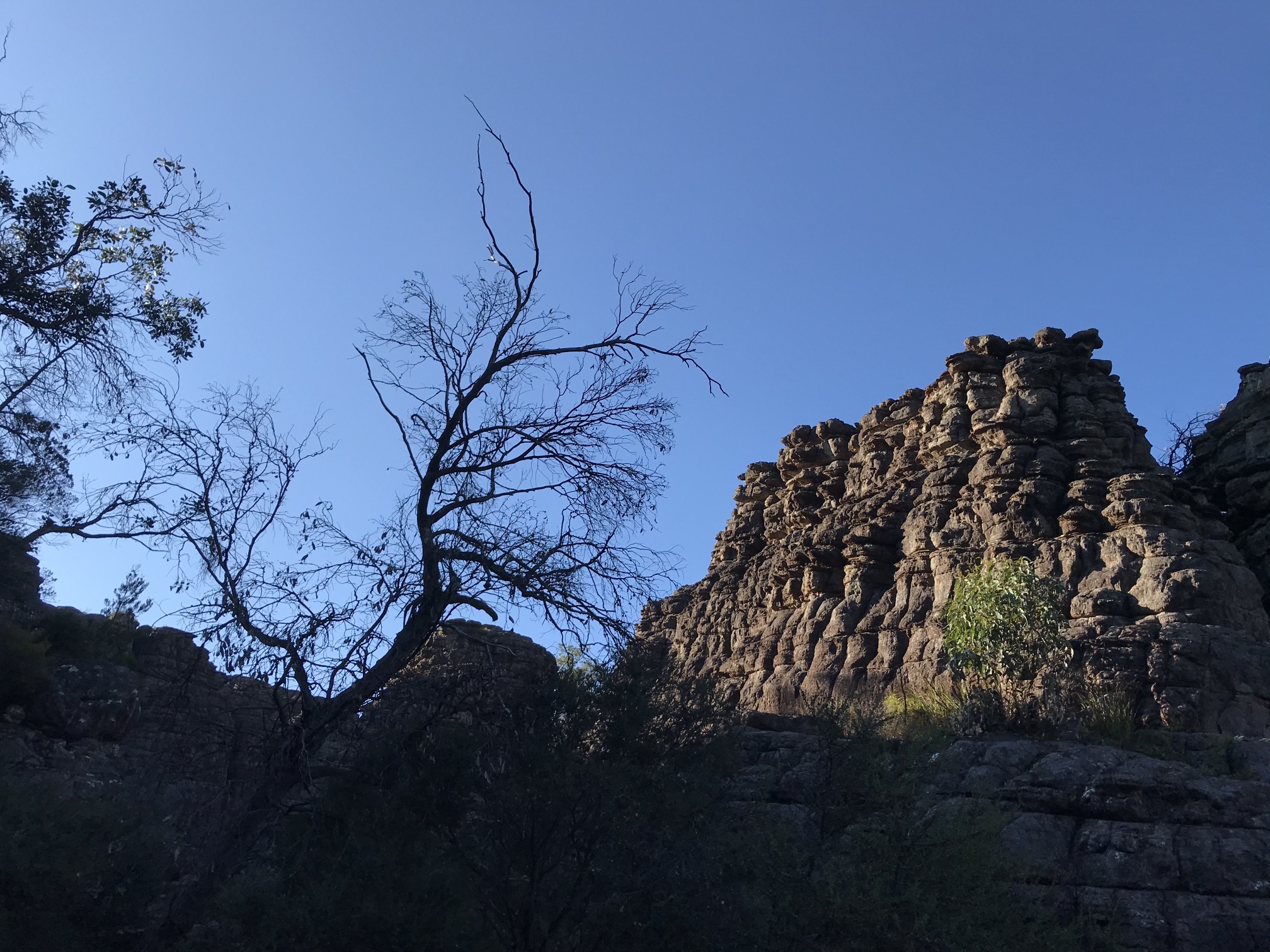
Another view of the fascinating sandstone rock formations of the Grand Canyon. The tree in the right foreground is covered with the interestingly named snotty-gobble climber (Persoonia longifolia).
Photo 2021/03/17 |
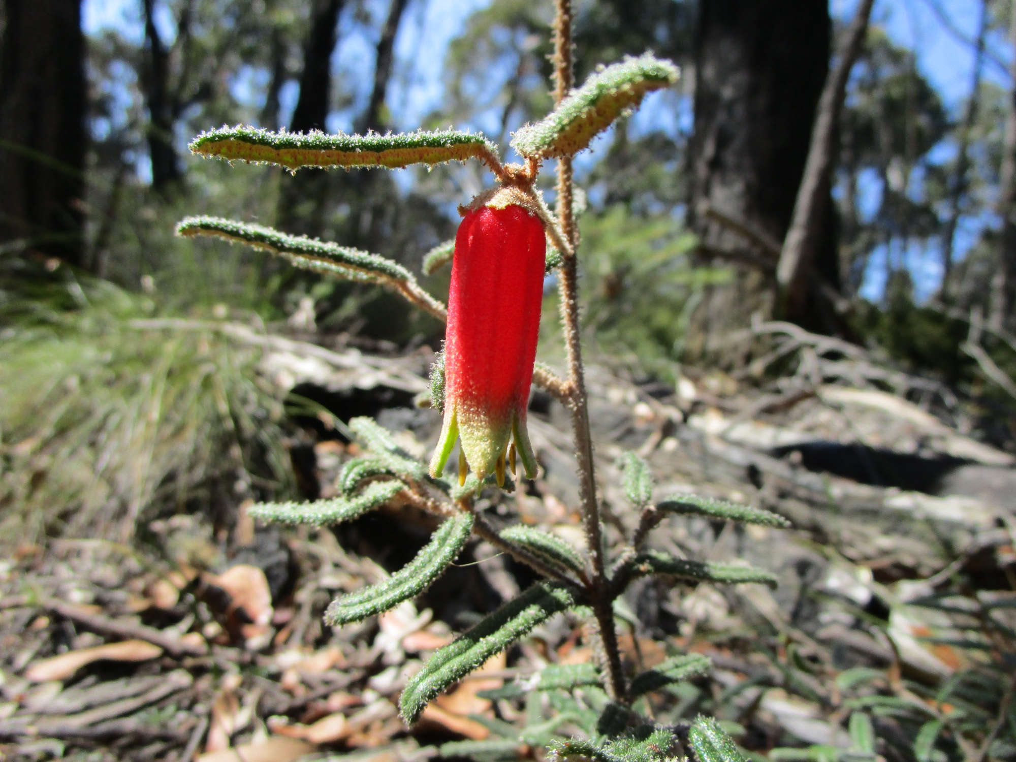
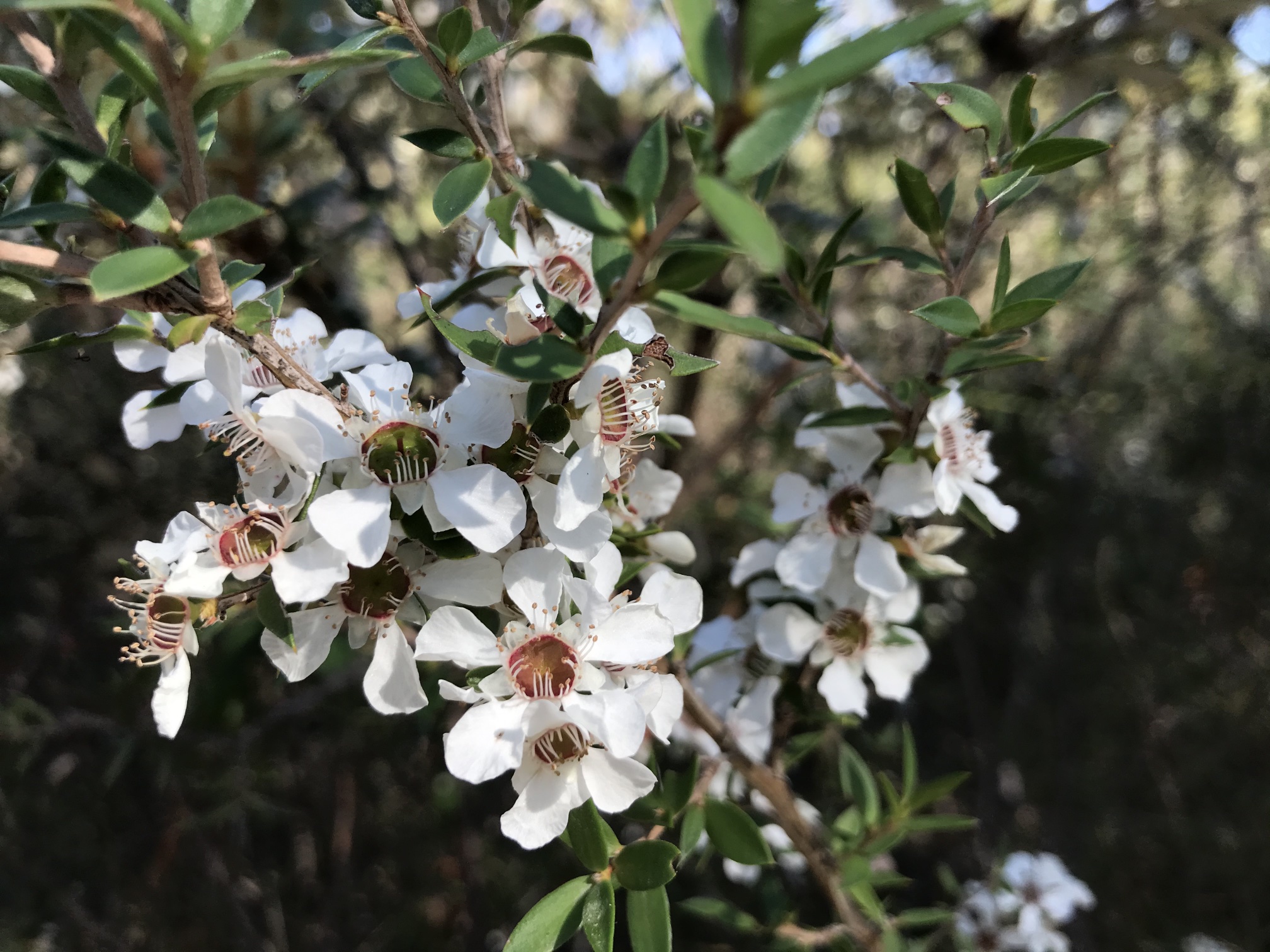
As we were in the Grampians in Autumn there weren't as many plants flowering as there would have been in Spring, but this one was in flower. I don't know its identity. Photo 2021/03/17 |
Photo 2021/03/17
|

|
|
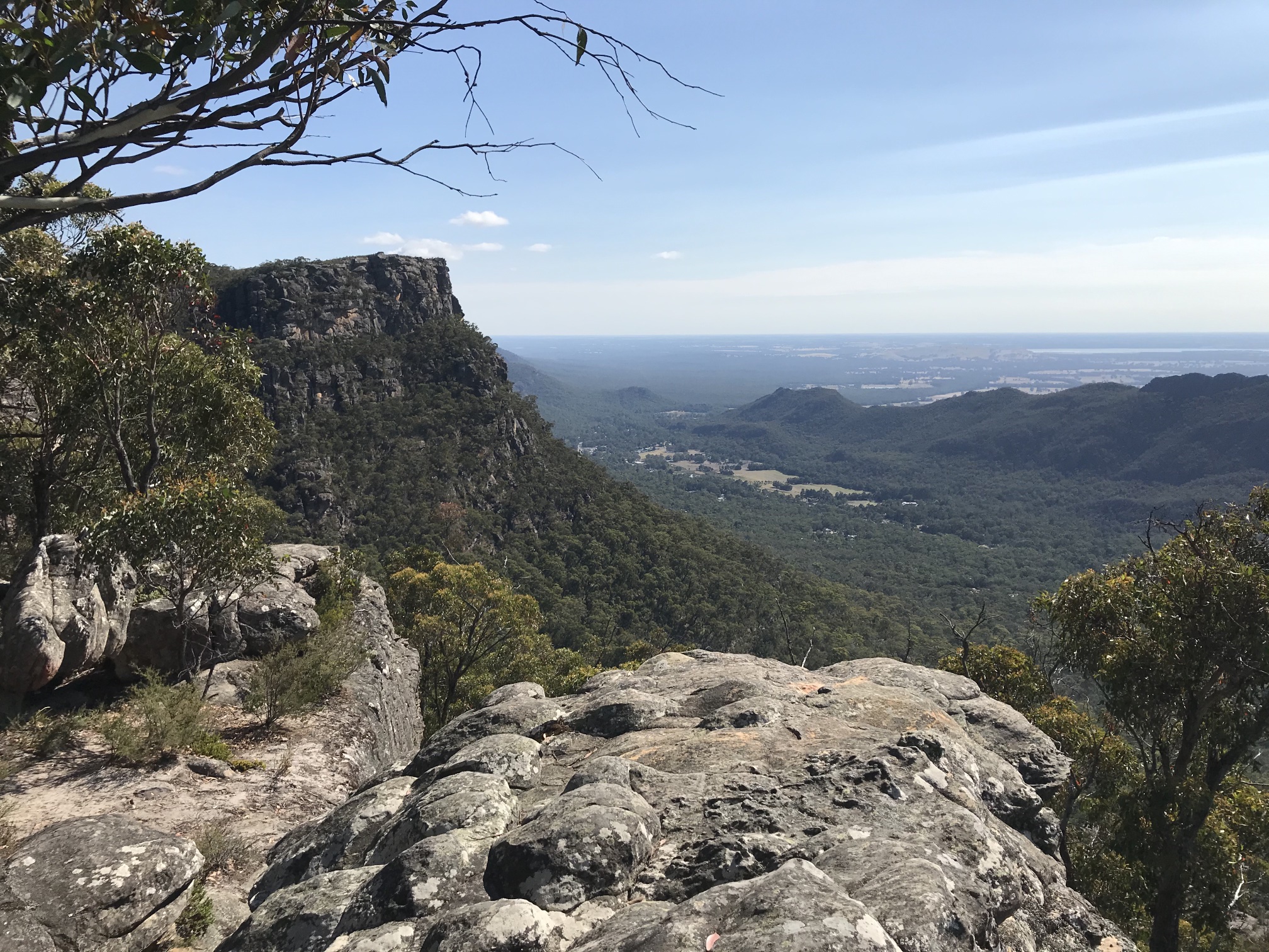
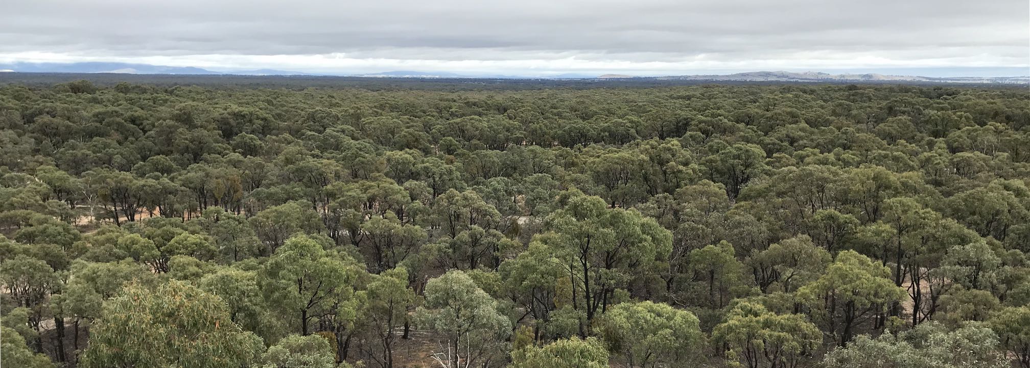
A panorama from Lakeview Lookout, which is a walk of about a kilometre from Sundial Carpark.
Photo 2021/03/ |
|
|
Looking north-east from Lakeview Lookout, Hall's Gap is in the area of the clearing in the middle distance.
Photo 2021/03/17 |
AraratArarat Acacia Caravan Park was one of the nicest that we stayed at during this trip. The toilets and showers were excellent and the camp kitchen certainly among the best equiped that we've ever come across. |

|
|
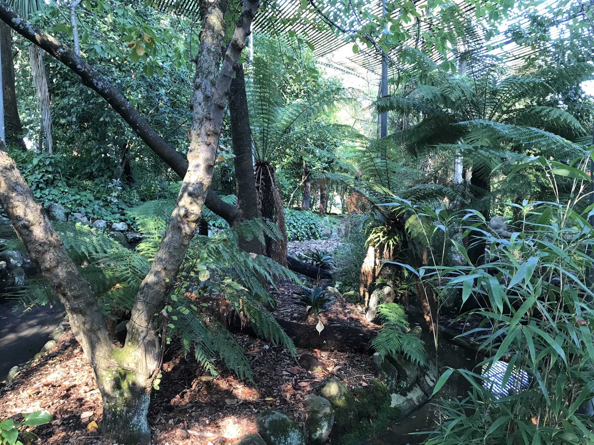
Rain forrest garden by the lake in Ararat
Photo 2021/03/19 |
The garden was very attractive, but unfortunately it was suffering a little from neglect. The plastic webbing that protects the plants from the strong sunlight had been torn by the winds. Elsewhere in the gardens there were weeds which could be removed with only a few hours work by volunteers or council employees. This lack of community spirit or civic pride, seems to be common in Australia; it's a pity.
Photo 2021/03/19 |

|
|
A family of wood ducks near the lake in Ararat.
Photo 2021/03/20 |
|
|
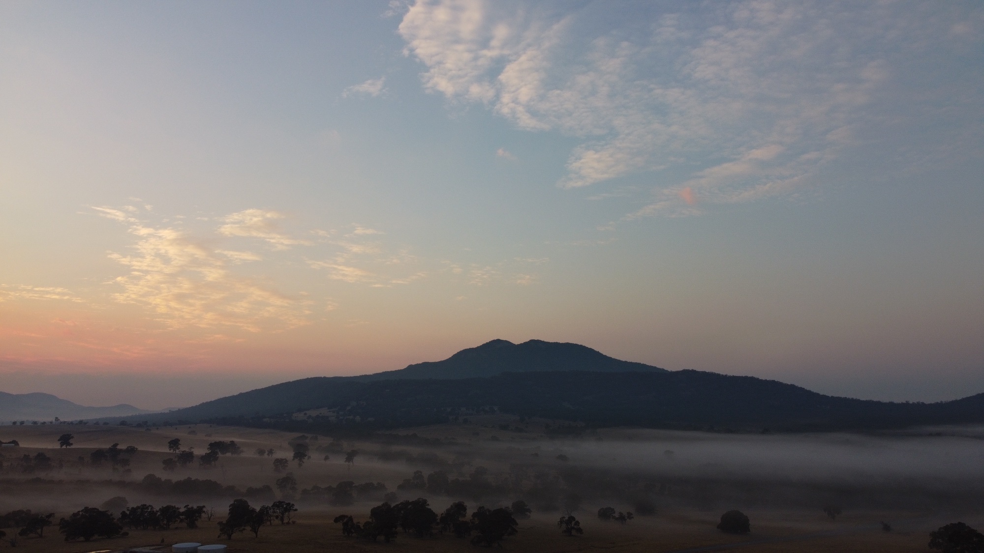
Looking toward Mount Buangor from the outskirts of Ararat before sunrise. The mountain's silhouette from this direction looks like that of a volcano; there are extinct volcanoes in the area. (It is not listed in Wikipedia's list of volcanoes in Australia.) On another trip my wife and I visited and recorded a number of old volcanoes in SA and Victoria.
Wikipedia has a list of the extinct volcanoes of Australia. Photo 2021/03/20 |
Ararat Wind FarmI strongly support the development of wind power. We must change from fossil fuels, particularly coal, to renewable energy if we are to limit climate change and give our kids a future that is not greatly inferior to the present. I have explained at some length on another page why any right-minded person should support wind power and other forms of renewable energy. |
|
|
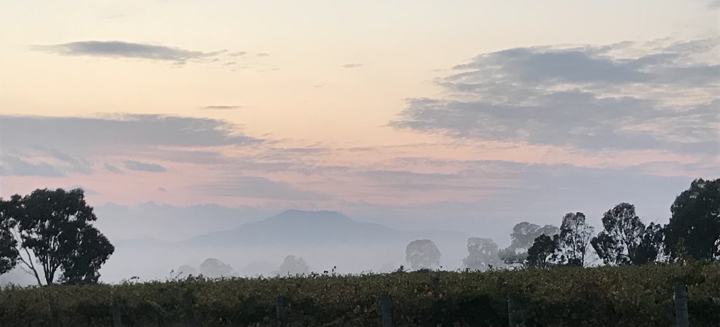
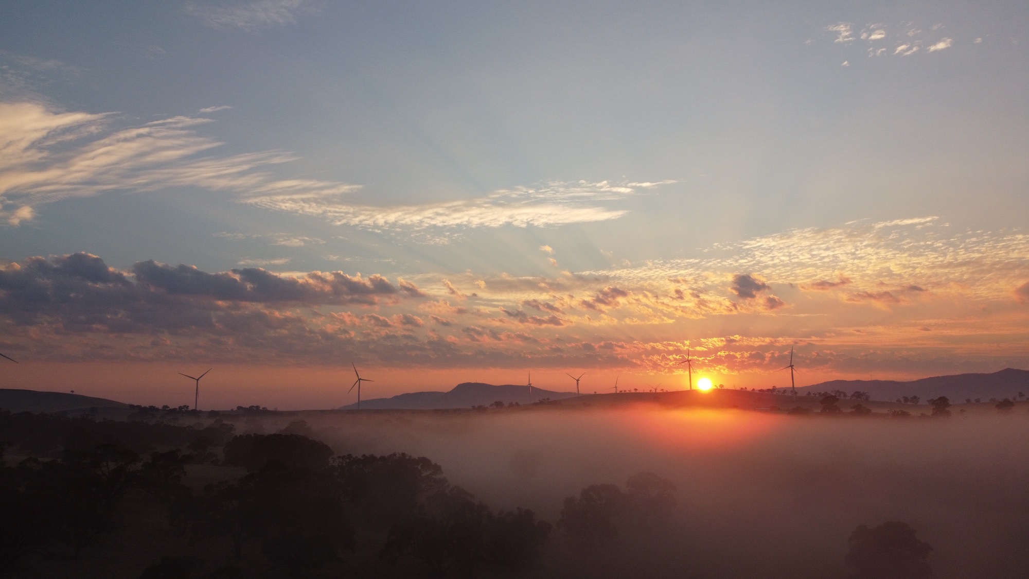
A drone photo; low-lying mist just before sunrise. Some of the turbines in the distance. Ararat Wind Farm has 75 turbines each of 3.2MW.
Drone photo 2021/03/20 |
Drone photo 2021/03/20
|

|
|
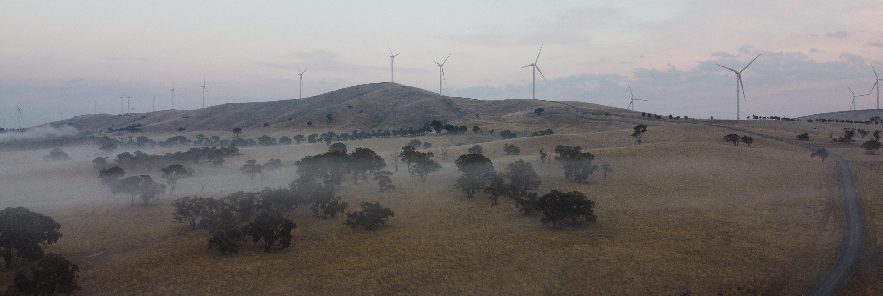
Sometimes when I go looking for drone photos of a wind farm the best images turn out to have few, if any, wind turbines in them. Low-lying mists can make for very attractive views from a drone.
This photo shows why the first hour of daylight is often called 'the golden hour' by photographers. Drone photo 2021/03/20 |
|
|
Sunrise over ground-mist at Ararat Wind Farm
Drone photo 2021/03/20 |
Photo 2021/03/15 |
Drone photo 2021/03/20
|

|
|
There is an attractive drive on a good unsealed road over Mount Cole.
The forrest on the mountain is beautiful.
Views over the surrounding land were very limited by the trees, the heavy smoke haze at the time we were there didn't help either. Photo 2021/03/20 |

|
|
A drone photo of a few of the turbines of Stockyard Hill Wind Farm, which is south of Beaufort and east of Ararat. It is owned by Goldwind, a Chinese company; at the time of writing their website was well out of date.
The trees at the base of the turbines, I believe, are Eucalypt monoculture planting, probably E. glubulus (Tasmanian blue gums). Wind farms are compatible with many other forms of land use; unlike solar farms they do not cover much ground. Photo 2021/03/20 |

|
|
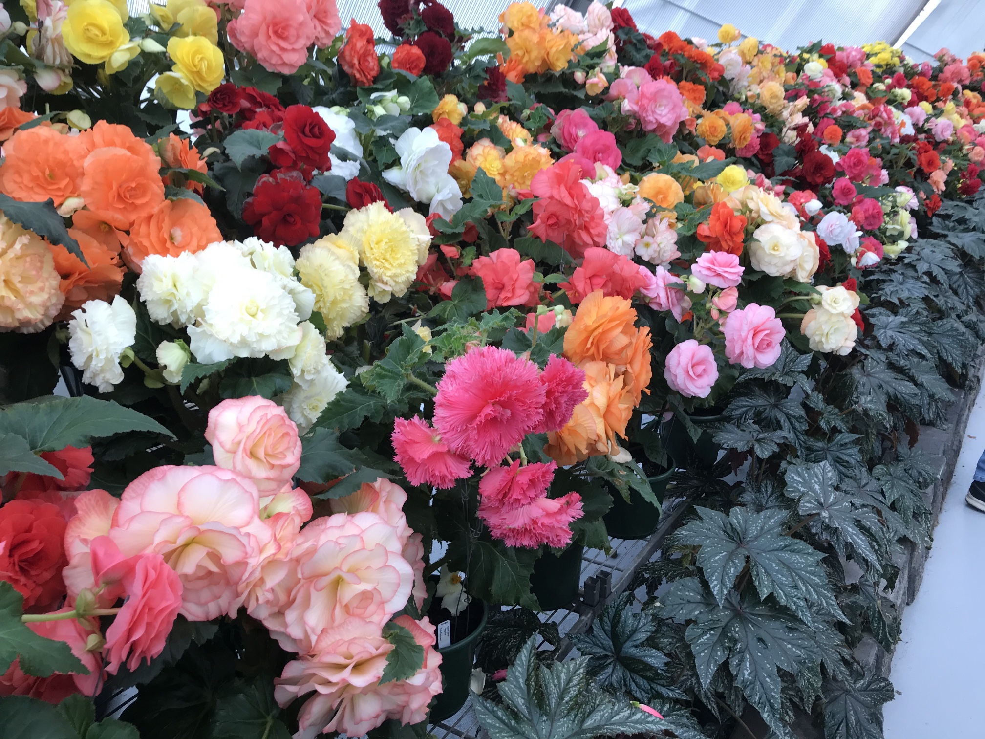
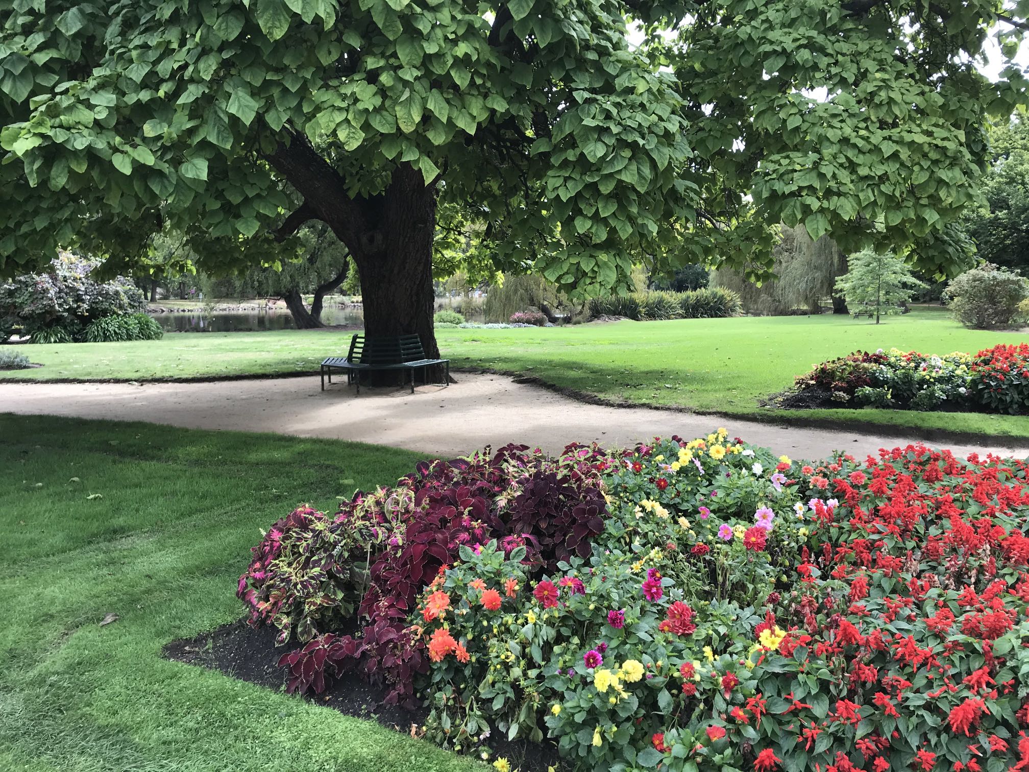
Flower beds of the botanic gardens, the Robert Clark Conservatory in the background. There was a begonia display in the Conservatory at the time of our visit, see below.
Photo 2021/03/21 |
Ballarat botanical gardens are always worth a visit. They never fail to impress. Photo 2021/03/21
|
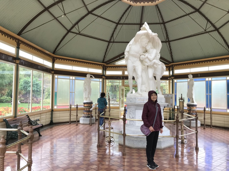
My wife Denece with her hat in the foreground. Photo 2021/03/21 |
The woman in the foreground is a stranger. Photo 2021/03/21
|
There were a couple of rainy days when we were in Ballarat, the tail end of the deluge that flooded the east coast of Australia further north. We stayed in a cabin in a caravan park rather than using our little tent-trailer. Photo 2021/03/21 |
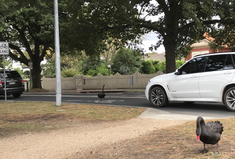
While I was watching one motorist got out of his car and chased a swan off the road before getting back in and driving on. Photo 2021/03/22
|
|
|
The art gallery in Ballarat is always worth visiting. We particularly like the more traditional paintings rather than the modern stuff. The Ballarat gallery had at least one Heysen.
This was an exception - a modern painting that I particularly liked (perhaps it's my geological background); it was titled Shift and done in 2008 by Dale Cox. Photo 2021/03/22 |
Clunes
A very good sculpture outside of a business in Clunes Photo 2021/03/23
|
|
|
These gardens were some of the best looked after that we found on our holiday. There was hardly a weed to be seen and the lawns were immaculate; a credit to whoever is responsible.
I am often disappointed to see gardens that could be beautiful being overrun by weeds due to a lack of community spirit or civic pride. Personally I am involved in looking after Gleeson Wetlands in Clare and Central Park in Crystal Brook and find the contribution to my community gives me great satisfaction. Photo 2021/03/23 |
|
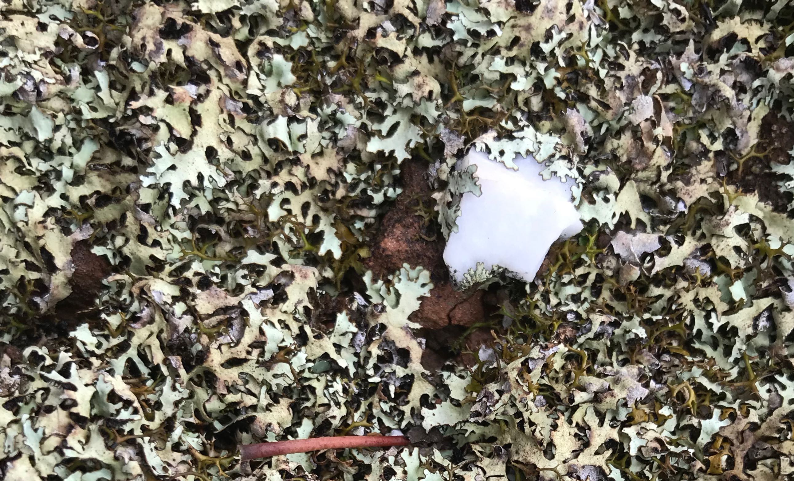
Lichen field, Maryborough
Quite probably the lichen is here because the soil was entirely removed by the mining operations and lichen was the only thing that could survive on the shallow, stony substrate that remained. Photo 2021/03/24 |
Click on the image to see the high definition version. Use back-arrow to return. The white object is a quartz pebble. Photo 2021/03/24 |
|
As recorded in eGold - A Nation's Heritage most of this land would have been cleared during the gold mining era. In my home state, South Australia, almost all the land that is flat enough and well watered enough for agriculture has been cleared of trees. I asked why this land hadn't been cleared, the answer I got was that the gold mining had left it in a state that made agriculture impractical. I could imagine from the chaotic mined landscape and the lichen covered 'soil' around the lookout tower that this could be quite true. It will take many thousands of years for good productive soil to form again. Photo 2021/03/24 |
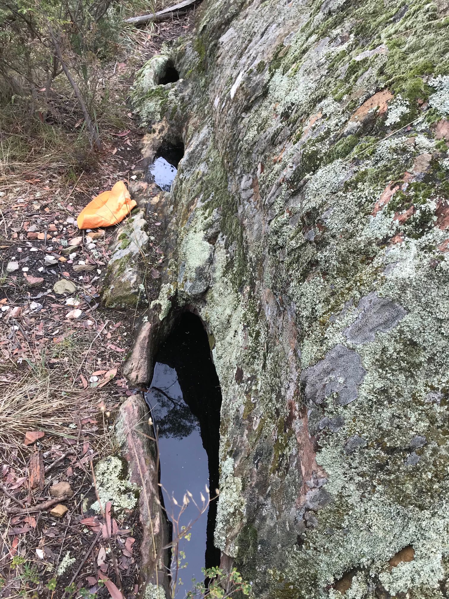
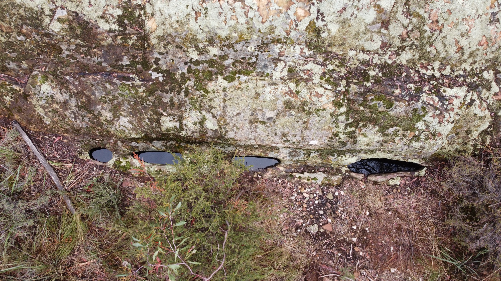
The Goldfields Guide tells us that the "Four holes have been excavated into the base of a large rock in a position which makes them a natural catchment for rainwater falling on the rock above. Three of the holes are joined together within the rock, creating one large cavity. The total holding capacity of these wells is 168 litres." It also tells us that the maximum depth is about 1.3m. Photo 2021/03/24
Wells and their origins in AustraliaSeeing these wells brought on a train of thought. Farmers and pastoralists in the past in Australia have relied very heavily on hand dug wells (over the last 70 or more years new wells have generally been drilled rather than dug).For several years I did surveys of wells in South Australia for the then Department of Mines. It is a subject with which I am familiar. Most wells, unlike these, intercept groundwater at greater depth. The assumption (at least my assumption) has always been that the wells that farmers and pastoralists used, usually about 1m by 1.6m in cross section, were dug by, or for, the early farmers and pastoralists themselves. But I wonder how many of them might at least have started with a well dug by Aborigines? I can well imagine an Aboriginal well being dug close to a water course being used by early settlers; many of the existing hand dug wells are close to water courses. The later well diggers may have deepened and expanded many wells started by First Nations people; the knowledge would since have been lost in at least most cases. |
|
|
A drone view of the four rock wells
This was one place that we weren't able to get to with our little Honda Jazz. More accurately, the road had too many muddy water-holes on it for us to risk getting bogged. So I walked 2.2km each way. Photo 2021/03/24 |
Laziness, ignorance or apathy?At the Maryland Diner in Maryborough we ordered a couple of coffees. We made sure they had crockery cups before we ordered (we always do), we asked to 'drink here'. The girl brought out throwaway cups!We've had similar things happen elsewhere. Reusable cups are available in the cafe, but coffee is brought out in throwaway cups. Is it that people are too lazy to wash cups, too ignorant to be aware of the waste problem that is inundating Australia and the world, or are they simply apathetic - just don't care? And then people in businesses that regularly buy coffees every day have one of their staff bring their coffees in throwaway cups. They could use keep cups. I have spent many hours cleaning up roadside rubbish. One of the most common items I find is throwaway cups. There is an organisation called Responsible Cafes that discourage throwaway cups, and I've written a page on responsible cafes in my region (although it's out of date). |
Castlemaine botanic gardens
Photo 2021/03/26
|
|
|
Another part of Castlemaine botanic gardens.
Photo 2021/03/26 |
Castlemaine art gallery
The skill that the Aborigines employed in making these glass spear points is very impressive. The collection of art was good for a small provincial city. Photo 2021/03/26 |
|
|
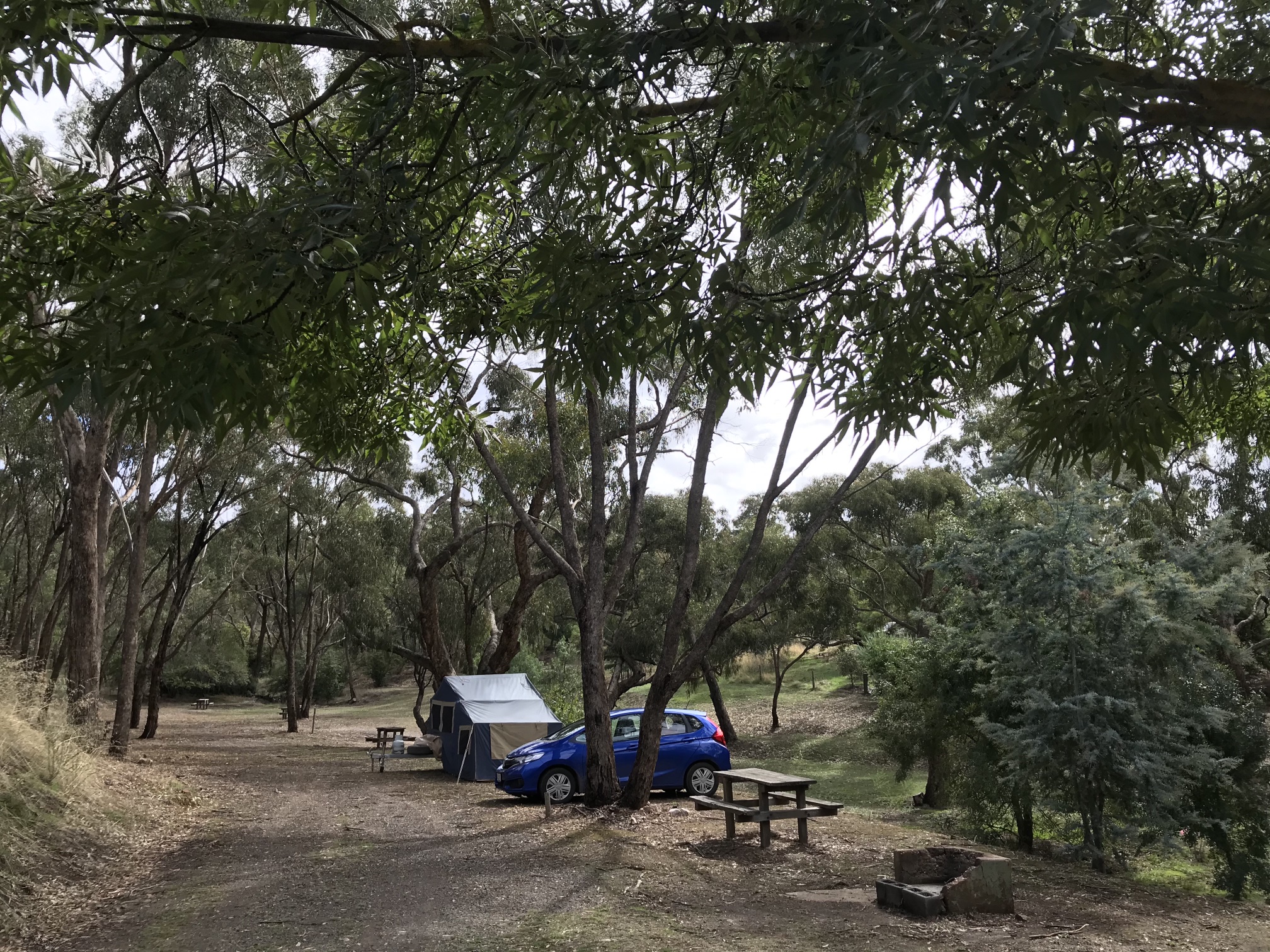
Maldon Caravan Park. There were no powered sites suitable for our tent trailer to set up (the caretaker said that the ground was too hard for tent pegs to be driven in) so we had to settle for an unpowered site.
It was a very quiet place, and beautiful. Kangaroos were about the place night and morning.
Photo 2021/03/25 |
Camping bases for tentsThe contrast in the ease with keeping our tent floor clean in Maldon to the sand that came in on our shoes at both Ararat and Maryborough got me thinking.
|
|
|
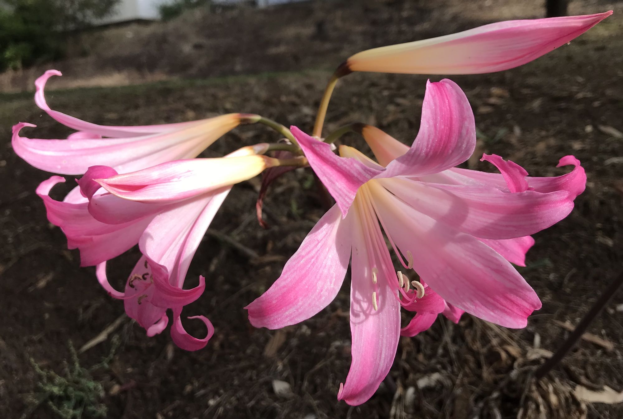
There were several of these Lillies blooming in Maldon Caravan Park.
I don't know the species, nor whether they were native or not.
Photo 2021/03/26 |
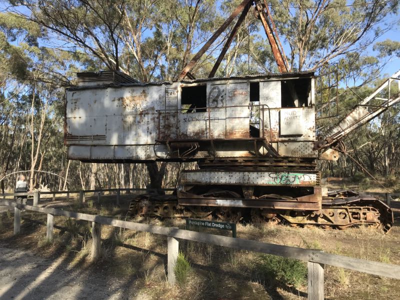
Photo 2021/03/26 |
There is another, very different old abandoned gold dredge in El Dorado, New South Wales. Photo 2021/03/26
|
|
|
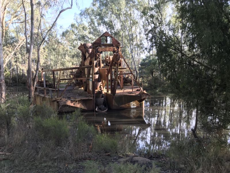
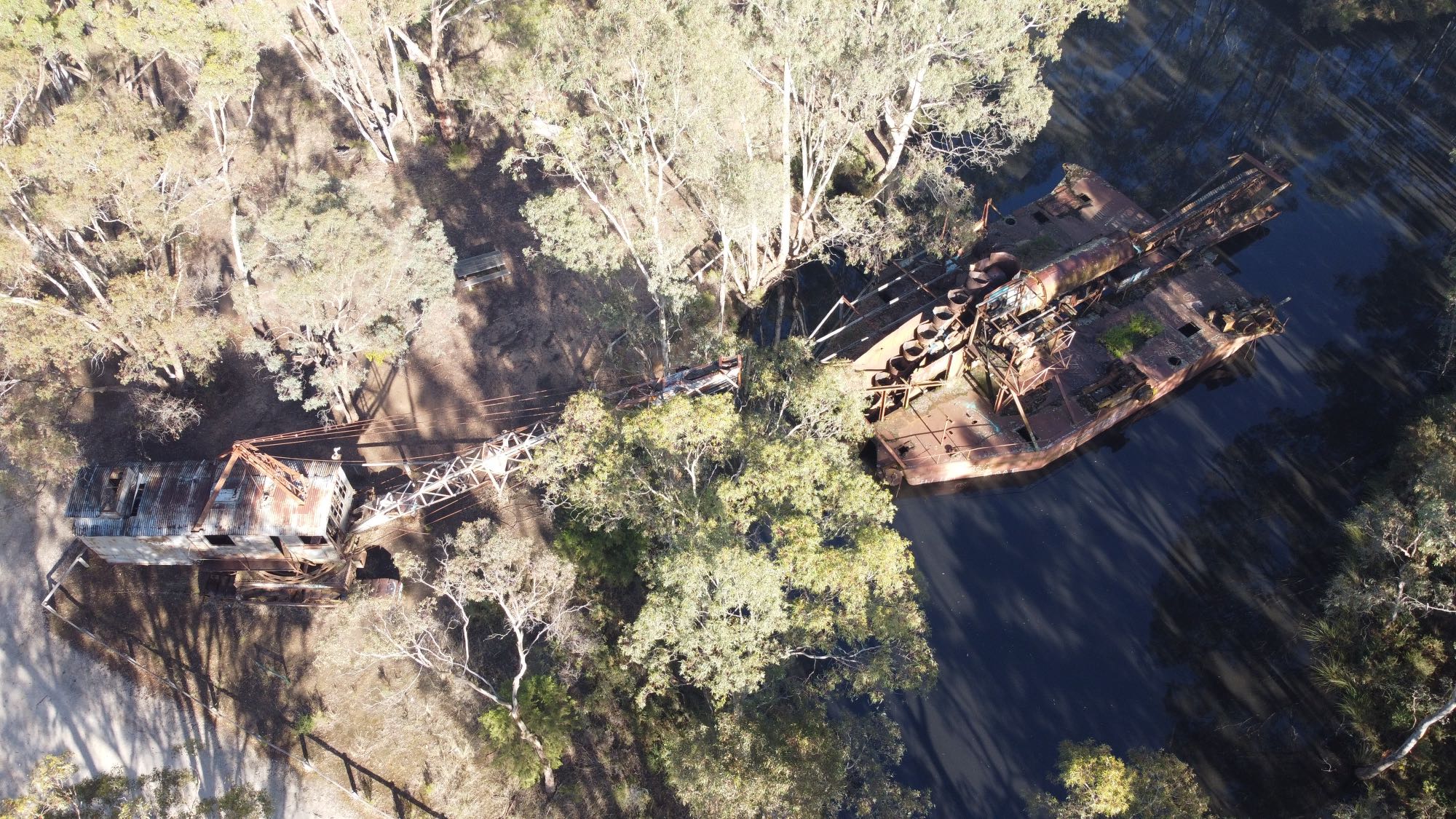
It is difficult to get a good view of the Porcupine Flat dredge from the ground, so I used my drone to get this areal view. Unfortunately the very high contrast between the early sun light on the tree tops and the deep shade around the dredge made it a difficult photographic subject. For more information see the Maldon page on it.
Photo 2021/03/26 |
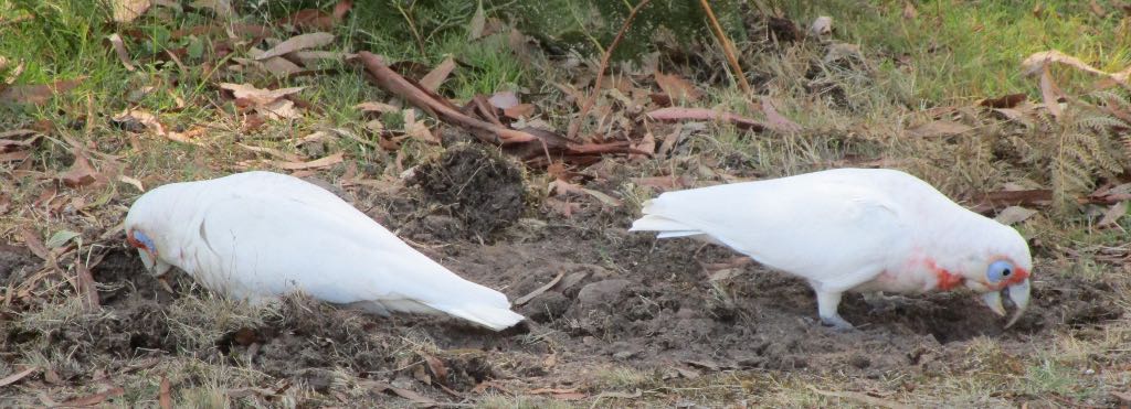
Foraging corellas, western Victoria
We also saw some long-billed corellas in the Grampians, I don't think I've seen them in South Australia. Photographed with a Canon Ixus 290, 2021/03/27 |
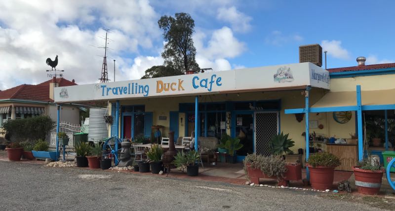
South Australia againTravelling Duck Cafe
This place was quite unexpected and very welcome, in the middle of no-where near the tiny hamlet of Geranium. We were expecting to have to drive another 60km or so to Tailem Bend. They provided a nice coffee, and in crockery, not use-once-and-throw-away, cups.
Photo 2021/03/28 |
|
|
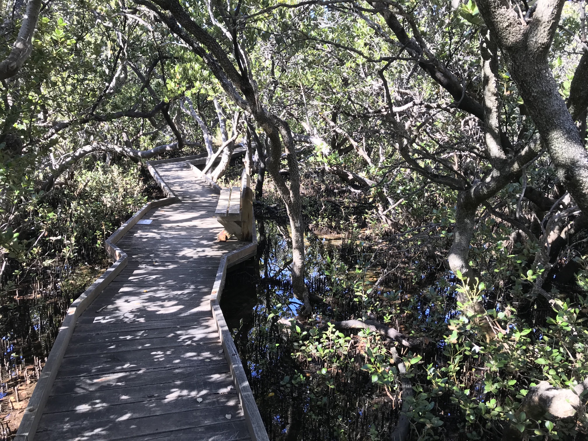
In the healthy part of the St Kilda mangrove forrest. The high variation between the sunlit parts of the forrest and the deeply shaded sections were too great for the iPhone camera to cope well with. I was quite beautiful in this part of the forrest.
Photo 2021/03/29 |
Photo 2021/03/29
|
|
|
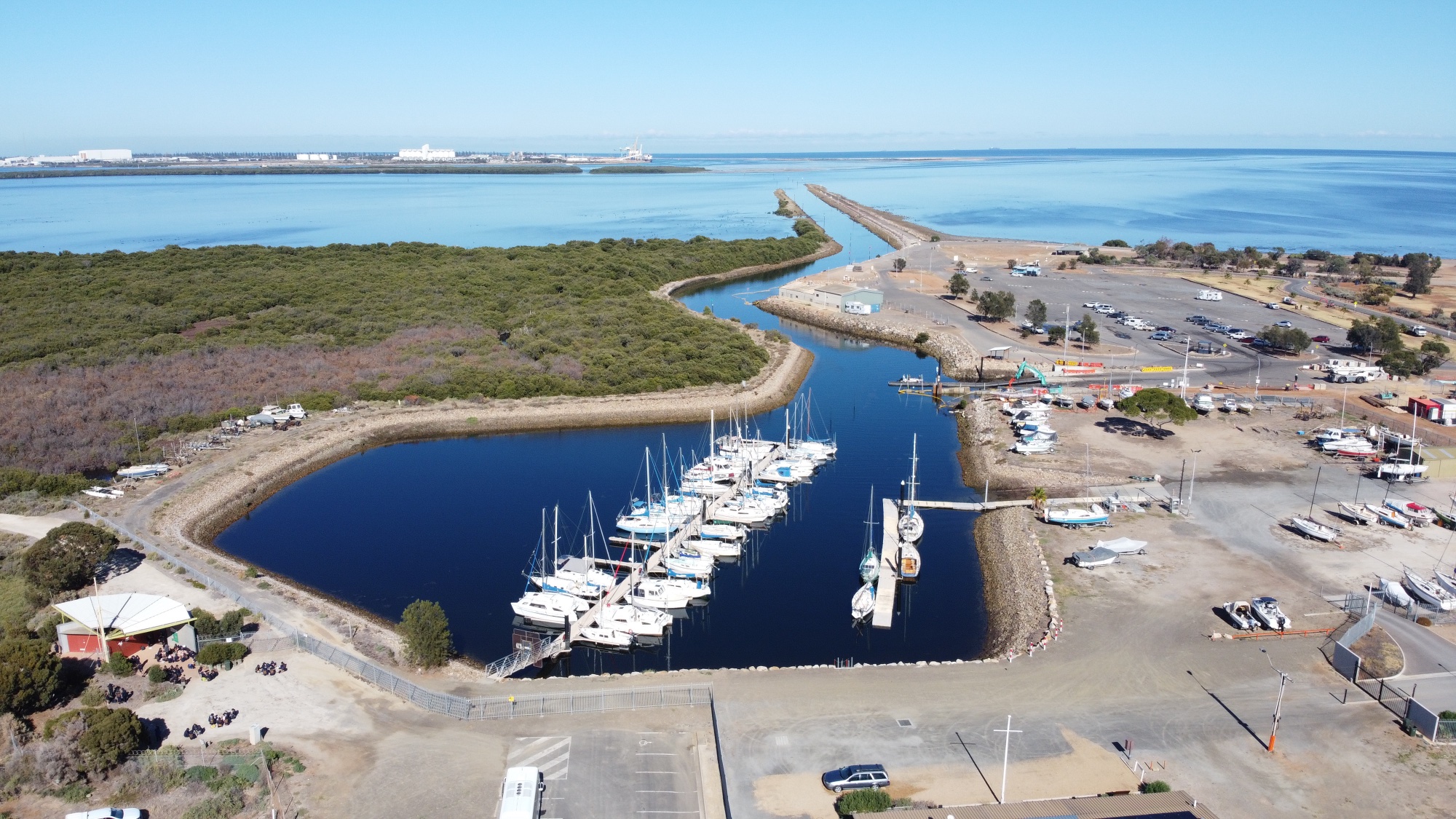
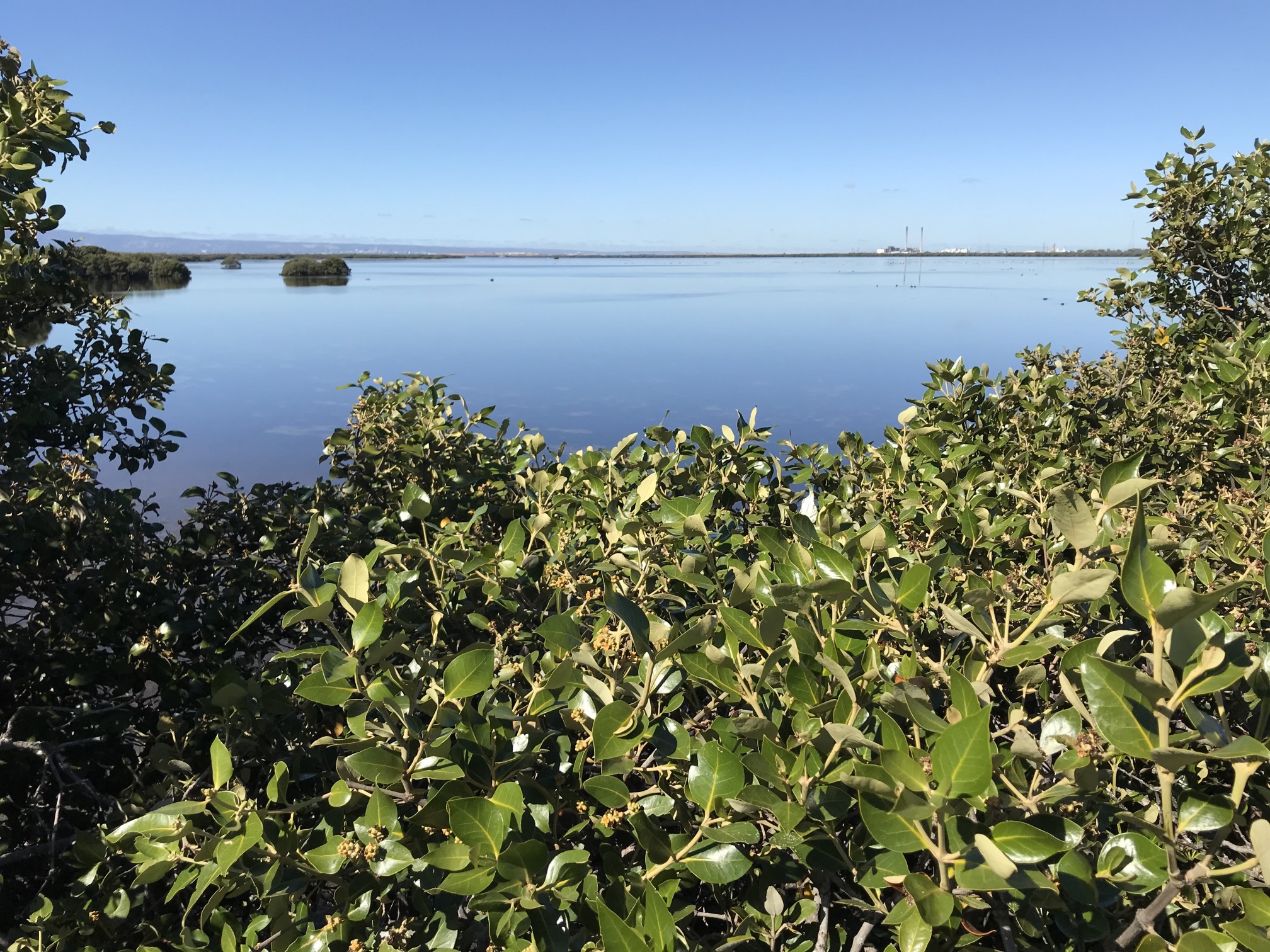
At the southern end of the Mangrove Trail, looking south; Torrens Island gas-fired power station in the distance. Note the healthy looking mangroves.
The extensive shallow waters north of Adelaide make great kayaking. Dolphins are often seen. Photo 2021/03/29 |
Click on the image to see a high definition image of the more distant mangroves. Photo 2021/03/29 |
|
|
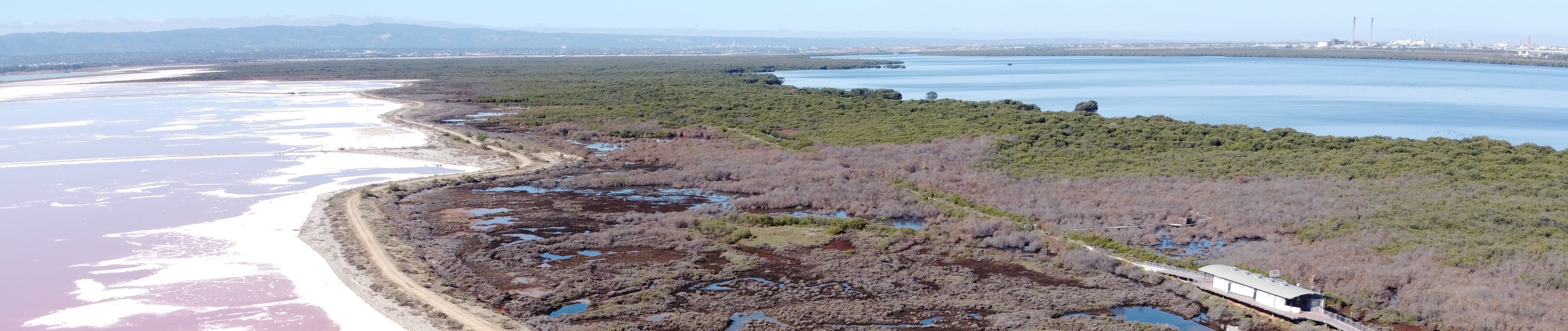
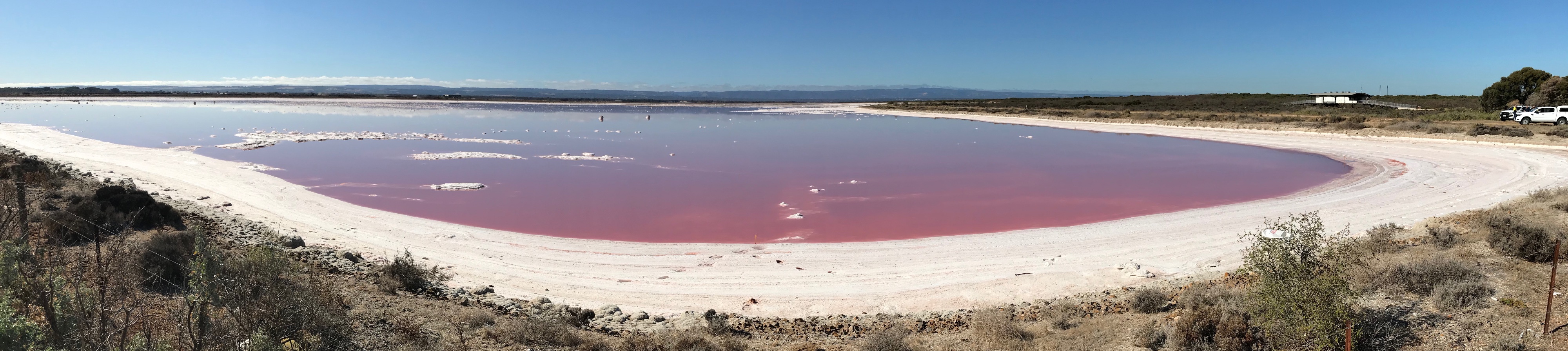
St Kilda beach and the Mangrove Trail area is surrounded by salt pans other than on the Gulf St Vincent side. This is a panorama showing the attractive contrast between the pink hyper-saline water, white salt, and blue sky.
Photo 2021/03/29 |
MiscellaneaThe cameras used for the photos on this pageOf my photos on this page:
The camera on the Mavic Mini is very impressive, I have written about its image quality on another page on this site. I bought the Canon Ixus in January 2021 because it has 10x optical zoom (useful for wildlife and other situations where a long focal length is valuable) and it comfortably fits into a pocket. I was surprised to find it also useful for macro photography. Of course when using long telephoto the depth of field is shallow, as it is in the macro shots; this is simply a matter of physics. With the digital cameras I've had in the past I've found that the pixel count was misleading. For example, a 4000 × 3000 pixel (12MP) image could be reduced to 2000 × 1500 pixels (3MP) with no loss of resolution. With the three cameras I've used on this page every pixel can be significant. I have not used the full resolution images on this page to reduce the file sizes. Effective resolutionIn the past one could buy a camera that took photos with a given number of pixels. In most cases the resolution achieved was effectively about a quarter of the pixel count. In the case of the three above cameras every pixel can count.VehiclesWe used a 2017 model Honda Jazz and a tent trailer.Yes, a little Honda Jazz is quite capable of towing a tent trailer, and it does not use much fuel. We averaged around 7 litres per 100 km. On our previous holiday we took an earlier Jazz model and trailer over the Snowy Mountains and on another holiday had no problems going over the Great Alpine Road in Victoria, again towing our tent trailer. The main limitation of the Jazz is its limited clearance and two-wheel-drive. Think of how much greenhouse emissions would be avoided if more people used a small car such as a Jazz and a little tent trailer rather than big 4WDs and big caravans! Denece and I make no claim to be saints in minimising our emissions, but we do make an effort to keep them as low as we can without greatly impacting on our life-styles. Minimising emissions generally comes with the added bonus of saving money. I was recently disappointed to read an article on small cars in the RAA (Royal Automobile Association) SA magazine in which the writer stated that small cars were good for use in the city (implying that they were not suitable for use in the country). We live in the country and have used nothing but small cars for over fifteen years; we often go on unsealed roads and have never seen any pressing need for a large 4x4.
I've written more on this subject in
what can (and should) we be doing to reduce our greenhouse gas emissions elsewhere on this site.
Reduced numbers of insectsOver the whole trip, several thousand kilometres, there were hardly any insects splattered on the windscreen. It seems that flying insects that could die on vehicle windscreens are much less numerous than they were ten or more years ago. This phenomenon has been noted by many others; it is likely connected with widespread use of insecticides. Of course our observation is not hard evidence of change, but it does seem significant. |
|
|
Related pagesPhoto pages inside AustraliaBeetaloo Dam, 2014Clare Valley, 2021 Clare Valley, 2007 Clare Valley impacted by climate change Coober Pedy: photos and observations, 2016 Central NSW, March-April 2017 South eastern SA and Victoria 2018 Flinders Ranges, 2006 Flinders Ranges, 2019 A collection from the Flinders Ranges over the years, 2020-2021 Kangaroo Island, 2009 'Across the Nullarbor', 2009 South eastern Australia, November 2016 Victoria, Autumn 2019 Photo pages outside of AustraliaIndia; visit 1989; modified 2009Indonesia; visit 1994; modified 2009 Japan, 2017 Vietnam, visits 2004-08; modified 2017 Cambodia, Laos, Vietnam, 2011 Singapore and Malaysia, 2015 |
|
|