|
|
|
|
|
|
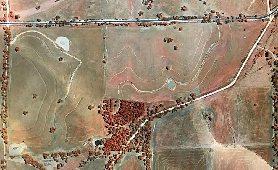
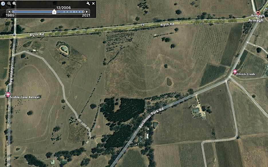
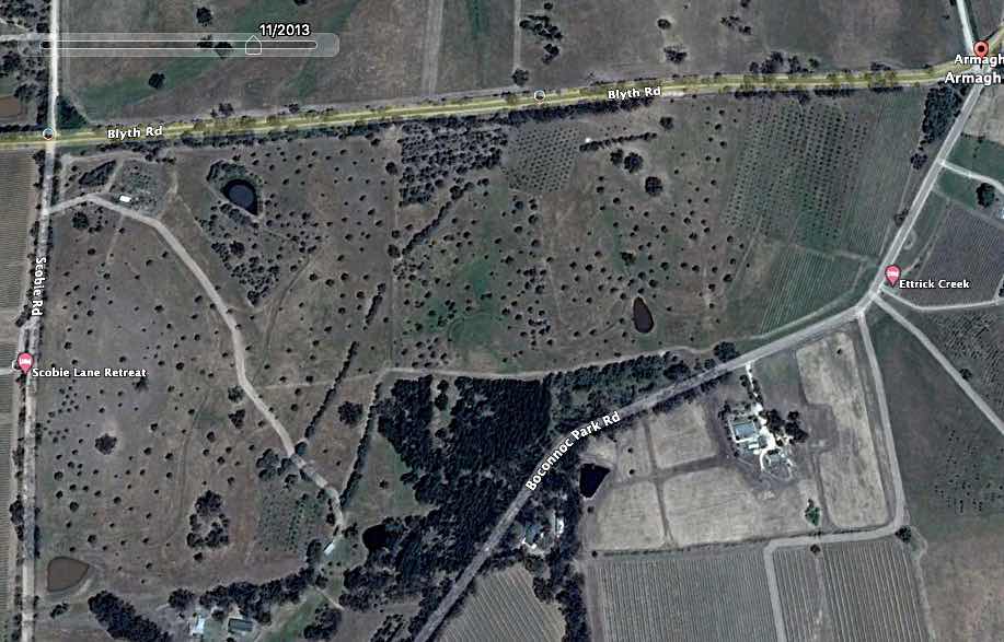
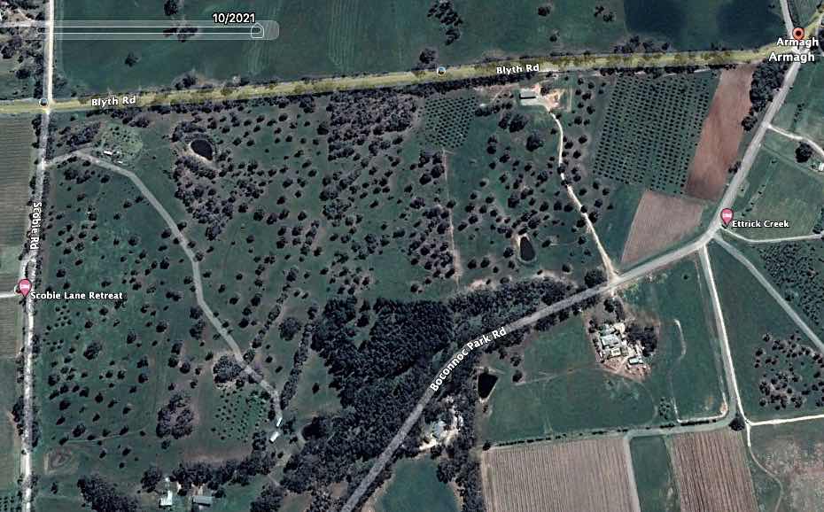
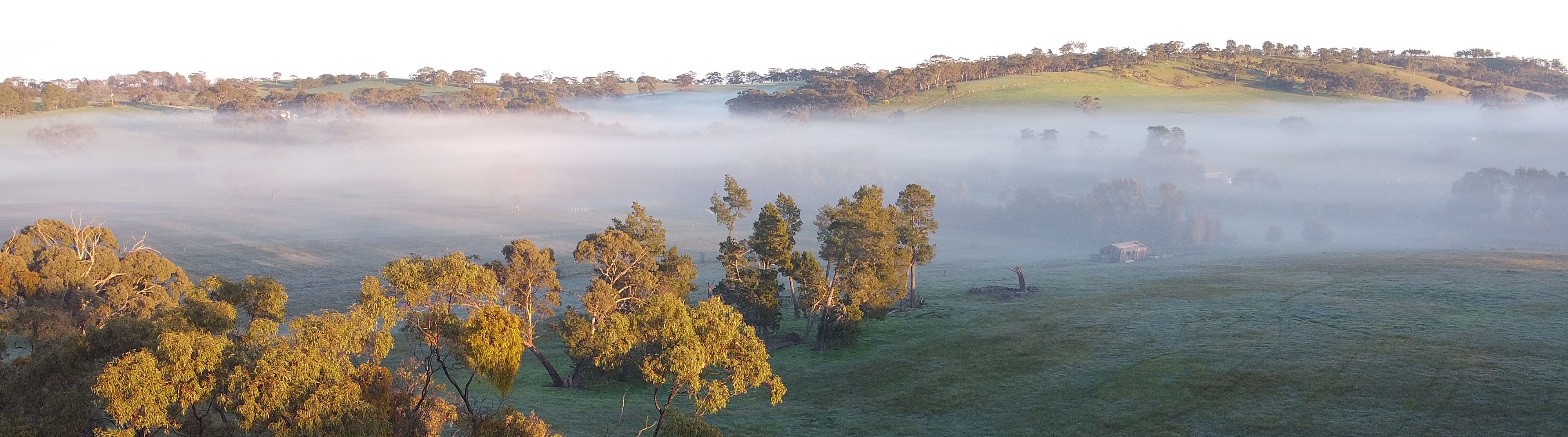
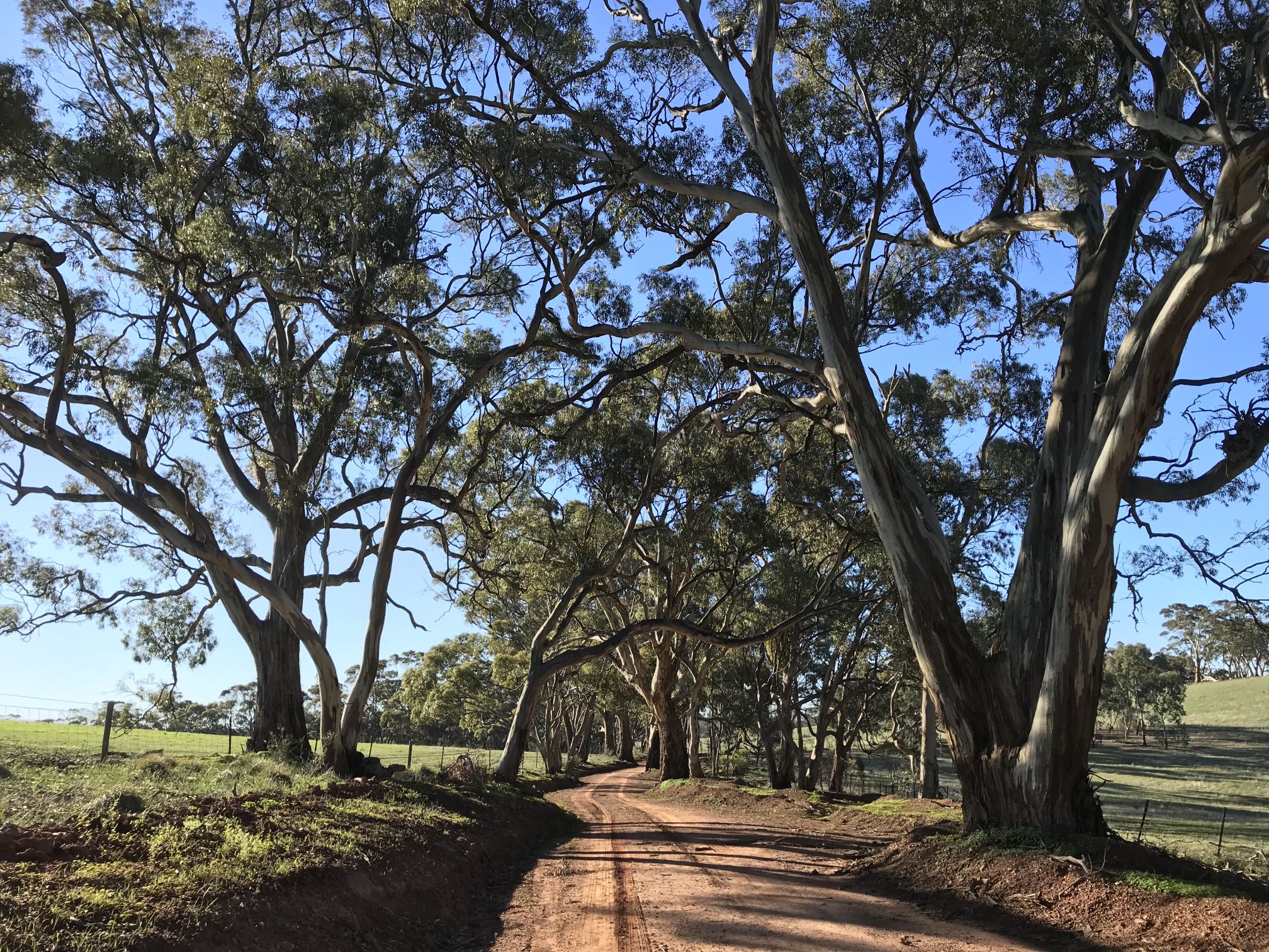
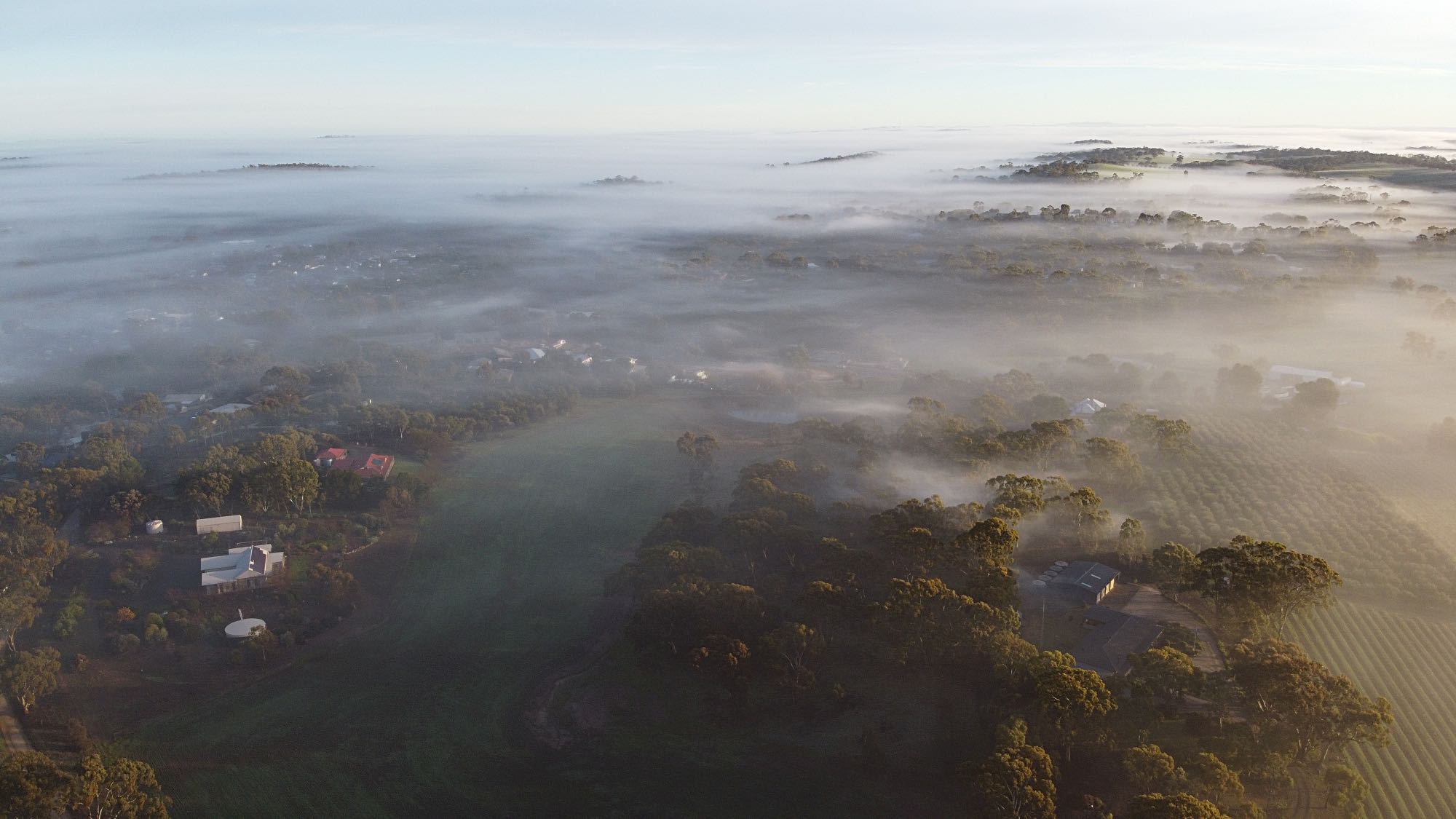
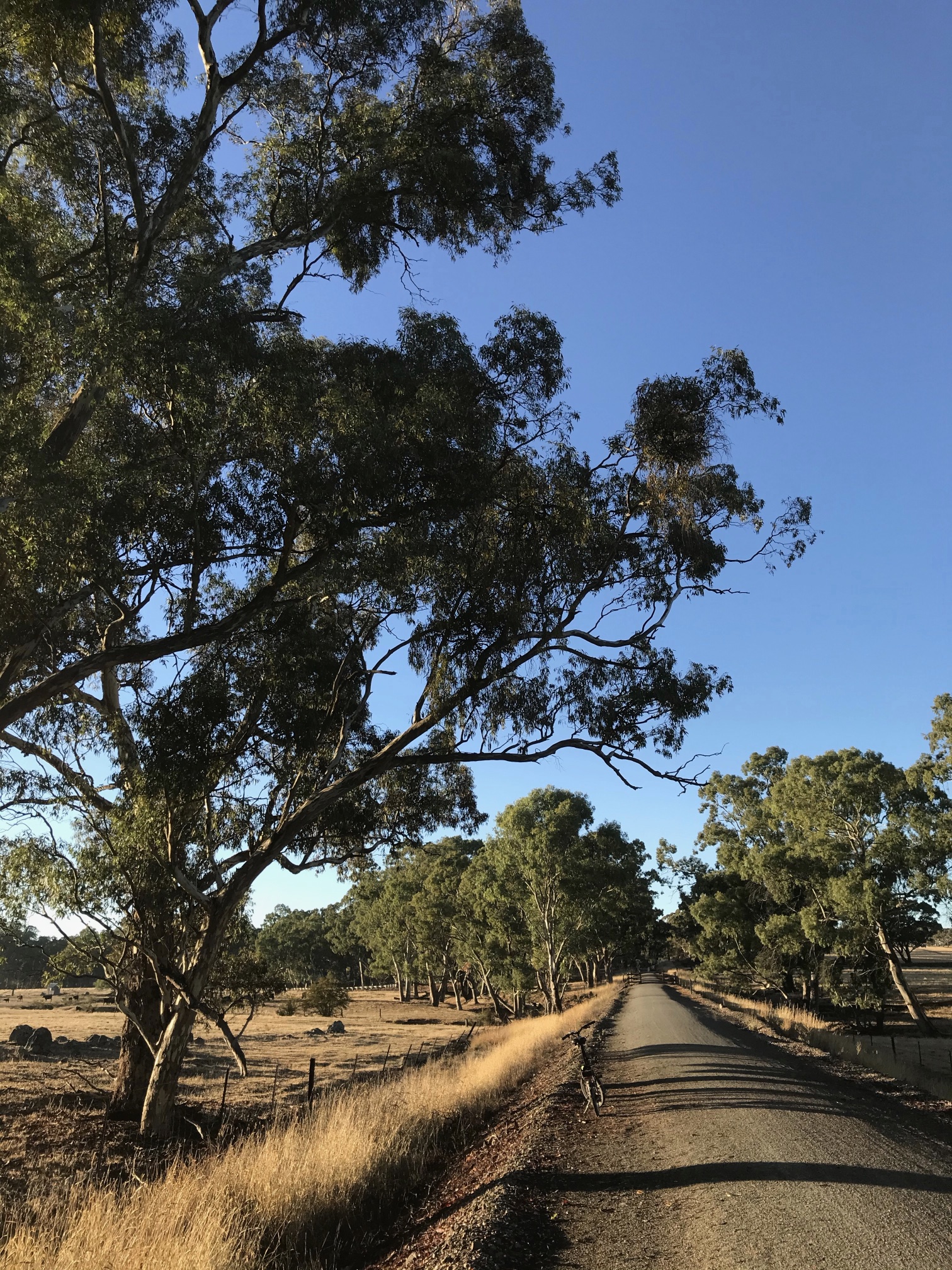
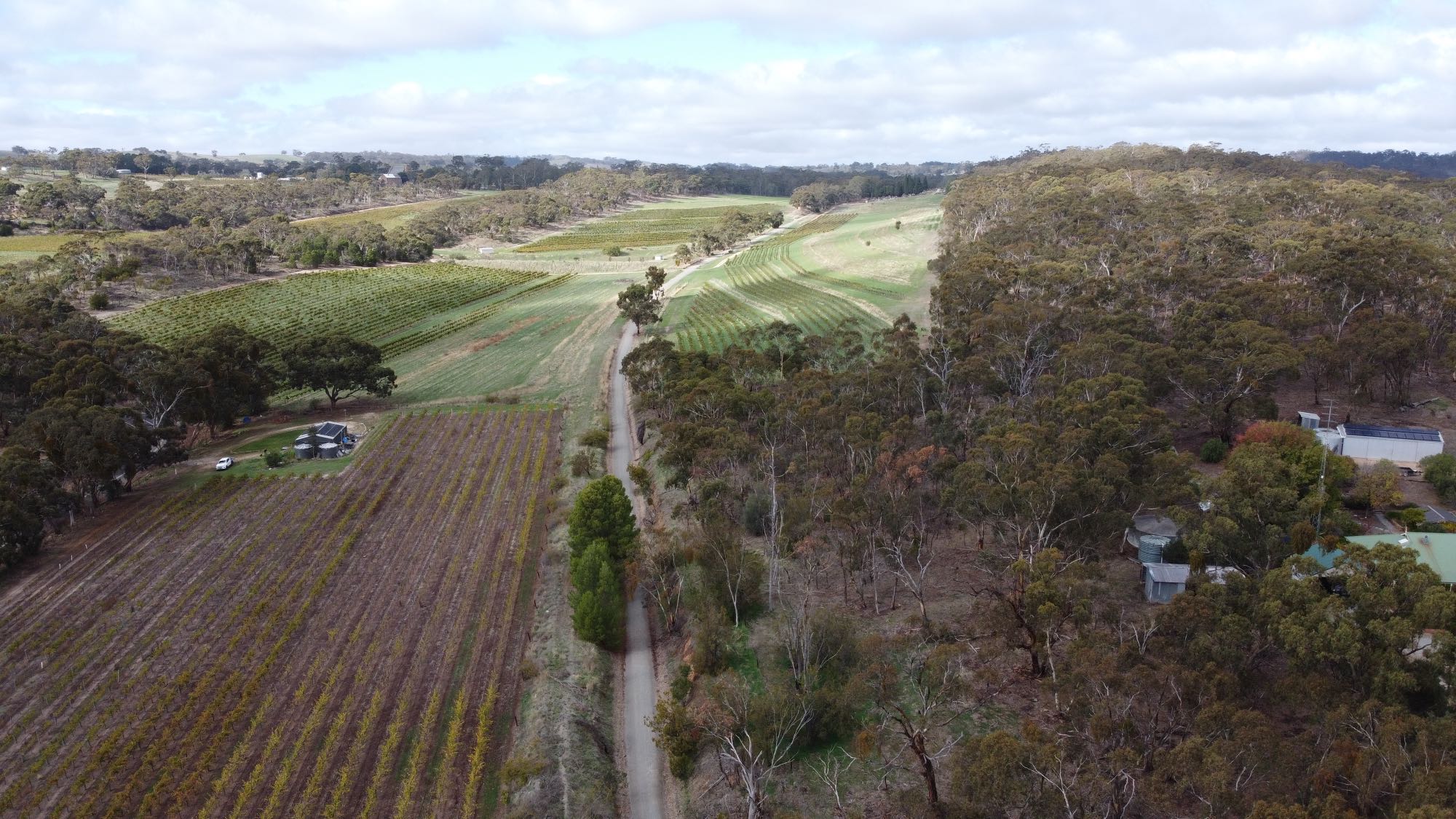
Aerial photo record of Elysium while we 'owned' it The four images below were taken over the period during which we had stewardship of the land. The property is bounded by Blyth Road on the north, Boconnoc Park Road on the south and east, Scobie Road on the west, and a fence near the line of trees in the south-west. I added these images to this page in January 2022. |
|
|
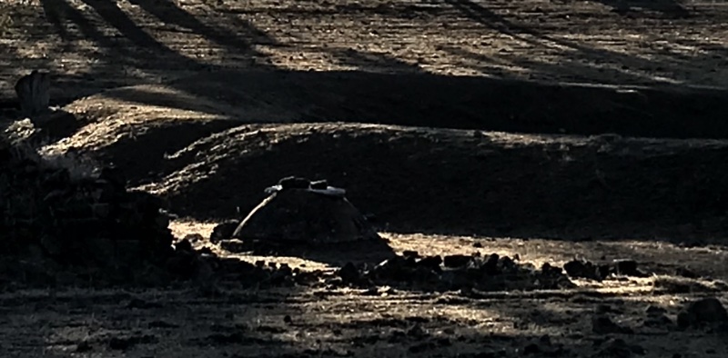
Infra-red aerial photo taken around 1994. The two dams on the western end of the property were in place and the shed near the old dam, lower left centre, had been built. The speck beneath the lone tree upper right centre is an 11kL concrete tank that we had placed there. The small white patch on the extreme east of the property is probably where the well had recently been drilled; but there is no indication of the pipeline that was to run from well to the tank and on to the shed. There is nothing to be seen of any trees that we had planted.
|
|
|
|
|
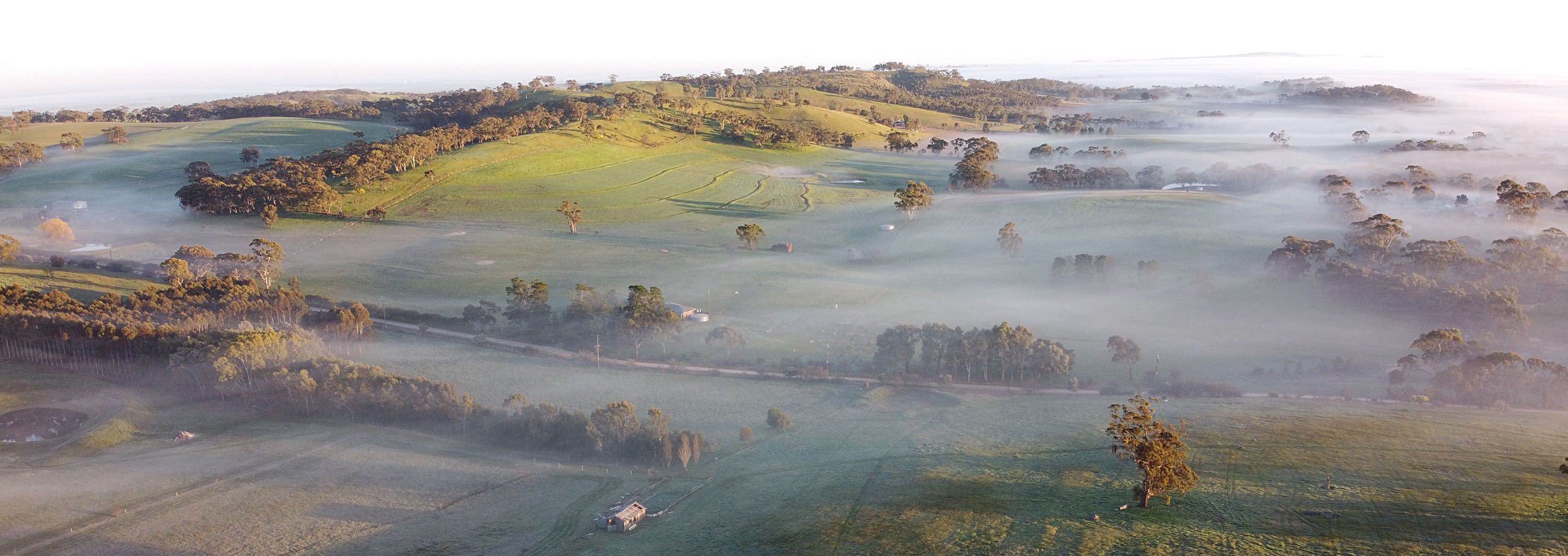
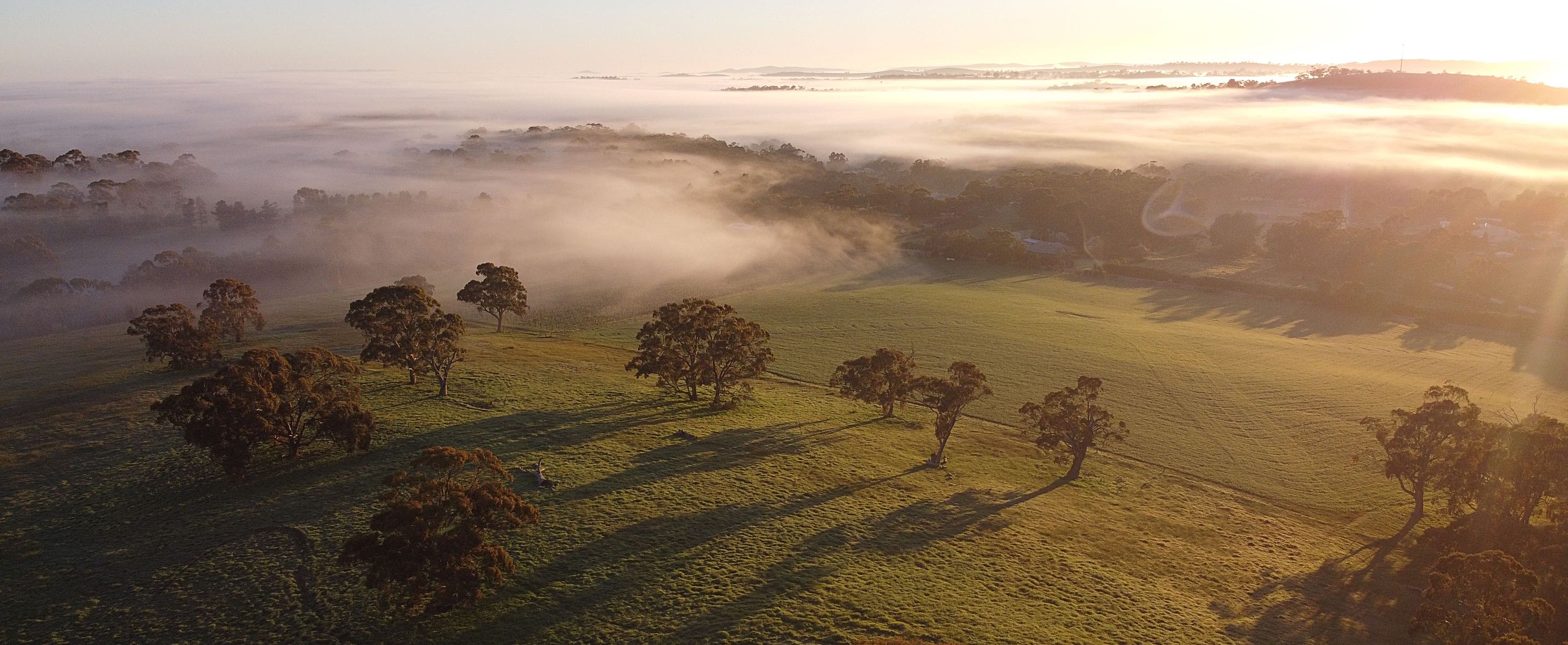
Google Earth image dated November 2013. Now many of the trees that had been planted right across the property (each protected from the sheep by an individual guard) are visible. The trees in the woodlot and the olive trees are noticeably bigger.
|
|
|
|
|
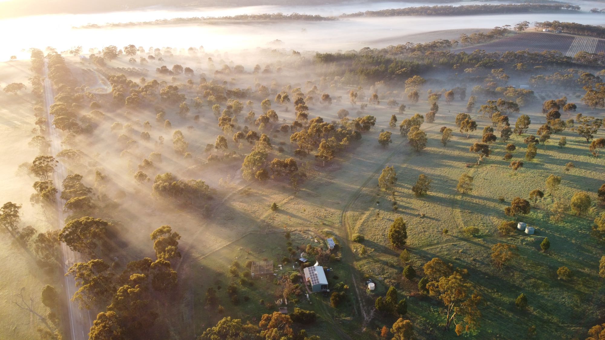
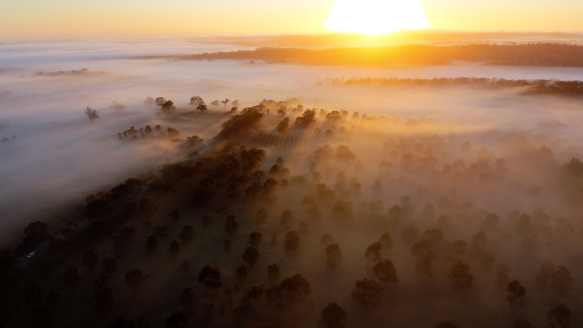
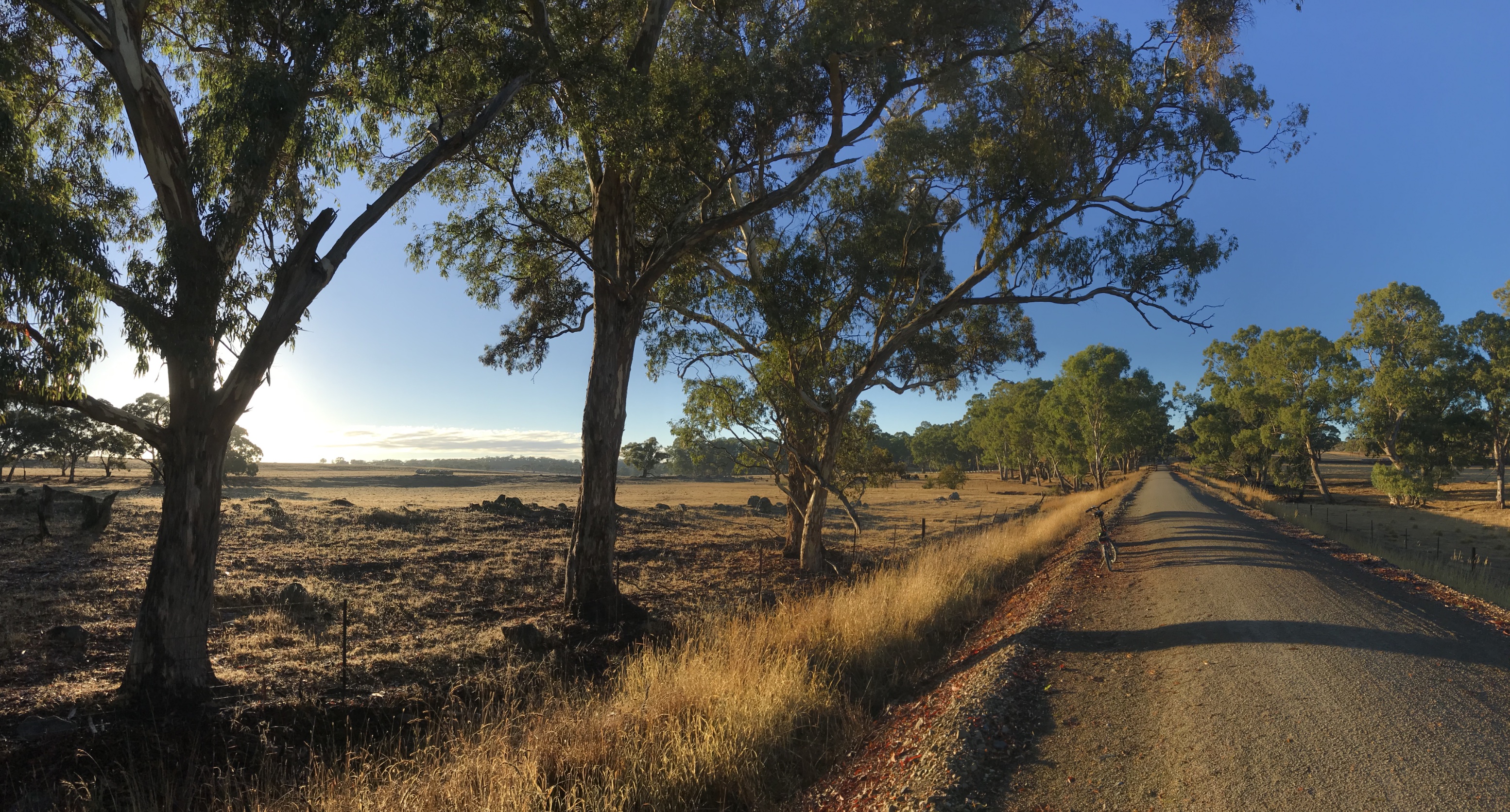
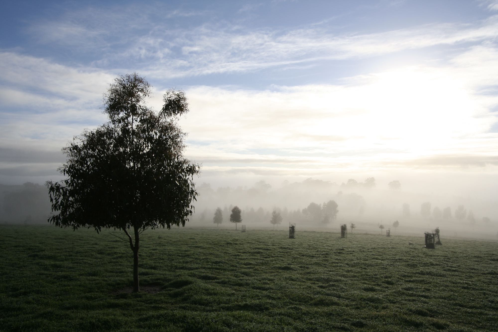
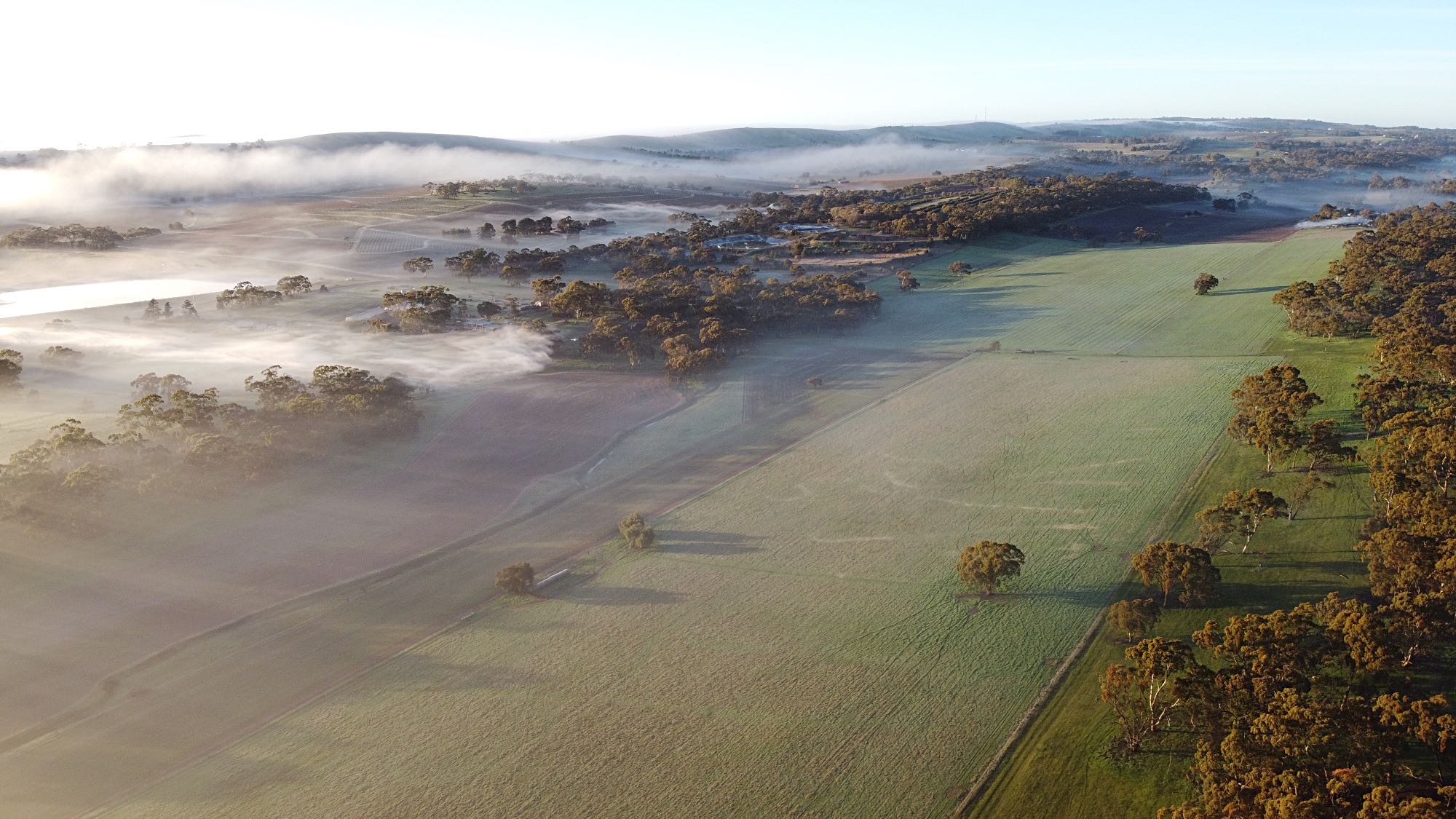
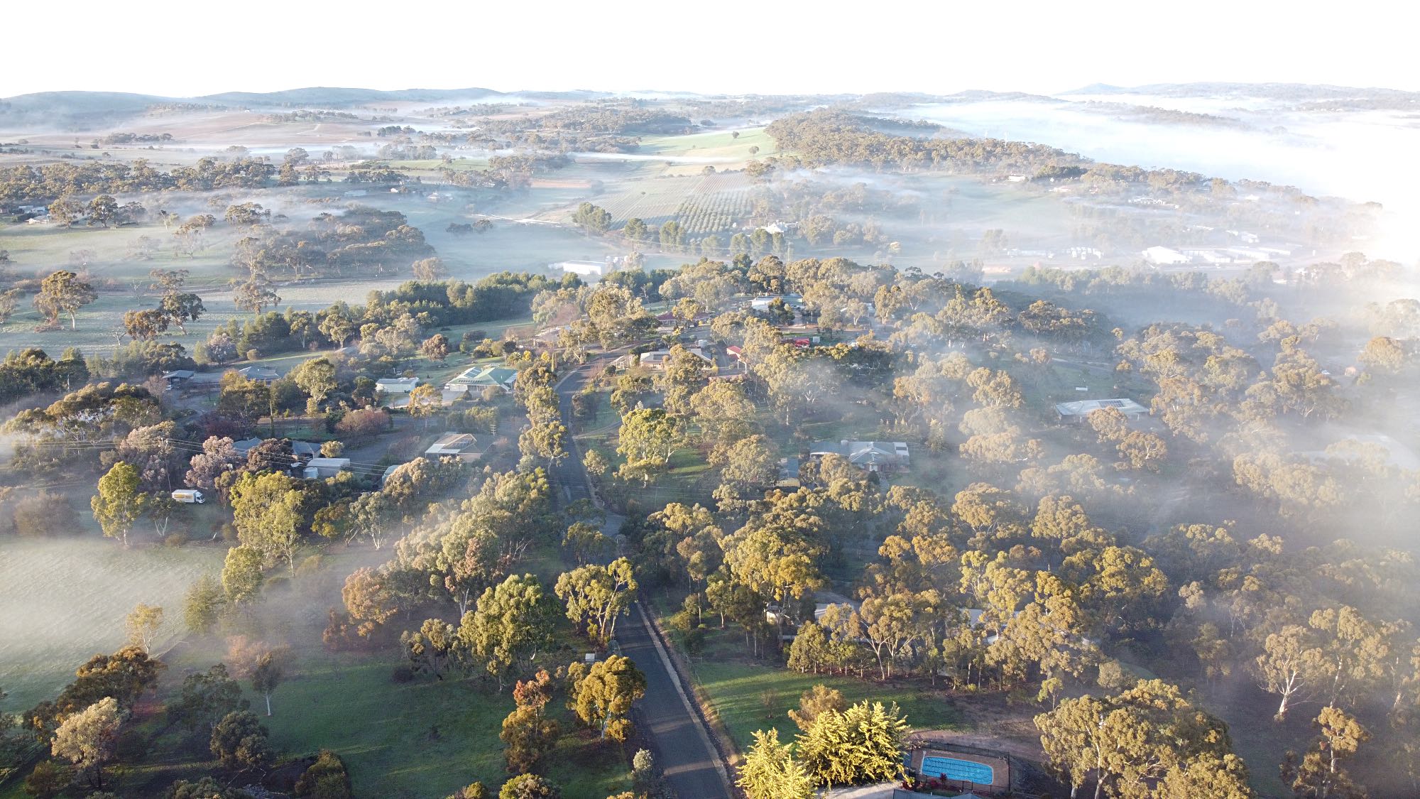
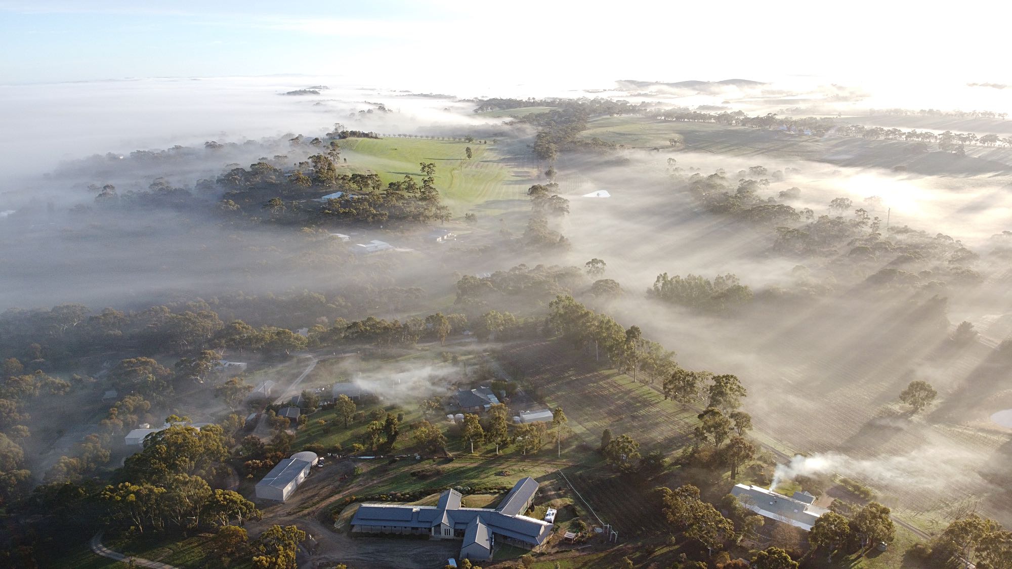
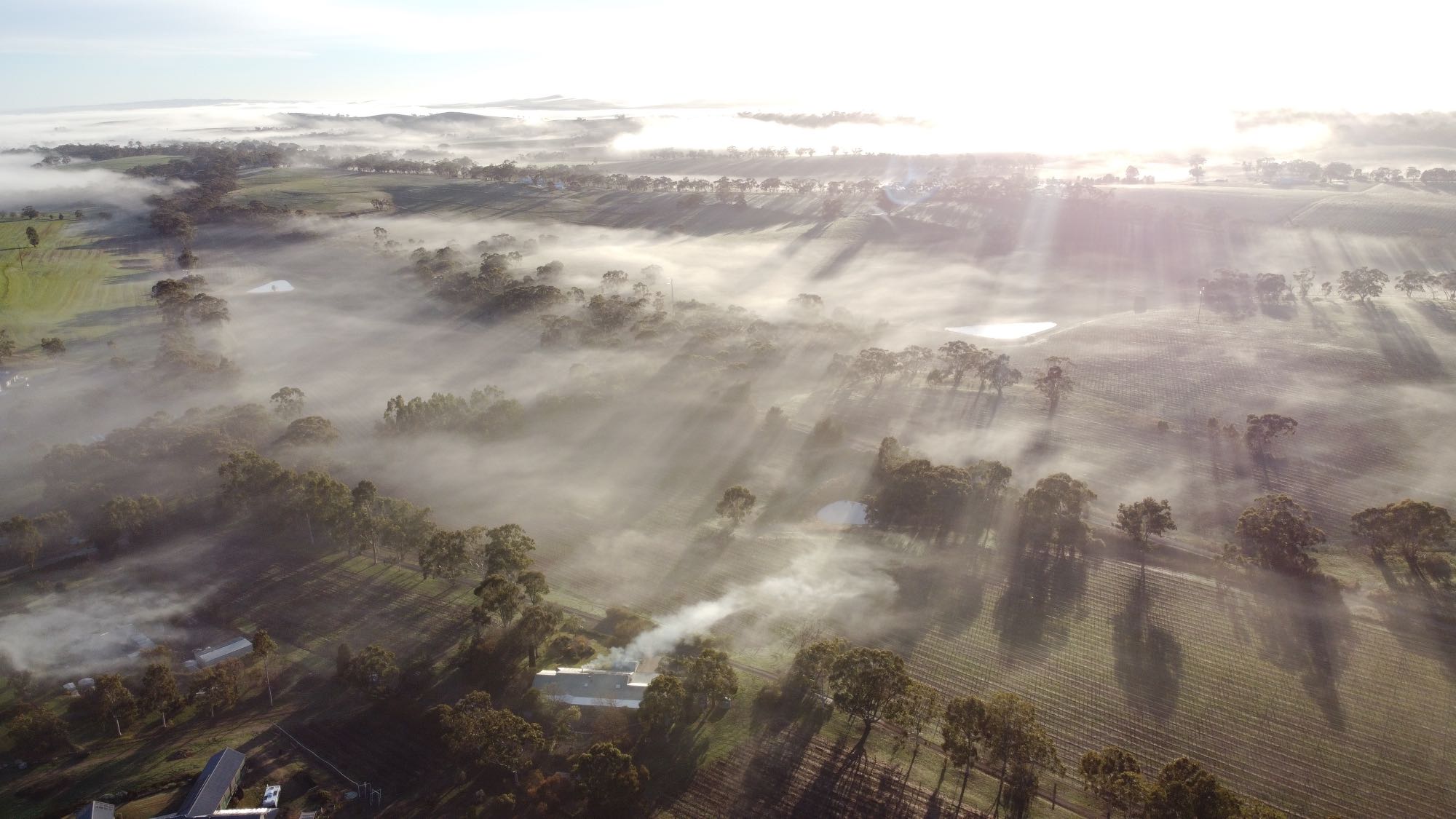
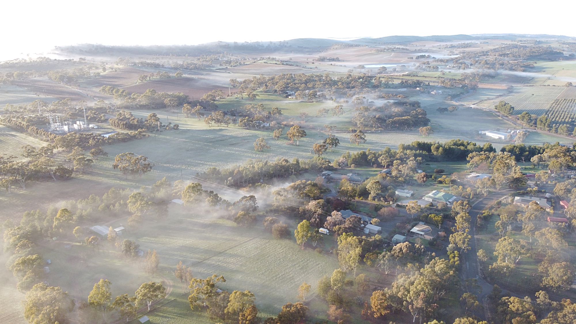
Sunrise over a ground mist on an Autumn morning. More photos of Elysium are on another page on this site.
Photo 2020/04/20, Mavic Mini drone |
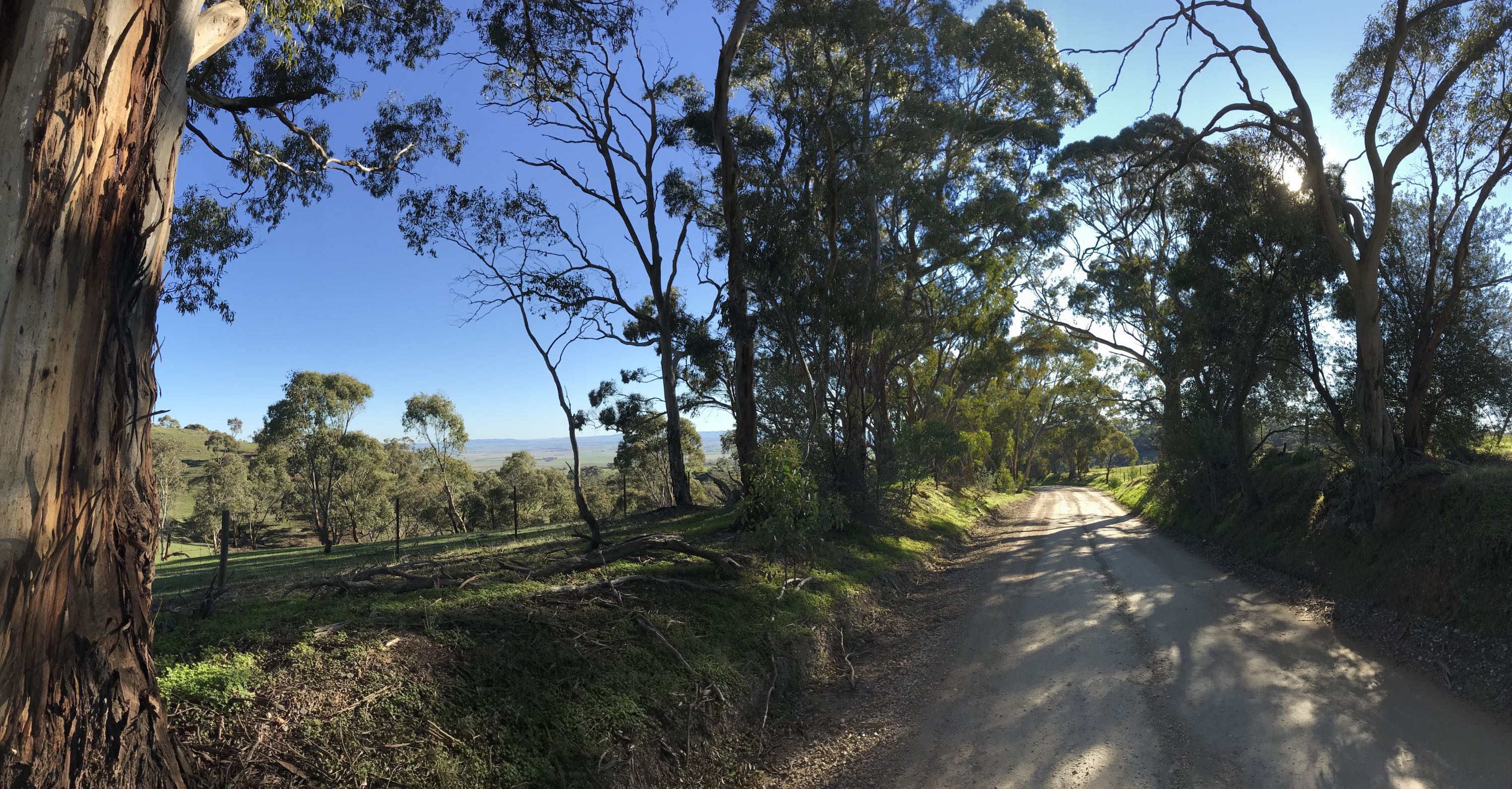
At the time sheep were being grazed on agistment to keep the fire load down, so all the trees had to be protected by individual guards.
Photo 2008/08/13, Canon EOS 350D DIGITAL.
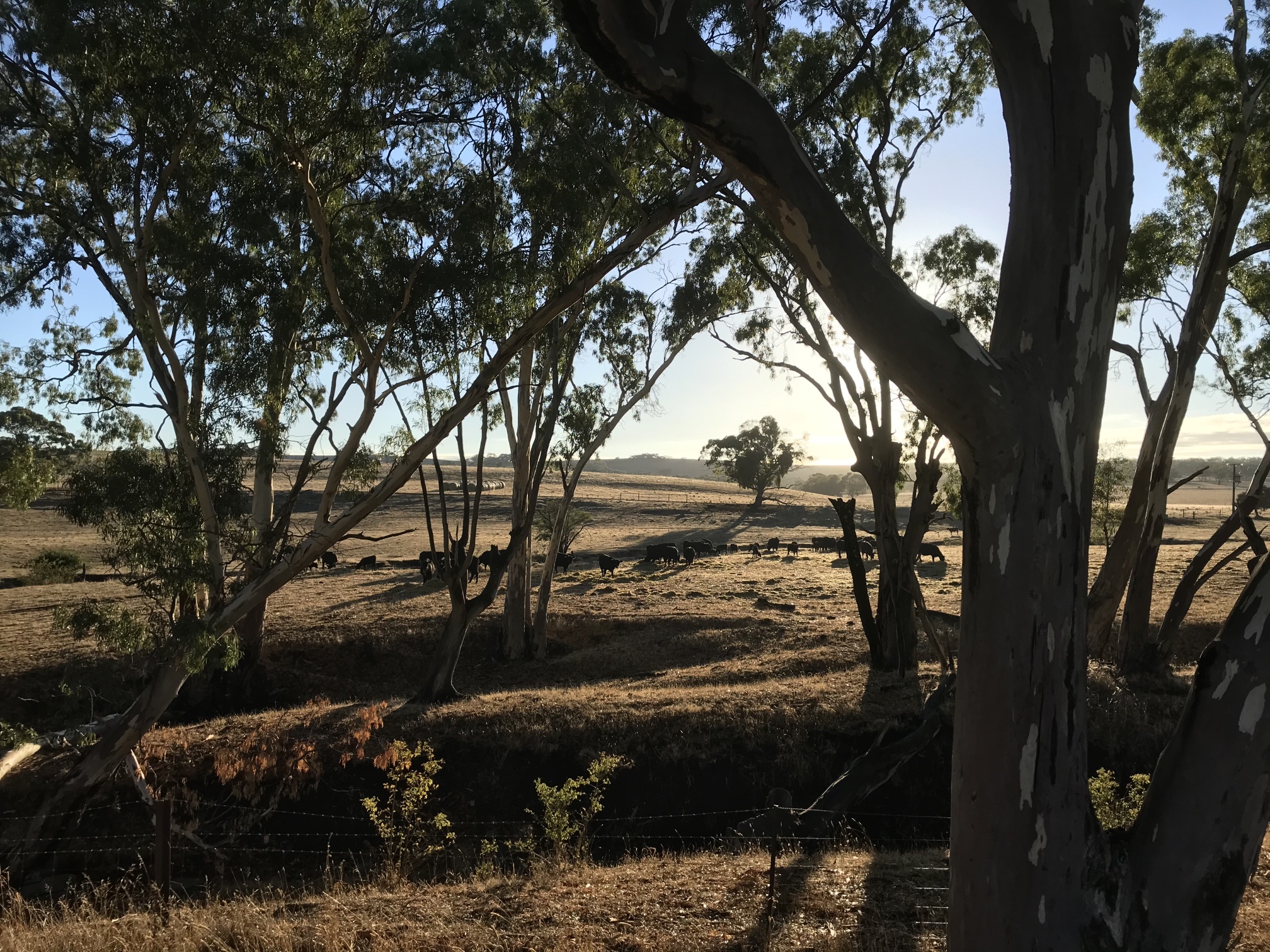
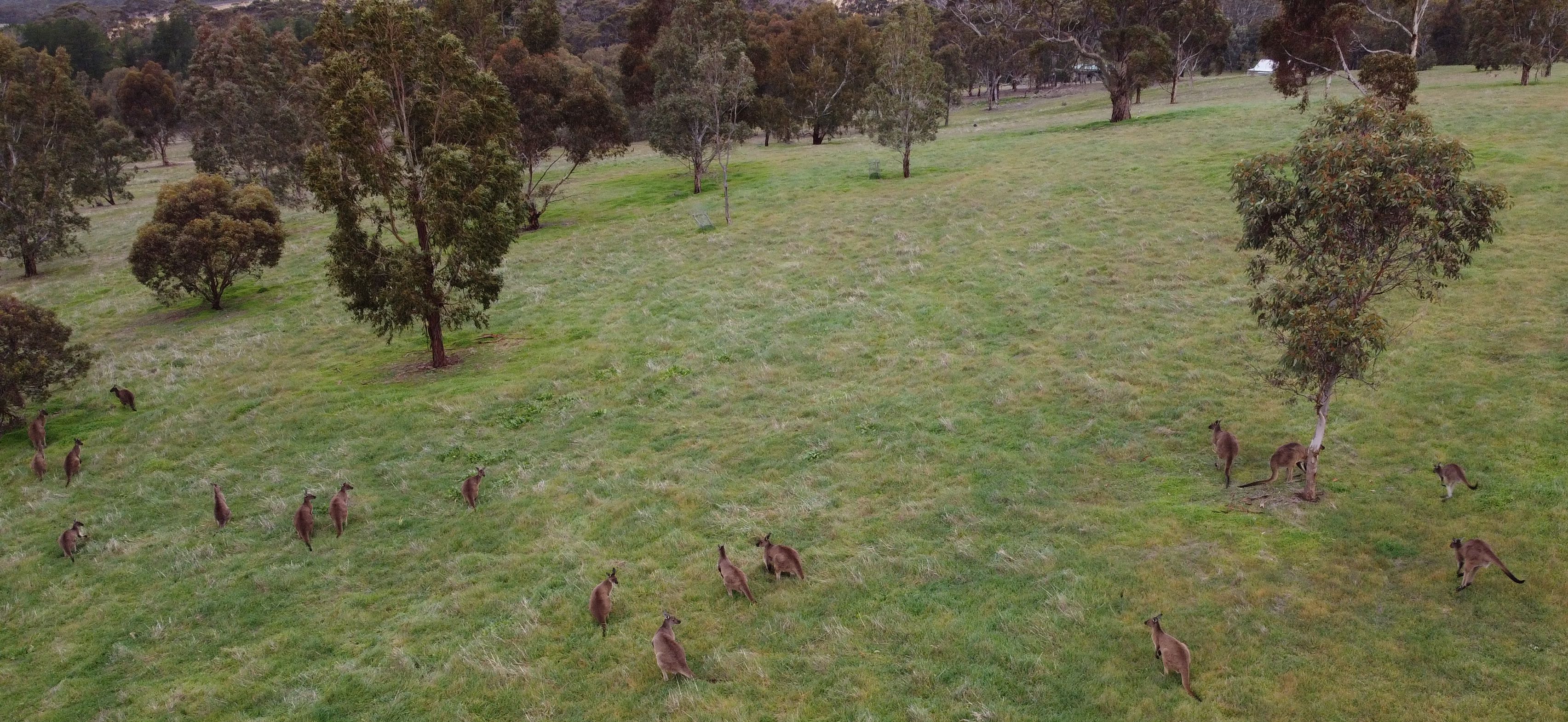
'Our' kangaroos
Photo 2020/06/14, Mavic Mini drone. We have had up to 22 kangaroos at a time on our property, Elysium. More often we see around six or eight.
I couldn't get close enough to get a photo like this without using the drone.
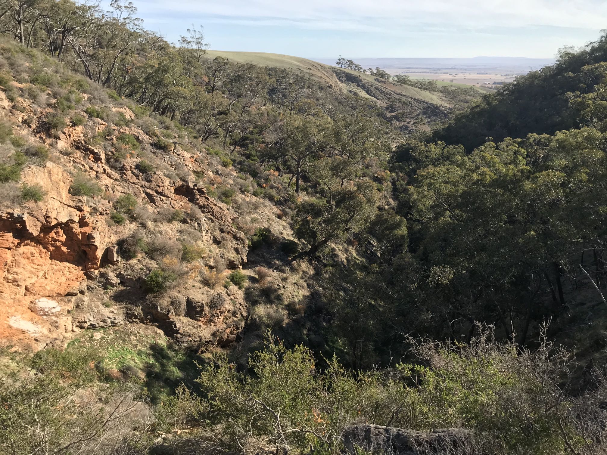
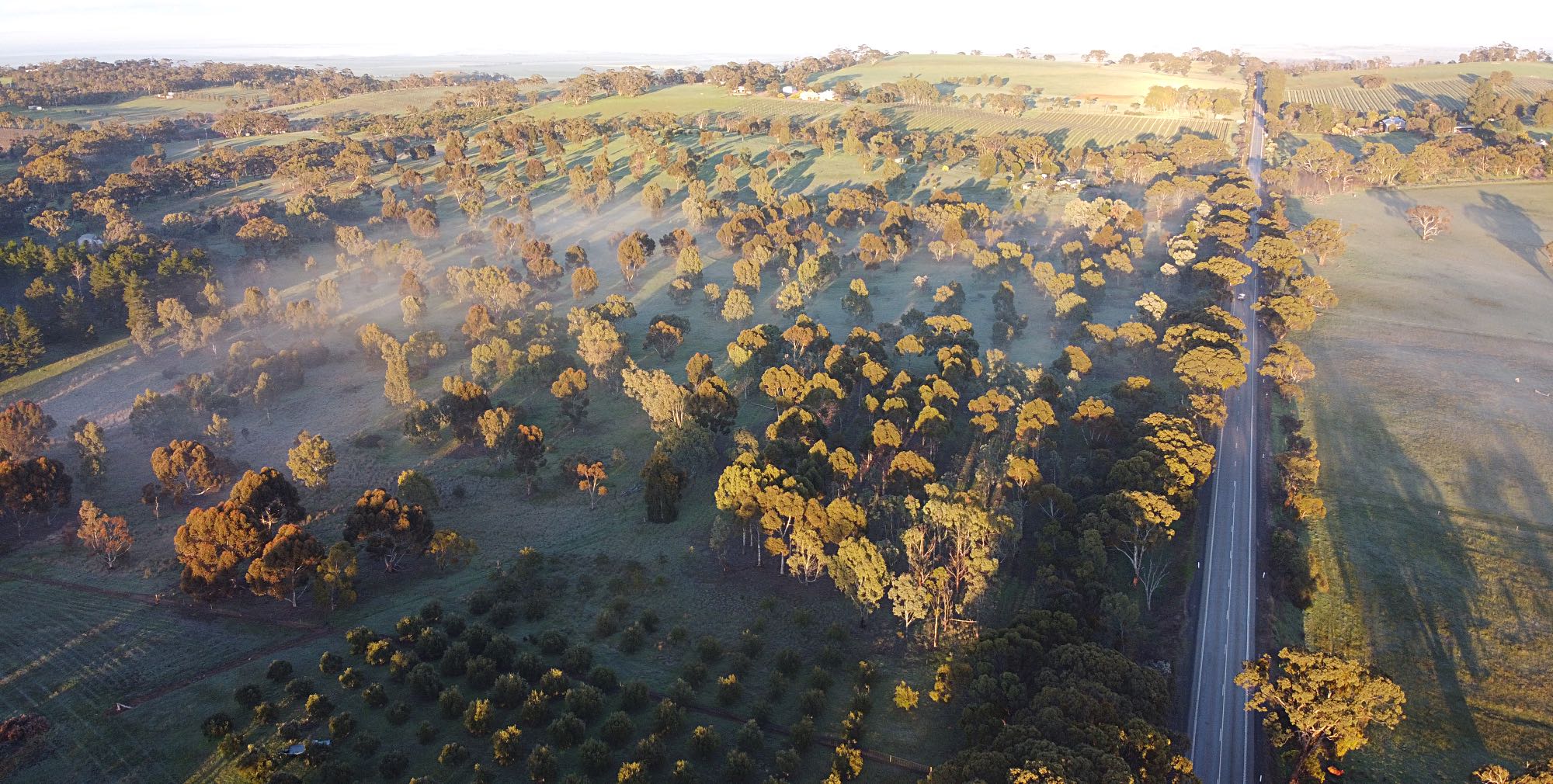
Above the big road cutting west of ArmaghThe following photos were taken on the early morning of 2021/08/25 using my Mavic Mini drone.
I planted the great majority of the trees on the left of the road, those in the foreground are olives.
|
|
|
Looking north from above the cutting. Emu Rock is at the far end of the ridge that rises above the mist on the right.
|
|
|
Looking northeast, Hicks Road is on the far side of the cleared paddock on the right. Armagh would be beneath the mist beyond that.
|
|
|
Looking nor-northwest from above the cutting. Emu Rock is on the far right.
More photos of the Armagh area are on another page on this site. |
|
|
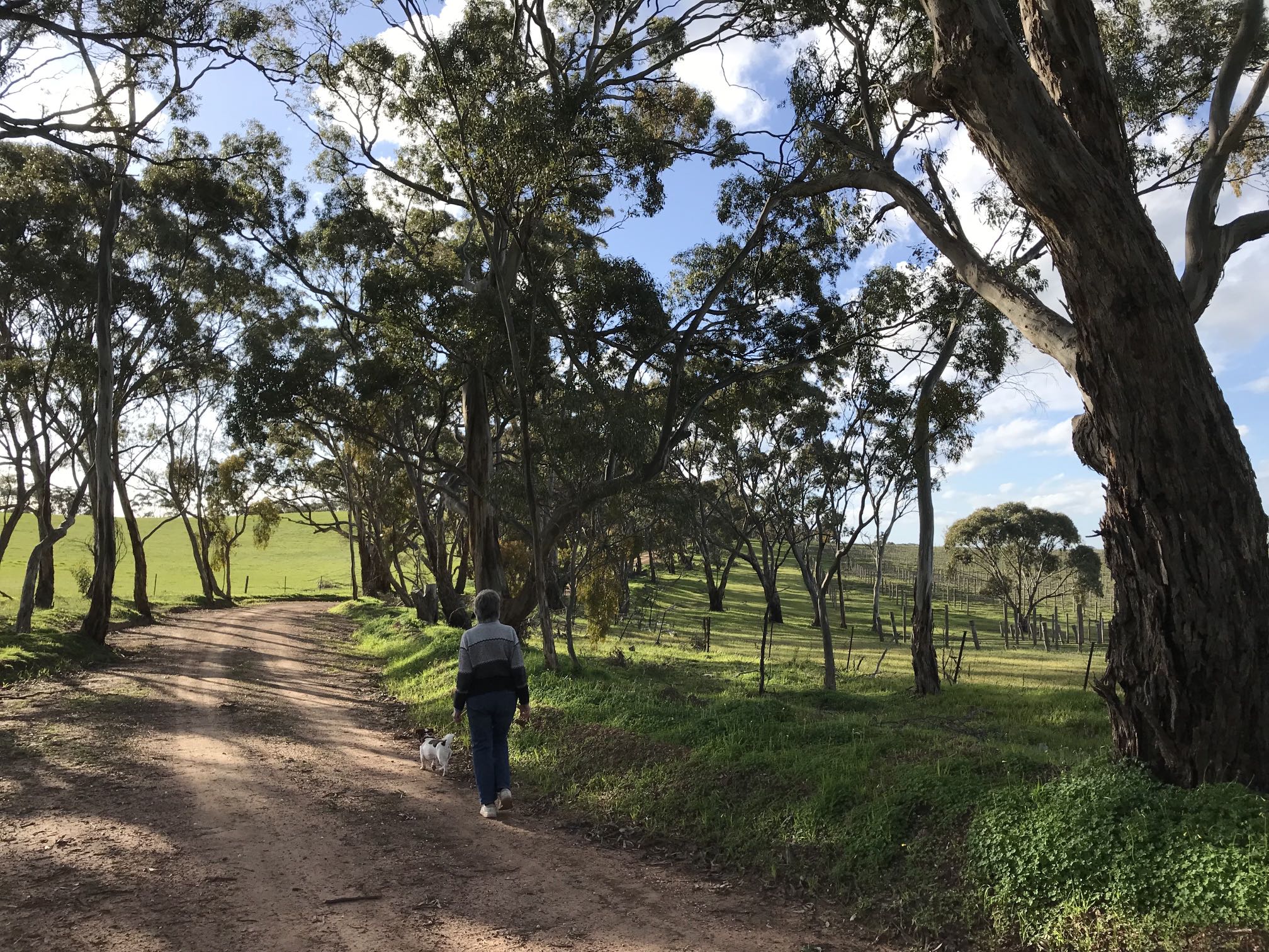
Jacobs Range Road, southwest of Armagh
I've recorded some other photos from Jacobs Range Road on another page on this site. Photo 2021/08/28, iPhone 7 |
|
|
From this section of Jacobs Range Road, near the southern end, you get views over the Blyth Plain.
Photo 2021/06/29, Apple iPhone 7, panorama |
Photo 2021/06/29, Apple iPhone
|
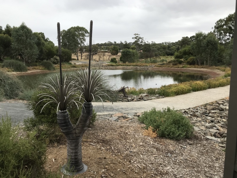
Gleeson WetlandsI've done volunteer work at the Gleeson Wetlands for the seven years that the Clare Lions have been involved. It's a work of love. |

|
This one is beside the bird hide.
Over 50 species of birds have been recorded at Gleeson Wetlands.
There are many more photos of the Gleeson Wetlands on a dedicated page. |
|
|
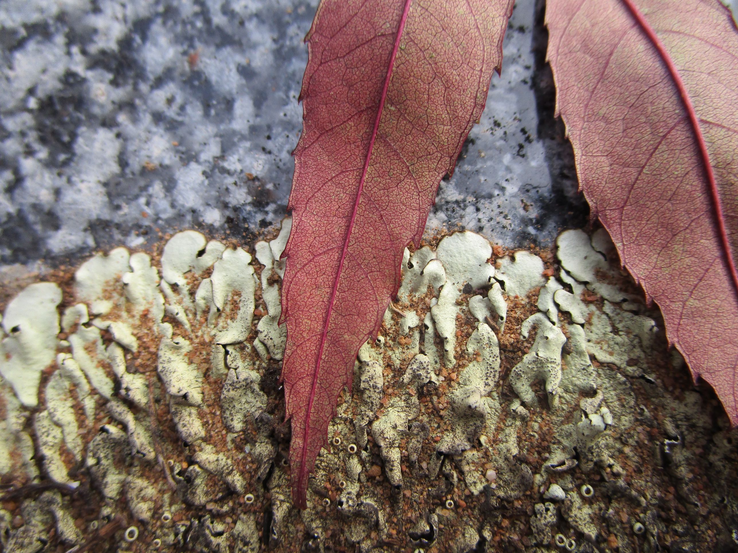
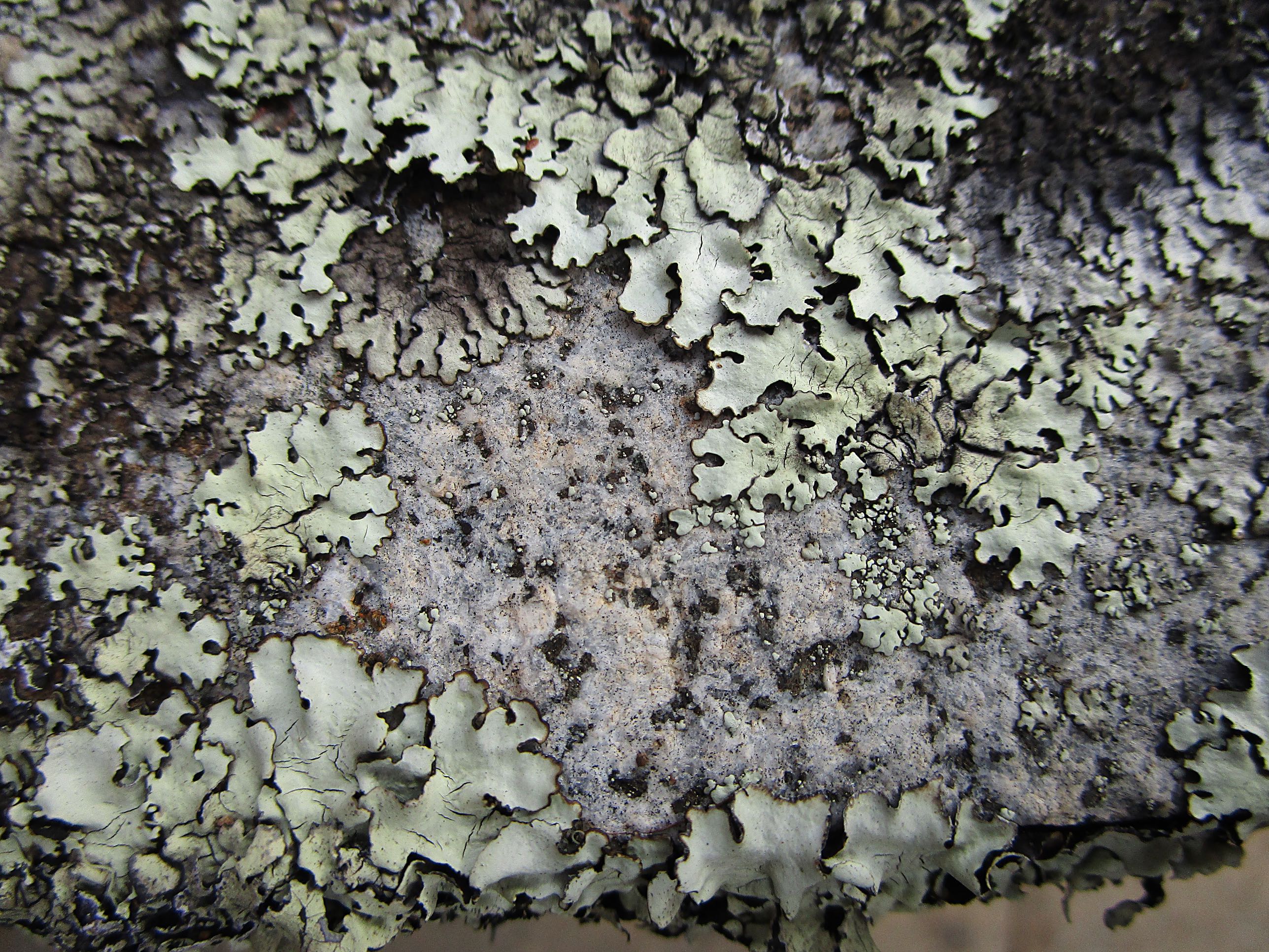
I love the veins in the leaves and the details in the lichen and sand grains (you'll need to look at the high definition image to see them properly).
Photo 2021/05/01, Canon Ixus 190
In the high-definition image (click on the low-definition image) note the baby lichen plants getting established preferentially on the dark mineral grains (probably amphiboles or pyroxenes) rather than the light grains (quartz and feldspar).
Photo 2021/05/01, Canon Ixus 190
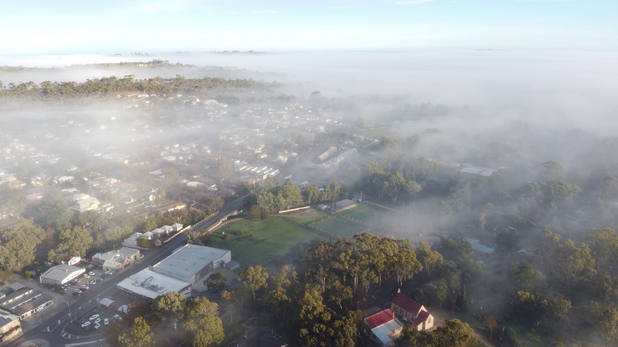
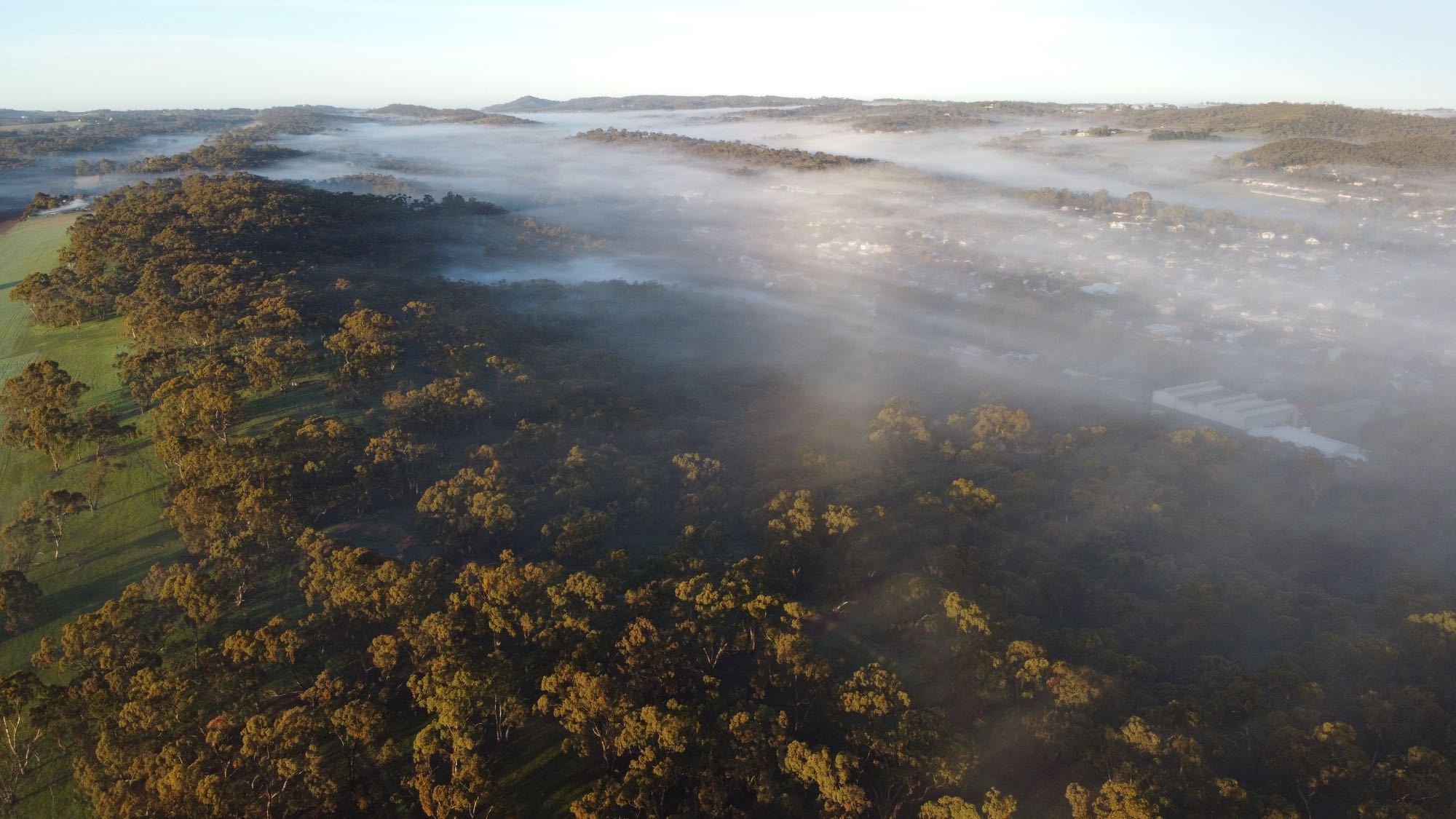
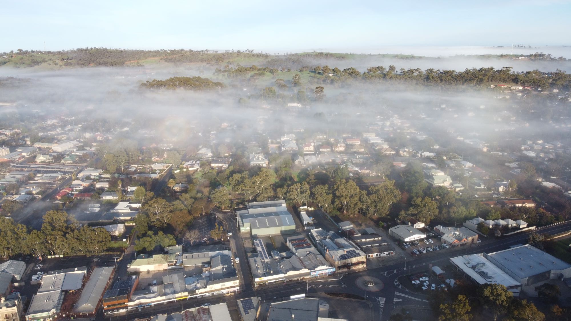
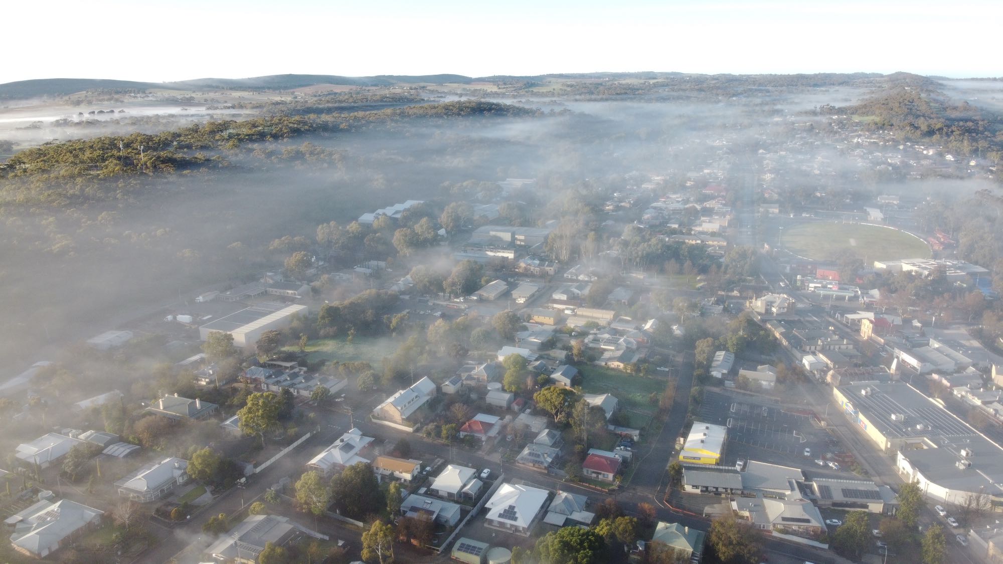
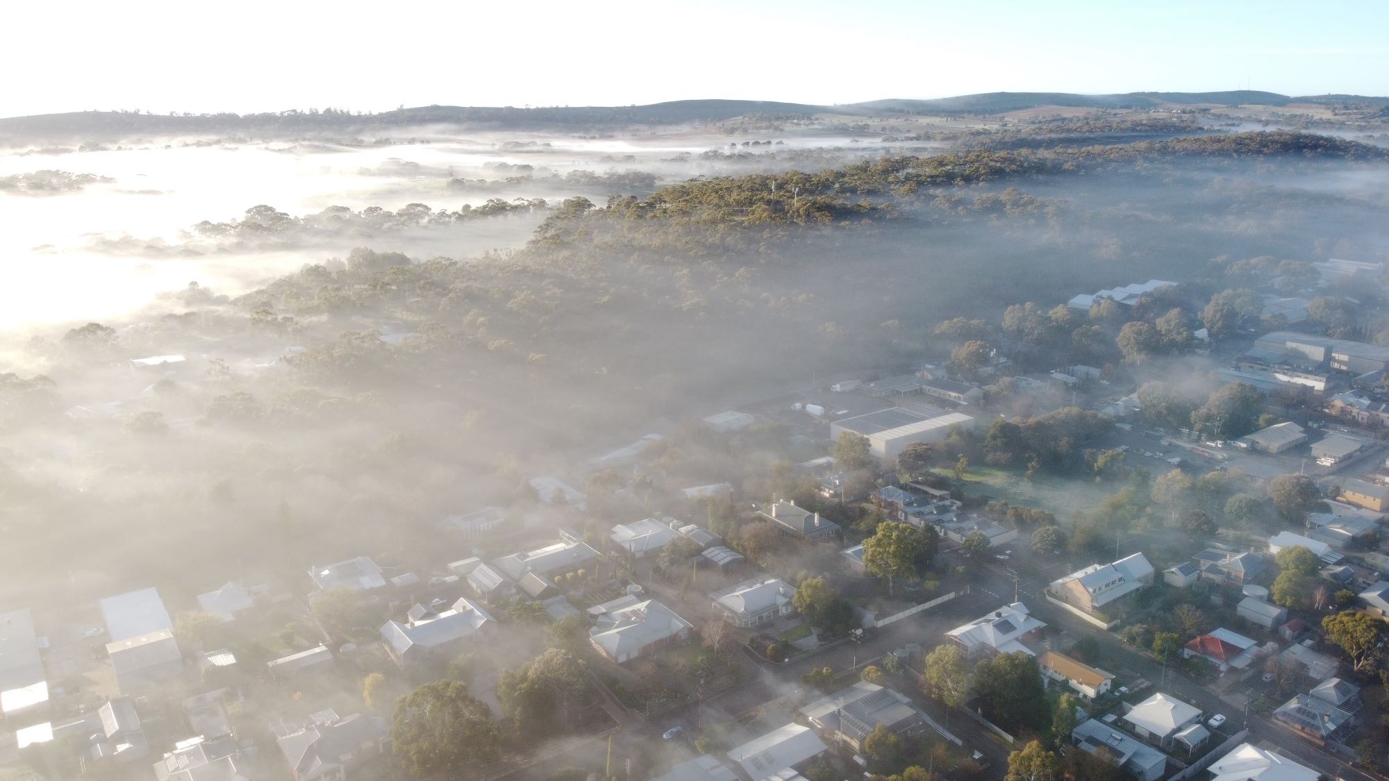
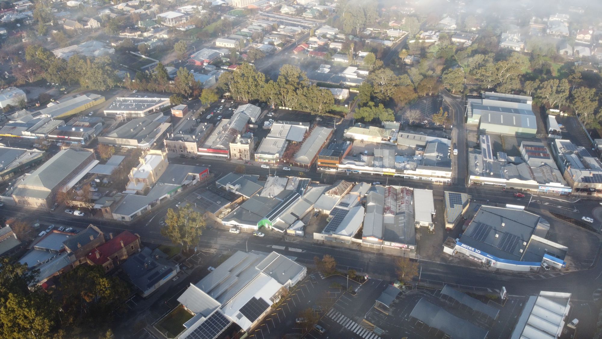
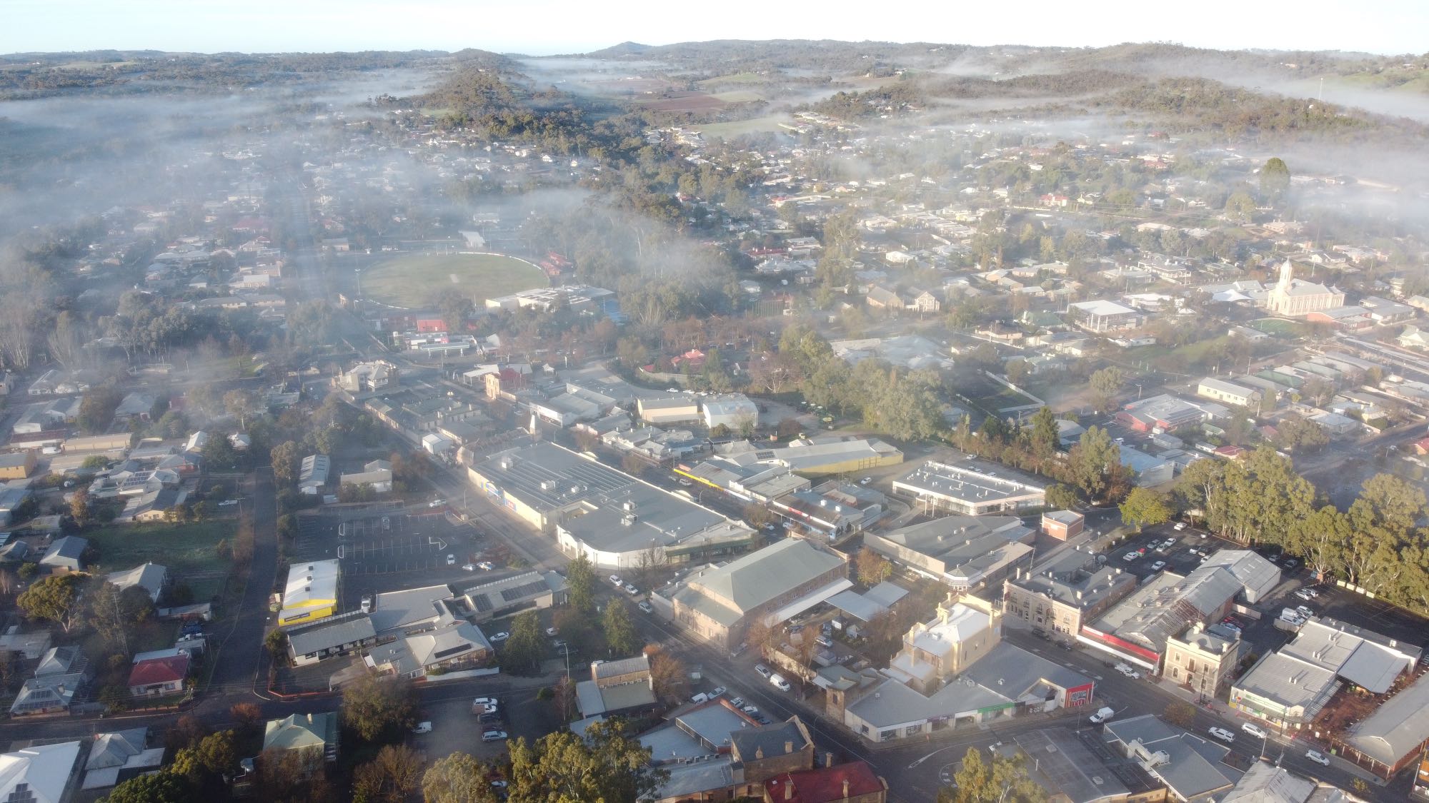
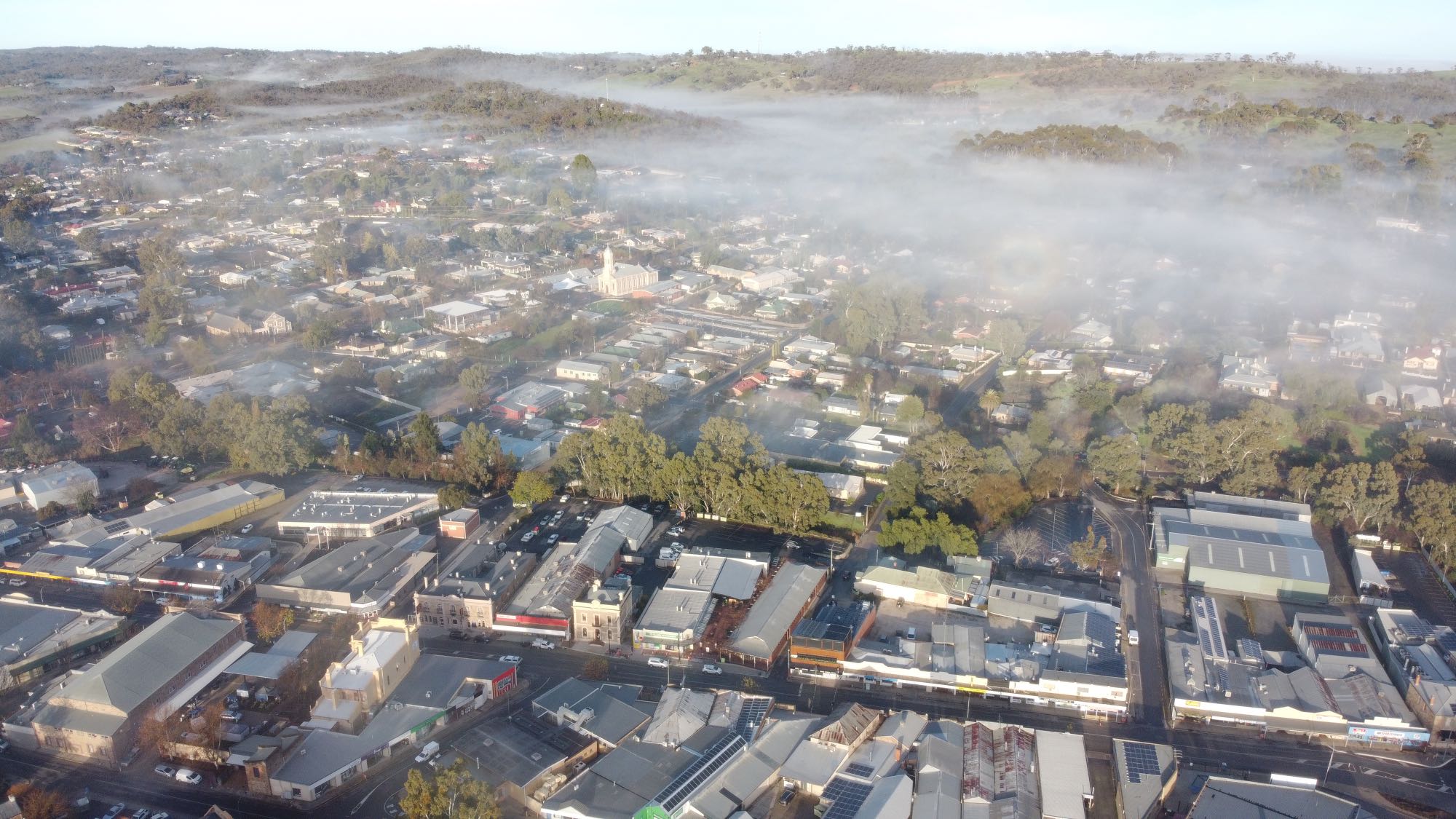
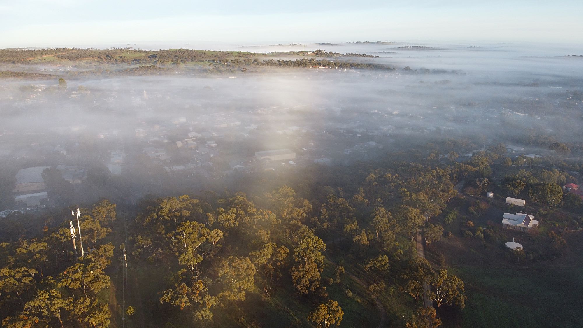
Clare township area, taken from my drone on a morning with a ground-hugging mist, 2021/07/10.Ground hugging mist in the Clare area can be beautiful but very few people see it, partly because it usually lasts only a very short time after sunrise.If you do want to see it the first requirement is to get out of bed early, and while early morning mists might sometimes be forecast when they are they do not always occur and then they might occur when they are not forecast. It can be see before sunrise but it’s most beautiful after sunrise. To see it from the ground you'll have to climb a hill within the half hour after sunrise; not many people do. I happen to be an early riser and also happen to have a hill near my home, again, not many people do. Some of the best of the early photos I've taken of my property involved an early morning ground-hugging mist. Or you can use a drone, but you still have to get up early. Drone photos from above Billygoat HillAll the photos in the next three sections, Billygoat Hill, Pinks Reserve and Jarman Crescent, were taken by my Mavik Mini drone on the early morning of 2021/07/10, and all were taken from a point either directly above where I was standing, or near to it. |
|
|
Looking toward the northwest, St Barnibus Anglican Church on the bottom right of centre.
|
Cheap-as-Chips is in the big building on the lower right, Old North Road on the left of that and Main North Road on the right side. The football oval in the middle distance on the right.
The intersection of Union Street and Mill Street is in the right foreground.
The Medical Centre is the large white roof in the centre foreground.
The Catholic Church is the steepled building on the right.
The peak on the horizon in the centre is probably Mount Oakden.
|
|
|
Drone photos from above Pinks Reserve
All photos by my Mavik Mini drone, 2021/07/10 and all were taken from a point directly above where I was standing, or close to it.
|
|
|
Looking south along the ridge of Pinks Reserve, Mount Oakden in the distance on the horizon. |
The steeple of the Catholic Church is just visible through the mist; Armagh would be in the mist-shrouded valley in the distance.
Drone photos from above Jarman Crescent
All photos by my Mavik Mini drone, 2021/07/10 and all were taken from a point directly above where I was standing, or close to it.
|
|
The southern end of Jarman Crescent is in the foreground. Pinks Reserve would be to the right of the cleared patch in the distance, upper centre.
|
|
|
|
The people in the house in the foreground have allowed their fire to burn with a lot of smoke. This can and should be avoided, but I think it adds something to the photo.
|
The Riesling Trail is hidden behind the dark pine trees in the right centre and runs from there across to the lower left. The Farrell Flat road is on the right beyond the Trail.
A power sub-station is conspicuous in the middle distance on the left.
|
|
|
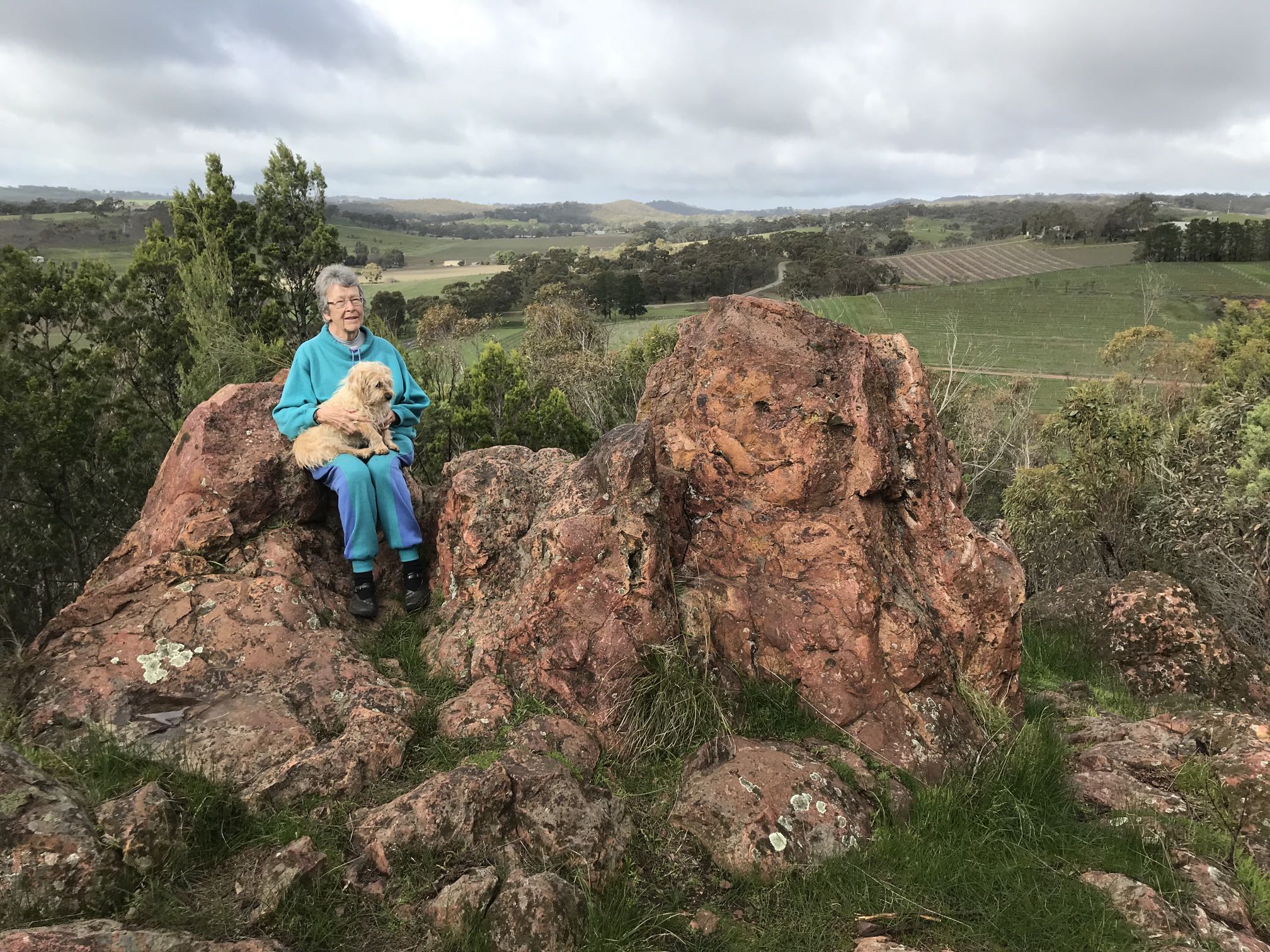
In the photo my wife, Denece, is holding our dog, Socrates.
The Rock is about 1.8km SSW of the Clare Post Office as the crow flies. The main access is from Neagles Rock Road. Alternatively it can be accessed from Bennys Hill Road.
Photo 2019/07/13
Riesling TrailThe Riesling Trail is a walking/cycling trail along the course of a railway line that was closed following a bushfire in 1983 that burned many of the wooden sleepers.The Trail runs from Barinia, north of Clare, to Auburn, a total distance of about 35km. The Rattler Trail connects at Auburn and runs south.
Trails SA has a page on the Riesling Trail, as does the Clare Valley directory. |
|
|
A panorama looking southeast from the Trail near Seven Hill. Photo 2021/03/11, 07:56 |
|
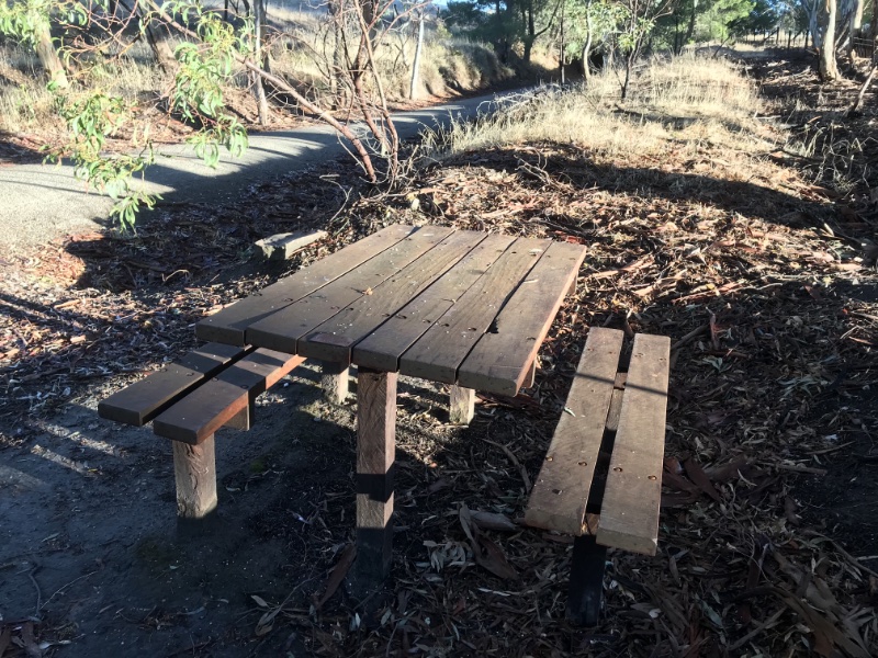
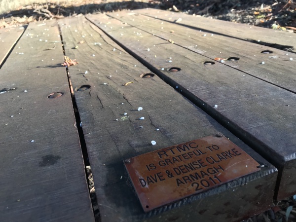
These were once popular ways of keeping water cool right through the heat of Summer. They are now fairly rare. Click on the image to see the tank in higher definition. Use Return to come back. Photo 2021/03/11, 08:05
This table was all red gum. For the other two I used 100mm square steel tube for the legs. I suspect either rot or termite attack in the legs will be the most likely cause for deterioration to the tables. It's pleasing that they look much the same as it did ten years ago. My impression is that the decking oil that I have applied every few years has greatly helped protect the wood from the weather.
Photo 2021/03/11
At the time I installed this, if I remember rightly, there were very few other seats and tables on the Trail. Now there are many. |
|
|
Looking east toward the low Sun from the Riesling Trail near Seven Hill. Contented cattle eating their hay.
Photo 2021/03/11, 08:00 |
|
|
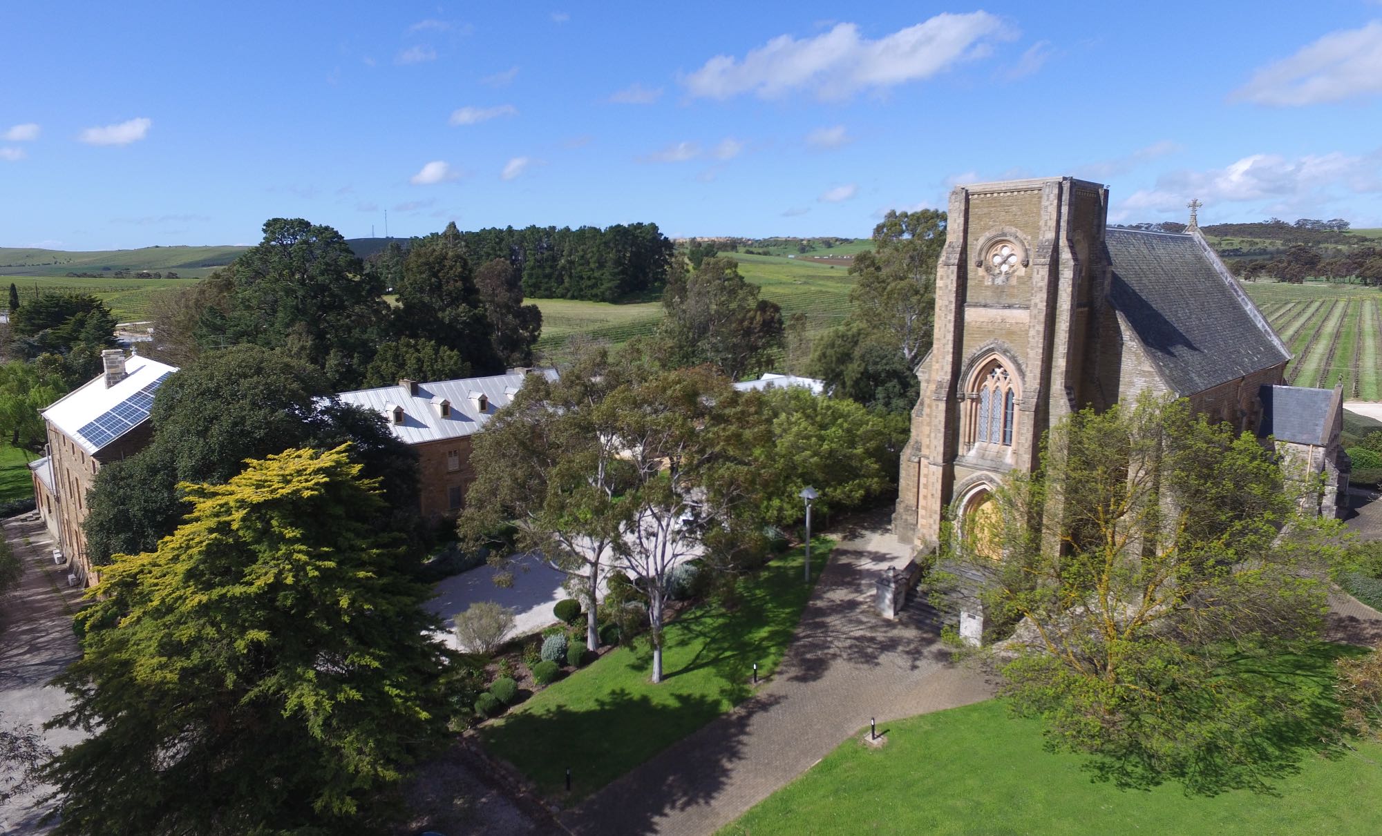
St Aloysius Church on the right and Jesuit retreat buildings centre and left. A little of the winery can be seen in the distance on the far left.
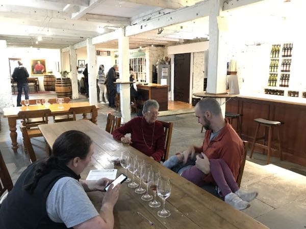
There is an informative page on Sevenhill and the Jesuits on the Sevenhill Winery site. Quoting from that page: "Sevenhill, in the Mid North of South Australia, was the birthplace of the Jesuits in Australia after they arrived in Adelaide as chaplains to a group of Austrians that fled Europe to escape political and religious oppression. The immigrants settled near the township of Clare and the Jesuits purchased 100 acres of land in 1851 [15 years after to proclamation of South Australia as a colony], naming it Sevenhill after the Seven Hill district of Rome."The church, while still holding weekly Masses, also hosts occasional musical events. My wife and I once greatly enjoyed a performance of The Messiah here. Photo by Phantom drone, 2016/09/26 |
Mary MacKillop, a saint to the Catholics, had a tenuous connection with the Jesuit retreat at Sevenhill. She was recorded as having stayed in what is now a recently stabilised ruin on the grounds. Photo 2021/04/22
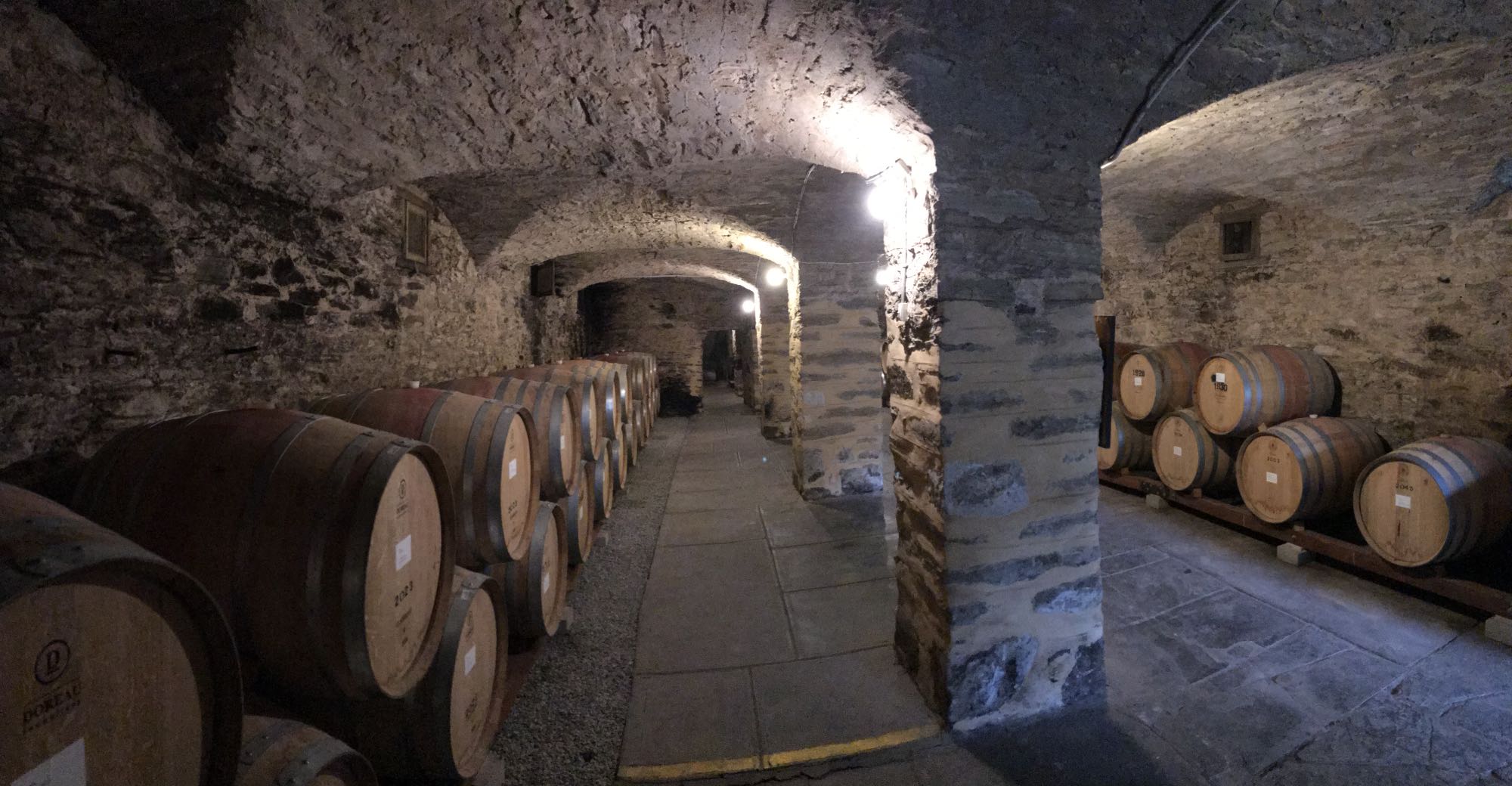
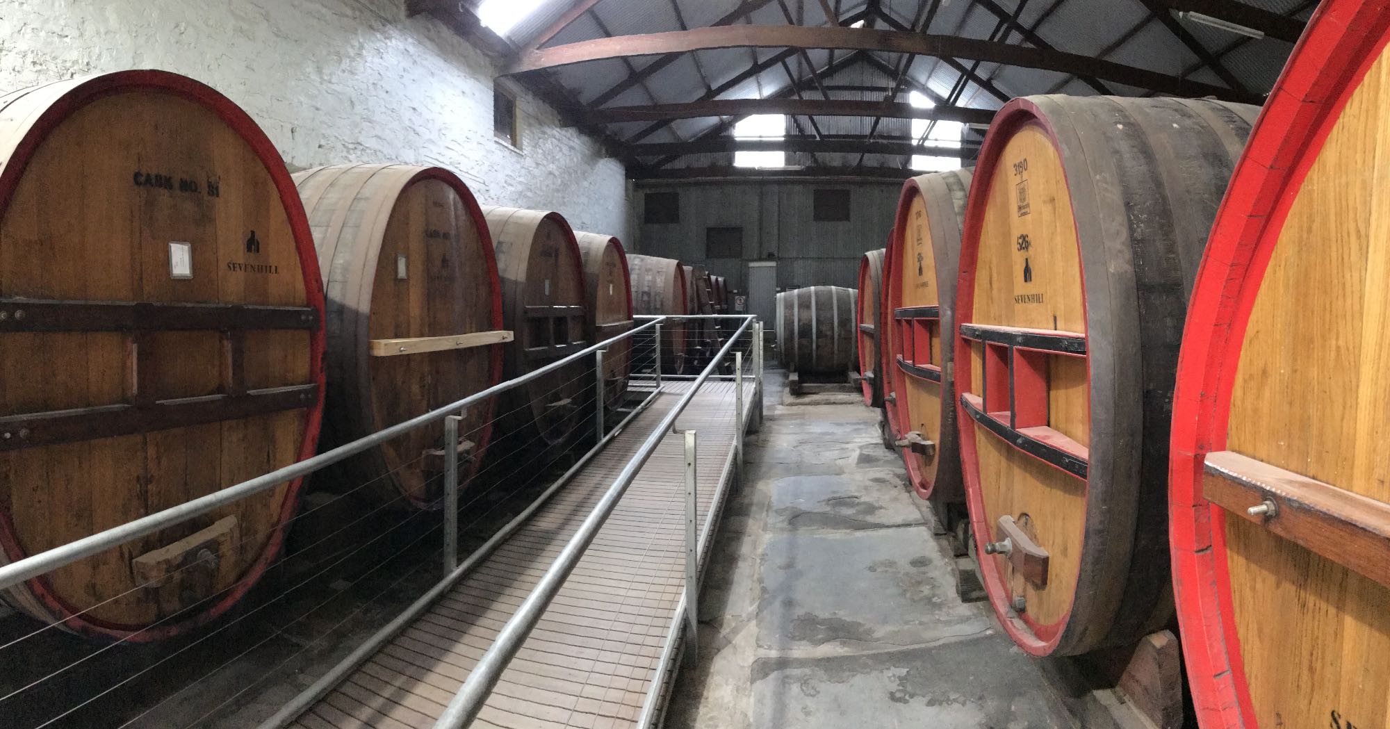
Vaulted wine cellar, Seven Hill Winery |
|
|
This is the only vaulted wine cellar I know of in South Australia that is open to the public.
Photo 2021/04/22 |
Photo 2021/04/22
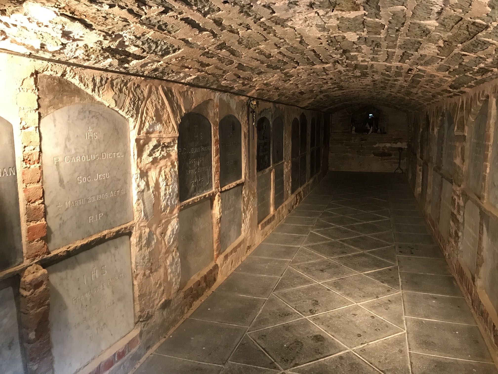
Crypt, St Aloysius Church, Sevenhill
I suppose there are similar crypts elsewhere in Australia, perhaps in South Australia, but I don't know of any.
Photo 2020/06/20
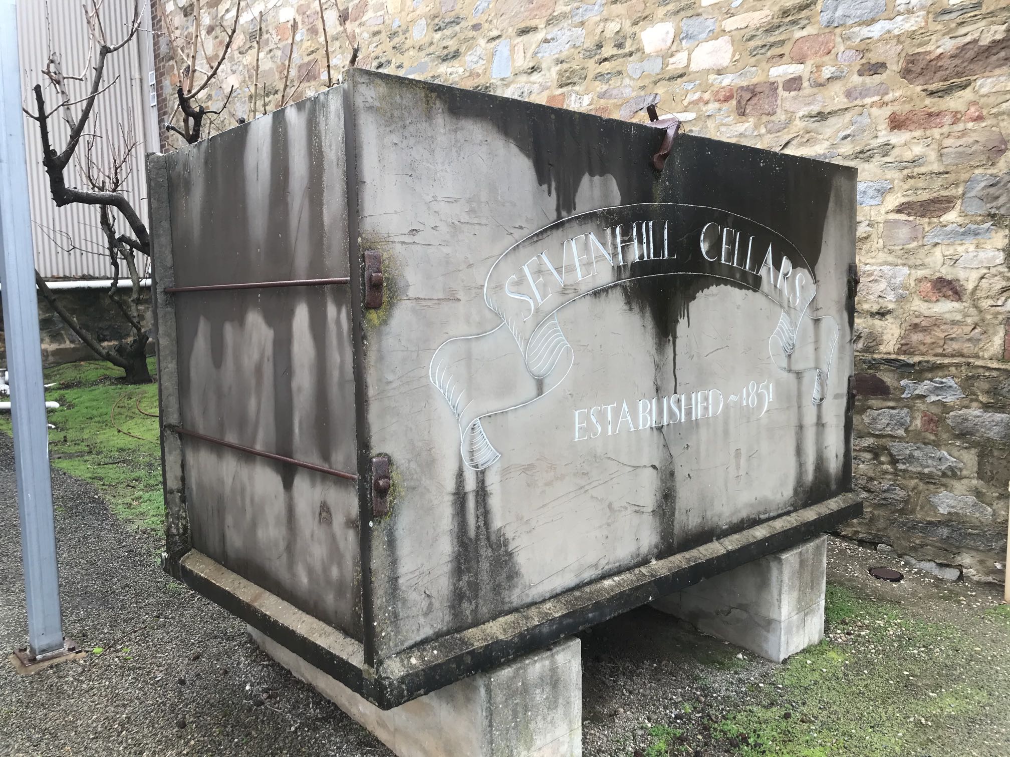
Slate tank, Sevenhill Winery
The 'slate', I believe, is actually a well bedded siltstone and is still mined at Mintaro. There are a few other examples of slate tanks around the 'Clare Valley'.
Photo, iPhone 7, 2020/06/20
Hughs Park Road and Gillentown Road
On the day I took this photo I rode my ebike from Penwortham westward on Horrocks Road, then northward in Hughs Gap Road and eastward on Bayes Road to Seven Hill. This is a very scenic loop off the Riesling Trail, sealed all the way. There is the bonus of the Little Red Grape coffee shop and bakery being on Bayes Road in Seven Hill. Photo 2021/03/11, 08:39
|
Photo 2021/03/11, 08:35 |

|
|
One of my favourite roads for cycling is Gillentown Road. It connects with Neagles Rock Road and Spring Gully Road in the north to Hughs Park Road and Bayes Road in the south. It is a short ride along Bayes Road to Sevenhill.
This panorama photo of about 150 degrees was taken on a chilly morning of 2018/05/13 |
|
|
|
|
The view down Spring Creek from The Cascades Lookout. In the distance is The Hummocks (between Port Wakefield and Kulpara) and behind the distant gum tree can just be made out (in the high definition image and possibly with a bit of imagination) the northern end of Saint Vincent's Gulf.
Photo 2020/04/22 |
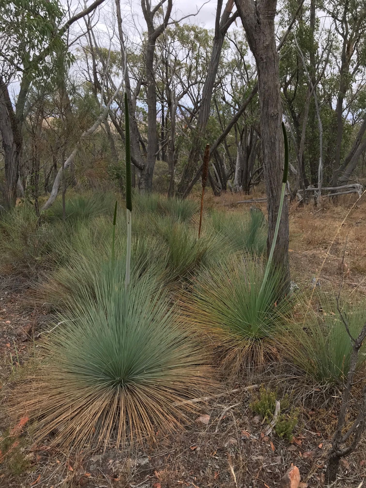
YaccasYaccas (Xanthorrhoea) are not generally common in the Clare area, but there are many right on top of the ridge in Spring Gully Conservation Park.Photo 2021/02/07
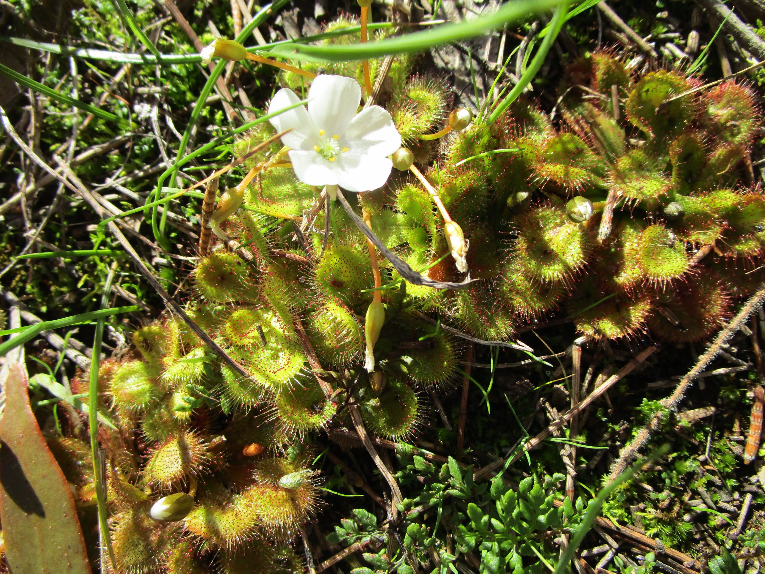
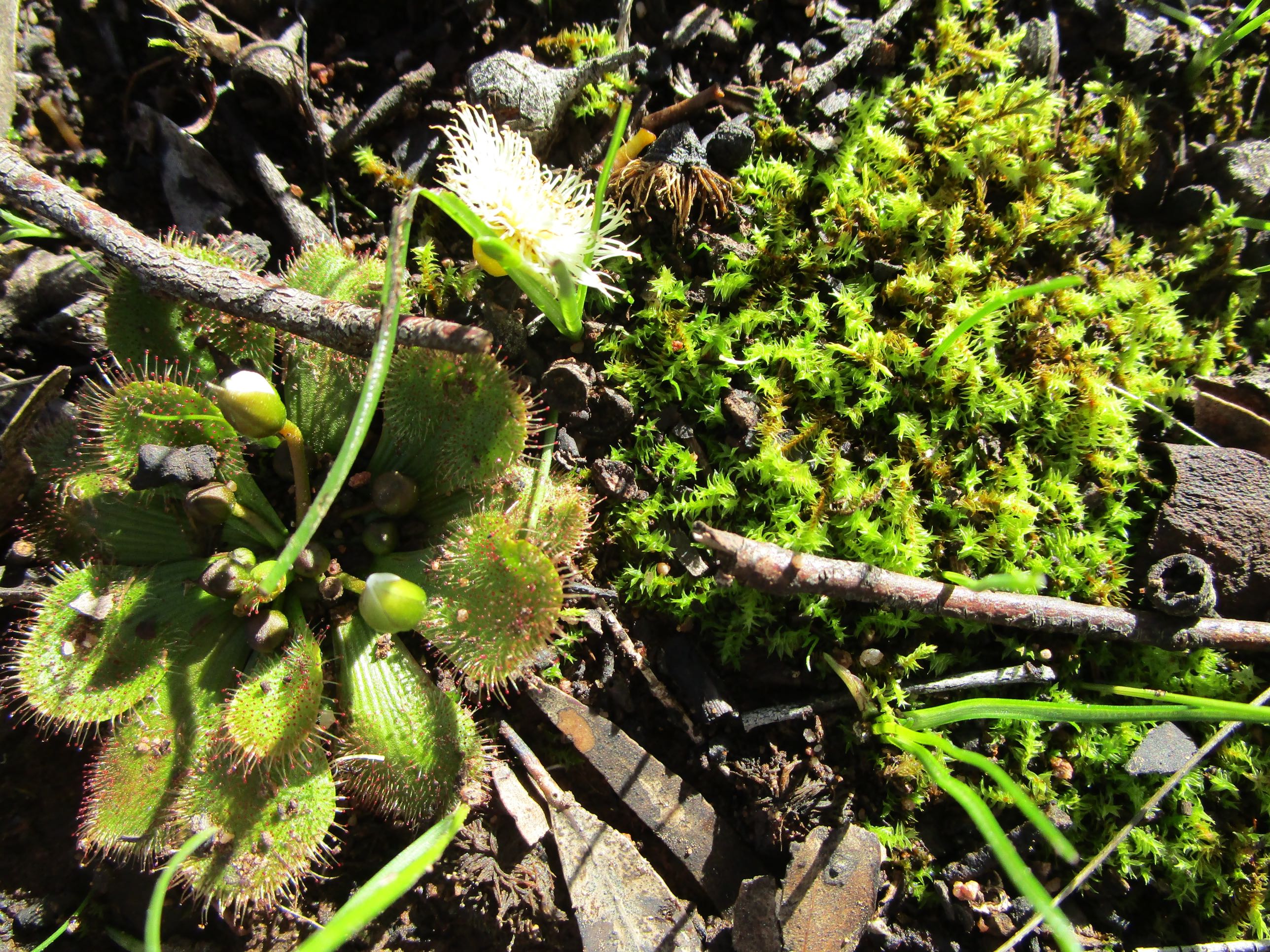
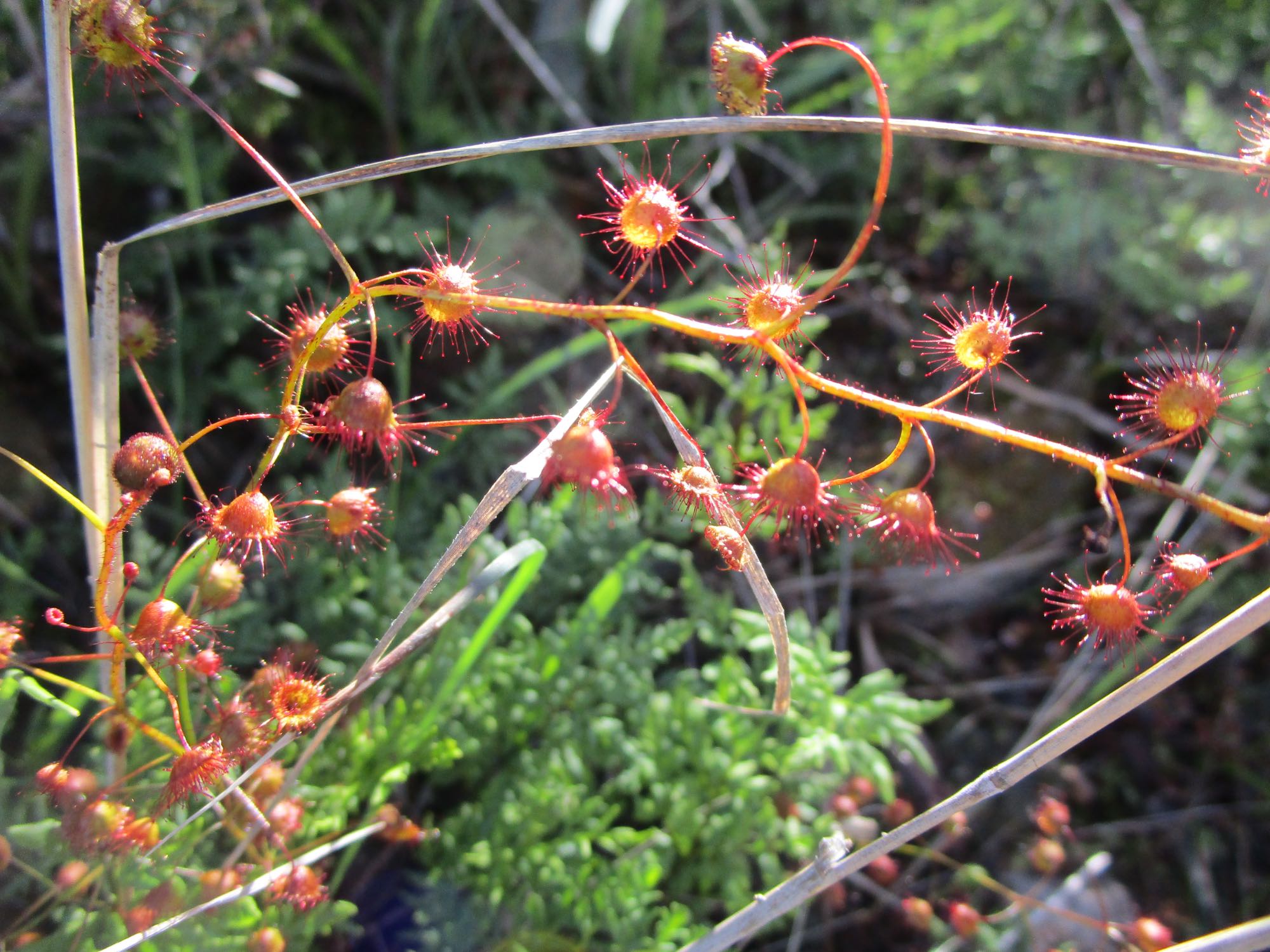
Sundews, Spring Gully Conservation Park
The sundew could be Drosera whitakeri; common name scented sundew or Whitaker's sundew.
Photo Canon Ixus 190, 2021/07/26
|
|
Photo Canon Ixus 190, 2021/07/26 Sundews are small carnivorous plants. It can be seen in the high definition images that there is a tiny glob of red fluid on the tips of each of the hairs surrounding the leaves. This is sticky. Small insects that touch the hairs will get stuck in the fluid, the leaf will curl over the insect and the plant will digest it. |
Photo Canon Ixus 190, 2021/07/26
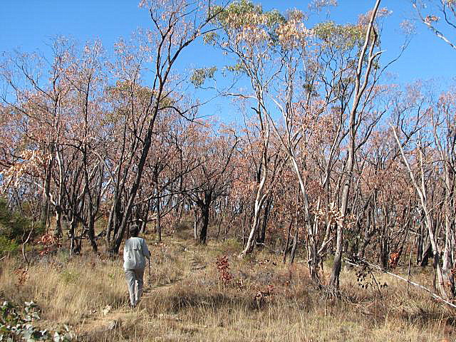
Then there's climate change, Spring Gully Conservation Park
This photo shows die-back in red stringybark trees in Spring Gully Conservation Park. Climate change is also showing up in the grape picking tending to get earlier each year. Photo May 2008 |
|
|
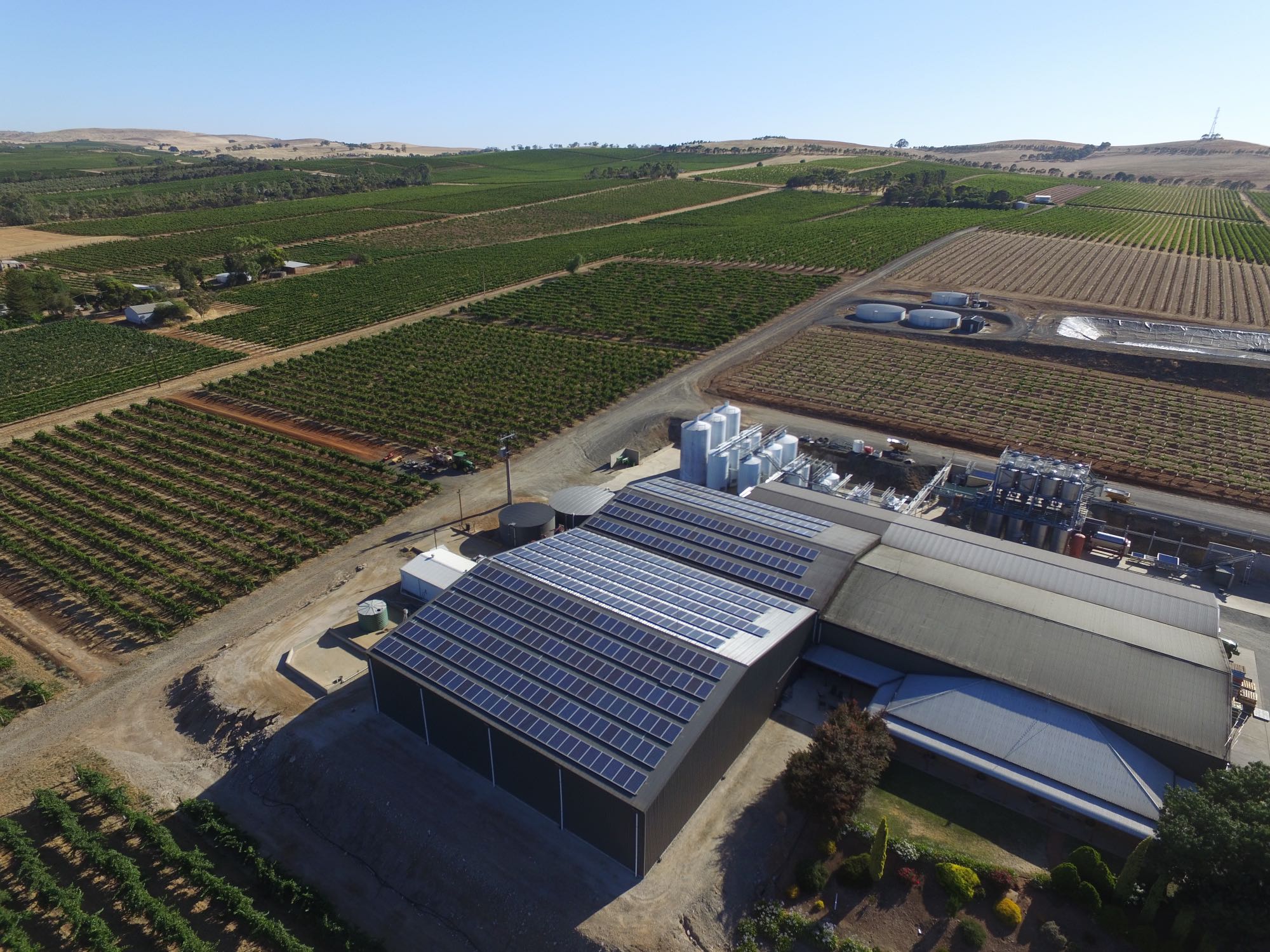
Leasingham
Several wineries in the Clare Valley have installed large rooftop solar power systems, such as the one on the image. There are about 490 panels. If each is 250 Watts, the installed capacity would be about 122 kilowatts.
Photo by DJI Phantom 3 Advanced drone 2016/01/17
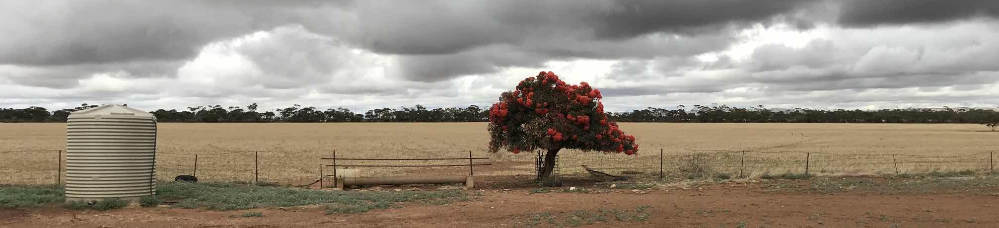
Brinkworth, not quite Clare Valley,
|
|
|
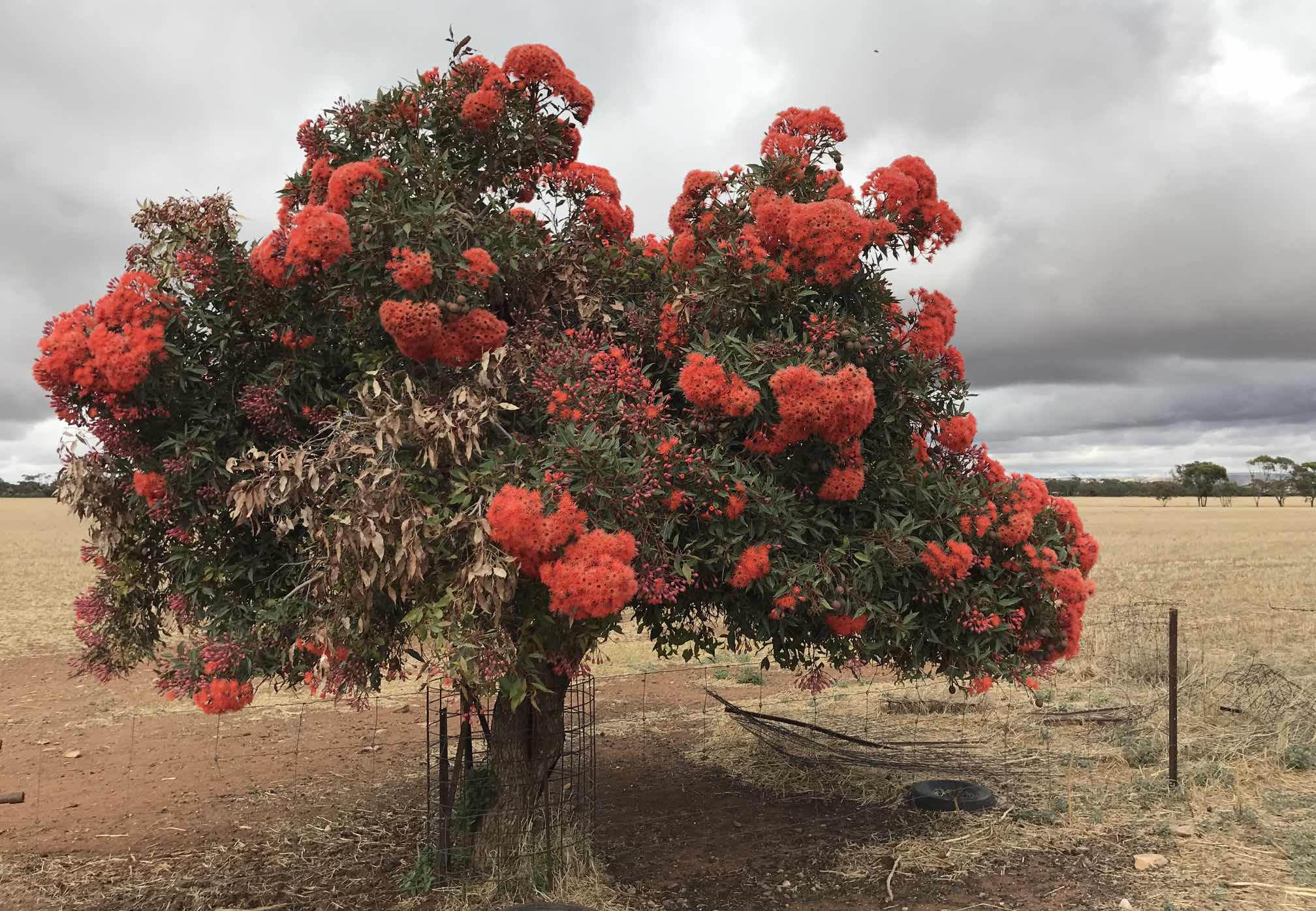
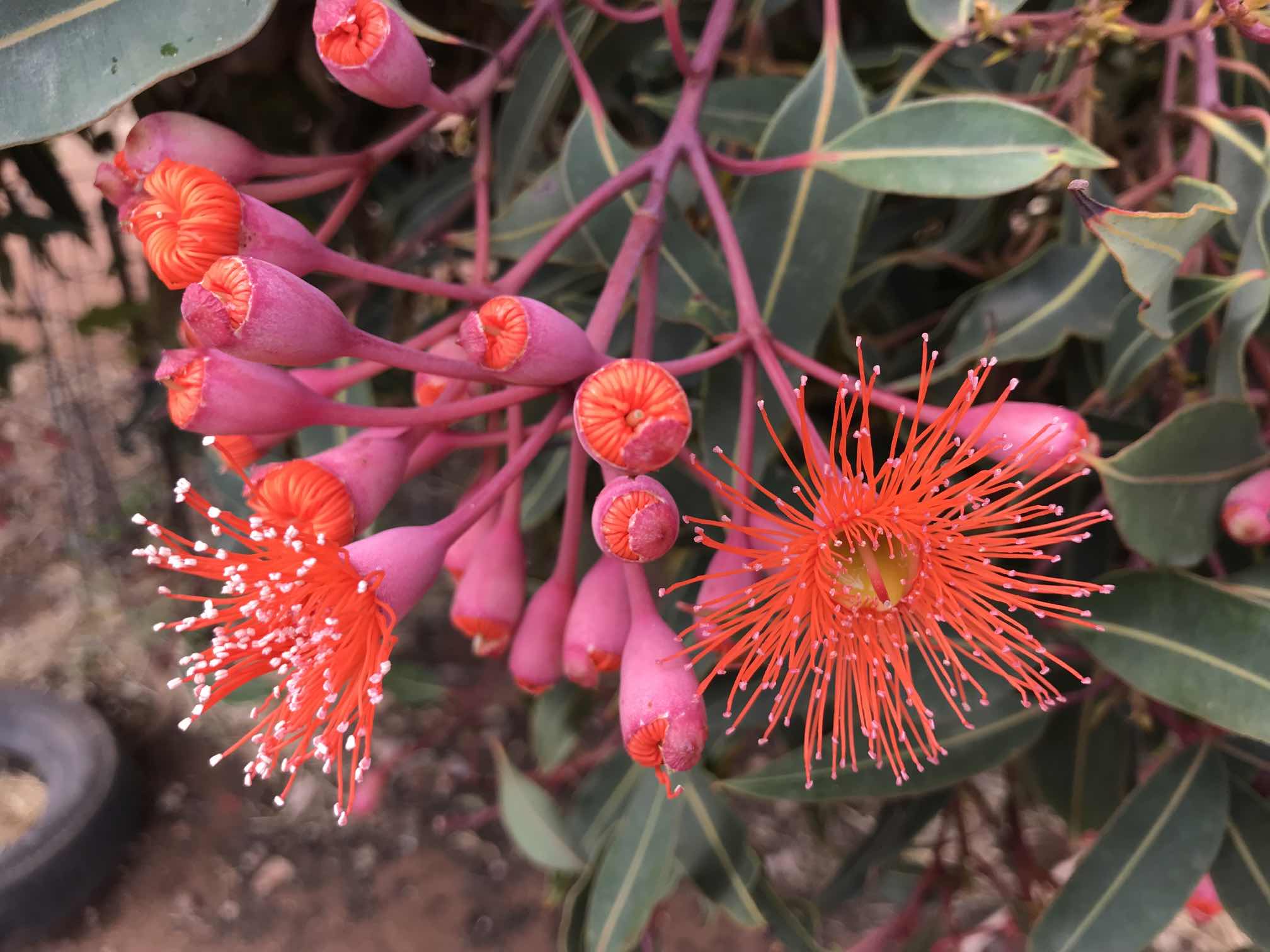
The story behind this group of photos is rather puzzling. My wife and I had driven past the location of this tree, a Corymbia ficifolia, about 40 metres off the Brinkworth-Koolunga road, literally hundreds of times over the 28 years before we noticed the brilliant display of blossom on 2022/01/06. It is unimaginable that we would have missed noticing this tree if it had anything like as bright a display of blossom as this in all that time.
|
|
|
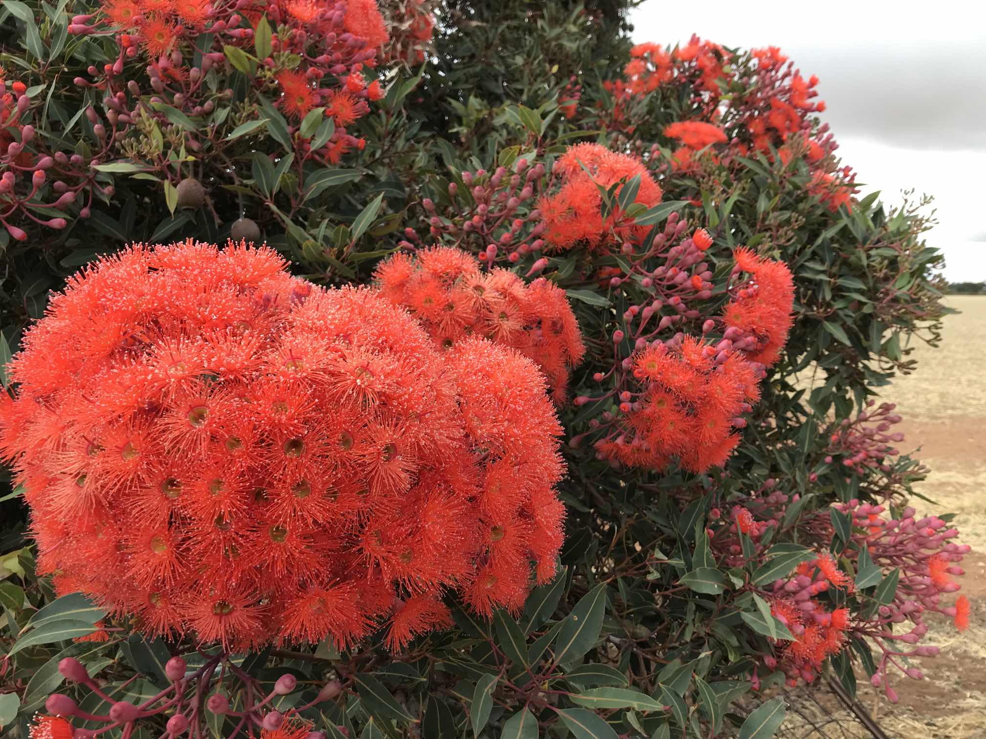
A closer view of the Corymbia ficifolia.
|
At a guess, based on the size of the tree and its trunk, I'd suppose that it would be ten to twenty years old.
I have read that Corymbia ficifolia blossom every two years. Had this one blossomed anything like this 2, 4 and 6 years ago I cannot imagine that we could have missed seeing it.
|
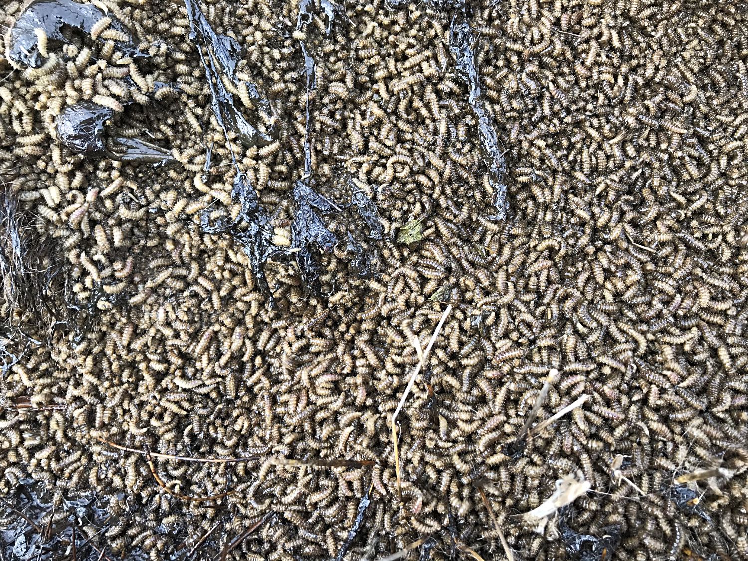
Dead kangarooThese photos are confronting. Those who have weak stomachs might choose not to see them. I am quite familiar with seeing road kill and other dead animals, but this particular one was still something of a shock to me.If you do want to see the photos, follow the links. Use you devices 'back' function to return. Second photo, maggots in the dead kangaroo Death is a part of life. Some people find contemplation of death difficult. I've written on death on another page on this site. |
The cameras used for the photos on this pageOf my photos on this page:
The camera on the Mavic Mini is very impressive, I have written about its image quality on another page on this site. I bought the Canon Ixus in January 2021 because it has 10x optical zoom (useful for wildlife and other situations where a long focal length is valuable) and it comfortably fits into a pocket. I was surprised to find it also useful for macro photography. Of course when using long telephoto the depth of field is shallow, as it is in the macro shots; this is simply a matter of physics. With the digital cameras I've had in the past I've found that the pixel count was misleading. For example, a 4000 × 3000 pixel (12MP) image could be reduced to 2000 × 1500 pixels (3MP) with no loss of resolution. With the three cameras I've used for this page every pixel can be significant. I have not used the full resolution images on this page to reduce the file sizes. Effective resolutionIn the past one could buy a camera that took photos with a given number of pixels. In most cases the resolution achieved was effectively about a quarter of the pixel count. In the case of the iPhone, Mavik Mini and Canon Ixus every pixel can count. |
|
|
Related pagesExternal sitesEnvironmentalism and ethical standards are very high on my list of priorities. The operators of the Watervale Hotel, in the centre of "The Clare Valley" also have very high ethical and environmental standards.On this siteGeneralGleeson Wetlands, ClareCentral Park, Crystal Brook Photo pages inside AustraliaBeetaloo Dam, 2014Clare Valley, 2007 Early photos of Elysium Clare Valley impacted by climate change Coober Pedy: photos and observations, 2016 Central NSW, March-April 2017 South eastern SA and Victoria 2018 Flinders Ranges, 2006 Flinders Ranges, 2019 A collection of my better photos of the Flinders Ranges over the years, 2020 Kangaroo Island, 2009 'Across the Nullarbor', 2009 South eastern Australia, November 2016 Victoria, Autumn 2019 Victoria, Autumn 2021 Photo pages outside of AustraliaIndia; visit 1989; modified 2009Indonesia; visit 1994; modified 2009 Japan, 2017 Vietnam, visits 2004-08; modified 2017 Cambodia, Laos, Vietnam, 2011 Singapore and Malaysia, 2015 |
|
|
IndexArmagh, west side, drone photos 2021/08/25Brinkworth, not quite Clare Valley Cameras used for the photos on this page Cemetery clare, a different angle Clare township Clare cemetery, a different angle Drone, morning mist, Clare area, 2021/07/10 Drone photos from above Billygoat Hill Drone photos from above Jarman Cresent Drone photos from above Pinks Reserve Neagles Rock Clare township environs Climate change Corymbia ficifolia Crypt, St Aloysius Church, Sevenhill Elysium, our patch Aerial photo record 'Our' kangaroos Gleeson Wetlands Hughs Park Road and Gillentown Road Jacobs Range Road Kangaroos Leasingham Neagles Rock Related pages Riesling Trail Sevenhill Slate tank, Seven Hill Winery Crypt, St Aloysius Church, Sevenhill Vaulted wine cellar, Seven Hill Winery Spring Gully Conservation Park Sundews, Spring Gully Vaulted wine cellar, Seven Hill Winery Yaccas in Spring Gully Conservation Park |
